- Joined
- Jul 23, 2013
- Messages
- 1,665
Last week I was scheduled to go backpacking with a friend through Zion National Park, but that fell through. Since I still had the days off, I began to make plans to do some backpacking in Grand Gulch, but since I would be solo, Jessica suggested I wait. (I think she really wants to be able to do it too.) That lead to an opportunity to take my three-year-old son, Lennox, out for a father-son adventure, since he's not yet in school, to do a bit of reconnaissance on some road conditions, campsites, ruin sites and hiking trails for our upcoming spring break trip I've been planning for the rest of the family. I couldn't have been happier with how it all turned out.
Day 1
Wednesday - March 23, 2016
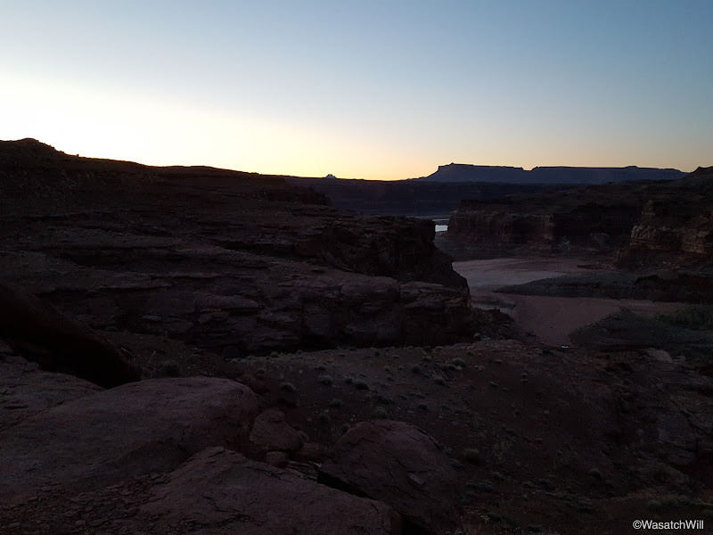
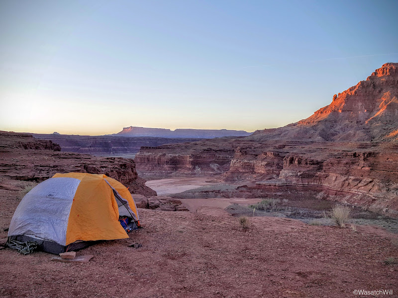
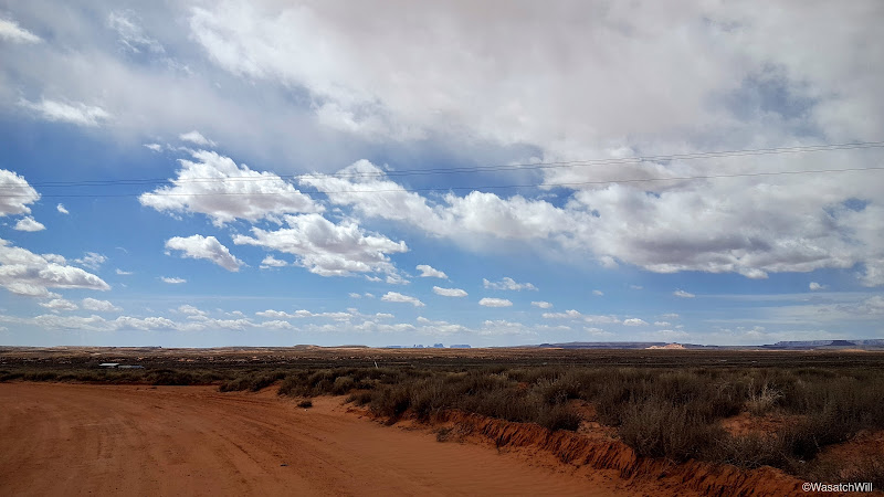
As is often the case, we got a late start on the road that evening. I had a site picked out to camp at in North Wash near Lake Powell and was hoping to get there by dusk. When the clock struck 6 pm as I was pulling out of a gas station in Provo, I knew that wasn't going to be happening. It was a four hour drive away. No matter. We'd just set up in the dark. That's what headlamps and car's headlights (when car camping) are for.
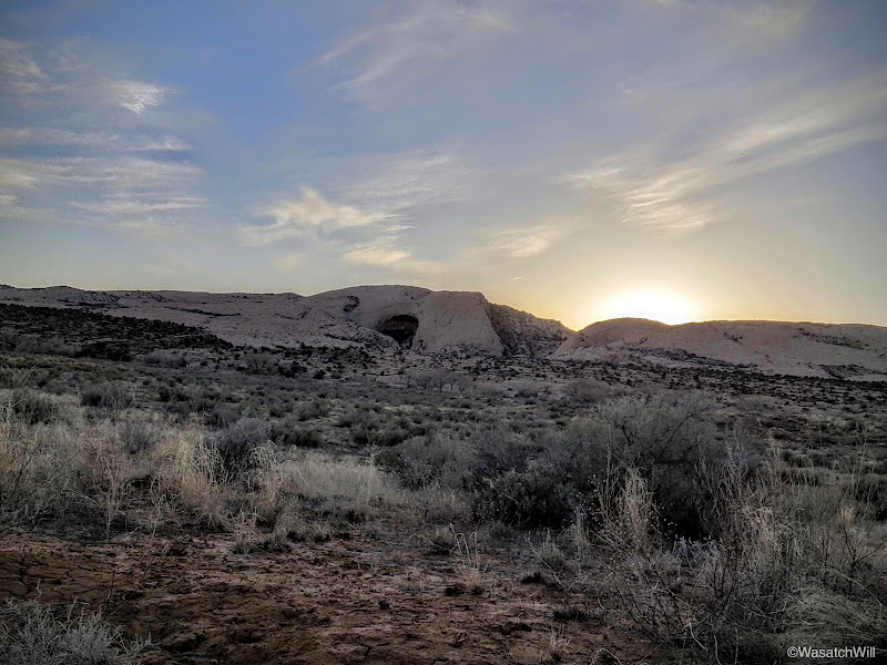
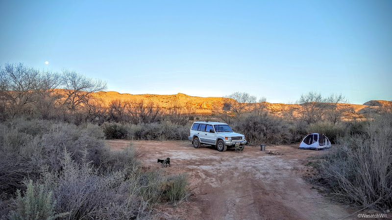
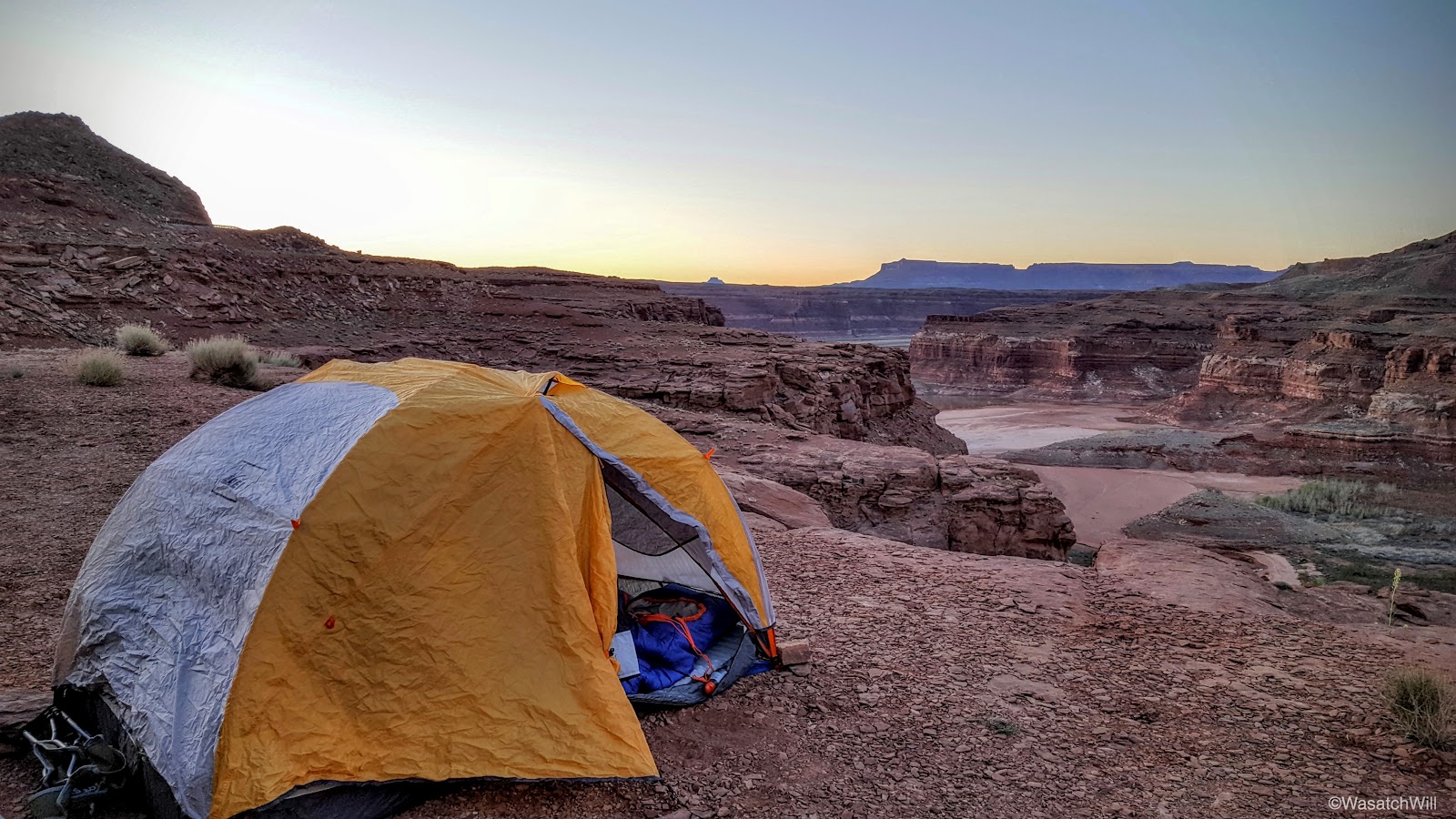
After a brief stop in Hanksville to top off on gas, we arrived at the campsite. As we got closer to it, given the lateness in the evening, I had grown nervous that it would already be taken, knowing that Salt Lake County schools, among others, were in the middle of their spring break. Much to my delight, it was perfectly empty. As I got out of the car, it became apparent why that may have been. The wind was relentless. I was tempted to head back up canyon to seek out a more sheltered spot, but no, I wanted to wake up here and Lennox had been sitting still long enough.
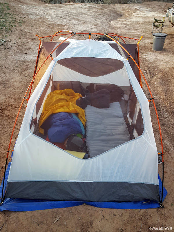
I began to unload the car only to realize I had left my tent stakes and guylines at home. Hmmm. How to do battle with the wind now? In order to keep the wind from taking my tent off the cliff we were perched atop of, I placed our food box and water cooler into it along with having Lennox jump in. That added all the necessary weight to keep it in place while I rigged up the poles and anchored the fly and tent corners with what nearby rocks I could gather up.
We then had a quick bite to eat and jumped into bed. It was so windy I was nervous how the tent was going to hold up in the wind without guylines rigged out to give it more strength and stability. I really feared a pole might snap. I lay there wondering if the wind would get better or worse and how long it would keep up and if it'd be just as bad waking up. Before long, I still managed to fall asleep.
Of course, it was dark and late when we had arrived, so no pictures would be taken until the next day.
Day 2
Thursday - March 24, 2016
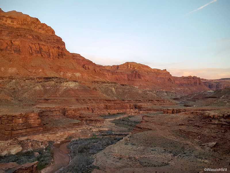
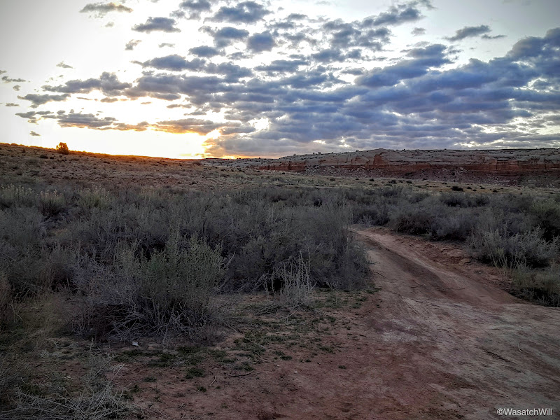
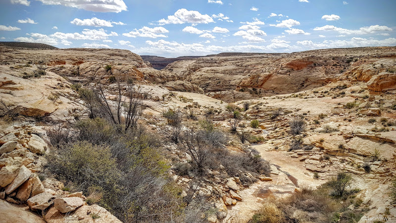
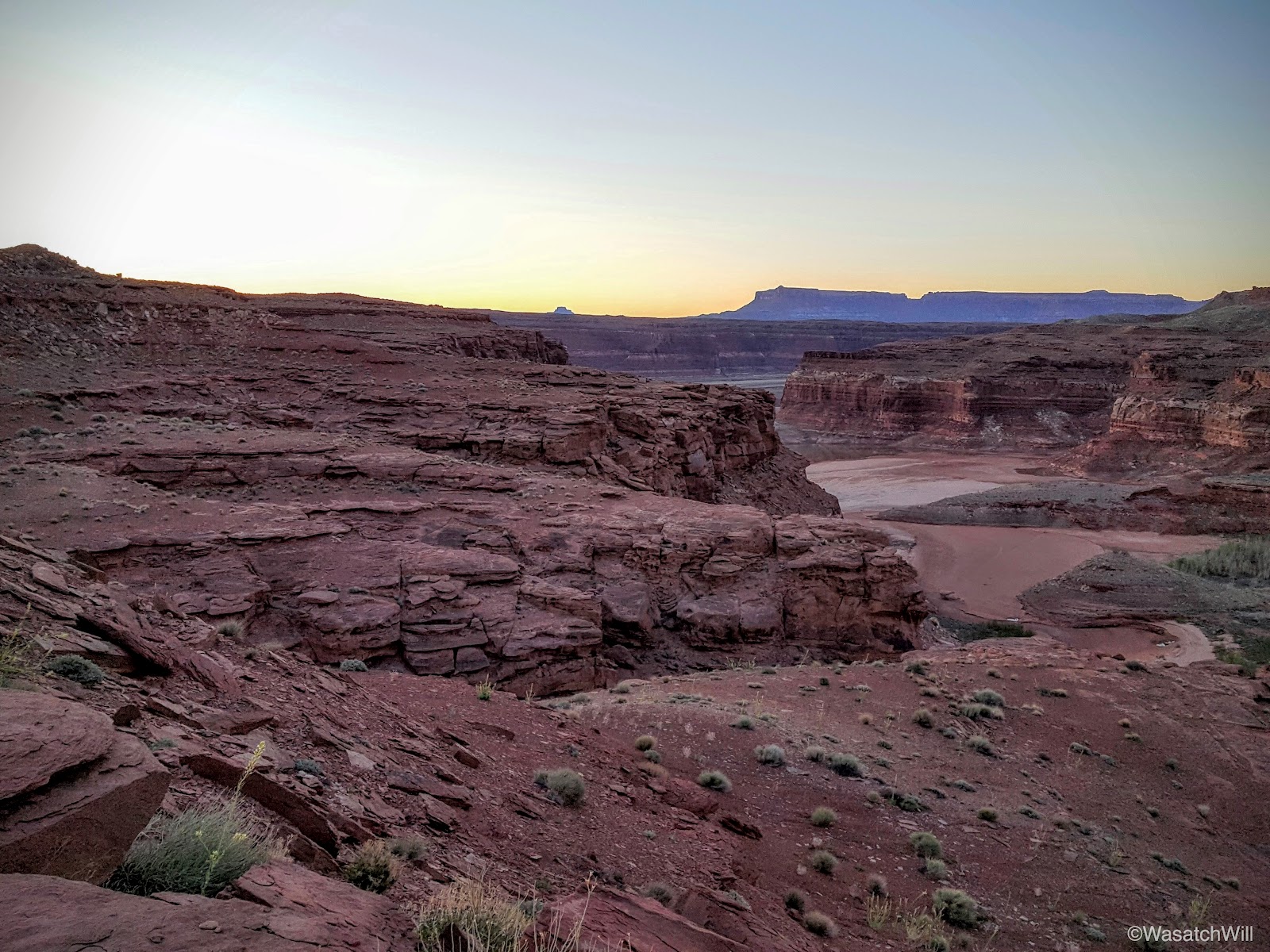
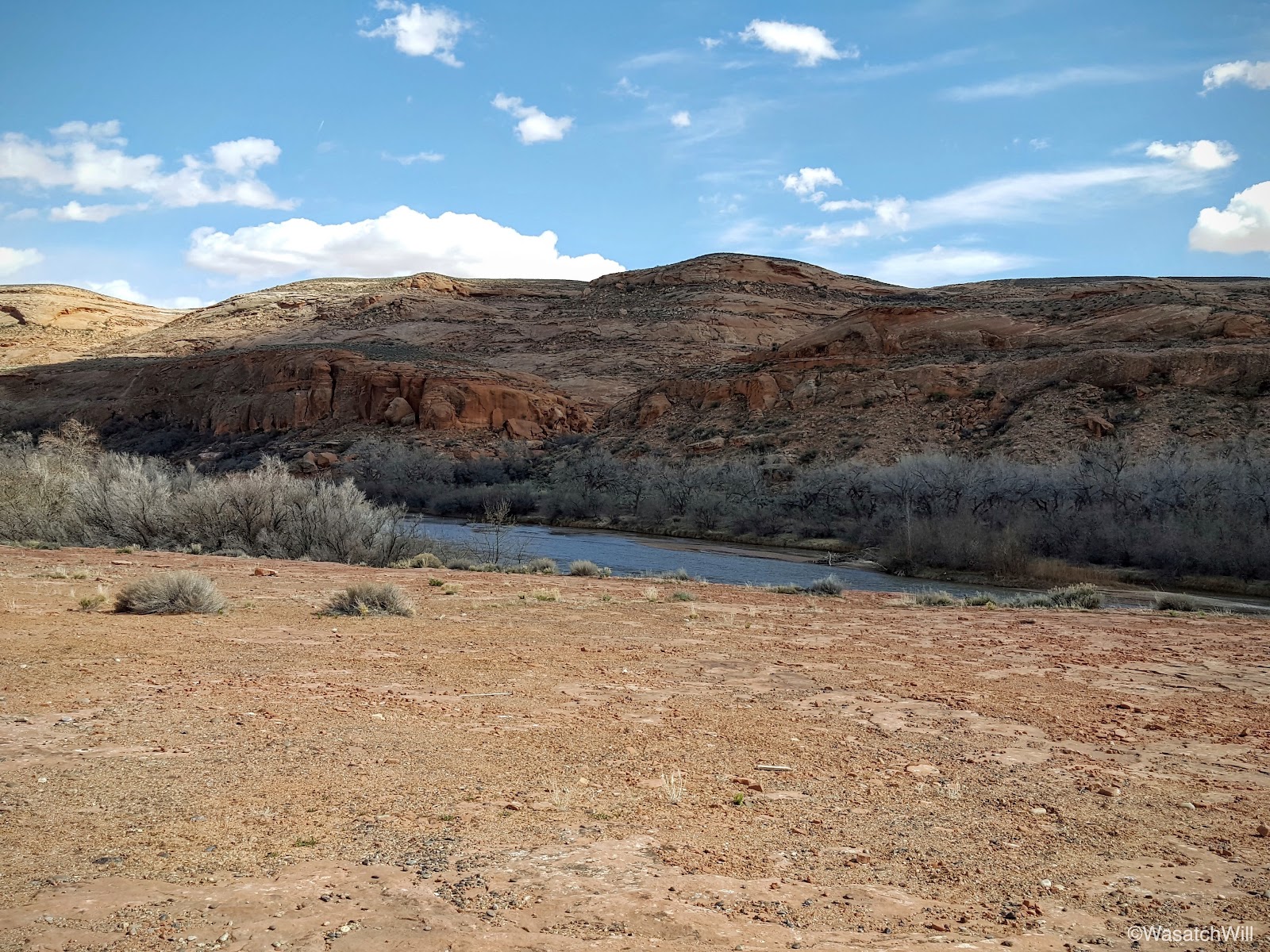
Somewhere in the middle of the night, that wind came to a halt, for when we woke up, it was as calm as could be and the tent was fully in tact. And what a sight it was as dawn approached and the sunlight crept over the horizon to illuminate the canyon cliffs surrounding us.
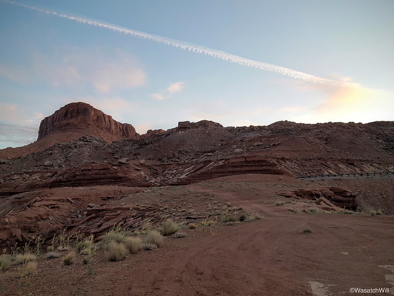


Warmed up by the emerging sun, some oatmeal, and hot chocolate, we broke camp and set off for the first point I had wanted to visit, a ruin site known as the Dollhouse.
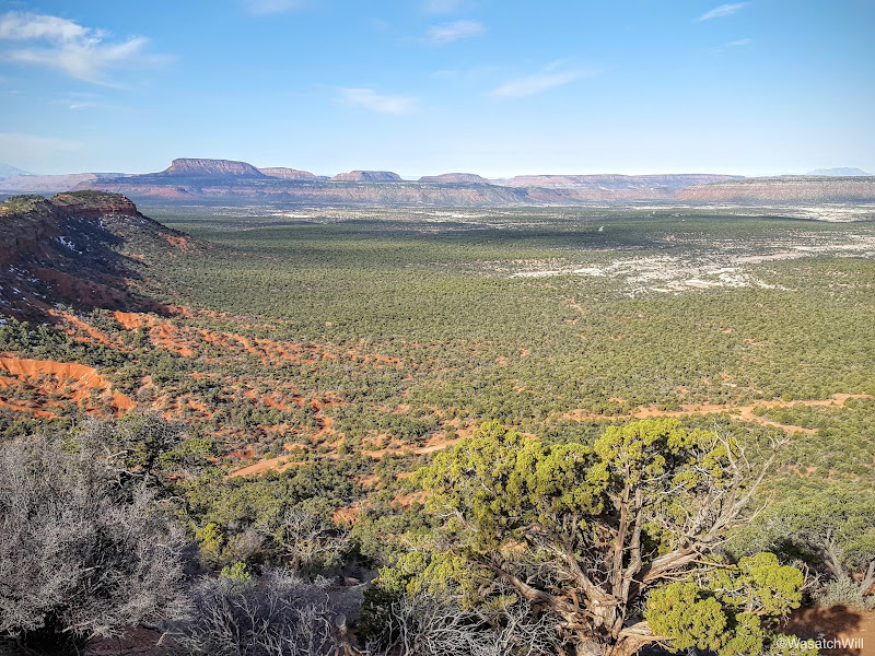
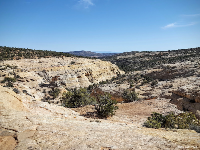
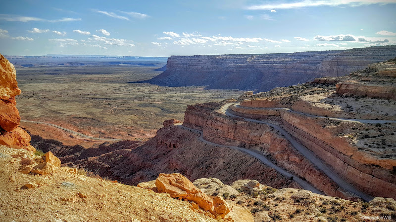
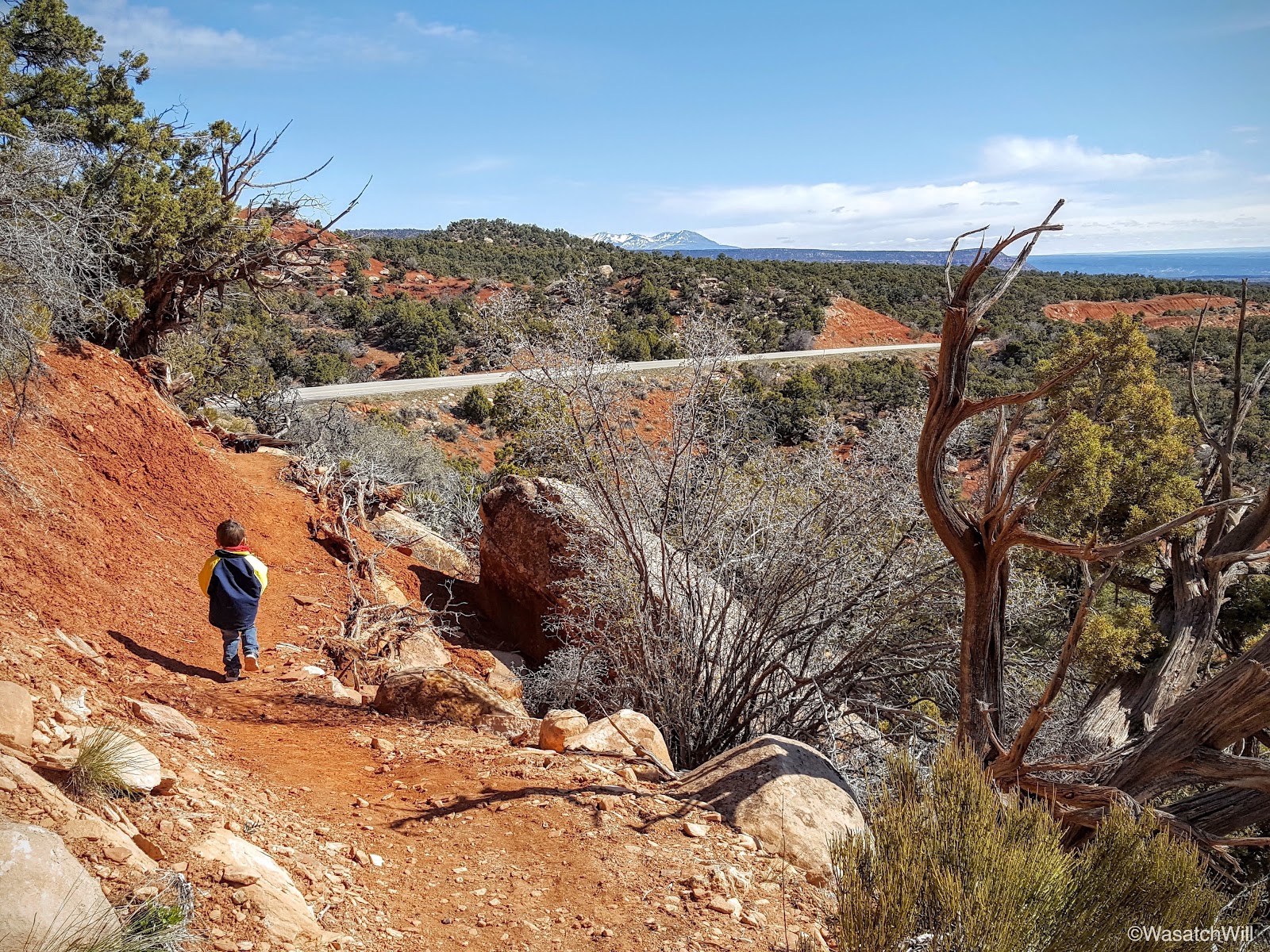
We made our way up the road where we were soon treated to a terrific view overlooking White Canyon and Natural Bridges way out in the distance. So far, so good.
Then, this.
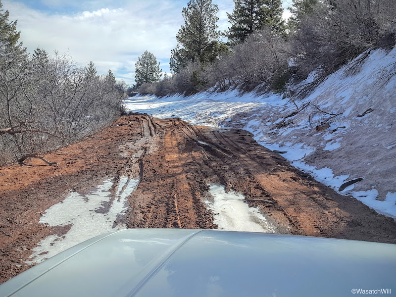
Perhaps my car could make it OK. Would the snow, mud, and ice be for just a short stretch? How would it be coming back after temperatures had warmed up some more? Bummer. There'd be no Dollhouse visit today. There were just too many other things to do and see on this trip to take the risk of possibly getting stuck on the way out or on the way back.
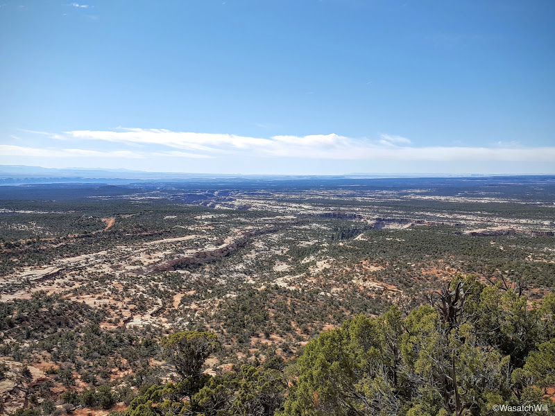
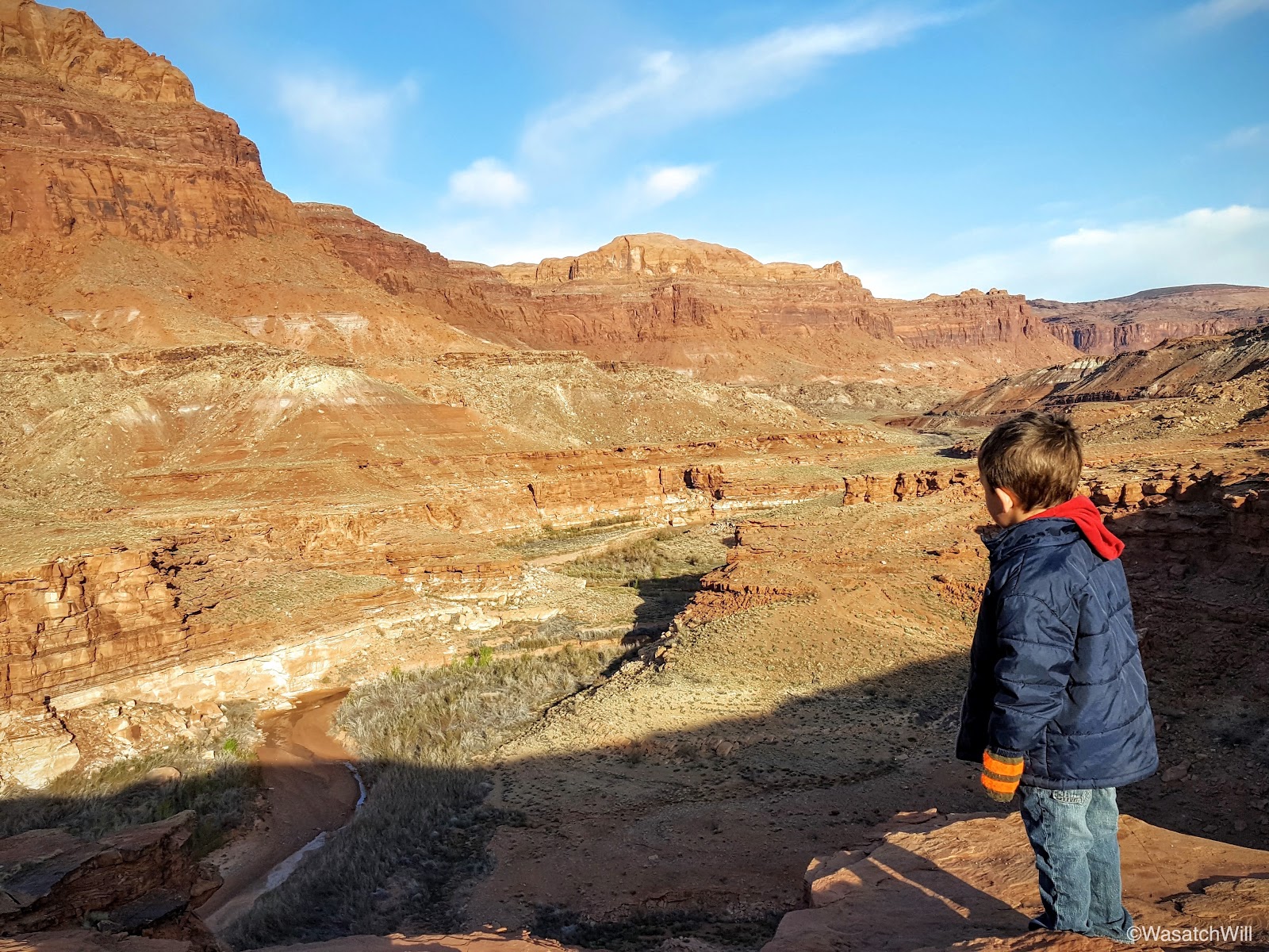
After a quick turn around, we returned to the highway and began to make our way toward Comb Wash. Along the way there, we pulled over to check out a little landmark called Salvation Knoll.
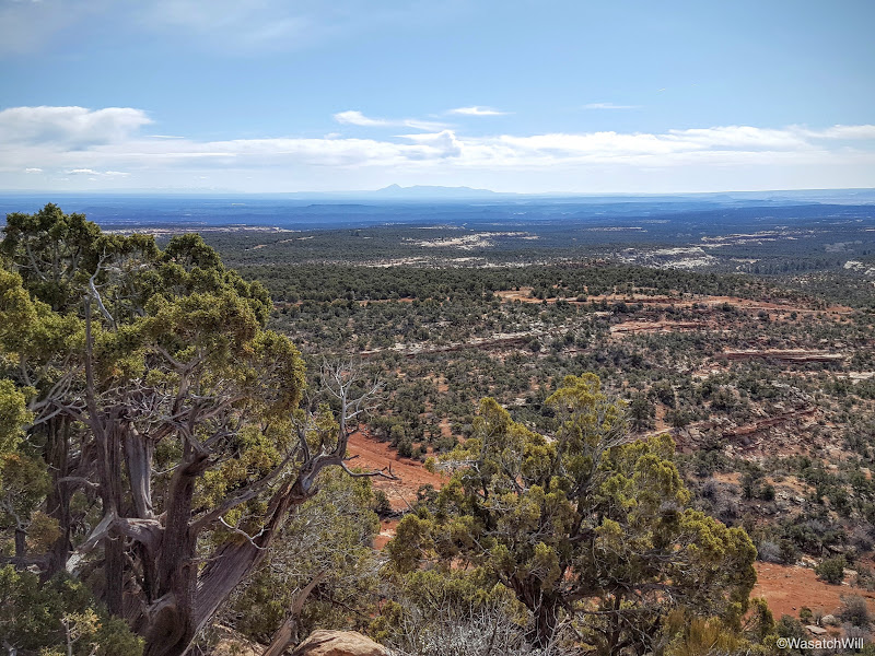
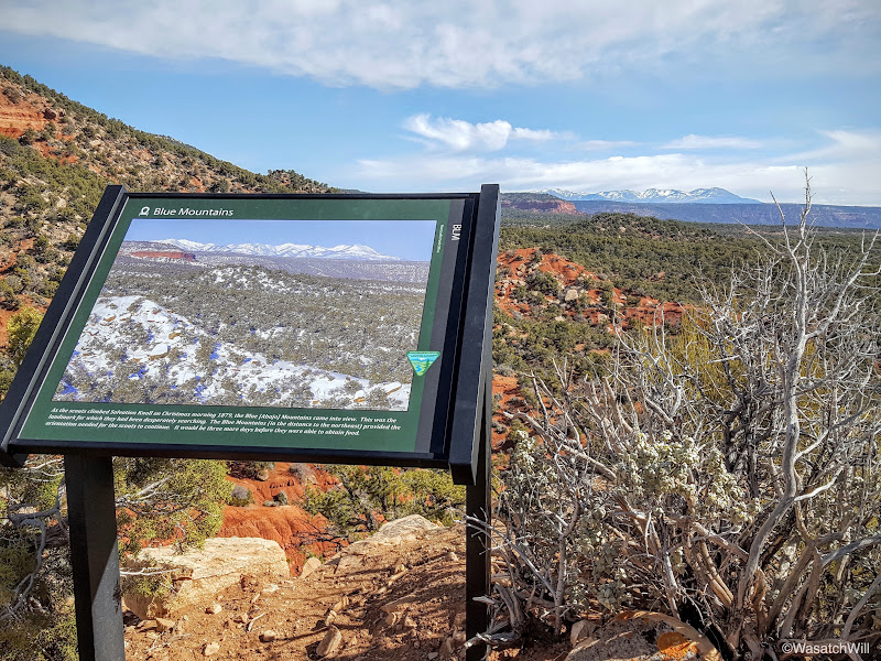
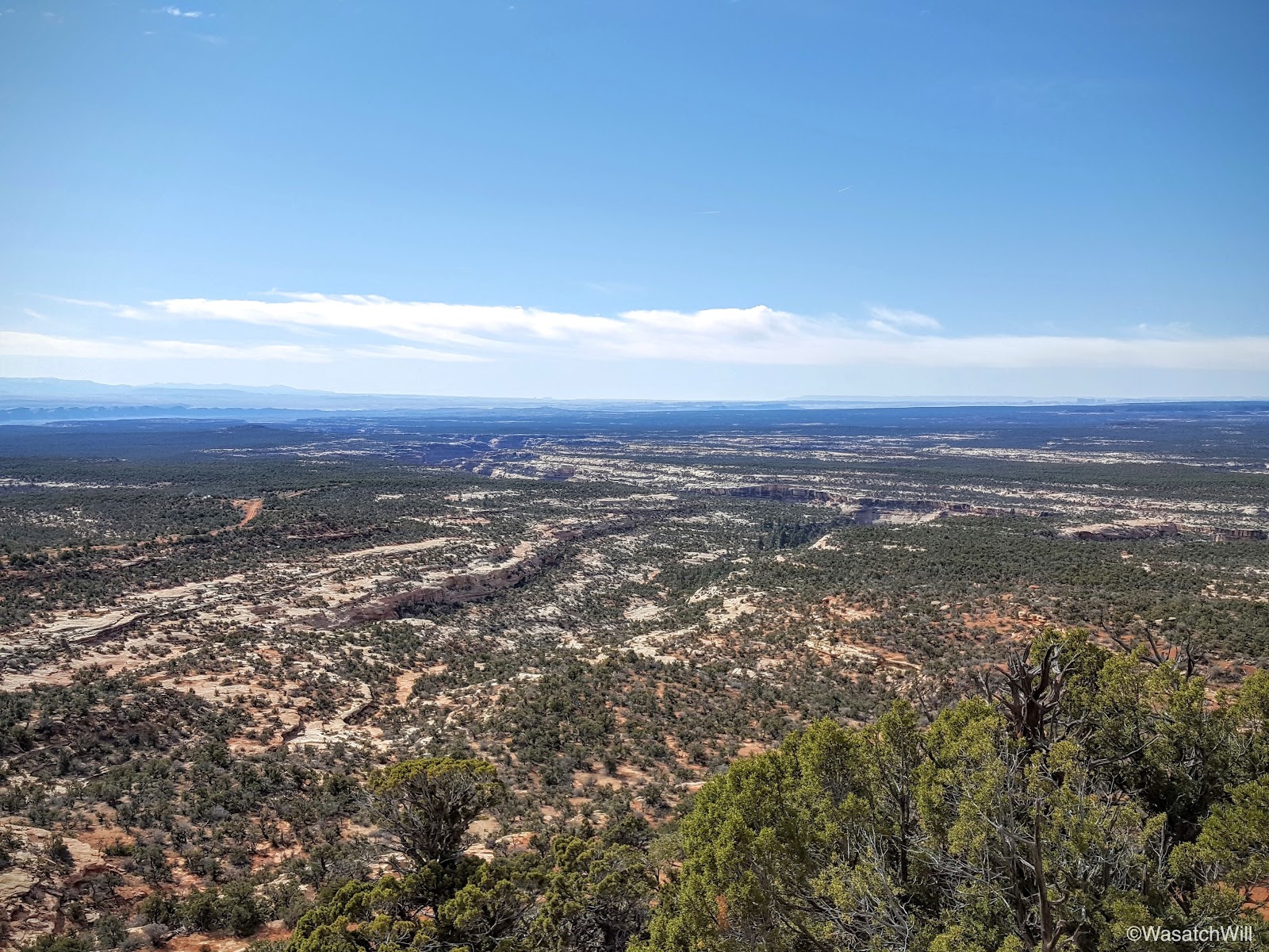
Salvation Knoll gets its name from an event back in 1879 where four scouts, part of the Hole in the Rock expedition of Mormon pioneers aiming to create a settlement down in the southeastern corner of the state, were out and about in the middle of December seeking out a safe passage around Grand Gulch and across Cedar Mesa to lay down a wagon road. Desperate to locate the Blue Mountains in order to orient themselves, their vision was continually obscured by Elk Ridge to the north. It wasn't until Christmas morning, having recently run out of food and believing their lives were soon to end, that they located a small cone shaped peak rising above the northern edge of the mesa whereby they were able to make a short scramble up to it and gain a whole new perspective of the mesa they were seeking to cross. It was there they were finally able to locate the Blue Mountains to the northeast and subsequently Comb Ridge across the east. Newly oriented with their surrounding, they now knew where they were to go and felt it proper to name the landmark Salvation Knoll, for to them, it had truly saved them.
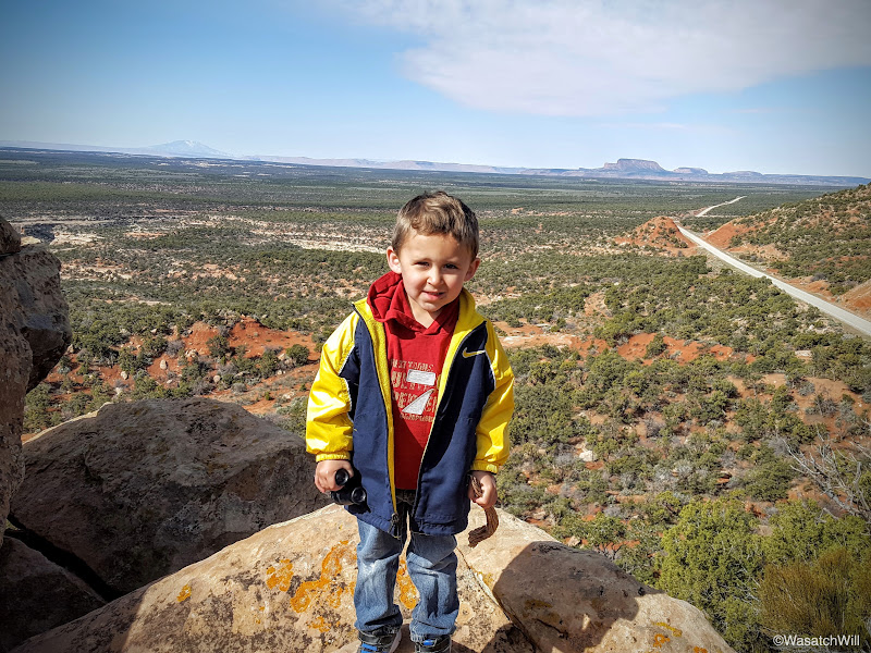
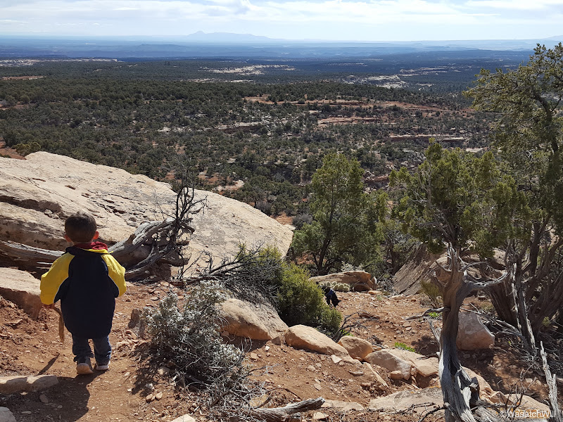
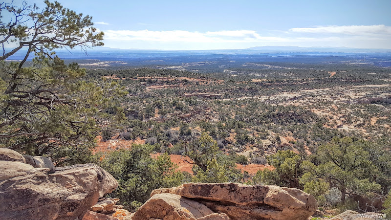
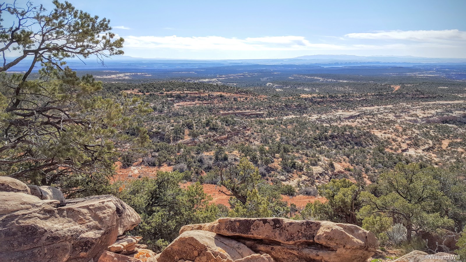
Lennox and I made quick work of it ourselves to see the same view those pioneer scouts did, albeit without all the snow covering the landscape. It really is quite a panoramic site to behold from such a short little knoll.
Comb Ridge could be seen sprawling across the southeast horizon with Arizona's Carrizo range far out beyond.
Colorado's Sleeping Ute Mountain could be seen out to the east.
Then, of course, there was the Blue Mountains to the northeast.
Salvation Knoll had proved to be the perfect little peak to bag for a three-year-old's legs.
Having had our fill of the view, we journeyed back down.
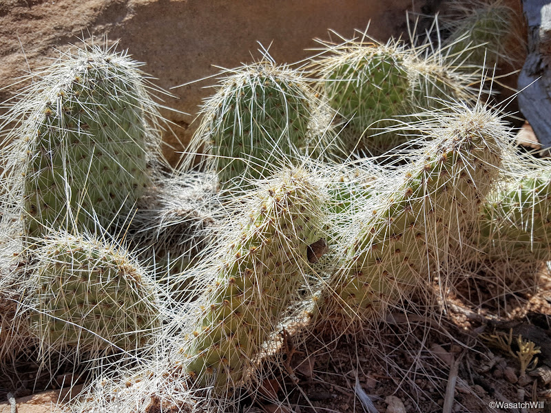
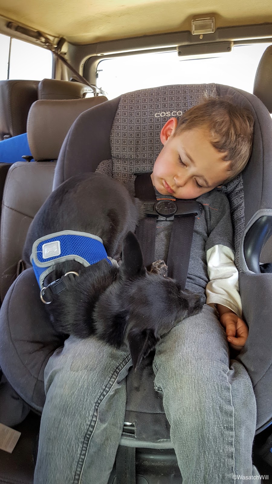
Cactus would become a consistent nemesis to our dog, Sophie, who had joined us for the trip.
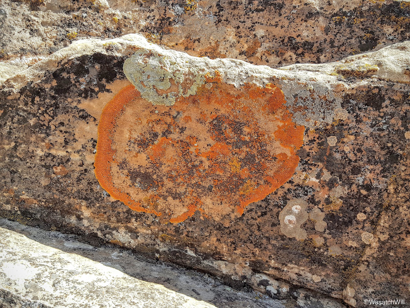
There was an interesting growth on one of the rocks along the side of the trail. I thought it looked like a pumpkin.

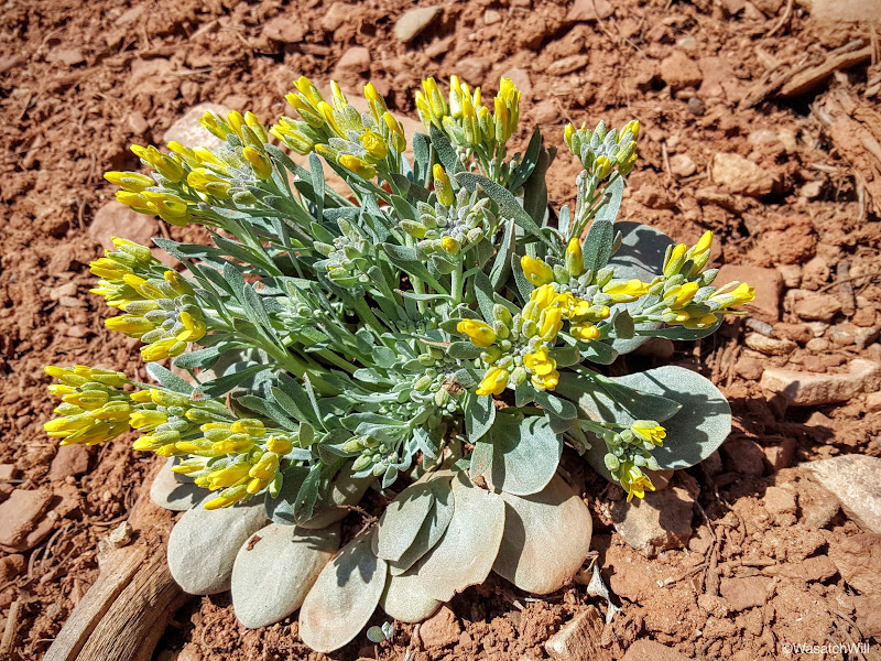
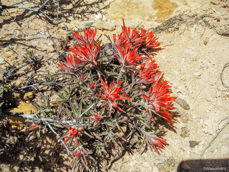
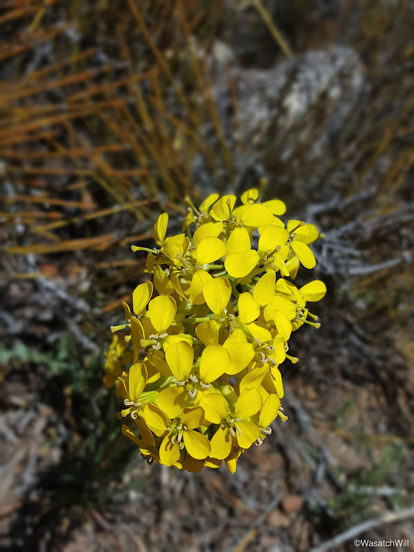
The desert's spring flowers were abundant.
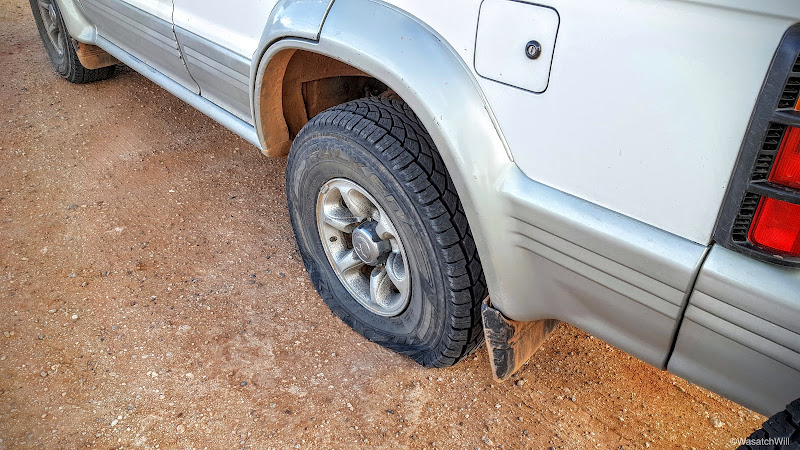
Once back at the car, we had a quick snack and drove on down to Comb Wash. Our next destination was Tower House Ruin, and I had thought to take the more adventurous 4WD road up out of Comb Wash to approach Tower House from the west. The higher the road got up out of the wash, the rougher and rockier it got. A group of ATV buggies were coming down and in chatting with them, they stated that the section I was trying to get up was like pavement compared to what lied ahead. Yikes! I didn't want to take all day negotiating such a road, so I made about a 12 point turn around to get back down to the wash in order to proceed back up the highway over Comb Ridge and make the smoother approach from the east. It wouldn't be without a bang onto a rock across the underneath side frame of the car. No damage done however, or so it seemed.
Shortly after getting back down to the wash, I heard the unmistakable sound of vomiting. Oh no! Lennox had become sick. Was he sick with a stomach bug now, or was he just car sick from the rough road we had just come off of? Logic suggested he was car sick. I pulled over at the next viable spot I could to assess the situation better. Fortunately, the mess was confined to small space: his pants, a bit of the straps on his car seat, and the floor beneath him. Nothing a change of clothes, some shop towels, and wet wipes couldn't clean up. Fortunately, we were equipped with all of the above.
All cleaned up, it didn't take long for him to return to feeling well again. Time to move on. Or not. The engine would not turn over, at all. Oh no! This can't be happening. Of course it was. When it rains, it pours. That's how it goes, right? I ran through all the troubleshooting I could think of, but to no avail. Scanning the underside of the engine and car as well as inside the hood revealed no obvious damage or other problems. The car's engine simply would not start.
There was a group camped no more than 200 feet down the road, so I walked their way and entered their camp just as they pulled in on their ATV's and four-wheelers. Perfect timing! Perhaps this was meant to be, after all. I explained the situation and they agreed to come up, have a look and give me a jump. Jump-starting was futile and they became as perplexed as I was. A jeep approached and offered to give us a lift into Blanding to make some calls or seek out a tow service if we were still there with the car after they returned from a leisure ride, which they expected to be a couple of hours. I told them thanks and that it was looking like it may well come down to that.
It was just after noon as they drove off and the other group returned to their camp. They offered their hospitality to us while we waited but I politely declined and opted to take Lennox and the dog on a walk the other way up the road to seek out any other campers that may be around and willing to give us a ride into Blanding. At worst, we could try some hitchhiking at the highway. After about 3/4 of a mile with about another 3/4 to go to reach the highway, I had a thought strike me that filled me with confidence. There was one other thing I hadn't checked on the car. Was it worth turning around and walking back to the car? The more I thought about it, the more confident I became about what the problem was. We turned around and began the walk back. The closer we got to the car, the more confident I was in the solution now brewing in my head.
Once we arrived back at the car, I immediately slid underneath the front passenger side and sure enough, there it was. The wire that runs from the starter switch inside the car and runs down and out to the starter motor had come loose and popped off. That bump on the road must have caused the connection to become loose. I put it back on, jumped into the car, set the starter and right away, the engine was humming. Yes!....Yes, Yes, Yes!!!
The trip was still on!
For all the delays, we weren't too far behind schedule. Now we could proceed to Tower House.
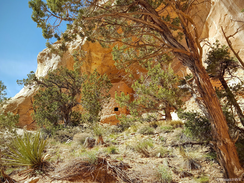
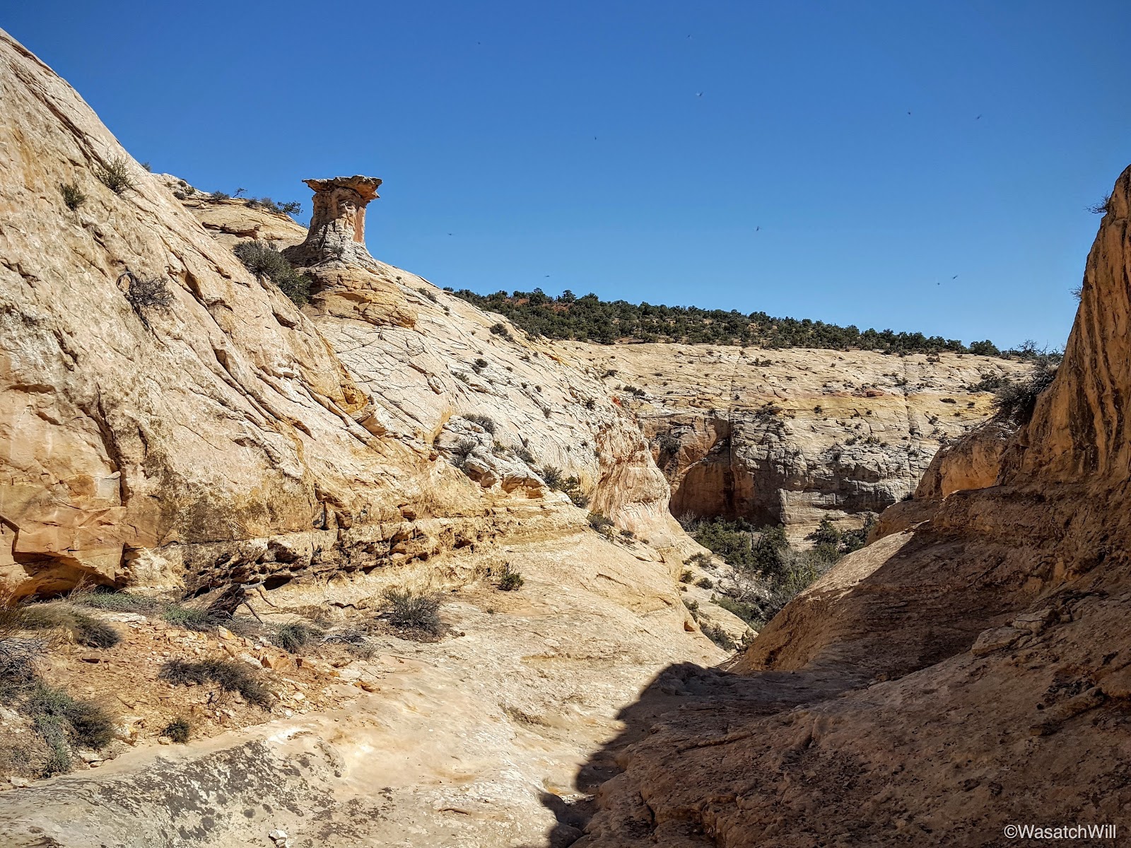
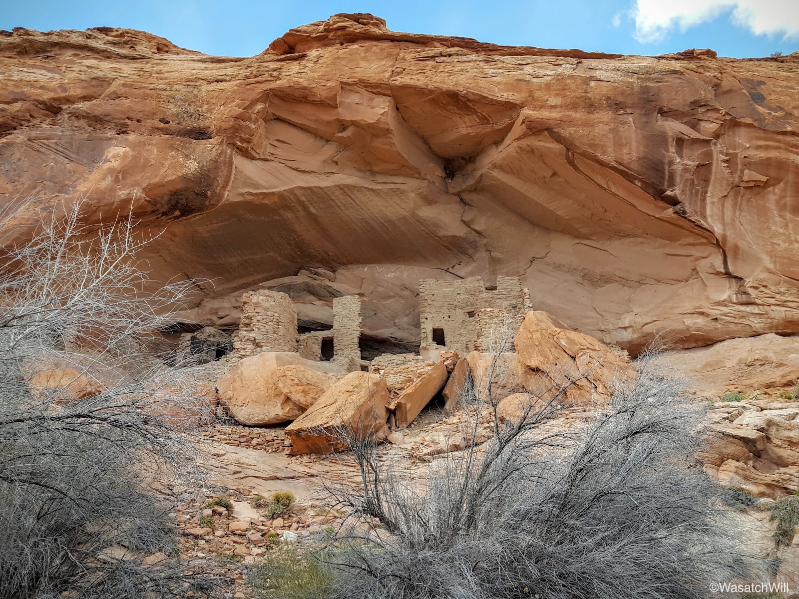
About a half hour later, we arrived at the top of the wash, ready to make the descent down.

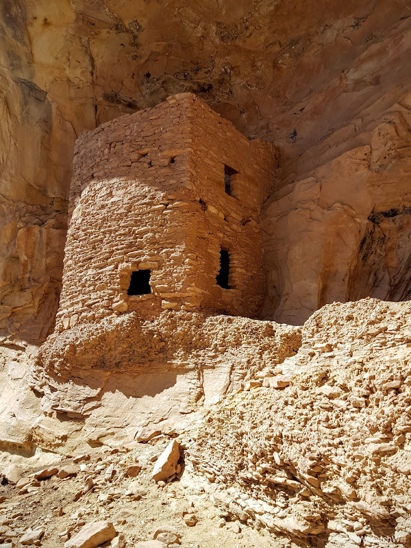
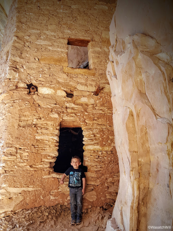
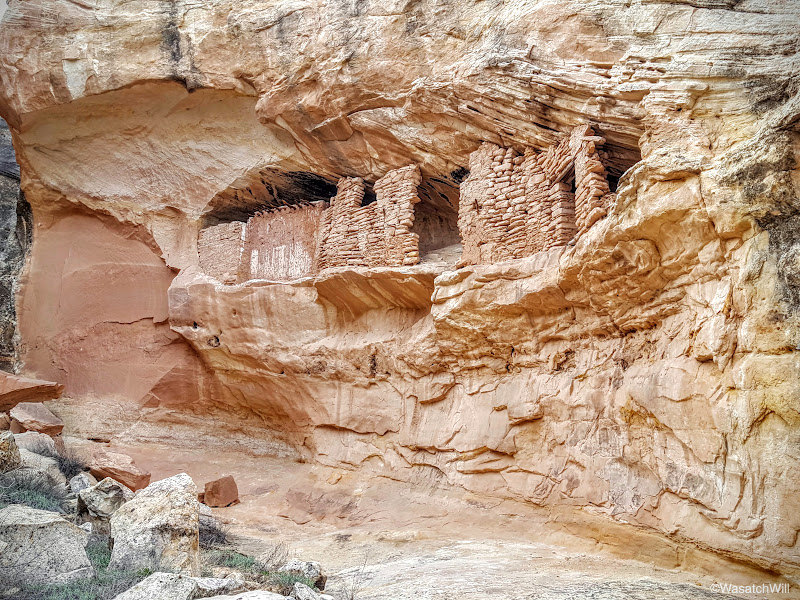
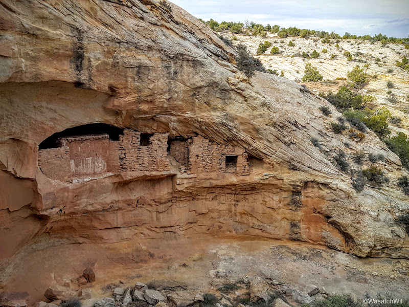
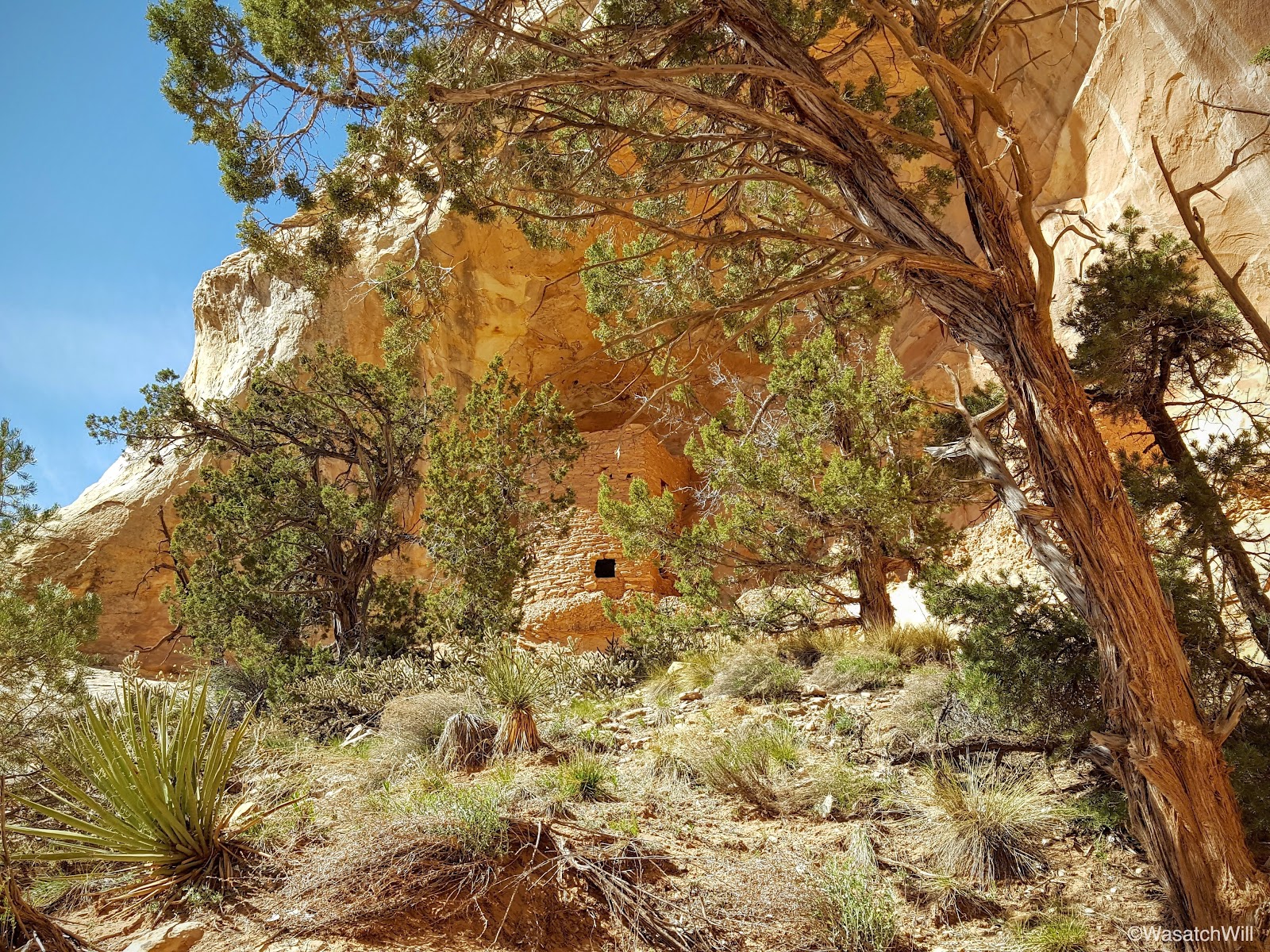
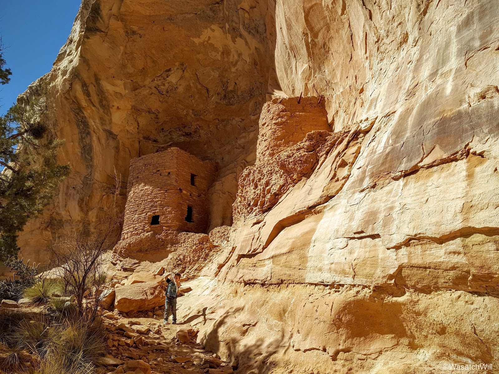
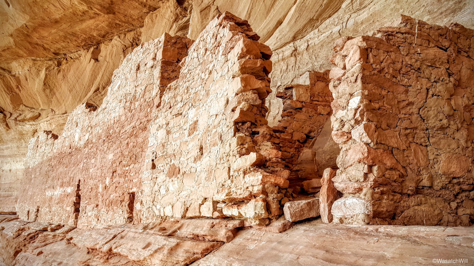
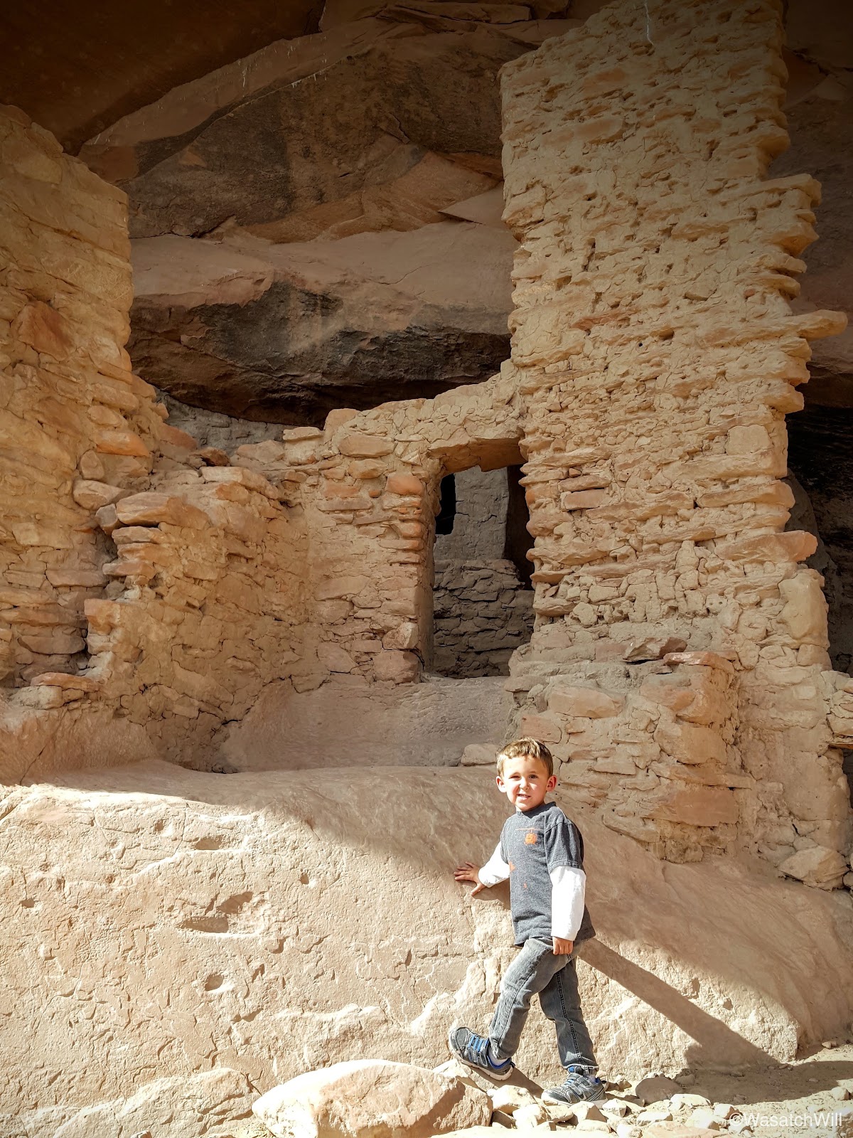
The descent presented us with a few tricky spots, particularly some small pour offs to navigate around that proved especially tricky with Lennox. With a bit of improvisation, we safely bypassed them, reached the bottom, turned the corner, and there it was, the two story structure resembling a tower.
Lennox was impressed.
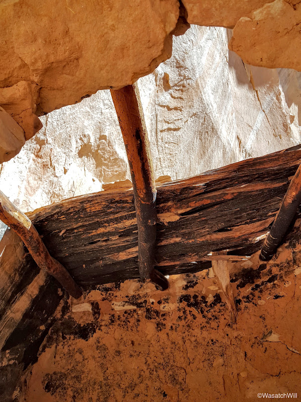
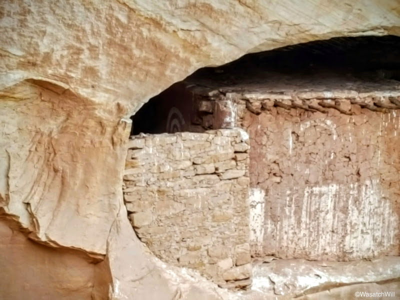
Looking up through the a window/entrance, remnants of the ceiling/floor separating the upper and lower level were still present, offering a first-hand look at some of the architecture and engineering techniques employed by the "ancient ones".
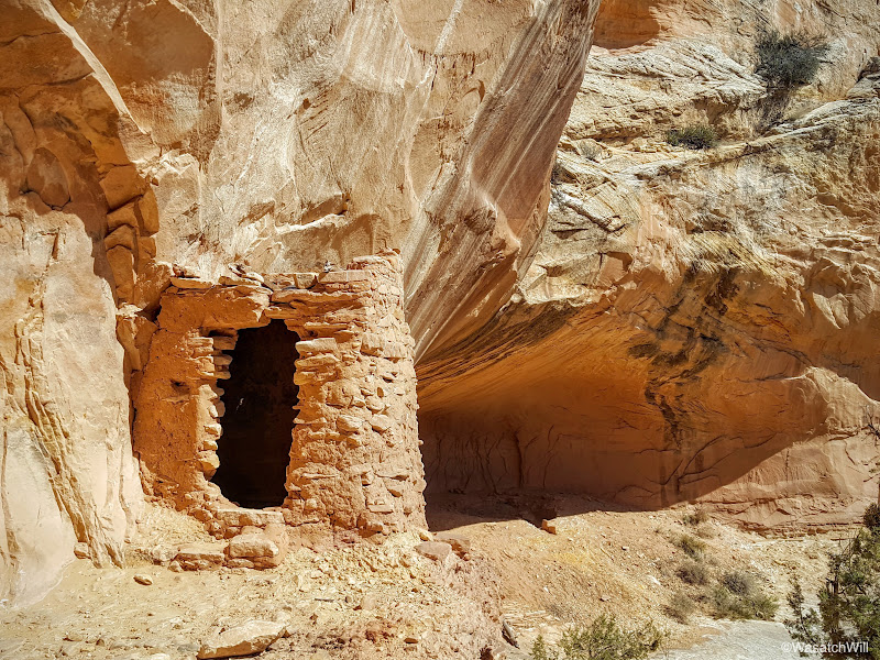
Right next door was a separate room or large granary.

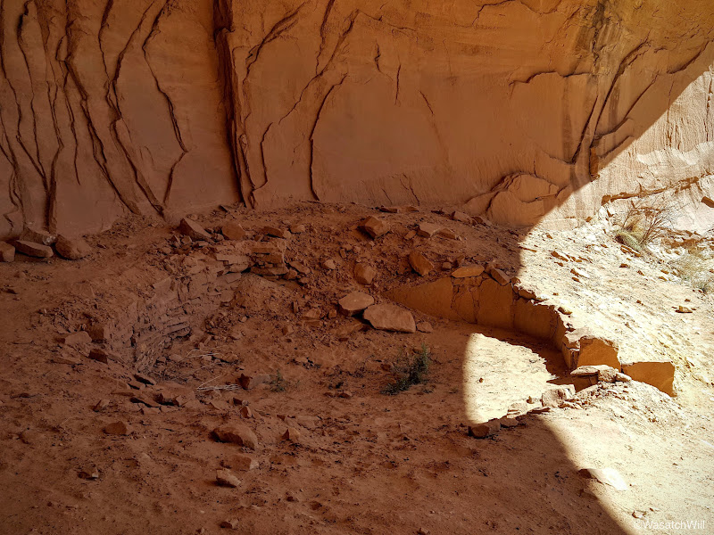
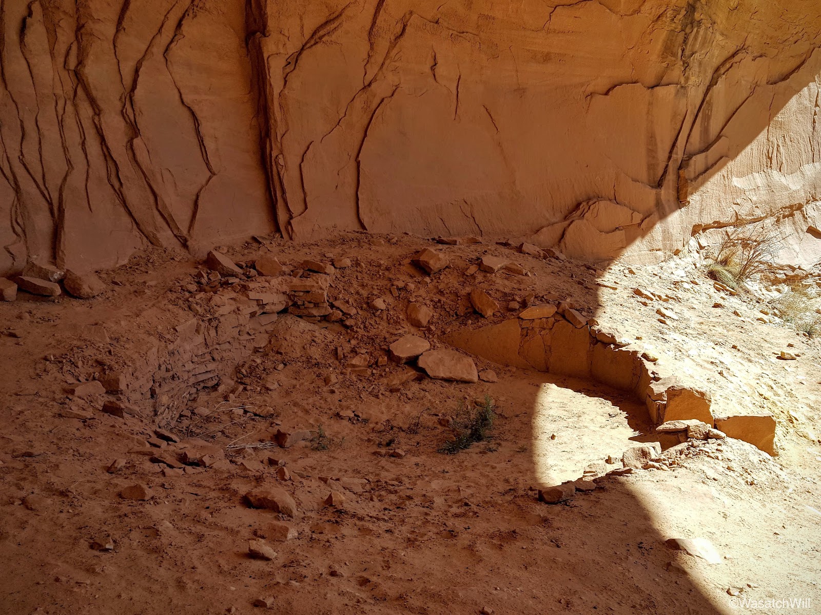
Further down in the alcove sits the remaining foundation of a kiva.
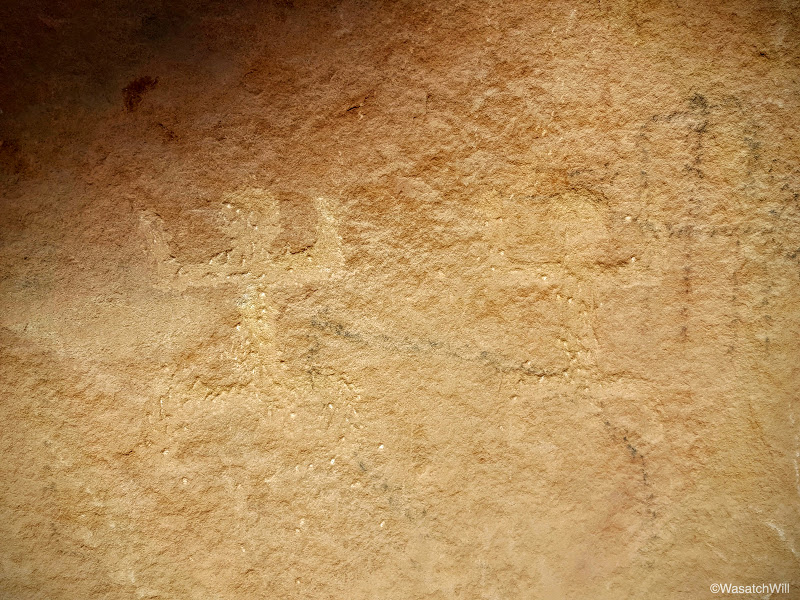
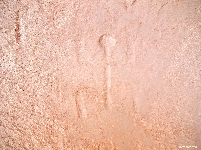
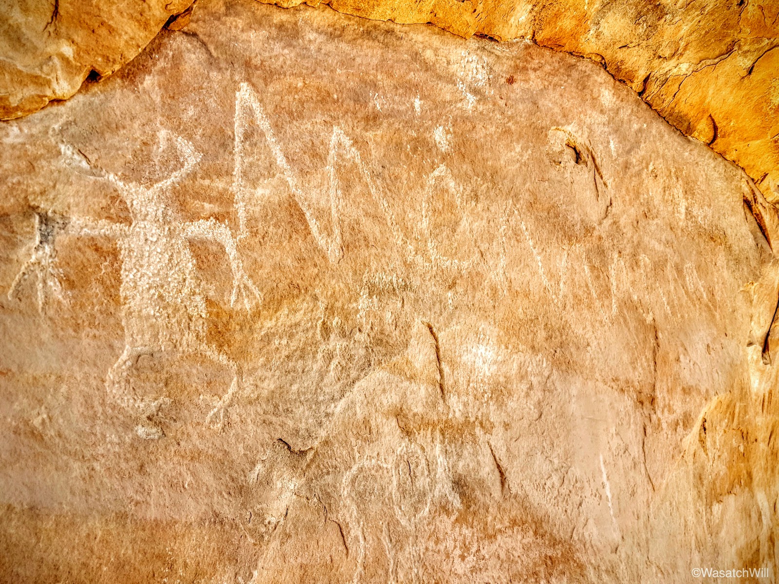
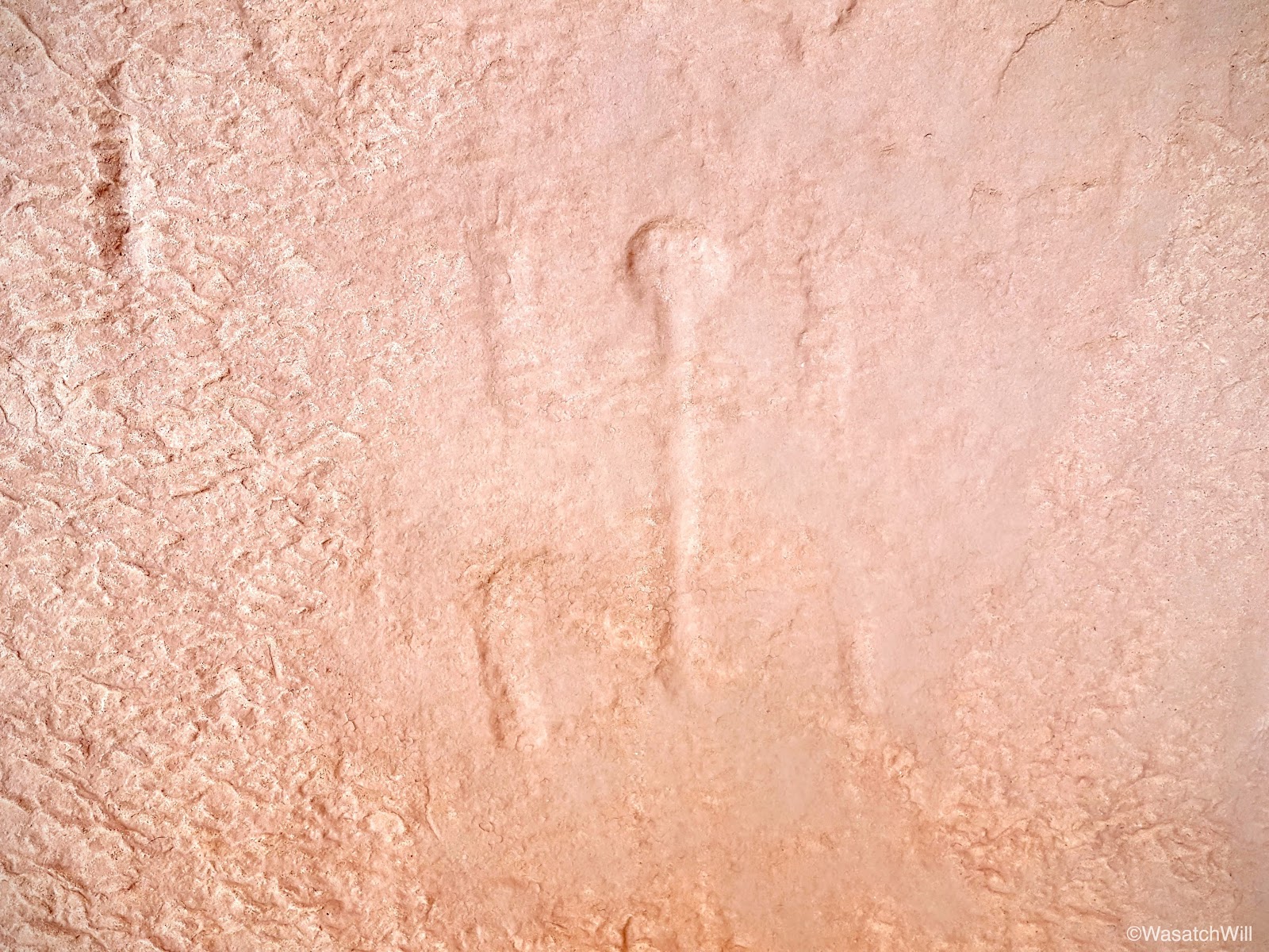
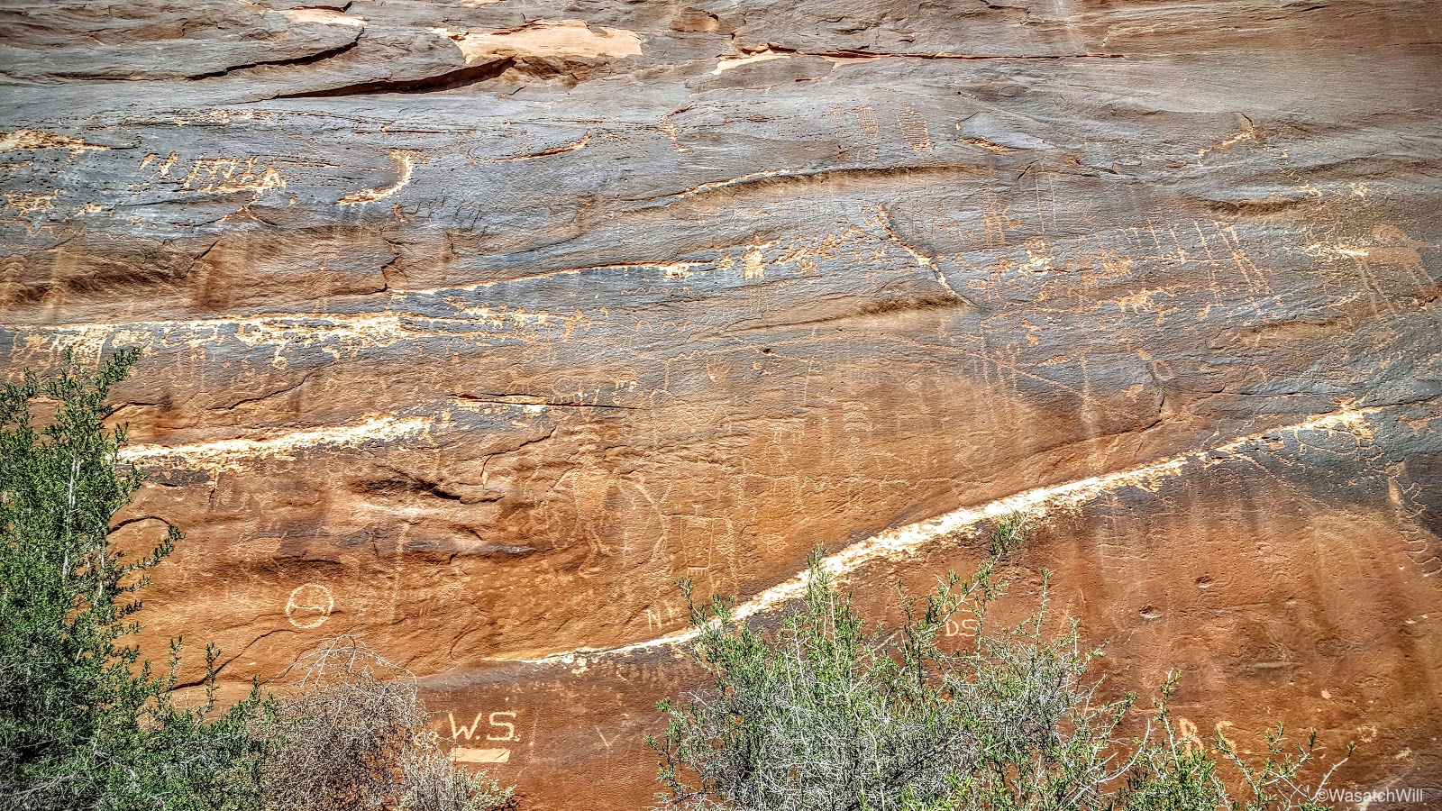
As expected, there were a few petroglyphs adorning the alcove walls as well.
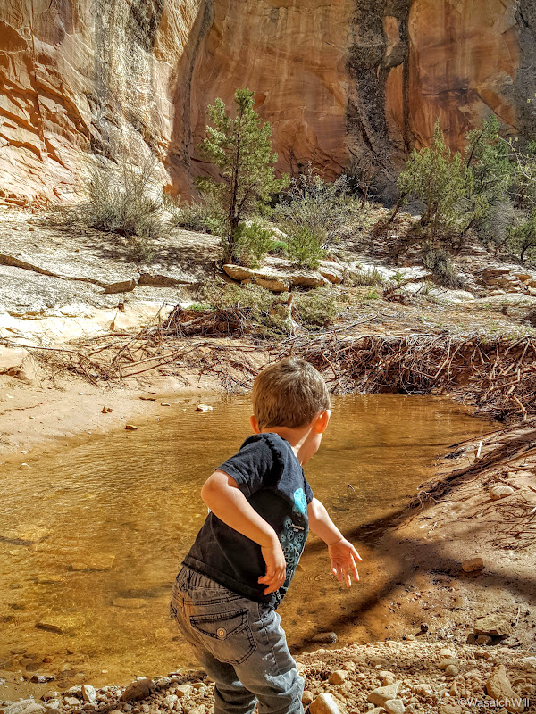
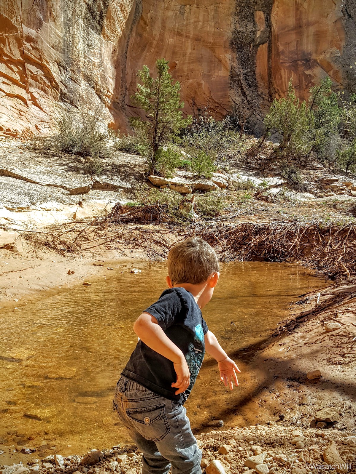
At the foot of the alcove, there was a shallow pool of water, a common feature at the head of canyons such as this. It was easy to see why such a site would be chosen for a dwelling. It was also too tempting for Lennox to resist tossing in a small rock. Don't worry, I ensured it was just that, a rock, and not some potsherd or other relic.
Having checked this site off the list, we hustled back up. Lizards would distract us numerous times, however.

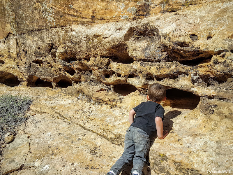
And then there was the cavities along the canyon wall. I always call them "swiss cheese" walls. Lennox refers to these features as "lizard hotels".
When we arrived back at the car, I noted we still had lots of daylight left, so we drove on down to make the hike up to Ballroom Cave and Target ruins.
The cottonwoods hadn't bloomed out yet, but the trail was still very pleasant and cool.
After a nice little 45 minute stroll through the wash and several stream crossings, we were gazing up at what were clearly some ruins sitting high up in an alcove above.
We located the most feasible path via some signs now posted, and inched our way up to the alcove.
Unfortunately, not much of this ruin site was left in tact. All structures had significant damage, but it was still a very unique place.
We quickly found the cave tucked back down in a corner of the alcove, or what we thought was the cave, only to be disappointed with how shallow it seemed. There was a register and info box right there though that confirmed this was the site of Ballroom Cave.

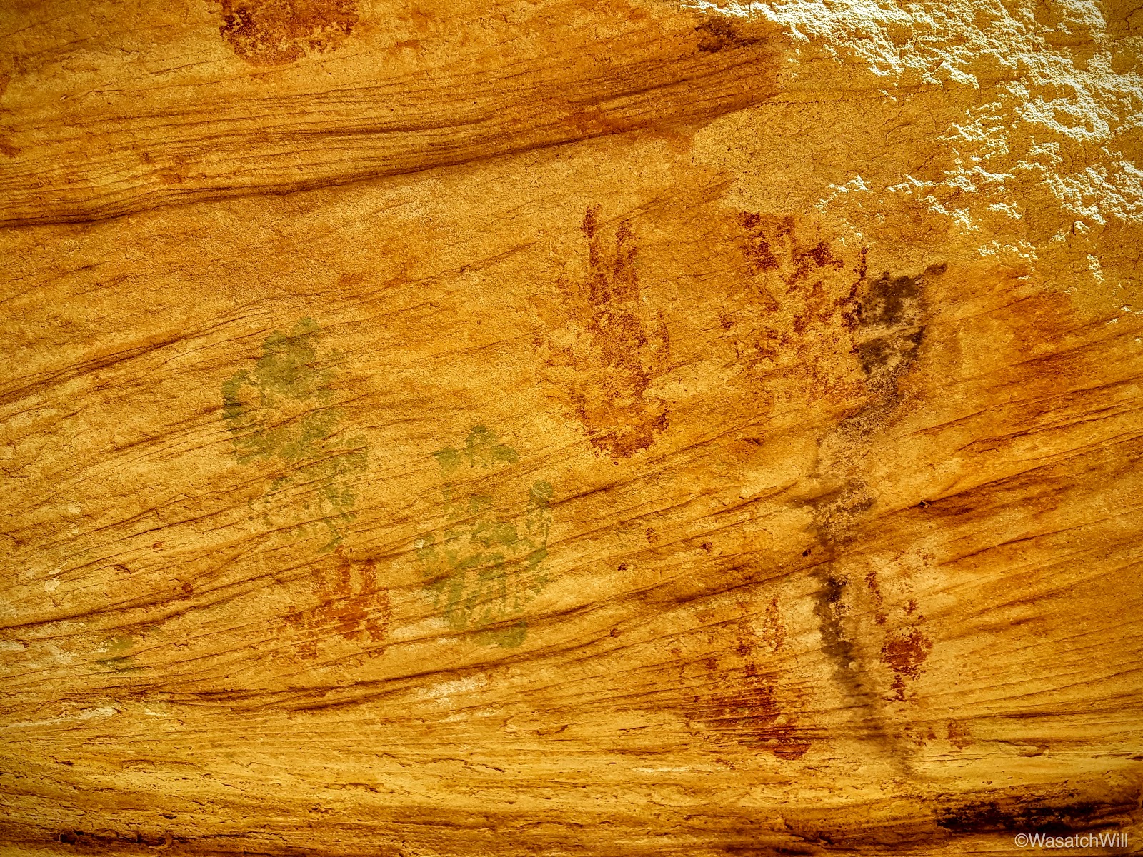
From what I had read and seen, there should be a cave much larger, deeper, and darker. But nothing else was in sight. There were a few interesting and colorful pictographs to view, however, mainly some handprints and anthropomorphic figures.

It was also interesting to observe the pattern used in the erecting of the adobe walls. Small stones layered between large stones.

Still, I was convinced there was a far more magnificent cave to be found. Up and around the ruins higher up in the alcove, we went.
And then, there it was! The big one!

What starts out looking like another relatively shallow cavity turned out to be every bit expansive as I was led to believe.
Lennox was certainly excited too! Wow, was it big and dark!
Inside, on one end, there was a wall that had been built up to create some kind of a room.

The other side of the cavern extended even deeper and farther. Looking back, the walled room virtually disappeared into the darkness the further into the other side we went. There weren't really any other obvious structures or remains. Mostly rocks and lots of dust, there was however a great big slab of rock where lots of metate depressions lined the top of it.

I imagine there must have been much more to this cave at one point, but was probably severely looted. We spent a bit more time admiring what remained of the ruins back outside of the two caves and tried to imagine what the whole site must have looked like and how it functioned with its ancient inhabitants.


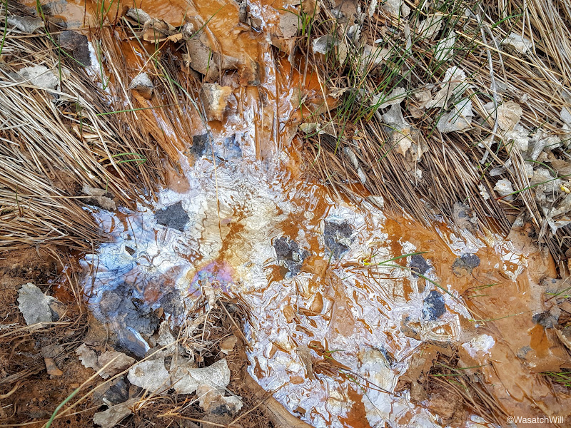
Having had our fun and fill of the Ballroom, we moved back down canyon looking for the turnoff up to Target Ruin. Along the way, I noticed some oily substance at various points along the stream. It wasn't pleasant to think about if one had to rely on capturing some water from here, but it sure added a colorful accent to the water surface.
Only minutes later we saw the turnoff for Target and with a quick walk up a hill and into its canyon, there in the wall above, we looked up and beheld the famous Target Ruin.
Of course, we had to get the iconic view of its namesake by scrambling up the hill across from it.
At which point, we could look down and zoom in on its famous bullseye target adorning the interior side wall.
Along the top edge of the hill across from Target Ruin lies another little alcove containing yet more ruins and other relics.


Now it was time to get back to the car and start making our way down Butler Wash to camp for the night. Along the way, we had to stop at a dinosaur track site we had just learned about prior to setting off on our trip.
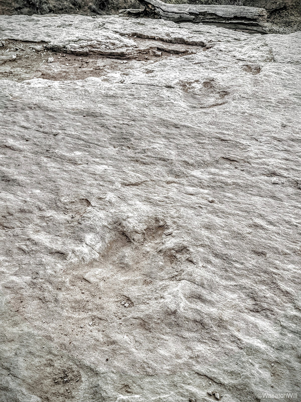
It was an instant hit for Lennox. Like many boys his age, he loves dinosaurs.
We continued on down Butler Wash and waved the sun goodbye for the evening as it set behind Fish Mouth Cave.
A few moments later, with just enough daylight to spare for setting up camp and cooking dinner, we found ourselves a spot in the area we wanted, very much near the trailhead for Monarch Cave.
Having no fire the previous night, Lennox was anxious to get his smore on.
We watched the moon rise in the east and it would have been a spectacular shot to try to capture if I owned a DSLR with a good zoom lens. Time to call it a night.
Day 3
Friday - March 25, 2016
While not quite as breathtaking as our previous campsite, Butler Wash proved exceptionally calm and peaceful save a few distant "moo's" from nearby cattle ranging in the area.
Comb Ridge spanned the entire western horizon above the wash.
Once again, it was time to break camp and set off on the final day's site-seeing extravaganza. Since we had camped out near Monarch Cave, of course we had to go up and see that.

Unfortunately you can no longer proceed any further into the ruin site because of this...
I could only wonder if the damage was natural or the result of some careless human interaction with it.
I tried to capture a shot of the pool of water also found beneath this ruin site, but it was too much in the shadows.
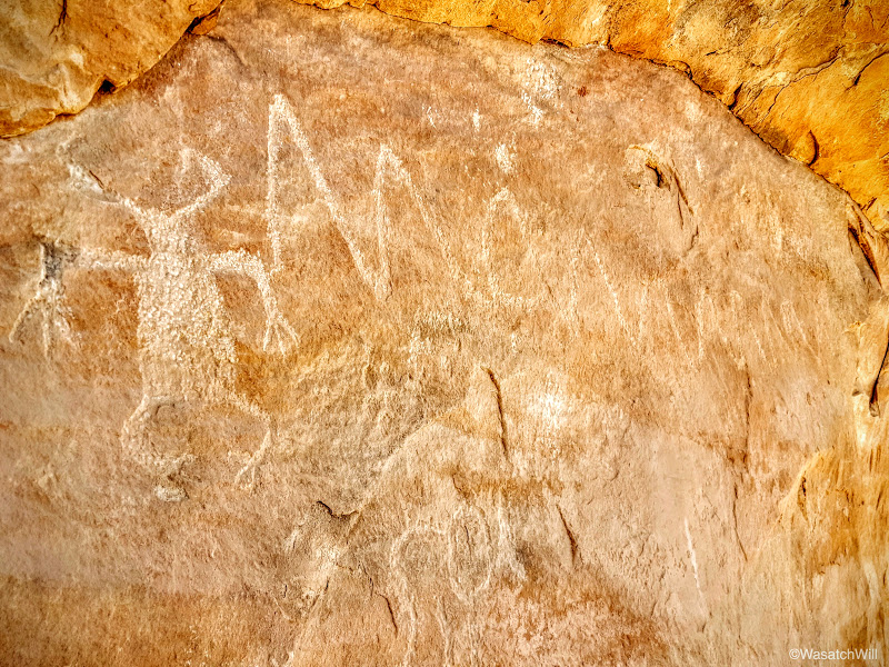
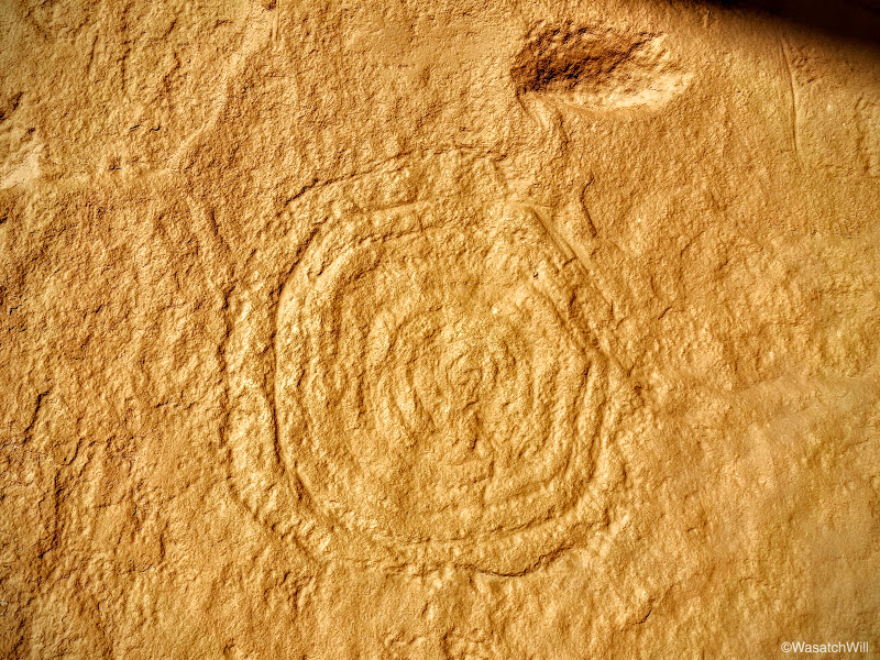
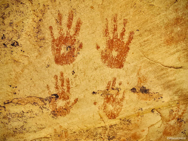
There were several unique petroglyphs and pictographs abundantly found all along the walls above.
This one was particularly interesting with the artistic pattern found within the hand print.
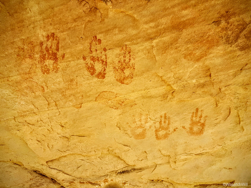
There were quite a few hand print arrangements.
And a figure I now call, "the buggy man".
More hands.
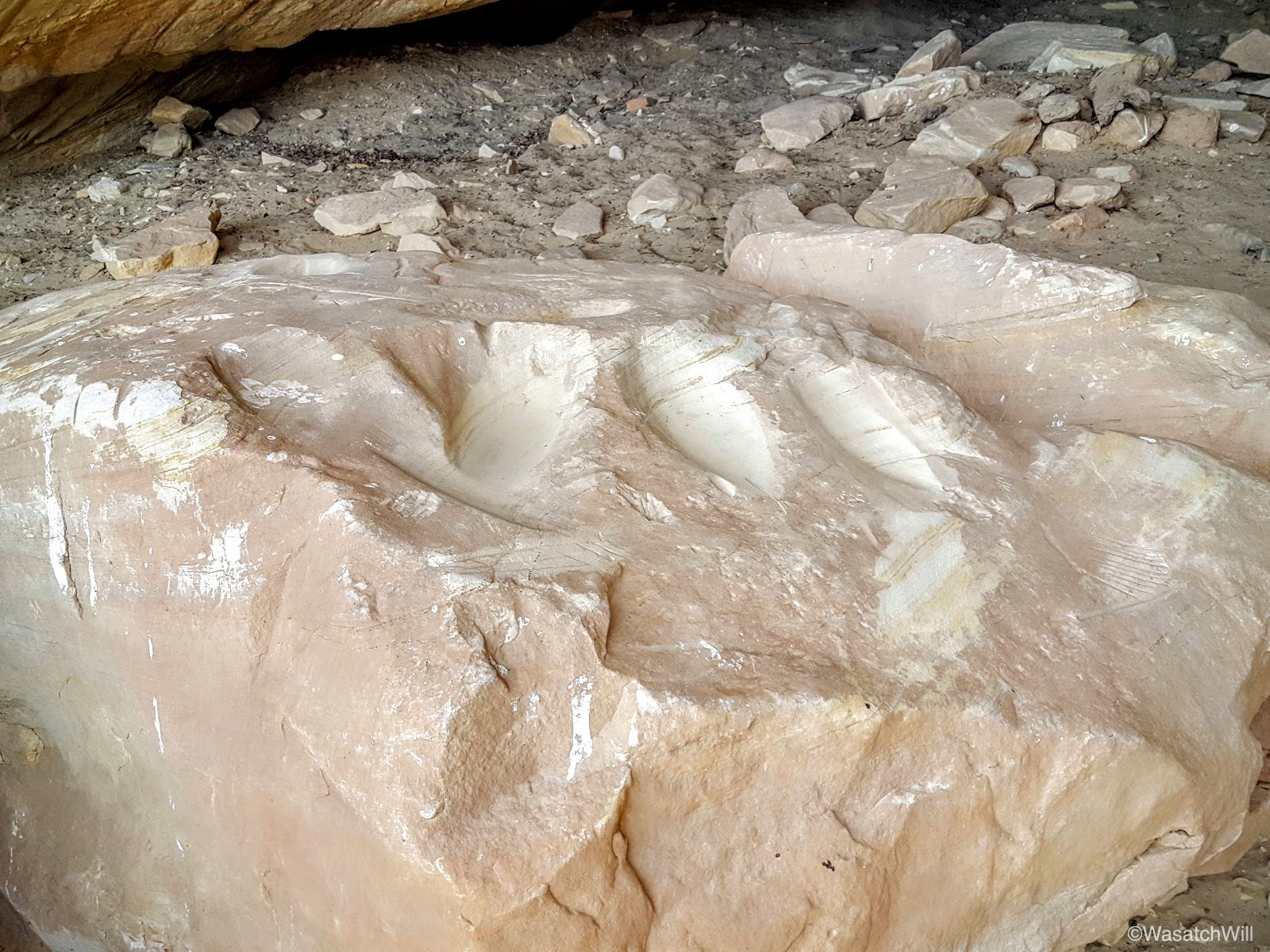
More metates.

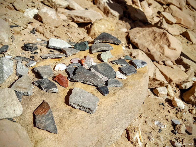
In addition to all the rock art, there were lots of sherds. More sherds laid out for display than I can recall seeing at any other ruin I've visited.
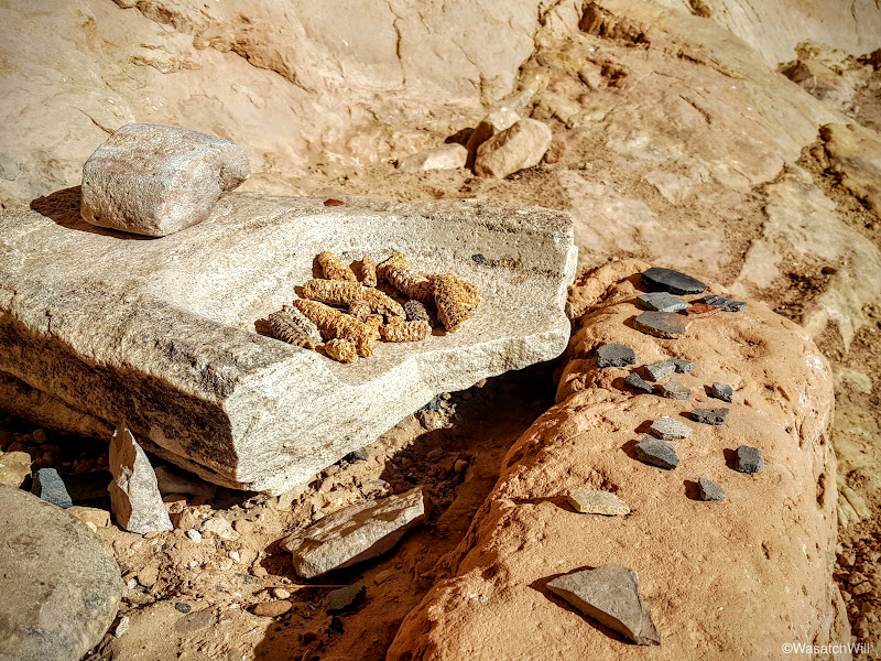
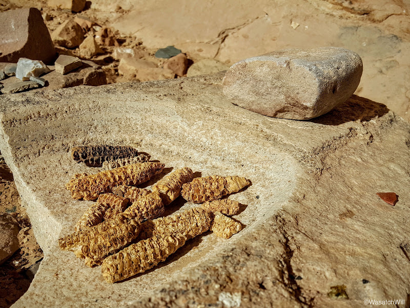
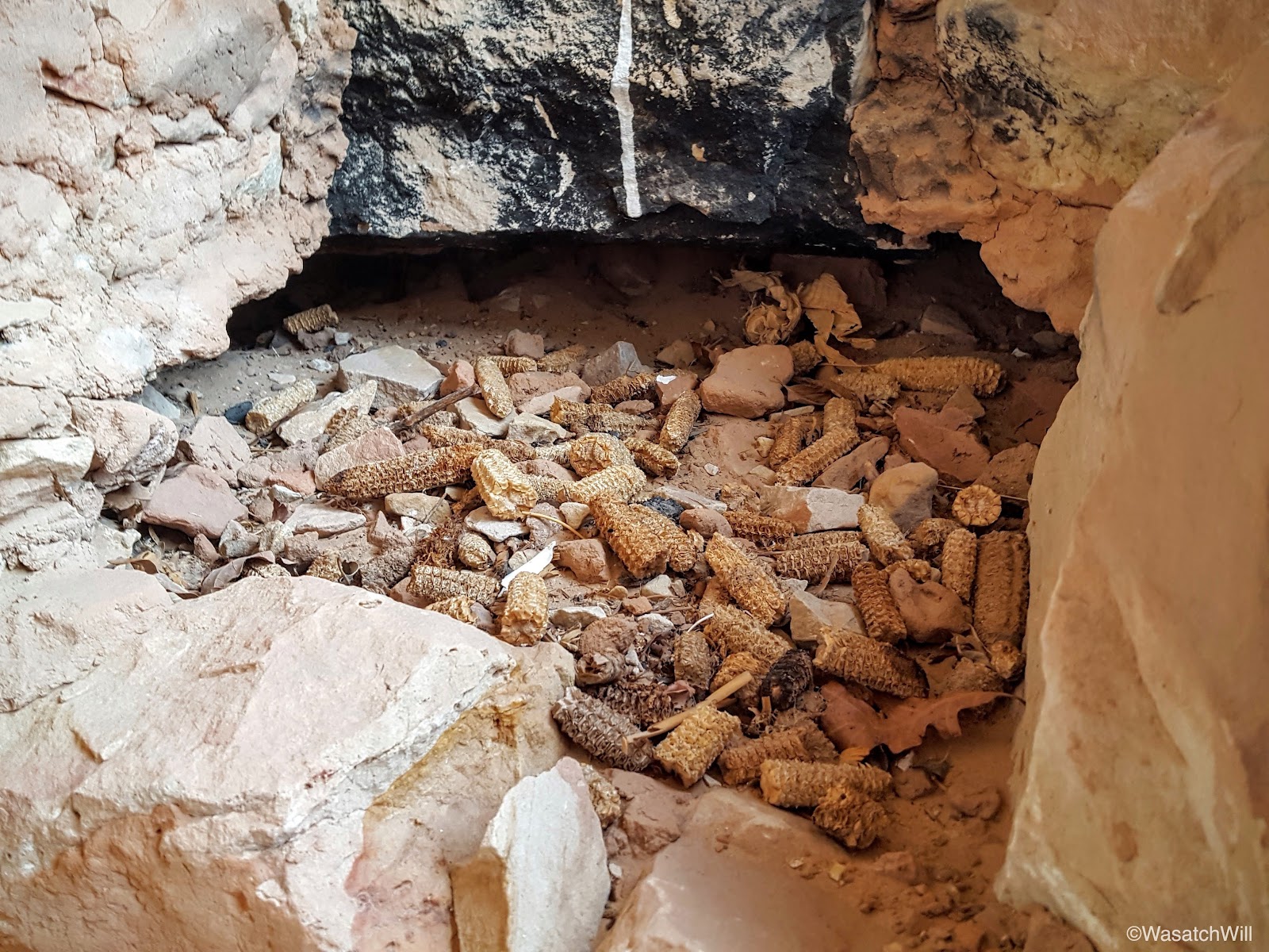
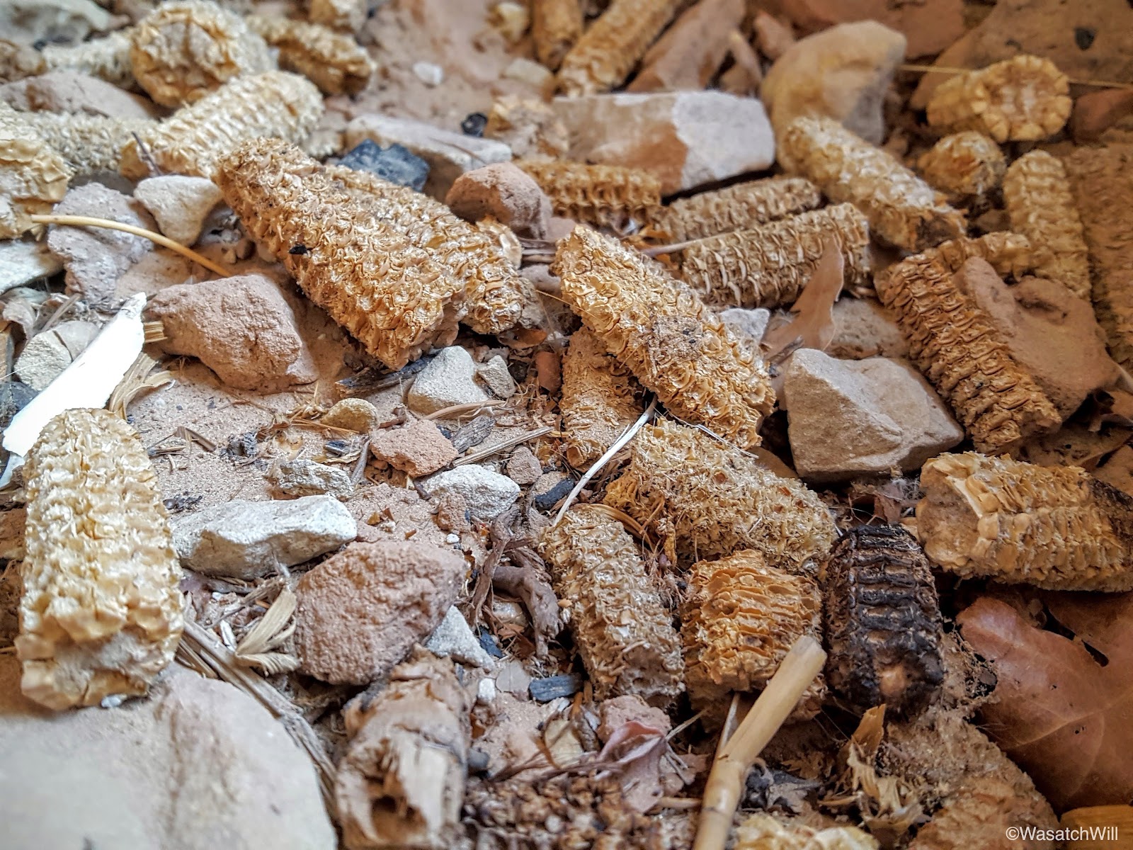
Close up of a manos and metate with ancient maize.
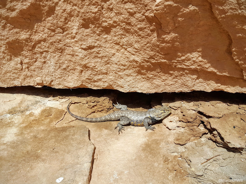
Adding to the excitement was this spiny who came out to say hi for a bit.
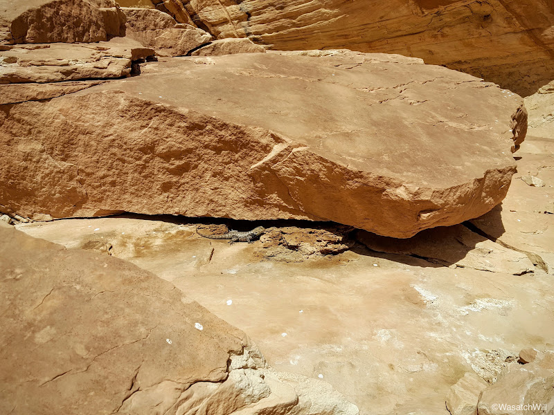
It was by far, the biggest lizard we had seen on the trip.
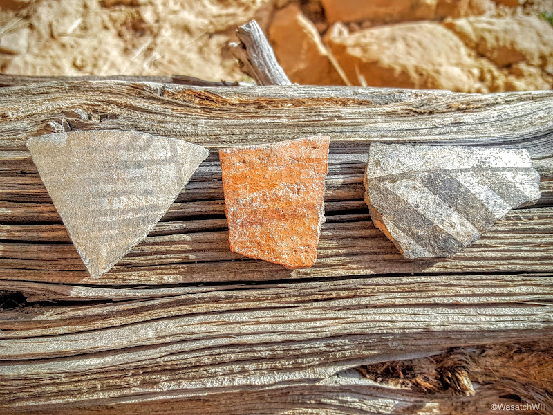
Back to pottery sherds, including a small piece of black-on-white.

Then there were these gems.
With Monarch Cave now done, we set off for Bluff. I had hoped to locate another rock art site called the Big Crane further down the wash on our way out, but once we had crossed the wash and saw how much further we'd have to go, I opted to save that one for a later attempt.
On to Bluff we went for a bit of lunch and to top off the gas tank once more. Lennox had suggested slushees and I obliged. Our next destination would be the Sand Island petroglyph panel just outside of town along the San Juan River.
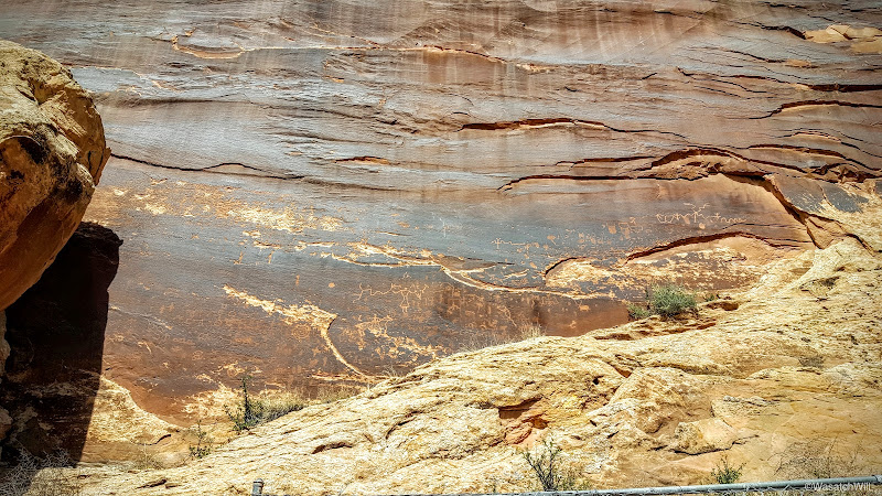
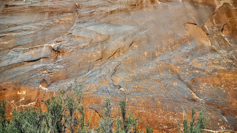
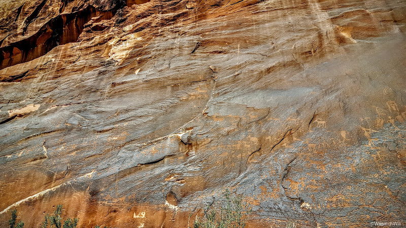
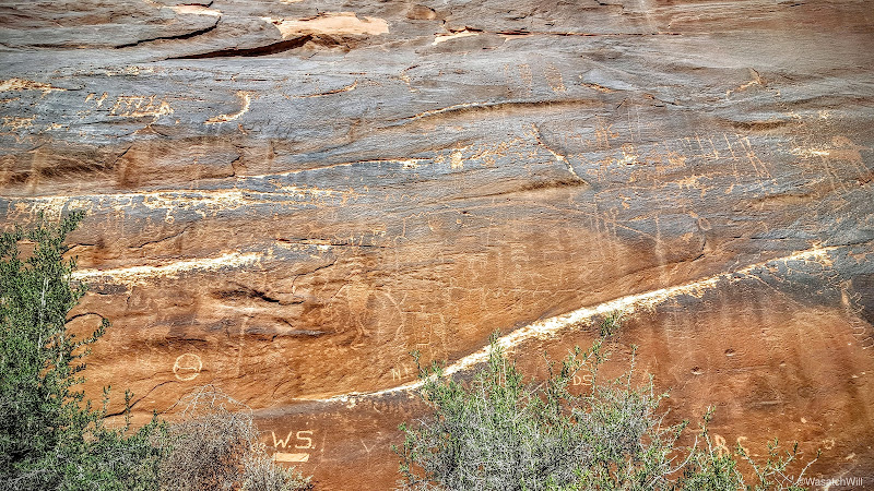
Like Rochester Panel, it was quite an active panel full of hundreds of figures. Not having a zoom lens for my cell phone, I was stuck with wide shots.


We then drove on out to pay a visit to Seventeen Room ruin located on the Navajo reservation across the river. At this point, all the hiking had caught up to Lennox and Sophie though. They were now checked out.

The road leads right below the ruin site, so I chose to let them rest while I made a quick run up to check it out.
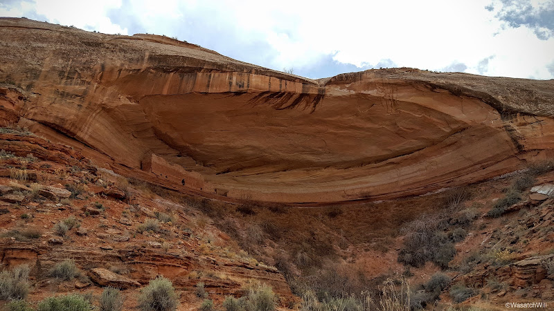
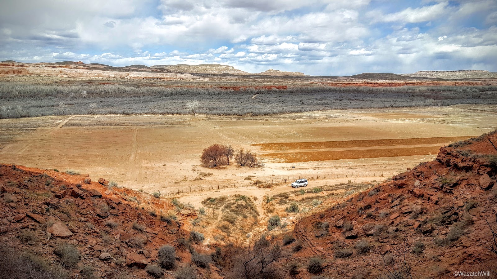
What makes this ruin unique isn't just its long continuous wall shared by all the many rooms (roughly 16 to 17) and hence its name, but it is also a dwelling built up in a north facing alcove. Most dwellings like this are found facing the south where they can capture the warmth of the winter suns among other benefits. Perhaps this was a great summer house then?
Looking down and out from the ruin, you can see across a farmers field and across the San Juan River valley.
On the drive out, I would make out Monument Valley way out on the horizon.
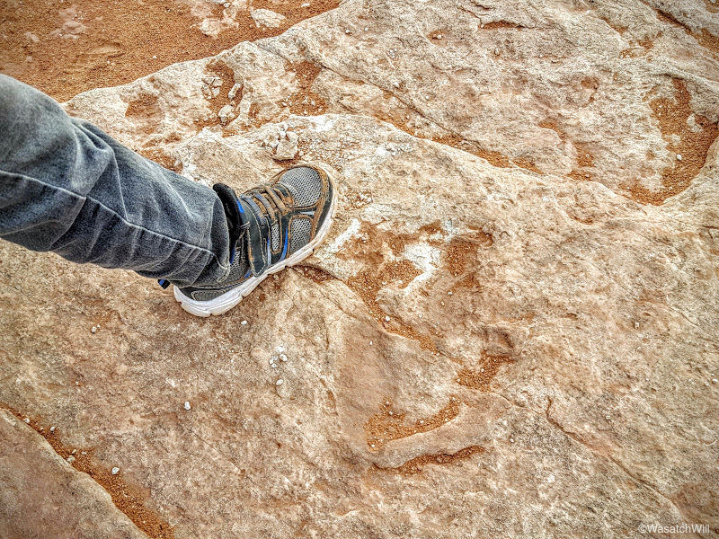
We could have made a drive out to Monument Valley but opted to stay closer to Bluff for the rest of the afternoon. I had read of some other dinosaur tracks that supposedly exist right along the old wagon road leading down into lower Butler Wash. So, we took the somewhat rough road out to that trail and began hiking down to see what we could see.
Some darker clouds were starting to roll in a bit and we still wanted to get out to one last big ruin site that afternoon so we didn't stray too far. We didn't find any obvious tracks either, but there was this shallow looking impression that may indeed be a dinosaur print?
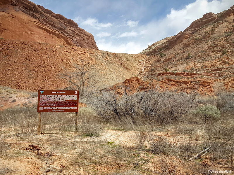
With our quick little dinosaur track hunt finished, we drove back through Comb Ridge and down into lower Comb Wash. There we paused for a moment to check out Navajo Spring, a landmark used in setting the course for the Hole in the Rock expedition mentioned earlier.
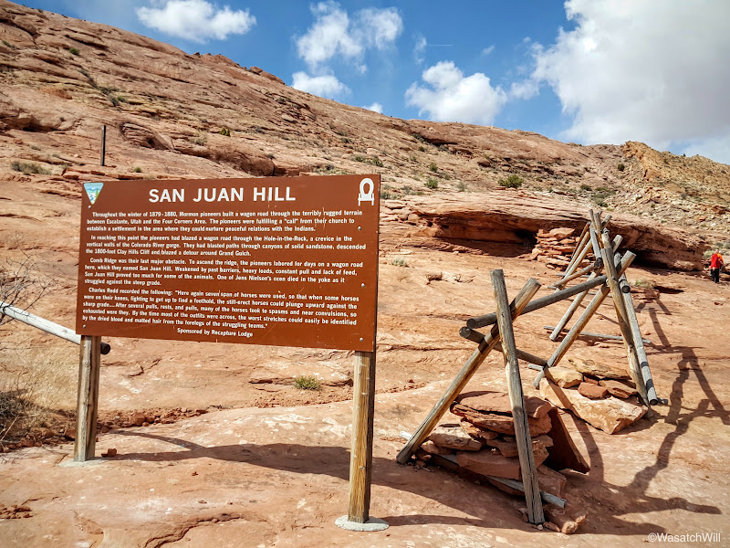
Then it was on down the wash for a few more miles before we arrived at San Juan Hill. This was the final obstacle for the Hole in the Rock pioneers to overcome in their bid to ultimately settle what is now Bluff.
It also proved to be quite an obstacle for my car to get to. I had been driving 2WD the whole way until reaching the turn up for this hill. There, the road climbs up a rather steep and rocky stretch and I didn't think to shift into 4WD first, so of course I got stuck for a moment and started spinning out in a pocket of sand between rocks. Even after shifting into 4WD, I was still spinning out a bit and unable to progress up the hill. It wasn't until I reversed back a few feet and gained just enough momentum to take us up the hill.
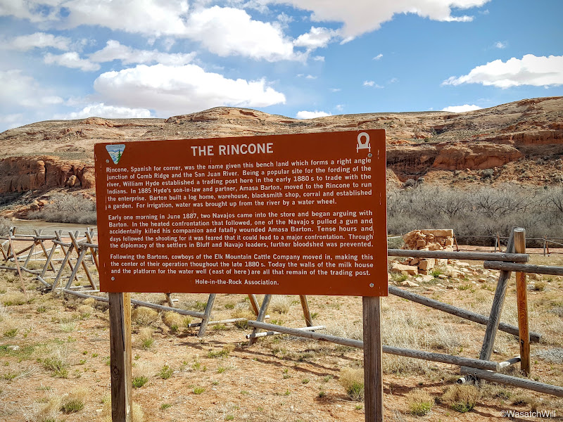
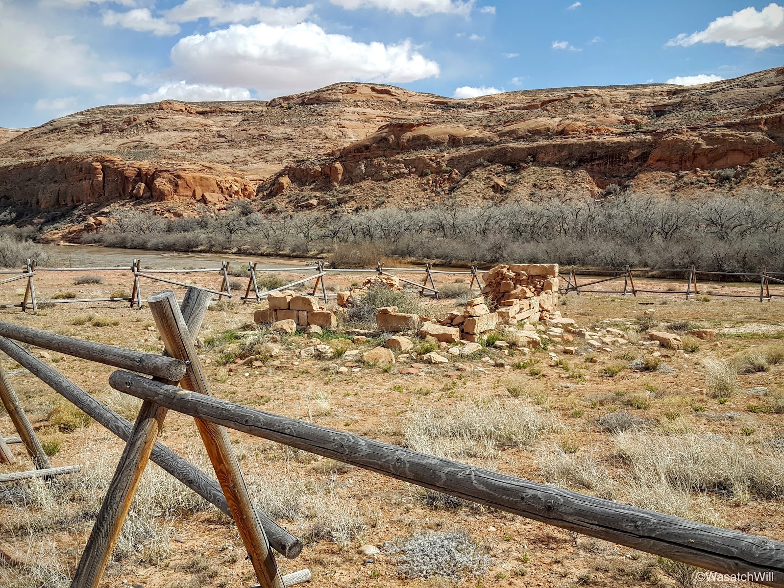
From there it was over to the Rincone where the remains of an old pioneer trading post sit.

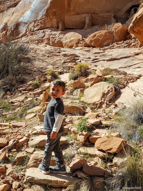
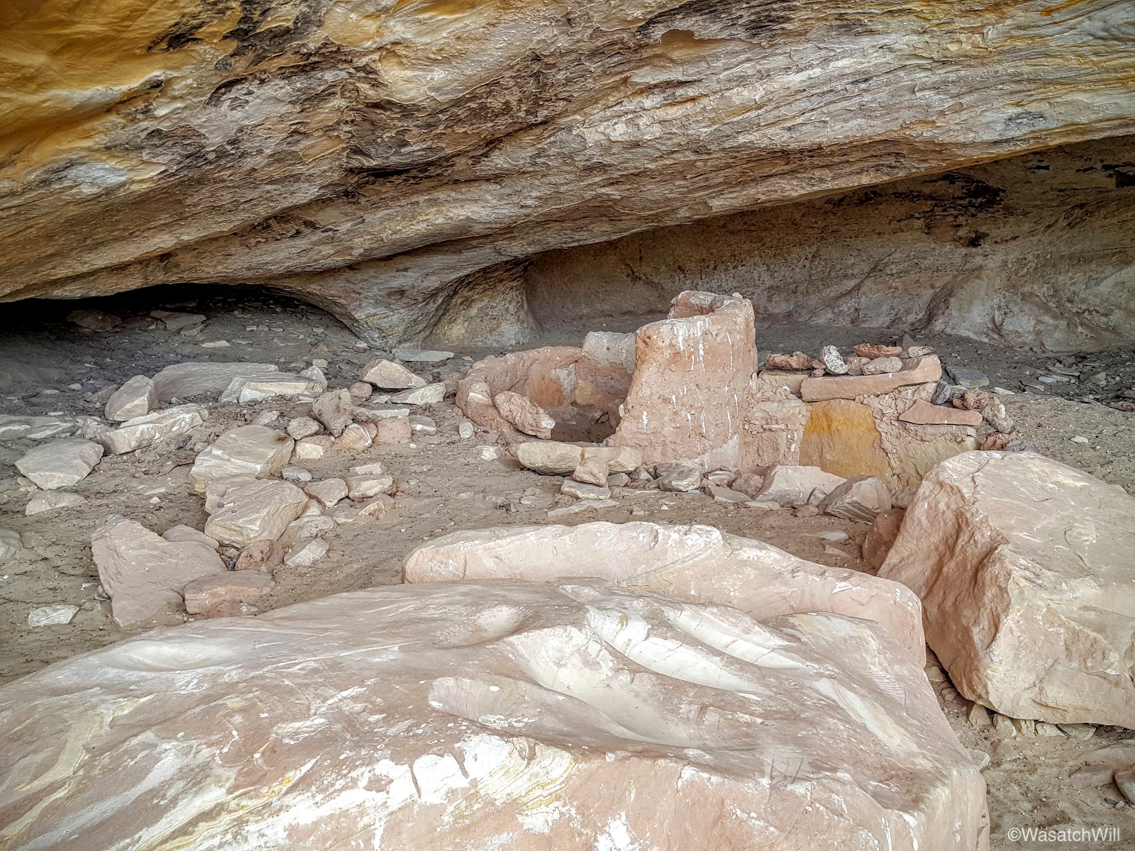
And then it was on down to the final ruin site of our trip, River House ruin.

This ruin was as every bit as fascinating as any of the others I've thus far been to. Much like Ballroom, there was so much more to it than what meets the eye from below. Particularly unique to this ruin is some actual stone staircases that were assumedly laid by its ancient inhabitants in order to access it.
This site turned out to be quite a complex as we observed all the many different rooms and even a two level structure with some keyhole-shaped doors.


There's some debate about the unique pictograph that adorns the upper wall and ceiling above. Some interpret it as a great long snake, and hence another name for the ruin: Snake House ruin. The other interpretation is that it is a depiction of the actual river that flows below it. I think the latter is the more commonly held belief and thus the more official name used by the BLM: River House Ruin.
This site, too, had a nice little collection of potsherds out on display.

And another spiny, though not quite as big as the last.

The San Juan River looked inviting for a moment. Some day I'd like to participate in a rafting trip down it.
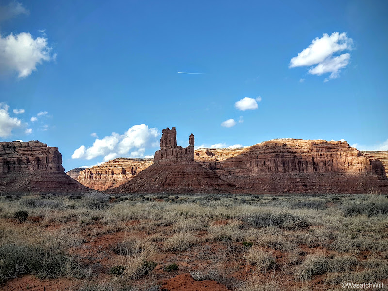
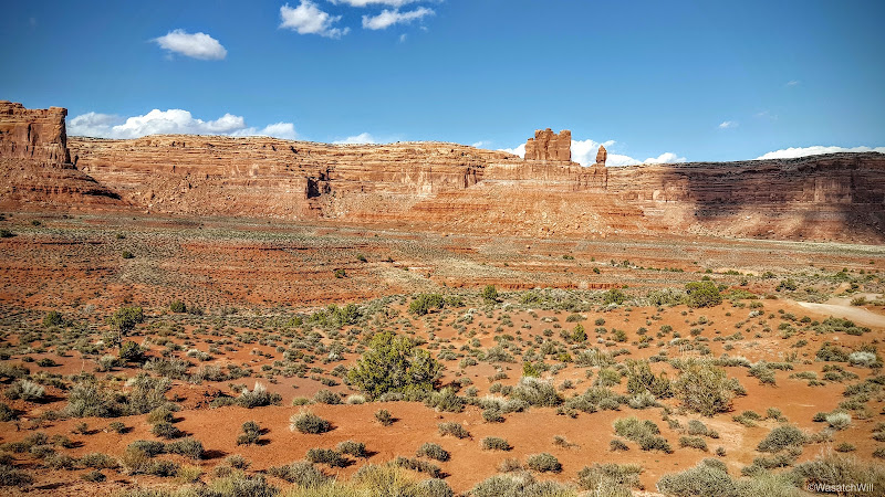
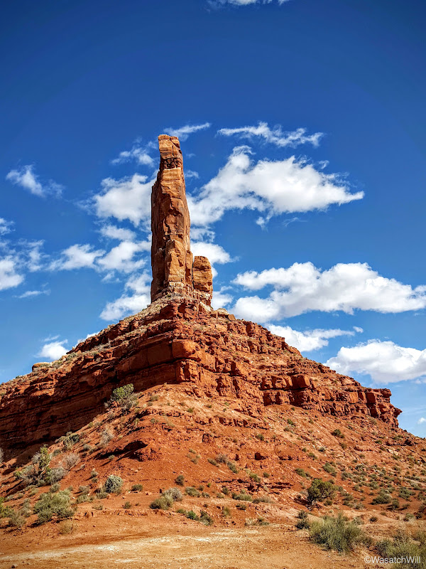
It was now getting to be quite late in the afternoon and I was set to drive all the way back home to Provo that evening so as to have Lennox back home for a neighborhood Easter egg hunt with his sisters. On the way back, we'd take the scenic route through Valley of the Gods, admiring its many buttes throughout.
Then it was on up the Moki Dugway for us.
Once we reached the top, I wanted to drive out to check out the view from Muley Point. As luck would have it, a few miles up the road I began suddenly hear "pssss...psssss...psss...pssss" out my window.
Oh no! That better not be what I think it is. I stop and listen some more. "Ssssssssssssss." Oh no. That can't be good! It could only be one thing. I was well on my way to having a flat tire and dummy me, I didn't take a jack with me. I now had a decision: continue out to Muley Point as quick as the tire would let me in hopes of finding or waiting for someone else to arrive out there with a jack I could borrow or flip a U-turn and head back out for the junction with the highway atop Moki Dugway. I chose the latter option.
There, my rear driver-side tire completed its deflation as I made contact with my wife to inform her of the delay.
I then stepped outside and flagged down the first vehicle to pass by. It was an older oriental couple who spoke little English but could see I needed help. They did not have a jack on them either, so they continued on having agreed to pull over at the next pull out down the dugway and alert anyone there on their way up of my situation.
A few minutes later, another SUV pulled up with a couple from Denver who were gracious enough to lend me their jack. We were saved!
With the spare now on, we thanked the couple and began the journey home. Jessica had suggested I just drive up to Torrey and stay the night with her parents instead of making the long drive home home in the dark.
I accepted.
[Ultimately, we'd wake up to a snowstorm moving in which soon created some sketchy white-out road conditions that gave me quite a white knuckle drive home. In the end, we arrived a half hour late to the easter egg hunt, but still in time for Lennox to get in on some egg hunting action of his own.]
On the way to Torrey that Friday night, I pulled over at the Colorado River, just prior to crossing it.
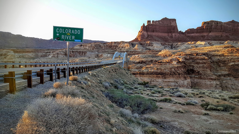
I pondered the little obstacles and set-backs Lennox and I had experienced on the trip. The good samaritans that were there to offer aid to us when we needed it. I looked at the bridge across the great Colorado. Wow, we are spoiled. Those pioneers didn't have such bridges. The very name of that Hole-in-the-Rock expedition comes from a chute or hole as it were, that they blasted through a narrow crevice in the rock further down canyon whereby they could drop their wagons down and ferry them across the river. They didn't have the luxury of good, kind people traveling by there way to offer additional tools and provisions only moments after a wagon wheel broke or other unfortunate setback.
And yet, they all succeeded in their journey and survived, through an entire winter, out in this incredibly beautiful but extremely harsh and unforgiving landscape. They forged roads and routes that many modern roads, whether paved or dirt, now follow to give us convenient access to such breathtaking viewpoints, canyons, and glimpses into our primitive past. What would Southeast Utah be, without the towns of Bluff, Blanding, and Monticello, having been settled by these pioneers, that now serve as an oasis of services and resupply points for fuel, food, and other supplies for visitors to the area? I must concede here that perhaps many of the ruin sites across Cedar Mesa and the surrounding area may have remained more in tact, but I digress.
Still, I thank you, Pioneers.
Day 1
Wednesday - March 23, 2016
As is often the case, we got a late start on the road that evening. I had a site picked out to camp at in North Wash near Lake Powell and was hoping to get there by dusk. When the clock struck 6 pm as I was pulling out of a gas station in Provo, I knew that wasn't going to be happening. It was a four hour drive away. No matter. We'd just set up in the dark. That's what headlamps and car's headlights (when car camping) are for.
After a brief stop in Hanksville to top off on gas, we arrived at the campsite. As we got closer to it, given the lateness in the evening, I had grown nervous that it would already be taken, knowing that Salt Lake County schools, among others, were in the middle of their spring break. Much to my delight, it was perfectly empty. As I got out of the car, it became apparent why that may have been. The wind was relentless. I was tempted to head back up canyon to seek out a more sheltered spot, but no, I wanted to wake up here and Lennox had been sitting still long enough.
I began to unload the car only to realize I had left my tent stakes and guylines at home. Hmmm. How to do battle with the wind now? In order to keep the wind from taking my tent off the cliff we were perched atop of, I placed our food box and water cooler into it along with having Lennox jump in. That added all the necessary weight to keep it in place while I rigged up the poles and anchored the fly and tent corners with what nearby rocks I could gather up.
We then had a quick bite to eat and jumped into bed. It was so windy I was nervous how the tent was going to hold up in the wind without guylines rigged out to give it more strength and stability. I really feared a pole might snap. I lay there wondering if the wind would get better or worse and how long it would keep up and if it'd be just as bad waking up. Before long, I still managed to fall asleep.
Of course, it was dark and late when we had arrived, so no pictures would be taken until the next day.
Day 2
Thursday - March 24, 2016
Somewhere in the middle of the night, that wind came to a halt, for when we woke up, it was as calm as could be and the tent was fully in tact. And what a sight it was as dawn approached and the sunlight crept over the horizon to illuminate the canyon cliffs surrounding us.


Warmed up by the emerging sun, some oatmeal, and hot chocolate, we broke camp and set off for the first point I had wanted to visit, a ruin site known as the Dollhouse.
We made our way up the road where we were soon treated to a terrific view overlooking White Canyon and Natural Bridges way out in the distance. So far, so good.

Then, this.

Perhaps my car could make it OK. Would the snow, mud, and ice be for just a short stretch? How would it be coming back after temperatures had warmed up some more? Bummer. There'd be no Dollhouse visit today. There were just too many other things to do and see on this trip to take the risk of possibly getting stuck on the way out or on the way back.
After a quick turn around, we returned to the highway and began to make our way toward Comb Wash. Along the way there, we pulled over to check out a little landmark called Salvation Knoll.
Salvation Knoll gets its name from an event back in 1879 where four scouts, part of the Hole in the Rock expedition of Mormon pioneers aiming to create a settlement down in the southeastern corner of the state, were out and about in the middle of December seeking out a safe passage around Grand Gulch and across Cedar Mesa to lay down a wagon road. Desperate to locate the Blue Mountains in order to orient themselves, their vision was continually obscured by Elk Ridge to the north. It wasn't until Christmas morning, having recently run out of food and believing their lives were soon to end, that they located a small cone shaped peak rising above the northern edge of the mesa whereby they were able to make a short scramble up to it and gain a whole new perspective of the mesa they were seeking to cross. It was there they were finally able to locate the Blue Mountains to the northeast and subsequently Comb Ridge across the east. Newly oriented with their surrounding, they now knew where they were to go and felt it proper to name the landmark Salvation Knoll, for to them, it had truly saved them.
Lennox and I made quick work of it ourselves to see the same view those pioneer scouts did, albeit without all the snow covering the landscape. It really is quite a panoramic site to behold from such a short little knoll.
Comb Ridge could be seen sprawling across the southeast horizon with Arizona's Carrizo range far out beyond.
Colorado's Sleeping Ute Mountain could be seen out to the east.

Then, of course, there was the Blue Mountains to the northeast.

Salvation Knoll had proved to be the perfect little peak to bag for a three-year-old's legs.

Having had our fill of the view, we journeyed back down.

Cactus would become a consistent nemesis to our dog, Sophie, who had joined us for the trip.

There was an interesting growth on one of the rocks along the side of the trail. I thought it looked like a pumpkin.

The desert's spring flowers were abundant.


Once back at the car, we had a quick snack and drove on down to Comb Wash. Our next destination was Tower House Ruin, and I had thought to take the more adventurous 4WD road up out of Comb Wash to approach Tower House from the west. The higher the road got up out of the wash, the rougher and rockier it got. A group of ATV buggies were coming down and in chatting with them, they stated that the section I was trying to get up was like pavement compared to what lied ahead. Yikes! I didn't want to take all day negotiating such a road, so I made about a 12 point turn around to get back down to the wash in order to proceed back up the highway over Comb Ridge and make the smoother approach from the east. It wouldn't be without a bang onto a rock across the underneath side frame of the car. No damage done however, or so it seemed.
Shortly after getting back down to the wash, I heard the unmistakable sound of vomiting. Oh no! Lennox had become sick. Was he sick with a stomach bug now, or was he just car sick from the rough road we had just come off of? Logic suggested he was car sick. I pulled over at the next viable spot I could to assess the situation better. Fortunately, the mess was confined to small space: his pants, a bit of the straps on his car seat, and the floor beneath him. Nothing a change of clothes, some shop towels, and wet wipes couldn't clean up. Fortunately, we were equipped with all of the above.
All cleaned up, it didn't take long for him to return to feeling well again. Time to move on. Or not. The engine would not turn over, at all. Oh no! This can't be happening. Of course it was. When it rains, it pours. That's how it goes, right? I ran through all the troubleshooting I could think of, but to no avail. Scanning the underside of the engine and car as well as inside the hood revealed no obvious damage or other problems. The car's engine simply would not start.
There was a group camped no more than 200 feet down the road, so I walked their way and entered their camp just as they pulled in on their ATV's and four-wheelers. Perfect timing! Perhaps this was meant to be, after all. I explained the situation and they agreed to come up, have a look and give me a jump. Jump-starting was futile and they became as perplexed as I was. A jeep approached and offered to give us a lift into Blanding to make some calls or seek out a tow service if we were still there with the car after they returned from a leisure ride, which they expected to be a couple of hours. I told them thanks and that it was looking like it may well come down to that.
It was just after noon as they drove off and the other group returned to their camp. They offered their hospitality to us while we waited but I politely declined and opted to take Lennox and the dog on a walk the other way up the road to seek out any other campers that may be around and willing to give us a ride into Blanding. At worst, we could try some hitchhiking at the highway. After about 3/4 of a mile with about another 3/4 to go to reach the highway, I had a thought strike me that filled me with confidence. There was one other thing I hadn't checked on the car. Was it worth turning around and walking back to the car? The more I thought about it, the more confident I became about what the problem was. We turned around and began the walk back. The closer we got to the car, the more confident I was in the solution now brewing in my head.
Once we arrived back at the car, I immediately slid underneath the front passenger side and sure enough, there it was. The wire that runs from the starter switch inside the car and runs down and out to the starter motor had come loose and popped off. That bump on the road must have caused the connection to become loose. I put it back on, jumped into the car, set the starter and right away, the engine was humming. Yes!....Yes, Yes, Yes!!!
The trip was still on!
For all the delays, we weren't too far behind schedule. Now we could proceed to Tower House.
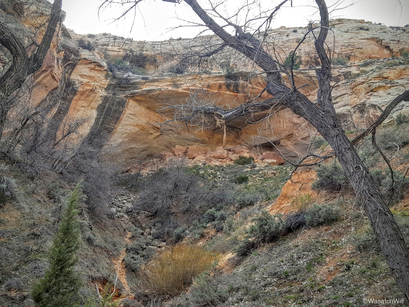
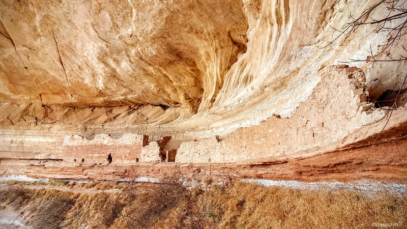
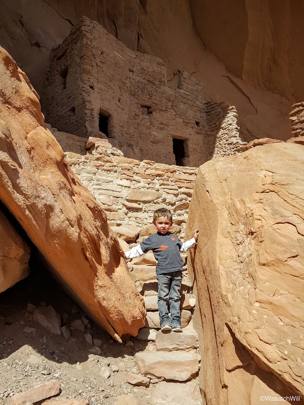
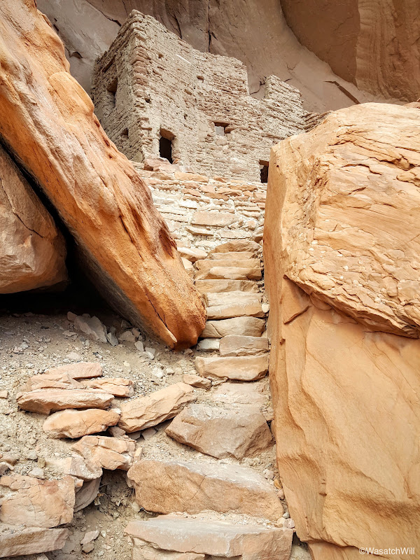
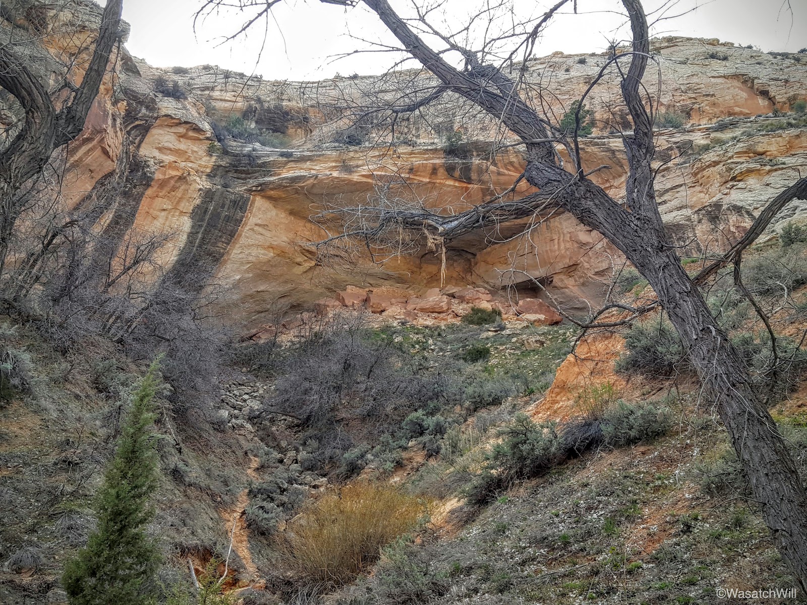
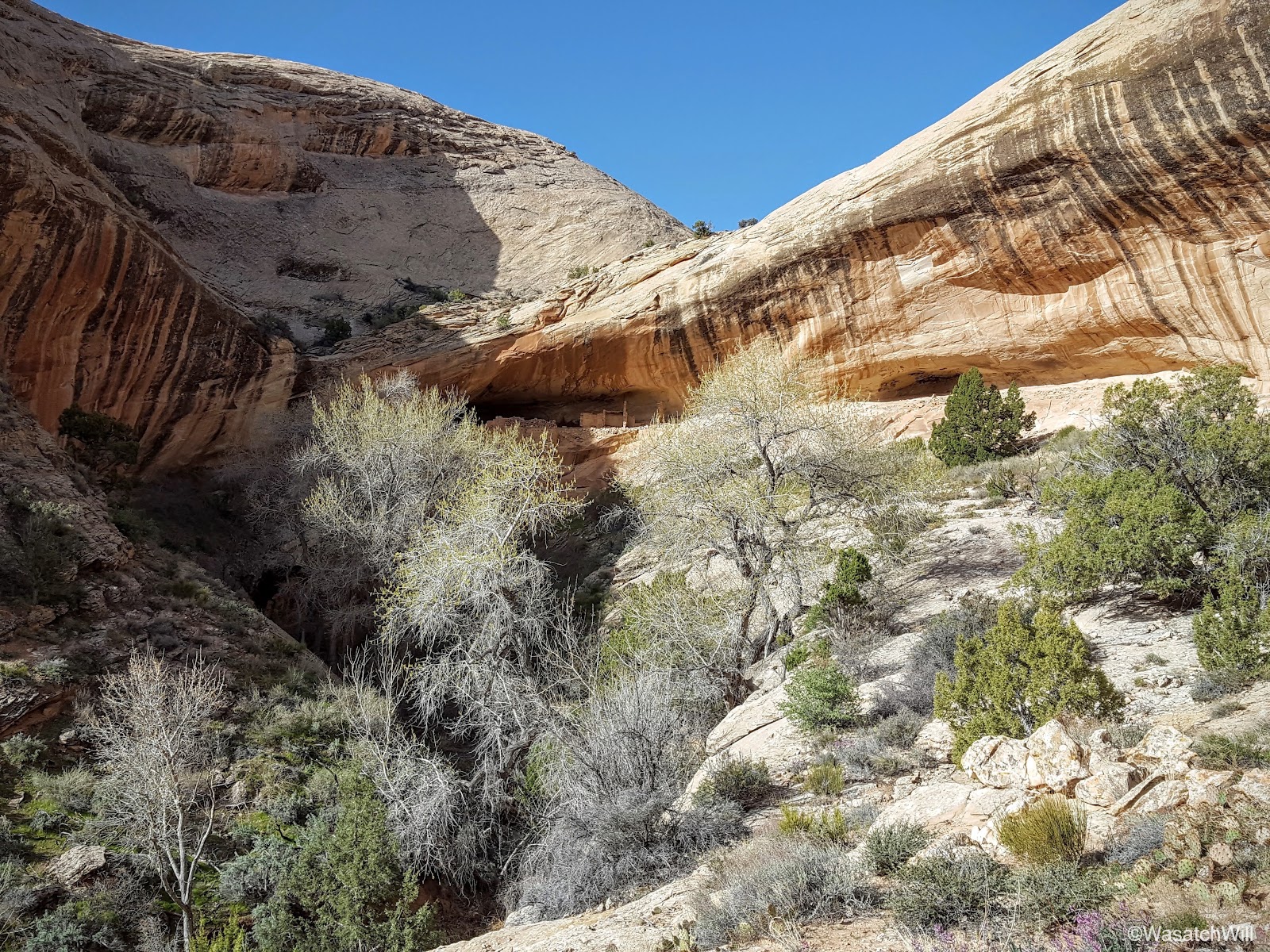
About a half hour later, we arrived at the top of the wash, ready to make the descent down.

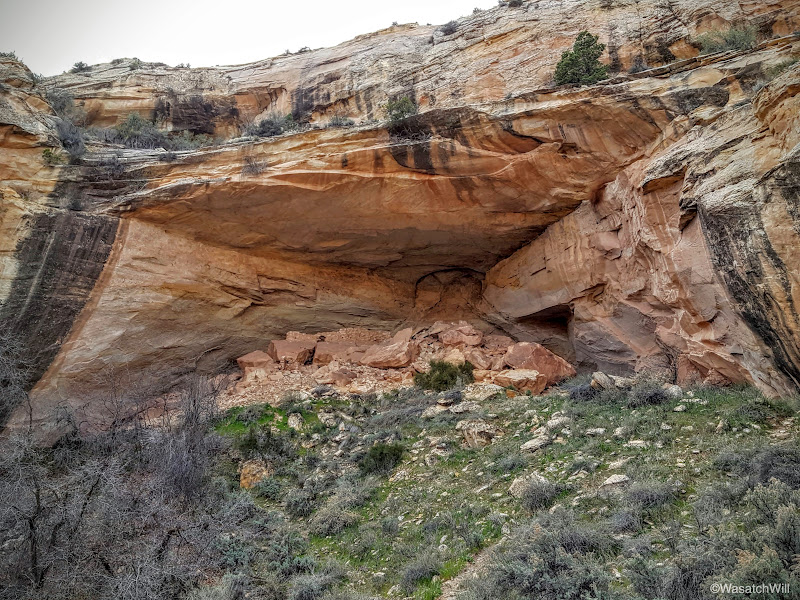
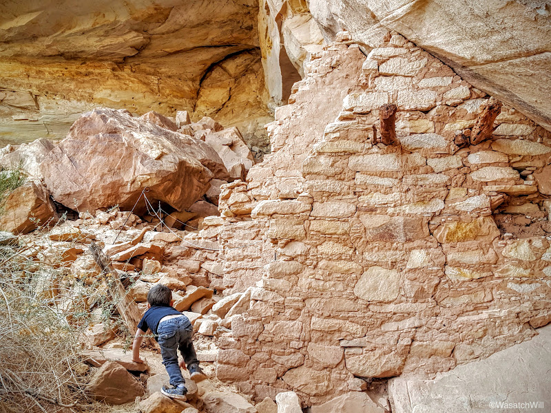
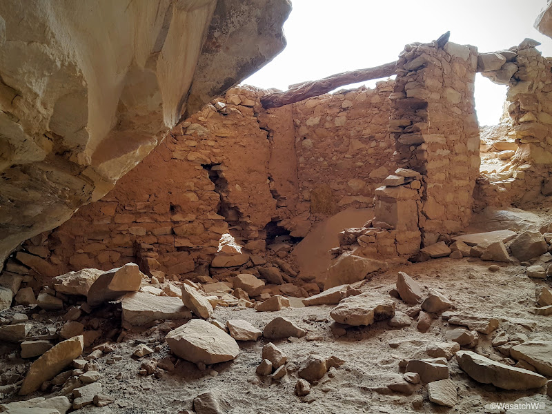
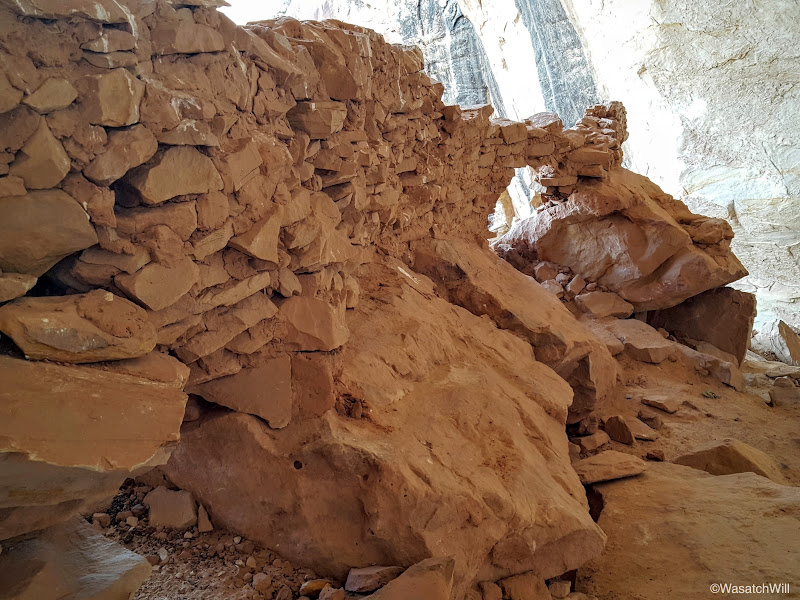
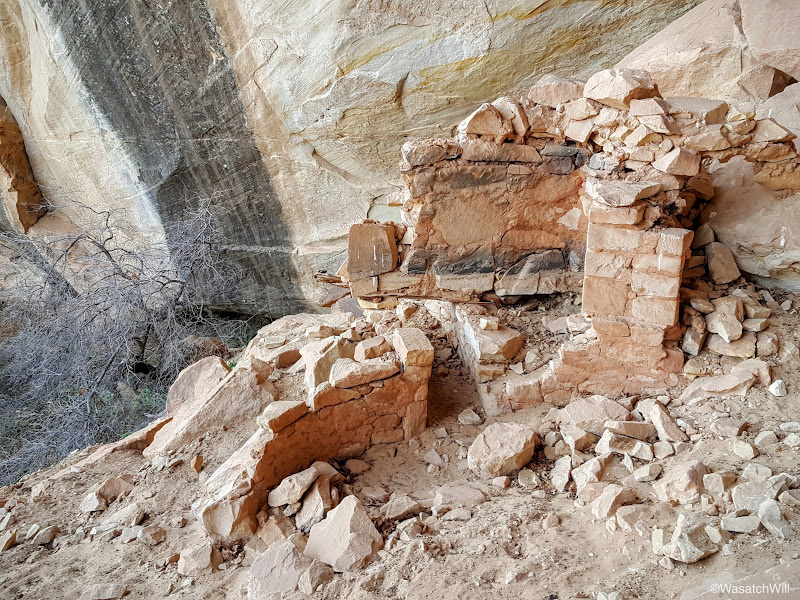
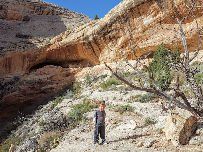
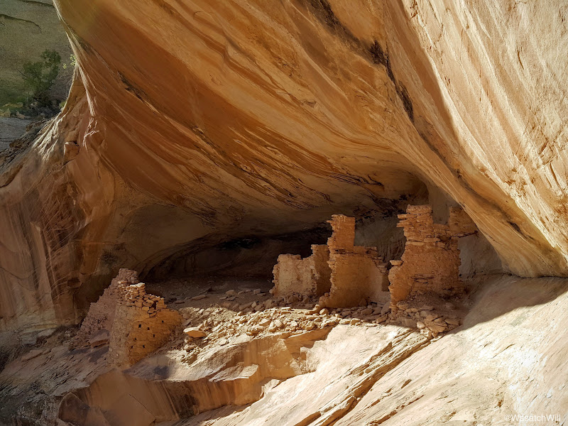
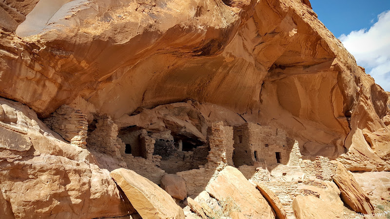
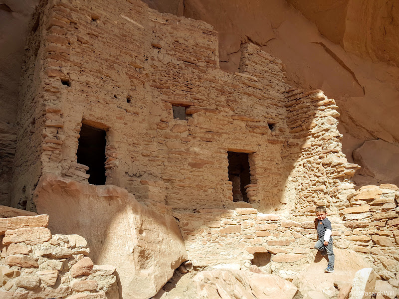
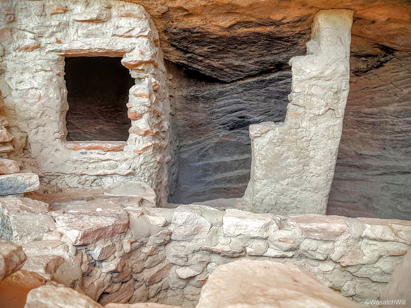
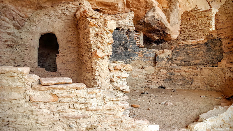
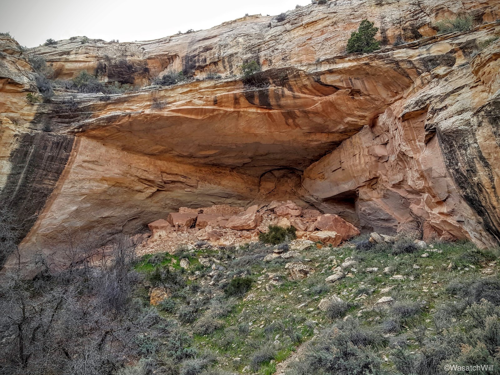
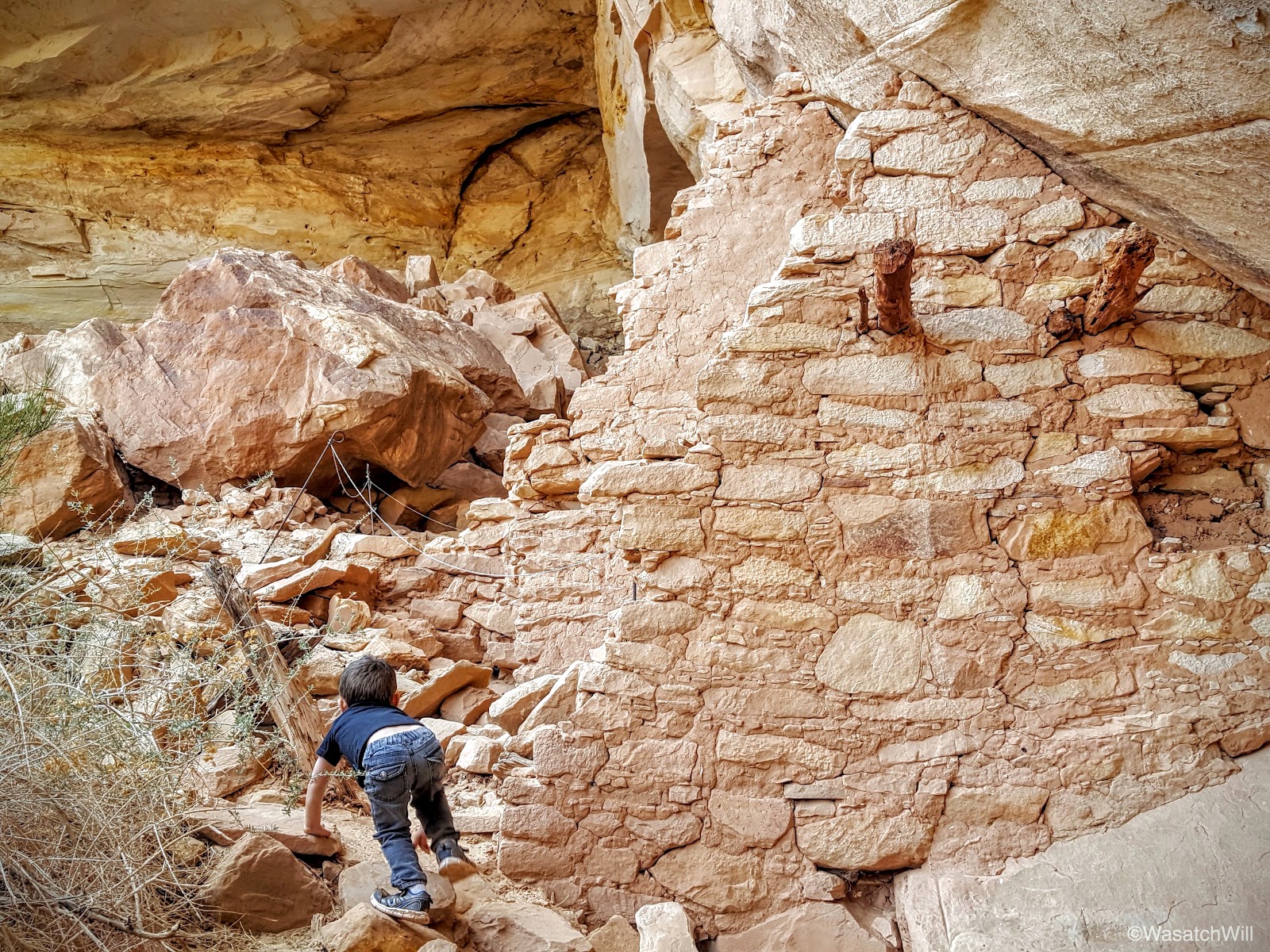
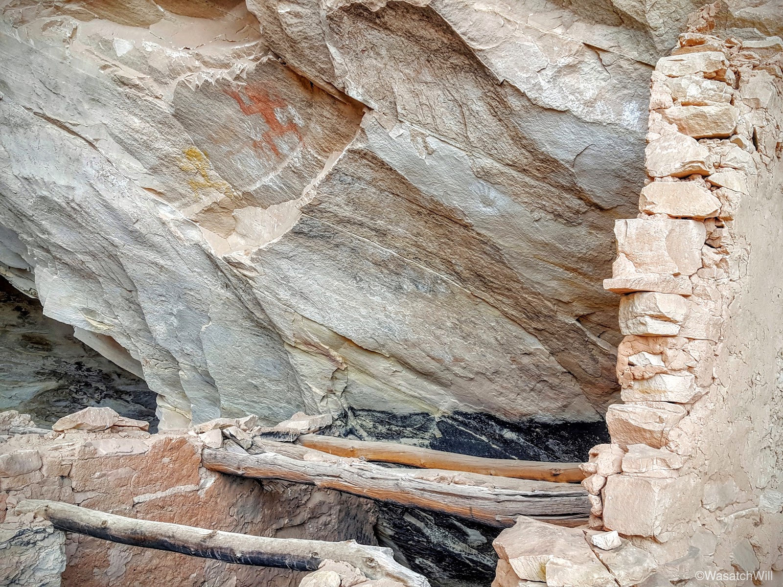
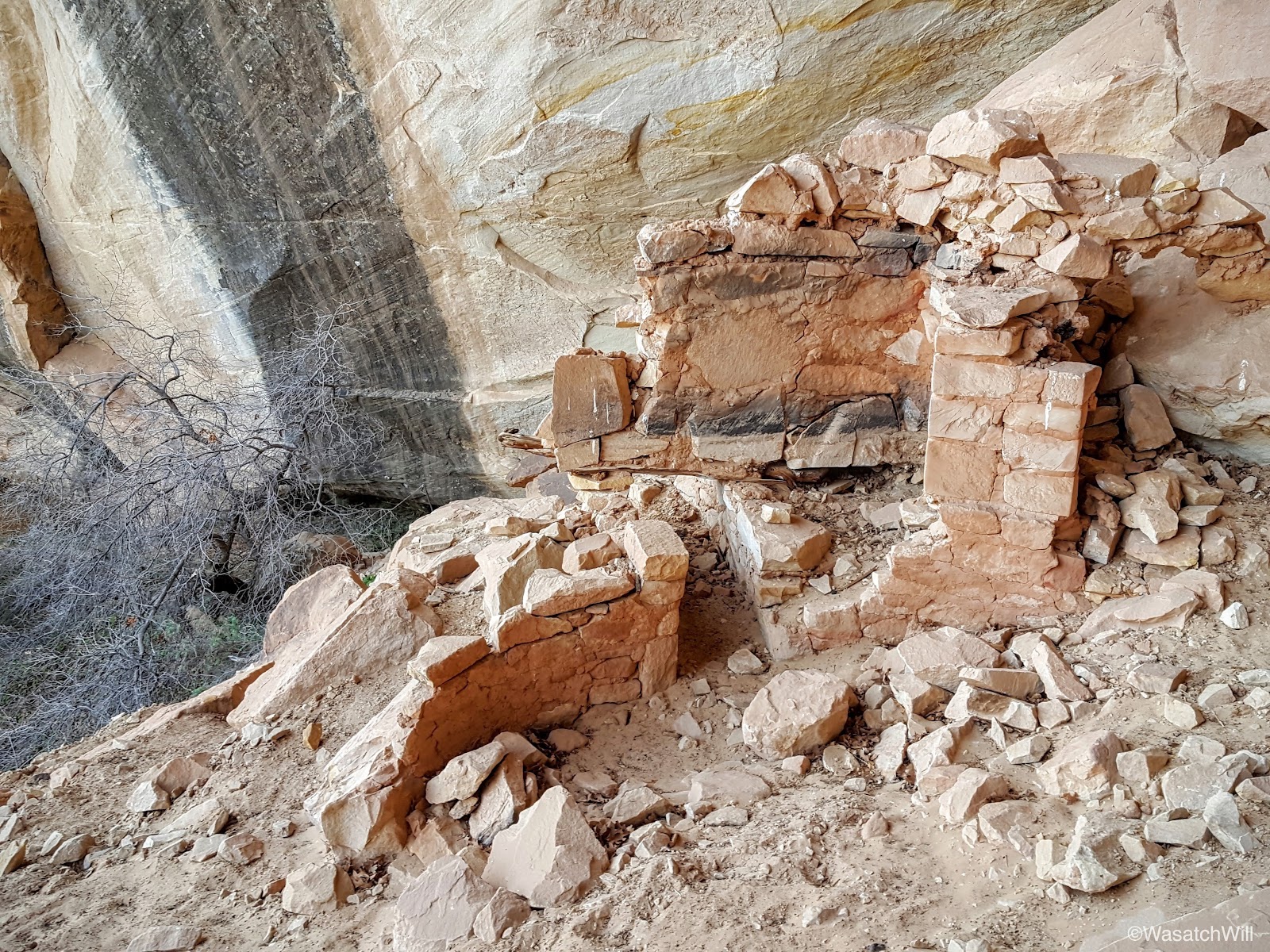
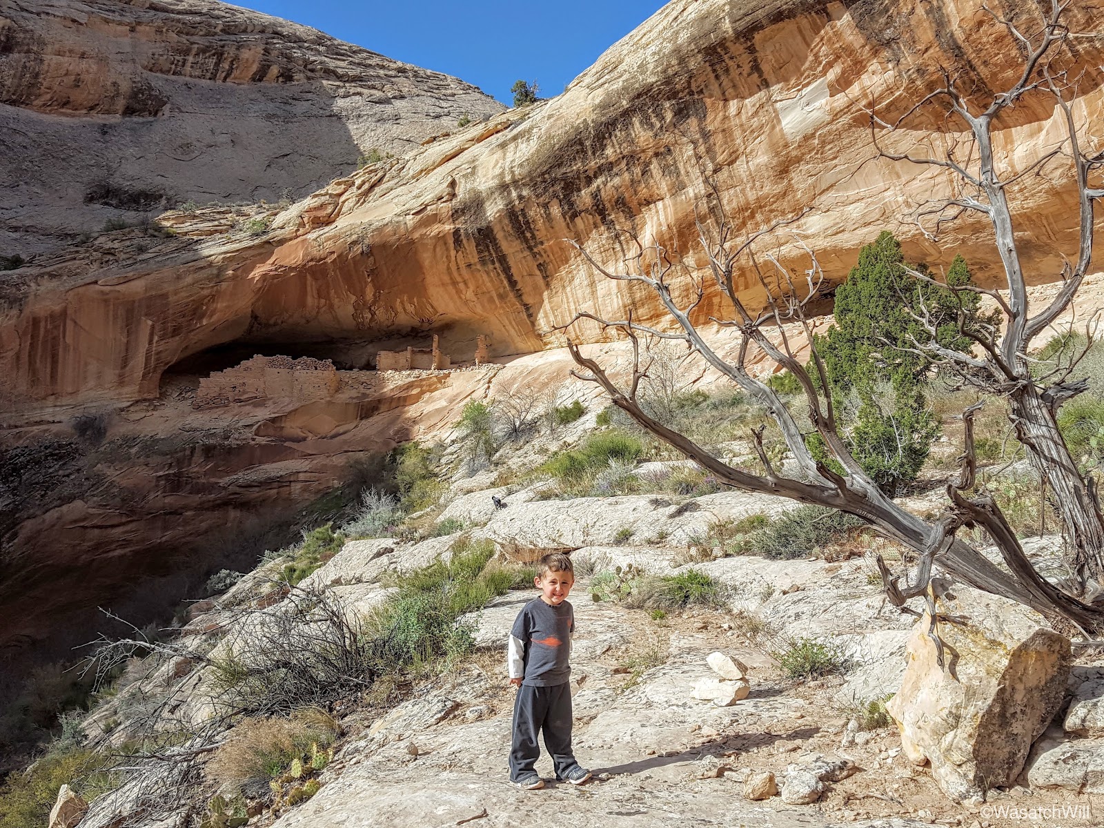
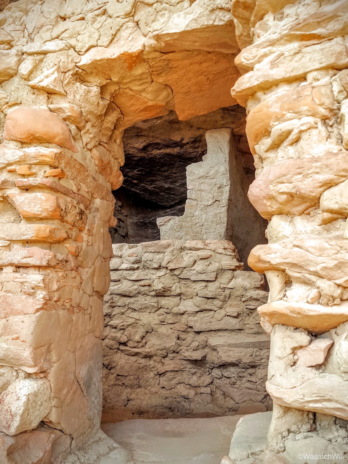
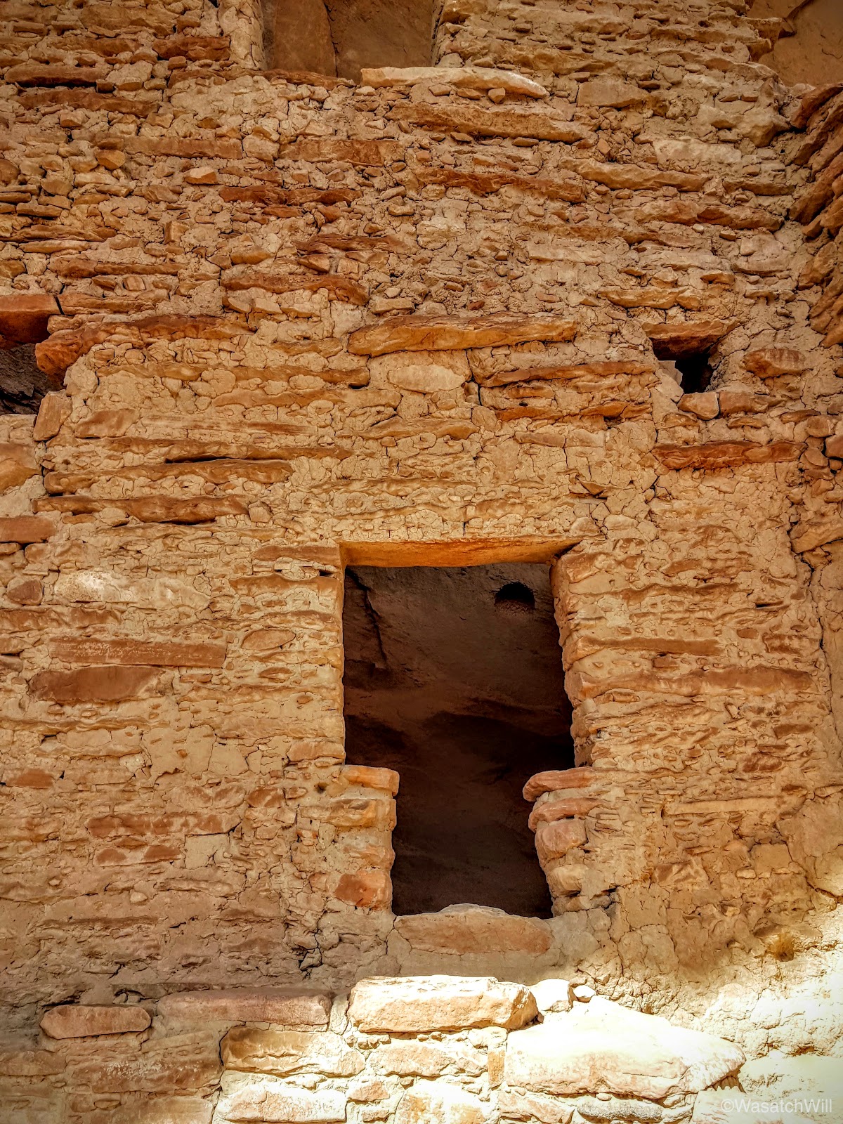
The descent presented us with a few tricky spots, particularly some small pour offs to navigate around that proved especially tricky with Lennox. With a bit of improvisation, we safely bypassed them, reached the bottom, turned the corner, and there it was, the two story structure resembling a tower.

Lennox was impressed.

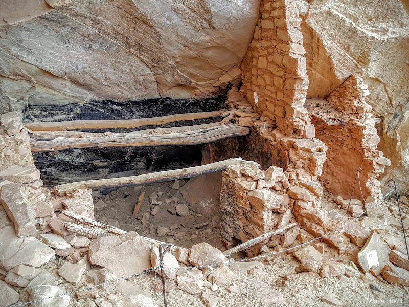
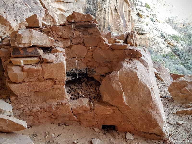
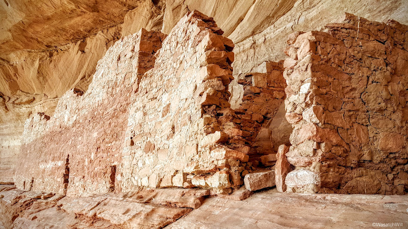
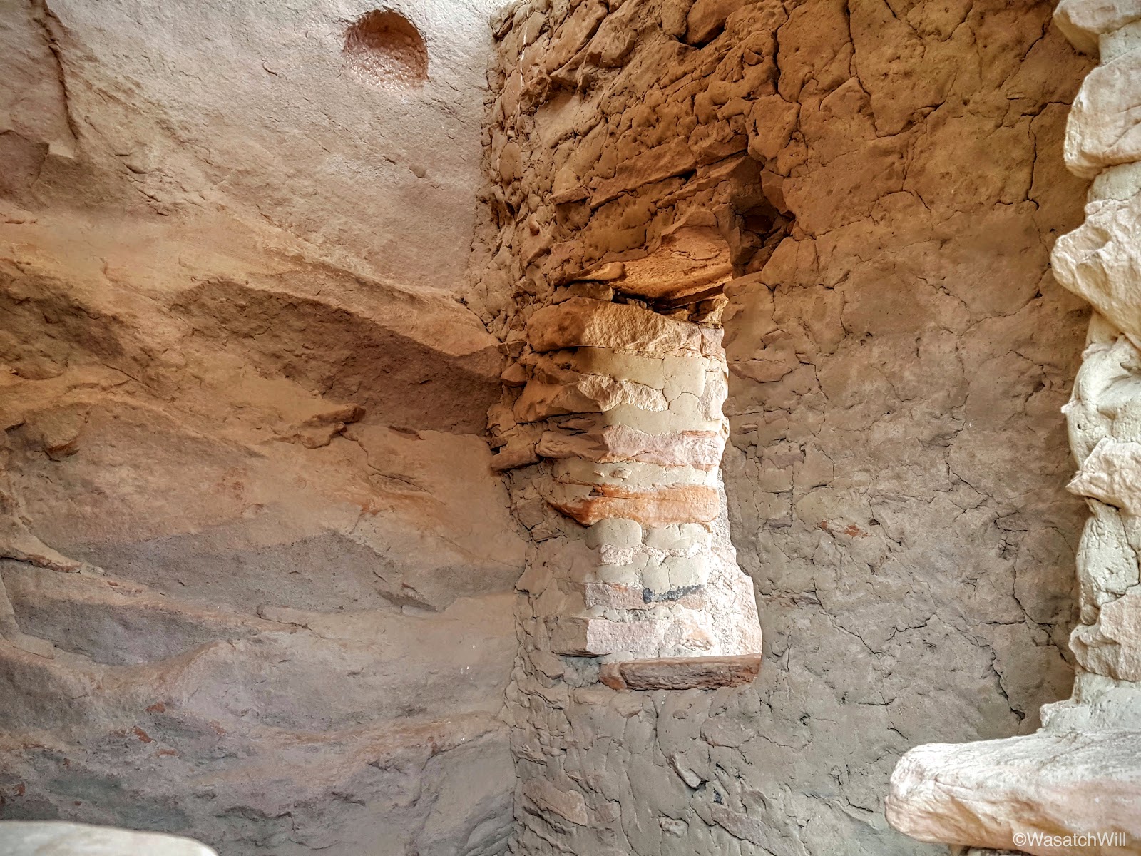
Looking up through the a window/entrance, remnants of the ceiling/floor separating the upper and lower level were still present, offering a first-hand look at some of the architecture and engineering techniques employed by the "ancient ones".

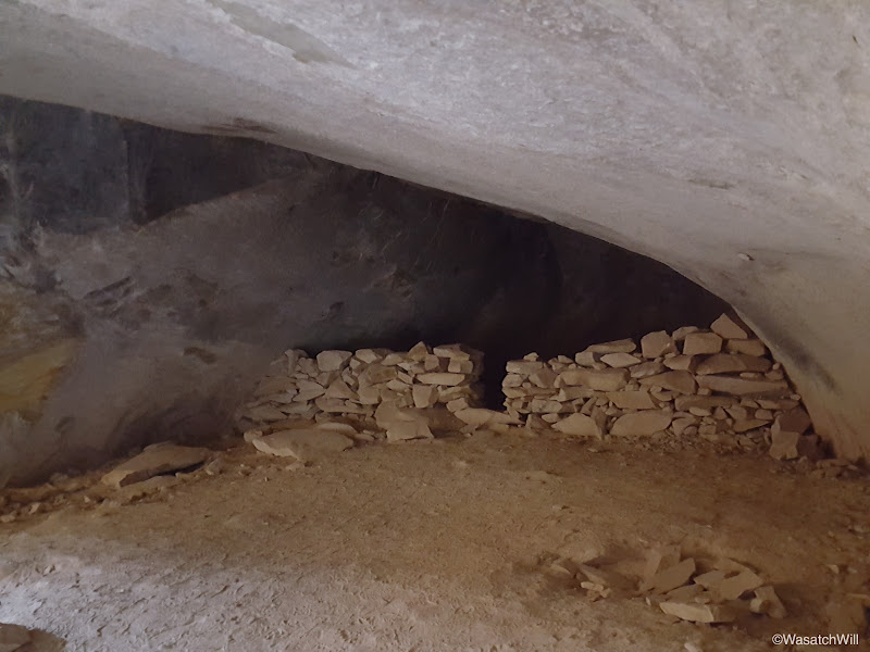
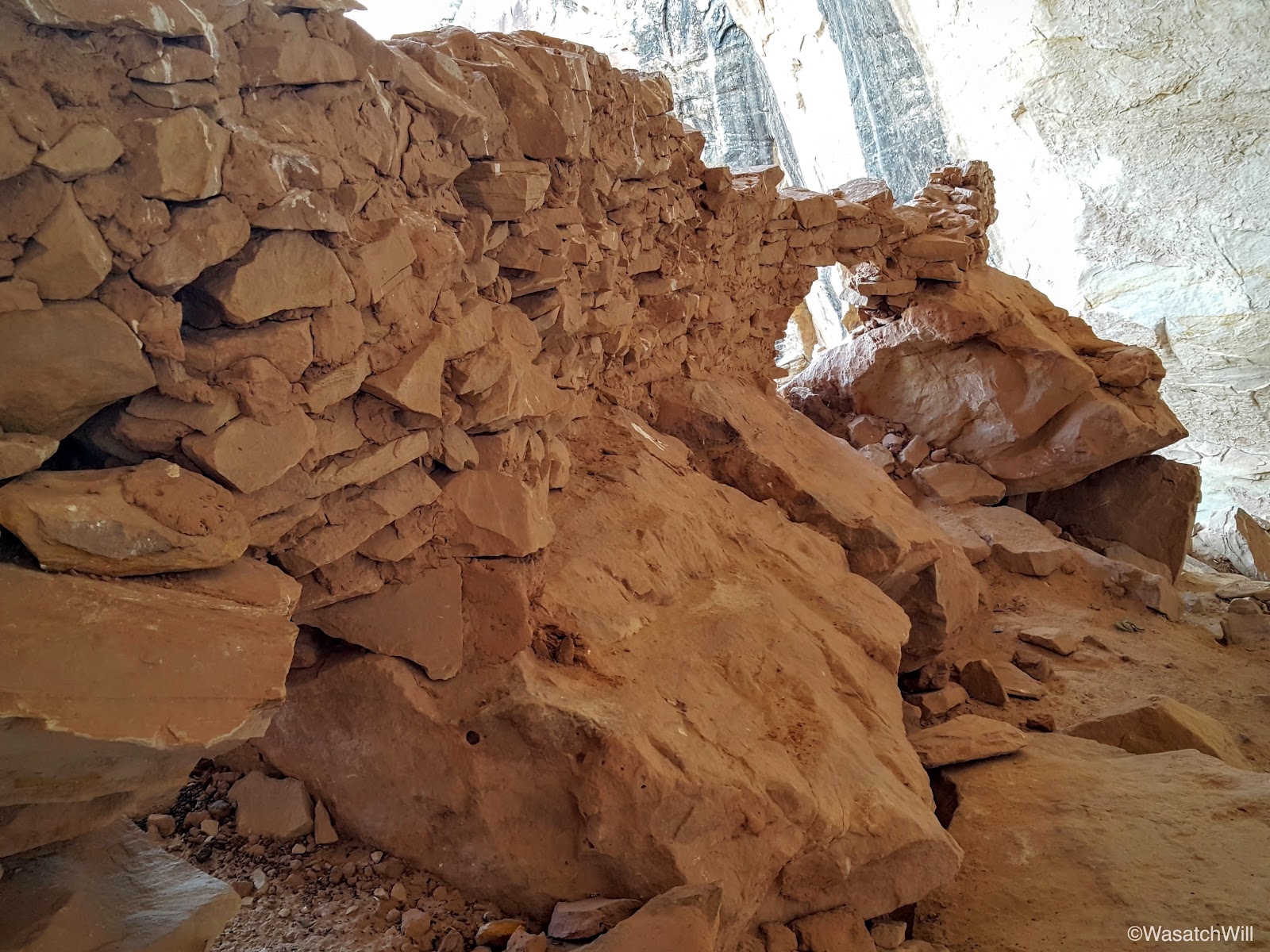
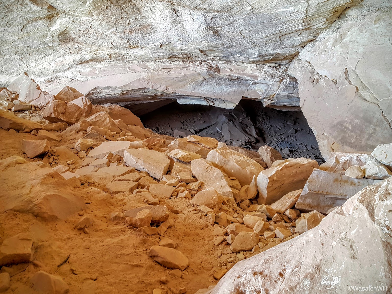
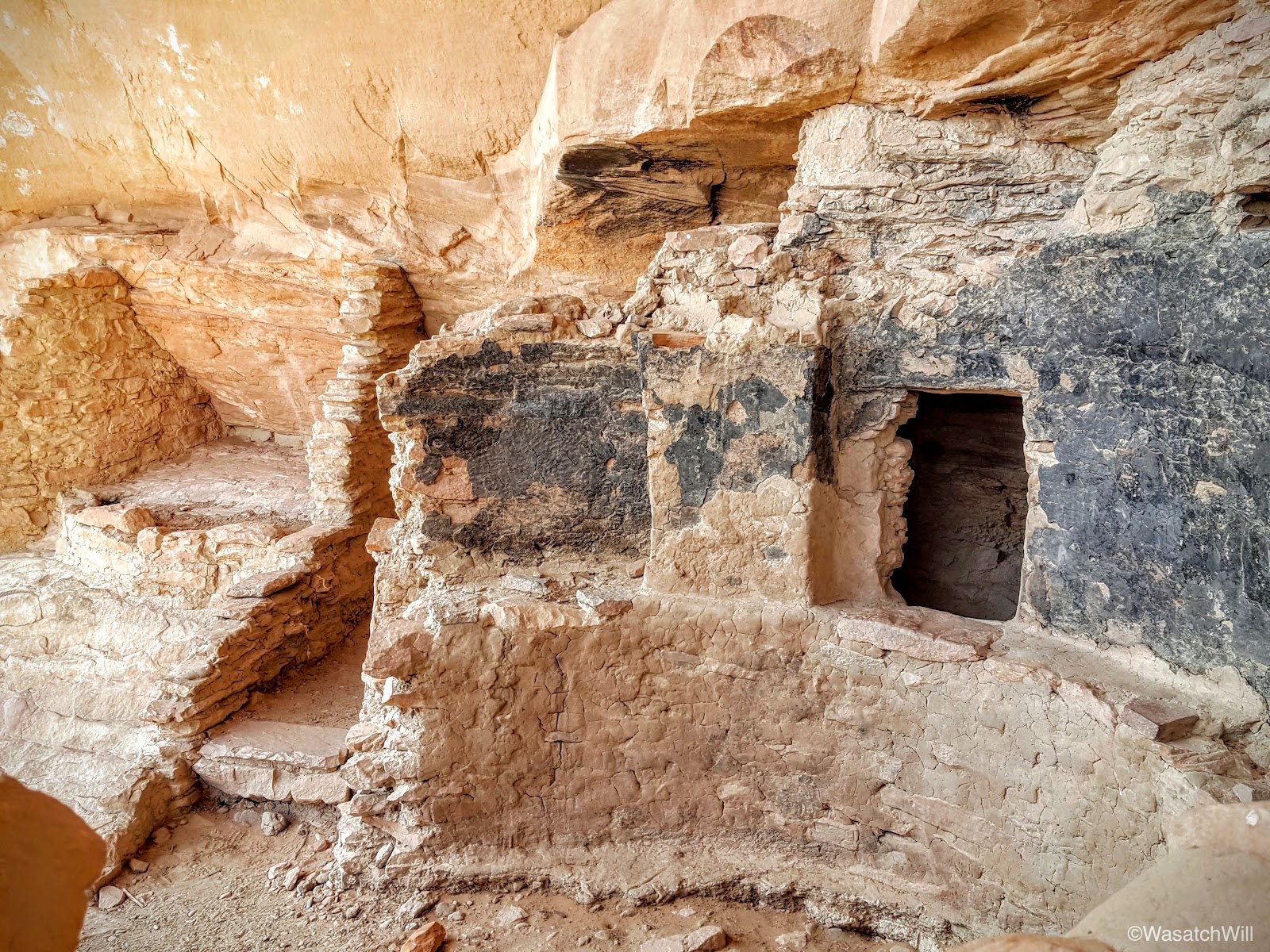
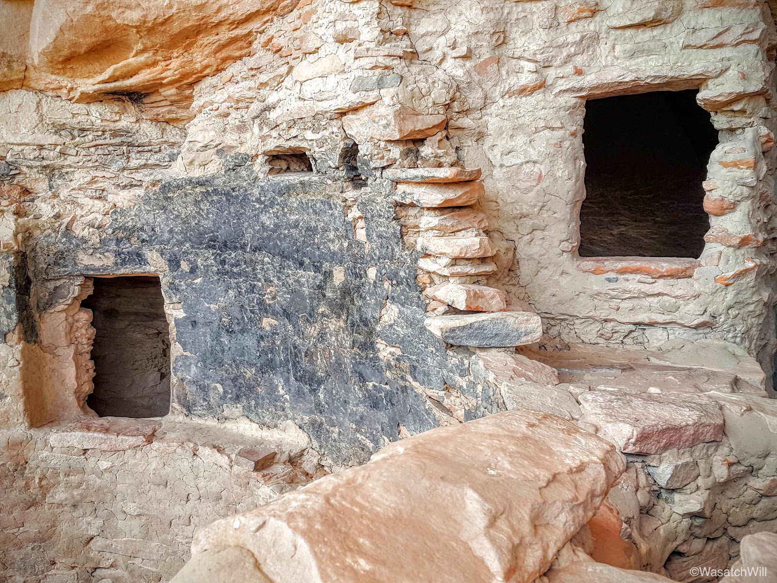
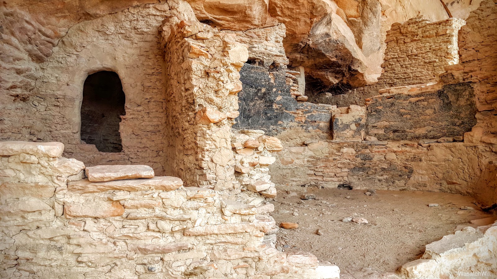
Right next door was a separate room or large granary.

Further down in the alcove sits the remaining foundation of a kiva.
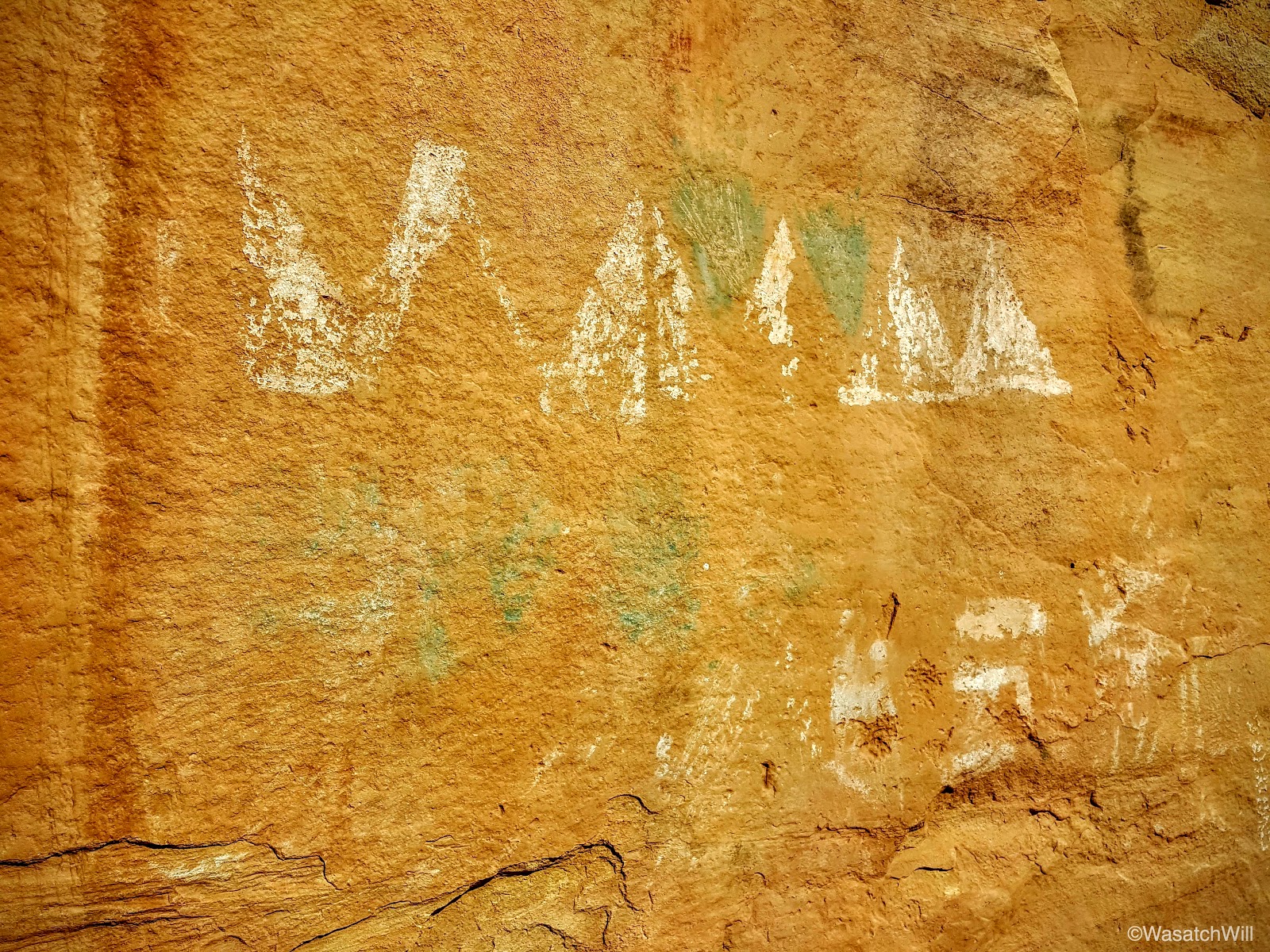
As expected, there were a few petroglyphs adorning the alcove walls as well.


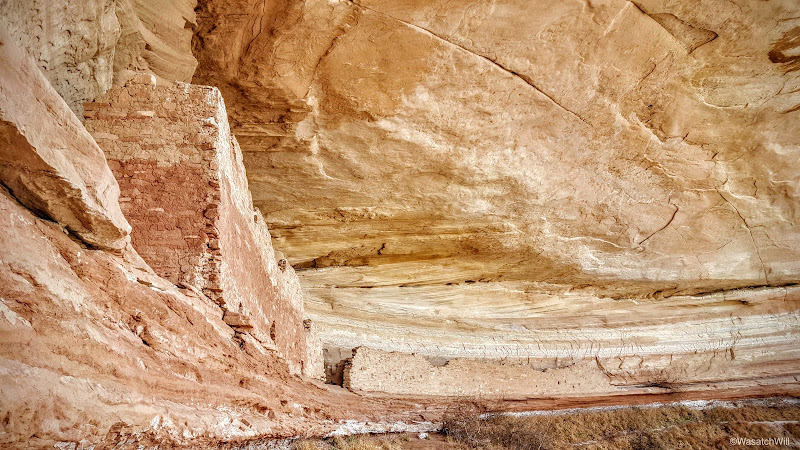
At the foot of the alcove, there was a shallow pool of water, a common feature at the head of canyons such as this. It was easy to see why such a site would be chosen for a dwelling. It was also too tempting for Lennox to resist tossing in a small rock. Don't worry, I ensured it was just that, a rock, and not some potsherd or other relic.
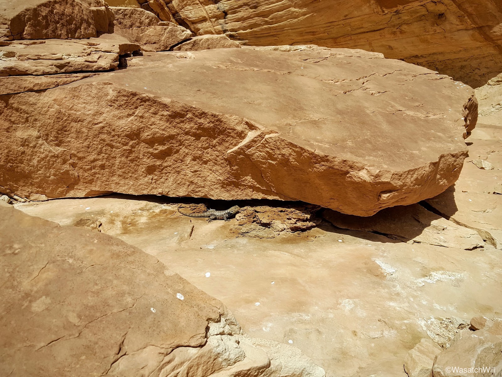
Having checked this site off the list, we hustled back up. Lizards would distract us numerous times, however.
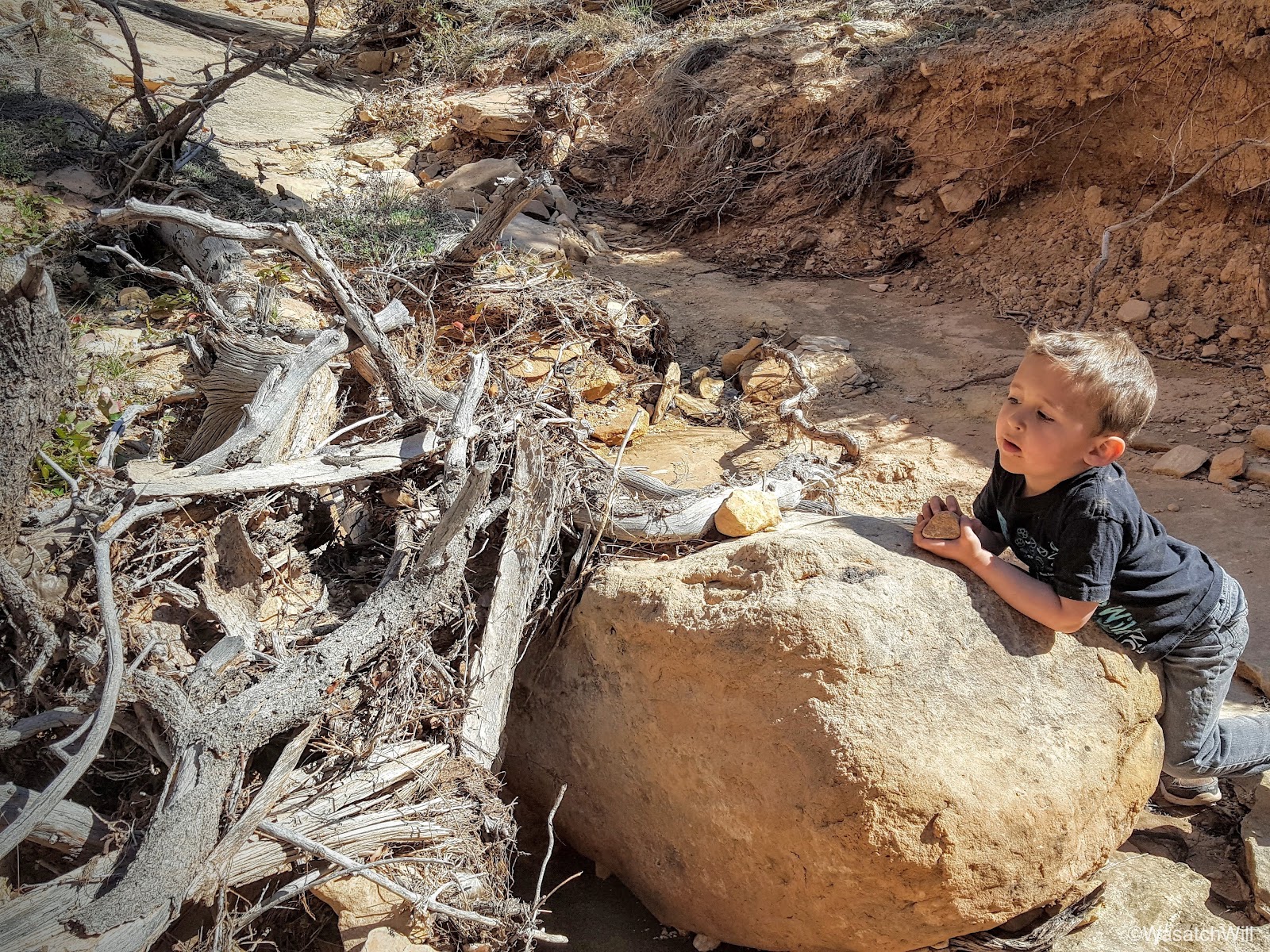
And then there was the cavities along the canyon wall. I always call them "swiss cheese" walls. Lennox refers to these features as "lizard hotels".

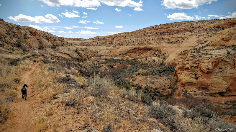
When we arrived back at the car, I noted we still had lots of daylight left, so we drove on down to make the hike up to Ballroom Cave and Target ruins.
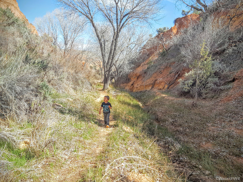
The cottonwoods hadn't bloomed out yet, but the trail was still very pleasant and cool.


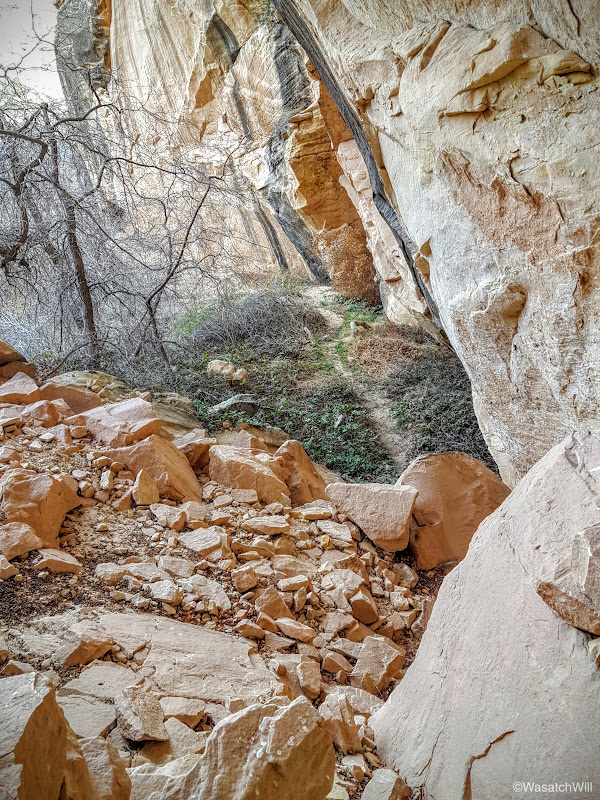
After a nice little 45 minute stroll through the wash and several stream crossings, we were gazing up at what were clearly some ruins sitting high up in an alcove above.
We located the most feasible path via some signs now posted, and inched our way up to the alcove.
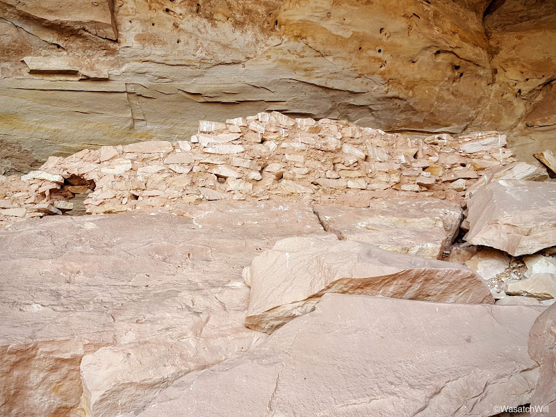
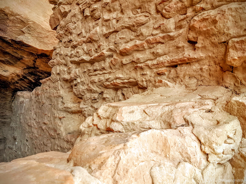
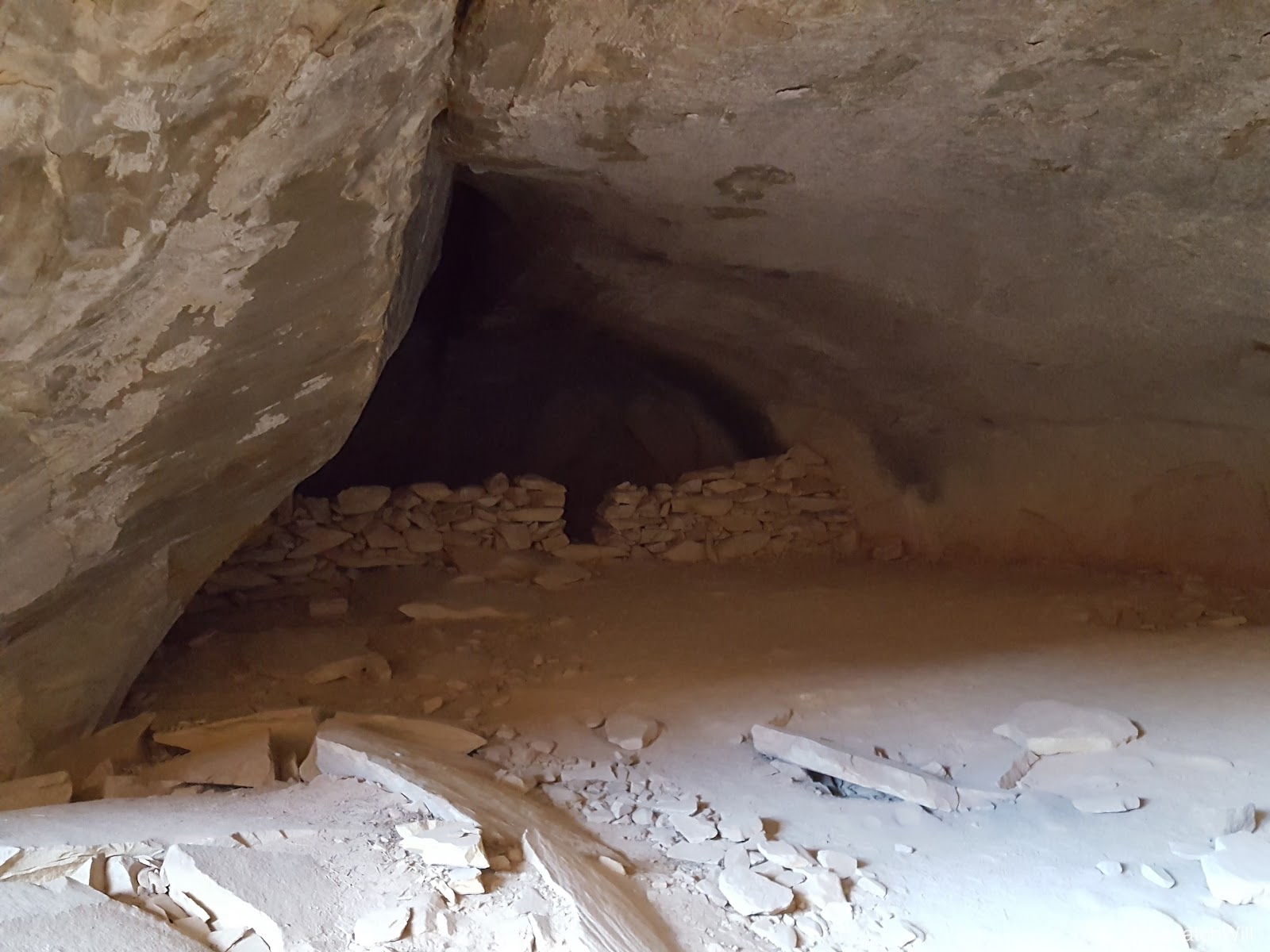
Unfortunately, not much of this ruin site was left in tact. All structures had significant damage, but it was still a very unique place.


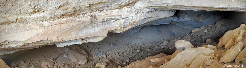
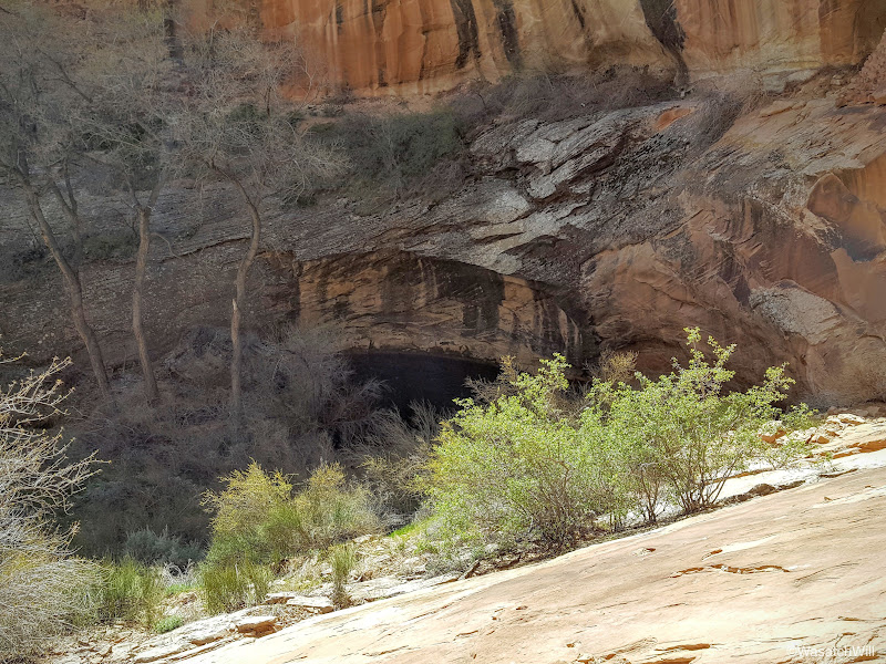
We quickly found the cave tucked back down in a corner of the alcove, or what we thought was the cave, only to be disappointed with how shallow it seemed. There was a register and info box right there though that confirmed this was the site of Ballroom Cave.
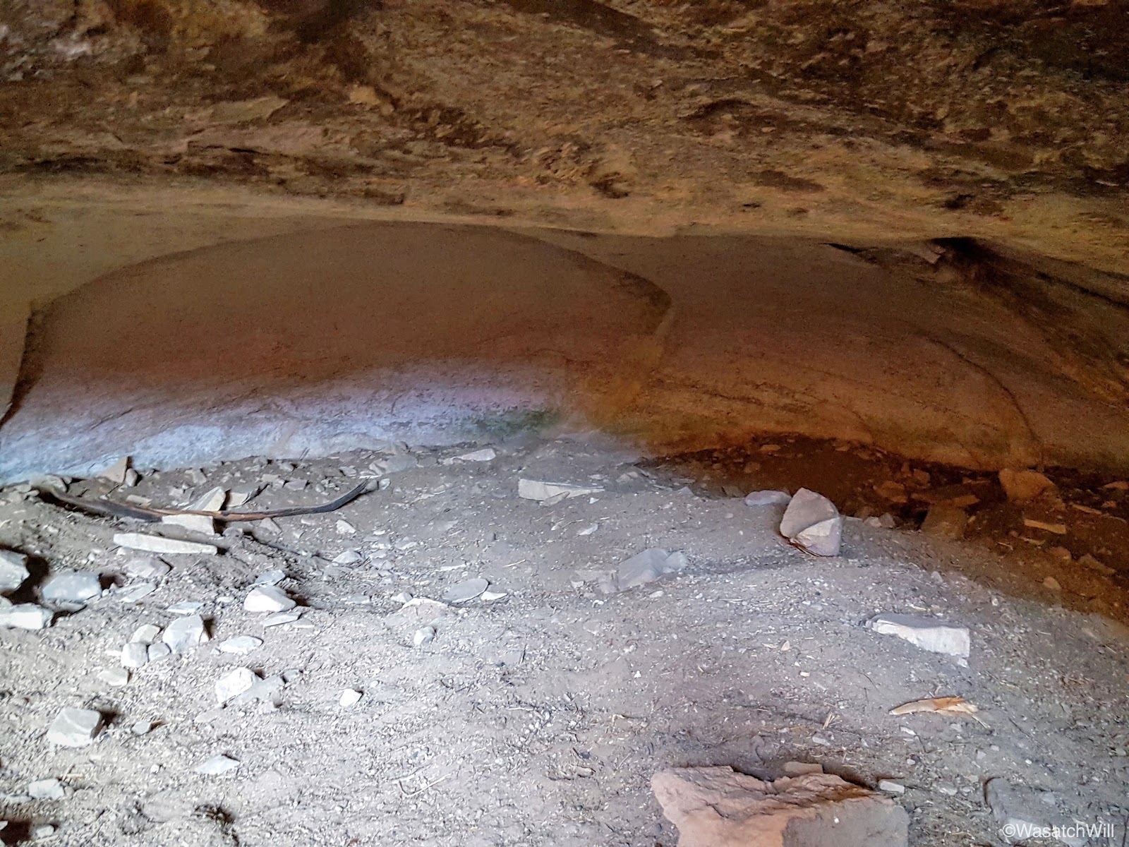
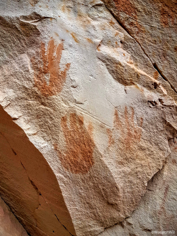
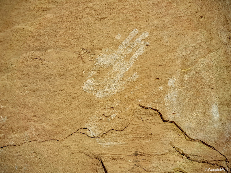
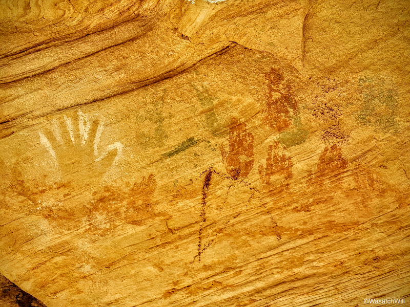
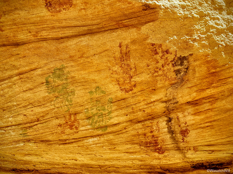
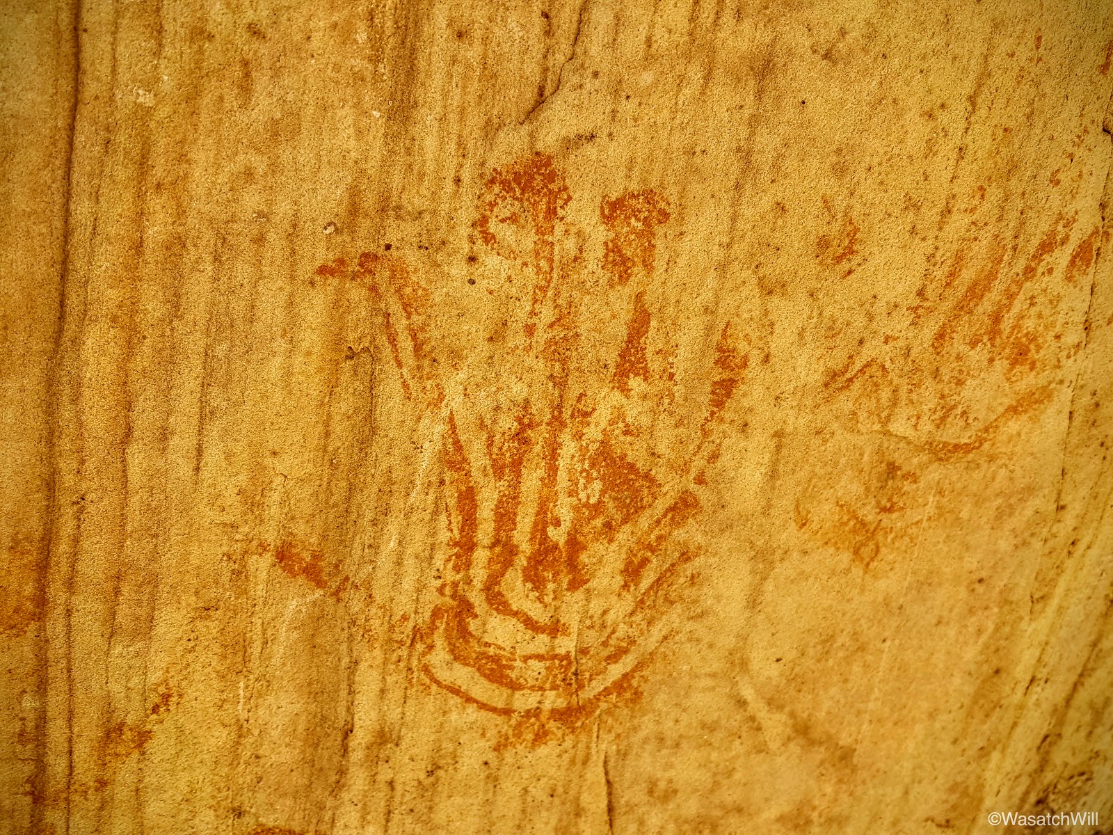
From what I had read and seen, there should be a cave much larger, deeper, and darker. But nothing else was in sight. There were a few interesting and colorful pictographs to view, however, mainly some handprints and anthropomorphic figures.


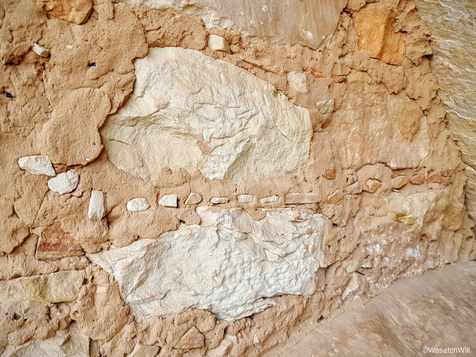
It was also interesting to observe the pattern used in the erecting of the adobe walls. Small stones layered between large stones.
Still, I was convinced there was a far more magnificent cave to be found. Up and around the ruins higher up in the alcove, we went.

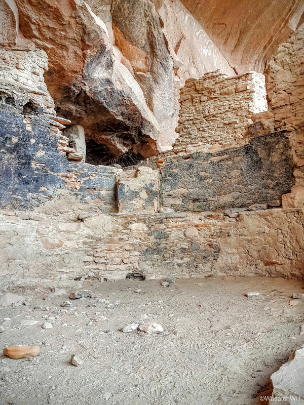
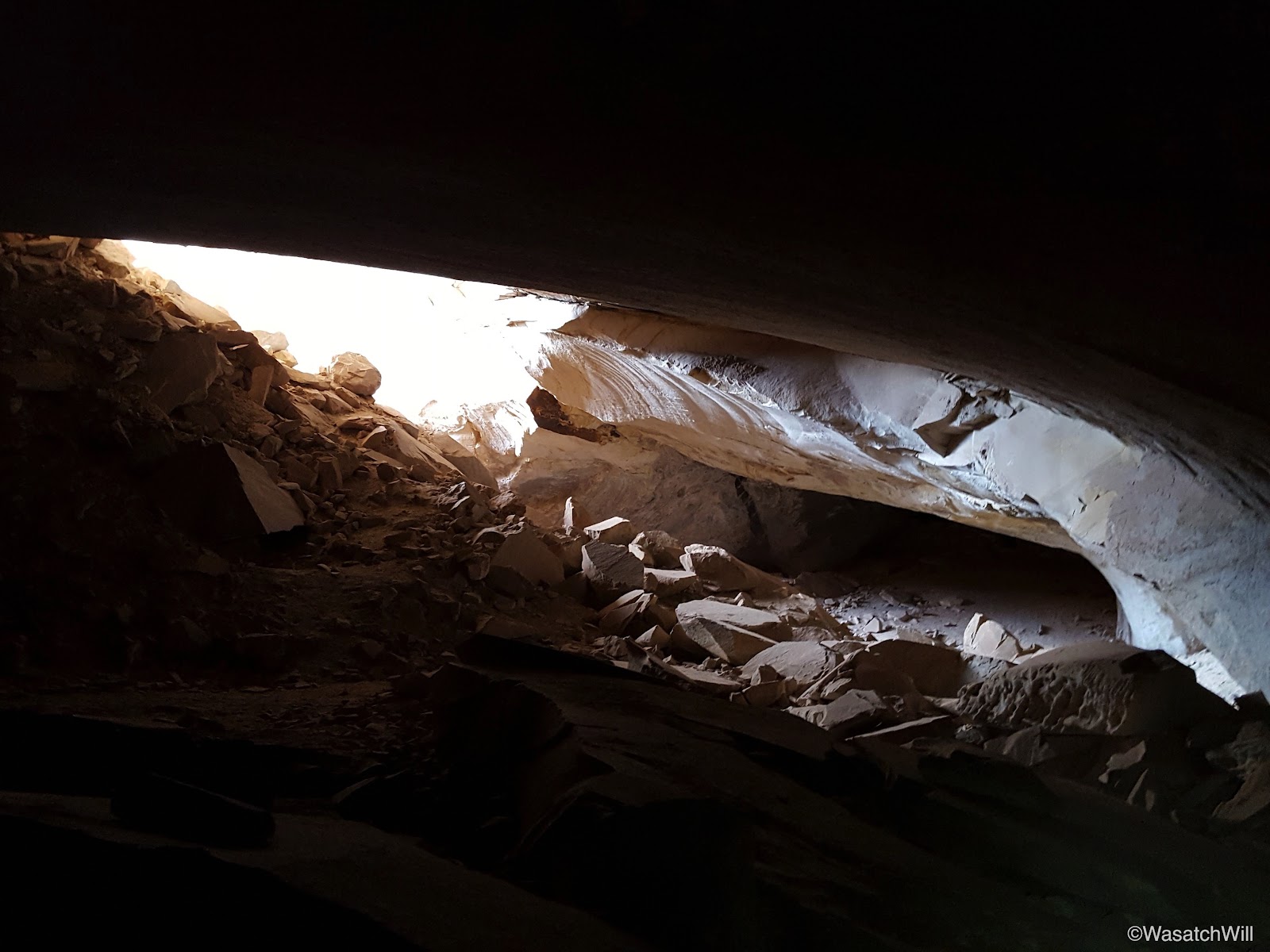
And then, there it was! The big one!
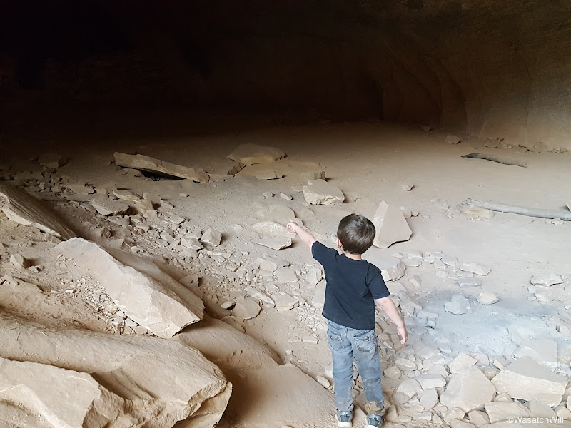
What starts out looking like another relatively shallow cavity turned out to be every bit expansive as I was led to believe.

Lennox was certainly excited too! Wow, was it big and dark!

Inside, on one end, there was a wall that had been built up to create some kind of a room.

The other side of the cavern extended even deeper and farther. Looking back, the walled room virtually disappeared into the darkness the further into the other side we went. There weren't really any other obvious structures or remains. Mostly rocks and lots of dust, there was however a great big slab of rock where lots of metate depressions lined the top of it.
I imagine there must have been much more to this cave at one point, but was probably severely looted. We spent a bit more time admiring what remained of the ruins back outside of the two caves and tried to imagine what the whole site must have looked like and how it functioned with its ancient inhabitants.


Having had our fun and fill of the Ballroom, we moved back down canyon looking for the turnoff up to Target Ruin. Along the way, I noticed some oily substance at various points along the stream. It wasn't pleasant to think about if one had to rely on capturing some water from here, but it sure added a colorful accent to the water surface.

Only minutes later we saw the turnoff for Target and with a quick walk up a hill and into its canyon, there in the wall above, we looked up and beheld the famous Target Ruin.

Of course, we had to get the iconic view of its namesake by scrambling up the hill across from it.

At which point, we could look down and zoom in on its famous bullseye target adorning the interior side wall.

Along the top edge of the hill across from Target Ruin lies another little alcove containing yet more ruins and other relics.
Now it was time to get back to the car and start making our way down Butler Wash to camp for the night. Along the way, we had to stop at a dinosaur track site we had just learned about prior to setting off on our trip.

It was an instant hit for Lennox. Like many boys his age, he loves dinosaurs.

We continued on down Butler Wash and waved the sun goodbye for the evening as it set behind Fish Mouth Cave.

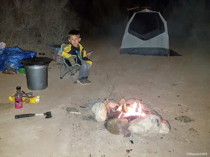
A few moments later, with just enough daylight to spare for setting up camp and cooking dinner, we found ourselves a spot in the area we wanted, very much near the trailhead for Monarch Cave.
Having no fire the previous night, Lennox was anxious to get his smore on.

We watched the moon rise in the east and it would have been a spectacular shot to try to capture if I owned a DSLR with a good zoom lens. Time to call it a night.
Day 3
Friday - March 25, 2016
While not quite as breathtaking as our previous campsite, Butler Wash proved exceptionally calm and peaceful save a few distant "moo's" from nearby cattle ranging in the area.


Comb Ridge spanned the entire western horizon above the wash.

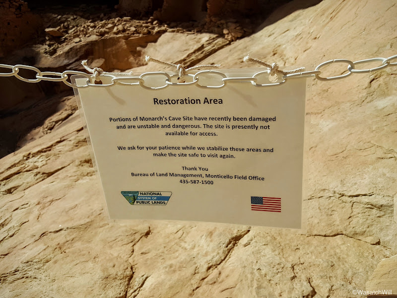
Once again, it was time to break camp and set off on the final day's site-seeing extravaganza. Since we had camped out near Monarch Cave, of course we had to go up and see that.

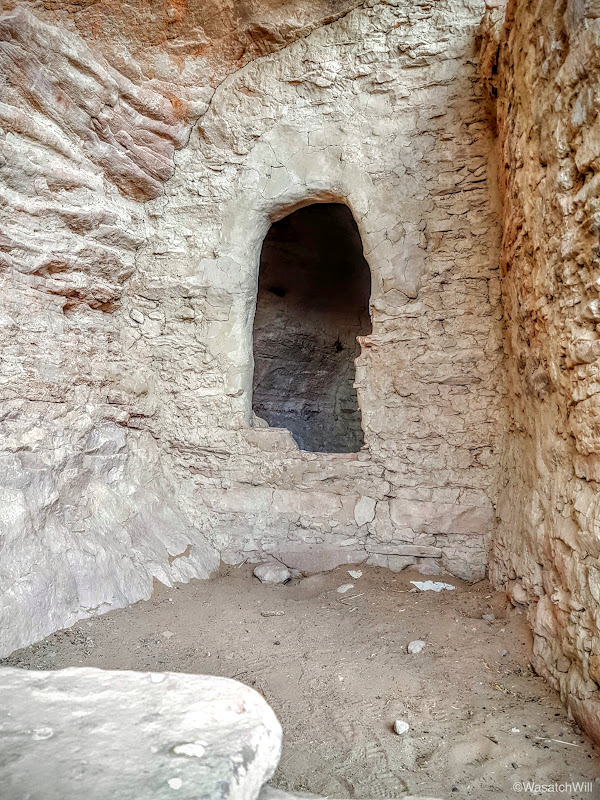
Unfortunately you can no longer proceed any further into the ruin site because of this...

I could only wonder if the damage was natural or the result of some careless human interaction with it.
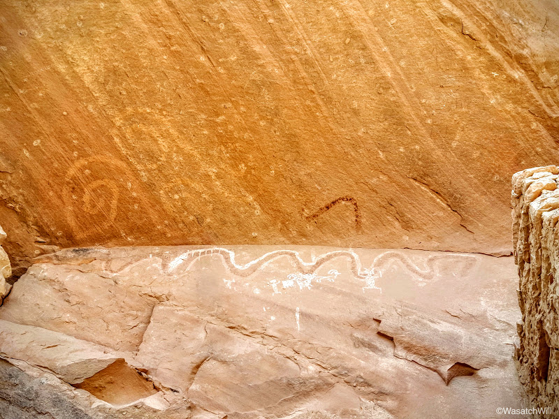
I tried to capture a shot of the pool of water also found beneath this ruin site, but it was too much in the shadows.

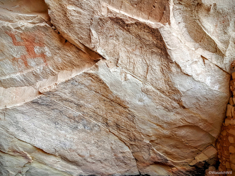
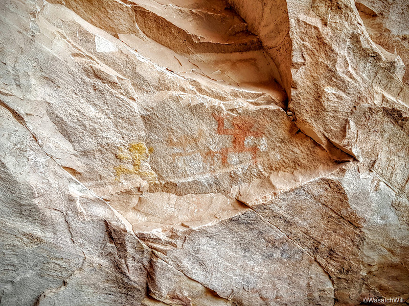
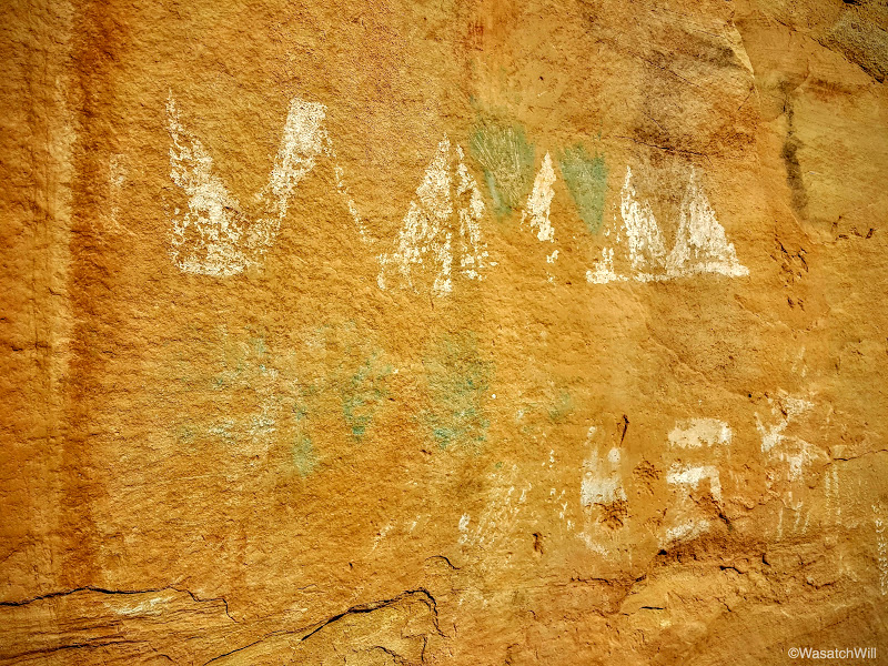
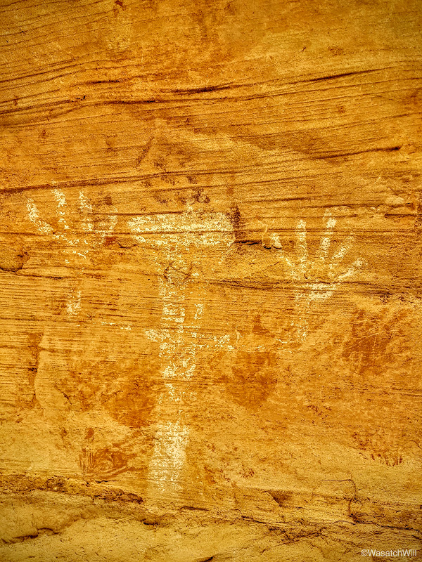
There were several unique petroglyphs and pictographs abundantly found all along the walls above.


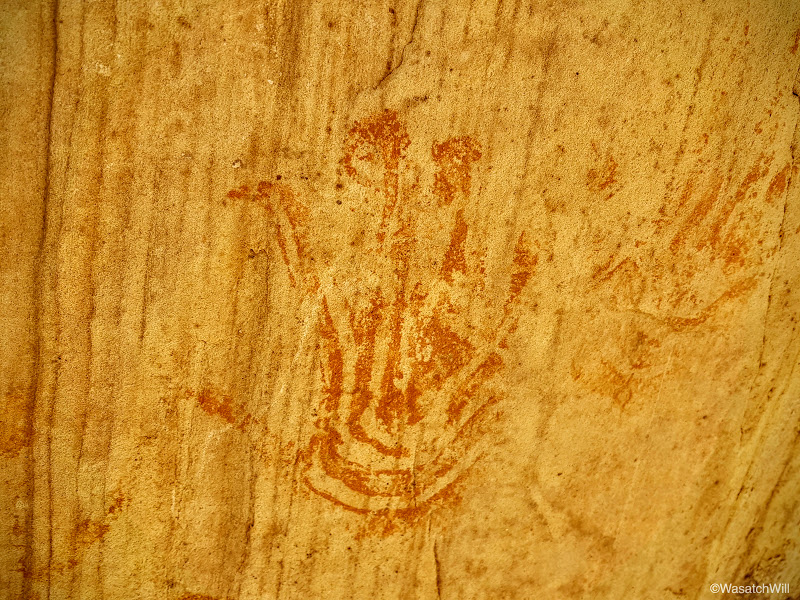
This one was particularly interesting with the artistic pattern found within the hand print.
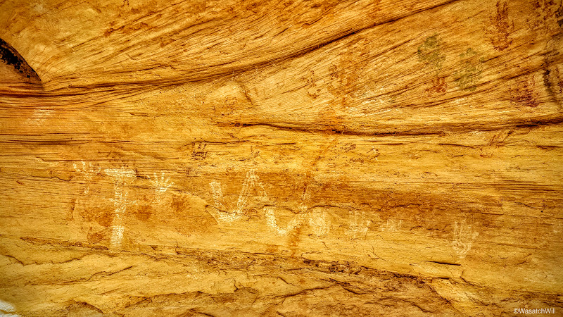
There were quite a few hand print arrangements.

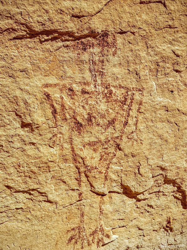
And a figure I now call, "the buggy man".
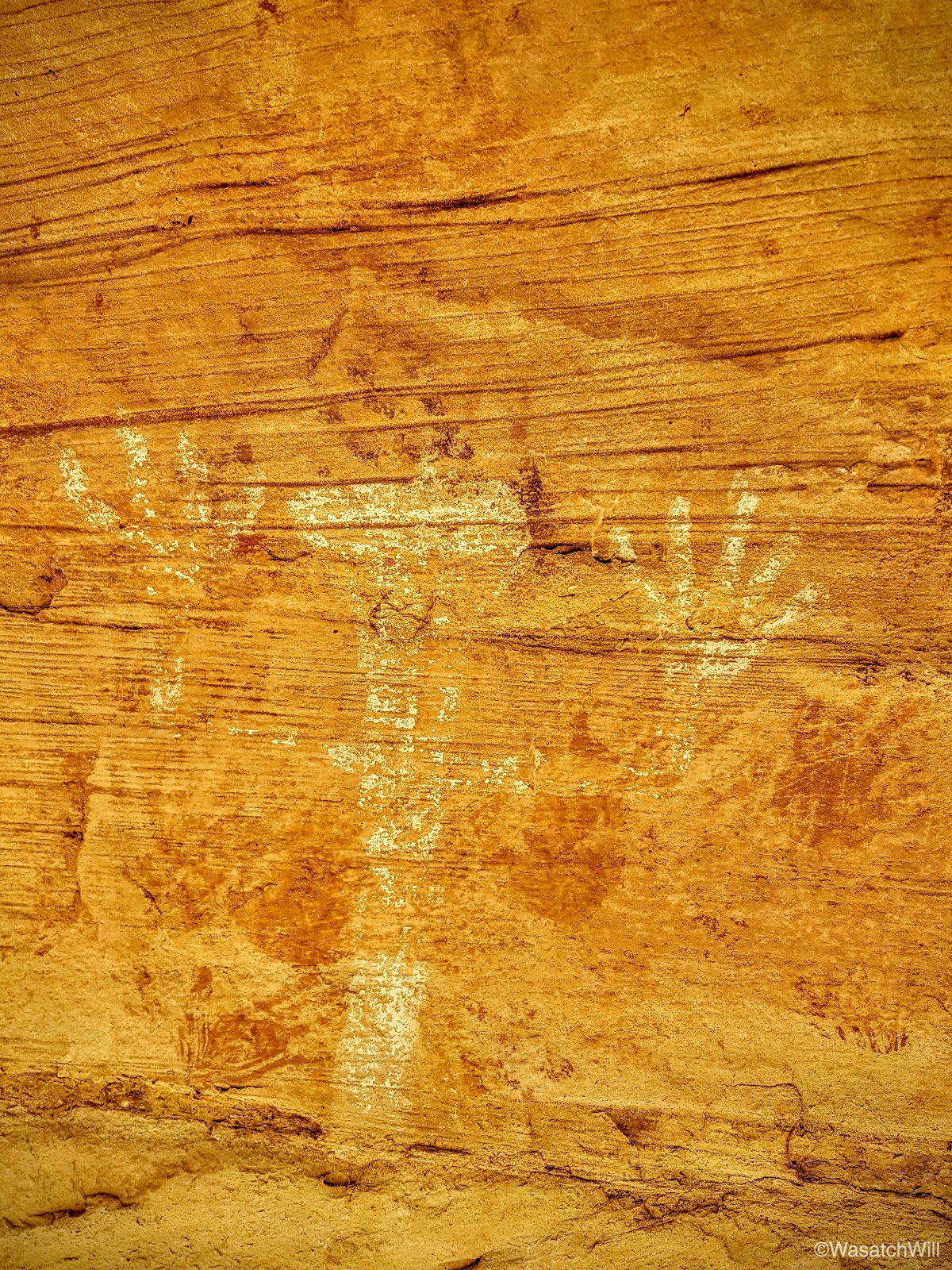

More hands.


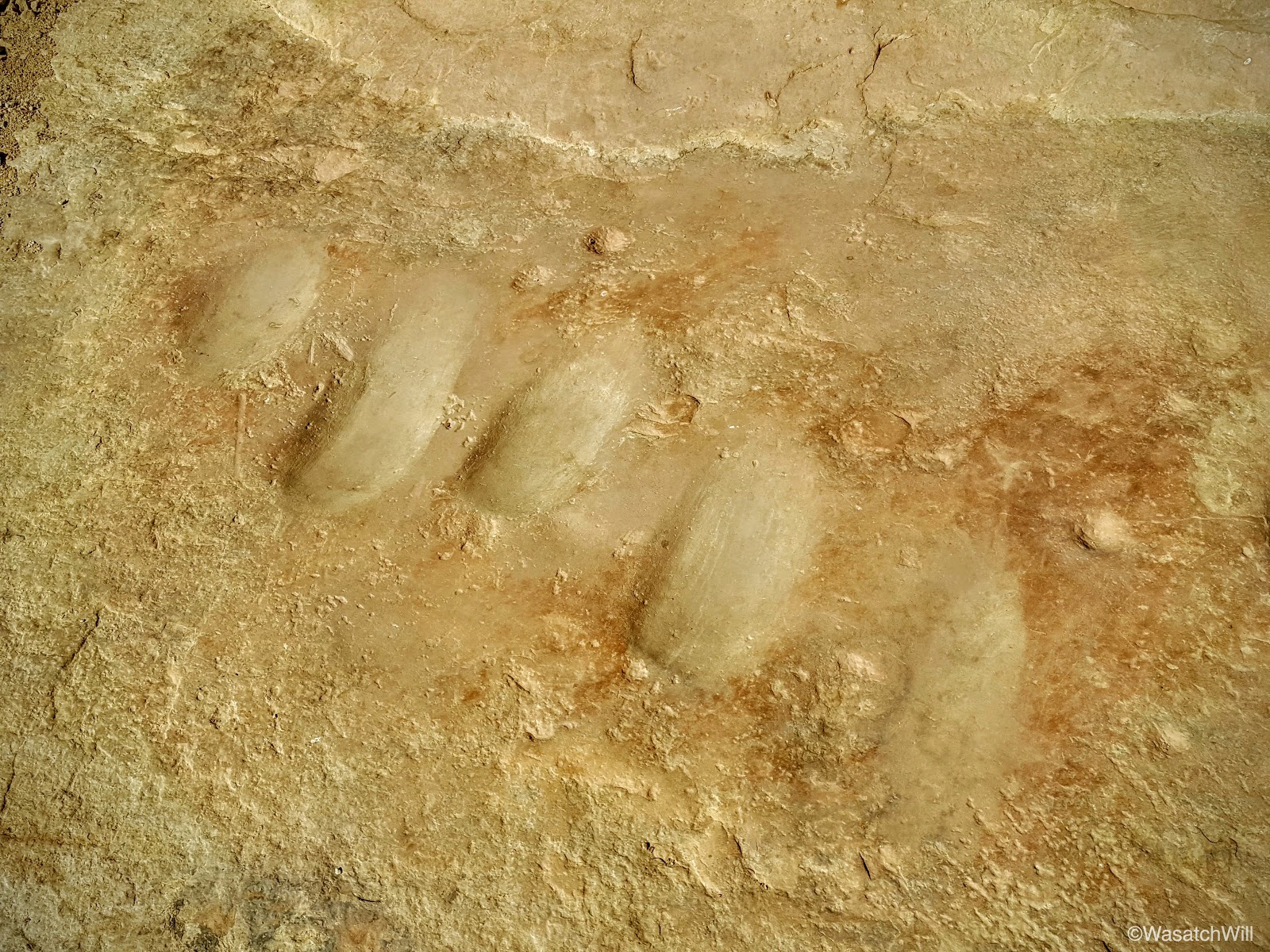
More metates.
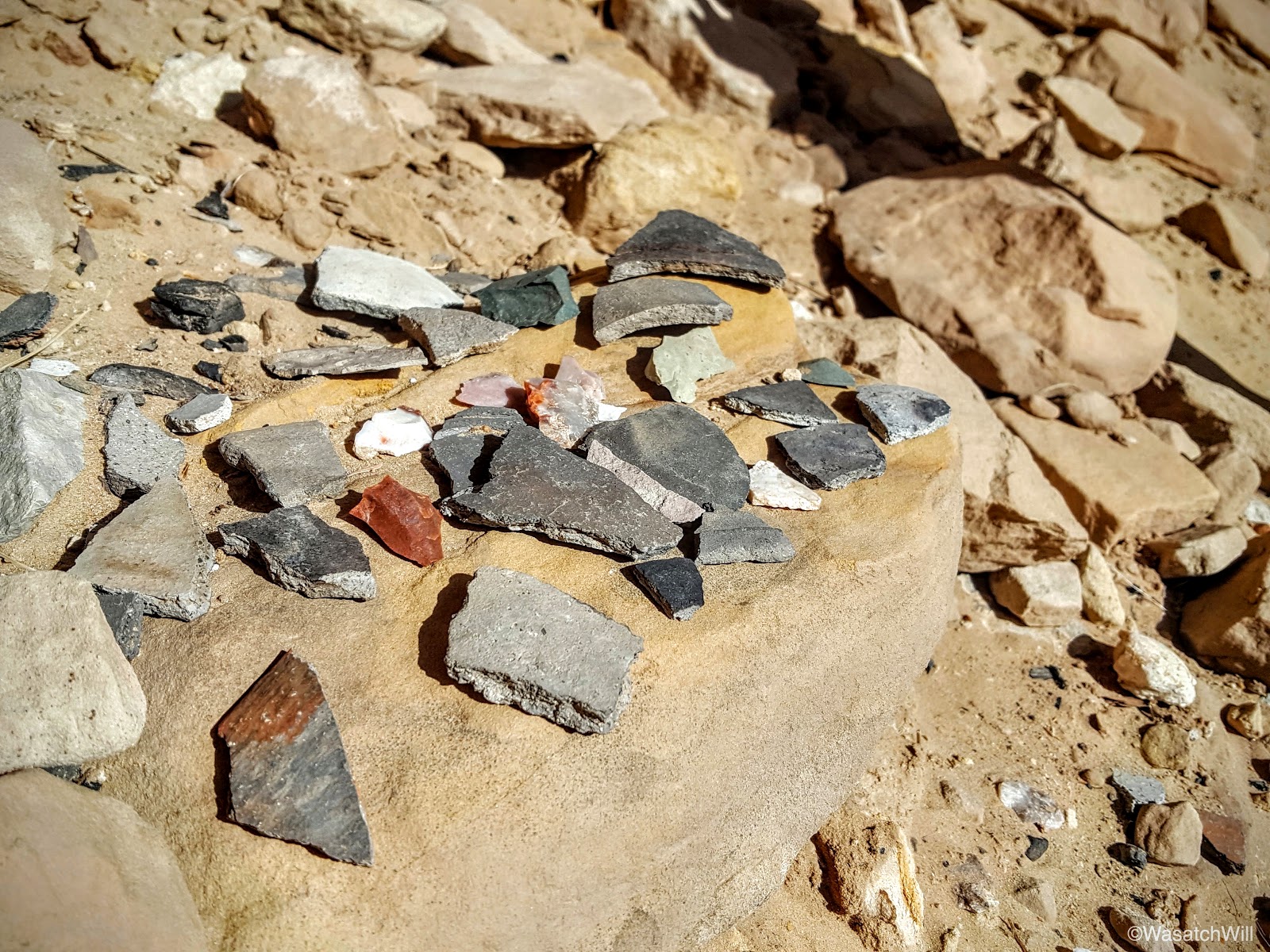
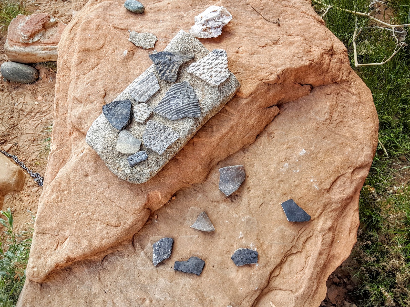
In addition to all the rock art, there were lots of sherds. More sherds laid out for display than I can recall seeing at any other ruin I've visited.
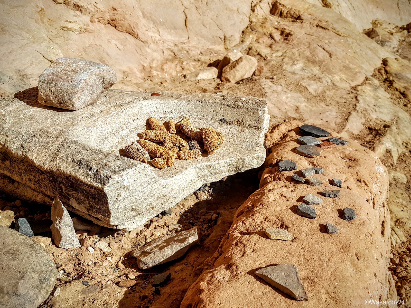
Close up of a manos and metate with ancient maize.

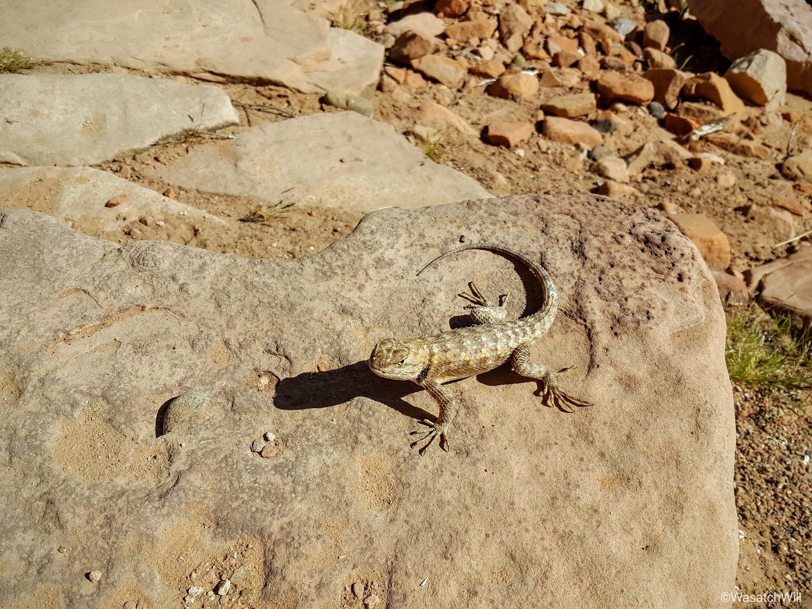
Adding to the excitement was this spiny who came out to say hi for a bit.
It was by far, the biggest lizard we had seen on the trip.

Back to pottery sherds, including a small piece of black-on-white.
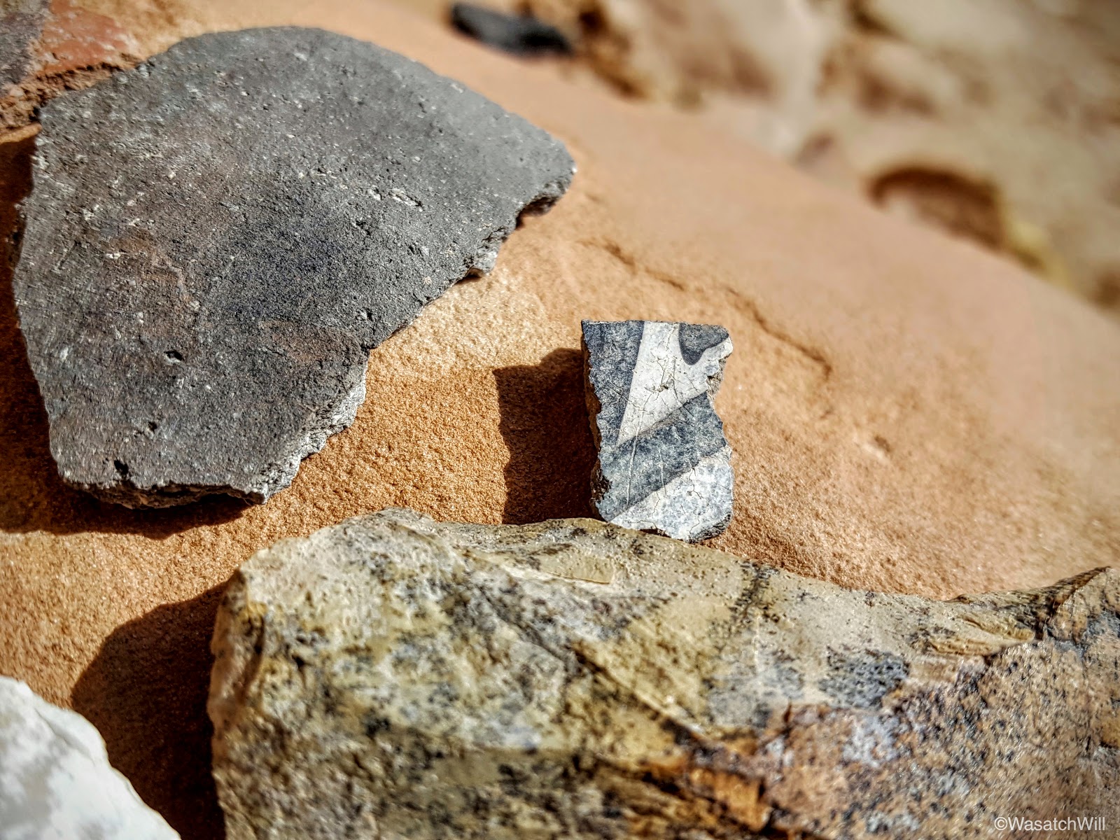
Then there were these gems.

With Monarch Cave now done, we set off for Bluff. I had hoped to locate another rock art site called the Big Crane further down the wash on our way out, but once we had crossed the wash and saw how much further we'd have to go, I opted to save that one for a later attempt.
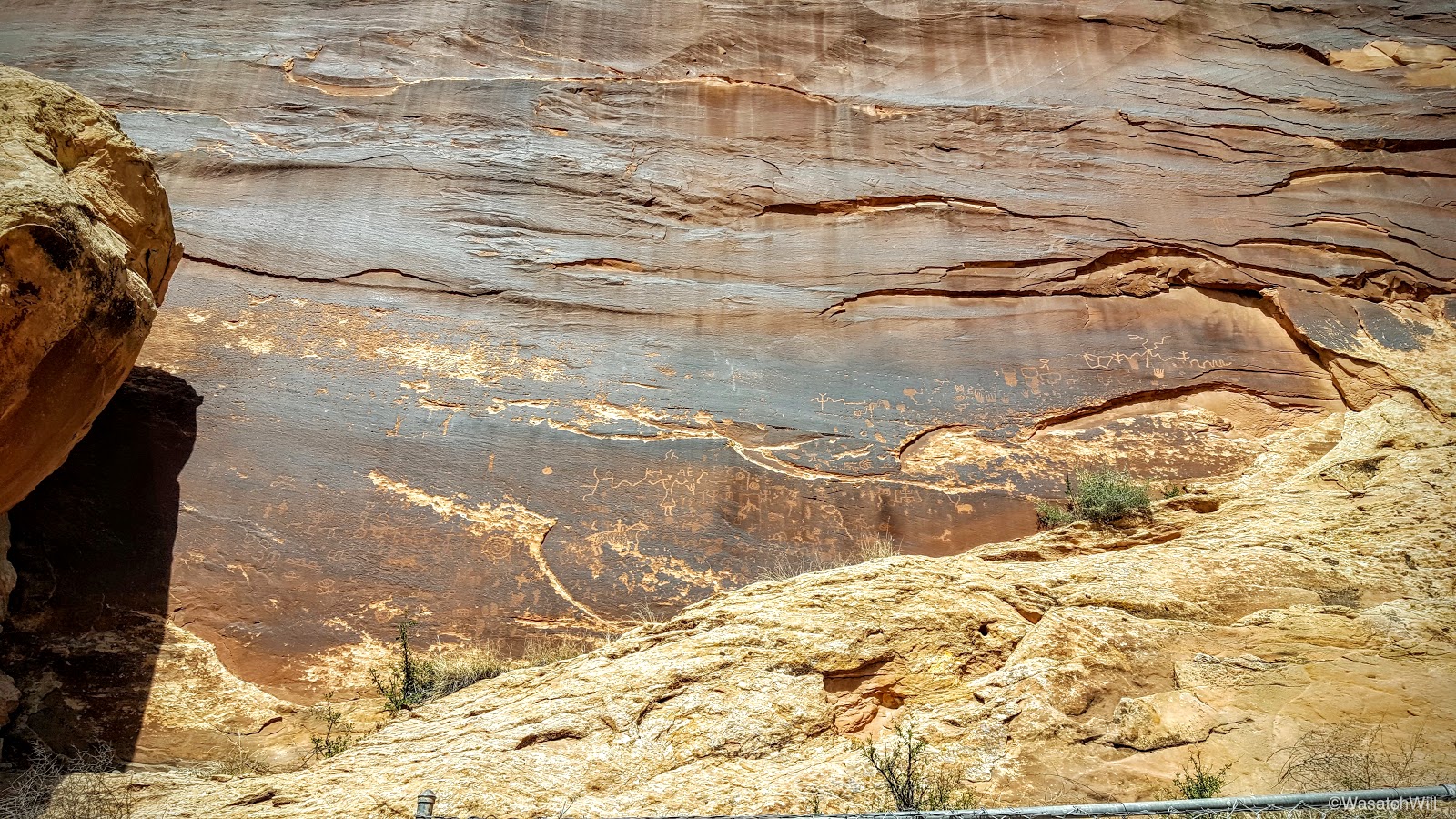
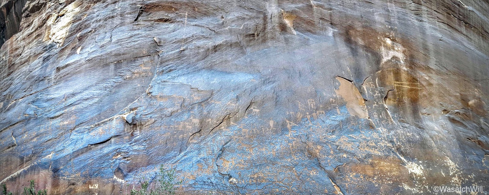
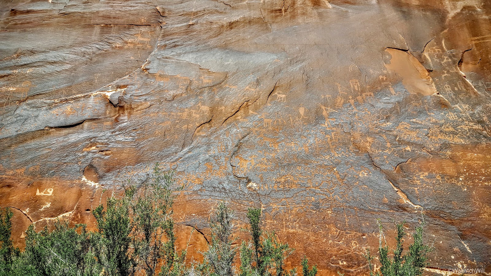
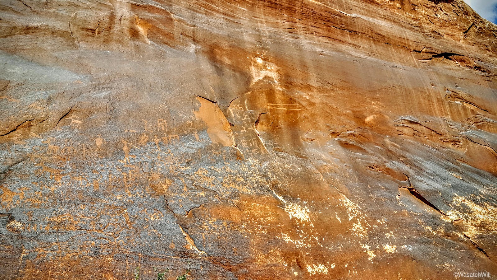
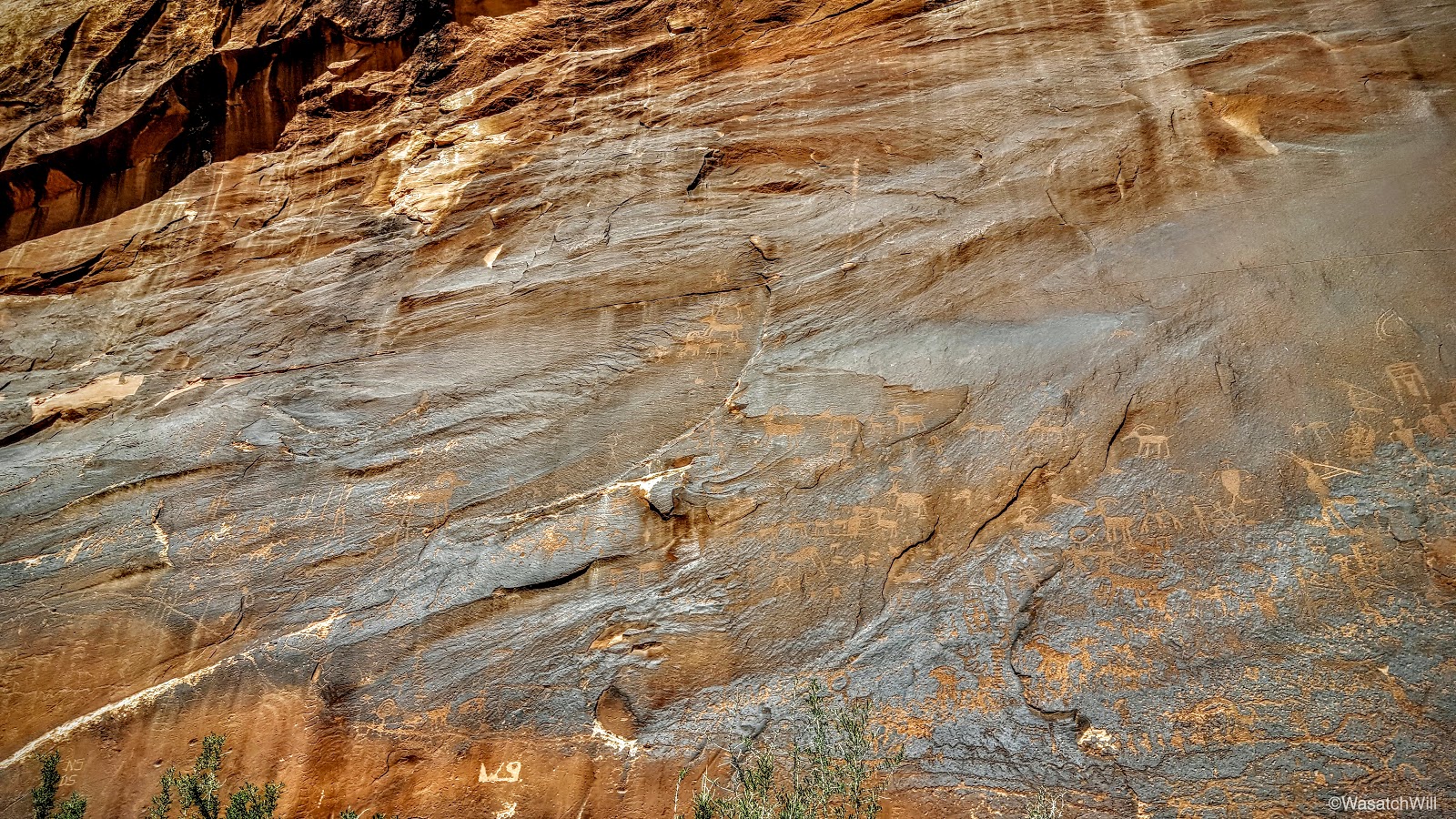
On to Bluff we went for a bit of lunch and to top off the gas tank once more. Lennox had suggested slushees and I obliged. Our next destination would be the Sand Island petroglyph panel just outside of town along the San Juan River.
Like Rochester Panel, it was quite an active panel full of hundreds of figures. Not having a zoom lens for my cell phone, I was stuck with wide shots.
We then drove on out to pay a visit to Seventeen Room ruin located on the Navajo reservation across the river. At this point, all the hiking had caught up to Lennox and Sophie though. They were now checked out.
The road leads right below the ruin site, so I chose to let them rest while I made a quick run up to check it out.

What makes this ruin unique isn't just its long continuous wall shared by all the many rooms (roughly 16 to 17) and hence its name, but it is also a dwelling built up in a north facing alcove. Most dwellings like this are found facing the south where they can capture the warmth of the winter suns among other benefits. Perhaps this was a great summer house then?


Looking down and out from the ruin, you can see across a farmers field and across the San Juan River valley.
On the drive out, I would make out Monument Valley way out on the horizon.

We could have made a drive out to Monument Valley but opted to stay closer to Bluff for the rest of the afternoon. I had read of some other dinosaur tracks that supposedly exist right along the old wagon road leading down into lower Butler Wash. So, we took the somewhat rough road out to that trail and began hiking down to see what we could see.


Some darker clouds were starting to roll in a bit and we still wanted to get out to one last big ruin site that afternoon so we didn't stray too far. We didn't find any obvious tracks either, but there was this shallow looking impression that may indeed be a dinosaur print?
With our quick little dinosaur track hunt finished, we drove back through Comb Ridge and down into lower Comb Wash. There we paused for a moment to check out Navajo Spring, a landmark used in setting the course for the Hole in the Rock expedition mentioned earlier.

Then it was on down the wash for a few more miles before we arrived at San Juan Hill. This was the final obstacle for the Hole in the Rock pioneers to overcome in their bid to ultimately settle what is now Bluff.
It also proved to be quite an obstacle for my car to get to. I had been driving 2WD the whole way until reaching the turn up for this hill. There, the road climbs up a rather steep and rocky stretch and I didn't think to shift into 4WD first, so of course I got stuck for a moment and started spinning out in a pocket of sand between rocks. Even after shifting into 4WD, I was still spinning out a bit and unable to progress up the hill. It wasn't until I reversed back a few feet and gained just enough momentum to take us up the hill.

From there it was over to the Rincone where the remains of an old pioneer trading post sit.

And then it was on down to the final ruin site of our trip, River House ruin.
This ruin was as every bit as fascinating as any of the others I've thus far been to. Much like Ballroom, there was so much more to it than what meets the eye from below. Particularly unique to this ruin is some actual stone staircases that were assumedly laid by its ancient inhabitants in order to access it.


This site turned out to be quite a complex as we observed all the many different rooms and even a two level structure with some keyhole-shaped doors.


There's some debate about the unique pictograph that adorns the upper wall and ceiling above. Some interpret it as a great long snake, and hence another name for the ruin: Snake House ruin. The other interpretation is that it is a depiction of the actual river that flows below it. I think the latter is the more commonly held belief and thus the more official name used by the BLM: River House Ruin.

This site, too, had a nice little collection of potsherds out on display.
And another spiny, though not quite as big as the last.
The San Juan River looked inviting for a moment. Some day I'd like to participate in a rafting trip down it.
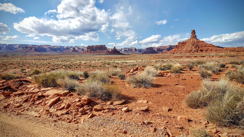
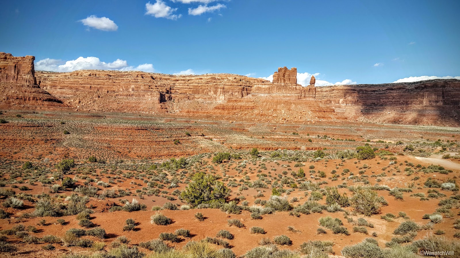
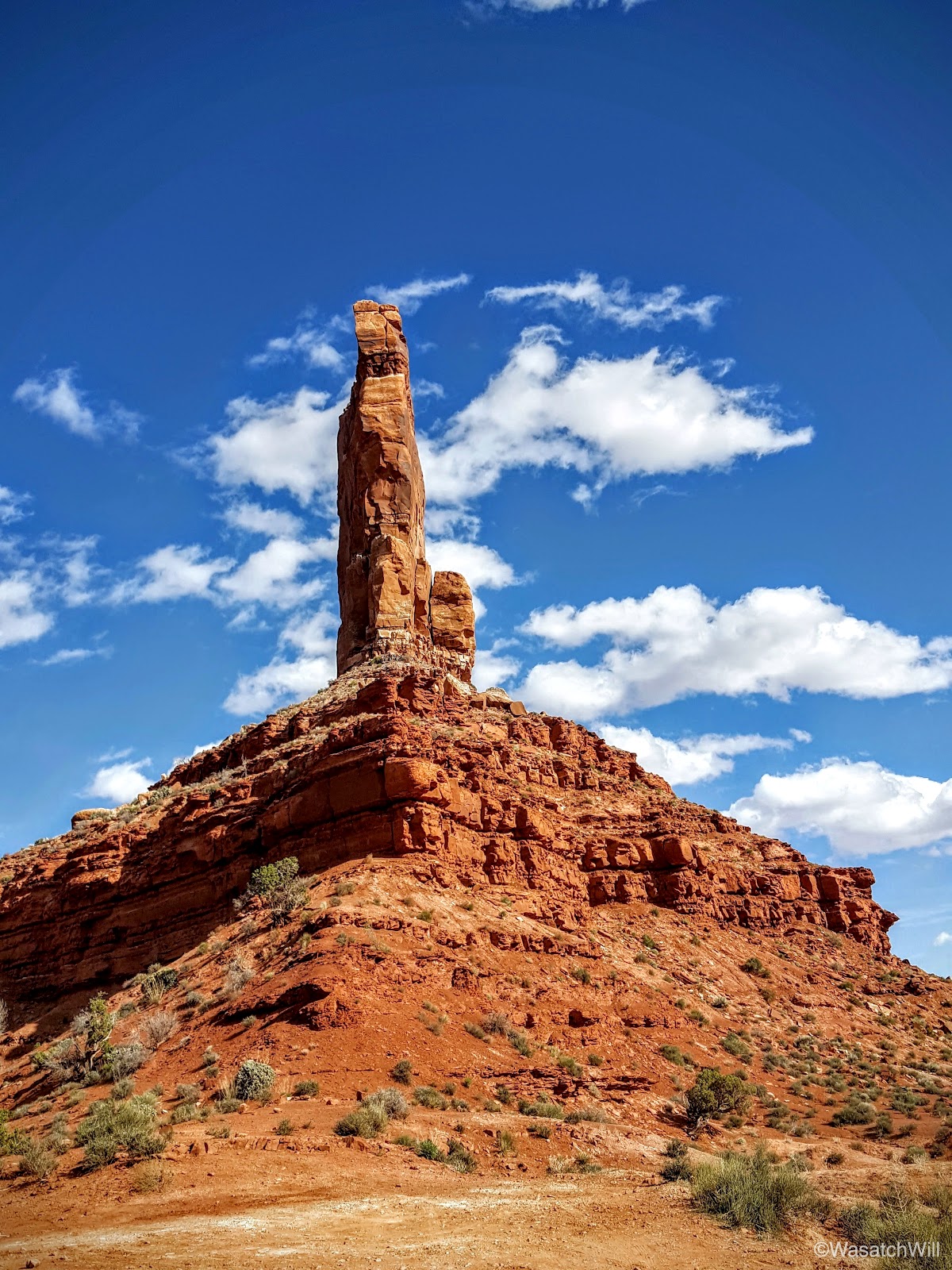
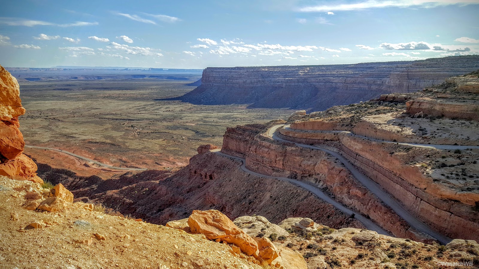
It was now getting to be quite late in the afternoon and I was set to drive all the way back home to Provo that evening so as to have Lennox back home for a neighborhood Easter egg hunt with his sisters. On the way back, we'd take the scenic route through Valley of the Gods, admiring its many buttes throughout.


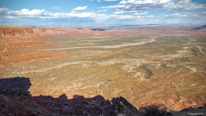
Then it was on up the Moki Dugway for us.
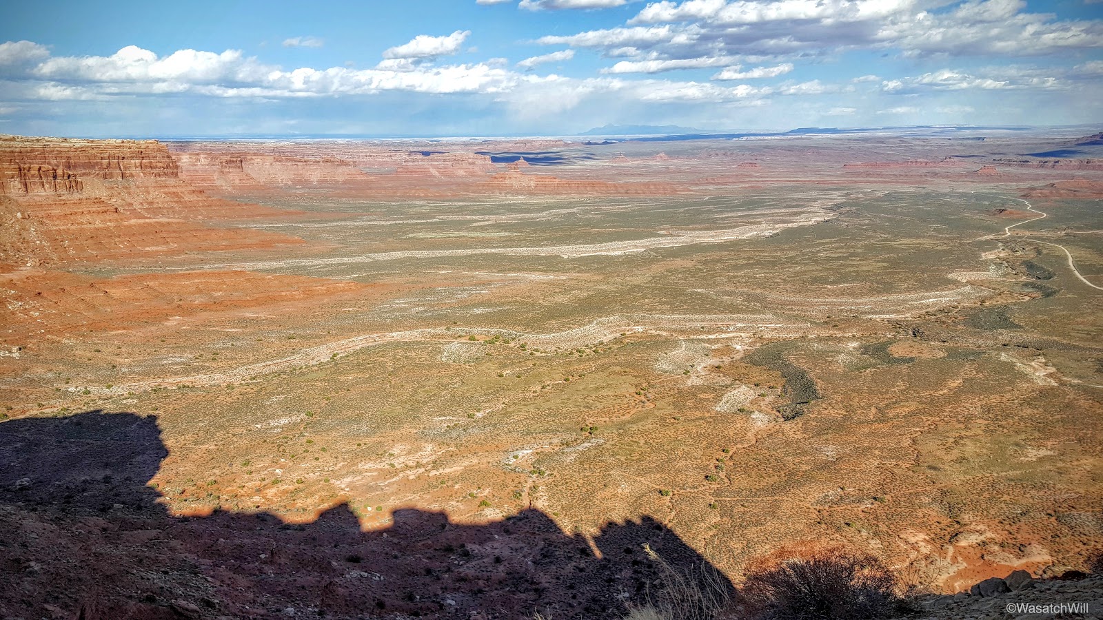
Once we reached the top, I wanted to drive out to check out the view from Muley Point. As luck would have it, a few miles up the road I began suddenly hear "pssss...psssss...psss...pssss" out my window.
Oh no! That better not be what I think it is. I stop and listen some more. "Ssssssssssssss." Oh no. That can't be good! It could only be one thing. I was well on my way to having a flat tire and dummy me, I didn't take a jack with me. I now had a decision: continue out to Muley Point as quick as the tire would let me in hopes of finding or waiting for someone else to arrive out there with a jack I could borrow or flip a U-turn and head back out for the junction with the highway atop Moki Dugway. I chose the latter option.
There, my rear driver-side tire completed its deflation as I made contact with my wife to inform her of the delay.

I then stepped outside and flagged down the first vehicle to pass by. It was an older oriental couple who spoke little English but could see I needed help. They did not have a jack on them either, so they continued on having agreed to pull over at the next pull out down the dugway and alert anyone there on their way up of my situation.
A few minutes later, another SUV pulled up with a couple from Denver who were gracious enough to lend me their jack. We were saved!
With the spare now on, we thanked the couple and began the journey home. Jessica had suggested I just drive up to Torrey and stay the night with her parents instead of making the long drive home home in the dark.
I accepted.
[Ultimately, we'd wake up to a snowstorm moving in which soon created some sketchy white-out road conditions that gave me quite a white knuckle drive home. In the end, we arrived a half hour late to the easter egg hunt, but still in time for Lennox to get in on some egg hunting action of his own.]
On the way to Torrey that Friday night, I pulled over at the Colorado River, just prior to crossing it.

I pondered the little obstacles and set-backs Lennox and I had experienced on the trip. The good samaritans that were there to offer aid to us when we needed it. I looked at the bridge across the great Colorado. Wow, we are spoiled. Those pioneers didn't have such bridges. The very name of that Hole-in-the-Rock expedition comes from a chute or hole as it were, that they blasted through a narrow crevice in the rock further down canyon whereby they could drop their wagons down and ferry them across the river. They didn't have the luxury of good, kind people traveling by there way to offer additional tools and provisions only moments after a wagon wheel broke or other unfortunate setback.
And yet, they all succeeded in their journey and survived, through an entire winter, out in this incredibly beautiful but extremely harsh and unforgiving landscape. They forged roads and routes that many modern roads, whether paved or dirt, now follow to give us convenient access to such breathtaking viewpoints, canyons, and glimpses into our primitive past. What would Southeast Utah be, without the towns of Bluff, Blanding, and Monticello, having been settled by these pioneers, that now serve as an oasis of services and resupply points for fuel, food, and other supplies for visitors to the area? I must concede here that perhaps many of the ruin sites across Cedar Mesa and the surrounding area may have remained more in tact, but I digress.
Still, I thank you, Pioneers.