IntrepidXJ
ADVENTR
- Joined
- Jan 17, 2012
- Messages
- 3,488
Friday - Sunday, October 24-26, 2014
Since Diane and I had a great long weekend in The Maze over Memorial Day weekend I wanted to show her some of my favorite places in The Needles district this weekend so she could experience more of Canyonlands National Park. Plus, I've been having a great year in Canyonlands by finally completing the White Rim and backpacking Salt Creek Canyon, so I wanted to keep the momentum going!
I left work early Friday morning and we made our way through Moab and Indian Creek Canyon to The Needles. Of course, we stopped at Newspaper Rock along the way to check out the impressive petroglyph panel. After arriving at the park, we hiked the short Cave Spring trail before driving over Elephant Hill to our campsite for the next two nights in the Devil's Kitchen. The beginning of the Elephant Hill trail was the easiest I have ever seen it. It appears that the Park Service has removed the large loose boulders that would constantly move and then filled the trail in with sand and dirt.
I've stopped at Newspaper Rock numerous times in the past, but it's always worth another quick visit when I'm driving by.
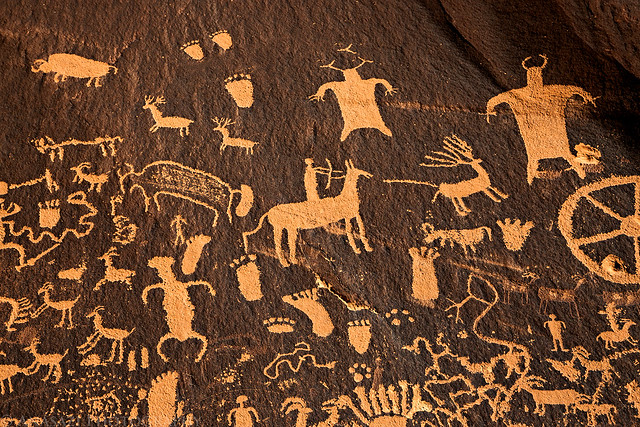
Newspaper Rock Petroglyphs by IntrepidXJ, on Flickr
The cowboy camp at Cave Spring.
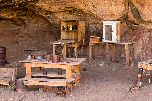
Cave Spring Cowboy Camp by IntrepidXJ, on Flickr
A few small pictographs near Cave Spring.
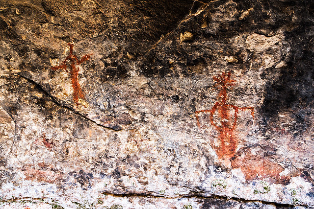
Cave Spring Pictographs by IntrepidXJ, on Flickr
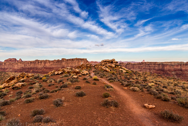
Along the Elephant Hill trail on our way to camp.
Elephant Hill Trail by IntrepidXJ, on Flickr
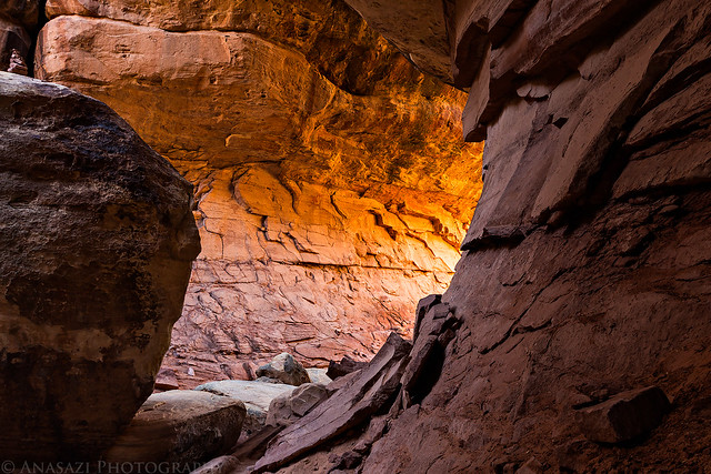
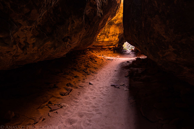
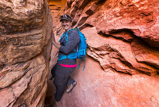
When we reached our campsite at the Devil's Kitchen there was some nice reflected light in the passages and slots behind our camp. I quickly grabbed my camera and tripod to take a few photos since I knew the light wouldn't last long.
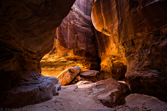
Entrance by IntrepidXJ, on Flickr
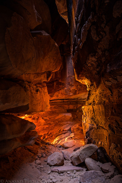
Camp Chamber by IntrepidXJ, on Flickr
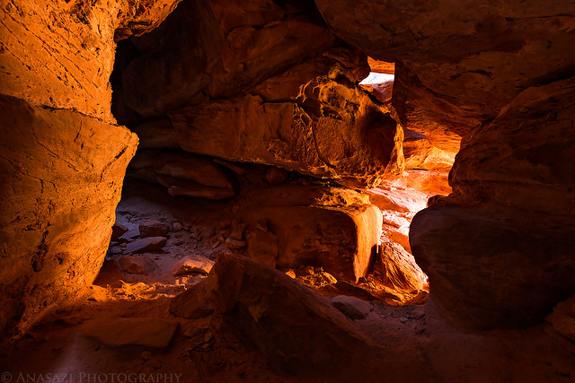
Intersection Glow by IntrepidXJ, on Flickr
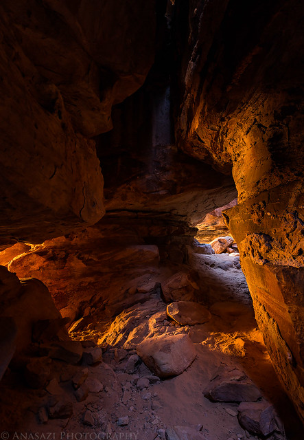
Passage Light by IntrepidXJ, on Flickr
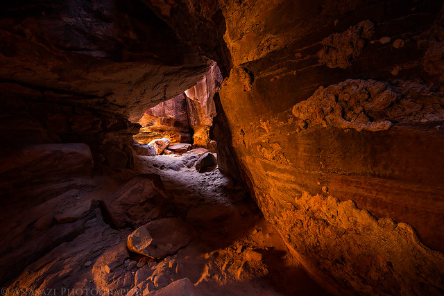
Fun With Light by IntrepidXJ, on Flickr
While I was taking photos of the reflected light, Diane was nice enough to get our tent setup all by herself.
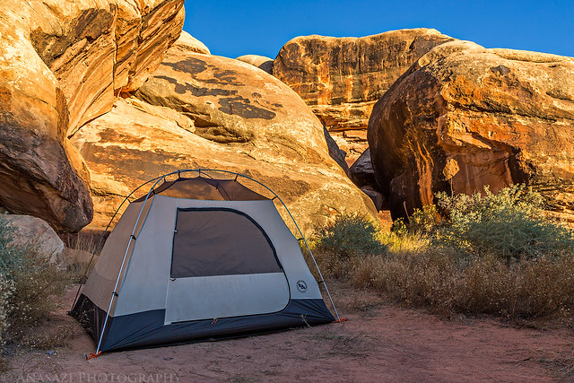
Devil's Kitchen #3 by IntrepidXJ, on Flickr
The sky was clear when the sun went down, so I really didn't bother taking any photos at that time. However, I did wait until it was dark enough to take some shots of the Milky Way above.
The Milky Way over Devil's Pocket from camp.
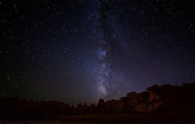
Needles Milky Way by IntrepidXJ, on Flickr
Diane was inside the tent reading while I took this photo.

Night Camp by IntrepidXJ, on Flickr
On Saturday morning we woke up with the sunrise, but there were no clouds again, so I didn't take any photos. Instead we had some breakfast and started our drive through Devil's Lane and over SOB Hill to the Joint Trail. We stopped at a few rock art sites on the way.
A well-known panel of pictographs right next to the road.

Hands & Feet by IntrepidXJ, on Flickr
Part of a larger Barrier Canyon Style pictograph panel that is very faded and hard to see.

Grabens Panel by IntrepidXJ, on Flickr
We enjoyed the short morning hike on the Joint Trail to the Chesler Park overlook and rested there in the shade. After a little while we heard and saw a large group of kids hiking through Chesler Park in the distance on their way towards the Joint Trail and we knew that it was time to get moving again. We did not want to get stuck near that group!
Entering the Cave of Cairns. There aren't as many cairns as there used to be in here. I've seen the Park Rangers knocking them over in the past.
Cave of Cairns by IntrepidXJ, on Flickr
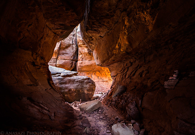
Some nice light around the corner.
Cave Glow by IntrepidXJ, on Flickr
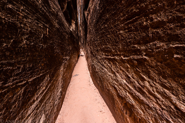
Trail through the joint.
Joint Trail by IntrepidXJ, on Flickr
The Joint by IntrepidXJ, on Flickr
Our view from the Chesler Park overlook. Maybe one day I'll finally catch a sunset here, but not today...
Chesler Park by IntrepidXJ, on Flickr
Diane heading back to the trailhead.
In the Joint by IntrepidXJ, on Flickr
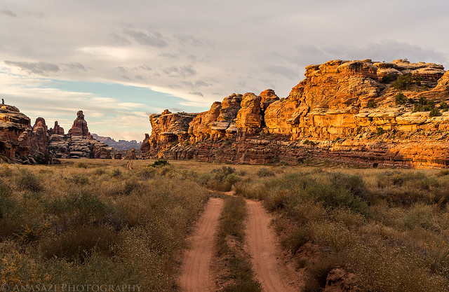
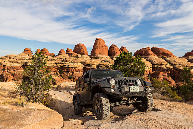
After our easy morning hike we decided to leave the park and drive up to Ruin Park, Beef Basin and Middle Park to visit a few ruins and search for some new ones. Bobby's Hole had been washed out earlier this year but had been repaired in the past few months and was in the same condition I have always seen it in.
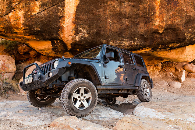
Leaving the park on the sandy trail.
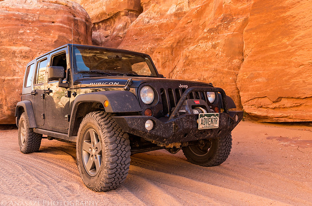
Jeep in Sand by IntrepidXJ, on Flickr
A new granary I found this trip, with a little help from my friend Jared.

New Granary by IntrepidXJ, on Flickr
These white pictographs were found next to the granary above. While lines of white dots are commonly found in these parts, the large egg-shaped figure in the middle of the line of dots is something new that I have not seen before.

Egg in the Middle by IntrepidXJ, on Flickr
We stopped to visit Farm House Ruin.

Farm House Ruin by IntrepidXJ, on Flickr
Before returning back to camp, we hiked to the Canyonlands Panel that I managed to find a few years back. This has got to be one of my very favorite petroglyph panels.

Canyonlands Panel by IntrepidXJ, on Flickr

Hunting Sheep by IntrepidXJ, on Flickr

Walk the Line by IntrepidXJ, on Flickr
One of my favorite signs.
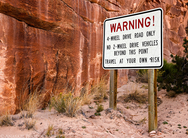
Warning! by IntrepidXJ, on Flickr
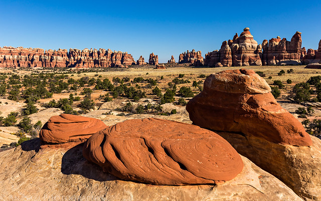
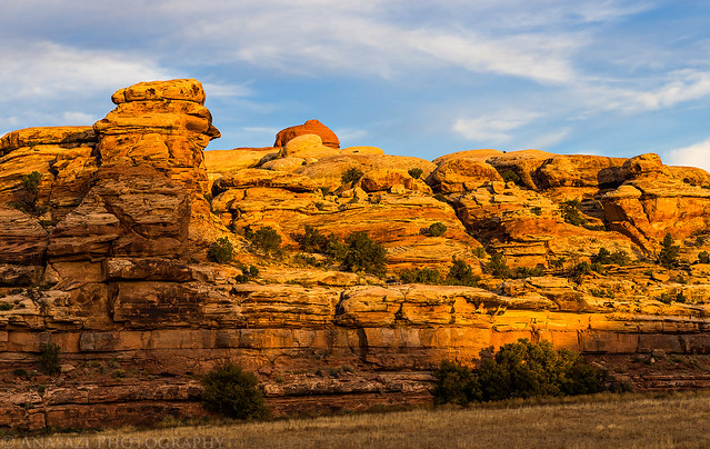
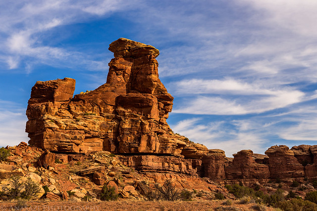
Sandstone spires come into view again as we get closer to our camp.
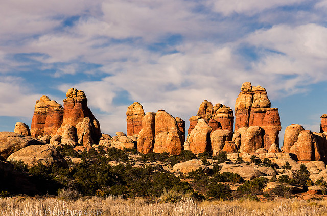
Return to the Needles by IntrepidXJ, on Flickr
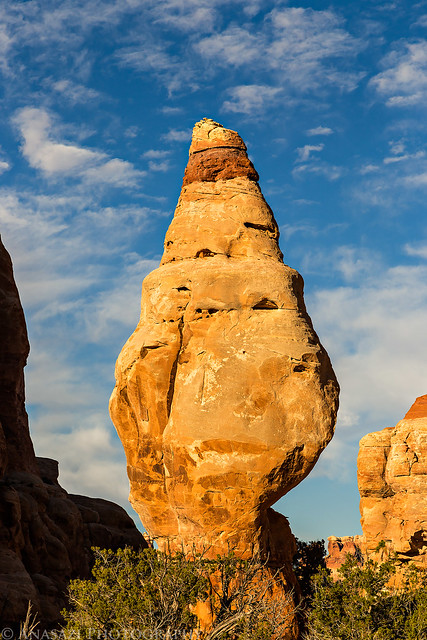
Seashell Rock by IntrepidXJ, on Flickr
There were a few small clouds left in the sky this evening that turned magenta after the sun was down.
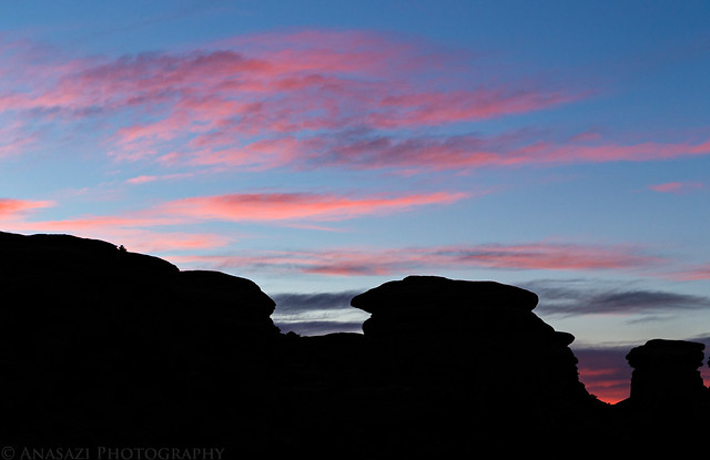
Last Light by IntrepidXJ, on Flickr
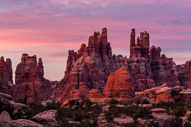
On Sunday morning we finally had some clouds move into the sky about an hour before sunrise which created some nice color when the sun did come up. It was a very nice sunrise!
The clouds starting to change color.
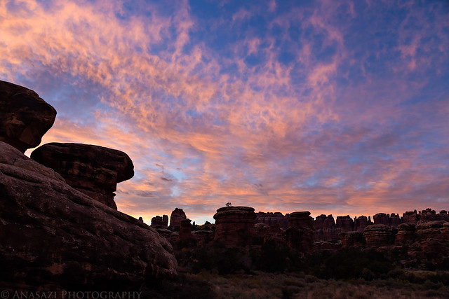
Morning Clouds by IntrepidXJ, on Flickr
Sunrise over Devil's Pocket. The magenta light bouncing off of the clouds and onto the spires was pretty intense.
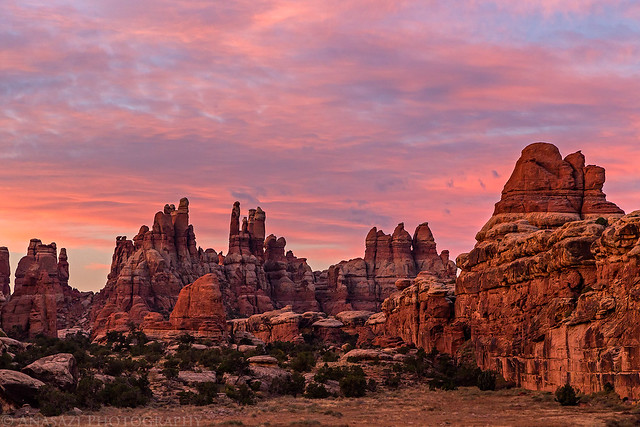
Devil's Pocket Sunrise by IntrepidXJ, on Flickr
A closer look at the needles.
Needles Sunrise by IntrepidXJ, on Flickr
Light on the spires when the color in the sky was gone.
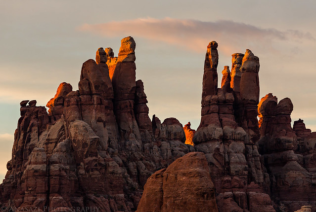
Light on the Spires by IntrepidXJ, on Flickr
After breakfast and packing up camp we continued our drive around the Elephant Hill trail loop so that we could head back home. We did stop to hike to the confluence of the Green and Colorado Rivers on the way out.
Nice light on the sandstone walls in the Devil's Lane.
Devil's Lane Light by IntrepidXJ, on Flickr
The sandy two-track through the Devil's Lane.
Devil's Lane by IntrepidXJ, on Flickr
Another faded Barrier Canyon Style pictograph that we passed by.

Faint BCS by IntrepidXJ, on Flickr
A view of the confluence from the overlook. I always enjoy seeing the two separate colors of each river where they meet.

The Confluence by IntrepidXJ, on Flickr
Hiking back to the Jeep from the overlook.
Confluence Overlook Trail by IntrepidXJ, on Flickr
Sandstone formations in Elephant Canyon as we drive back out.
Stone Scenery by IntrepidXJ, on Flickr
The final climb over Elephant Hill.
Elephant Hill by IntrepidXJ, on Flickr
The rest of the drive home was pretty uneventful, but we did stop in Moab for a nice lunch at The Blu Pig, one of our favorite restaurants in town")
>> A Needles Tour Photo Gallery
>> The Original Trip Report on ADVENTR.CO\
Featured image for home page:

Since Diane and I had a great long weekend in The Maze over Memorial Day weekend I wanted to show her some of my favorite places in The Needles district this weekend so she could experience more of Canyonlands National Park. Plus, I've been having a great year in Canyonlands by finally completing the White Rim and backpacking Salt Creek Canyon, so I wanted to keep the momentum going!
I left work early Friday morning and we made our way through Moab and Indian Creek Canyon to The Needles. Of course, we stopped at Newspaper Rock along the way to check out the impressive petroglyph panel. After arriving at the park, we hiked the short Cave Spring trail before driving over Elephant Hill to our campsite for the next two nights in the Devil's Kitchen. The beginning of the Elephant Hill trail was the easiest I have ever seen it. It appears that the Park Service has removed the large loose boulders that would constantly move and then filled the trail in with sand and dirt.
I've stopped at Newspaper Rock numerous times in the past, but it's always worth another quick visit when I'm driving by.
Newspaper Rock Petroglyphs by IntrepidXJ, on Flickr
The cowboy camp at Cave Spring.
Cave Spring Cowboy Camp by IntrepidXJ, on Flickr
A few small pictographs near Cave Spring.
Cave Spring Pictographs by IntrepidXJ, on Flickr
Along the Elephant Hill trail on our way to camp.
Elephant Hill Trail by IntrepidXJ, on Flickr
When we reached our campsite at the Devil's Kitchen there was some nice reflected light in the passages and slots behind our camp. I quickly grabbed my camera and tripod to take a few photos since I knew the light wouldn't last long.
Entrance by IntrepidXJ, on Flickr
Camp Chamber by IntrepidXJ, on Flickr
Intersection Glow by IntrepidXJ, on Flickr
Passage Light by IntrepidXJ, on Flickr
Fun With Light by IntrepidXJ, on Flickr
While I was taking photos of the reflected light, Diane was nice enough to get our tent setup all by herself.
Devil's Kitchen #3 by IntrepidXJ, on Flickr
The sky was clear when the sun went down, so I really didn't bother taking any photos at that time. However, I did wait until it was dark enough to take some shots of the Milky Way above.
The Milky Way over Devil's Pocket from camp.
Needles Milky Way by IntrepidXJ, on Flickr
Diane was inside the tent reading while I took this photo.
Night Camp by IntrepidXJ, on Flickr
On Saturday morning we woke up with the sunrise, but there were no clouds again, so I didn't take any photos. Instead we had some breakfast and started our drive through Devil's Lane and over SOB Hill to the Joint Trail. We stopped at a few rock art sites on the way.
A well-known panel of pictographs right next to the road.
Hands & Feet by IntrepidXJ, on Flickr
Part of a larger Barrier Canyon Style pictograph panel that is very faded and hard to see.
Grabens Panel by IntrepidXJ, on Flickr
We enjoyed the short morning hike on the Joint Trail to the Chesler Park overlook and rested there in the shade. After a little while we heard and saw a large group of kids hiking through Chesler Park in the distance on their way towards the Joint Trail and we knew that it was time to get moving again. We did not want to get stuck near that group!
Entering the Cave of Cairns. There aren't as many cairns as there used to be in here. I've seen the Park Rangers knocking them over in the past.
Cave of Cairns by IntrepidXJ, on Flickr
Some nice light around the corner.
Cave Glow by IntrepidXJ, on Flickr
Trail through the joint.
Joint Trail by IntrepidXJ, on Flickr
The Joint by IntrepidXJ, on Flickr
Our view from the Chesler Park overlook. Maybe one day I'll finally catch a sunset here, but not today...
Chesler Park by IntrepidXJ, on Flickr
Diane heading back to the trailhead.
In the Joint by IntrepidXJ, on Flickr
After our easy morning hike we decided to leave the park and drive up to Ruin Park, Beef Basin and Middle Park to visit a few ruins and search for some new ones. Bobby's Hole had been washed out earlier this year but had been repaired in the past few months and was in the same condition I have always seen it in.
Leaving the park on the sandy trail.
Jeep in Sand by IntrepidXJ, on Flickr
A new granary I found this trip, with a little help from my friend Jared.
New Granary by IntrepidXJ, on Flickr
These white pictographs were found next to the granary above. While lines of white dots are commonly found in these parts, the large egg-shaped figure in the middle of the line of dots is something new that I have not seen before.
Egg in the Middle by IntrepidXJ, on Flickr
We stopped to visit Farm House Ruin.
Farm House Ruin by IntrepidXJ, on Flickr
Before returning back to camp, we hiked to the Canyonlands Panel that I managed to find a few years back. This has got to be one of my very favorite petroglyph panels.
Canyonlands Panel by IntrepidXJ, on Flickr
Hunting Sheep by IntrepidXJ, on Flickr
Walk the Line by IntrepidXJ, on Flickr
One of my favorite signs.
Warning! by IntrepidXJ, on Flickr
Sandstone spires come into view again as we get closer to our camp.
Return to the Needles by IntrepidXJ, on Flickr
Seashell Rock by IntrepidXJ, on Flickr
There were a few small clouds left in the sky this evening that turned magenta after the sun was down.
Last Light by IntrepidXJ, on Flickr
On Sunday morning we finally had some clouds move into the sky about an hour before sunrise which created some nice color when the sun did come up. It was a very nice sunrise!
The clouds starting to change color.
Morning Clouds by IntrepidXJ, on Flickr
Sunrise over Devil's Pocket. The magenta light bouncing off of the clouds and onto the spires was pretty intense.
Devil's Pocket Sunrise by IntrepidXJ, on Flickr
A closer look at the needles.
Needles Sunrise by IntrepidXJ, on Flickr
Light on the spires when the color in the sky was gone.
Light on the Spires by IntrepidXJ, on Flickr
After breakfast and packing up camp we continued our drive around the Elephant Hill trail loop so that we could head back home. We did stop to hike to the confluence of the Green and Colorado Rivers on the way out.
Nice light on the sandstone walls in the Devil's Lane.
Devil's Lane Light by IntrepidXJ, on Flickr
The sandy two-track through the Devil's Lane.
Devil's Lane by IntrepidXJ, on Flickr
Another faded Barrier Canyon Style pictograph that we passed by.
Faint BCS by IntrepidXJ, on Flickr
A view of the confluence from the overlook. I always enjoy seeing the two separate colors of each river where they meet.
The Confluence by IntrepidXJ, on Flickr
Hiking back to the Jeep from the overlook.
Confluence Overlook Trail by IntrepidXJ, on Flickr
Sandstone formations in Elephant Canyon as we drive back out.
Stone Scenery by IntrepidXJ, on Flickr
The final climb over Elephant Hill.
Elephant Hill by IntrepidXJ, on Flickr
The rest of the drive home was pretty uneventful, but we did stop in Moab for a nice lunch at The Blu Pig, one of our favorite restaurants in town
>> A Needles Tour Photo Gallery
>> The Original Trip Report on ADVENTR.CO\
Featured image for home page: