- Joined
- Aug 21, 2018
- Messages
- 736
This report has a bit of a twist in that it covers a day hike that took place during an outing in the backcountry.
In early September 2025 @scatman , @Bob , @CajunPoncho , friend Cody, and I spent some time in the Southwestern Yellowstone wilderness. Bob had to take off a bit early but the rest of us followed a path from Buffalo Lake down to the Bechler Ranger Station. We stayed at campsite 9A4 / Talus Terrace for two nights allowing us to leave the heavy stuff in camp and take a nice day hike to pass the time. I had wanted to see/stay at the Dunanda Falls campsite (9A3), but it was not available when we made our reservation. Of course, I will post a trip report of the entire four nights/five days in the future, but using this approach allows me to post a lot of pictures for a single day.
Hugh and I discussed what we might do on our "day off." We thought a route that took us to the upper reaches of Silver Scarf Creek might be interesting as there is a large thermal area there that has been called the "Valley of Death." We'd then follow a path downstream towards Silver Scarf Falls, make our way to Dunanda Falls, then simply take the official trail back up to our campsite. It looked like a doable route on a flat computer screen in Google Earth, so that became the plan.
Hugh has hiked with me once or twice before and by now should be well aware that I can get my rights and lefts confused, my sense of direction might be average at best, and that I am probably not the best person to plot a course thru the wilderness. In the past we usually dream up a route, then Hugh shows up with premade maps highlighted with GPS waypoints following a sensible path. He must have left the maps/GPS in the Subaru this time and I was instructed to lead the way. . . something he may have been regretting an hour or so into the day.
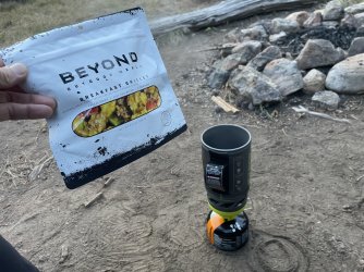
Our day started with a hearty breakfast at Campsite 9A4. I do not typically eat a large breakfast in the backcountry, but because we were not breaking down camp or in a hurry to get moving, I tried a new offering from Beyond Outdoor Meals.
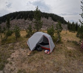
The campsite is also called "Talus Terrace," which probably has something to do with the giant wall of rocks situated to the East (seen behind Hugh's tent in the next picture). The rock wall is much steeper when seen in person, this picture with the GoPro is probably not the best to appreciate scale.
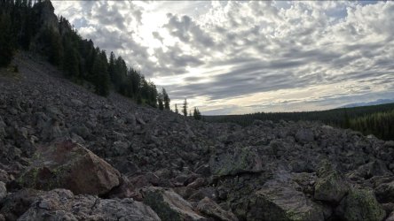
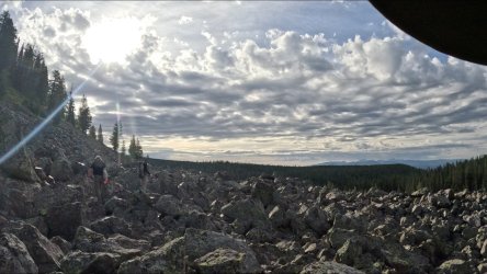
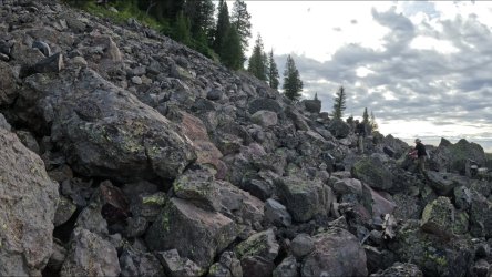
The Valley of Death thermal area is more or less on the other side of the rocks/cliffs. Hugh wanted to take the classic Scatman "as the crow flies" approach and hike straight over the cliff. I chose to contour around the steepest stuff instead, but it involved a lot of rock hopping over some good-sized boulders. Most of my pictures from this part of the day are frames taken from the GoPro video that was mounted on my shoulder. I was afraid that if I dropped a lens cap (or my camera) down in the rocks I'd never get it back.
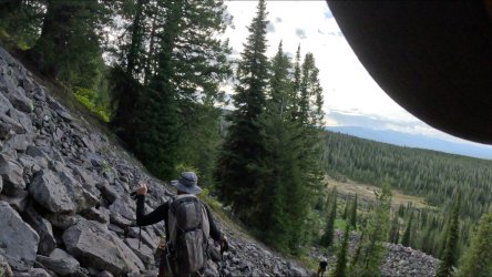
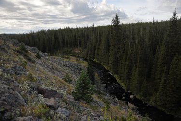
Good views of Boundary Creek as we made our ascent.
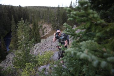
I cannot tell if Hugh is wincing in pain or if he is in his happy place taking pictures. . . safe to say that morale is still high right now.
After climbing the initial wall of rock this was the view looking forward. We more or less aimed for the trees in the center of the picture.
Cody and Patrick took right to the rock hopping. They led the way thru a good portion of it.
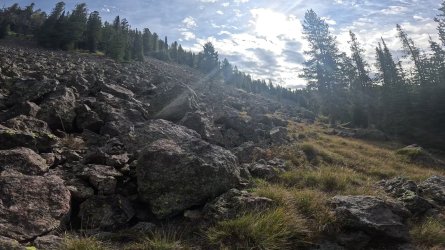
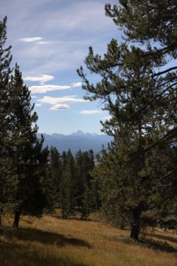
Our route may have been slow going, but it was rewarding to know we were covering ground few have covered before. . . plus there was the view.
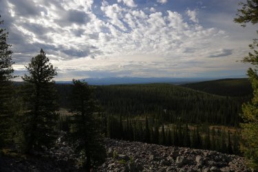
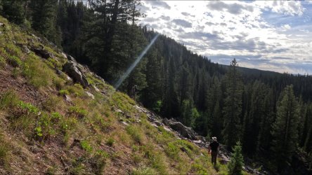
Eventually the rock hopping transitioned to slope walking.
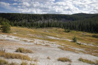
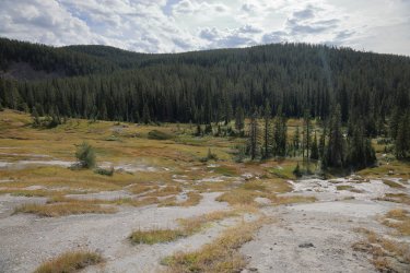
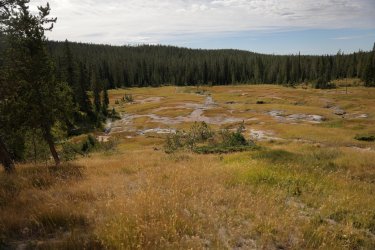
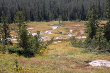
A short walk thru some trees with a less than typical burden of downfall led us to what is likely the headwaters of Silver Scarf Creek. This area is very thermal in nature, in some ways it reminded me of the terrain on the North side of Glen Africa Basin in Hayden Valley. The thermal features here were abundant but low in pressure/volatility. A lot of squishy, hot ground around here so we chose to walk along the solid hillside rather than venture down to the creek. This place has been called the Valley of Death. . . I was not interested in testing the accuracy of its description.
Content with our observations of the thermal area we took a path somewhat parallel to the creek. We found a nice game trail that made for easy walking, but it led us away from the creek and in the general direction of the official Boundary Creek Trail. This would probably be the route to take if one ever wanted to return to the Silver Scarf Headwaters.
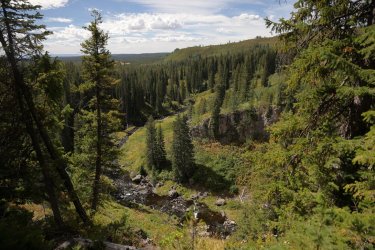
We left the game trail and covered some high ground on our way back to the creek. A little out of the way, but a path that provided some nice views. This would have been a great spot for a backcountry campsite if the park would allow it.
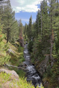
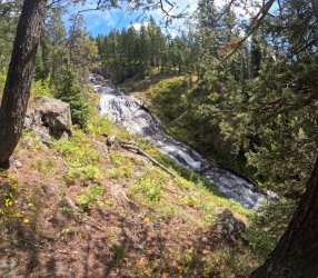
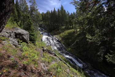
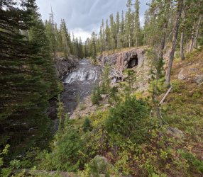
Silver Scarf Creek flows thru some scenic terrain on its way down the plateau.
We stopped for lunch when we reached the main run of Silver Scarf Falls. It was here that Patric attempted to improve on his backcountry burrito culinary skills.
Generally speaking, Patrick is a decent cook. Back home he knows his way around a grill and can plate up some tasty cuisine. He also has a unique set of taste buds that allow him to combine any leftovers into one heaping pile and gobble them up regardless of the resulting flavor. In 2023 we were somewhere above Yellowstone's Bog Creek when we took our lunch break. Patrick proceeded to create a burrito out of random bits of ingredients he had with them -- plus stuff that Hugh, Cody, and I threw in for good measure. Think cheeze-its, twizzlers, meal bars, etc. There were moments of hesitation and the occasional facial grimace, but he finished his creation and noted in his trail journal that "Burritos need sauce."
Jump ahead to 2025. This would be the year that a lack of sauce would not be an issue. Patrick snagged a large jar of Tabasco sauce in West Yellowstone and packed it in with him. Breakfasts. . . dinners. . . his jar of peanut butter. . . sauce was added, even if it was the opinion of the rest of the group that it was not needed. So, the time came for our day hike lunch. Patrick moved ahead with another one-of-a-kind burrito creation. I do not know exactly what was in it, but I think gatorade powder was a contributor. Finally, he would feel redemption from a lesson learned several years before. . . only there was one problem. He forgot his jar of sauce back in camp.
Maybe next time Patrick. Maybe next time.
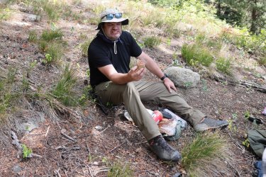
The man and the burrito.
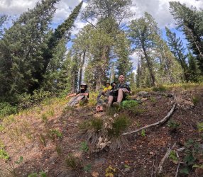
A group shot during our lunch break near Silver Scarf Falls.
Some pictures of Silver Scarf Falls.
After lunch it was time to move over to see what was happening at Dunanda Falls. A visit to the falls has been something I have had on my Yellowstone list for years. Based on stories I've heard I half expected a mob of people to be there, but I still wanted to see if Dunanda was as impressive in person as all the pictures make it look. Our first stop was an overlook near the brink of the falls that provided a nice view downstream of Boundary Creek.
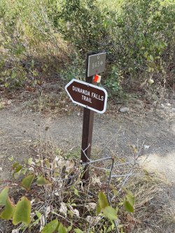
The waters below looked empty. . . where were all the people? We all found our way down to the bottom. The park service has built a new trail taking you to the base of the falls and there were trail crews working on erosion control. New signs are installed -- I hate to be a critic, but they feel/look generic and lack some of the rustic charm that the old wood signs have. Even the engraved metal signs have more personality if you ask me.
When we reached the base of the falls we noted two other day hikers soaking in one of the hot pools, but that was it. They took a good look at us and it was not long after that they packed up and headed out. . . a group like ours can have that kind of effect on people.
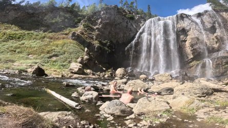
We spent the next part of the afternoon soaking in the thermal pools, splashing around under the falls, and simply enjoying being where we were. I realize that the water flow at this time of year was down, but the power and sound of Dunanda Falls was nonetheless impressive.
Prepare yourselves for an abundance of waterfall pictures.
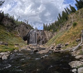
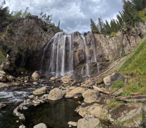
Hopefully not too much skin for the good folks of BCP.
I really liked that you could walk right up to the base of the falls. You get soaked by mist and nearly blown over by the pressure of the falling water, but you can do it.
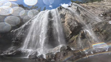
We thoroughly enjoyed the afternoon. We also kept an eye on the clock and the clouds overhead as we knew afternoon thunderstorms were a possibility. When we felt the time was right we reluctantly left this little piece of backcountry paradise and started back up the trail to campsite 9A4.
One last look back for good measure.
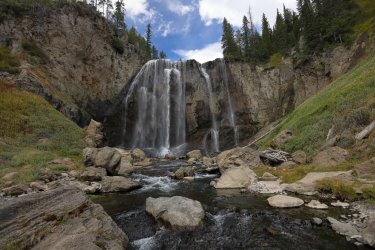
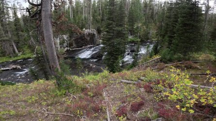
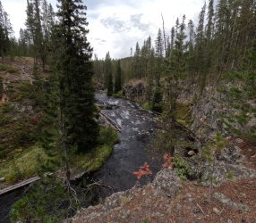
The hike back to camp was pleasant. The trail is mostly wooded and follows Boundary Creek as it heads North. You can hear the creek as you walk along but you cannot always see it. It was worth the occasional off trail creek investigation to see some of the interesting cascades and rapids flowing downhill.
There were a couple of creek crossings and several marshy sections of trail on the way back to camp, but we made it back in time to avoid any rain. In fact, I think the clouds thinned out as late afternoon rolled on and we experienced some blue in the sky at dinner.
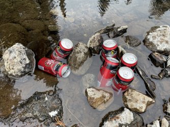
We had a treat of sorts waiting for us -- Cody and I packed in some beers to celebrate an enjoyable day in case we had one (or to drown out a miserable day if one should occur ). Our only miscalculation was that the waters of Boundary Creek near campsite 9A4 are mildly warm due to nearby thermal activity. Still, a slightly cold beer is better than no beer with dinner if you ask me.
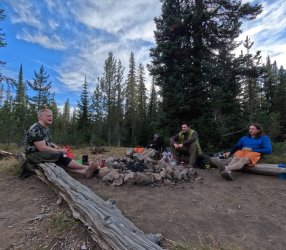
The gang around the eating area, reminiscing about a very good day in the backcountry. I cannot remember what I had for dinner that evening (I'm sure I have a picture somewhere) but I know it was good. I do believe Patrick took full advantage of the Tabasco now that he was reunited with his sauce -- you can see the look of satisfaction on his face. The only negative of the day was knowing we'd have to pack up in the morning and move on from this happy place. The silver lining was we'd be passing right by Dunanda Falls again, so maybe a repeat visit would be in our future. . . and that was something to look forward to.
In early September 2025 @scatman , @Bob , @CajunPoncho , friend Cody, and I spent some time in the Southwestern Yellowstone wilderness. Bob had to take off a bit early but the rest of us followed a path from Buffalo Lake down to the Bechler Ranger Station. We stayed at campsite 9A4 / Talus Terrace for two nights allowing us to leave the heavy stuff in camp and take a nice day hike to pass the time. I had wanted to see/stay at the Dunanda Falls campsite (9A3), but it was not available when we made our reservation. Of course, I will post a trip report of the entire four nights/five days in the future, but using this approach allows me to post a lot of pictures for a single day.
Hugh and I discussed what we might do on our "day off." We thought a route that took us to the upper reaches of Silver Scarf Creek might be interesting as there is a large thermal area there that has been called the "Valley of Death." We'd then follow a path downstream towards Silver Scarf Falls, make our way to Dunanda Falls, then simply take the official trail back up to our campsite. It looked like a doable route on a flat computer screen in Google Earth, so that became the plan.
Hugh has hiked with me once or twice before and by now should be well aware that I can get my rights and lefts confused, my sense of direction might be average at best, and that I am probably not the best person to plot a course thru the wilderness. In the past we usually dream up a route, then Hugh shows up with premade maps highlighted with GPS waypoints following a sensible path. He must have left the maps/GPS in the Subaru this time and I was instructed to lead the way. . . something he may have been regretting an hour or so into the day.
Our day started with a hearty breakfast at Campsite 9A4. I do not typically eat a large breakfast in the backcountry, but because we were not breaking down camp or in a hurry to get moving, I tried a new offering from Beyond Outdoor Meals.
The campsite is also called "Talus Terrace," which probably has something to do with the giant wall of rocks situated to the East (seen behind Hugh's tent in the next picture). The rock wall is much steeper when seen in person, this picture with the GoPro is probably not the best to appreciate scale.
The Valley of Death thermal area is more or less on the other side of the rocks/cliffs. Hugh wanted to take the classic Scatman "as the crow flies" approach and hike straight over the cliff. I chose to contour around the steepest stuff instead, but it involved a lot of rock hopping over some good-sized boulders. Most of my pictures from this part of the day are frames taken from the GoPro video that was mounted on my shoulder. I was afraid that if I dropped a lens cap (or my camera) down in the rocks I'd never get it back.
Good views of Boundary Creek as we made our ascent.

I cannot tell if Hugh is wincing in pain or if he is in his happy place taking pictures. . . safe to say that morale is still high right now.

After climbing the initial wall of rock this was the view looking forward. We more or less aimed for the trees in the center of the picture.
Cody and Patrick took right to the rock hopping. They led the way thru a good portion of it.
Our route may have been slow going, but it was rewarding to know we were covering ground few have covered before. . . plus there was the view.

Eventually the rock hopping transitioned to slope walking.
A short walk thru some trees with a less than typical burden of downfall led us to what is likely the headwaters of Silver Scarf Creek. This area is very thermal in nature, in some ways it reminded me of the terrain on the North side of Glen Africa Basin in Hayden Valley. The thermal features here were abundant but low in pressure/volatility. A lot of squishy, hot ground around here so we chose to walk along the solid hillside rather than venture down to the creek. This place has been called the Valley of Death. . . I was not interested in testing the accuracy of its description.


Content with our observations of the thermal area we took a path somewhat parallel to the creek. We found a nice game trail that made for easy walking, but it led us away from the creek and in the general direction of the official Boundary Creek Trail. This would probably be the route to take if one ever wanted to return to the Silver Scarf Headwaters.
We left the game trail and covered some high ground on our way back to the creek. A little out of the way, but a path that provided some nice views. This would have been a great spot for a backcountry campsite if the park would allow it.
Silver Scarf Creek flows thru some scenic terrain on its way down the plateau.
We stopped for lunch when we reached the main run of Silver Scarf Falls. It was here that Patric attempted to improve on his backcountry burrito culinary skills.
Generally speaking, Patrick is a decent cook. Back home he knows his way around a grill and can plate up some tasty cuisine. He also has a unique set of taste buds that allow him to combine any leftovers into one heaping pile and gobble them up regardless of the resulting flavor. In 2023 we were somewhere above Yellowstone's Bog Creek when we took our lunch break. Patrick proceeded to create a burrito out of random bits of ingredients he had with them -- plus stuff that Hugh, Cody, and I threw in for good measure. Think cheeze-its, twizzlers, meal bars, etc. There were moments of hesitation and the occasional facial grimace, but he finished his creation and noted in his trail journal that "Burritos need sauce."
Jump ahead to 2025. This would be the year that a lack of sauce would not be an issue. Patrick snagged a large jar of Tabasco sauce in West Yellowstone and packed it in with him. Breakfasts. . . dinners. . . his jar of peanut butter. . . sauce was added, even if it was the opinion of the rest of the group that it was not needed. So, the time came for our day hike lunch. Patrick moved ahead with another one-of-a-kind burrito creation. I do not know exactly what was in it, but I think gatorade powder was a contributor. Finally, he would feel redemption from a lesson learned several years before. . . only there was one problem. He forgot his jar of sauce back in camp.

Maybe next time Patrick. Maybe next time.
The man and the burrito.
A group shot during our lunch break near Silver Scarf Falls.
Some pictures of Silver Scarf Falls.
After lunch it was time to move over to see what was happening at Dunanda Falls. A visit to the falls has been something I have had on my Yellowstone list for years. Based on stories I've heard I half expected a mob of people to be there, but I still wanted to see if Dunanda was as impressive in person as all the pictures make it look. Our first stop was an overlook near the brink of the falls that provided a nice view downstream of Boundary Creek.
The waters below looked empty. . . where were all the people? We all found our way down to the bottom. The park service has built a new trail taking you to the base of the falls and there were trail crews working on erosion control. New signs are installed -- I hate to be a critic, but they feel/look generic and lack some of the rustic charm that the old wood signs have. Even the engraved metal signs have more personality if you ask me.
When we reached the base of the falls we noted two other day hikers soaking in one of the hot pools, but that was it. They took a good look at us and it was not long after that they packed up and headed out. . . a group like ours can have that kind of effect on people.
We spent the next part of the afternoon soaking in the thermal pools, splashing around under the falls, and simply enjoying being where we were. I realize that the water flow at this time of year was down, but the power and sound of Dunanda Falls was nonetheless impressive.
Prepare yourselves for an abundance of waterfall pictures.


Hopefully not too much skin for the good folks of BCP.
I really liked that you could walk right up to the base of the falls. You get soaked by mist and nearly blown over by the pressure of the falling water, but you can do it.

We thoroughly enjoyed the afternoon. We also kept an eye on the clock and the clouds overhead as we knew afternoon thunderstorms were a possibility. When we felt the time was right we reluctantly left this little piece of backcountry paradise and started back up the trail to campsite 9A4.
One last look back for good measure.

The hike back to camp was pleasant. The trail is mostly wooded and follows Boundary Creek as it heads North. You can hear the creek as you walk along but you cannot always see it. It was worth the occasional off trail creek investigation to see some of the interesting cascades and rapids flowing downhill.

There were a couple of creek crossings and several marshy sections of trail on the way back to camp, but we made it back in time to avoid any rain. In fact, I think the clouds thinned out as late afternoon rolled on and we experienced some blue in the sky at dinner.
We had a treat of sorts waiting for us -- Cody and I packed in some beers to celebrate an enjoyable day in case we had one (or to drown out a miserable day if one should occur
The gang around the eating area, reminiscing about a very good day in the backcountry. I cannot remember what I had for dinner that evening (I'm sure I have a picture somewhere) but I know it was good. I do believe Patrick took full advantage of the Tabasco now that he was reunited with his sauce -- you can see the look of satisfaction on his face. The only negative of the day was knowing we'd have to pack up in the morning and move on from this happy place. The silver lining was we'd be passing right by Dunanda Falls again, so maybe a repeat visit would be in our future. . . and that was something to look forward to.
Last edited:

