b.stark
Forever Wandering
- Joined
- Apr 8, 2015
- Messages
- 1,192
In April of this year, I went for a backpacking trip with @Curt in the Grand Canyon. I was the "third wheel" of the group, having not met anybody save for Curt, who I got to know via this very forum. He had a 7-day route planned, though we ended up hiking it in 6 days. Finally finished getting through the pictures from the backpacking trip. Going to go really light on the commentary on this one and just post some highlights to get a post up since it was certainly a trip that deserves to be shared. We hiked from Lipan Point to Grandview Point.
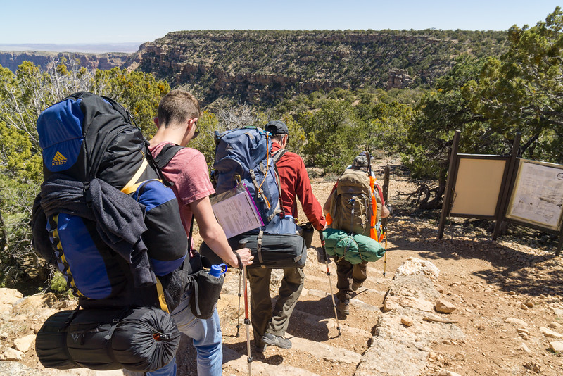
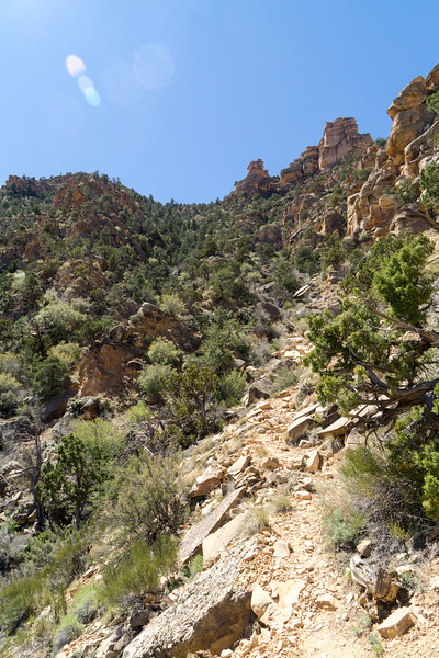
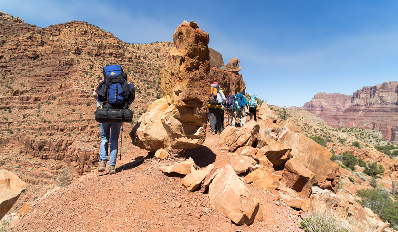
Day 1: Lipan Point to a dry camp above the redwall
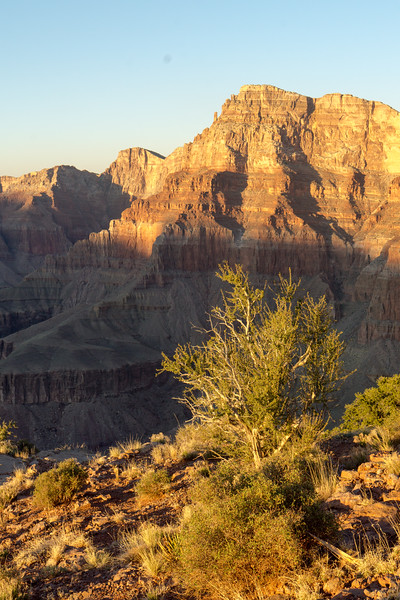
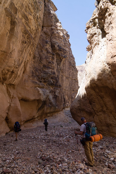
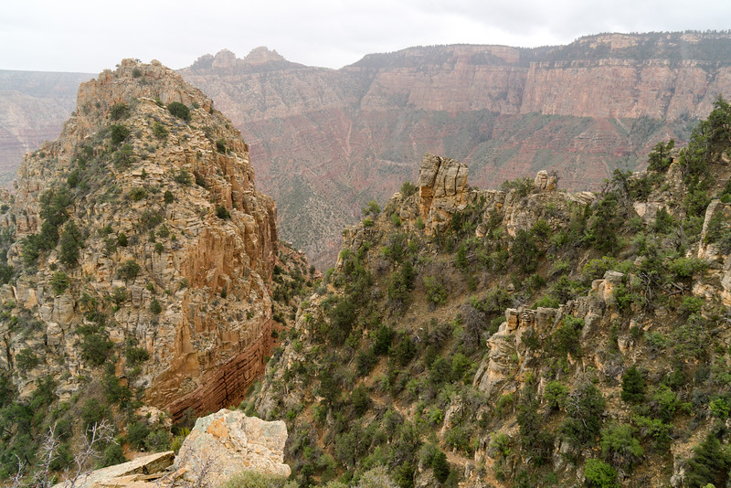
All hikes start somewhere, this one started at Lipan Point
We came down there
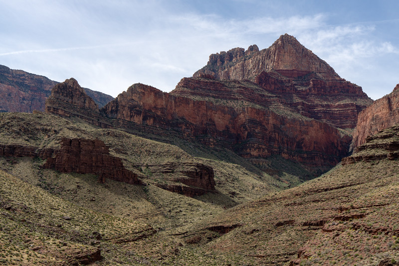
At the "Stegosaurus" rocks
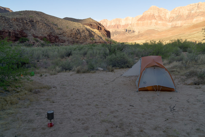
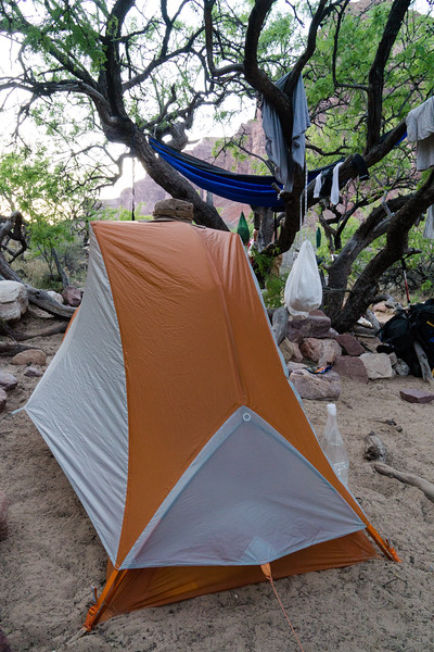
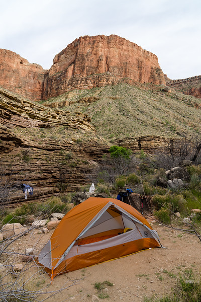
Camp above the redwall.
A firey sunset
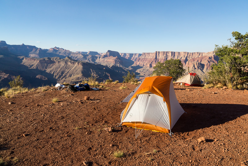
Day 2: Above the redwall to Cardenas Creek
My first sunrise in the Canyon--the camera did a fair job but never gets the fullness of the beauty you see
A break on the way down to the river
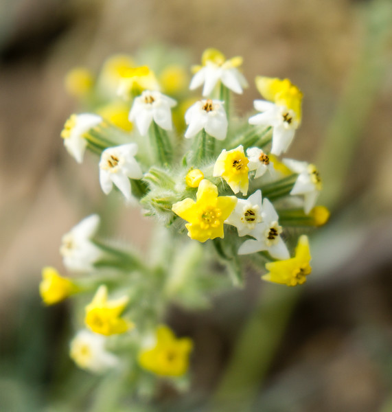
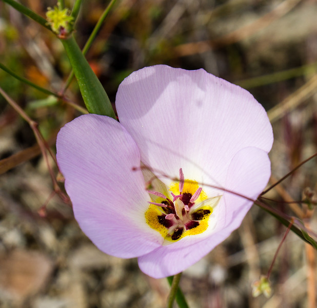
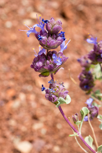
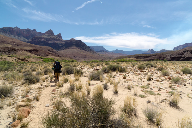
I did not at all expect the incredible amount of flowers in the desert. They were everywhere and came in pretty much every color you could imagine.
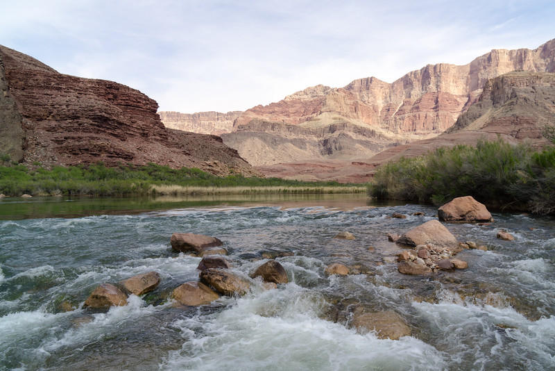
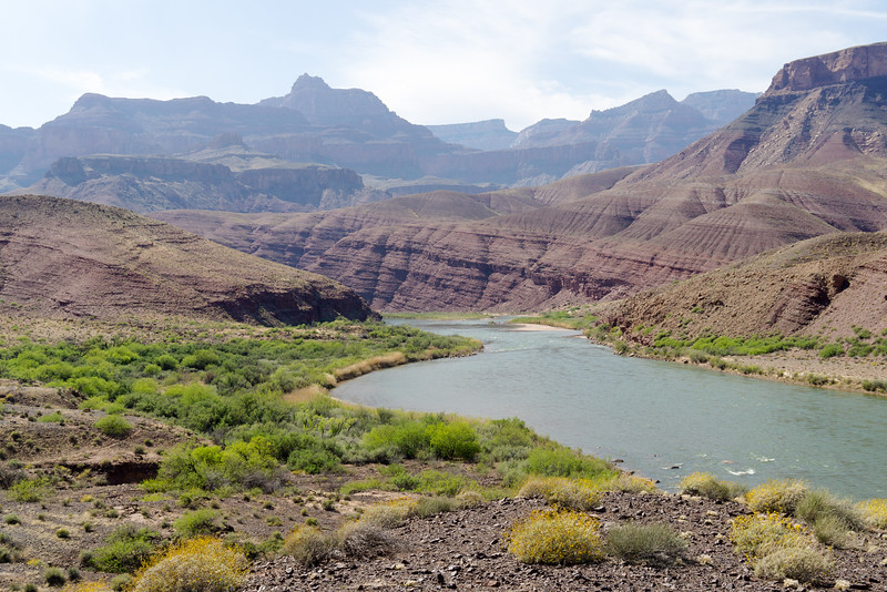
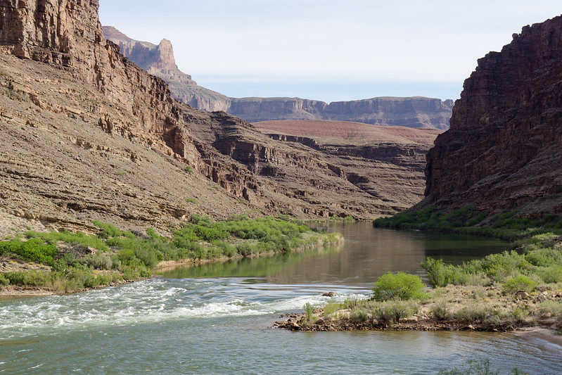
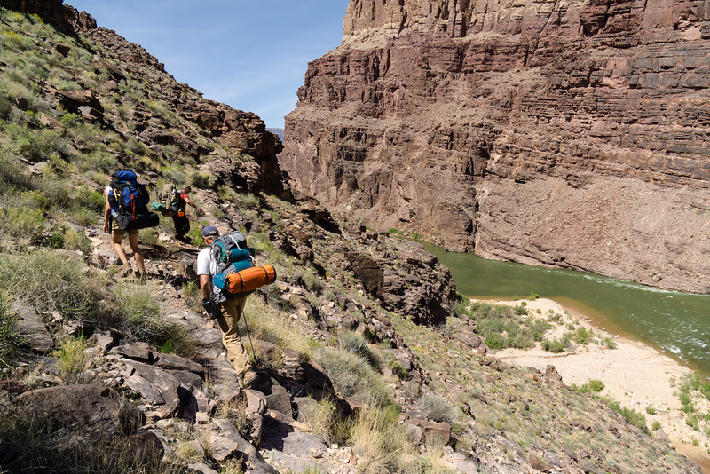
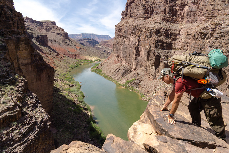
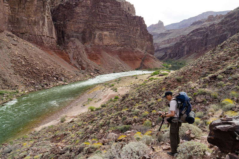
Closer and closer to the river!
Finally there! And time for my first soak in the surprisingly clear and COLD Colorado river!
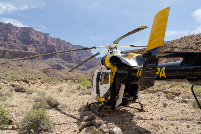
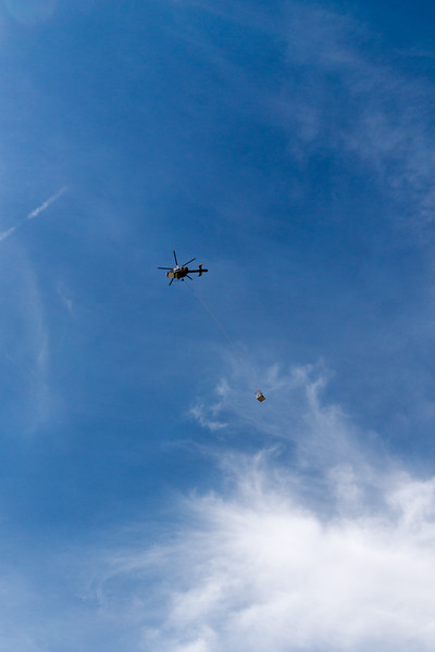
As we chilled by (and in) the river, a helicopter landed nearby. We ran up to see what was going on. They were dropping a couple guys off to do some kind of backcountry patrol and changing out the latrine at Tanner beach.
After a refreshing soak and fresh, cold water, it was off to cross the Tanner beach dunes and Furnace Flats. The latter really lived up to its name!
What's that flying above us? Keep your mouth closed lest you get an untasty surprise!
Cardenas Creek in view, almost at camp.
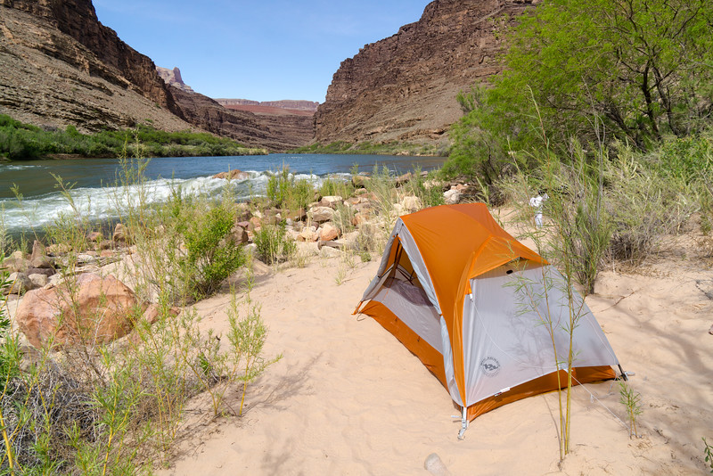
Camp at Cardenas Creek. We shared the beach with some rafters.
Day 3: Cardenas Creek to Escalante Creek
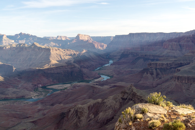
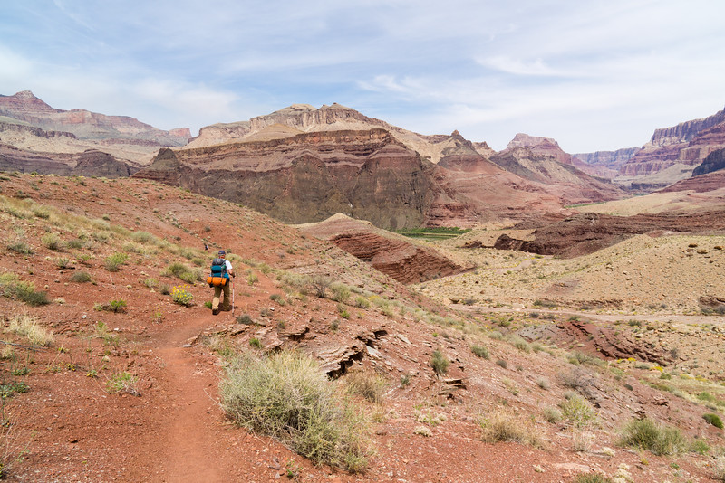
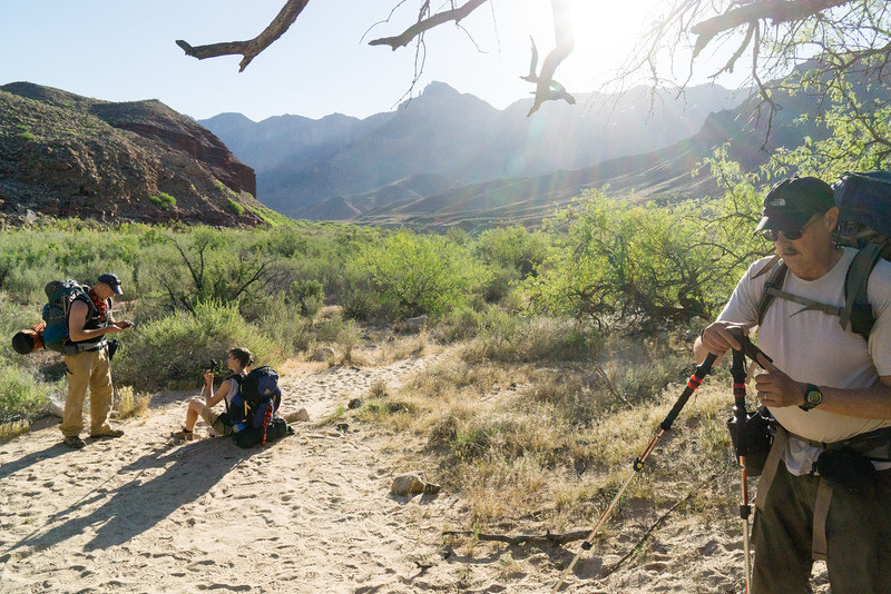
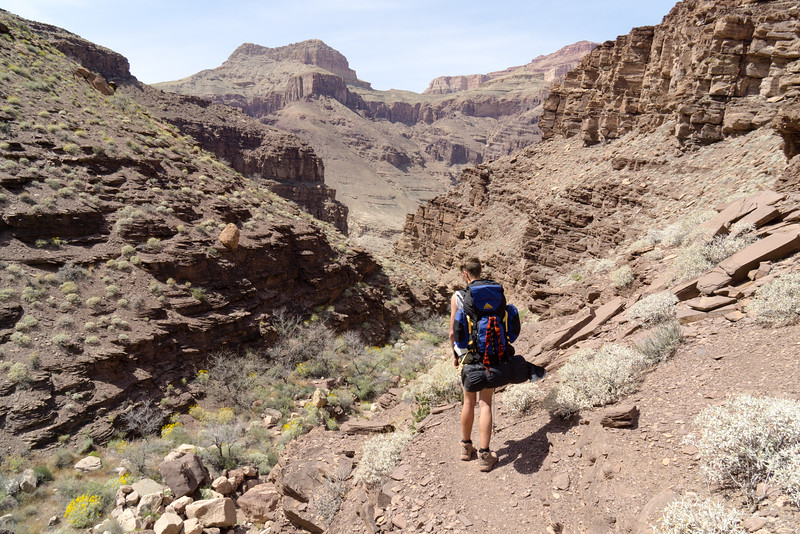
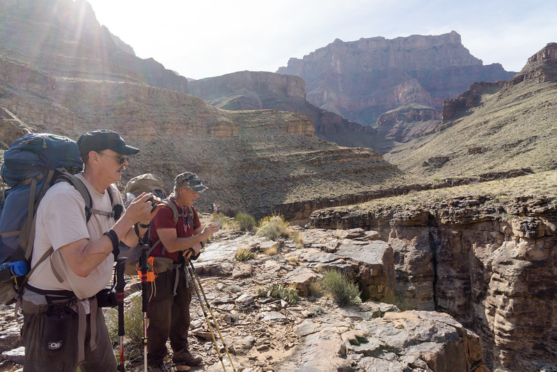
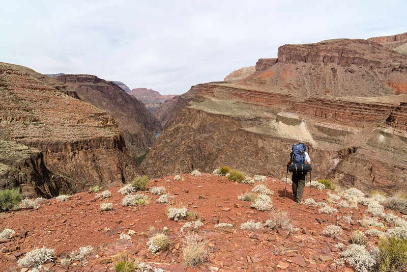
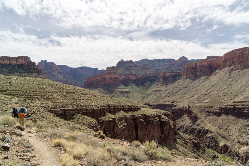
Getting ready to mobilize for the third day's hike. A long haul would take us high up and away from the river, then back down to it at the very end.
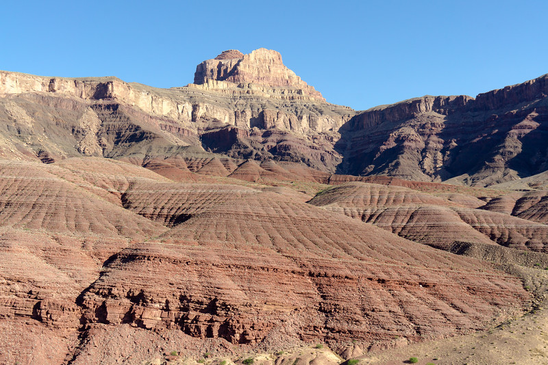
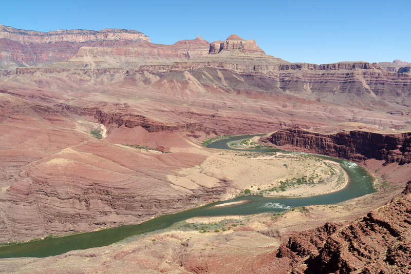
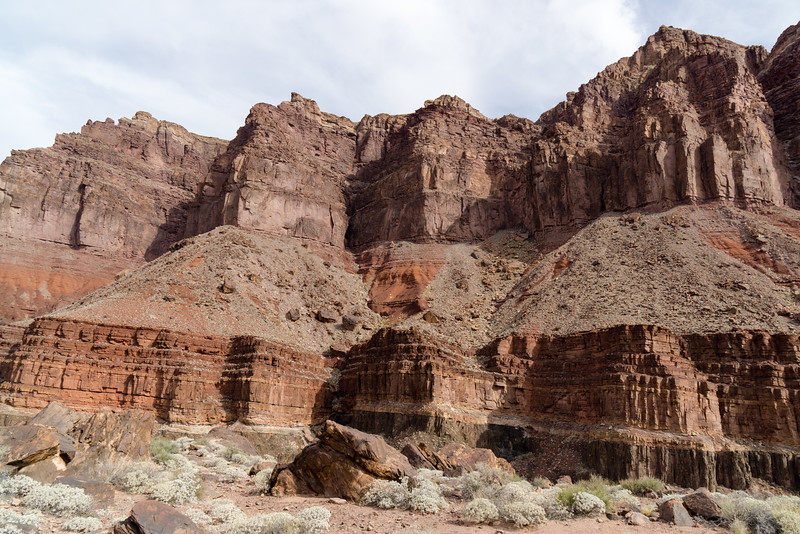
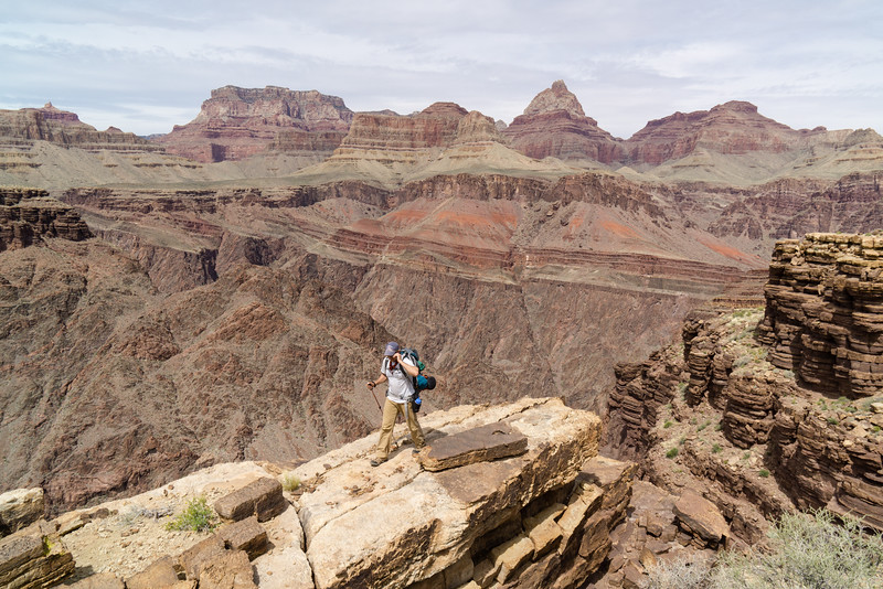
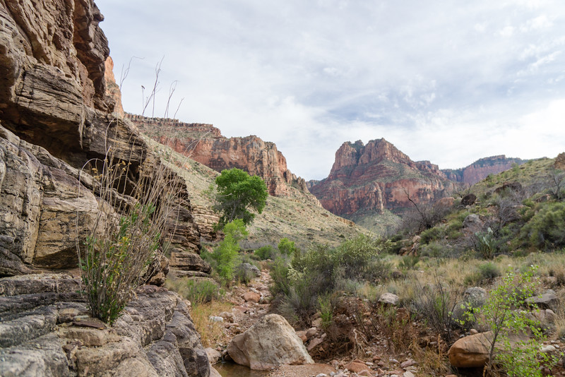
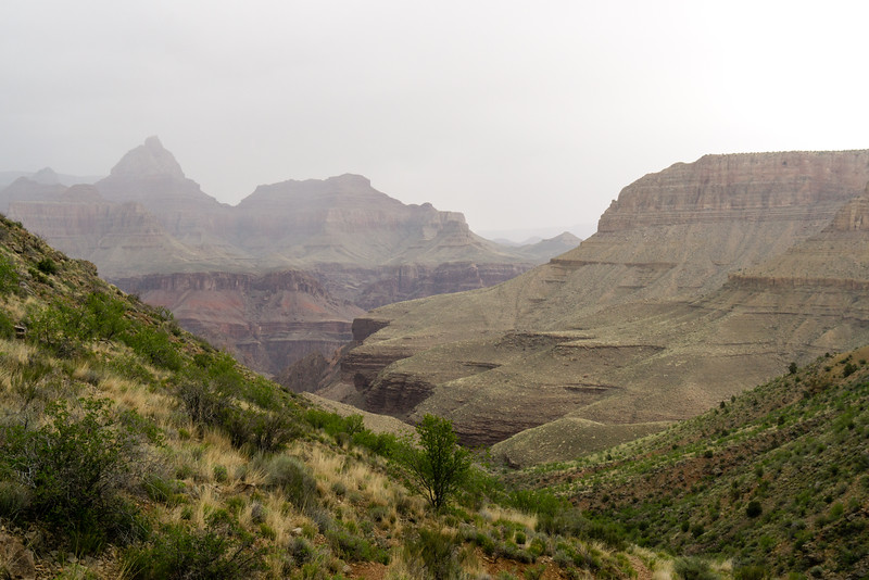
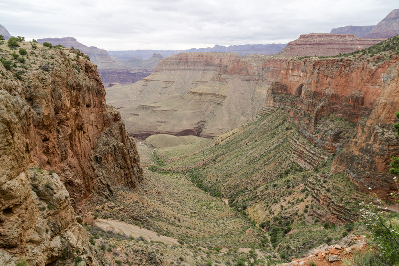
The day was full of amazing views. There was really not a time at any point in the trip where the view was not amazing.
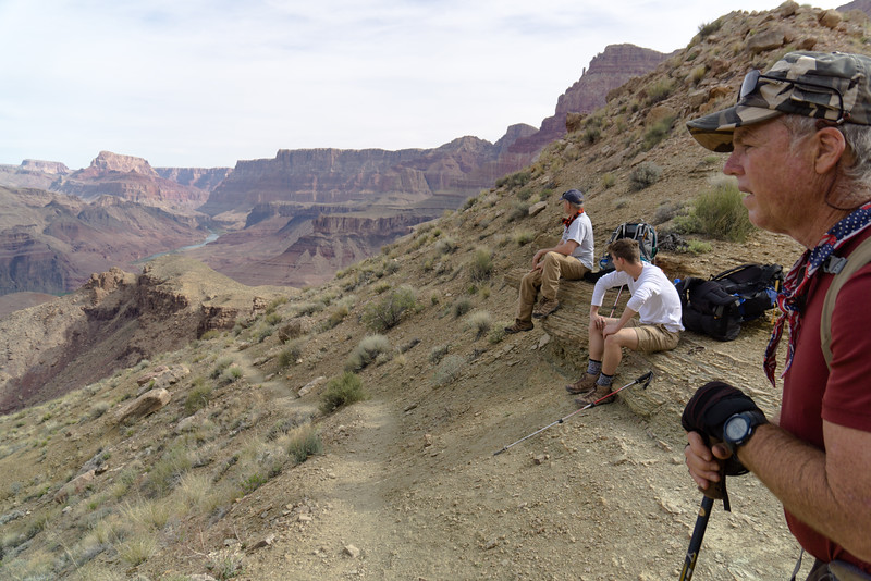
Upward we traveled on, stopping to watch some rafters run the Unkar Rapids.
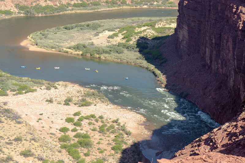
Excellent views of the Unkar delta
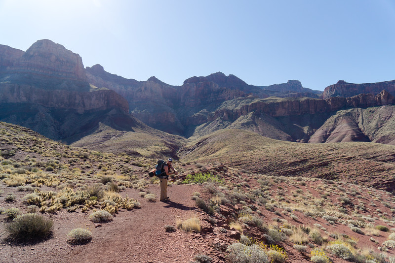
After a break for lunch at the high point of the hike, we headed down Escalante Creek toward where we would camp for the night
The theme became that the canyon has some incredible campsites.
Day 4: Escalante Creek to Red Canyon/Hance Rapids
We began by hiking up toward Seventyfive Mile Canyon. Looking back, we could see the point of beach where we camped.
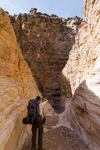
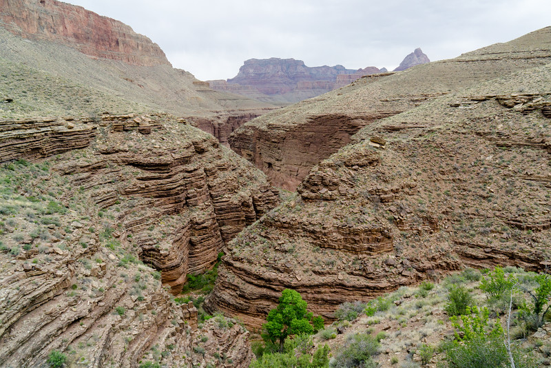
Seventyfive Mile Canyon looked like something out of a movie to us.
The trail follows the canyon up until you can get down into the bottom, then you go right back down the canyon to the river.
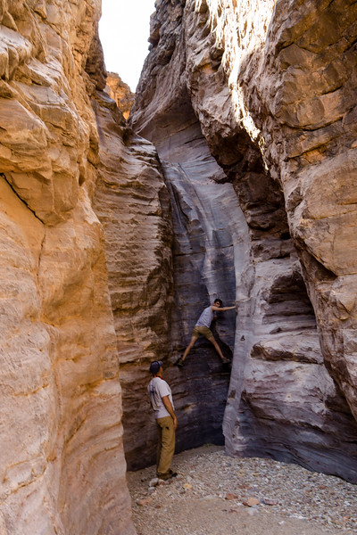
It's not quite a slot canyon, but it's close enough for a Nebraska boy
The hike down this canyon was very fun.
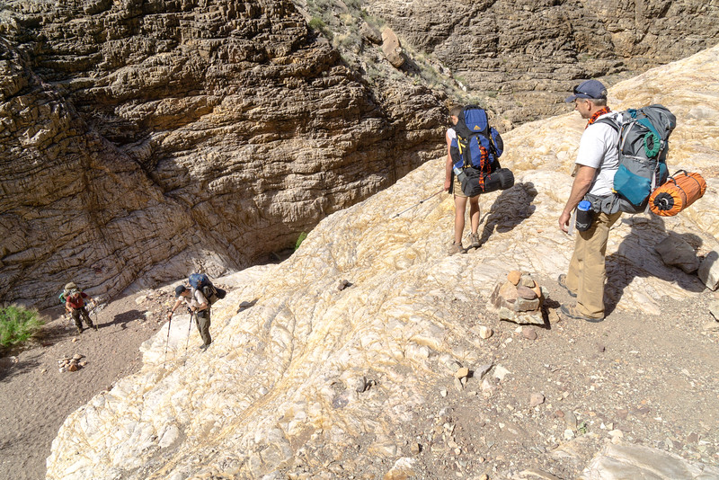
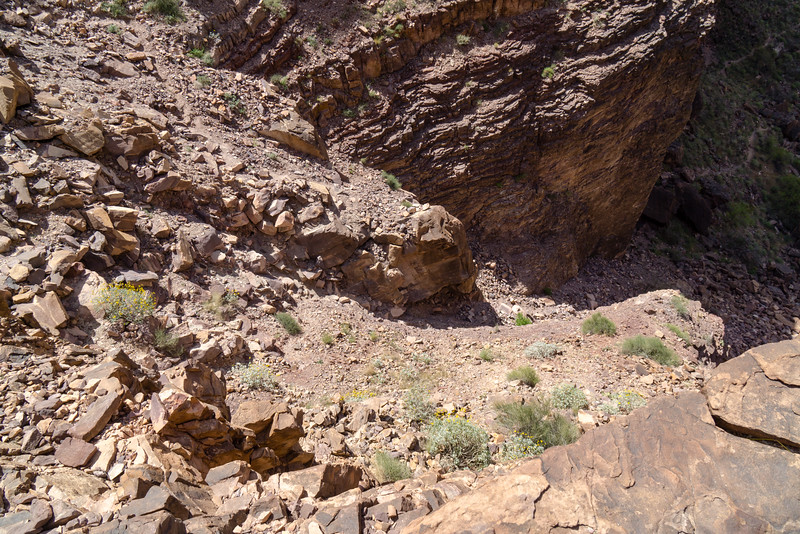
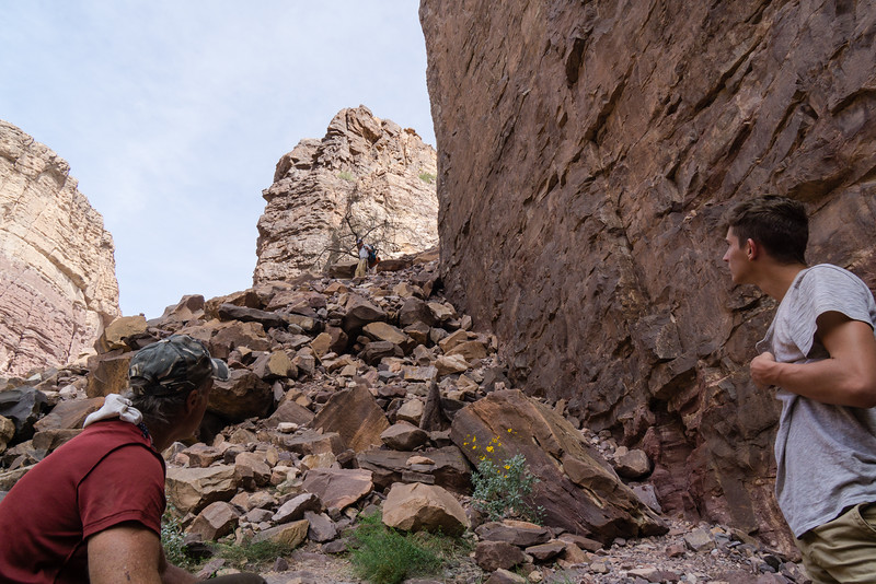
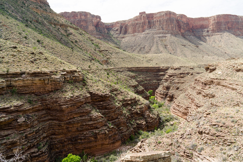
Then came a very rough trail to Papago Creek and the much spoken of Papago Wall and Slide.
There's a neat pour-off at the end of Papago Creek
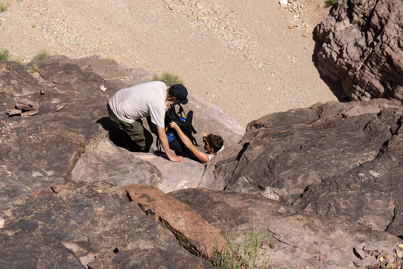
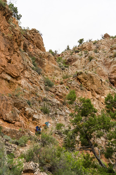
Getting up the Papago Wall is an exciting little climb. Some of us did it with packs on, some with packs off.
The trail then climbs high above the river to bypass some cliffs. After finishing the climb we got a good look at the Papago Slide. It looks a lot worse than it is. We took a break at the top of the climb here for lunch.
Just climb down that, they said. It'll be fun, they said. (It was actually pretty stable and much less difficult than I expected)
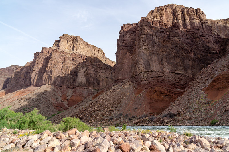
All of us made it safely down. Then was another rocky trail to Red Canyon and the night's campsite.
The rapids here were impressive, as was the scenery. This would be our last campsite along the river, so I spent a lot of time near it. Not only to cool off and clean off, but also to enjoy the last of my time along the Colorado, which had provided us with precious water.
There were a few groups here, and we hurried to grab a site big enough to hold all of us. We ended up in a nice spot, but we made it look a bit rough with all our gear hung everywhere.
Day 5: Red Canyon to Hance Creek
This day would take us up up and away from the Colorado River. No water until Hance Creek, which is where we would camp that evening. We bid the river farewell and began climbing.
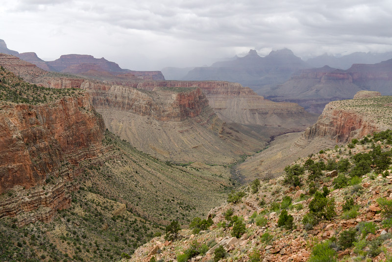
The views were again amazing.
Shade was scarce, so when we found shade under a large rock, we stopped and had lunch. I don't have a picture of the rock, it seems, but this was the scenery from somewhere near where the rock was.
After more hiking, we came to the impressive Hance Creek canyon.
The hike along the rim of Hance Creek's canyon was something that pictures don't do justice to.
Finally we got near the upper reaches of Hance Creek, and near camp. I've never been so happy to see cottonwood trees in my life.
Wasn't expecting this campsite to be as memorable as it was. I picked a site a bit away from the rest of the group on this evening. This was due to no conflict with the rest of the group, but rather because after a week with strangers I as happy to have a little space to myself. Thousands of little frogs serenaded us when the sun went down.
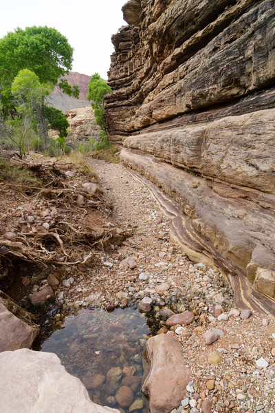
It was a perfect little creek. Just a beautiful trickle of clear life-giving water.
Day 6: Hance Creek to Grandview Point
Originally the plan was to camp on Horseshoe Mesa next, but we decided to make the hike all the way to Grandview Point. Yeah, we were feeling ambitious.
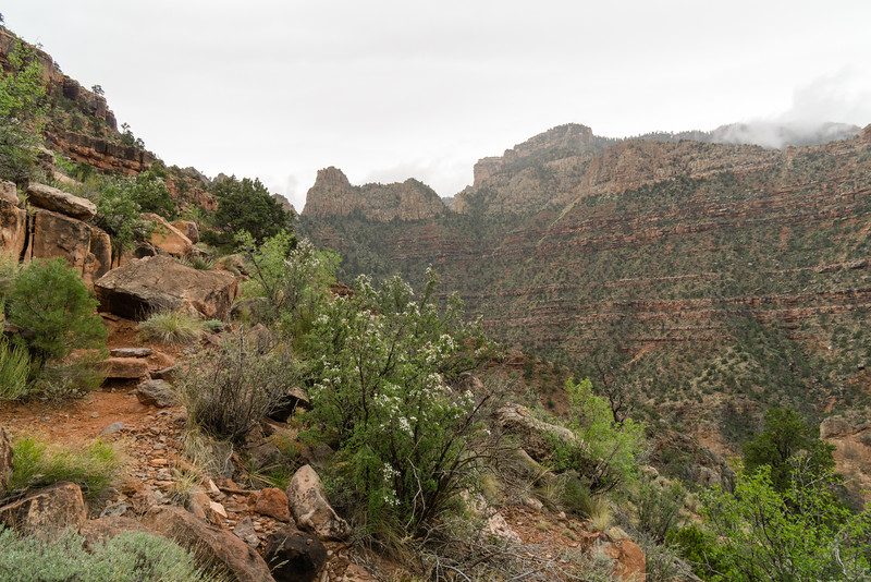
The day dawned a bit dreary and the conditions did not improve. We welcomed the shade and cooler temperatures for the climb, though, and the occasional drizzle did not dampen our mood.
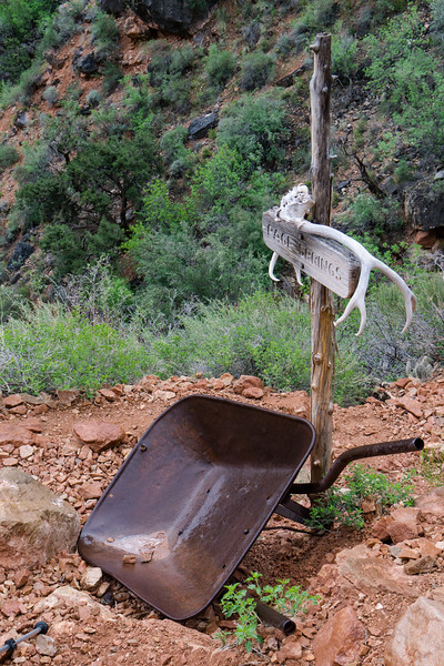
We took a short break at the junction to Page/Miner's Spring. None of us walked over to it though. We all felt confident we had enough water to make it to the top (in the end nobody ran short that I recall).
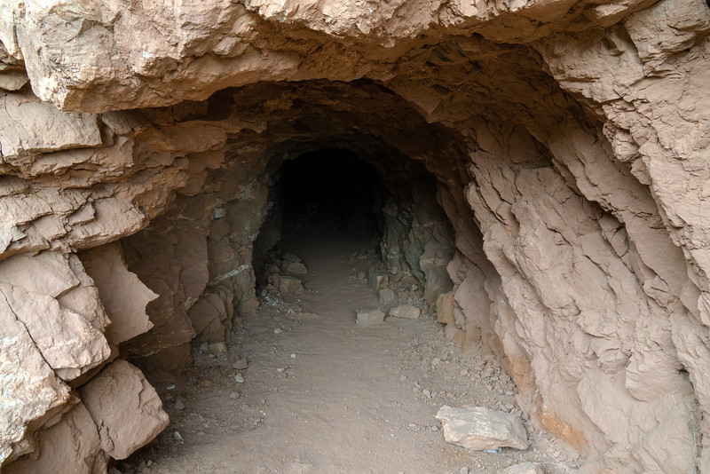
We took an extended break and lots of pictures at the mine.
From there on up, the trail looks really ugly but is surprisingly not too bad, albeit steep.
The view back down to Hance Creek, with tailings from the mine visible.
From this point out there was some nice trail construction at various points.
Made it to Horseshoe Mesa in good time, and still feeling pretty good for the rest of the climb. We took a good break and took a short side hike to the miner's cabin.
The miner's cabin (or at least what's left of it)
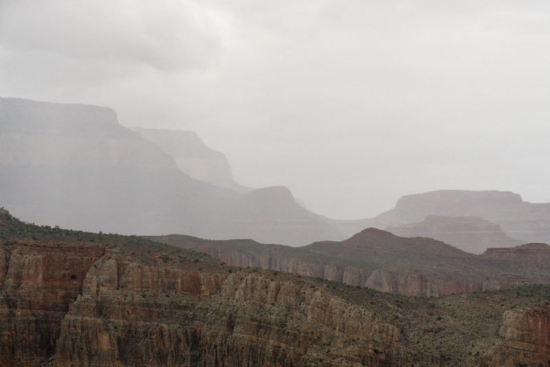
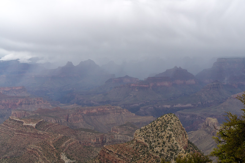
The clouds began to look more ominous as we continued to climb.
The trail takes you up some stuff that looks impossible (and can feel like it at times!). The uphill here is pretty relentless, but getting into a groove of a sure and steady pace helps the climb go by.
Yeah looks like it's a matter of time until the rain gets us
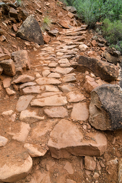
The evidence of the mining here is pretty interesting, and makes you appreciate just how hard the job was. Parts of the trail were paved with an amazingly well constructed cobblestone surface--that was super steep! Hauling equipment and ore up and down this trail would have been absolutely backbreaking.
Higher and higher we climbed. After a break at the notch in this picture, I took off ahead of the group on my own, feeling more comfortable on the climb setting my own steady pace. Not that I was a whole lot faster than the rest of them, I just prefer setting my own pace on a climb like this.
The clouds continued to gather, and the temperature dropped.
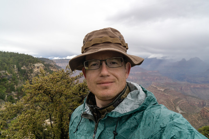
In short order the rain decided to fall. I first put on my rain jacket, then after a while had to get my rain pants on as well. It was a super cold rain, and I avoided breaks to keep from getting too cold. My exposed hands got pretty cold, and I noticed a lot of ice pellets falling too. In the end the cold rain really helped me get to the top at a really good pace, and about the time I got there, the rain stopped and I had to put on my jacket to stay warm while waiting for the others. It was interesting to watch other tourists dealing with the cold, rainy, windy conditions at the overlook.
Packs stuffed in the back of one of the group's pickups, ready for the shuttle back to Lipan Point after everybody made it safely to Grandview Point.
And finally back to where we began, which a much different cast to the scene. Overall one of my favorite backpacking trips ever, and certainly some of the best weather I've ever had while backpacking. Could not have asked for a better group to hike with, also. While I still prefer the mountains, the canyon is a truly amazing and special place, and I'm glad we had such good conditions as I can see how it could really challenge you when things aren't optimal.
Hope you enjoyed the pictures.
Here is the video that I shot during the trip.
Day 1: Lipan Point to a dry camp above the redwall
All hikes start somewhere, this one started at Lipan Point
We came down there
At the "Stegosaurus" rocks
Camp above the redwall.
A firey sunset
Day 2: Above the redwall to Cardenas Creek
My first sunrise in the Canyon--the camera did a fair job but never gets the fullness of the beauty you see
A break on the way down to the river
I did not at all expect the incredible amount of flowers in the desert. They were everywhere and came in pretty much every color you could imagine.
Closer and closer to the river!
Finally there! And time for my first soak in the surprisingly clear and COLD Colorado river!
As we chilled by (and in) the river, a helicopter landed nearby. We ran up to see what was going on. They were dropping a couple guys off to do some kind of backcountry patrol and changing out the latrine at Tanner beach.
After a refreshing soak and fresh, cold water, it was off to cross the Tanner beach dunes and Furnace Flats. The latter really lived up to its name!
What's that flying above us? Keep your mouth closed lest you get an untasty surprise!
Cardenas Creek in view, almost at camp.
Camp at Cardenas Creek. We shared the beach with some rafters.
Day 3: Cardenas Creek to Escalante Creek
Getting ready to mobilize for the third day's hike. A long haul would take us high up and away from the river, then back down to it at the very end.
The day was full of amazing views. There was really not a time at any point in the trip where the view was not amazing.
Upward we traveled on, stopping to watch some rafters run the Unkar Rapids.
Excellent views of the Unkar delta
After a break for lunch at the high point of the hike, we headed down Escalante Creek toward where we would camp for the night
The theme became that the canyon has some incredible campsites.
Day 4: Escalante Creek to Red Canyon/Hance Rapids
We began by hiking up toward Seventyfive Mile Canyon. Looking back, we could see the point of beach where we camped.
Seventyfive Mile Canyon looked like something out of a movie to us.
The trail follows the canyon up until you can get down into the bottom, then you go right back down the canyon to the river.
It's not quite a slot canyon, but it's close enough for a Nebraska boy
The hike down this canyon was very fun.
Then came a very rough trail to Papago Creek and the much spoken of Papago Wall and Slide.
There's a neat pour-off at the end of Papago Creek
Getting up the Papago Wall is an exciting little climb. Some of us did it with packs on, some with packs off.
The trail then climbs high above the river to bypass some cliffs. After finishing the climb we got a good look at the Papago Slide. It looks a lot worse than it is. We took a break at the top of the climb here for lunch.
Just climb down that, they said. It'll be fun, they said. (It was actually pretty stable and much less difficult than I expected)
All of us made it safely down. Then was another rocky trail to Red Canyon and the night's campsite.
The rapids here were impressive, as was the scenery. This would be our last campsite along the river, so I spent a lot of time near it. Not only to cool off and clean off, but also to enjoy the last of my time along the Colorado, which had provided us with precious water.
There were a few groups here, and we hurried to grab a site big enough to hold all of us. We ended up in a nice spot, but we made it look a bit rough with all our gear hung everywhere.
Day 5: Red Canyon to Hance Creek
This day would take us up up and away from the Colorado River. No water until Hance Creek, which is where we would camp that evening. We bid the river farewell and began climbing.
The views were again amazing.
Shade was scarce, so when we found shade under a large rock, we stopped and had lunch. I don't have a picture of the rock, it seems, but this was the scenery from somewhere near where the rock was.
After more hiking, we came to the impressive Hance Creek canyon.
The hike along the rim of Hance Creek's canyon was something that pictures don't do justice to.
Finally we got near the upper reaches of Hance Creek, and near camp. I've never been so happy to see cottonwood trees in my life.
Wasn't expecting this campsite to be as memorable as it was. I picked a site a bit away from the rest of the group on this evening. This was due to no conflict with the rest of the group, but rather because after a week with strangers I as happy to have a little space to myself. Thousands of little frogs serenaded us when the sun went down.
It was a perfect little creek. Just a beautiful trickle of clear life-giving water.
Day 6: Hance Creek to Grandview Point
Originally the plan was to camp on Horseshoe Mesa next, but we decided to make the hike all the way to Grandview Point. Yeah, we were feeling ambitious.
The day dawned a bit dreary and the conditions did not improve. We welcomed the shade and cooler temperatures for the climb, though, and the occasional drizzle did not dampen our mood.
We took a short break at the junction to Page/Miner's Spring. None of us walked over to it though. We all felt confident we had enough water to make it to the top (in the end nobody ran short that I recall).
We took an extended break and lots of pictures at the mine.
From there on up, the trail looks really ugly but is surprisingly not too bad, albeit steep.
The view back down to Hance Creek, with tailings from the mine visible.
From this point out there was some nice trail construction at various points.
Made it to Horseshoe Mesa in good time, and still feeling pretty good for the rest of the climb. We took a good break and took a short side hike to the miner's cabin.
The miner's cabin (or at least what's left of it)
The clouds began to look more ominous as we continued to climb.
The trail takes you up some stuff that looks impossible (and can feel like it at times!). The uphill here is pretty relentless, but getting into a groove of a sure and steady pace helps the climb go by.
Yeah looks like it's a matter of time until the rain gets us
The evidence of the mining here is pretty interesting, and makes you appreciate just how hard the job was. Parts of the trail were paved with an amazingly well constructed cobblestone surface--that was super steep! Hauling equipment and ore up and down this trail would have been absolutely backbreaking.
Higher and higher we climbed. After a break at the notch in this picture, I took off ahead of the group on my own, feeling more comfortable on the climb setting my own steady pace. Not that I was a whole lot faster than the rest of them, I just prefer setting my own pace on a climb like this.
The clouds continued to gather, and the temperature dropped.
In short order the rain decided to fall. I first put on my rain jacket, then after a while had to get my rain pants on as well. It was a super cold rain, and I avoided breaks to keep from getting too cold. My exposed hands got pretty cold, and I noticed a lot of ice pellets falling too. In the end the cold rain really helped me get to the top at a really good pace, and about the time I got there, the rain stopped and I had to put on my jacket to stay warm while waiting for the others. It was interesting to watch other tourists dealing with the cold, rainy, windy conditions at the overlook.
Packs stuffed in the back of one of the group's pickups, ready for the shuttle back to Lipan Point after everybody made it safely to Grandview Point.
And finally back to where we began, which a much different cast to the scene. Overall one of my favorite backpacking trips ever, and certainly some of the best weather I've ever had while backpacking. Could not have asked for a better group to hike with, also. While I still prefer the mountains, the canyon is a truly amazing and special place, and I'm glad we had such good conditions as I can see how it could really challenge you when things aren't optimal.
Hope you enjoyed the pictures.
Here is the video that I shot during the trip.