fossana
Member
- Joined
- Jan 11, 2018
- Messages
- 1,060
Yes, as did my on the fly approach route from a side canyon off of 25M Wash.Did the Kelsey route go?
Follow along with the video below to see how to install our site as a web app on your home screen.
Note: This feature may not be available in some browsers.
Yes, as did my on the fly approach route from a side canyon off of 25M Wash.Did the Kelsey route go?


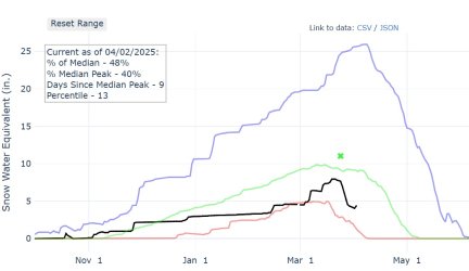
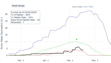
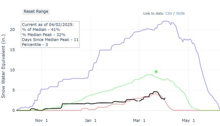
Due to a lack of better judgment, I am wanting to float the Escalante river. Any chance you got a photo of the river or have an idea of how much water is there?Just did a quick loop from Early Weed Bench to scout a Kelsey-described cattle route onto Baker Bench (not mentioned by Allen). Almost no potholes anywhere had water, including the giant one at the top of the chimney/slab climb onto Scorpion Bench and the shaded ones in the Baker canyons maze. On the upside, there was very little silt in the Escalante River.
Did not take a photo, but it was low, at most shin deep during my crossings. Here's the current gauge data. The rule of thumb is to double the flow since the gauge is upstream from the Boulder Creek junction.Due to a lack of better judgment, I am wanting to float the Escalante river. Any chance you got a photo of the river or have an idea of how much water is there?
Don't like ads? Become a BCP Supporting Member and kiss them all goodbye. Click here for more info.
