IntrepidXJ
ADVENTR
- Joined
- Jan 17, 2012
- Messages
- 3,493
Labor Day Weekend | Sunday & Monday, August 31 - September 1, 2014
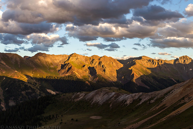
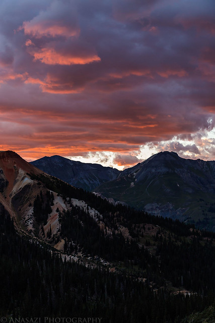
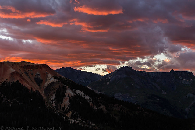
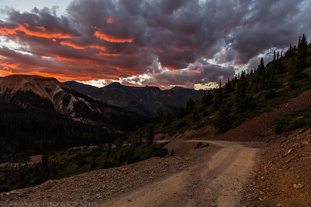
After our overnight backpacking trip into Wetterhorn Basin we decided to stick around the San Juan Mountains for one more day and drive a few of the high mountain passes and trails around Silverton. After lunch in Ouray, we drove over Red Mountain Pass and found a campsite up in Mineral Basin. While I was pretty sure we'd be able to find one of our usual campsites in this area open, I was surprised to find that there was no one else around considering it was Labor Day weekend. We had the area to ourselves for the night. We spent a few hours resting in camp before driving up to a few passes in the late afternoon to catch the sunset. The fast-moving clouds that had been around all day made for another spectacular sunset!
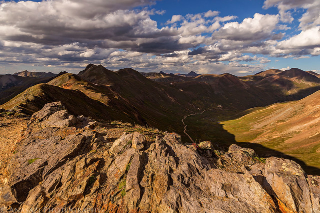
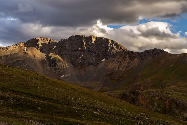
After checking out the views from the Sunnyside Saddle over Eureka Gulch we made our way over Hurricane Pass. Hurricane Peak (13,447 feet) is straight ahead and lit up by the sun.
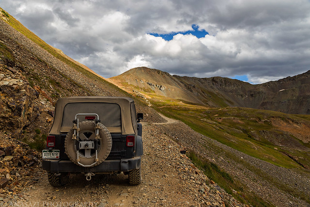
Hurricane Peak by IntrepidXJ, on Flickr
We made a short stop at 12,730 foot Hurricane Pass before continuing on to California Pass.
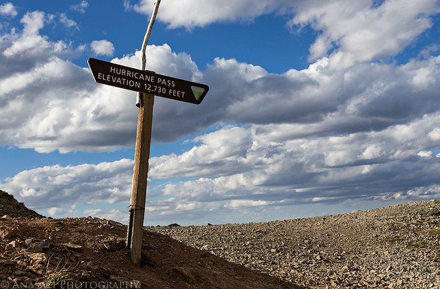
Hurricane Pass by IntrepidXJ, on Flickr
The view over Lake Como and Poughkeepsie Gulch towards Tuttle Mountain (13,203 feet) as we descend from the pass.
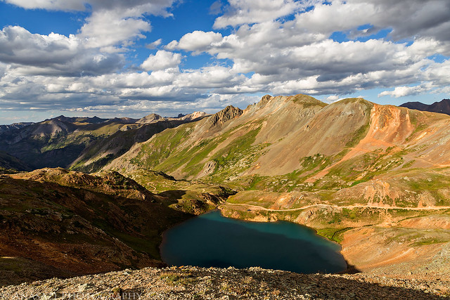
Lake Como by IntrepidXJ, on Flickr
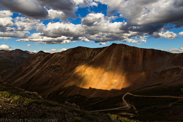
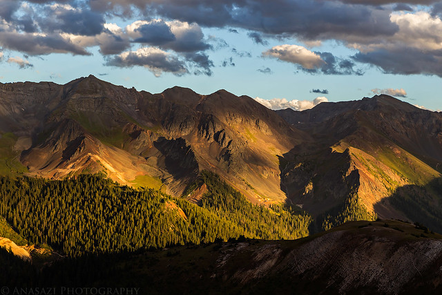
We spent some time at California Pass (12,930 feet) watching the clouds move quickly above creating shadows on the landscape below. The California Gulch Road is down below and in the distance 14ers Uncompahgre Peak and Wetterhorn Peak are visible in the shadows with Matterhorn Peak between them.
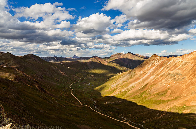
California Gulch Shadow by IntrepidXJ, on Flickr
I hiked a short distance along the ridge leading to Tuttle Mountain.
California Gulch by IntrepidXJ, on Flickr
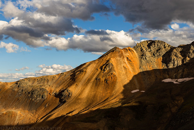
Spotlight on California Mountain (13,220 feet) across the gulch.
California Mountain Spotlight by IntrepidXJ, on Flickr
Evening light on Hanson Peak (13,454 feet).
Evening Peak by IntrepidXJ, on Flickr
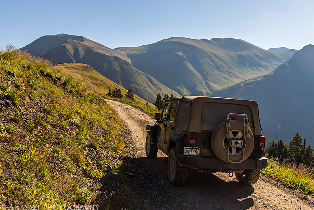
My Jeep parked at California Pass as I hiked back.
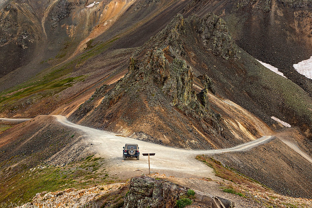
California Pass by IntrepidXJ, on Flickr
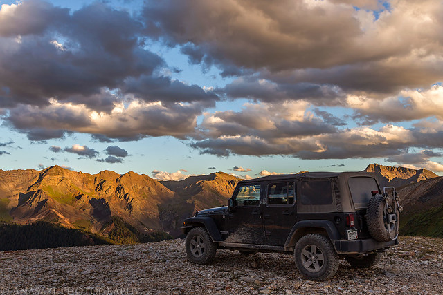
View towards Bonita Peak (13,286 feet) over Ross Basin as we drove over to Corkscrew Pass to catch the sunset.
Ross Basin by IntrepidXJ, on Flickr
Beautiful evening light and shadows on the surrounding peaks.
Mountain Shadows by IntrepidXJ, on Flickr
The clouds were pretty nice this evening.
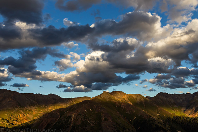
Nice Clouds by IntrepidXJ, on Flickr
Looking back at the Hurricane Pass Road climbing up between Hurricane Peak and Brown Mountain (13,339 feet). There are a lot of 13ers in this area I need to climb!
Hurricane Pass Road by IntrepidXJ, on Flickr
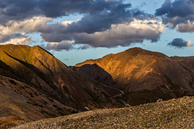
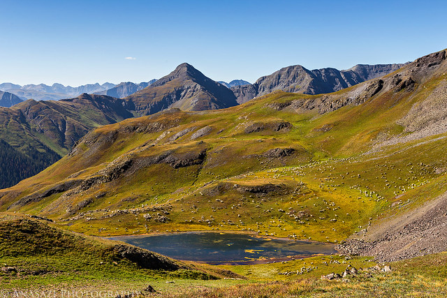
View across to Minnehaha Basin with Emery Peak (13,310 feet) and Proposal Peak (13,330 feet) above.
Minnehaha Basin by IntrepidXJ, on Flickr
Sunset on Red Mountain #1 (12,592 feet) from Corkscrew Pass (12,400 feet).
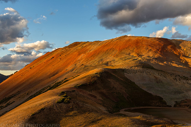
Red Mountain #1 Sunset by IntrepidXJ, on Flickr
My Jeep near the pass.
Jeep in the Mountains by IntrepidXJ, on Flickr
Driving down the switchbacks into Corkscrew Gulch.
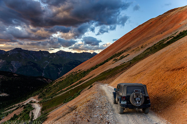
Corkscrew Switchback by IntrepidXJ, on Flickr
There was a beautiful magenta sky as we descended into Corkscrew Gulch to head back to camp.
Red Mountain Sunset by IntrepidXJ, on Flickr
Corkscrew Sunset by IntrepidXJ, on Flickr
Corkscrew Gulch Sunset by IntrepidXJ, on Flickr
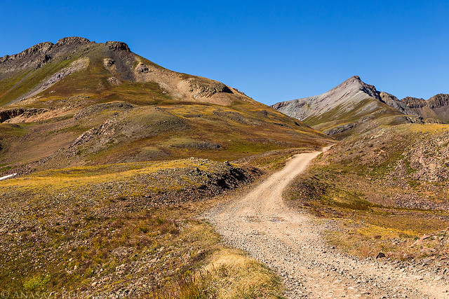
We decided to sleep in on Monday morning and I'm glad we did. When we looked out of the tent we saw that all of the clouds had disappeared and we were left with nothing but blue skies above. The wind that was around the previous evening had died down overnight but started to pick up again when the sun came back out. After packing up camp we wanted to drive one more short Jeep road near Silverton known as the Treasure Mountain Loop. This route starts out by climbing through Picayune Gulch (spelled Picayne on the USGS topo maps) to a ridge of Treasure Mountain and then drops down into Placer Gulch. I had driven this trail way back in 2007 but had not been back since and I wanted to check out the area again since my memory of it was pretty foggy. While we were at the top of the ridge between the two gulches I took a short hike to the top of Treasure Mountain (12,900 feet).
Driving out of Picayune Gulch with Grouse Gulch and the very top of Handies Peak in the distance.
Picayne Gulch by IntrepidXJ, on Flickr
After climbing back down from the summit of Treasure Mountain I spotted four Ptarmigan in the rocks. Only three are pictured here. Had one of them not been standing on the snow, I probably would have missed them completely since the others blended in well with the surrounding rocks.
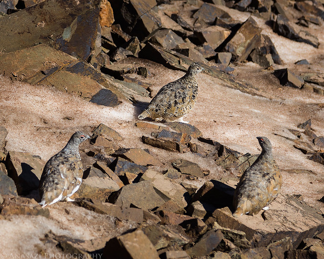
Three Ptarmigan by IntrepidXJ, on Flickr
Crossing the ridge between Picayune and Placer Gulches with Hanson Peak straight ahead.
Treasure Mountain Road by IntrepidXJ, on Flickr
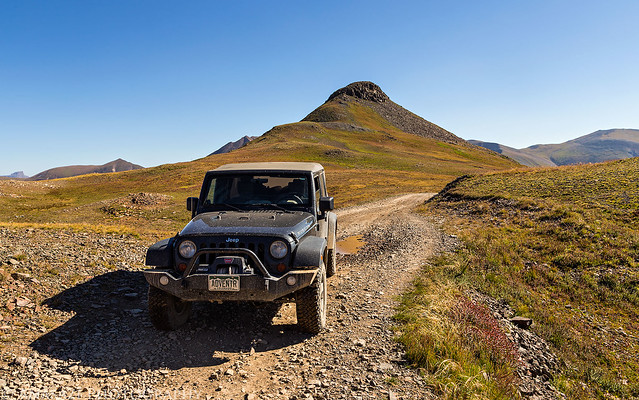
My Jeep with the summit of Treasure Mountain behind it. It was an easy hike from the road up there.
Treasure Mountain by IntrepidXJ, on Flickr
Before descending into Placer Gulch we stopped at an overlook of Parson Lake which had a sheep camp setup nearby. Look closely and you'll notice that those aren't white rocks scattered about, there are sheep everywhere.
Parson Lake & Sheep by IntrepidXJ, on Flickr
We stopped to check out the remains of the Gold Prince Mine on our way through Placer Gulch.
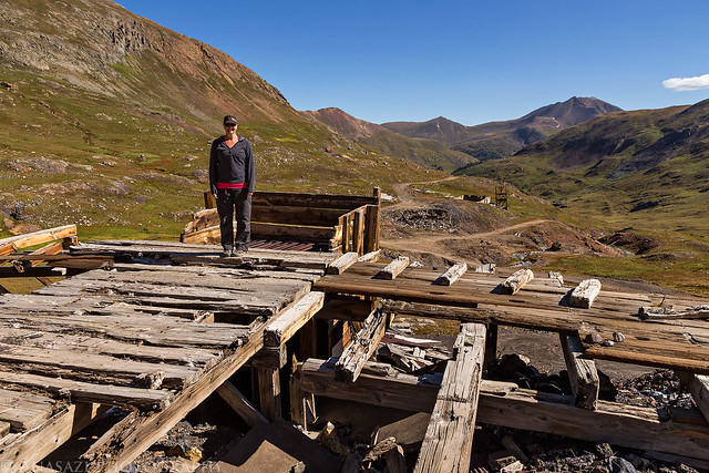
Gold Prince Mine by IntrepidXJ, on Flickr
This little pika was scurrying around in the rocks near the old mine.
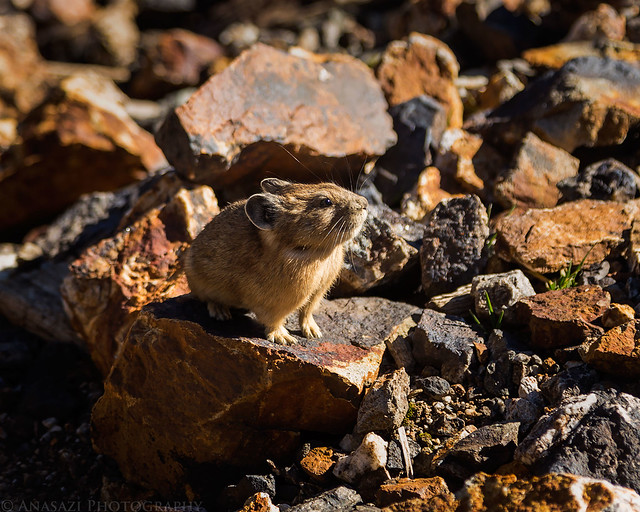
Pika by IntrepidXJ, on Flickr
After finishing the loop at the ghost town of Animas Forks we started our drive back home. It was a nice relaxing holiday weekend in the mountains.
>> A Drive Around the San Juan's Photo Gallery
>> The Original Trip Report on ADVENTR.CO
After our overnight backpacking trip into Wetterhorn Basin we decided to stick around the San Juan Mountains for one more day and drive a few of the high mountain passes and trails around Silverton. After lunch in Ouray, we drove over Red Mountain Pass and found a campsite up in Mineral Basin. While I was pretty sure we'd be able to find one of our usual campsites in this area open, I was surprised to find that there was no one else around considering it was Labor Day weekend. We had the area to ourselves for the night. We spent a few hours resting in camp before driving up to a few passes in the late afternoon to catch the sunset. The fast-moving clouds that had been around all day made for another spectacular sunset!
After checking out the views from the Sunnyside Saddle over Eureka Gulch we made our way over Hurricane Pass. Hurricane Peak (13,447 feet) is straight ahead and lit up by the sun.
Hurricane Peak by IntrepidXJ, on Flickr
We made a short stop at 12,730 foot Hurricane Pass before continuing on to California Pass.
Hurricane Pass by IntrepidXJ, on Flickr
The view over Lake Como and Poughkeepsie Gulch towards Tuttle Mountain (13,203 feet) as we descend from the pass.
Lake Como by IntrepidXJ, on Flickr
We spent some time at California Pass (12,930 feet) watching the clouds move quickly above creating shadows on the landscape below. The California Gulch Road is down below and in the distance 14ers Uncompahgre Peak and Wetterhorn Peak are visible in the shadows with Matterhorn Peak between them.
California Gulch Shadow by IntrepidXJ, on Flickr
I hiked a short distance along the ridge leading to Tuttle Mountain.
California Gulch by IntrepidXJ, on Flickr
Spotlight on California Mountain (13,220 feet) across the gulch.
California Mountain Spotlight by IntrepidXJ, on Flickr
Evening light on Hanson Peak (13,454 feet).
Evening Peak by IntrepidXJ, on Flickr
My Jeep parked at California Pass as I hiked back.
California Pass by IntrepidXJ, on Flickr
View towards Bonita Peak (13,286 feet) over Ross Basin as we drove over to Corkscrew Pass to catch the sunset.
Ross Basin by IntrepidXJ, on Flickr
Beautiful evening light and shadows on the surrounding peaks.
Mountain Shadows by IntrepidXJ, on Flickr
The clouds were pretty nice this evening.
Nice Clouds by IntrepidXJ, on Flickr
Looking back at the Hurricane Pass Road climbing up between Hurricane Peak and Brown Mountain (13,339 feet). There are a lot of 13ers in this area I need to climb!
Hurricane Pass Road by IntrepidXJ, on Flickr
View across to Minnehaha Basin with Emery Peak (13,310 feet) and Proposal Peak (13,330 feet) above.
Minnehaha Basin by IntrepidXJ, on Flickr
Sunset on Red Mountain #1 (12,592 feet) from Corkscrew Pass (12,400 feet).
Red Mountain #1 Sunset by IntrepidXJ, on Flickr
My Jeep near the pass.
Jeep in the Mountains by IntrepidXJ, on Flickr
Driving down the switchbacks into Corkscrew Gulch.
Corkscrew Switchback by IntrepidXJ, on Flickr
There was a beautiful magenta sky as we descended into Corkscrew Gulch to head back to camp.
Red Mountain Sunset by IntrepidXJ, on Flickr
Corkscrew Sunset by IntrepidXJ, on Flickr
Corkscrew Gulch Sunset by IntrepidXJ, on Flickr
We decided to sleep in on Monday morning and I'm glad we did. When we looked out of the tent we saw that all of the clouds had disappeared and we were left with nothing but blue skies above. The wind that was around the previous evening had died down overnight but started to pick up again when the sun came back out. After packing up camp we wanted to drive one more short Jeep road near Silverton known as the Treasure Mountain Loop. This route starts out by climbing through Picayune Gulch (spelled Picayne on the USGS topo maps) to a ridge of Treasure Mountain and then drops down into Placer Gulch. I had driven this trail way back in 2007 but had not been back since and I wanted to check out the area again since my memory of it was pretty foggy. While we were at the top of the ridge between the two gulches I took a short hike to the top of Treasure Mountain (12,900 feet).
Driving out of Picayune Gulch with Grouse Gulch and the very top of Handies Peak in the distance.
Picayne Gulch by IntrepidXJ, on Flickr
After climbing back down from the summit of Treasure Mountain I spotted four Ptarmigan in the rocks. Only three are pictured here. Had one of them not been standing on the snow, I probably would have missed them completely since the others blended in well with the surrounding rocks.
Three Ptarmigan by IntrepidXJ, on Flickr
Crossing the ridge between Picayune and Placer Gulches with Hanson Peak straight ahead.
Treasure Mountain Road by IntrepidXJ, on Flickr
My Jeep with the summit of Treasure Mountain behind it. It was an easy hike from the road up there.
Treasure Mountain by IntrepidXJ, on Flickr
Before descending into Placer Gulch we stopped at an overlook of Parson Lake which had a sheep camp setup nearby. Look closely and you'll notice that those aren't white rocks scattered about, there are sheep everywhere.
Parson Lake & Sheep by IntrepidXJ, on Flickr
We stopped to check out the remains of the Gold Prince Mine on our way through Placer Gulch.
Gold Prince Mine by IntrepidXJ, on Flickr
This little pika was scurrying around in the rocks near the old mine.
Pika by IntrepidXJ, on Flickr
After finishing the loop at the ghost town of Animas Forks we started our drive back home. It was a nice relaxing holiday weekend in the mountains.
>> A Drive Around the San Juan's Photo Gallery
>> The Original Trip Report on ADVENTR.CO