- Joined
- Aug 9, 2007
- Messages
- 12,959
Utah is pretty awesome. Last weekend I went down to Moab on a solo trip. My goal was to zip through Arches hiking and re-hiking many of the most popular trails. Not so much because I had a burning desire to do so, but more because I am currently working on another 60 trail guides for Intermountain Healthy Hikes. By July it'll be up to 180 hikes on there!
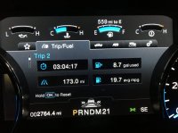
With an awesome forecast, I loaded up and headed south late Friday afternoon. Going solo is one thing, but leaving my pup Sage behind was tough, especially when I pulled into my campsite just outside Arches NP around 8:30pm. But the killer gas mileage I got in my truck (3.5 L Ecoboost) from SLC to Green River sure made me happy. I never even came close to that in my v6 Taco! I won't even mention the Tundra...
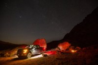
The first spot I shot for was full of cows and ranchers camped out so I kept heading south toward Arches. Part of me thought I might just head for the campground. I wouldn't normally consider it, but when camping solo there's sometimes something nice about having people nearby. But on the way down, I found a little pull off to a sweet campsite in Salt Valley. I pulled in and settled in for the night.
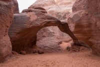
The next morning I took the back door in to Arches. I thought about starting with a hike on the Devil's Garden Loop, but I decided I'd better knock out a few short ones on the main drag before the crowds showed up. First, Sand Dune Arch. Yeah, I know, at under a half mile, it's not so much a hike, but that's the scope of work for this project.
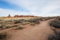
After that, Double Arch. Still no one around at this point.
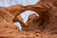
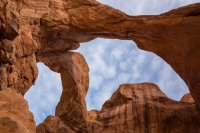
After Double Arch I went over to Balanced Rock and then up to where Abbey's trailer was at the picnic spot. The sky was increasingly overcast which just doesn't work for trail guide photos. I had Balanced Rock and Park Ave on my list, so to burn time until the sun came out, I decided to drive out to Eye of the Whale Arch. I made it about half way there until I got to a crazy twist in the road. It doesn't look like much in this shot...
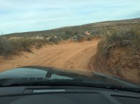
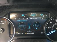
But my truck was already way tilted, 15˚ to the side and the grade probably doubled after that. I know, it looks fine in this photo, but it was much worse in person. The photo doesn't show it well, but the wall of dirt on the right was a good 7' tall - well over my head. I got out and scouted it. It leveled out around the bend. But I was alone out there. Something about having no one else around that makes my tail crawl way up between my legs. I put it in reverse and went back to Balanced Rock for the leisurely .3 mile stroll around that precarious pinnacle. I'm sure many of you who have driven this road will get a chuckle about me turning back, but I promise if you want to go out there with me, I'll follow you. I'm just a little gun shy when solo for some strange reason.
There wasn't much blue out, but between these photos and some photos from another trip, I was able to squeeze out enough to make it work.
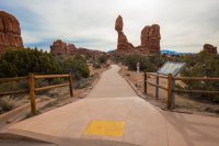
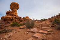
After Balanced Rock I drove up to Park Ave and waited for the clouds to clear. I did some work on my bike that I had to do some paved trails in town as I waited. After an hour or so, I was out there by my tailgate as the cars whizzed by. A couple of them went by with girls hanging out of the sunroof and some god awful hip hop blasting out the windows. I looked behind them hoping to see a park ranger in pursuit, but nothing. 11am on a Saturday in February. Time to get the hell out of Arches.
Next stop, Canyonlands: Island in the Sky. I stopped along the way to see some rock art for personal enjoyment. Nothing to do with the trail guides.
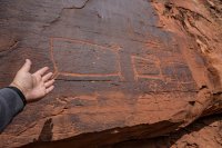
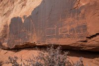
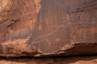
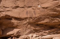
I eventually made it out to the end of Grandview Point as the clouds vaporized. It was still a little cloudy over by Arches, but from the west over, it was perfect. I started with the 2 mile round trip hike to the Grandview Point Overlook.
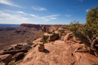
I couldn't help but think of the chapter in Desert Solitaire, Dead Man at Grand View Point, on my way out. From my recollection, Ed was called out to help look for a missing person. They walked all over the area and eventually found him expired under a Juniper. It's certainly a different place now. Plenty of parking stalls, some toilets and lots of beautiful stone steps lining the way.
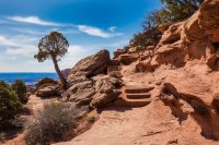
No complaining about the views on this hike.
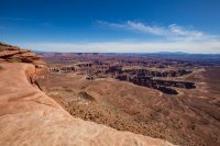
I made it out to the end where the views were awesome, but really not much different than the rest. It was nice to put eyes on the Maze again though.
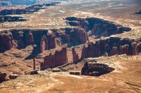
Next stop was the White Rim Overlook trail, starting from the picnic area just north of the Grand View Point parking area. This on sees far less traffic. I guess it's not as fantastic for the first .6 miles or so, but the last .4 are way better than Grand View Point! For views, this was my favorite of the trip. And I only saw a few other people for the entire 2 miles round trip (park service lists it as 1.6).

A little knob toward the end of the White Rim Overlook Trail
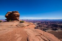
The end of the White Rim Overlook. Mountain goats like @slc_dan would undoubtedly hop right on out to the bleeding edge. I bravely made my way out onto the first pedestal and then said hell no to the next one.
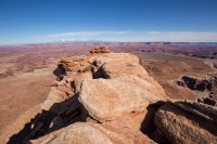
Instead I got out a water bottle, some dried pineapple and my long lens and took some shots of the White Rim and Monument Basin, directly below.
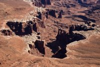
This hike finally made me want to drive the White Rim Road. Monument Basin looks so awesome.
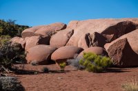
Fun rocks on the way back.
It was getting late in the day now. I debated whether to race back to Arches to hit Delicate for sunset. The thought of a few dozen of the 'sunroof girls' up there taking selfies quickly solved that dilemma. I was now 5 hikes deep into my day. I know, it's a stretch to call stuff like Sand Dune, Double Arch and Balanced Rock 'hikes', but this is a business trip! My goal was to do 6-8 for the weekend, so I decided to race over to Whale Rock. After a quick hike to the top, I was taking in a new view. Instead of looking down from the edge of iSky, I was looking down on it. I spent a little extra time exploring on top.
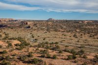
The view toward Upheaval Dome from on top of Whale Rock
I had a bit over an our of daylight left when I got back to my truck at Whale Rock. I was kind of toast as I haven't been hiking much, but I thought if I could just squeeze out one more, then I could run home that night and spend the next day writing rather than feeling sore and trying to get a couple more done. I decided to make a run for the Upheaval Dome Overlooks. I'd never done it, and all I knew was that it was 1.8 miles round trip to the second overlook. I refilled my bottles and headed up the trail. I found out quickly that this trail has a lot more elevation change than the others I'd done that day.
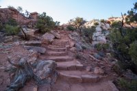
I made it to the first overlook with the light fading fast.
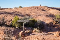
I was seriously tempted to just call it and go home, but this hike would be worth nothing if i didn't finish it. On to the second overlook. This is the rim looking down toward the second overlook. Somewhere out there...
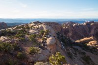
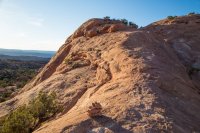
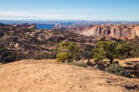
It was significantly more difficult getting to the second overlook. A good amount of up and down and even some interesting constructed sections where the trail is carved out of the side of the rock. But if you really just want a view of Upheaval Dome, it's good at many points along the trail.
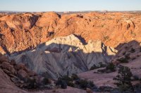
The final descent to the second overlook. As cool as this trail was, I was bent that I had to drop another couple hundred feet.
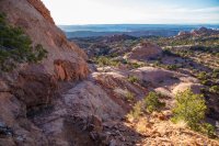
Success at the second overlook. Now just to get my gimpy self back to the trailhead.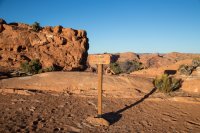
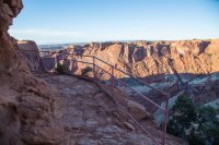
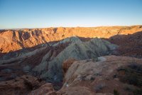
I arrived back at the first overlook just in time for the last rays of light on the landscape.
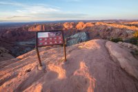
I got back to the truck, hopped in, and drove all the way back to Salt Lake. I made it home a little before 11pm. The next day I sat in front of the computer writing and processing photos. Good times. 33 hikes to go.
With an awesome forecast, I loaded up and headed south late Friday afternoon. Going solo is one thing, but leaving my pup Sage behind was tough, especially when I pulled into my campsite just outside Arches NP around 8:30pm. But the killer gas mileage I got in my truck (3.5 L Ecoboost) from SLC to Green River sure made me happy. I never even came close to that in my v6 Taco! I won't even mention the Tundra...

The first spot I shot for was full of cows and ranchers camped out so I kept heading south toward Arches. Part of me thought I might just head for the campground. I wouldn't normally consider it, but when camping solo there's sometimes something nice about having people nearby. But on the way down, I found a little pull off to a sweet campsite in Salt Valley. I pulled in and settled in for the night.

The next morning I took the back door in to Arches. I thought about starting with a hike on the Devil's Garden Loop, but I decided I'd better knock out a few short ones on the main drag before the crowds showed up. First, Sand Dune Arch. Yeah, I know, at under a half mile, it's not so much a hike, but that's the scope of work for this project.


After that, Double Arch. Still no one around at this point.


After Double Arch I went over to Balanced Rock and then up to where Abbey's trailer was at the picnic spot. The sky was increasingly overcast which just doesn't work for trail guide photos. I had Balanced Rock and Park Ave on my list, so to burn time until the sun came out, I decided to drive out to Eye of the Whale Arch. I made it about half way there until I got to a crazy twist in the road. It doesn't look like much in this shot...

But my truck was already way tilted, 15˚ to the side and the grade probably doubled after that. I know, it looks fine in this photo, but it was much worse in person. The photo doesn't show it well, but the wall of dirt on the right was a good 7' tall - well over my head. I got out and scouted it. It leveled out around the bend. But I was alone out there. Something about having no one else around that makes my tail crawl way up between my legs. I put it in reverse and went back to Balanced Rock for the leisurely .3 mile stroll around that precarious pinnacle. I'm sure many of you who have driven this road will get a chuckle about me turning back, but I promise if you want to go out there with me, I'll follow you. I'm just a little gun shy when solo for some strange reason.

There wasn't much blue out, but between these photos and some photos from another trip, I was able to squeeze out enough to make it work.


After Balanced Rock I drove up to Park Ave and waited for the clouds to clear. I did some work on my bike that I had to do some paved trails in town as I waited. After an hour or so, I was out there by my tailgate as the cars whizzed by. A couple of them went by with girls hanging out of the sunroof and some god awful hip hop blasting out the windows. I looked behind them hoping to see a park ranger in pursuit, but nothing. 11am on a Saturday in February. Time to get the hell out of Arches.
Next stop, Canyonlands: Island in the Sky. I stopped along the way to see some rock art for personal enjoyment. Nothing to do with the trail guides.


I eventually made it out to the end of Grandview Point as the clouds vaporized. It was still a little cloudy over by Arches, but from the west over, it was perfect. I started with the 2 mile round trip hike to the Grandview Point Overlook.

I couldn't help but think of the chapter in Desert Solitaire, Dead Man at Grand View Point, on my way out. From my recollection, Ed was called out to help look for a missing person. They walked all over the area and eventually found him expired under a Juniper. It's certainly a different place now. Plenty of parking stalls, some toilets and lots of beautiful stone steps lining the way.

No complaining about the views on this hike.

I made it out to the end where the views were awesome, but really not much different than the rest. It was nice to put eyes on the Maze again though.
Next stop was the White Rim Overlook trail, starting from the picnic area just north of the Grand View Point parking area. This on sees far less traffic. I guess it's not as fantastic for the first .6 miles or so, but the last .4 are way better than Grand View Point! For views, this was my favorite of the trip. And I only saw a few other people for the entire 2 miles round trip (park service lists it as 1.6).

A little knob toward the end of the White Rim Overlook Trail

The end of the White Rim Overlook. Mountain goats like @slc_dan would undoubtedly hop right on out to the bleeding edge. I bravely made my way out onto the first pedestal and then said hell no to the next one.

Instead I got out a water bottle, some dried pineapple and my long lens and took some shots of the White Rim and Monument Basin, directly below.

This hike finally made me want to drive the White Rim Road. Monument Basin looks so awesome.

Fun rocks on the way back.

It was getting late in the day now. I debated whether to race back to Arches to hit Delicate for sunset. The thought of a few dozen of the 'sunroof girls' up there taking selfies quickly solved that dilemma. I was now 5 hikes deep into my day. I know, it's a stretch to call stuff like Sand Dune, Double Arch and Balanced Rock 'hikes', but this is a business trip! My goal was to do 6-8 for the weekend, so I decided to race over to Whale Rock. After a quick hike to the top, I was taking in a new view. Instead of looking down from the edge of iSky, I was looking down on it. I spent a little extra time exploring on top.

The view toward Upheaval Dome from on top of Whale Rock

I had a bit over an our of daylight left when I got back to my truck at Whale Rock. I was kind of toast as I haven't been hiking much, but I thought if I could just squeeze out one more, then I could run home that night and spend the next day writing rather than feeling sore and trying to get a couple more done. I decided to make a run for the Upheaval Dome Overlooks. I'd never done it, and all I knew was that it was 1.8 miles round trip to the second overlook. I refilled my bottles and headed up the trail. I found out quickly that this trail has a lot more elevation change than the others I'd done that day.

I made it to the first overlook with the light fading fast.

I was seriously tempted to just call it and go home, but this hike would be worth nothing if i didn't finish it. On to the second overlook. This is the rim looking down toward the second overlook. Somewhere out there...


It was significantly more difficult getting to the second overlook. A good amount of up and down and even some interesting constructed sections where the trail is carved out of the side of the rock. But if you really just want a view of Upheaval Dome, it's good at many points along the trail.

The final descent to the second overlook. As cool as this trail was, I was bent that I had to drop another couple hundred feet.

Success at the second overlook. Now just to get my gimpy self back to the trailhead.


I arrived back at the first overlook just in time for the last rays of light on the landscape.

I got back to the truck, hopped in, and drove all the way back to Salt Lake. I made it home a little before 11pm. The next day I sat in front of the computer writing and processing photos. Good times. 33 hikes to go.
