- Joined
- Jul 23, 2013
- Messages
- 1,665
Red Castle. This iconic landmark in the High Uintas Wilderness has certainly become one of the most sought after destinations in all the Uinta range over recent years. Like so many others, it too, quickly found a place on my bucket list. But for years, I kept putting it off in favor of other trips or when plans with others fell through. I finally checked it off when my wife, Jessica, proposed a trip to celebrate my 37th birthday.
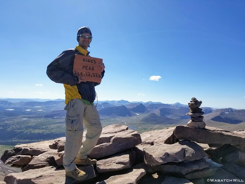
Red Castle and its accompanying lakes, along with Kings Peak, might well be the most popular places in the Uinta range not situated along Utah State Highway 150 (aka - Mirror Lake Highway), which bisects the western tip of the Uinta Range and can easily be accessed out of Salt Lake City. Kings Peak, because of its claim to being the state high point, standing at 13,528 feet above sea level, is a must for any serious resident peak bagger and anyone wanting to stand atop the entire state, if only for a moment.
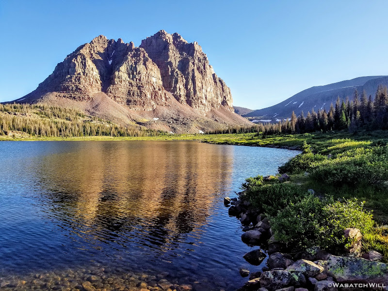
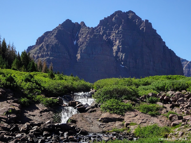
Red Castle on the other hand, doesn't even make it into the top 10 highest peaks of the Uintas, rising only to 12,680 feet above sea level at its highest point, nearly a full 1000 feet lower than Kings. However, what it lacks in stature, it makes up for in beauty and wonder. Its photogenic qualities make it a favorite for landscape photographers, both professional and amateur alike. Indeed, it may well be the most photographed landmark in all the Uintas. Its unique reddish hue, believed to be from traces of oxidized iron, makes it stand out even more so from many other peaks in the range.
Both Red Castle and Kings Peak are rather close neighbors. They aren't exactly next door to each other, but they are indeed in close proximity to each other and if both places are on one's to-do list, they can both be enjoyed as part of a lollipop loop. Such a lolli-loop can be achieved from either the Henry's Fork Trailhead or the China Meadows Trailhead. Since Jess hadn't been up to Kings Peak yet either and had the itch to do it herself, we made such a plan for ourselves. We opted for China Meadows.
Day 1
Monday - August 24, 2019
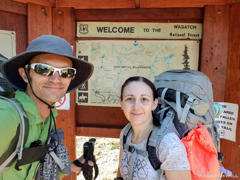
Having driven up to the trailhead the night before, we selected a campsite at the trailhead, paid the fee, and simply slept in my 4Runner to ensure an early start on the trail in the morning.
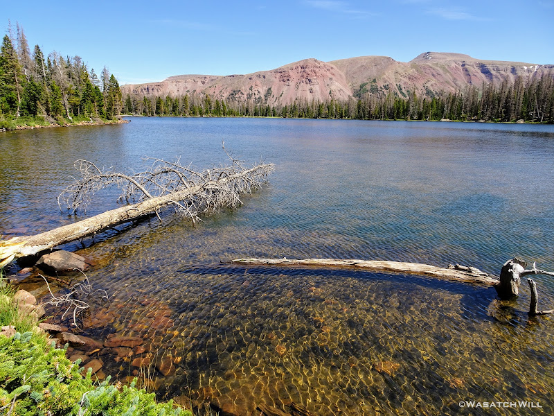
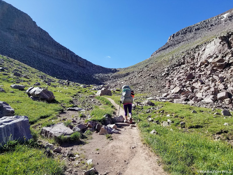
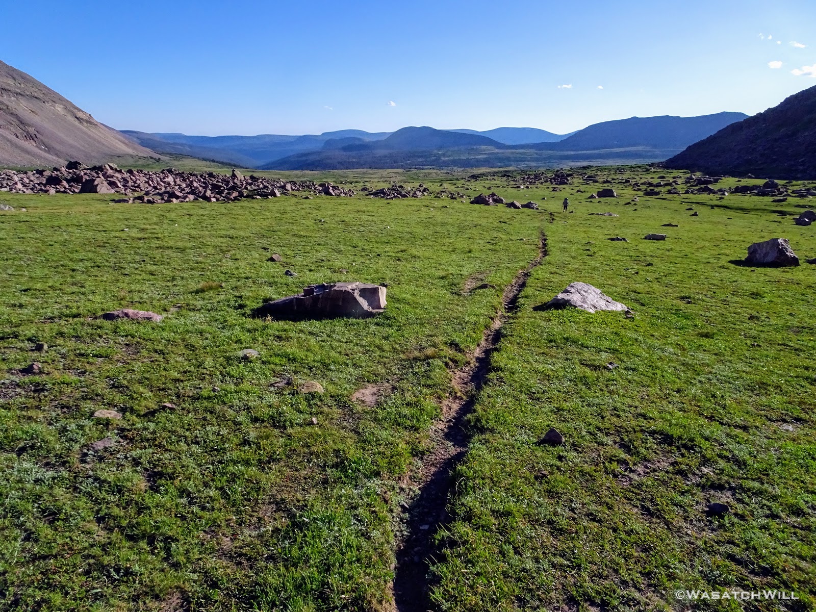
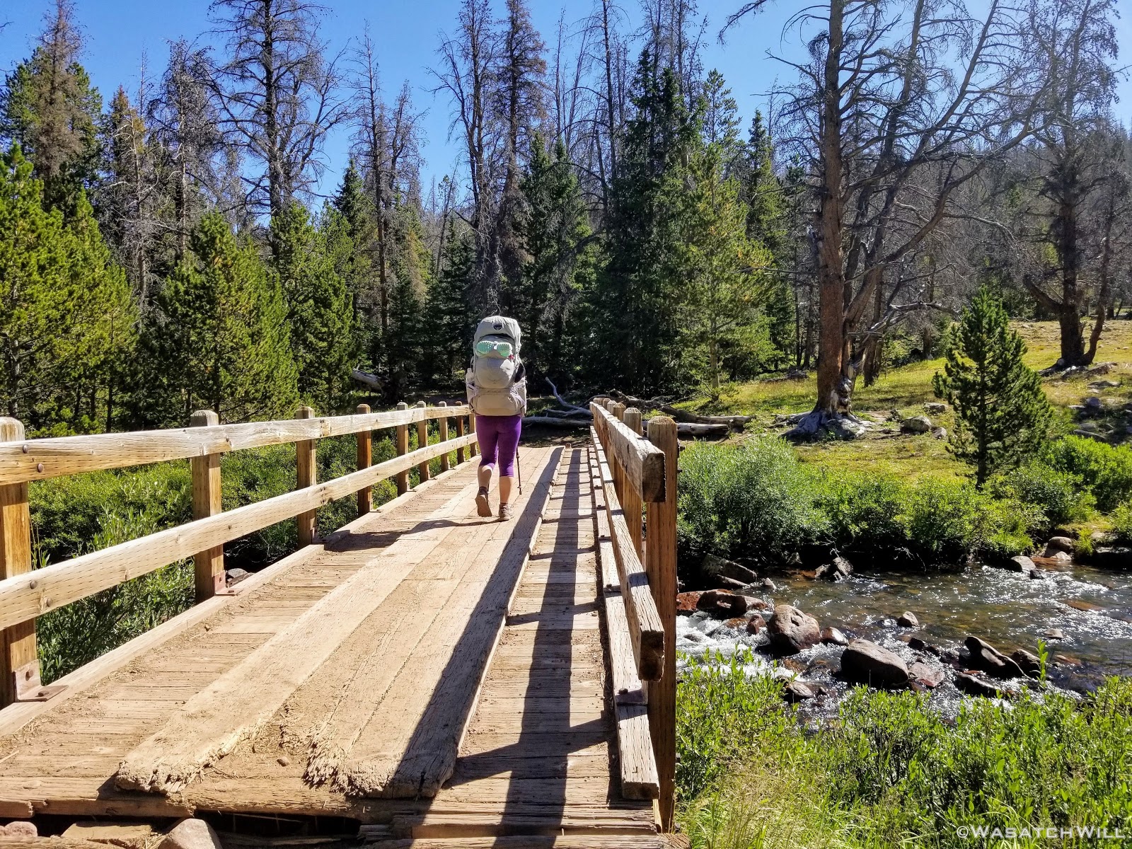
The trail out of China Meadows, like many other Uinta trails, starts out in rather dense tree cover for the first few miles, only occasionally emerging out into a meadow or some other clearing.
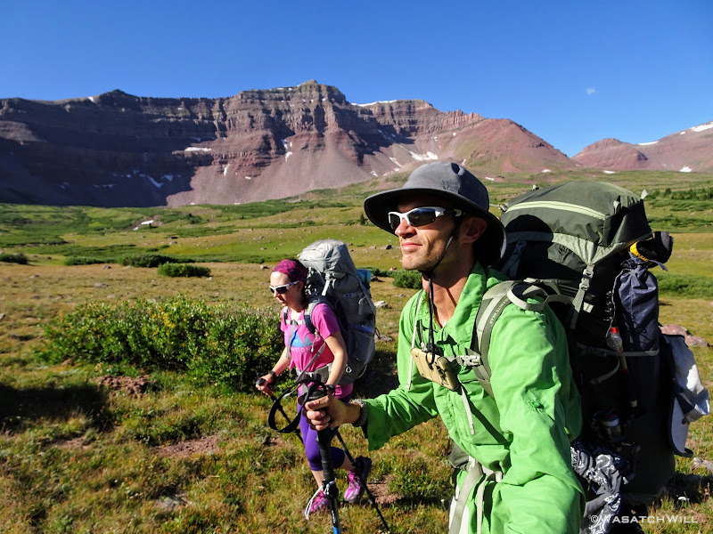
We had decided to make Kings Peak the first priority and save Red Castle for last. That meant a turn to the left at the junction with the North Slope trail. This would take us toward Henry Fork where we'd look for a place to call home for the night in preparation for summiting Kings the following day. Along the way, we pulled off for a quick look around at Hessie Lake.

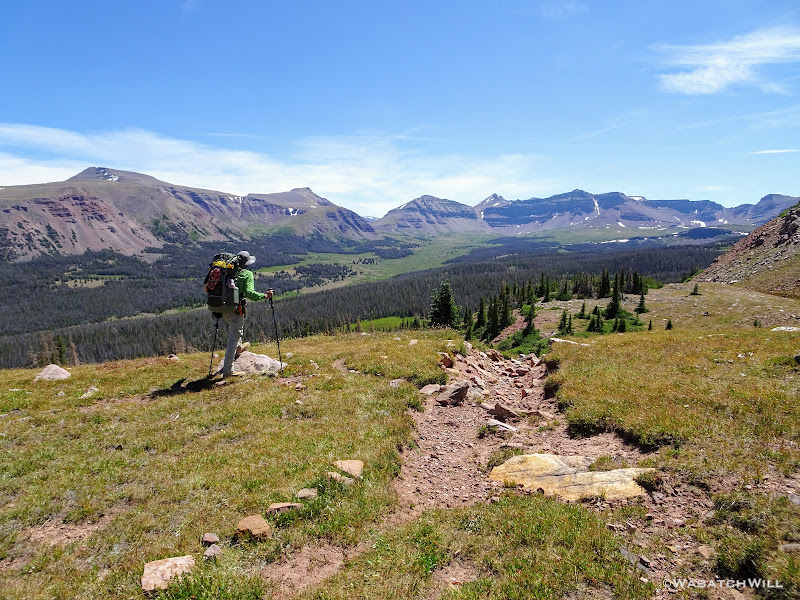
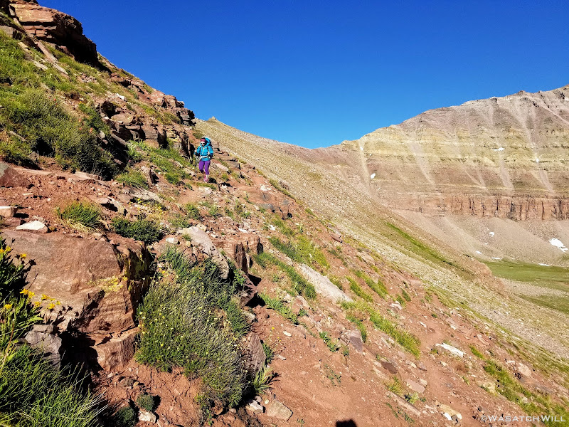
Soon after moving on from Hessie Lake, we lost the trail for a bit but quickly picked it up thereafter, or so we thought. This trail ended up being what turned out to be the Big Meadows Trail and had us heading in the wrong direction. With a coarse correction using the aid of my phone's GPS and downloaded map, we were once again heading back in the right direction and soon picked up our desired trail. Moments later, we were greeted to what instantly became one of my favorite views I'd ever experienced to date in all the range.
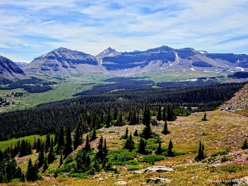
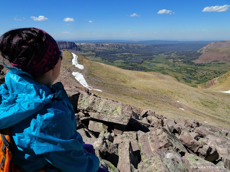
There stood the great wide Henry's Fork Basin below our feet spread out in front of us with Kings Peak peaking out beyond the center of the horizon. Gilbert Peak, Gunsight Peak, Dome Peak, Henrys Fork Peak, and the Powell peaks all made up the rest of the horizon. I had been up to Kings Peak twice before, but both approaches were from alternative directions. The first time was via the standard way used by most seeking the summit, directly up from Henry's Fork Trailhead. The second time was part of a hike along a majority of the Highline Trail where the approach was made from across Painter Basin.
Just below the edge of the ridge we were about to descend, we took a well deserved lunch break in the shade of a small stand of trees that also served as shelter from the relentless wind that was beating upon us there and allowed us to continue to soak up the view before us.
Once rested and fed, we were back up and at it, heading down into Henry's Fork.
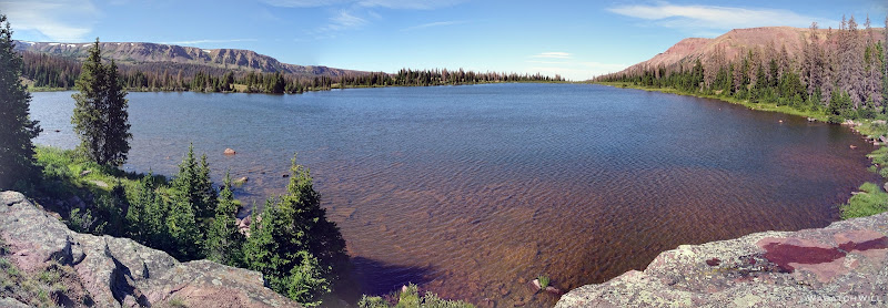
We soon passed by Bear Lake, not to be confused with the much bigger Bear Lake lying across the northern border of Utah and southern border of Idaho.
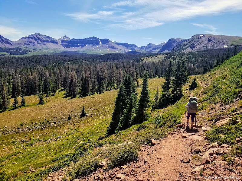
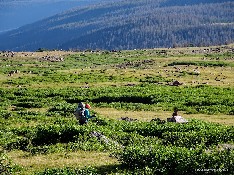
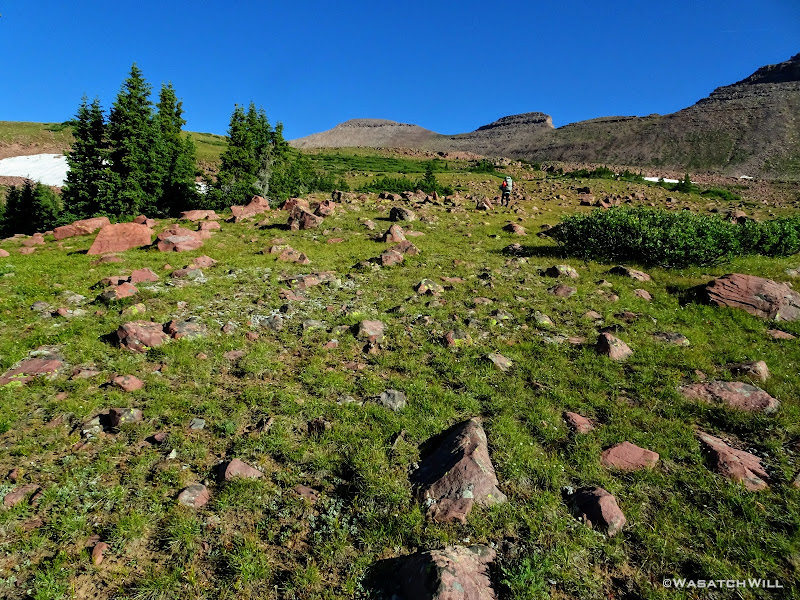
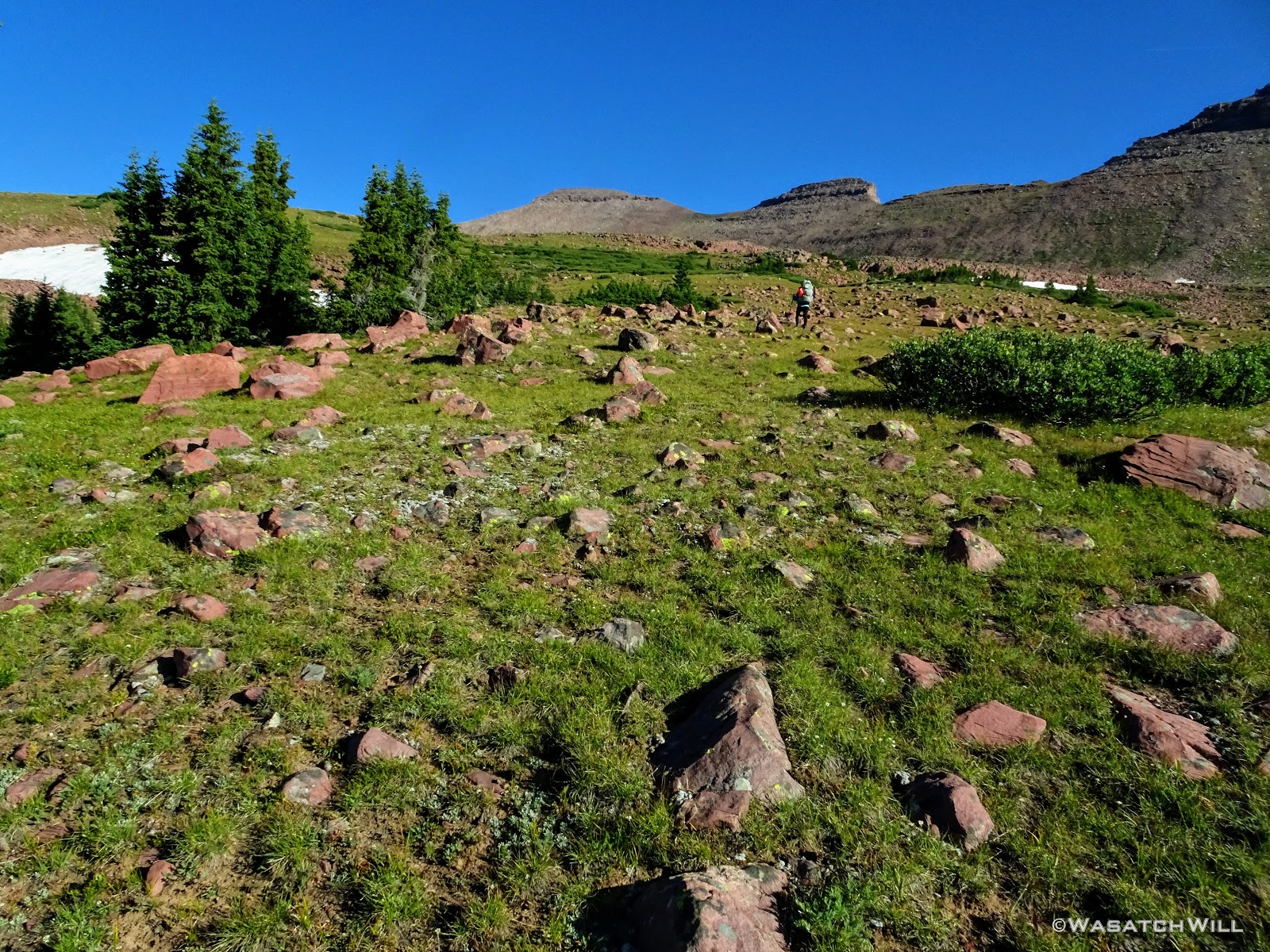
From there we continued through vast meadows, crossing a few streams and bypassing some marshes.
At one point we passed by a small lake with no name and a peak with no name rising above it sticking out from Flat Top Mountain. I quite like the occasional landmark, be it a peak or a lake, with no name. It makes it all feel even more wild and remote and it let's me choose to give it a name myself, or simply leave it nameless. In this instance, I got to enjoy both a nameless peak and lake at the same time and chose to leave them both nameless. Instead, I admired them enough just for their scenic beauty.
Growing quite tired, we took another good rest at Henry's Fork Lake.
Wanting to get a little bit closer to Gunsight Pass for the following morning, however, we picked up our packs and kept the day's journey going a little longer.
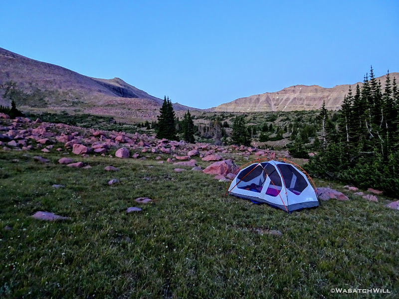
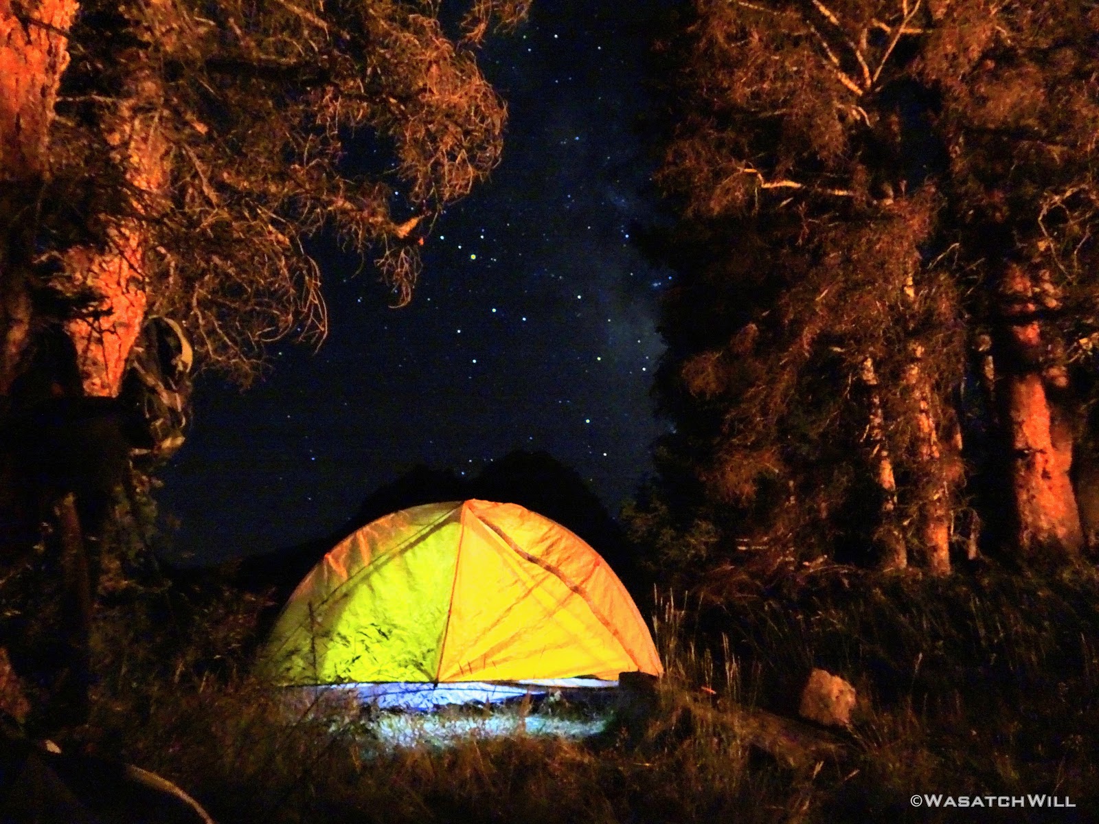
Over a half mile later, we settled into a cozy and private little campsite sheltered among some trees, out of sight and sound from the main trail.
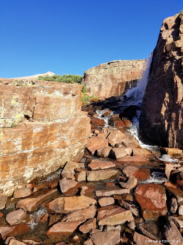
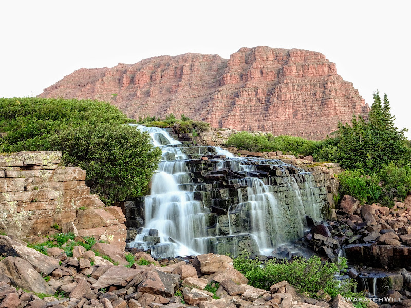
I then went out to the nearest water source I could find to retrieve some water. Such source turned out to feature a nice little waterfall.
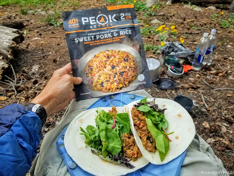
Back at camp, we cooked up some dinner. We had packed along some fresh greens to include in some burrito wraps we'd make using a Peak Refuel meal. Yum!
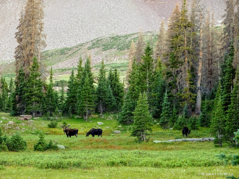
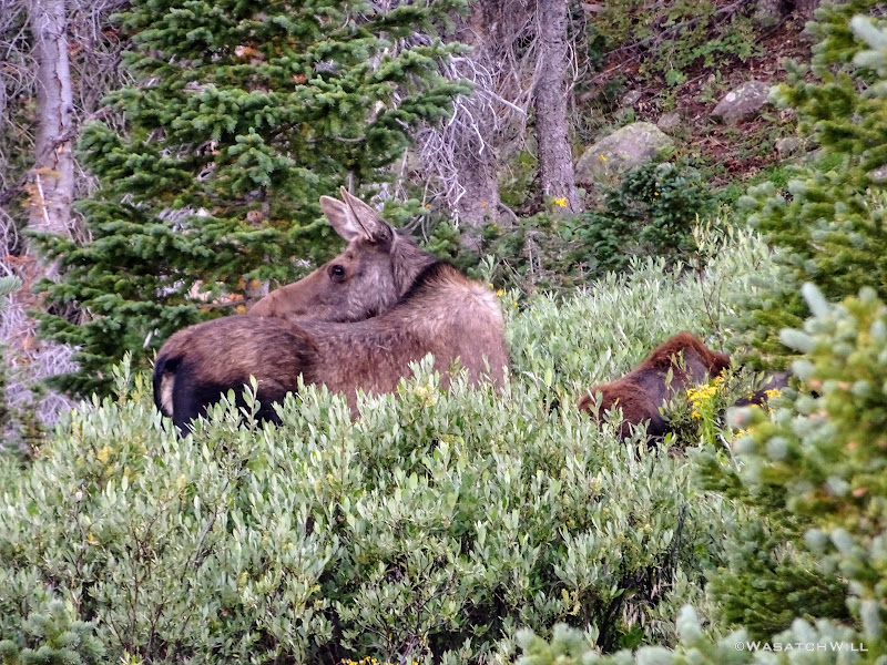
With a good hour of daylight left and despite being plenty tired from hiking all day, I got a bit of my own version of restless leg syndrome and sought to explore a bit more around our camp. So I ventured up the hill from our camp and found a trio of moose chowing down on some dinner themselves. Two bulls and a cow.
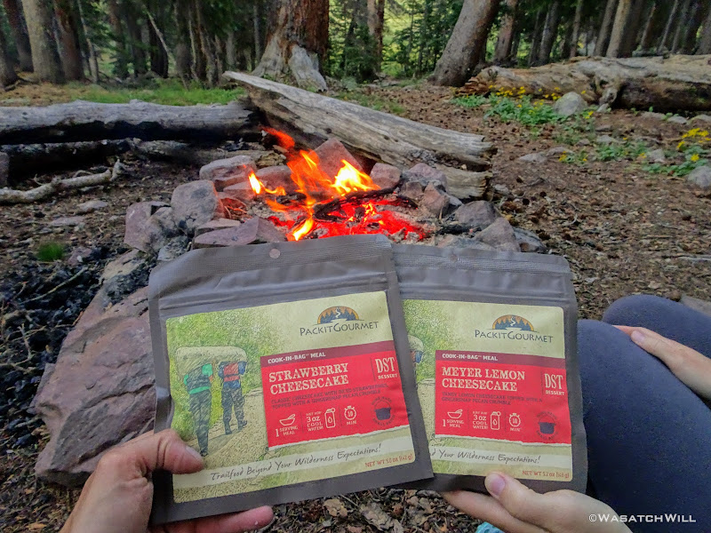
Back at camp, being over a quarter mile from any of the lakes and outside of the fire restricted zones, I took the liberty to build up a small fire while Jess made some dessert. We enjoyed some tasty cheesecake desserts from Pack-It Gourmet. Yum again!
Day 2
Tuesday - August 25, 2019
Knowing the skies were expected to remain clear all day, we didn't rush getting up to get up to the summit as early as is usually advised. Instead, I decided to let Jess rest up a bit more with some extra sleep while I went out to do a bit more exploring out in another section of the basin I had been wanting to check out. I returned back in the direction of Henry's Fork Lake but stayed higher.
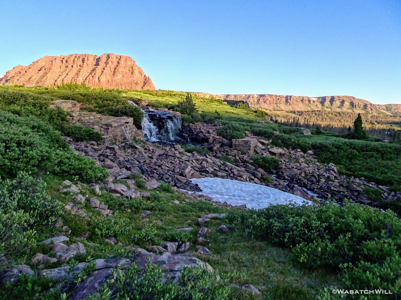
It took a ton of bushwhacking and navigating through and around some marshy bits, and yet more navigation to keep plenty of distance between the resident moose I had stumbled into the night before that were out and about in the same area once again. I finally arrived at a waterfall I had wanted to get a long exposure of before the sun came out. So beautiful and peaceful!
From there, I circled up and around to have a look at Blanchard Lake.
Had I the whole day, I would have loved to explore up higher and all around that corner of the basin some more, but alas, it was time to return to camp, wake up Jess, and be on our way over to Gunsight Pass to make the summit of Kings Peak.
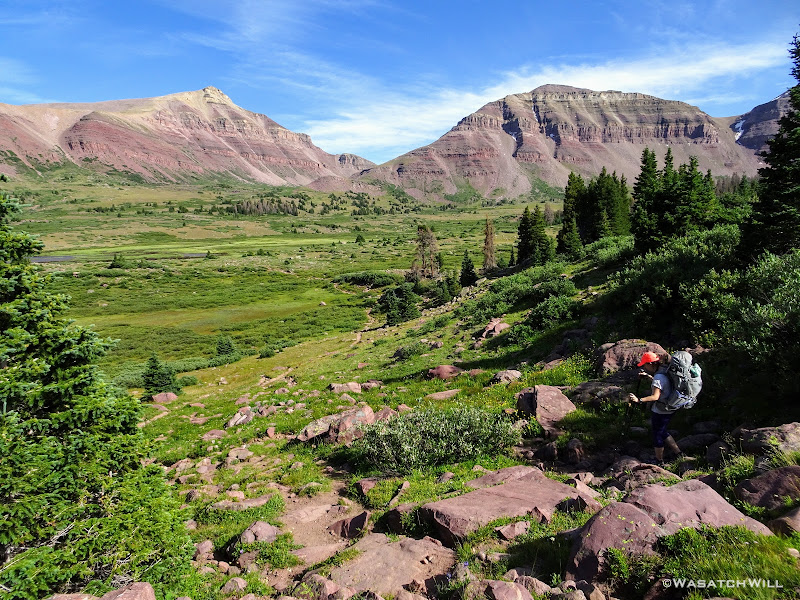
Once over Gunsight Pass, our intent was to take a shortcut path to save ourselves some elevation loss. We must have missed it because we ended up taking a social trail that looked like it was to be it a little further down from where we should have found it and ended up getting ourselves in little bit of a spicy situation. Not willing to return back to the pass to reset, we opted to descend a big boulder field down to the main trail out below us. It turned out to be quite a chore and the whole ordeal ended up costing us a good hour of trail time. As it turned out, the shortcut path we wanted was quite a bit further above the social trail we had followed. Bummer!
We ended up loosing the elevation we wanted to avoid after all and had to hike up the entirety of the trail out of Painter Basin up to Anderson Pass. We took a lunch break partway up, both because it was well into the afternoon by then and to ensure we had adequate fuel in our bellies to power us up the long and high pass.
Once up on the pass, it was time to stash our packs behind some rocks and away from the main trail. Kings Peak now awaited us along the very same ridge.
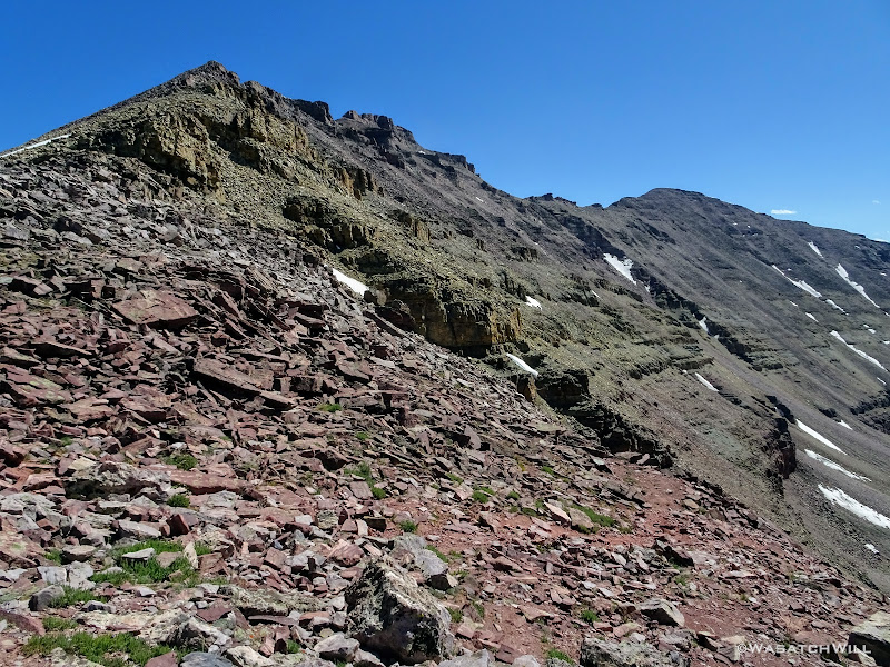
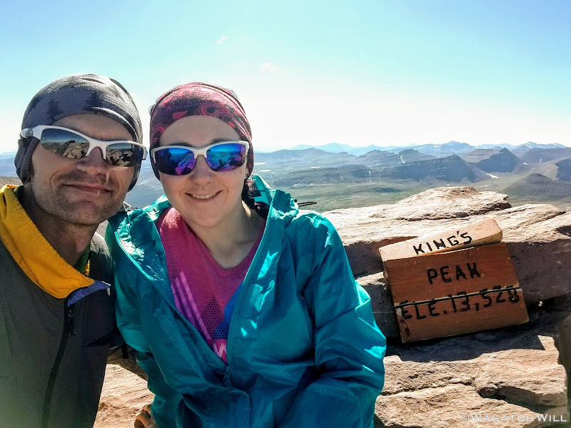
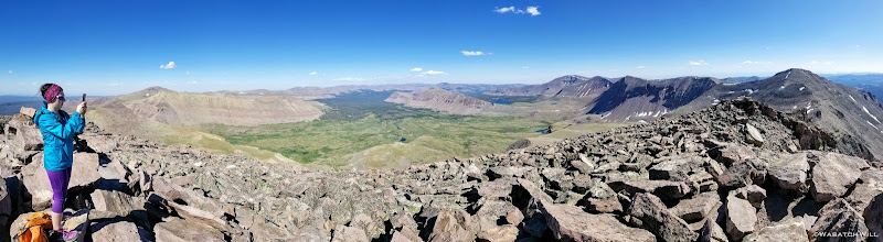
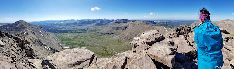
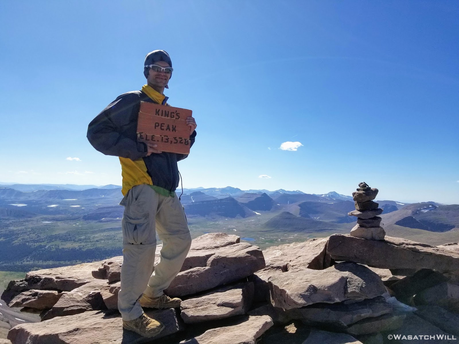
Three quarters of a mile, a few brief breaks, and lots of boulder hopping and scrambling later, we finally arrived on the summit. We had passed quite a few people on their way back down, but somehow, for the third time in as many times I had now been on the summit, we had it all to ourselves. Guess that's a perk to tackling it later on in the day. Good thing too, because it all became a very emotional moment for Jess.
After several minutes of some celebration and reflection we made our way back down to our packs and set sail down the other side of Anderson Pass.

As we got further down into the Yellowstone drainage, we eventually veered to the right off trail and began traveling cross country a good way until our legs and backs had all they could handle and with one hour of good light left in the day, picked out a virgin site to camp at.
It was absolutely tranquil.
Day 3
Wednesday - August 26, 2019
HAPPY BIRTHDAY...TO ME!
Yes, it was now officially my birthday. We had a great sleep and awoke to blue bird skies once again. We had another big day ahead of us and were both full of excitement having the hardest and highest point of the trip behind us. It was also Red Castle Day! In a few hours, we'd both get to lay our eyes on the infamous Red Castle in real life for the first time and see what all its hype was about.
Packed up, we made way for Smiths Fork Pass.
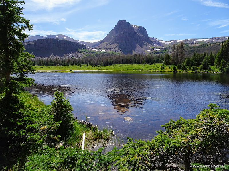
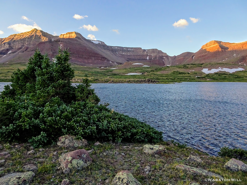
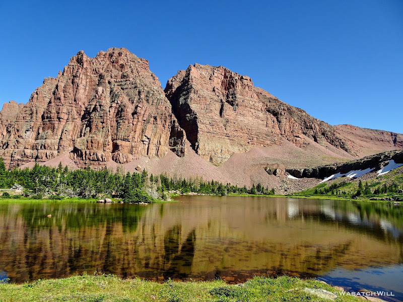
Once over Smiths Fork Pass, Smiths Fork Pass Lake and East Red Castle came into view.
We pulled over at Smiths Fork Pass for a big break. I tried a bit of fishing here, but got no action on my line.
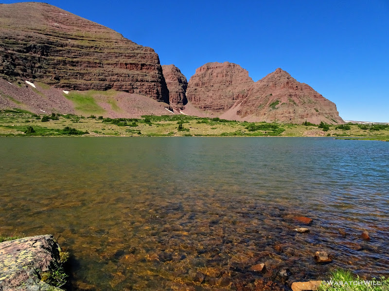
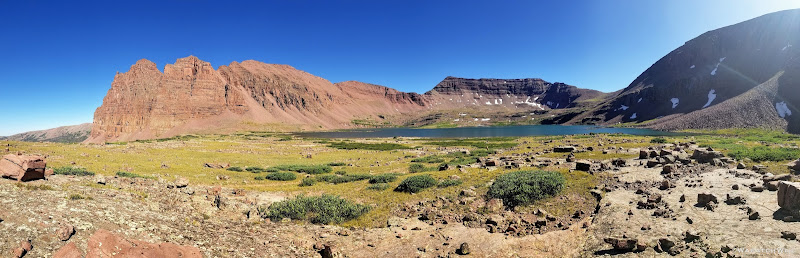
Moving along, we took a brief detour off trail to set our eyes upon East Red Castle Lake. It was tempting to call it good for the day in this area and set up camp nearby, but alas, I was really excited to also see Lower Red Castle Lake and the greater Red Castle Lake.
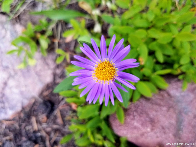
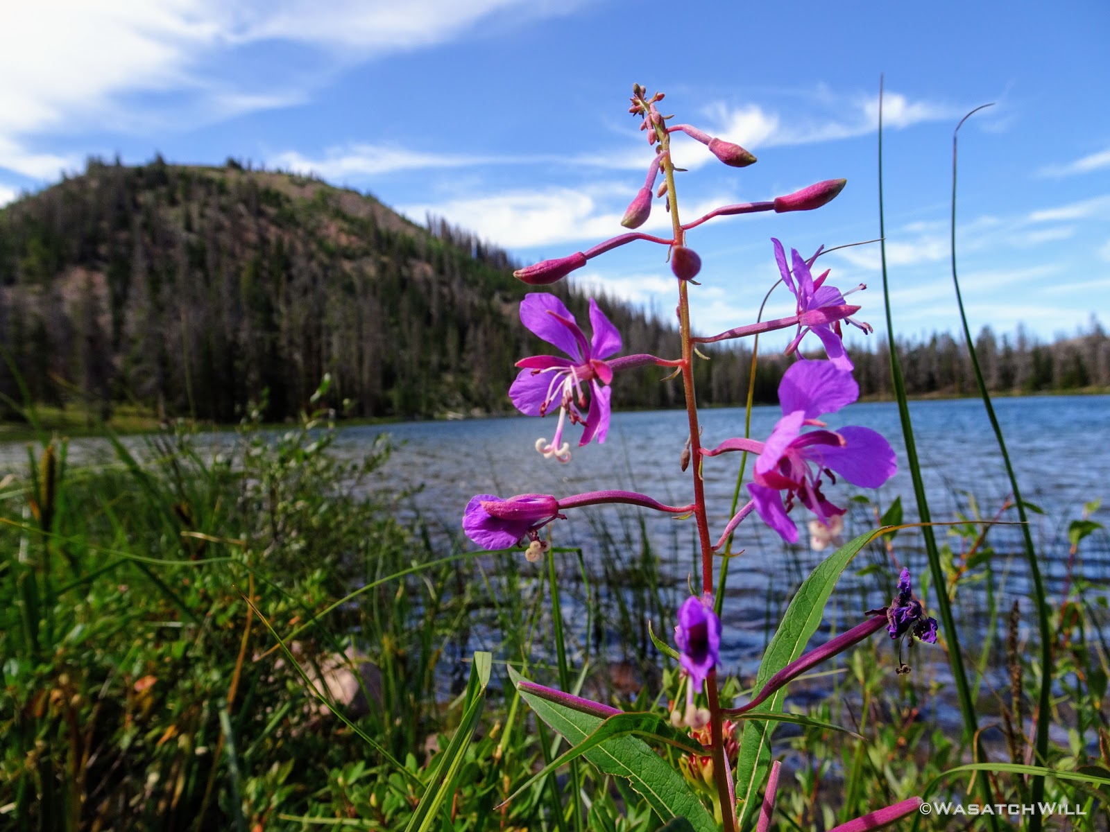
We returned to the trail and kept the day's journey going. We passed back into some tree cover and in and out of some meadows with a few flowers holding on here an there.
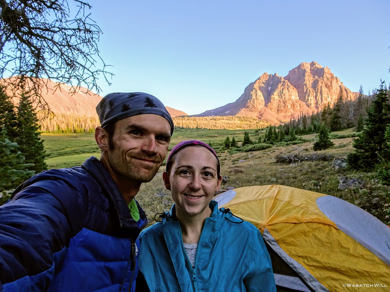
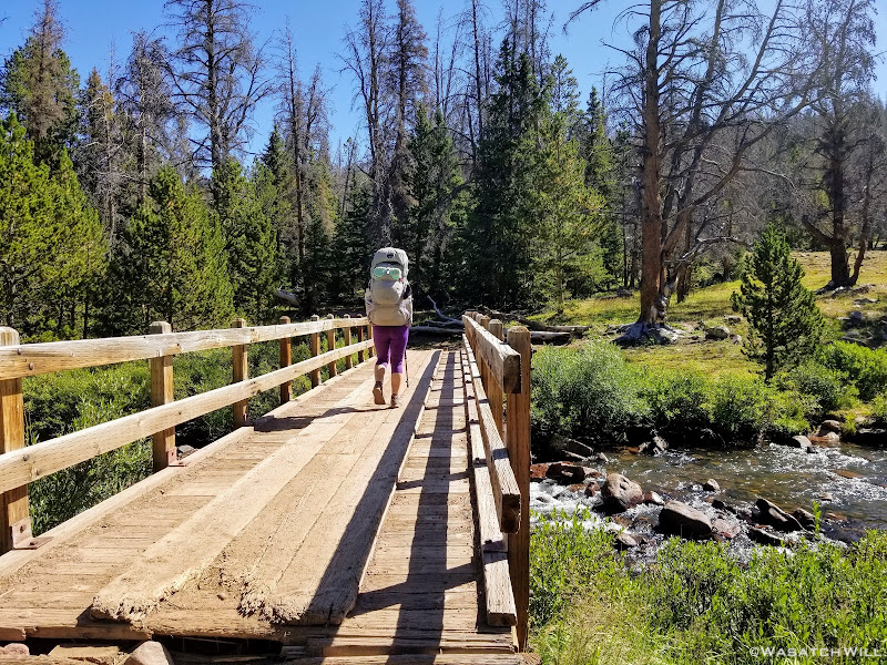
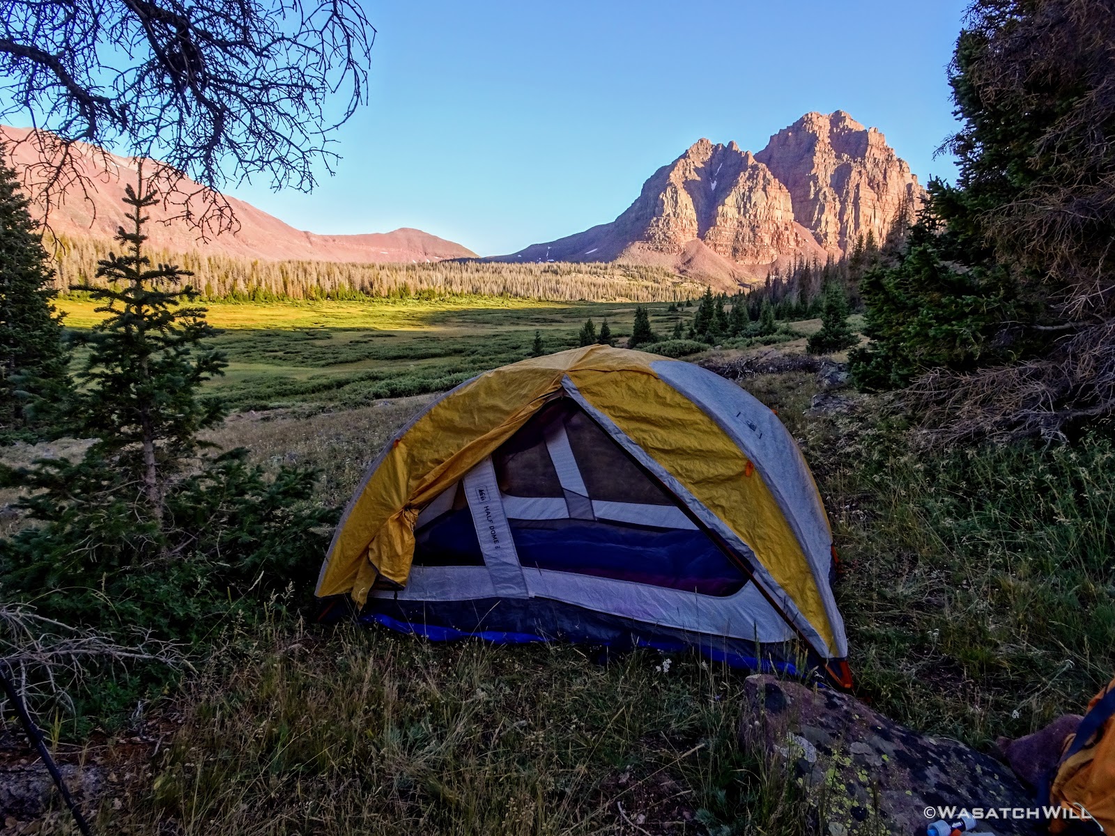
Finally, the front side of Red Castle came into view. Eager to find a good spot to camp though, we quickly kept pushing down the trail until we reached the bridge crossing over East Fork Smiths Fork Creek and the junction with Smiths Fork Trail. From there we found an available and adequate site nearby and a couple hundred feet off trail as desired.
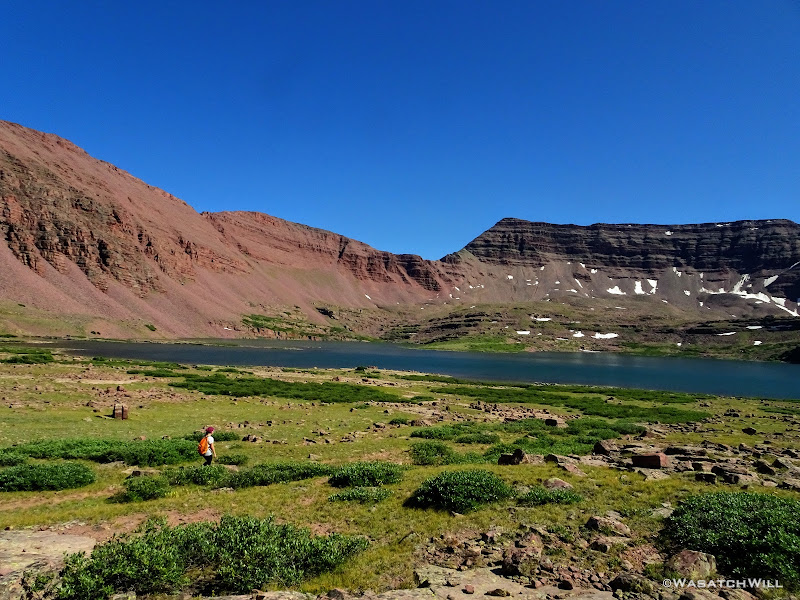
With camp setup, we loaded up our little summit packs with some snacks, and fishing gear and went up trail to get closer up to Red Castle and all its majesty. We opted to take an upper trail from near our camp that took us in the direction of Red Castle Lake. We'd pass through some beautiful forest and several different campsites, some occupied, some not. Once back out in the open, we found ourselves looking out on the west face of Red Castle now as the trail lead us above tree line and by a shallow unnamed lake lying at the foot of the bench holding Red Castle Lake.
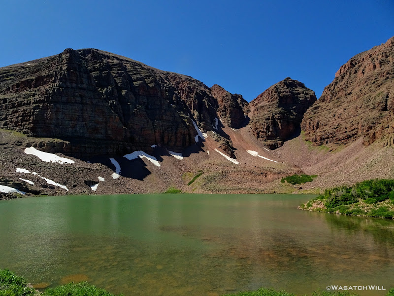
With one more short uphill surge, we reached the shores of Red Castle Lake.
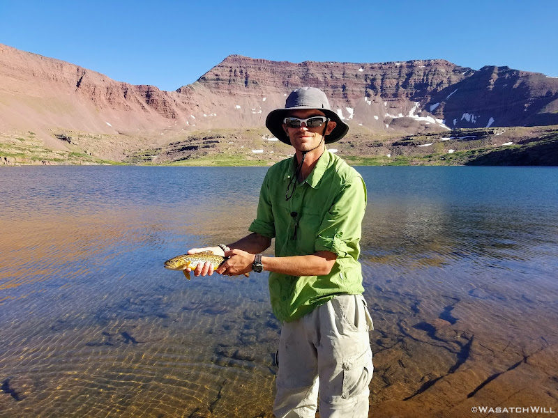
Jess just wanted to sit, rest, and take in the scenery surrounding us. I was eager to test the fishing, so I set up my pole and got to work. The fishing turned out to be pretty good for me. In between getting my lures snagged a few times in some rocks, I was able to reel in a few Tigers.
As much as I wanted to keep it going with the fishing, the sun had now fallen behind the mountain to the west of us, signaling to us that it was time to pack back up and move on back down to camp if we wanted to have much light left to cook dinner.
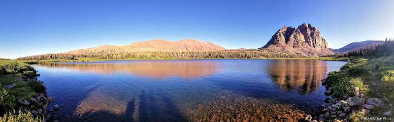
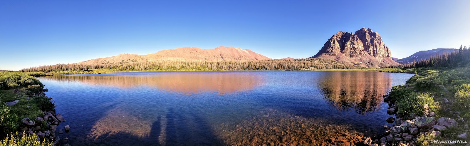
On our way back, we took the lower trail that runs along side much of Lower Red Castle Lake, pausing at the lower end for the reflective view seen in so many pictures taken before us. I also tried a few more casts with my pole here but got nothing.
Finally back at camp, we began to set up for dinner.

In preparing for dinner, I had to go back up trail a little ways to a stream crossing to retrieve some water. While I was filling up the water bag I heard some stirring and a strange moaning noise in the bushes just above me. I stood up slowly not knowing what to expect and became almost instantly paralyzed as I beheld a mother moose and calf not more than about 30 feet away from me. Yikes!
I slowly lowered myself back down almost to my knees and then slowly and quietly moved around some trees next to me before turning and heading back down the trail for camp. In doing so, I realized I had left my water filter next to the stream. I ended up bringing Jess back to see the moose from a safer distance and we waited for what felt like several minutes for the mother and calf to move uphill a bit more before I felt it worth the risk to move in and quickly grab my filter as stealthily as I could.
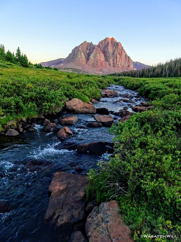
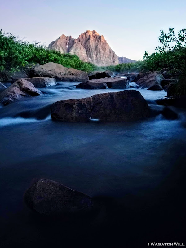
Relieved to have not made the mother nervous enough to charge, we arrived back at camp to get some water boiling for our final night's dinner. While dinner cooked, I walked down below camp in the other direction to the creek to capture some pictures of the last bit of alpenglow kissing the top of Red Castle.
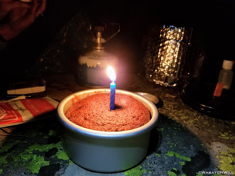
We enjoyed our dinner as the dark of night quickly came upon us. It also grew quite cold, so once more, being well beyond a quarter mile away from the nearest lake, we bundled up to a bit of a fire, while we dry baked a small chocolate muffin to serve as a birthday cake for me. We split it in half as a dessert for the both of us. The whole day made for a very delightful birthday.

Day 4
Thursday - August 27, 2019
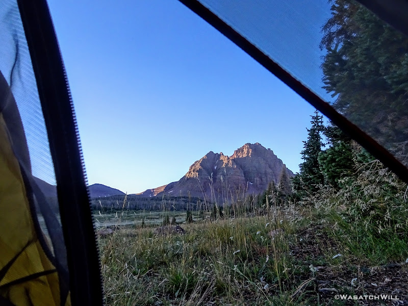
Our final night turned out to be the coldest night of the trip, dipping down into the 20's. All our gear was covered in frost and our water bottles frozen when we awoke. Fortunately, being on the western side of the basin, we had an early sunrise and as soon as the sun was out, we laid out all that we could to be warmed up and dry out a bit while we sat down to breakfast with a view.
At last, we had to say farewell to Red Castle and conclude our trip with a nine mile hike back down to the trailhead. We think it lived up to the hype, but I'd still be just as happy in many other Uinta basins as most all have their own unique charm to them.
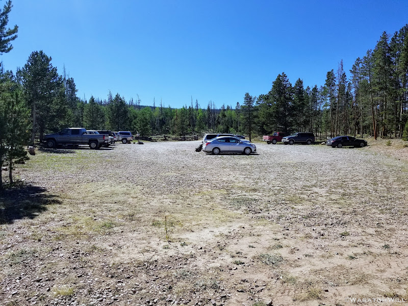
Returning to the trailhead was quite a contrast from when we had started out on Monday. We could barely find space available among several dozen vehicles for our car when we started, but in arriving back, there weren't even a dozen vehicles.
I couldn't be any luckier to have a wife who's willing to put up with the some of discomforts of backpacking to keep me company and share the beauty of such backcountry spaces with. While she didn't succeed in keeping it a surprise, I'm still so glad she made it happen!
Red Castle and its accompanying lakes, along with Kings Peak, might well be the most popular places in the Uinta range not situated along Utah State Highway 150 (aka - Mirror Lake Highway), which bisects the western tip of the Uinta Range and can easily be accessed out of Salt Lake City. Kings Peak, because of its claim to being the state high point, standing at 13,528 feet above sea level, is a must for any serious resident peak bagger and anyone wanting to stand atop the entire state, if only for a moment.
Red Castle on the other hand, doesn't even make it into the top 10 highest peaks of the Uintas, rising only to 12,680 feet above sea level at its highest point, nearly a full 1000 feet lower than Kings. However, what it lacks in stature, it makes up for in beauty and wonder. Its photogenic qualities make it a favorite for landscape photographers, both professional and amateur alike. Indeed, it may well be the most photographed landmark in all the Uintas. Its unique reddish hue, believed to be from traces of oxidized iron, makes it stand out even more so from many other peaks in the range.
Both Red Castle and Kings Peak are rather close neighbors. They aren't exactly next door to each other, but they are indeed in close proximity to each other and if both places are on one's to-do list, they can both be enjoyed as part of a lollipop loop. Such a lolli-loop can be achieved from either the Henry's Fork Trailhead or the China Meadows Trailhead. Since Jess hadn't been up to Kings Peak yet either and had the itch to do it herself, we made such a plan for ourselves. We opted for China Meadows.
Day 1
Monday - August 24, 2019
Having driven up to the trailhead the night before, we selected a campsite at the trailhead, paid the fee, and simply slept in my 4Runner to ensure an early start on the trail in the morning.

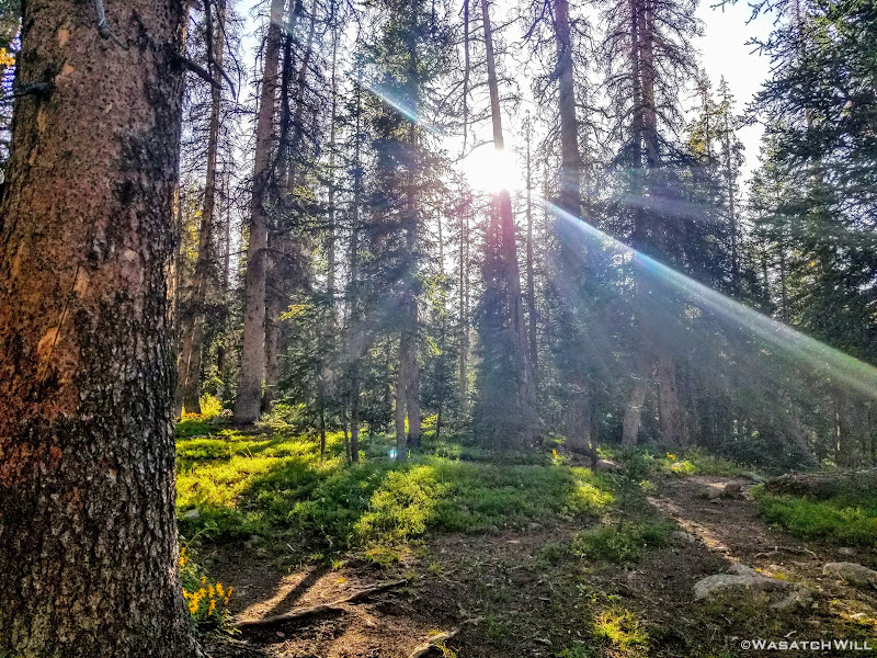
The trail out of China Meadows, like many other Uinta trails, starts out in rather dense tree cover for the first few miles, only occasionally emerging out into a meadow or some other clearing.
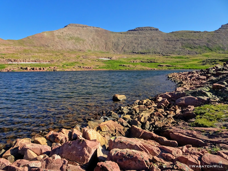
We had decided to make Kings Peak the first priority and save Red Castle for last. That meant a turn to the left at the junction with the North Slope trail. This would take us toward Henry Fork where we'd look for a place to call home for the night in preparation for summiting Kings the following day. Along the way, we pulled off for a quick look around at Hessie Lake.
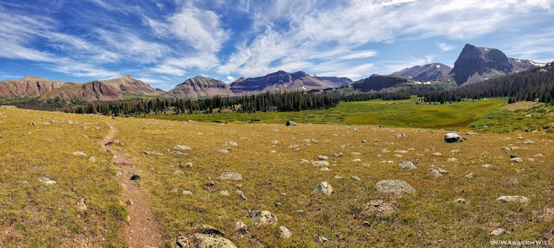
Soon after moving on from Hessie Lake, we lost the trail for a bit but quickly picked it up thereafter, or so we thought. This trail ended up being what turned out to be the Big Meadows Trail and had us heading in the wrong direction. With a coarse correction using the aid of my phone's GPS and downloaded map, we were once again heading back in the right direction and soon picked up our desired trail. Moments later, we were greeted to what instantly became one of my favorite views I'd ever experienced to date in all the range.
There stood the great wide Henry's Fork Basin below our feet spread out in front of us with Kings Peak peaking out beyond the center of the horizon. Gilbert Peak, Gunsight Peak, Dome Peak, Henrys Fork Peak, and the Powell peaks all made up the rest of the horizon. I had been up to Kings Peak twice before, but both approaches were from alternative directions. The first time was via the standard way used by most seeking the summit, directly up from Henry's Fork Trailhead. The second time was part of a hike along a majority of the Highline Trail where the approach was made from across Painter Basin.


Just below the edge of the ridge we were about to descend, we took a well deserved lunch break in the shade of a small stand of trees that also served as shelter from the relentless wind that was beating upon us there and allowed us to continue to soak up the view before us.
Once rested and fed, we were back up and at it, heading down into Henry's Fork.

We soon passed by Bear Lake, not to be confused with the much bigger Bear Lake lying across the northern border of Utah and southern border of Idaho.

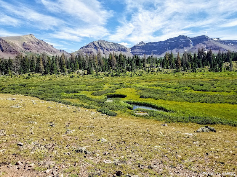
From there we continued through vast meadows, crossing a few streams and bypassing some marshes.


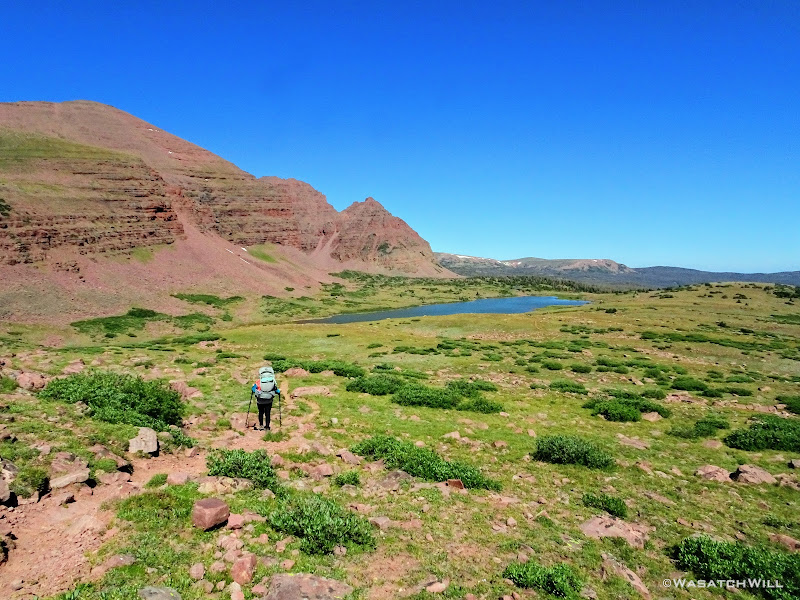
At one point we passed by a small lake with no name and a peak with no name rising above it sticking out from Flat Top Mountain. I quite like the occasional landmark, be it a peak or a lake, with no name. It makes it all feel even more wild and remote and it let's me choose to give it a name myself, or simply leave it nameless. In this instance, I got to enjoy both a nameless peak and lake at the same time and chose to leave them both nameless. Instead, I admired them enough just for their scenic beauty.

Growing quite tired, we took another good rest at Henry's Fork Lake.

Wanting to get a little bit closer to Gunsight Pass for the following morning, however, we picked up our packs and kept the day's journey going a little longer.


Over a half mile later, we settled into a cozy and private little campsite sheltered among some trees, out of sight and sound from the main trail.
I then went out to the nearest water source I could find to retrieve some water. Such source turned out to feature a nice little waterfall.

Back at camp, we cooked up some dinner. We had packed along some fresh greens to include in some burrito wraps we'd make using a Peak Refuel meal. Yum!

With a good hour of daylight left and despite being plenty tired from hiking all day, I got a bit of my own version of restless leg syndrome and sought to explore a bit more around our camp. So I ventured up the hill from our camp and found a trio of moose chowing down on some dinner themselves. Two bulls and a cow.


Back at camp, being over a quarter mile from any of the lakes and outside of the fire restricted zones, I took the liberty to build up a small fire while Jess made some dessert. We enjoyed some tasty cheesecake desserts from Pack-It Gourmet. Yum again!

Day 2
Tuesday - August 25, 2019
Knowing the skies were expected to remain clear all day, we didn't rush getting up to get up to the summit as early as is usually advised. Instead, I decided to let Jess rest up a bit more with some extra sleep while I went out to do a bit more exploring out in another section of the basin I had been wanting to check out. I returned back in the direction of Henry's Fork Lake but stayed higher.
It took a ton of bushwhacking and navigating through and around some marshy bits, and yet more navigation to keep plenty of distance between the resident moose I had stumbled into the night before that were out and about in the same area once again. I finally arrived at a waterfall I had wanted to get a long exposure of before the sun came out. So beautiful and peaceful!


From there, I circled up and around to have a look at Blanchard Lake.

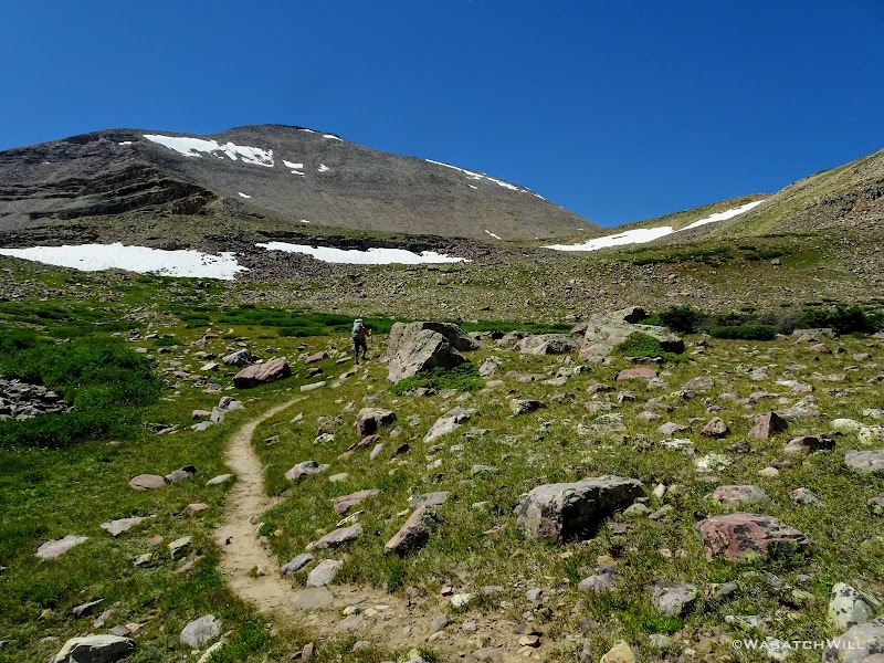
Had I the whole day, I would have loved to explore up higher and all around that corner of the basin some more, but alas, it was time to return to camp, wake up Jess, and be on our way over to Gunsight Pass to make the summit of Kings Peak.


Once over Gunsight Pass, our intent was to take a shortcut path to save ourselves some elevation loss. We must have missed it because we ended up taking a social trail that looked like it was to be it a little further down from where we should have found it and ended up getting ourselves in little bit of a spicy situation. Not willing to return back to the pass to reset, we opted to descend a big boulder field down to the main trail out below us. It turned out to be quite a chore and the whole ordeal ended up costing us a good hour of trail time. As it turned out, the shortcut path we wanted was quite a bit further above the social trail we had followed. Bummer!
We ended up loosing the elevation we wanted to avoid after all and had to hike up the entirety of the trail out of Painter Basin up to Anderson Pass. We took a lunch break partway up, both because it was well into the afternoon by then and to ensure we had adequate fuel in our bellies to power us up the long and high pass.

Once up on the pass, it was time to stash our packs behind some rocks and away from the main trail. Kings Peak now awaited us along the very same ridge.


Three quarters of a mile, a few brief breaks, and lots of boulder hopping and scrambling later, we finally arrived on the summit. We had passed quite a few people on their way back down, but somehow, for the third time in as many times I had now been on the summit, we had it all to ourselves. Guess that's a perk to tackling it later on in the day. Good thing too, because it all became a very emotional moment for Jess.


After several minutes of some celebration and reflection we made our way back down to our packs and set sail down the other side of Anderson Pass.


As we got further down into the Yellowstone drainage, we eventually veered to the right off trail and began traveling cross country a good way until our legs and backs had all they could handle and with one hour of good light left in the day, picked out a virgin site to camp at.
It was absolutely tranquil.

Day 3
Wednesday - August 26, 2019
HAPPY BIRTHDAY...TO ME!
Yes, it was now officially my birthday. We had a great sleep and awoke to blue bird skies once again. We had another big day ahead of us and were both full of excitement having the hardest and highest point of the trip behind us. It was also Red Castle Day! In a few hours, we'd both get to lay our eyes on the infamous Red Castle in real life for the first time and see what all its hype was about.
Packed up, we made way for Smiths Fork Pass.

Once over Smiths Fork Pass, Smiths Fork Pass Lake and East Red Castle came into view.

We pulled over at Smiths Fork Pass for a big break. I tried a bit of fishing here, but got no action on my line.

Moving along, we took a brief detour off trail to set our eyes upon East Red Castle Lake. It was tempting to call it good for the day in this area and set up camp nearby, but alas, I was really excited to also see Lower Red Castle Lake and the greater Red Castle Lake.

We returned to the trail and kept the day's journey going. We passed back into some tree cover and in and out of some meadows with a few flowers holding on here an there.


Finally, the front side of Red Castle came into view. Eager to find a good spot to camp though, we quickly kept pushing down the trail until we reached the bridge crossing over East Fork Smiths Fork Creek and the junction with Smiths Fork Trail. From there we found an available and adequate site nearby and a couple hundred feet off trail as desired.
With camp setup, we loaded up our little summit packs with some snacks, and fishing gear and went up trail to get closer up to Red Castle and all its majesty. We opted to take an upper trail from near our camp that took us in the direction of Red Castle Lake. We'd pass through some beautiful forest and several different campsites, some occupied, some not. Once back out in the open, we found ourselves looking out on the west face of Red Castle now as the trail lead us above tree line and by a shallow unnamed lake lying at the foot of the bench holding Red Castle Lake.

With one more short uphill surge, we reached the shores of Red Castle Lake.


Jess just wanted to sit, rest, and take in the scenery surrounding us. I was eager to test the fishing, so I set up my pole and got to work. The fishing turned out to be pretty good for me. In between getting my lures snagged a few times in some rocks, I was able to reel in a few Tigers.

As much as I wanted to keep it going with the fishing, the sun had now fallen behind the mountain to the west of us, signaling to us that it was time to pack back up and move on back down to camp if we wanted to have much light left to cook dinner.

On our way back, we took the lower trail that runs along side much of Lower Red Castle Lake, pausing at the lower end for the reflective view seen in so many pictures taken before us. I also tried a few more casts with my pole here but got nothing.

Finally back at camp, we began to set up for dinner.

In preparing for dinner, I had to go back up trail a little ways to a stream crossing to retrieve some water. While I was filling up the water bag I heard some stirring and a strange moaning noise in the bushes just above me. I stood up slowly not knowing what to expect and became almost instantly paralyzed as I beheld a mother moose and calf not more than about 30 feet away from me. Yikes!
I slowly lowered myself back down almost to my knees and then slowly and quietly moved around some trees next to me before turning and heading back down the trail for camp. In doing so, I realized I had left my water filter next to the stream. I ended up bringing Jess back to see the moose from a safer distance and we waited for what felt like several minutes for the mother and calf to move uphill a bit more before I felt it worth the risk to move in and quickly grab my filter as stealthily as I could.

Relieved to have not made the mother nervous enough to charge, we arrived back at camp to get some water boiling for our final night's dinner. While dinner cooked, I walked down below camp in the other direction to the creek to capture some pictures of the last bit of alpenglow kissing the top of Red Castle.


We enjoyed our dinner as the dark of night quickly came upon us. It also grew quite cold, so once more, being well beyond a quarter mile away from the nearest lake, we bundled up to a bit of a fire, while we dry baked a small chocolate muffin to serve as a birthday cake for me. We split it in half as a dessert for the both of us. The whole day made for a very delightful birthday.

Day 4
Thursday - August 27, 2019
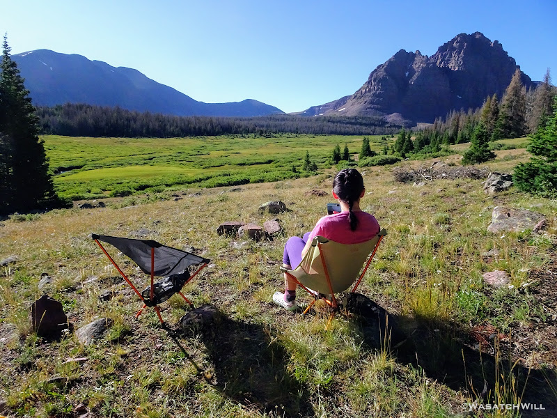
Our final night turned out to be the coldest night of the trip, dipping down into the 20's. All our gear was covered in frost and our water bottles frozen when we awoke. Fortunately, being on the western side of the basin, we had an early sunrise and as soon as the sun was out, we laid out all that we could to be warmed up and dry out a bit while we sat down to breakfast with a view.


At last, we had to say farewell to Red Castle and conclude our trip with a nine mile hike back down to the trailhead. We think it lived up to the hype, but I'd still be just as happy in many other Uinta basins as most all have their own unique charm to them.

Returning to the trailhead was quite a contrast from when we had started out on Monday. We could barely find space available among several dozen vehicles for our car when we started, but in arriving back, there weren't even a dozen vehicles.

I couldn't be any luckier to have a wife who's willing to put up with the some of discomforts of backpacking to keep me company and share the beauty of such backcountry spaces with. While she didn't succeed in keeping it a surprise, I'm still so glad she made it happen!
 Loved the Moose - they are a sign of a healthy ecosystem. Looking forward bagging King's in a few weeks as I hike the UHT from East to West!