4 days 3 nights in the Uintas

2eez4life

Member
Joined
Oct 10, 2018
Messages
29
Wanted some feedback about a good 4 day 3 night backpacking trip in Uintas. Been alot of places in Uintas, but haven't ever had more than 2/3 days. Wanting to get into some zones that I couldn't previously. Trying to keep it at less than 30 miles rt. Fishing is a consideration. Loops are preferred. less popular is always a plus.
Problem is right now I have too many ideas:

East Fork Bear River to Allsop and connect with Priord and back.
Naturalist Basin (from highline) connecting to four lakes and back.
I'm assuming both Rock Creek and Lake Fork are off limits due to the fire last season.
Garfield Basin out and back from center park trail.
Henry's Fork Basin - out and back.
Burnt fork to island, then fox and back
West fork white rocks TH to queant

Any advocating or feedback on these routes or others is welcome.
 
Garfield Basin is very cool and seems more secluded than other areas. Only been there once but it was 4th of July weekend 2 years ago and I only saw 2 other people in that basin. I started from the Swiftcreek trailhead since it was part of a bigger loop hike (55 is miles) so not sure how the Center park trail is but I bet it's more scenic to get to Garfield basin than Swiftcreek was. There is a lot to see up in Garfield basin. Great views from Doll lake, Tungsten lake is very cool. And if you are that close, you might as well go up to Wilson Peak. The views up there are incredible, especially overlooking Red Castle. On the way up to the peak you also get a great view from Porcupine Pass. Might be a little over 30 if you go to the peak though.

Henry's Fork is also well worth doing, especially if you haven't done Kings Peak. Don't think it's any better than Wilson Peak but I always think its cool to get to the highest point. You will see way more people there though. Usually pretty crowded.
 
We did Garfield Basin from Center Park last year and mixed in a summit of King's peak. I think it was 3 nights...camped at Swasey, Tungsten, and then by Spider on they way out. It wasn't my favorite basin but it was something new. Solid. Had nice big views once you get up there. Plenty of area to explore, I'm bummed we didn't check out Doll Lake (since priz1234 said it was cool).

Allsop and Priod are both cool (I've never connected in the same trip). Each of those basin's are kind of a "one trick pony" in my book. But cool basins. We summitted The Cathedral on one trip. Pretty fun.

Rock Creek has plenty to explore (not sure where the fire was exactly). We did a point to point over Deadhorse and Rocky Sea and it was fun.

I didn't love Fox Lake. Crescent (right nearby) had fun fishing for ok sized cuts (if I remember right).
 
Garfield Basin is very cool and seems more secluded than other areas. Only been there once but it was 4th of July weekend 2 years ago and I only saw 2 other people in that basin. I started from the Swiftcreek trailhead since it was part of a bigger loop hike (55 is miles) so not sure how the Center park trail is but I bet it's more scenic to get to Garfield basin than Swiftcreek was. There is a lot to see up in Garfield basin. Great views from Doll lake, Tungsten lake is very cool. And if you are that close, you might as well go up to Wilson Peak. The views up there are incredible, especially overlooking Red Castle. On the way up to the peak you also get a great view from Porcupine Pass. Might be a little over 30 if you go to the peak though.

Henry's Fork is also well worth doing, especially if you haven't done Kings Peak. Don't think it's any better than Wilson Peak but I always think its cool to get to the highest point. You will see way more people there though. Usually pretty crowded.
Thanks for the input. always appreciate a good summit and off trail lake recommendation!
We did Garfield Basin from Center Park last year and mixed in a summit of King's peak. I think it was 3 nights...camped at Swasey, Tungsten, and then by Spider on they way out. It wasn't my favorite basin but it was something new. Solid. Had nice big views once you get up there. Plenty of area to explore, I'm bummed we didn't check out Doll Lake (since priz1234 said it was cool).

Allsop and Priod are both cool (I've never connected in the same trip). Each of those basin's are kind of a "one trick pony" in my book. But cool basins. We summitted The Cathedral on one trip. Pretty fun.

Rock Creek has plenty to explore (not sure where the fire was exactly). We did a point to point over Deadhorse and Rocky Sea and it was fun.

I didn't love Fox Lake. Crescent (right nearby) had fun fishing for ok sized cuts (if I remember right).
How rugged was Center park trail? Good camping in Garfield? What was not impressive?
Caltopo fire history will show you the fire overlay, it is pretty awesome.
How did you approach Fox/Crescent?
 
Hmm...my memory isn't the best but it seems as if Center Park Trail was neither easy nor rugged. Kind of a mixed bag. I remember lots of ups and downs on the way in to Swasey which was a little frustrating to my out-of-shape body. :) After that it seemed to be a little more gentle. I think there were plenty of good spots for camping. I think the thing that left me slightly unimpressed was how wide and spread out it was (in general). I like basins that are a little tighter with peaks that are less roundy and have more prominence. That said, it was still an awesome area. Definitely worth exploring. Some links if you want to see our write ups and pictures:

Mine
My friend Lane's

That fire history layer is cool. Certainly looks like Rock Creek Basin got destroyed. I wonder how "accurate" it is. Looking at that data you'd think the entire basin burned to the ground. I wonder what it actually looks like up in there. Do you what this means on the bottom of the page?

1627748721027.png


It looks like a portion of the Center Park Trail got burned too!

I visited Fox via Queant with the scouts one year. It seems like Queant is just out of the wilderness boundary so we were able to camp with more than just 12 (or whatever the limit is). (So I think it was the West fork white rocks trailhead that you're talking about). Queant was about 3 miles from the trail head.

Oh...and one more thing I didn't love about Fox and some of the lakes in Garfield were the man-made structures (dams or weirs or whatever).
 

Attachments

  • 1627748717718.png
    1627748717718.png
    20.7 KB · Views: 10
Yeah one thing I hadn't considered was how low those manmade lakes in Garfield would be. Might be pretty low this year due to the low snowpack this winter. Garfield definitely isn't that narrow of a drainage, I do think the best parts of it are further up the drainage. Closer to Tungsten, and North Star lake and up to Porcupine Pass.
 
Hmm...my memory isn't the best but it seems as if Center Park Trail was neither easy nor rugged. Kind of a mixed bag. I remember lots of ups and downs on the way in to Swasey which was a little frustrating to my out-of-shape body. :) After that it seemed to be a little more gentle. I think there were plenty of good spots for camping. I think the thing that left me slightly unimpressed was how wide and spread out it was (in general). I like basins that are a little tighter with peaks that are less roundy and have more prominence. That said, it was still an awesome area. Definitely worth exploring. Some links if you want to see our write ups and pictures:

Mine
My friend Lane's

That fire history layer is cool. Certainly looks like Rock Creek Basin got destroyed. I wonder how "accurate" it is. Looking at that data you'd think the entire basin burned to the ground. I wonder what it actually looks like up in there. Do you what this means on the bottom of the page?

View attachment 100371


It looks like a portion of the Center Park Trail got burned too!

I visited Fox via Queant with the scouts one year. It seems like Queant is just out of the wilderness boundary so we were able to camp with more than just 12 (or whatever the limit is). (So I think it was the West fork white rocks trailhead that you're talking about). Queant was about 3 miles from the trail head.

Oh...and one more thing I didn't love about Fox and some of the lakes in Garfield were the man-made structures (dams or weirs or whatever).
Thicc basins indeed. Thanks for the info.
I dunno what the colors mean and not sure the actual extent of the damage. Those trailheads are still closed though if I'm not mistaken.
 
Yeah one thing I hadn't considered was how low those manmade lakes in Garfield would be. Might be pretty low this year due to the low snowpack this winter. Garfield definitely isn't that narrow of a drainage, I do think the best parts of it are further up the drainage. Closer to Tungsten, and North Star lake and up to Porcupine Pass.
it always gets better, just a little further.
 
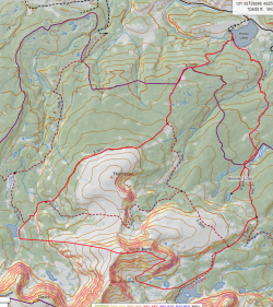
If anyone has some idea on if this is possible, going up and over North Burro Peak to make a trip connect to Island lake that would be really cool.
Beaver Creek Drainage.
Screen Shot 2021-08-01 at 9.23.50 PM.png
 
Back
Top