2024 CO Plateau conditions

the Swell last weekend (April 12-14) was a bit warm. minor cedar gnats and a handful of mosquitoes in Cottonwood Wash in the 5000-6500' range. plenty of water is available at the moment. LOTS of mosquito larvae in the larger potholes so the canyon bottoms might be buggy soon.
 
Southern Escalante (week of 4/21/2024)
Elevation range visited:
5200-6600'
Potholes: no water on the mesas
Biting insects: minor cedar gnats and mosquitoes on the mesas, a few mosquito swarms along the Escalante River (did not camp along waterways)
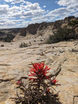
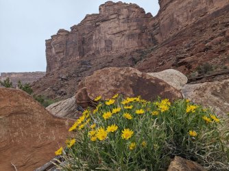
Wildflowers: blooming

PXL_20240421_220518178.jpeg
 
Couple skeeters in the Glen Canyon area.

HITR road bumpy but dry and passable to most vehicles to at least Fiftymile.

Found a couple nice potholes in the Navajo.
 
Up on the waterpocket fold in the 5500-6500' range there's still some water. Ran into a older guy from the Notom ranch who was out looking for bighorn sheep, which apparently have had a tough time of it recently in that area (and we didn't see any of them, or any recent signs). He said it there was a big rain ~5 weeks ago that flashed some of those canyons, so that's why it's still a bit wet. We had minor cedar gnats and just a couple mosquitoes. It was very warm both at night and during the day.
 
SW UT (week of 5/20)
Elevation range visited:
3900-8800'
Water: creeks and springs flowing
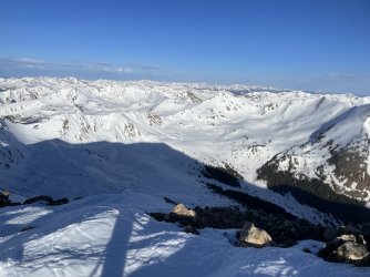
Snow: remaining patches starting at ~8K
Roads: good condition
Biting insects: prolific cedar gnats and deer flies in the trees and around water starting at ~6000'
Wildflowers: blooming
Rattlers: out at 6500' and lower
 
Last edited:
Memorial Day and Post Memorial Day stuff off HITRR...

HITRR
Do not let the first 8-9 miles fool you. There are some ok stretches, but plenty of washboard and sand that is getting worse. A couple of rancher trailers went by with tires dragged behind to try and help, but it's a real bumpy ride.

Surprisingly, bugs were not bad yet. Some gnats and flies, but with the days getting hotter those will get worse.
I ended up with a few bites around my ankles. I was wearing long pants and a sunshirt, so that might have been the only good skin exposed.
I saw a couple nude hikers in the distance. I took a long break in an alcove to make sure I did not have to follow any cracks around. If I went nude that would be an itchy, scratched up, tomato-colored mess.

Flowers were blooming. The birds and the frogs were singing.
The 80d heat was too much for me, and a 45d bag was too much at night.
 
Lower Paria:
Water ankle-deep and fairly clear.
No mosquitos or cedar gnats.
Biting flies got progressively annoying the lower down the canyon we got. Not too terrible though (we never seriously considered changing into pants because the heat was worse than the bugs)
Problematic mice in the popular campsites near the confluence with Buckskin.
Buckskin is completely dry until right near the confluence.
The various springs off of the Paria are flowing well.
 
If I went nude that would be an itchy, scratched up, tomato-colored mess.
All that, plus it would be so uncomfortable where the pack rubs. I can't understand why nude hiking would be pleasing, other than for shock value!
 
SW UT (week of 5/27)
Elevation range visited: 7
000-9400'
Water: creeks and springs flowing
Snow: sparse patches starting at ~8.5K+
Roads: good condition
Biting insects: few
Wildflowers: blooming

PXL_20240530_225533599 (1).jpg
 
All that, plus it would be so uncomfortable where the pack rubs. I can't understand why nude hiking would be pleasing, other than for shock value!
Where a shirt.
 
SW UT (week of 6/1)
Elevation range visited:
7500-10400'
Water: creeks and springs flowing
Snow: sparse patches on northern/shady faces at ~9K' and up; melting fast
Roads: good condition
Biting insects: few
Wildflowers: blooming

PXL_20240606_235643395.jpg
 
SW UT (week of 6/23)
Elevation range visited:
3800-10,000'
Water: mainly spring-fed water sources remain
Snow: nearly gone
Biting insects: clouds of mosquitos in boggy areas; some horse/deer flies
Wildflowers: blooming

PXL_20240626_004505188.jpg

PXL_20240625_212714146 (1).jpg
 
SW UT (week of 6/30)
Elevation range visited:
3800-11,000'
Water: some spring-fed streams still running
Snow: nearly gone
Biting insects: few, but it was windy at elevation
Wildflowers: blooming
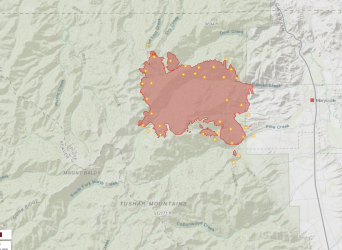
Fires/smoke: Was OK, but now there's a large, rapidly spreading fire in the Tushars. It was almost 11K acres 2 days in. The fire cause is listed as lightning. We were hiking at Brian Head on the 5th with views of the Tushars, and saw no smoke from this fire nor any thunderheads, so it must have happened later in the day.

Screen Shot 2024-07-08 at 9.51.04 AM.png
 
SW UT (week of 7/7)
Elevation range visited:
3800-11,700'
Water: Some spring-fed streams still running.
Snow: Snowfields remain in the Tushars at 11K+ on shadier aspects.
Biting insects: Mosquitoes and deer flies active at 9K'+.
Wildflowers: Blooming at higher elevations
Fires/smoke: Situation changing rapidly with new/spreading fires. Cedar Canyon/Cedar Breaks was clear prior to the new Graff Point Fire S of Cedar. The Tushars had some haze, but it was better than expected with the 2 large fires to the NE and S. The E side of the ridge line is now closed due to the Silver King fire, but Mt Holly and Delano Peak remain accessible.

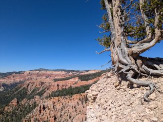
Cedar Breaks on 7/8
PXL_20240708_220955312.jpg
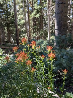
PXL_20240708_225117023.jpg

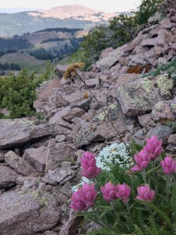
Tushars on 7/12
original_909551b8-9ae8-467e-9081-fc5d47658080_PXL_20240712_174452121.jpg
 
Anybody been out recently? I'm looking at Dark Canyon/Bowdie area in 2-3 weeks. I see that basin is average for the water year that just ended on Oct. 1, above average for August, but September was very dry.
Even if you haven't been in that area, just general info for southern Utah water would be helpful.
 
Back
Top