Kullaberg63
Member
- Joined
- Mar 6, 2014
- Messages
- 659
For a while I have wanted to do a 15 day trip with no resupply.
The main experiment was the many days: it’s been decades since a similar type unsupported trip. We were also looking for mostly trailless terrain with the occasional scrambling and light rope work; plus the route should have no crossings of roads or mid trip proximity to trailheads. The larger mountain ranges in the lower 48 can all accommodate these criteria but I would need to carry two bear canisters to fit 26 pounds of provisions plus 8 lbs of dog food
So the focus shifted to the Colorado plateau. While remote and desolate I know from experience that few areas are big enough to avoid jeep roads at some point during a trip of this length. An obvious choice, the Grand Canyon, was out because of no dogs
But one stunning, ruggedly complex region near Glen Canyon do qualify on all points, while also adding the potential charm of not seeing anyone else during the entire trip. I have familiarity with the area and know that trips can be even 30 days if one’s body allowed that sort of pack weight
We chose late November because the Plateau is at its best with low sun and long shadows; and frosty nights and sunny frigid days are my kind of conditions
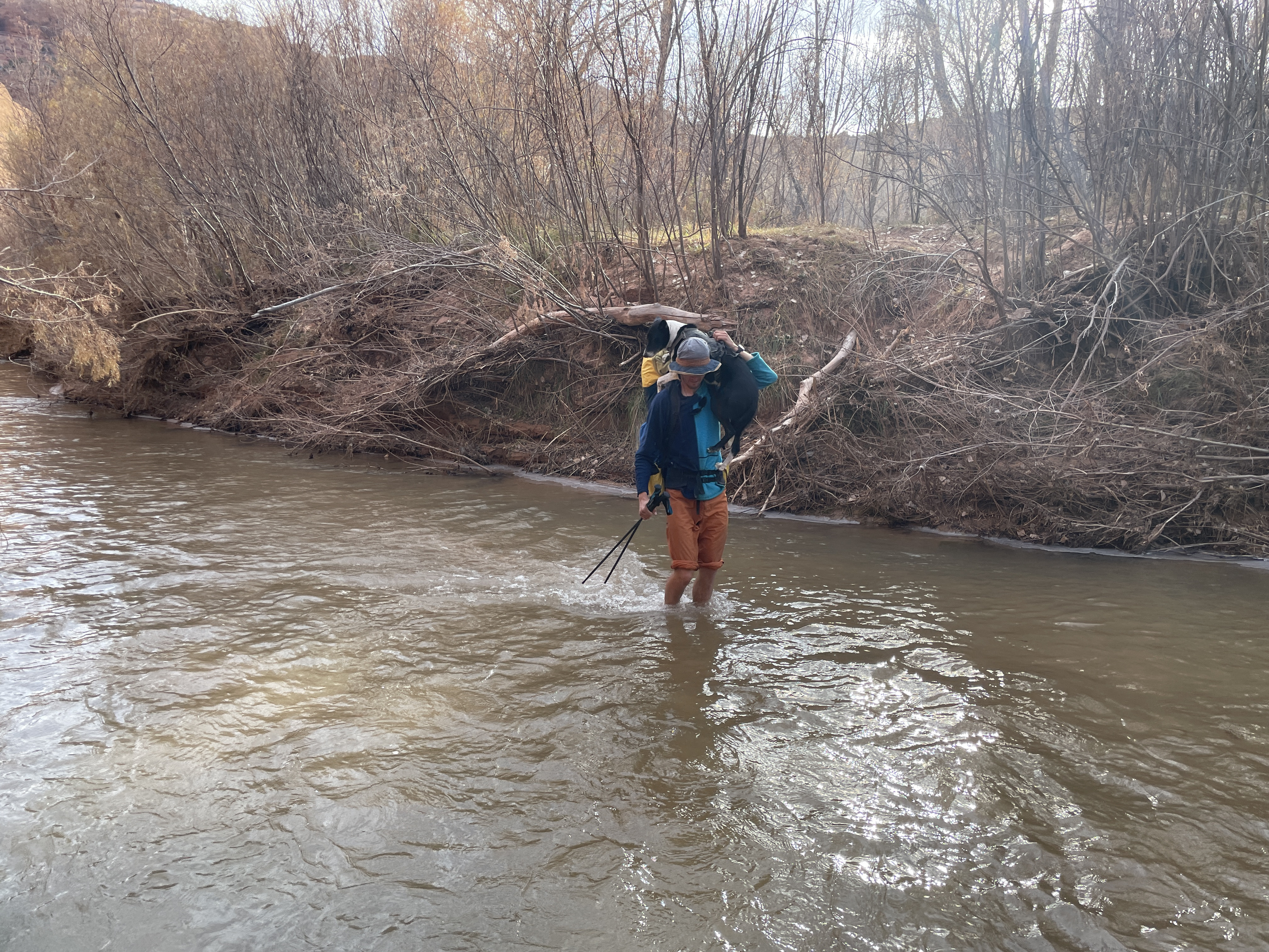
As water is a major issue all throughout this area we were hoping to hit it at the tail end of a real storm, but no, it was as dry as I’ve seen it. However, the rare light precipitation of fall do linger in the potholes longer compared to the rapid evaporation of the summer rains, especially if they freeze over. Besides the brief encounters with the river we saw one flowing creek and two springs meaning nearly all our water needs were sustained by spending a good deal of time hunting for potholes. Anyone familiar with Colorado Plateau hiking will know this pattern. The dog’s affinity for sniffing out hidden filled holes as opposed to dry ones was helpful, if one pay close attention to his signals. On a couple of occasions we had to tank up with a gallon each and ‘dry’ camp
The risk of early season snow at that time is a serious concern as the miles of exposed and angled slickrock pared with the difficult key passages will become impassable with a thin veneer of snow, effectively stranding you. We rode out three storm cycles dropping lots of fresh on the nearby mountains, but just mere sprinkles in the canyons
We picked an access point behind the tilted rocks of a major geological feature and laid out some rough ideas on a map: descend a non technical, gorgeous canyon to the main water course in the area; pick up the lower eight days of a legendary Steve Allen route and garnish it with digressions to areas we’ve been studying on satellite for years
The Allen section of our route did not disappoint. A strenuous and serious route with the bare minimum of info at the back one of Allen’s books (and really no additional hints online), it goes without trails or cairns in and out of steep canyons, across vast plateaus of buttes and valleys, and via the most notoriously difficult, exposed sections it travels deep down to the river and immediately back up through some weakness on the other side
Often the route use obscure historic stock trails to link features. While exposed and improbable and hard to locate, these are generally low stress. At the other end of the safety spectrum are the prehistoric lines of Moqui steps: rows of little footholds carved into impossibly smooth walls, weathered and worn by centuries of erosion. The canyons hide hundreds of these ancient access points, some of which are basically long pitches of upper fifth class climbs with zero protection. The Moqui steps on the Allen route do benefit from ropes but are typically not super dangerous
In between cattle trails and prehistoric climbs are the routes Steve ratted out when putting the route together back in the nineties. Given the vast size of the terrain and the difficulty of moving around it must have taken season after season of trips in there for him to locate these absolutely key passages that all goes just below the ‘too difficult’ level
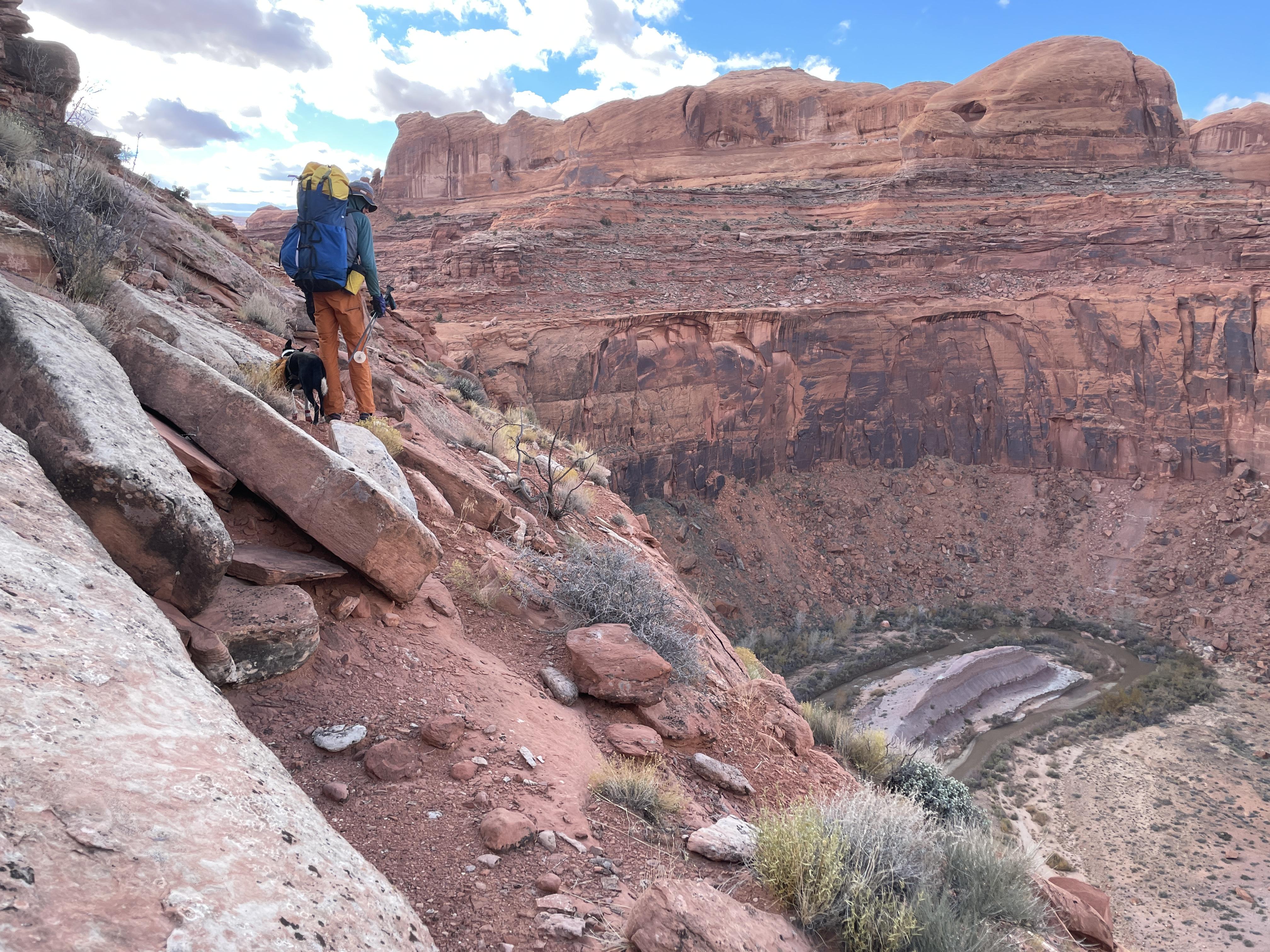
After all this we found the hole-in-the-wall cattle trail leaving the river. Here we turned 180 degrees to link together a five day route back to the car, involving crossing or ascending major canyons we only knew of from the USGS quads on our phones
Nights hit the teens in the early morning and days ranged from way below freezing along the shady canyon bottoms to mid forties in the open. An icy breeze ruled the plateaus, which became a real factor as the effects of a minimal diet and hard hiking piled on.
I brought a 28°F hoodless mummy bag, an Alpha overbag with hood and a torso sized ProLite combined with a specially sourced tough 1/8” full length EV50 pad. My bags are warm so I used spare clothing for pillow, as usual
When not cowboy camping we used a 9x9 mid for the two of us and the dog, creating a cozy, out of the wind space to cook and hang out on the long dark evenings.
With the days being generally cold I used an Alpha lined windshell over a wool base hoodie quite a lot. Alpha lined wind pants over my hiking pants were invaluable in camp, pared with a super puffy down vest.
I made morning coffee on isobutane, but otherwise used a twig stove for dinners and lots of hot drinks - truly a success due to ambiance, mood and low weight. We often had a warming mug of tea or coffee with lunch, especially towards the end.
Food worked out, and mostly based on a tried and true diet: 1.6lbs with 3100 cal per day. It consisted of the same stuff every meal with only very minor variances - the repetitiveness almost got to me in the end, yet the fact that I could pull off a long strenuous trip with no hiker hunger made me somewhat appreciate even Probar #28
My pack was 70 liters plus pockets and weighed just under 50lbs on day one. This included dog stuff, ropes and water
The dog did fine. We lowered and hauled him when our packs needed the same. His front paws got a tender spot, thankfully without cracks or tears, around day 8. Hiking with booties for a while healed them up until the last day. He has a thin coat and was historically bred for all day herding duty in hot weather, so keeping him warm during the long nights takes a ridiculous level of care. He carried his pack until day 11. At that point my load was manageable so I took his stuff
Gear that disappointed:
My son’s Aqua Mira bottles developed a dosing issue and later a leak, leaving us with just my set
The Challenge Ultra Weave bottom of my pack got several penny sized holes from butt-scooching down steep abrasive sandstone slabs. The other pack with 1000d Cordura bottom merely got fuzzy. That pack was 5 lbs heavier than mine and we both had medium/soft stuff packed low
My sungloves was shredded in the palms from scrambling by day 7. With the sustained cold some of those knitted work gloves with plasti-dip palms and fingers would have ruled
Even with the moderate lows my isobutane canister needed time in the sleeping bag to deliver. No surprise here, but kinda annoying for a guy used to liquid fuel stoves
One of our 1.5 L Smart Water bottles bit the dust early from hauling packs or throwing them off ledges. Shortly thereafter we luckily found a Nalgene neatly sitting on a rock. Later a 3 liter soft flask got a pin hole, again from beating up the packs in tight spots
Done with fanny packs
Dog booties slip and roll, even with tight Gorilla tape on the narrow part of the ankle. They also shredded after 25 miles and does not allow the crucial use of the nails. A better solution for us is an inner layer of white athletic tape covered with a generous wrap of Gorilla tape on top. The nails are in the open, the pads can breathe and they last 3 days at least, and then can be rebuilt with minimal supplies. My dog has cat-like narrow paws which may be why this works so well
An outing of this caliber with such stunning terrain and continuously interesting hiking amazingly shows no signs of use. This is likely due to the abundant expert terrain pared with very demanding navigation even in the age of phone GPS, a factor that probably spread the already limited groups out over a number of different routes. All this in a hard to access region requiring a big commitment of time and planning. We did 160 miles with only 5 or so on trails. I didn’t record a GPX track and only took a few pics, but if you’re a seasoned desert traveler with the appropriate Allen book, an adventurous spirit and some sound risk management go find this stuff
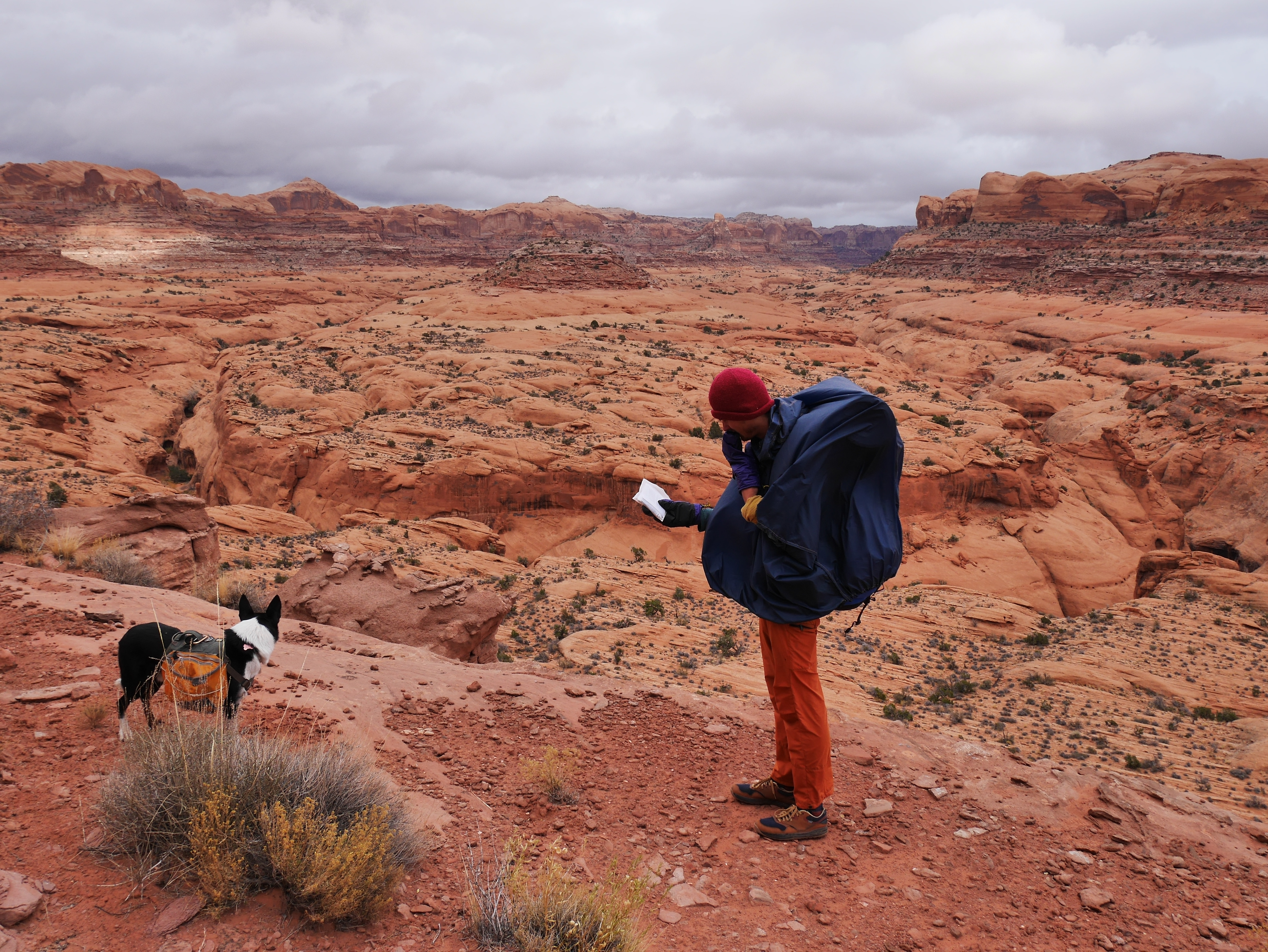
The next 4 hours of complex route finding up and around this canyon system is covered by a single terse sentence in the notes.
Kayenta benches are your friends
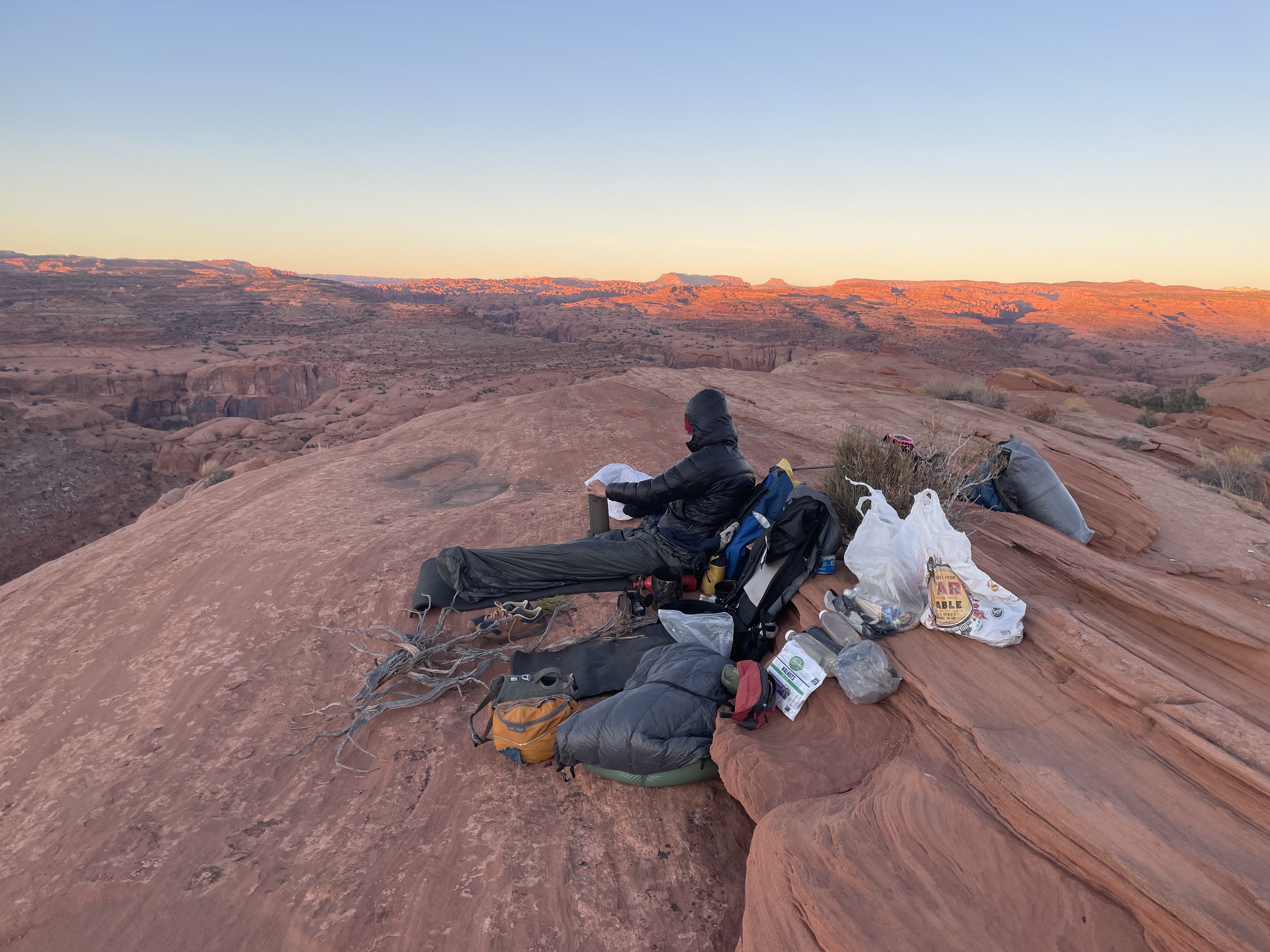
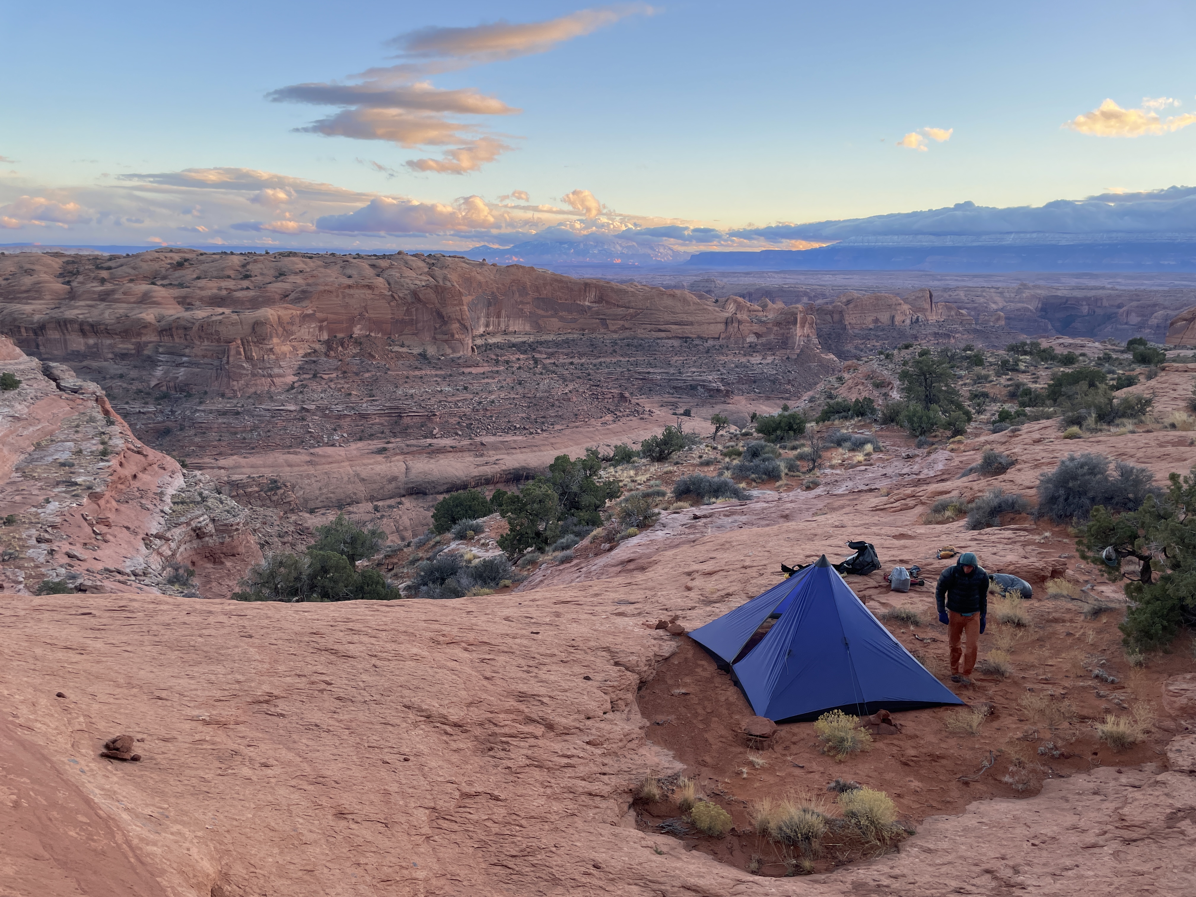
Plateau camp. Cold and exposed to wind, but hey
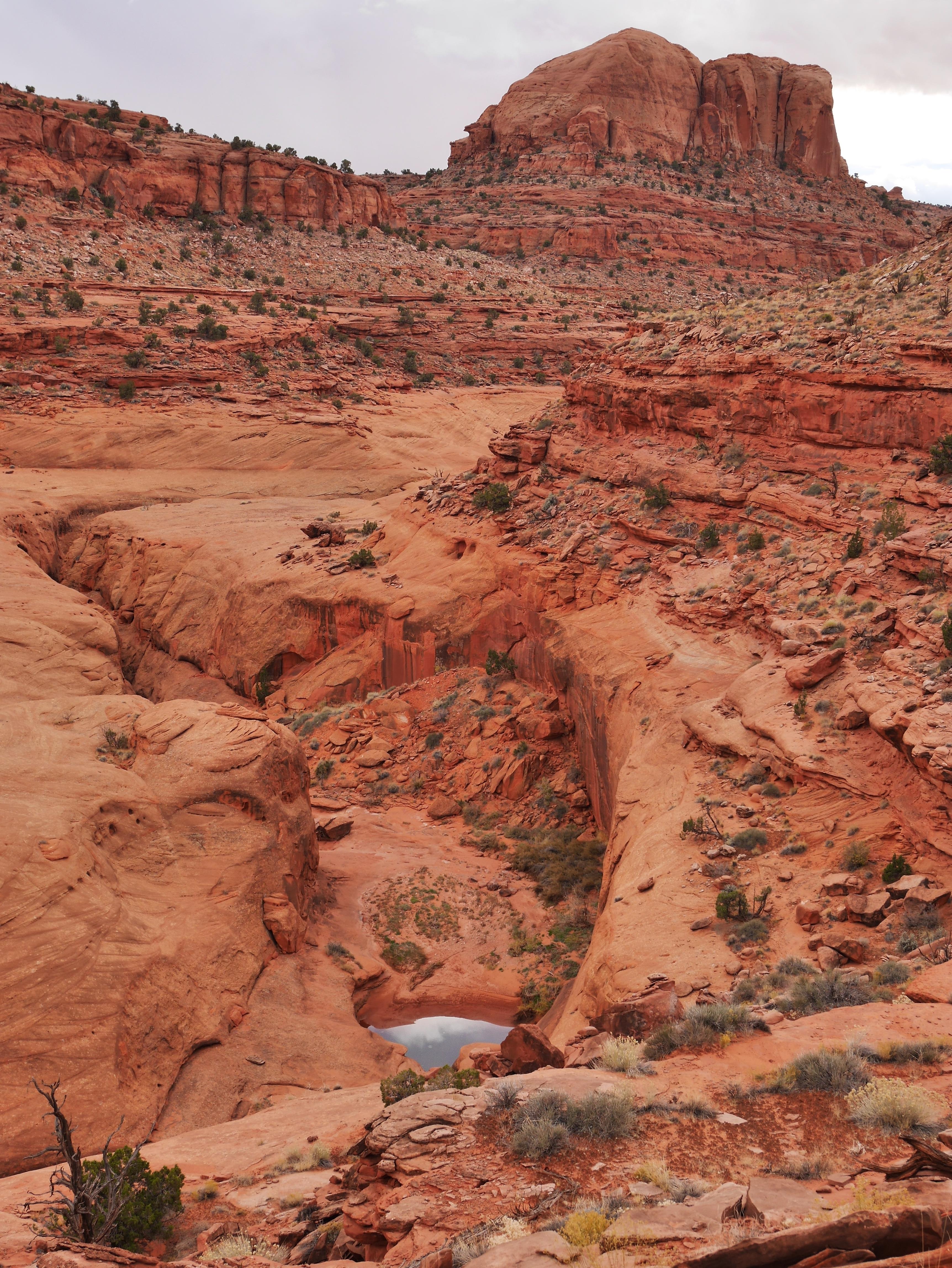
Cattle route followed by our only water epic - don't leave a perfectly good pothole untapped at 4pm
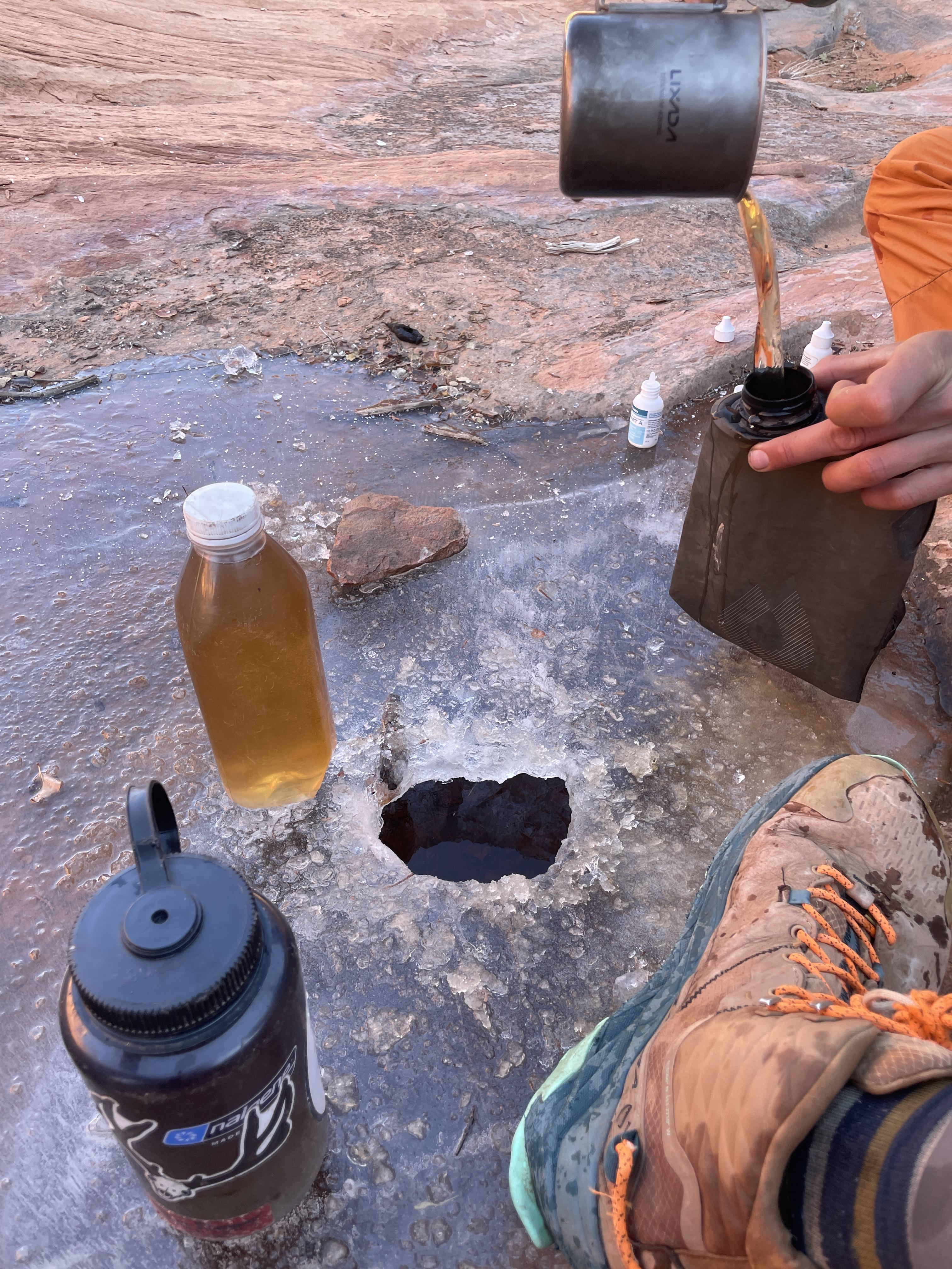
Sweet tasting water despite the piss color
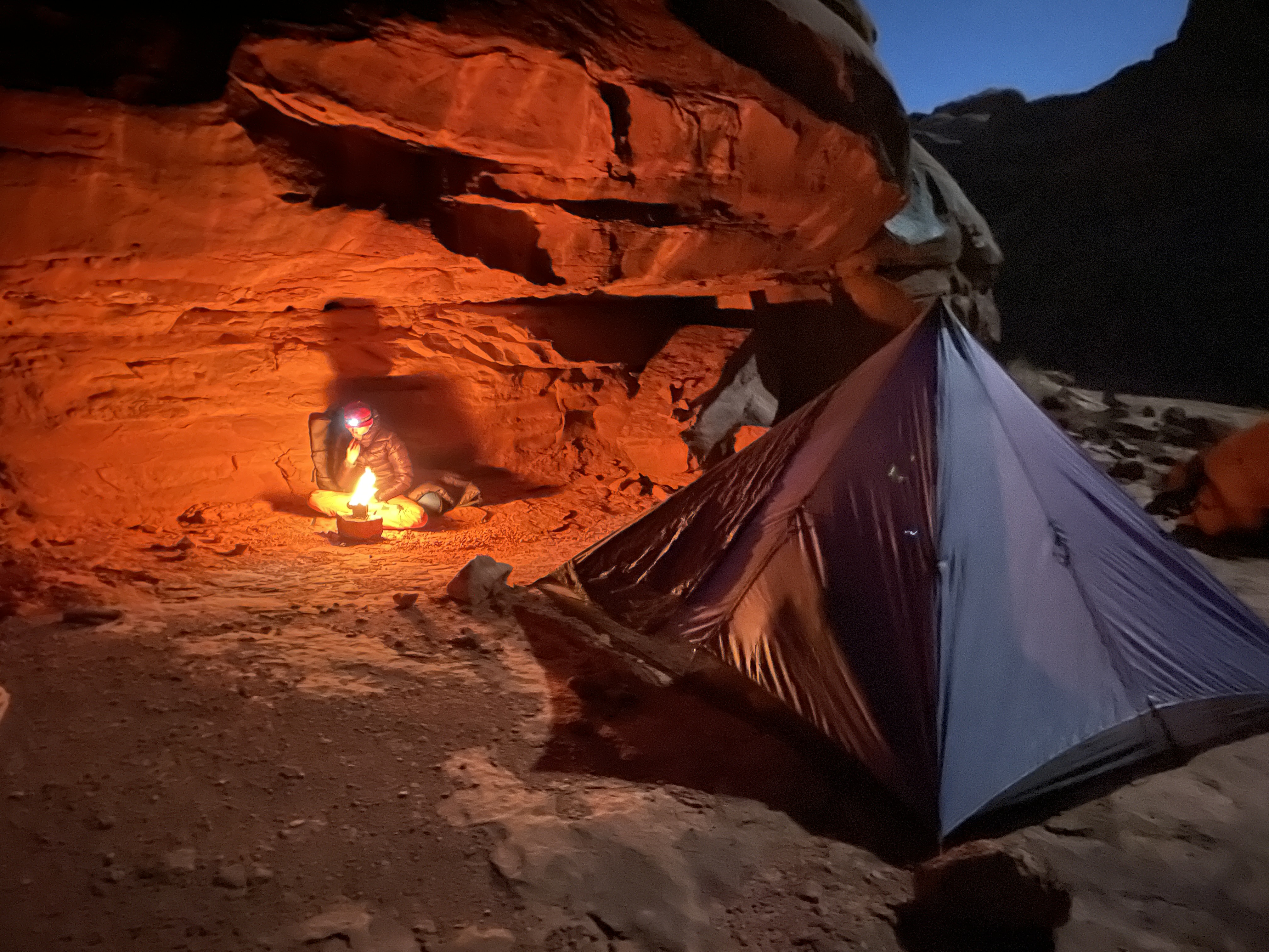
Twig stove and snug alcove
Wet sand after a quick shower still doesn't hold @stakes
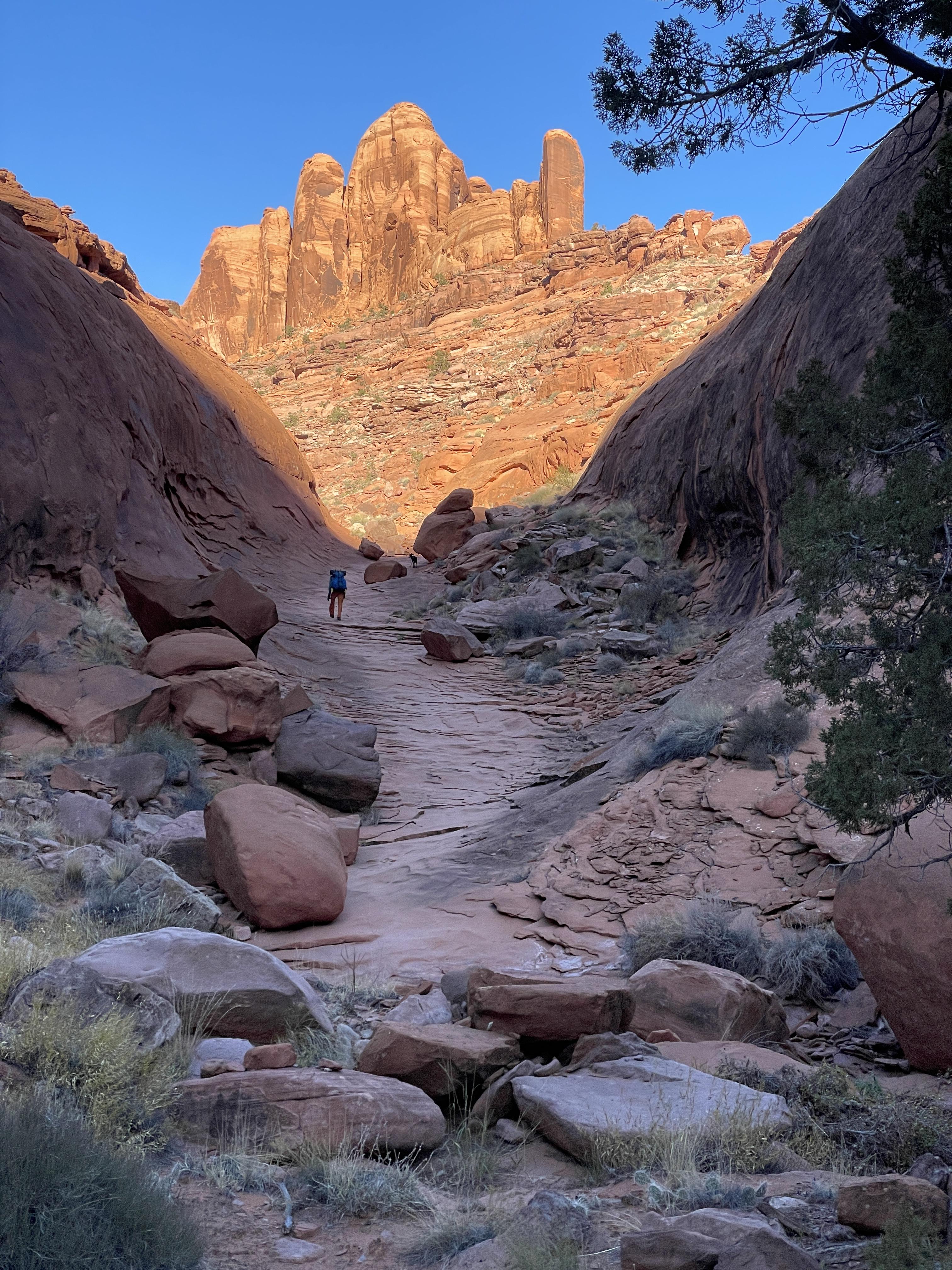
Bighorn Route
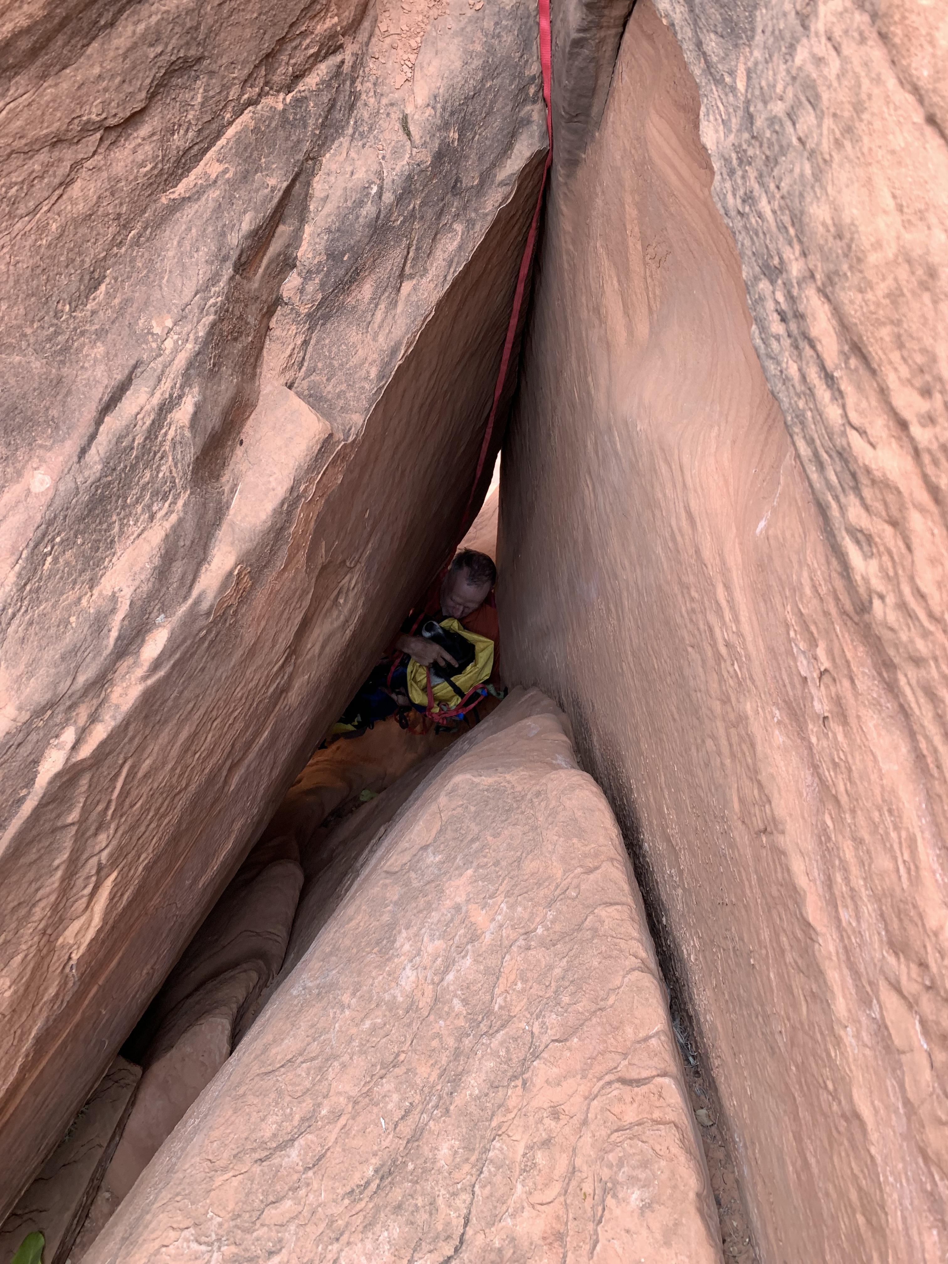
Dog in pack belayed on rope and held by nervous owner
Record breaking pothole! Now how to get there? (Moqui steps). Zoom in and study left wall above water and notice the exit steps
Late in the day already at 30°F. Don't want wet dog at camp.
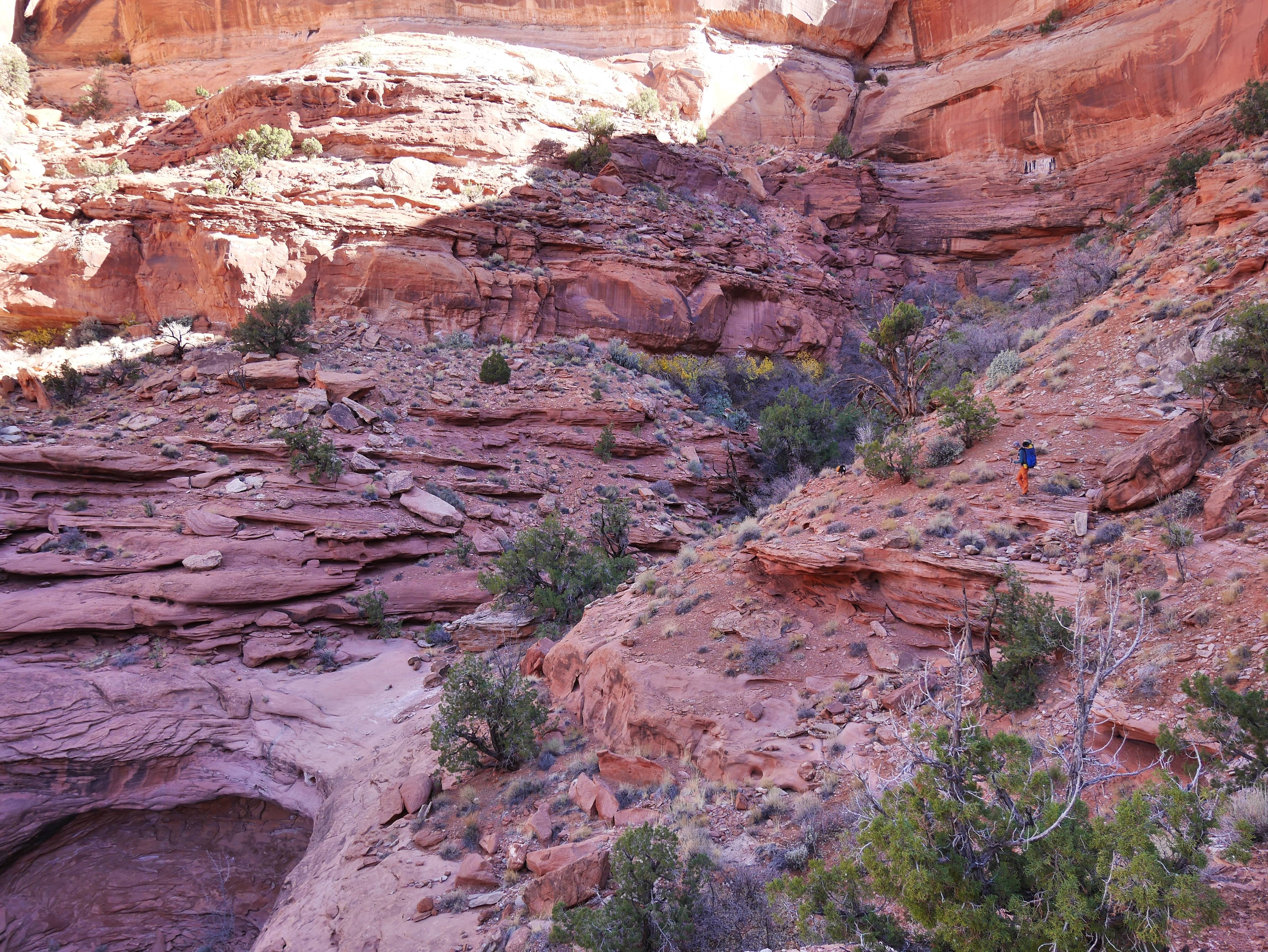
To see the kind of kayenta bench we are traversing look across the canyon
The main experiment was the many days: it’s been decades since a similar type unsupported trip. We were also looking for mostly trailless terrain with the occasional scrambling and light rope work; plus the route should have no crossings of roads or mid trip proximity to trailheads. The larger mountain ranges in the lower 48 can all accommodate these criteria but I would need to carry two bear canisters to fit 26 pounds of provisions plus 8 lbs of dog food
So the focus shifted to the Colorado plateau. While remote and desolate I know from experience that few areas are big enough to avoid jeep roads at some point during a trip of this length. An obvious choice, the Grand Canyon, was out because of no dogs
But one stunning, ruggedly complex region near Glen Canyon do qualify on all points, while also adding the potential charm of not seeing anyone else during the entire trip. I have familiarity with the area and know that trips can be even 30 days if one’s body allowed that sort of pack weight
We chose late November because the Plateau is at its best with low sun and long shadows; and frosty nights and sunny frigid days are my kind of conditions
As water is a major issue all throughout this area we were hoping to hit it at the tail end of a real storm, but no, it was as dry as I’ve seen it. However, the rare light precipitation of fall do linger in the potholes longer compared to the rapid evaporation of the summer rains, especially if they freeze over. Besides the brief encounters with the river we saw one flowing creek and two springs meaning nearly all our water needs were sustained by spending a good deal of time hunting for potholes. Anyone familiar with Colorado Plateau hiking will know this pattern. The dog’s affinity for sniffing out hidden filled holes as opposed to dry ones was helpful, if one pay close attention to his signals. On a couple of occasions we had to tank up with a gallon each and ‘dry’ camp
The risk of early season snow at that time is a serious concern as the miles of exposed and angled slickrock pared with the difficult key passages will become impassable with a thin veneer of snow, effectively stranding you. We rode out three storm cycles dropping lots of fresh on the nearby mountains, but just mere sprinkles in the canyons
We picked an access point behind the tilted rocks of a major geological feature and laid out some rough ideas on a map: descend a non technical, gorgeous canyon to the main water course in the area; pick up the lower eight days of a legendary Steve Allen route and garnish it with digressions to areas we’ve been studying on satellite for years
The Allen section of our route did not disappoint. A strenuous and serious route with the bare minimum of info at the back one of Allen’s books (and really no additional hints online), it goes without trails or cairns in and out of steep canyons, across vast plateaus of buttes and valleys, and via the most notoriously difficult, exposed sections it travels deep down to the river and immediately back up through some weakness on the other side
Often the route use obscure historic stock trails to link features. While exposed and improbable and hard to locate, these are generally low stress. At the other end of the safety spectrum are the prehistoric lines of Moqui steps: rows of little footholds carved into impossibly smooth walls, weathered and worn by centuries of erosion. The canyons hide hundreds of these ancient access points, some of which are basically long pitches of upper fifth class climbs with zero protection. The Moqui steps on the Allen route do benefit from ropes but are typically not super dangerous
In between cattle trails and prehistoric climbs are the routes Steve ratted out when putting the route together back in the nineties. Given the vast size of the terrain and the difficulty of moving around it must have taken season after season of trips in there for him to locate these absolutely key passages that all goes just below the ‘too difficult’ level
After all this we found the hole-in-the-wall cattle trail leaving the river. Here we turned 180 degrees to link together a five day route back to the car, involving crossing or ascending major canyons we only knew of from the USGS quads on our phones
Nights hit the teens in the early morning and days ranged from way below freezing along the shady canyon bottoms to mid forties in the open. An icy breeze ruled the plateaus, which became a real factor as the effects of a minimal diet and hard hiking piled on.
I brought a 28°F hoodless mummy bag, an Alpha overbag with hood and a torso sized ProLite combined with a specially sourced tough 1/8” full length EV50 pad. My bags are warm so I used spare clothing for pillow, as usual
When not cowboy camping we used a 9x9 mid for the two of us and the dog, creating a cozy, out of the wind space to cook and hang out on the long dark evenings.
With the days being generally cold I used an Alpha lined windshell over a wool base hoodie quite a lot. Alpha lined wind pants over my hiking pants were invaluable in camp, pared with a super puffy down vest.
I made morning coffee on isobutane, but otherwise used a twig stove for dinners and lots of hot drinks - truly a success due to ambiance, mood and low weight. We often had a warming mug of tea or coffee with lunch, especially towards the end.
Food worked out, and mostly based on a tried and true diet: 1.6lbs with 3100 cal per day. It consisted of the same stuff every meal with only very minor variances - the repetitiveness almost got to me in the end, yet the fact that I could pull off a long strenuous trip with no hiker hunger made me somewhat appreciate even Probar #28
My pack was 70 liters plus pockets and weighed just under 50lbs on day one. This included dog stuff, ropes and water
The dog did fine. We lowered and hauled him when our packs needed the same. His front paws got a tender spot, thankfully without cracks or tears, around day 8. Hiking with booties for a while healed them up until the last day. He has a thin coat and was historically bred for all day herding duty in hot weather, so keeping him warm during the long nights takes a ridiculous level of care. He carried his pack until day 11. At that point my load was manageable so I took his stuff
Gear that disappointed:
My son’s Aqua Mira bottles developed a dosing issue and later a leak, leaving us with just my set
The Challenge Ultra Weave bottom of my pack got several penny sized holes from butt-scooching down steep abrasive sandstone slabs. The other pack with 1000d Cordura bottom merely got fuzzy. That pack was 5 lbs heavier than mine and we both had medium/soft stuff packed low
My sungloves was shredded in the palms from scrambling by day 7. With the sustained cold some of those knitted work gloves with plasti-dip palms and fingers would have ruled
Even with the moderate lows my isobutane canister needed time in the sleeping bag to deliver. No surprise here, but kinda annoying for a guy used to liquid fuel stoves
One of our 1.5 L Smart Water bottles bit the dust early from hauling packs or throwing them off ledges. Shortly thereafter we luckily found a Nalgene neatly sitting on a rock. Later a 3 liter soft flask got a pin hole, again from beating up the packs in tight spots
Done with fanny packs
Dog booties slip and roll, even with tight Gorilla tape on the narrow part of the ankle. They also shredded after 25 miles and does not allow the crucial use of the nails. A better solution for us is an inner layer of white athletic tape covered with a generous wrap of Gorilla tape on top. The nails are in the open, the pads can breathe and they last 3 days at least, and then can be rebuilt with minimal supplies. My dog has cat-like narrow paws which may be why this works so well
An outing of this caliber with such stunning terrain and continuously interesting hiking amazingly shows no signs of use. This is likely due to the abundant expert terrain pared with very demanding navigation even in the age of phone GPS, a factor that probably spread the already limited groups out over a number of different routes. All this in a hard to access region requiring a big commitment of time and planning. We did 160 miles with only 5 or so on trails. I didn’t record a GPX track and only took a few pics, but if you’re a seasoned desert traveler with the appropriate Allen book, an adventurous spirit and some sound risk management go find this stuff
The next 4 hours of complex route finding up and around this canyon system is covered by a single terse sentence in the notes.
Kayenta benches are your friends
Plateau camp. Cold and exposed to wind, but hey
Cattle route followed by our only water epic - don't leave a perfectly good pothole untapped at 4pm
Sweet tasting water despite the piss color
Twig stove and snug alcove
Wet sand after a quick shower still doesn't hold @stakes
Bighorn Route
Dog in pack belayed on rope and held by nervous owner
Record breaking pothole! Now how to get there? (Moqui steps). Zoom in and study left wall above water and notice the exit steps
Late in the day already at 30°F. Don't want wet dog at camp.
To see the kind of kayenta bench we are traversing look across the canyon
Last edited:
 ).
).