12 days in Wyoming's Teton Wilderness, part 6, 7/25/2022

Fungi

Member
Joined
May 9, 2022
Messages
83
MOUNTAIN CRY​


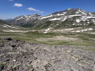
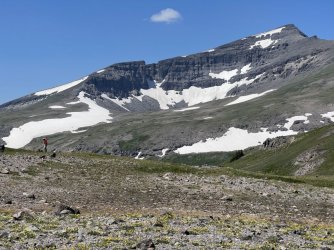
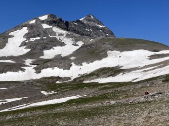
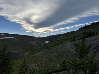
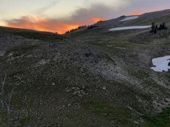
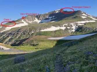
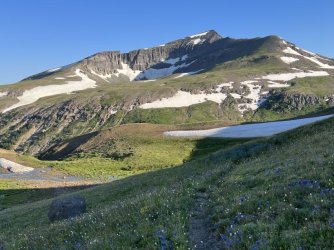
Our goal the next morning was to climb Younts Peak. Younts Peak is the tallest mountain in the area, and it is one of the most remote peaks in the contiguous United States. The view from the summit encompasses a vast swath of the Teton and Washakie Wilderness Areas.

IMG_3844.jpg
Younts Peak

IMG_3848.jpg
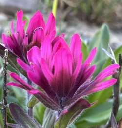
Paintbrush

IMG_3901.jpg
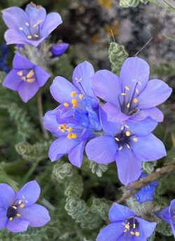
Sky Pilot​

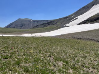
We got up early and carried light packs for our summit attempt. We left our campsite and backtracked on the trail for a few minutes. Then we left the trail and headed down to the South Fork of the Yellowstone River. We had to avoid some gullies, but otherwise the route was straightforward. We hoped across the infant river and began climbing the south slope of Younts Peak. We climbed to a bench, which we followed west below the cliffs that form the south face of the mountain. Our goal was to access the south ridge.

We were passing through a bowl just east of the target ridge when I heard the unmistakable roar of a mountain lion. It was one of the most incredible things I’ve ever heard. Every hair on my body stood straight up. The sound was somewhat distant, but I still spent a couple of minutes looking for the source. I did not see any sign of a cat. My best guess is that he was somewhere among the cliffs just to our north. Unfortunately, Larry didn’t have his hearing aids in and missed the whole thing.

We climbed a steep snowfield to reach the south ridge. Fortunately the snow was soft and not icy. Once on the ridge we headed up. This was a mistake. I could see a lot of snow and a rocky cliff band farther up, but I figured we could find a way through. It turns out that we should have continued west to a gap in the southwest ridge. I think we could have followed that ridge all the way to the summit.

IMG_3855.jpg
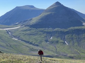
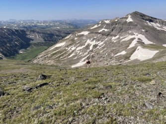
Larry hiking up Younts Peak

IMG_3884.jpg
Larry hiking up Younts Peak​

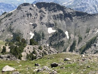
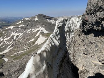
Instead, we climbed steeply, keeping an eye out for mountain lions. As we neared the crux I grew concerned. There was a lot of snow up there. We reached the base of a steep rock face. I think I could have climbed it, but I wasn’t certain. I looked to my left and saw that the snowpack had pulled away from the base of the cliff. That left a corridor of rock and packed snow. I decided to follow it. The corridor led along the base of the cliff before ending at the bottom of a ledge. Right before the end, I plunged through a soft spot in the snow. Clearly the snowpack was unstable. That was a concern, because getting up onto the ledge would require forcefully pushing off on the snowpack. I thought it would work, but I couldn’t be sure that the whole thing wouldn’t give way.

IMG_3889.jpg
Corridor behind the snow pack​

Larry caught up, and we discussed our options. Ultimately we decided that it wasn’t worth the risk. We decided to bail. In hindsight, we still could have worked our way around to the gap in the southwest ridge and resumed the climb. I wish we had. We were already behind schedule though, as we had some miles to cover that afternoon.
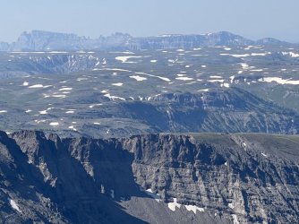
IMG_3891.jpg
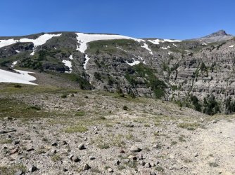
We could see most of the rest of the journey from here. Our car was parked near the base of the cliffs in the distance.


BEGINNINGS​


We took a slightly different route on our return to camp. Instead of dropping down to the river, we stayed higher and contoured around below Thorofare Peak. This was mostly easy walking, and it led us directly to the very beginning of the South Fork of the Yellowstone River. The source wasn’t terribly exciting – it was just some puddles in a low spot at the base of a small snowfield. Still, it was fascinating to see the very beginning of the longest undammed river in the contiguous United States.

IMG_3915.jpg
Larry hiking below Thorofare Mountain


IMG_3928.jpg
The South Fork of the Yellowstone River starts here​


From there we hiked southwest, mostly staying on a bench below rugged cliffs. We worked our way around to a beautiful alpine tarn. We were surprised to see tents there. There was another group of backpackers a short distance from our campsite, but we had been totally unaware of their presence. From there, we continued around to rejoin the trail, which we followed back to camp.
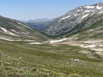
IMG_3937.jpg
View down the South Fork Yellowstone River valley
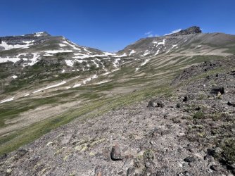
IMG_3941.jpg
Younts Peak and Thorofare Mountain

IMG_3942.jpg
Younts Peak and the South Fork Yellowstone River
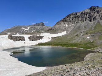
IMG_3949.jpg
Alpine tarn near our campsite

IMG_3965.jpg
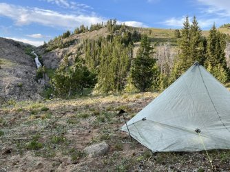
Larry at our campsite


MISSED THE FERRY​


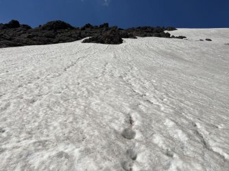
We returned to camp early that afternoon. We had lunch and broke camp. Our goal for the afternoon was to backpack to Ferry Lake. We followed the trail southwest, contouring well below the Continental Divide. This was rugged stretch of trail, but with beautiful scenery. After some steep ups and downs we reached a sketchy area. The trail crosses two steep snowfields. Each one leads into a chute that runs to the brink of a cliff, and the terrain is steep enough that you do not want to slip. Fortunately the snow was soft, and we were able to cross by cautiously kicking steps in the snow. For future reference, it is best to avoid this stretch of trail in early summer early in the morning, when the snow is likely to be icy.
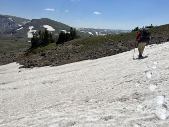
IMG_3984.jpg
This snowfield would be dangerous if it were icy. Don't look down to your left!
IMG_3986.jpg
Looking up from the same spot

IMG_3974.jpg
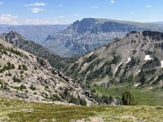
Marston Creek Trail visible over there
IMG_3979.jpg
View down the Marston Creek valley towards Wall Mountain
IMG_3996.jpg
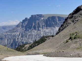
Wall Mountain​

From there we descended quickly to a fork. We stayed left, as I wanted to take a side trip over to Marston Pass. We followed a faint path over to another junction with a heavily used trail. We followed that trail back to the east. Views were limited from the actual pass, so we continued east on the trail to a gap in the east ridge. Although we were well east of the Continental Divide, there is a sign here, and a great view looking back towards Younts Peak. The trail ahead continues down Marston Creek to the South Fork of the Shoshone River.

IMG_3999.jpg
The trail contours along that hillside and crosses those two snowfields​

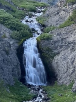
We doubled-back and continued west on the trail along Lost Creek. We descended gradually through open meadows, staying well above the creek. We were a couple of hours behind schedule, but we were making up time thanks to the easy hiking. We didn’t see any camping options along Lost Creek. After a couple of miles Lost Creek turned south to descend into a canyon. We continued ahead on the trail, climbing over a minor divide. We then descended into the headwaters of Lake Creek. A bit farther on we reached a major junction with a trail leading down Lake Creek and on to the South Fork Buffalo. We continued ahead, climbing to the crest of a prominent ridge. It was getting late, and we still had over a mile to go to reach Ferry Lake. I explored out the ridge and found a spot that was suitable for a campsite. I hated to stop short of Ferry Lake, but it was almost dusk, and the ridge had a spectacular view of a gorgeous waterfall. That waterfall is on an unnamed tributary of Lake Creek. After setting up camp, I followed the trail down to the creek, which it crosses just downstream from the waterfall. The view was nice there, but even better from our campsite.
52257453458_f8dc226a50_o.jpg
Waterfall viewed from our campsite

IMG_4043.jpg
Campsite with a waterfall view

That evening I messaged my wife using my Garmin In Reach. I sent her a message every evening just to let her know that everything was ok. While I was doing that, I found myself wishing that I could get a current weather forecast. We would be finishing our trip with 3 days of off-trail hiking along the Continental Divide, high above treeline. That would be a bad place to be in bad weather. My Garmin has a weather forecast feature, but it is powered by Dark Sky, which is worthless. In a moment of brilliance, I sent my wife another message and asked her to send me the weather forecast for DuBois, WY. I checked my messages later, and got the weather forecast. Our long run of good weather was about to end. The next two days looked good, but there was a good chance of afternoon thunderstorms on Thursday and Friday.​

We had planned a layover day at Ferry Lake on Tuesday, followed by three days along the Continental Divide back to Brooks Lake starting on Wednesday. That plan didn’t mesh well with the weather forecast. Larry and I discussed our options. We could take a different route back to Brooks Lake, but I didn’t really want to do that. Instead, I suggested that we skip the layover day and start the hike out a day early. That would give us good weather for the Continental Divide on Tuesday, Wednesday, and Thursday morning. If we made good time, we could be off the divide before Thursday afternoon’s storms. I hated to give up the layover day and the visit to Ferry Lake, but it seemed like the best choice. Larry was in favor of the change, so we planned to break camp and head back to the Continental Divide in the morning.

IMG_4042.jpg
Beautiful clouds at sunset

IMG_4049.jpg
Sunset
 

Attachments

  • Day 8 Part 2 - Yellowstone River headwaters to Ferry Lake.pdf
    945.1 KB · Views: 10
  • Day 8 - Younts Peak.pdf
    826.6 KB · Views: 12
"That evening I messaged my wife using my Garmin In Reach. I sent her a message every evening just to let her know that everything was ok. While I was doing that, I found myself wishing that I could get a current weather forecast. We would be finishing our trip with 3 days of off-trail hiking along the Continental Divide, high above treeline. That would be a bad place to be in bad weather. My Garmin has a weather forecast feature, but it is powered by Dark Sky, which is worthless. In a moment of brilliance, I sent my wife another message and asked her to send me the weather forecast for DuBois, WY. I checked my messages later, and got the weather forecast. Our long run of good weather was about to end. The next two days looked good, but there was a good chance of afternoon thunderstorms on Thursday and Friday."

Check out the thread here titled "Off Trail Advice." @wsp_scott described a way to get weather updates from NWS on the inreach. I haven't tried it out yet, but I will for sure the next time I do a trip lasting more then a couple of days.
 
Lol .... nice hearing a cat. Could have been a mile away, their sound really carries.

Good view looking clear to the Ramshorns
 
Instead, we climbed steeply, keeping an eye out for mountain lions. As we neared the crux I grew concerned. There was a lot of snow up there. We reached the base of a steep rock face. I think I could have climbed it, but I wasn’t certain. I looked to my left and saw that the snowpack had pulled away from the base of the cliff. That left a corridor of rock and packed snow. I decided to follow it. The corridor led along the base of the cliff before ending at the bottom of a ledge. Right before the end, I plunged through a soft spot in the snow. Clearly the snowpack was unstable. That was a concern, because getting up onto the ledge would require forcefully pushing off on the snowpack. I thought it would work, but I couldn’t be sure that the whole thing wouldn’t give way.

View attachment 117846
Corridor behind the snow pack​

Larry caught up, and we discussed our options. Ultimately we decided that it wasn’t worth the risk. We decided to bail. In hindsight, we still could have worked our way around to the gap in the southwest ridge and resumed the climb. I wish we had. We were already behind schedule though, as we had some miles to cover that afternoon.
I recognize that spot... though last time I saw it @mike_offerman was wedged inside of it. He and @travel2walk actually made it up that way - I think we were a week+ ahead of you though, so the snow quality was probably better. Things were melting fast.

I climbed the rock face - the rock out there is a little sketchy, but there were some pretty good holds. Probably Class 4+.

Very cool to hear a mountain lion - @mike_offerman spotted some tracks near Marston Pass, but that was our only sign. (We did see 7 grizzlies in the bowl below Younts though. ;))
 
As I was reading the post, I immediately recognized where you were. I was hoping you guys made it up and had a photo of the log on top! We dropped off the summit to the Southeast ridge and it turned out to be a great route down.
 
I recognize that spot... though last time I saw it @mike_offerman was wedged inside of it. He and @travel2walk actually made it up that way - I think we were a week+ ahead of you though, so the snow quality was probably better. Things were melting fast.

I climbed the rock face - the rock out there is a little sketchy, but there were some pretty good holds. Probably Class 4+.

Very cool to hear a mountain lion - @mike_offerman spotted some tracks near Marston Pass, but that was our only sign. (We did see 7 grizzlies in the bowl below Younts though. ;))
Yea, the snow was pretty solid while we were there. I don't know if I'd gone up that way if Mike didn't lead the way.

Do y'all remember the sounds we heard down the valley as we left the camp for the summit from the valley to our north east? I know we weren't sure of what they were, possibly wolves. Could that haven been the mountain lion?
 
"That evening I messaged my wife using my Garmin In Reach. I sent her a message every evening just to let her know that everything was ok. While I was doing that, I found myself wishing that I could get a current weather forecast. We would be finishing our trip with 3 days of off-trail hiking along the Continental Divide, high above treeline. That would be a bad place to be in bad weather. My Garmin has a weather forecast feature, but it is powered by Dark Sky, which is worthless. In a moment of brilliance, I sent my wife another message and asked her to send me the weather forecast for DuBois, WY. I checked my messages later, and got the weather forecast. Our long run of good weather was about to end. The next two days looked good, but there was a good chance of afternoon thunderstorms on Thursday and Friday."

Check out the thread here titled "Off Trail Advice." @wsp_scott described a way to get weather updates from NWS on the inreach. I haven't tried it out yet, but I will for sure the next time I do a trip lasting more then a couple of days.
Thanks, I'll check that out!
 
Lol .... nice hearing a cat. Could have been a mile away, their sound really carries.

Good view looking clear to the Ramshorns
That was my first time hearing one, and it was an amazing experience! I wish I'd seen it (from a distance)...
 
As I was reading the post, I immediately recognized where you were. I was hoping you guys made it up and had a photo of the log on top! We dropped off the summit to the Southeast ridge and it turned out to be a great route down.
 
Yeah, I want a do-over on that one. I think it would have been a simple walk up if we had just aimed for the next ridge. Hopefully next time...
 
I recognize that spot... though last time I saw it @mike_offerman was wedged inside of it. He and @travel2walk actually made it up that way - I think we were a week+ ahead of you though, so the snow quality was probably better. Things were melting fast.

I climbed the rock face - the rock out there is a little sketchy, but there were some pretty good holds. Probably Class 4+.

Very cool to hear a mountain lion - @mike_offerman spotted some tracks near Marston Pass, but that was our only sign. (We did see 7 grizzlies in the bowl below Younts though. ;))
I debated climbing that rock face, but it looked a little above my comfort level. If it was 4+ I made the right decision! I was really tempted to try to snow pack route, but the penalty for failure could have been really high.
 
Fungi, again another wonderful and great trip report! Loved it and your photos! Thanks for posting. Hearing that Mountain Lion must of been Awesome!

Now have climbed Younts Peak. Everytime would use that low gap that is SW of the peak. And from there just a walk up to the top. Now even people on horses have ridden to the top of Younts Peak with using that low gap SW of the peak. Never will I go up that ridge that you botth used. Near where you camped, I have a certain spot where I sit and glass the peak and area for critters. How many times have I seen Grizzlies in that high south facing high basin. Onetime in mid summer I saw 9 bears at once in that basin. Am surprised you didn't see any bears there around Younts. And at various times have seen Wolf tracks up near Younts Peak. Also those snow patches and steep chutes you talk about do certainly remember. Never had a problem. But have seen where someone on a horse had crossed over this when still all snow covered. Such Great Wild Country where someone can get lost on purpose and just live good and well in the wilds.
 
Last edited:
Weather forecast on InReach https://wx2inreach.weebly.com/

I have my 3rd free message set for this, so asking for the weather doesn't cost anything but the reply does. I'm on the cheapest plan so I get 10 free messages a month so not getting charged for the request is nice.
 
Fungi, again another wonderful and great trip report! Loved it and your photos! Thanks for posting. Hearing that Mountain Lion must of been Awesome!

Now have climbed Younts Peak. Everytime would use that low gap that is SW of the peak. And from there just a walk up to the top. Now even people on horses have ridden to the top of Younts Peak with using that low gap SW of the peak. Never will I go up that ridge that you botth used. Near where you camped, I have a certain spot where I sit and glass the peak and area for critters. How many times have I seen Grizzlies in that high south facing high basin. Onetime in mid summer I saw 9 bears at once in that basin. Am surprised you didn't see any bears there around Younts. And at various times have seen Wolf tracks up near Younts Peak. Also those snow patches and steep chutes you talk about do certainly remember. Never had a problem. But have seen where someone on a horse had crossed over this when still all snow covered. Such Great Wild Country where someone can get lost on purpose and just live good and well in the wilds.
That's awesome! The only time I've seen more than a couple of grizzlies at a time was at Brooks Falls in Katmai NP in Alaska, but that was expected.
 
Just a reference for future visitors. Coming up from the opposite side (northwest) is basically a straight walk up. Coming up from the northeast side is at best a terrible idea - and probably not possible.

The bergschrund is directly left of the Class 4 section, but is probably only an option very briefly each year.
IMG_3844.jpg
 
Last edited:
Yes. I wouldn't do the east either
 
"In hindsight, we still could have worked our way around to the gap in the southwest ridge and resumed the climb."

Sounds like you made the right call based on what was in front of you. It's easy to think, later, "Awww... should have pushed it a little further."
 
Back
Top