Uintas Conditions 2015

For all of us who are going out over the 4th of July, I think this weekend should be a good barometer as it's been blazing hot all week and stuff should have dried out considerably. Dead Horse may still be tricky over the 4th of July, and maybe the north side of Gunsight and Smiths Fork. Other than that, can anyone think of any trouble spots?
 
Monsoon hasn't started yet. Clear forecast. No rain.
Well, it did technically rain this weekend in the Grandaddy Basin. It was only a sprinkling for about 5 min. Friday afternoon around 4:00.
I spent 2 nights without a rain fly, the 3rd night we put them on because of some dark clouds...but nothing overnight.
TR will be coming on Monday.
 
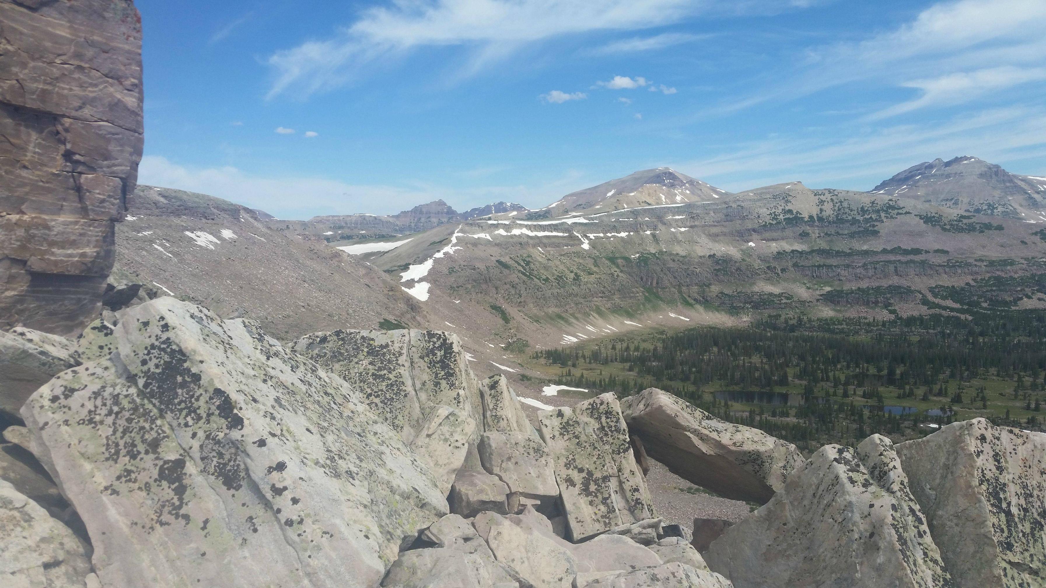
As for conditions in the Grandaddy Basin...no snow in the basin and all the lakes are great. Some muddy spots, and a TON of mosquitoes right now!
 
Well, it did technically rain this weekend in the Grandaddy Basin. It was only a sprinkling for about 5 min. Friday afternoon around 4:00.
I spent 2 nights without a rain fly, the 3rd night we put them on because of some dark clouds...but nothing overnight.
TR will be coming on Monday.
This weekend, as in today/yesterday? I got caught in a 3 hour thunderstorm with almost dime-size hail coming back from Four Lakes Basin on the Highline Trail.
 
This weekend, as in today/yesterday? I got caught in a 3 hour thunderstorm with almost dime-size hail coming back from Four Lakes Basin on the Highline Trail.
Ya, Friday the 26th. We could hear thunder...that must have been you
 
This weekend, as in today/yesterday? I got caught in a 3 hour thunderstorm with almost dime-size hail coming back from Four Lakes Basin on the Highline Trail.
Hey Larry, we also trekked into Four Lakes Basin Friday afternoon and just got home Sunday evening. Spectacular, as usual! We camped on the SE side of Dale Lake. Man/Woman/Black and White Small Dog. Bugs were light to moderate and increasing. We also were wailed on Saturday afternoon with a couple of hours of rain/hail/sleet and some big boomers. We had just made it back to our tent after exploring the north and east sides of the basin. There is great camping under that pass on the east side. One lightning bolt probably hit the floor of the basin. All in all a great trip and the crowds were nought surprisingly. Even the Hayden Pass trailhead had plenty of room Friday and Sunday. I don't know why. We got home to scorching temps and the valley is over 100.

There is virtually no snow - even on the ridges above 11,000'. Didn't see the north side. Did seem some great Red Crossbills on the trudge out.
 
How did we not see you? We camped just west of the Naturalist Basin turnoff on the Highline Trail Friday night. Then on Saturday morning, we did ridge around the basin (from that shoulder right before you drop into the basin itself, we went up the ridge and traversed around to Cyclone Pass) and hiked back through the basin around noon-ish, maybe a half hour or so before the storms started rolling in. I couldn't find any record online of anybody hiking that ridge, but it was pretty straight-forward with just one easy scramble section. And the views of Rock Creek, Naturalist, and Four Lakes basins were stunning. We were three dudes in obnoxiously orange shirts (total coincidence) rolling through in case you saw us.

And yes the storm yesterday afternoon was something to behold; we had hail that was closer to dime-size than pea-size on the way back. Did it storm this afternoon as well? The clouds to the east looked pretty fearsome.
 
I camped in the Ruth Lake area last night. No snow on the ground, very little on any of the surrounding peaks. It's looking beautiful up there, but the mosquitoes were HORRIBLE! I hiked in at 6:00 last night and was out by 10:00 a.m. this morning. 9 hours of that time was spent sleeping, and I still came home with 30+ bites. :eek:
 
How did we not see you? We camped just west of the Naturalist Basin turnoff on the Highline Trail Friday night. Then on Saturday morning, we did ridge around the basin (from that shoulder right before you drop into the basin itself, we went up the ridge and traversed around to Cyclone Pass) and hiked back through the basin around noon-ish, maybe a half hour or so before the storms started rolling in. I couldn't find any record online of anybody hiking that ridge, but it was pretty straight-forward with just one easy scramble section. And the views of Rock Creek, Naturalist, and Four Lakes basins were stunning. We were three dudes in obnoxiously orange shirts (total coincidence) rolling through in case you saw us.

And yes the storm yesterday afternoon was something to behold; we had hail that was closer to dime-size than pea-size on the way back. Did it storm this afternoon as well? The clouds to the east looked pretty fearsome.

Mountaineers! Cool. I could see how you could miss us but how could we not see three yahoos in orange ridge-running the whole cirque we were in? Totally joking of course. How was that slope above the pass you refer to? 3rd or 4th class?. We were scouting that Amy lake on the north side of the basin and I was plotting a route up and out of the basin there right about 11:30 so it must have been a little behind your traverse location. Small world. Then on our hike out just now we ran into a couple we knew. It is still a pretty small population of people like us - I am often surprised by seeing people I know in the backcountry. They said that it had snowed on them an hour or two earlier (2 pm? today Sunday) and snowed out their Ruth Lake climbing day.

I have been up to Cyclone Pass previously and double thumbs up the quality of the Rock Creek and points-farther-east view. Makes you want to do the great traverse?
That slope is only class II to get up onto the ridge. It's a little steep and it's a lot more fun going up than it would be going down, but it doesn't present any significant challenges if you've got any sort of backcountry experience. The "crux" is a section with a few low-end class III moves (have to scramble through a field of large, slabby boulders) approaching the saddle northeast of Amy Lake. It's slow going, but there's no significant exposure, the rock quality is generally solid, and you have unbelievable views.

emunR5G.jpg
Great! @DrNed and @JoshuaDyal take note of the high country for your upcoming trips... (as you probably already have)

So @LarryBoy if I have this right you walked in 5 miles to your camp and then walked 20 miles Saturday doing this whole high ridge back to the trailhead. Good on ya!
 
image.jpg image.jpg Just completed the highline(the full trek) the only part we were scared of was dead horse pass due to snow but all in all it was awesome!!(except the skeeters)
 
Great! Well done @Mullet ! Where did you start? How many days? So Deadhorse pass is free of snow. Wild!
 
image.jpg image.jpg
Great! Well done @Mullet ! Where did you start? How many days? So Deadhorse pass is free of snow. Wild!
We started at leidy peak at 2pm last Saturday and ended today at 1 pm. So six. We were going to take 7 but on on the forth we booked it up Anderson pass, up to kings, up tungsten and up porcupine and camped about 3 miles in the meadow below.... It was a killer. Dead horse is NOT free of snow. The trail is covered in snow on towards the top but is very muddy and sketchy, but that was yesterday. It was an awesome trip! Those mountains are beautiful!
 
Last edited:
First, I want to say thanks to all of you for posting this information. It is very helpful to an out of state person like me who is planning on hiking the Uintas in early August, specifically Aug. 10-15. I plan to do the Highline Trail, most likely from Chepeta Lake to Hayden Pass, although I am contemplating a more easterly start. What should I expect in terms of "Monsoon" and mosquitos during the early August time frame at those elevations. It looks like snow won't be much, if any, of an issue from the prior posts.
 
count on monsoons every afternoon at that time of year. Mosquitos should be pretty good by that point.
 
x2 to what @andyjaggy says.

Congrats on the crossing @Mullet. Trip report?? :D
Thanks nick. It was amazing! Loved every min of it. Ya I know I need to do a trip report, but I'm afraid my pictures aren't up to par with the pros on this site. Oh nick I saw that you were quoted in backpacker magazine this month! You gave up the sweet my favorite spot. :(Oh well I found some more more last week on the highline that are very close to that location :)
 
Awww, man. We don't need pro photos to enjoy a great trip report! This place would be boring if that were the case. Re: Priord, yes, I was sad to hear it was getting featured in Backpacker. They reached out to me on it and I tried my best to make it sound inhospitable and mediocre. Apparently it didn't work. I still need to get my hands on a copy of that so I can read the whole thing.
 
Ha ha ya I was surprised to see it. And they even had a picture! Nick have you been down in meadows past porcupine meadows?
 
Similar threads
Thread starter Title Forum Replies Date
Upgrayedd Uintas Conditions 2023 Trip Planning 39
2eez4life Uintas Conditions 2022 Trip Planning 18
Upgrayedd Uintas Conditions 2021 Trip Planning 9
Upgrayedd Uintas Conditions 2020 Trip Planning 69
J Uintas Conditions 2019 Trip Planning 209
Dave Uintas Conditions 2018 General Discussion 210
Dave Uintas Conditions 2017 General Discussion 128
Jackson Uintas Conditions 2016 General Discussion 93
Vegan.Hiker Wasatch/Uintas conditions late April/early May Trip Planning 6
Upgrayedd Starting a fire in damp conditions in the Uintas General Discussion 14
Udink Uintas Conditions 2014 Trip Planning 219
MtnMatt Uintas conditions?? Trip Planning 9
MtnMatt current conditions in the Uintas General Discussion 1
Nick Uintas Conditions 2013 General Discussion 115
Tarp Boy Looking for Shuttle service for Uintas Granddaddy basin trip Trip Planning 0
2eez4life Suggestions: Uintas Backpacking with some rock climbing routes Trip Planning 0
regehr (Uintas) Lake Fork Fun Backpacking 8
scatman Reid's Peak - Uintas - July 22, 2023 Hiking & Camping 6
NorthwestWanderer First time in the High Uintas | Red Castle SNEAK Loop | I give these mountains 5 out of 5 stars Backpacking 7
regehr Uintas this weekend? Trip Planning 4
2eez4life 4 days 3 nights in the Uintas Trip Planning 9
6 Uintas Trip Planning Trip Planning 5
Perry Sunrise/Sunset Uintas Marriage Proposal Location Suggestions Trip Planning 25
N Gilbert Meadows- High Uintas Trip Planning 0
WasatchWill The High Uintas 4-4-4: Four Basins, Four Passes, Four Days Backpacking 20
C High Uintas Wilderness - Last minute plans Trip Planning 4
Mountain Wanderer High Uintas Wilderness - Granddaddy Basin Backpacking 4
scatman Bourbon Lake, Uintas - July 11, 2020 Hiking & Camping 4
ridings82 Uintas Backpacking Loop Trip Reports 12
B Uintas question Hiking & Camping 3
Tarp Boy Uintas in late June? Trip Planning 10
Born to Hike Mountain Solitude: Reconnaissance Lake, High Uintas, early Sept 2019 Backpacking 9
Ehouston24 Uintas Loop (Red Castle/Kings Peak) Trip Planning 14
DrNed Plan B to High Uintas Backpacking Trip Planning 20
DrNed Recommendation for 35-45 Mile Route in the Uintas Trip Planning 7
Yvonne A weekend in the Uintas Hiking & Camping 10
WasatchWill 5 Guys on a Trail: A Tour of the Southwestern Uintas Backpacking 12
wabenho Rainbow Lake, Uintas - September 2018 Backpacking 6
DesertRatShorty Solitude in the Uintas -- Gilbert Lake Loop Backpacking 14
jdfut66 Uintas - Priord Lake to Deadhorse Lake Loop Backpacking 6
Born to Hike Clements Lake and East Basin in the High Uintas, mid-July 2018 Backpacking 6
TrektheWorld Need help with Uintas trip - camping Trip Planning 8
Perry Missing hiker in Uintas - Ray Humpherys General Discussion 104
Mike K Uintas Three Nighter Backpacking 13
LarryBoy In Which I Forget Sunscreen (Uintas 2015) Backpacking 11
Brian Handsaker Uintas Backpacking (or Montana) Trip Planning 9
Uncle_Dim October in the Uintas Trip Planning 2
Perry Late Season Uintas Day Hike Ideas. Bear River to WFBF and Back? Trip Planning 13
r3biker Backpacking trip to Clyde lake in Uintas Backpacking 8
WasatchWill An Intro to the Uintas Hiking & Camping 2

Similar threads

Back
Top