Udink
Still right here.
- Joined
- Jan 17, 2012
- Messages
- 1,692
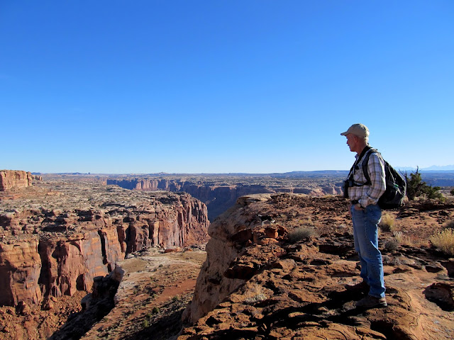
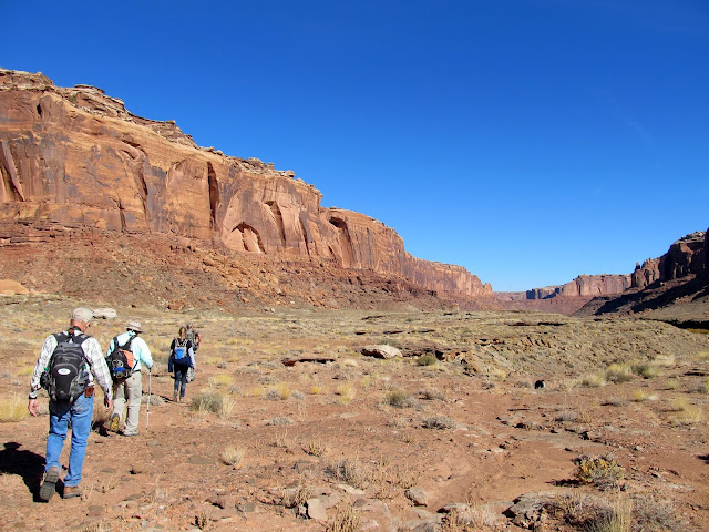
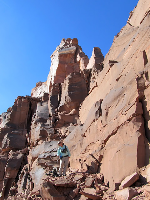
There's an old stock trail in the right fork of Twomile Canyon that connects the highlands of Keg Point to the Green River in Labyrinth Canyon, 1,200' below. It's one of relatively few places to access Labyrinth Canyon from the rim. Several months ago Wade began planning a trip down the trail to the river, then upstream along Oak Bottom, ending with a climb up to Bowknot Saddle to see some historic inscriptions. We set a date about a month in advance of the trip and, on Saturday morning, met near Keg Knoll where most people start their hike to Colonnade Arch. Alan rode with me from Price, and we met Wade and his family along with new hiking buddy and history buff Lyman. We set out across the slickrock to the northeast and in a short time located a cairn marking the top of the trail.
Obligatory photo of Horse Bench Reservoir during the drive south
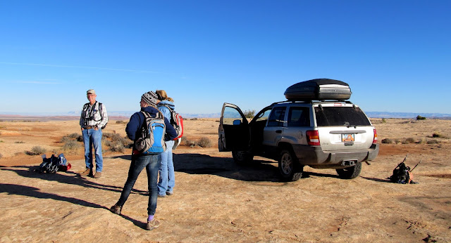
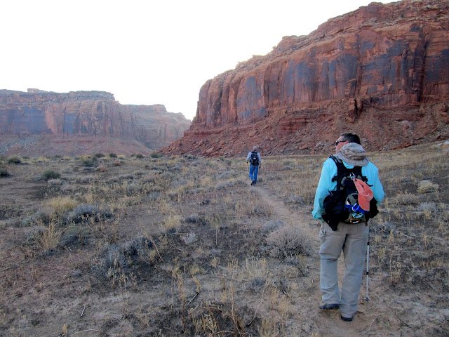
Getting ready to hike
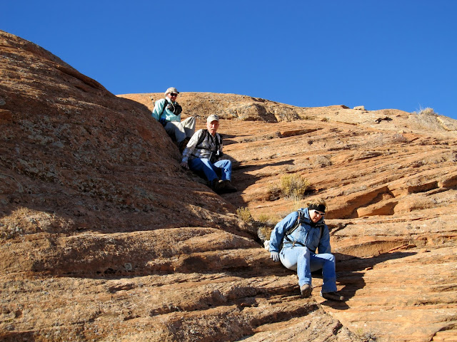
Scooting down the chute
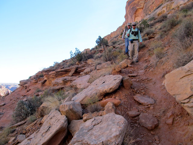
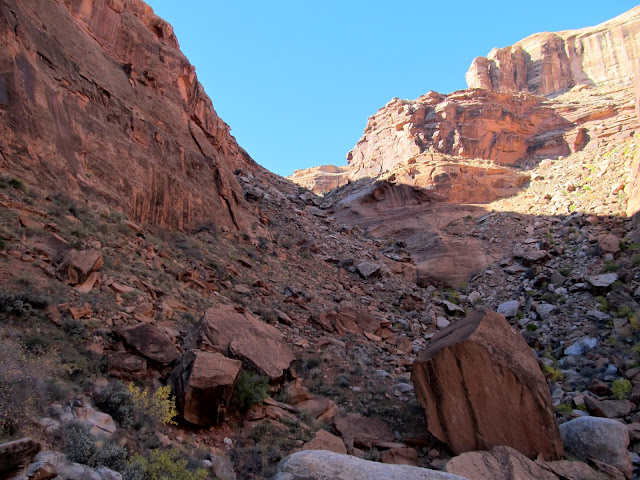
Approaching the top of the trail
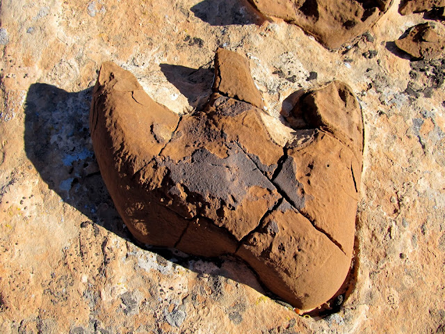
Dinosaur footprint?
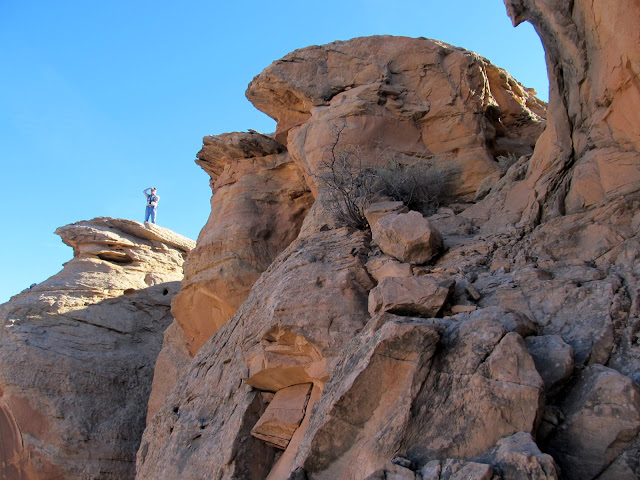
Lyman near the top of the trail
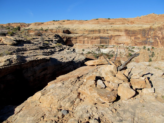
Break in the cliff at the top of the trail (left) and cairn marker
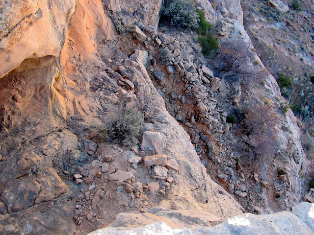
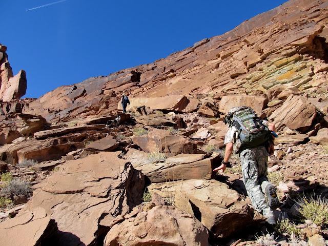
A break in the cliffs led down to a short section that had been blasted out of the sandstone. There were a couple of short, constructed switchbacks before the trail turned west and leveled out. It then descended a long and rocky talus slope to the bottom of the right fork of Twomile Canyon. It took us an hour and 40 minutes to hike from the vehicles to the bottom of the canyon, where we rested up a bit before moving along.
View straight down on the trail
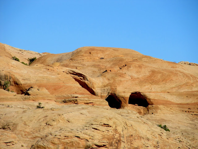
Colonnade Arch
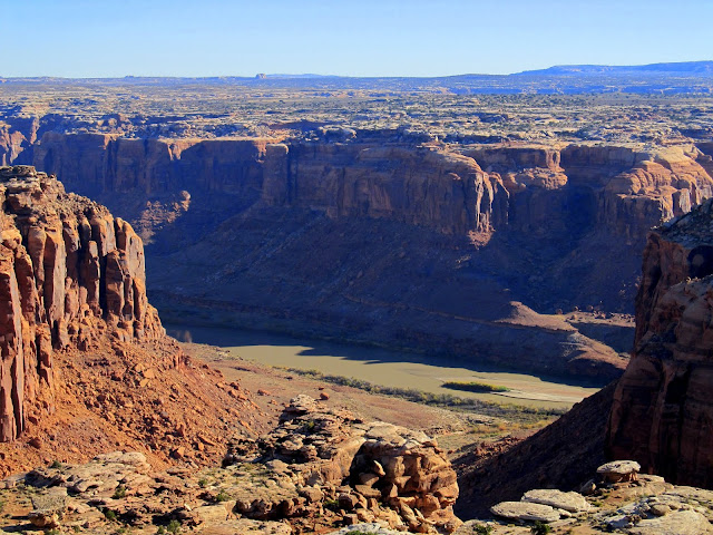
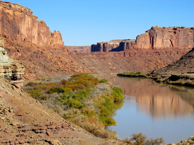
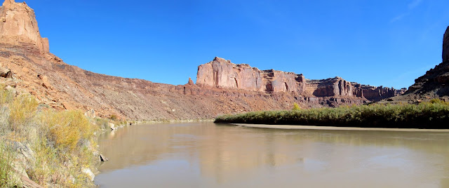
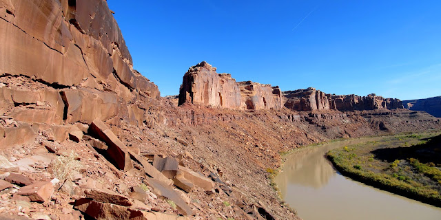
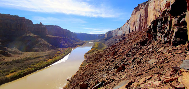
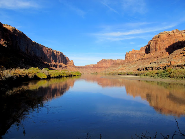
Green River at the mouth of Twomile Canyon
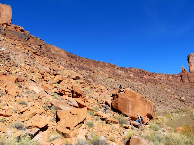
Starting down the trail
The trail descends the cliff break on the right
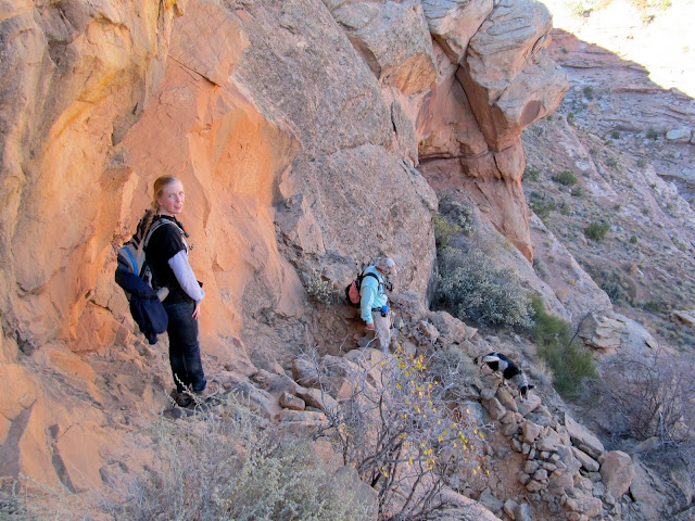
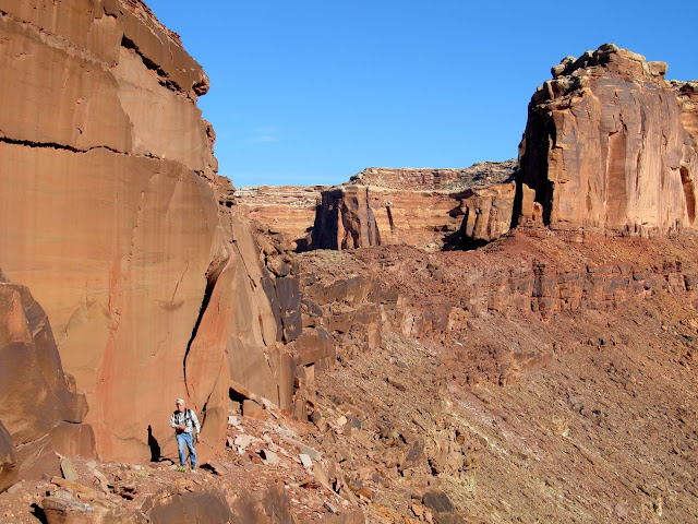
Lyman and Alan
Dropping down some ledges
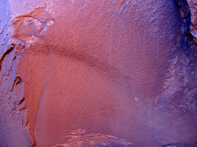
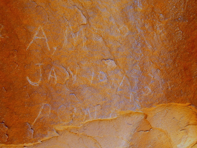
"Sundry" inscription
View from the trail toward the top
View up the trail from near the bottom
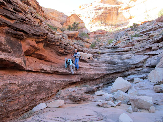
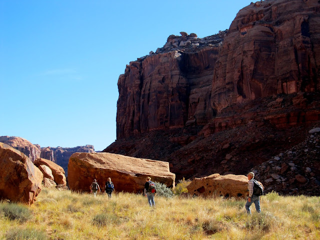
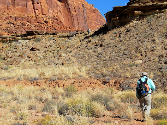
The hike down Twomile Canyon was fairly level and easy. A few of us spread out and we checked the large boulders in the canyon's bottom for rock art and inscriptions. We found a few modern names scratched into the sandstone but one 1901 inscription stood out: J.W. Shand from Manti, Utah. At the mouth of Twomile Canyon we turned northeast and hiked along a flat bench above the banks of the Green River. It was easy hiking and there was even sort of a trail along most of the bench. We reached the lower end of Oak Bottom and that's where it got a little difficult.
Hiking down Twomile Canyon
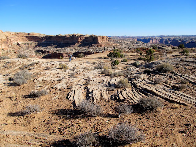
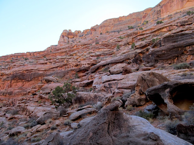
View up the main fork of Twomile Canyon
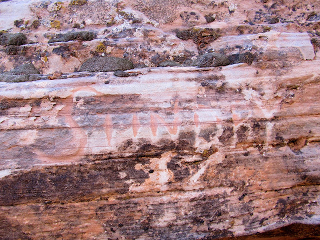
A faint inscription: J.W. Shand, Manti, 1901
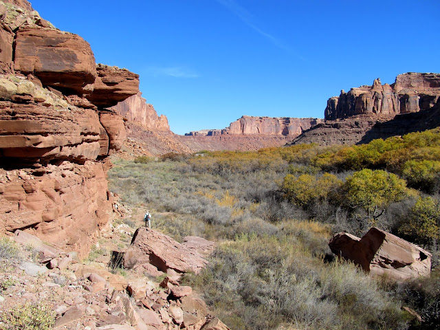
Hiking along the bench above the Green River
Crossing a drainage and climbing back onto the bench
Oak Bottom with Bowknot Saddle beyond it
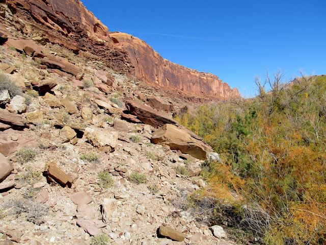
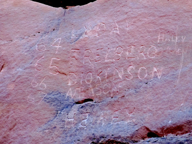
Oak Bottom is completely choked with trees and brush between the river bank and the talus slope at the bottom of Labyrinth Canyon's vertical walls. Our only real option was to scramble across the rocky talus for about a quarter of a mile until the brush eased and we were able to walk on the relatively flat flood plain. In the less brushy section of Oak Bottom we encountered a large boulder with the names of several sheepherders carved into it. Near the upper end of Oak Bottom we were surprised to find a rock with the initials of the "Lucky Thirteen," a group of early river runners who later completed a trip down the Colorado through the Grand Canyon.
There are two options to travel up Oak Bottom: scrambling or bushwhacking
Near the end of the scrambling along Oak Bottom
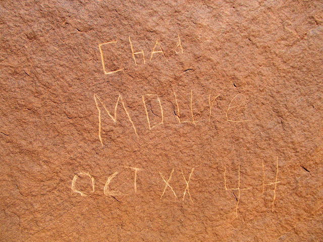
Chad Moore, Oct. XX, '44
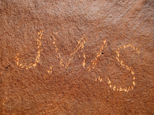
J.W.S. (another from Shand)
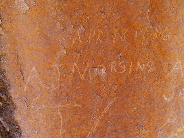
April 18, 1936, A.J. Marsing
A. Moore, Jan. 10, 1939
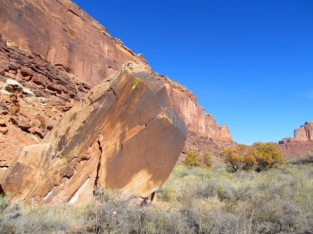
Boulder with inscriptions along Oak Bottom
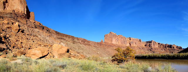
Green River below Bowknot Saddle
The "Lucky Thirteen" from 1927
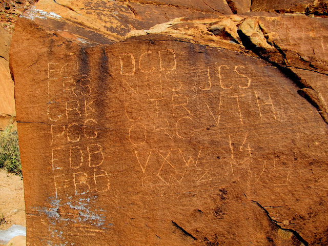
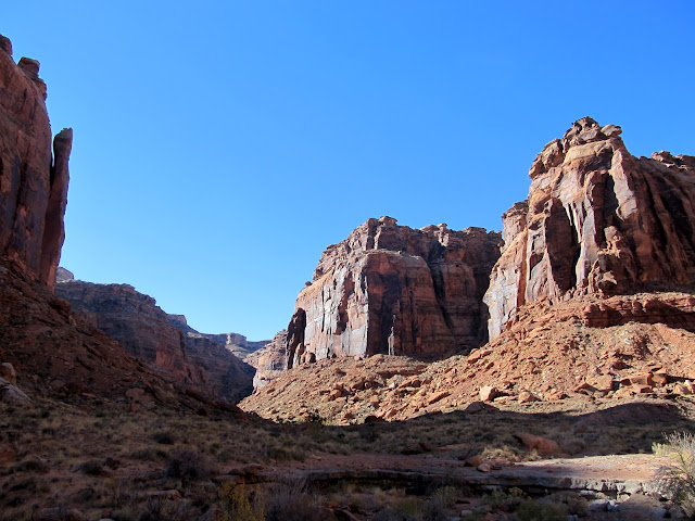
Oak Bottom pinches out to nothing at its upper end, just below Bowknot Saddle, which is where we began our ascent. The original route up that we'd planned looked impossible from the bottom, so we spent a lot of time scrambling up and down looking for a break in the cliffs that would lead us up to the saddle. A couple of us (myself included) were getting a little exhausted, and it was already late enough in the day that we were certain to run out of daylight for the return trip. Wade kept at it, though, and finally found a route to the saddle! Lyman and I were the only ones to follow. Wade guided us up from above and we met him near the inscriptions that we came for. There were names from early explorers, miners, and river runners, with dates ranging from the early 1900s well into the 1940s.
Start of the ascent to Bowknot Saddle
Climbing up to Bowknot Saddle
Dead end number one
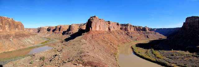
Panorama below the saddle
Downstream along the Green
Finally on the right path to the saddle
Bowknot Saddle
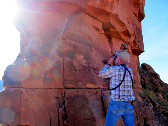
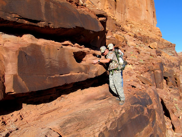
Photographing old inscriptions
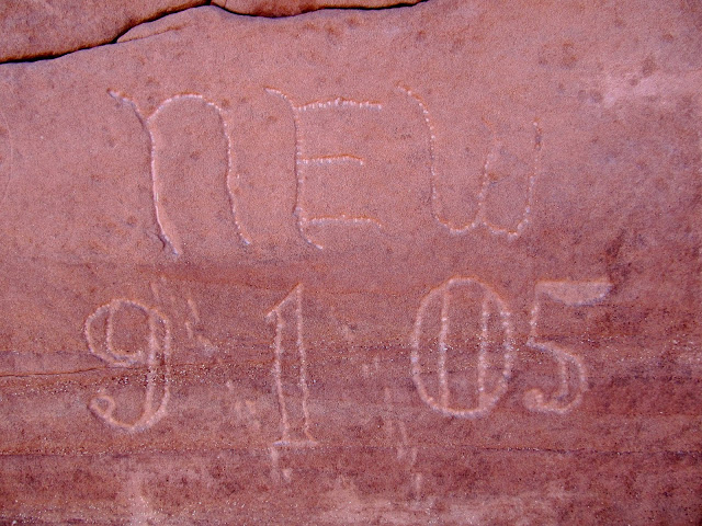
Norville Edwin Wolverton, 9/1/05
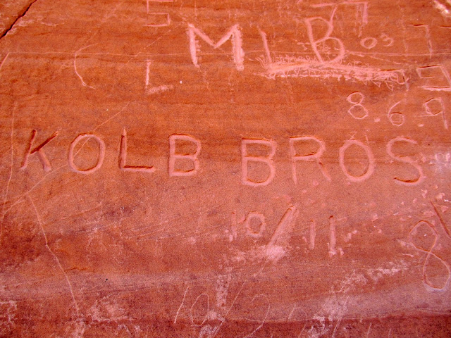
Kolb Bros., 10/11 (bio here)
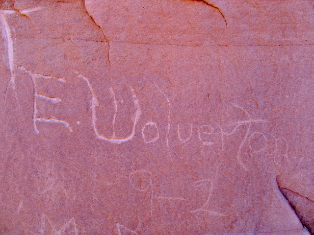
E. Wolverton, 9-2
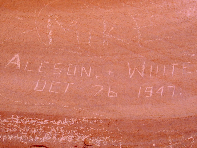
Aleson + White, Oct. 26, 1947 (great history here)
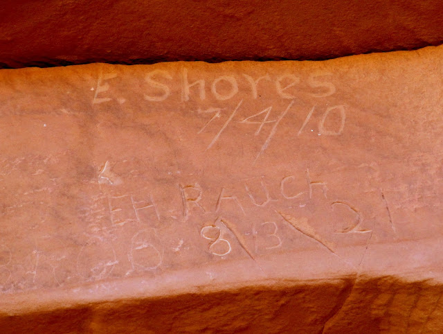
E. Shores, 7/4/10, and E.H. Rauch, 8/13/21
We spent less time at the saddle than I'd hoped for, but we really had to get moving back. During the hike back my legs started to cramp, and I began to seriously worry about whether I'd be able to climb back up the trail. Just while walking across the flat ground along the river I had to take a couple of breaks to wait for leg cramps to lessen. Surely the steep climb up the trail in Twomile Canyon would kill me. I plodded along very slowly up the trail, and somehow I made it to the top without my muscles cramping up. Before reaching the top of the trail it got dark enough to require the use of headlamps. I was the last one back to the vehicles--glad that it was over, but even more glad that I went.
Sketchy ledge coming down off Bowknot Saddle
Bowknot Saddle from the upper end of Oak Bottom
Inscriptions at the campsite on lower Oak Bottom
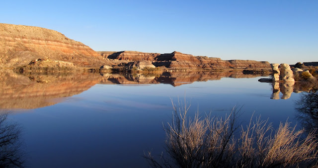
Green River reflection
Hiking back toward Twomile Canyon
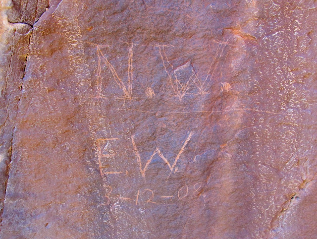
Neville and Edwin Wolverton, 3-12-08
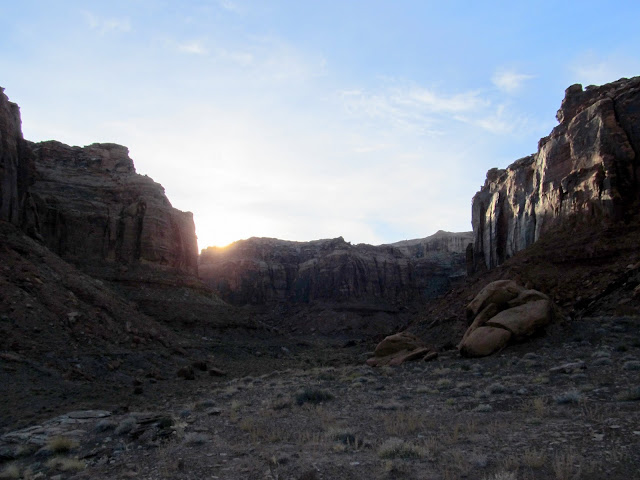
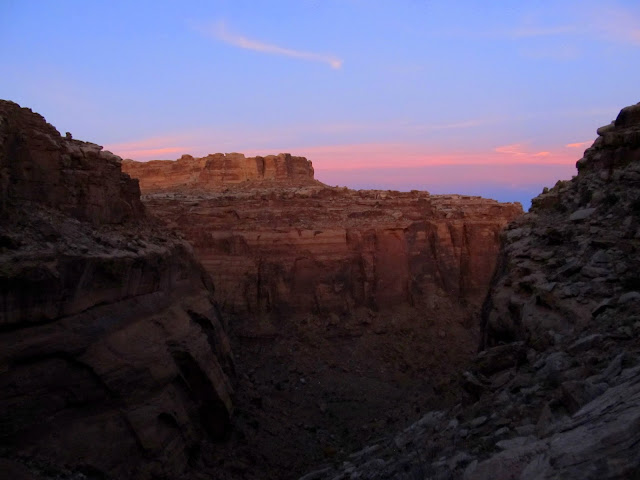
Sunset above Twomile Canyon
Colorful sky after sunset
Hiking out by headlamp
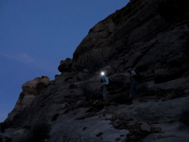
Photo Gallery: Twomile Canyon to Bowknot Saddle
Featured image for home page:

Obligatory photo of Horse Bench Reservoir during the drive south
Getting ready to hike
Scooting down the chute
Approaching the top of the trail
Dinosaur footprint?
Lyman near the top of the trail
Break in the cliff at the top of the trail (left) and cairn marker
A break in the cliffs led down to a short section that had been blasted out of the sandstone. There were a couple of short, constructed switchbacks before the trail turned west and leveled out. It then descended a long and rocky talus slope to the bottom of the right fork of Twomile Canyon. It took us an hour and 40 minutes to hike from the vehicles to the bottom of the canyon, where we rested up a bit before moving along.
View straight down on the trail
Colonnade Arch
Green River at the mouth of Twomile Canyon
Starting down the trail
The trail descends the cliff break on the right
Lyman and Alan
Dropping down some ledges
"Sundry" inscription
View from the trail toward the top
View up the trail from near the bottom
The hike down Twomile Canyon was fairly level and easy. A few of us spread out and we checked the large boulders in the canyon's bottom for rock art and inscriptions. We found a few modern names scratched into the sandstone but one 1901 inscription stood out: J.W. Shand from Manti, Utah. At the mouth of Twomile Canyon we turned northeast and hiked along a flat bench above the banks of the Green River. It was easy hiking and there was even sort of a trail along most of the bench. We reached the lower end of Oak Bottom and that's where it got a little difficult.
Hiking down Twomile Canyon
View up the main fork of Twomile Canyon
A faint inscription: J.W. Shand, Manti, 1901
Hiking along the bench above the Green River
Crossing a drainage and climbing back onto the bench
Oak Bottom with Bowknot Saddle beyond it
Oak Bottom is completely choked with trees and brush between the river bank and the talus slope at the bottom of Labyrinth Canyon's vertical walls. Our only real option was to scramble across the rocky talus for about a quarter of a mile until the brush eased and we were able to walk on the relatively flat flood plain. In the less brushy section of Oak Bottom we encountered a large boulder with the names of several sheepherders carved into it. Near the upper end of Oak Bottom we were surprised to find a rock with the initials of the "Lucky Thirteen," a group of early river runners who later completed a trip down the Colorado through the Grand Canyon.
There are two options to travel up Oak Bottom: scrambling or bushwhacking
Near the end of the scrambling along Oak Bottom
Chad Moore, Oct. XX, '44
J.W.S. (another from Shand)
April 18, 1936, A.J. Marsing
A. Moore, Jan. 10, 1939
Boulder with inscriptions along Oak Bottom
Green River below Bowknot Saddle
The "Lucky Thirteen" from 1927
Oak Bottom pinches out to nothing at its upper end, just below Bowknot Saddle, which is where we began our ascent. The original route up that we'd planned looked impossible from the bottom, so we spent a lot of time scrambling up and down looking for a break in the cliffs that would lead us up to the saddle. A couple of us (myself included) were getting a little exhausted, and it was already late enough in the day that we were certain to run out of daylight for the return trip. Wade kept at it, though, and finally found a route to the saddle! Lyman and I were the only ones to follow. Wade guided us up from above and we met him near the inscriptions that we came for. There were names from early explorers, miners, and river runners, with dates ranging from the early 1900s well into the 1940s.
Start of the ascent to Bowknot Saddle
Climbing up to Bowknot Saddle
Dead end number one
Panorama below the saddle
Downstream along the Green
Finally on the right path to the saddle
Bowknot Saddle
Photographing old inscriptions
Norville Edwin Wolverton, 9/1/05
Kolb Bros., 10/11 (bio here)
E. Wolverton, 9-2
Aleson + White, Oct. 26, 1947 (great history here)
E. Shores, 7/4/10, and E.H. Rauch, 8/13/21
We spent less time at the saddle than I'd hoped for, but we really had to get moving back. During the hike back my legs started to cramp, and I began to seriously worry about whether I'd be able to climb back up the trail. Just while walking across the flat ground along the river I had to take a couple of breaks to wait for leg cramps to lessen. Surely the steep climb up the trail in Twomile Canyon would kill me. I plodded along very slowly up the trail, and somehow I made it to the top without my muscles cramping up. Before reaching the top of the trail it got dark enough to require the use of headlamps. I was the last one back to the vehicles--glad that it was over, but even more glad that I went.
Sketchy ledge coming down off Bowknot Saddle
Bowknot Saddle from the upper end of Oak Bottom
Inscriptions at the campsite on lower Oak Bottom
Green River reflection
Hiking back toward Twomile Canyon
Neville and Edwin Wolverton, 3-12-08
Sunset above Twomile Canyon
Colorful sky after sunset
Hiking out by headlamp
Photo Gallery: Twomile Canyon to Bowknot Saddle
Featured image for home page: