shredhiker
Member
- Joined
- Feb 14, 2023
- Messages
- 112
I've been wanting to do a trip like this one for a few years now, finally found the time & courage to make it happen. Despite not getting a terribly great pick in the new YNP backcountry lottery system, I was able to get almost every campsite I wanted on the dates that I needed them. Initially this trip was going to be completely solo, with me renting a car that would sit for a week, and then hitching a ride between trailheads. A few weeks prior, we worked it out so that Amber could travel with me, but this hike was a bit more than she wanted to take on. As it happened, she had some friends working in Colter Bay who had some time off that week, so everything worked out quite nicely all around.
Traveling was fairly uneventful & stress free for once. We flew into Bozeman Sept 4, grabbed some bear spray & fuel cans from Sportsmans Warehouse, a quick trip to the grocery store, and headed south to our campsite at Lewis Lake for the night. It was a lousy rainy day, so we took our time driving through the park rather than heading straight down to camp. We ended up grabbing dinner down at Flagg Ranch, then sleeping in the SUV at our campsite as it was still pouring rain. By the next morning the sky was looking much better. Amber started working on breakfast as I headed to the south entrance ranger station to pick up my permit. The lady working that day insisted that I watch the bear safety video again, but as luck would have it they lost power the moment my permit got printed about a minute into the video. I made it back to Lewis Lake, permit in hand, as Amber was finishing up some delicious diced potatoes, vegetables, and eggs. I enjoyed my last freshly cooked meal, then we cleaned everything up, and I did one final check making sure my pack was all ready to go. I weighed it on the little luggage scale we'd brought along; 40 lbs on the dot, that included a few liters of water and a tall boy I was packing in to drink the first night. then we made our way to the Heart Lake Trailhead.
Day 1 (9/5/23): In to Heart Lake
We got to the trailhead just before 11 am. It was a warm day and the sun was shining nicely, but last I'd checked there was going to be rain later on, so I was prepared for anything. She was pretty nervous dropping me off, this was the longest and furthest out trip I'd ever done. At least this time I had a new garmin in-reach so I could check in with her when she had cell signal. I'd agreed to buy one, after the near miss with the grizzly during my last trip, something I should have done a year or two ago but had been putting off.
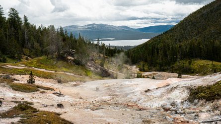
I made pretty quick work getting through the first few miles of wooded hiking, and was happy to come out of the trees into the thermal area, seeing that beautiful view looking down into Heart Lake once again. Last year we'd done a whole trip around the lake, and it was almost hard to believe this time it would now be quick stop on a much longer journey. I could see a few grey clouds lingering in the distance, but nothing that looked too ominous. I took my time heading down to the hot springs, and across the meadows toward the lake & patrol cabin. I arrived at the cabin around 3:30, as a light sprinkling of rain was just starting to come down, almost exactly like it had last year. I had a late lunch there and chatted with a couple of CDT hikers, while we watched a bat crawling around the door to the cabin. The rain let up, but it was obvious more was on the way, as I made my way down the shore of the lake headed to camp.
I made it to 8J1 somewhere around 4:30, hung my bear bag, and set my tent up, as the light rain came & went through the afternoon. I got down to the lake to collect some water, and in my attempt to wedge the beer I'd bought between some rocks in the lake to keep it cold for later, I put a pinhole in it! At that point there was no choice but to haul it back up to where the fire pit was, attempt to patch it with some duct tape, start sipping it, and light up a cigar while laughing at myself. The rain continued to start & stop throughout the evening, just enough to have my wearing my rain gear around camp, but never to the point that I needed to take shelter.
Around 7:30 I was about to call it a night, as the rain was starting to pick up, when a voice came along that startled the daylights out of me. Another CDT hiker told me she was in a bind and very politely asked if I'd share my camp for the night, she'd been permitted to stay at 8C5 but had a hard time getting a ride from Grant Village earlier that day. I've had my share of days that haven't gone according to plan, so I told her to go ahead and find a decent tent spot before it got completely dark. She was extremely grateful, and tied off her ursack & disappeared into the trees for the night. I got into my tent a few minutes later, and it started raining heavily which persisted for several hours, eerily similar to how last years trip had started off. At least this time, my tent didn't wet through, and it wasn't a terribly cold one, I slept quite well.
Day 2: Heart Lake to Grouse Creek
I woke up around 7am to a very foggy Heart Lake, in fact I could hardly look down the bank from camp and see more than a few feet past the waters edge. So much for the iconic morning view I'd hoped for, looking across at Mt Sheridan. I began my coffee and breakfast routine, as the lady I'd shared camp with reappeared. She thanked me once again for being so agreeable & apologized for interrupting my solitude. I knew I wouldn't see many people over the next week, so it was no big deal. I remembered from the previous year that I'd have a few water crossings with little visibility as I made my way off the CDT corridor from camp, so I waited until 10am when most of the fog had burned off, before leaving camp.
It was a beautiful and scenic day, no big wildlife sightings, and not much of a story to tell, except for being happy to be out on the trail. I saw two other hikers the whole day, one as I left camp who said he was with a group from MSU collecting samples from the thermal features around the lake. Another gentleman I ran into along Outlet Creek said he was camped near the eastern edge of Heart Lake and was going to attempt a summit of Channel Mountain. He said he'd hike the area a few times before, and gave me some good intel about the South Boundary trail, near Big Game Ridge where I was headed.
Somehow I lost the trail about a half a mile from camp, following a very well used unofficial trail downhill toward the creek, which dead-ended into the waist high grass, when the actual trail should have stayed up high. I checked my GPS to see that I hadn't gotten off by very far, but it was a tedious half hour getting over dead trees and navigating around some soft mud & muck before I climbed my way back up to the trail I'd managed to lose. I continued on toward campsite 7G1, there was a water crossing right by the camp, and a few scattered markers that were a bit confusing, but I found the camp around 4:30. There's a spur trail to the two campsites right where the trail that continues on crosses Grouse Creek, as best I can tell, part of the trail got washed out by high water at some point, and now there was just a few orange markers in some trees to assist with navigating.
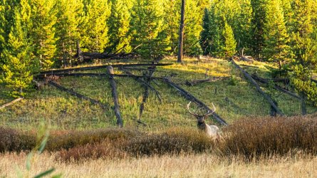
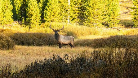
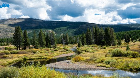
It was a very pretty campsite, on a lovely section of the creek, in a small cluster of trees with a large open meadow back to the east. The weather was still looking great, so after getting all of my camp chores done, I strung up my little hummingbird hammock and lounged around for an hour or so, just enjoying my surroundings until the sun started to disappear and I began working on dinner. A little after 7pm, I happened to glance out into the meadow behind where I'd set my tent, and saw a massive bull elk walking around, one of the larger ones I'd seen. As he noticed me, he stopped and we just looked at each other for about 20 seconds, with maybe 150 yards between us. I didn't bother trying to grab my camera, I was just glad to enjoy such a moment. Then he galloped off into the trees, and after maybe 10 minutes he made a few barking-like sounds, I spotted him again up in the hills beyond the meadow. He was staring dead at me, almost as if he was trying to get some type of response. A few seconds later he walked off into the woods, where I assumed I wouldn't see him again. I laid down shortly after that, and maybe an hour went by before it began raining yet again. It never came down very hard, but there was some thunder & lightning throughout the night. I heard a few elk bugling somewhere, but they didn't sound very close. It was around a 9.5 mile day.
Day 3: Grouse Creek to Yellowstone River
I crawled out of my tent around 7am. Almost immediately I heard a very loud elk bugle, I looked back out into the meadow, shocked to see what I assume was the same bull from the previous evening. This time he was substantially closer. As quietly as I could, I got my camera out of the tent, and was able to watch him through the trees while getting some photos and video of him hopping around almost playfully and raking his antlers the ground for a few minutes, until he noticed I was watching and his demeanor became a little more serious. I did my best to stay hidden where I could continue watching him, but every few minutes he'd spot me again and just stare at me, not coming any closer or moving away. I eventually decided that my watching was interrupting his morning, so I went on about making breakfast & coffee, trying to stay quiet and not disturb his routine. He hung around out in the meadow for a little while longer, before taking off into the hills once again. It was a pretty epic start to the day.
I headed out around 10am, followed the spur trail back to the main trail, crossed Grouse Creek, got turned around in the trees on the other side, and a few minutes later found myself headed right back toward the campsite. Well, this was embarrassing. It took me a few minutes to spot the orange markers in the trees on either side of the creek, designating how to pick the trail back up around the crossing, more or less, with an identical marker for the campsite. I made my way across once again, found the trail, and realized how pointless it was to have taken the spur trail to the campsite to begin with. Lesson learned, the spur trail is probably much more useful & necessary to make it up to 7G2, but I never took the time to follow it up that far. The next few miles would have me walking through plenty of tall grass, riddled with ankle deep mud pits. I lost the trail once again around the south arm of the lake, near the cutoff trail toward Two Ocean Plateau. Still it was exciting to finally see Yellowstone Lake from the southern end, and I was starting to see wolf tracks on the muddy trail.
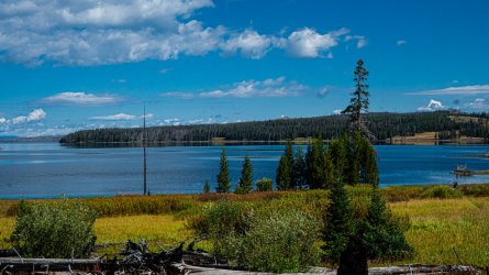
Around 3pm I'd made it to the southeast arm of the lake, and stopped for a late lunch, looking at the amazing view across the water. About 5 minutes down the trail past that, I realized the trail creek patrol cabin had some very nice picnic tables sitting outside that I wish I'd known about. Finally I was on a much more solid and easy to follow trail, enjoying the views of the lake, and all of the endless marsh surrounding it as I continued on. It was close to 6pm when I arrived at campsite 6B2, on the Yellowstone River. Down a little dead end spur trail, it was a fairly small & cramped site in the woods, next to a steep bank down to the water, with a pretty fantastic view, and a bit of a scramble down to the river. Once I got past a bit of mud though, there was a nice bed of smooth pebbles along the rivers edge. After a surprisingly tough 12 mile day, I laid down around 8, excited to finally be heading into the Thorofare the following morning.
Day 4: Upper Ford to Three Mile Bend
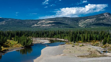
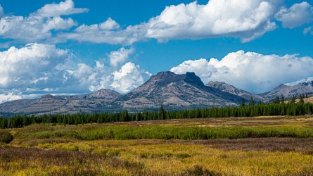
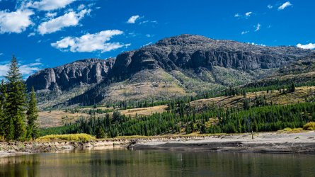
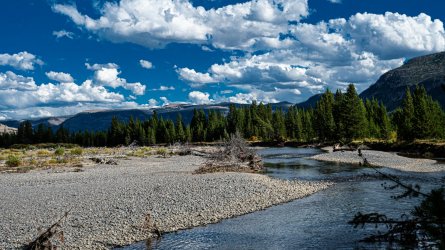
I woke up around 6:30 and spotted an elk up in the hills across the river from camp, too far off to really get a good look at. That night it had rained yet again, but with a relatively short day coming up, I was hopeful for good weather so that my socks & shoes could finally dry out for once. I'd been hiking on wet feet for a few days at that point. Around 10am I was crossing the Yellowstone River for the first time, it was just past knee deep, and not moving too swiftly where the trail crossing was. The views of the valley became more impressive & exciting as I headed south.
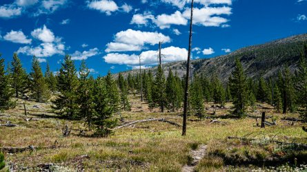
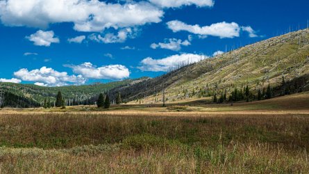
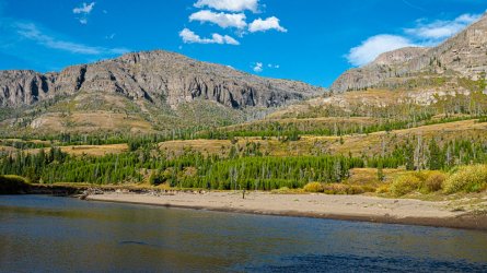
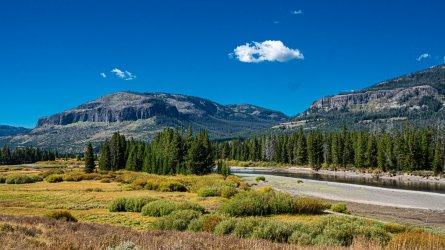
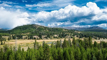
The weather was as looking as perfect as could be for most of the afternoon, until around 3:00 when I got rained on for a bit, despite still being in the hot shining sun. I stopped in at campsite 6Y7 as no one was there, and it offered some trees to take shelter under. I threw my rain gear on sat there snacking for a bit, until the rain let up and I could continue on to my 6Y6, where I was staying for the night. I arrived there around 4pm, and I have to say it was my favorite campsite of the entire trip. The spot was absolutely grand in every way; large wooded area surrounded by vast open country, great fire ring & tent spots, right on the river, with enormous views on either side. I got in plenty early enough to rinse off in the water, dry out all my clothes, collect wood for the nights campfire, and celebrate my arrival in the Thorofare with some whiskey and a cigar. Shockingly I didn't hear any wildlife at all throughout the night. It was an easy & enjoyable 8 mile day.
Day 5: Three Mile Bend to Thorofare Creek
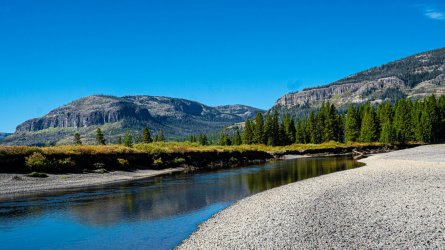
This was the shortest day of the trip. My next camp was only 4 miles away, which would allow plenty of time for me to take the obligatory detour to the Thorofare patrol cabin. I woke up around 7:30, enjoying the beautiful view looking over the river during my morning routine. Before packing up, I took a good half hour to just walk the pebbly shore along the rivers edge and soak it all in, then finally hiked out around 11.
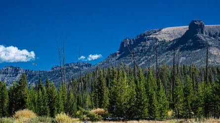
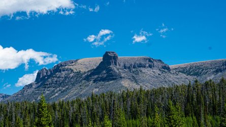
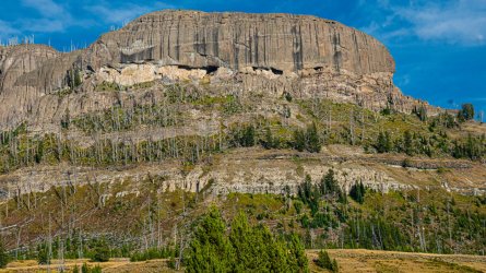
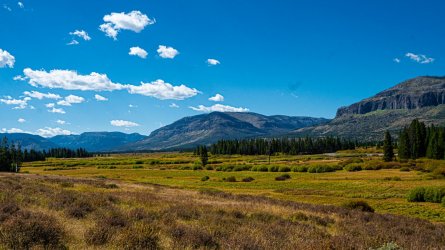
It was another perfect weather day. I moved as slowly as I could, taking plenty of time to admire the endless views in every direction, and taking lots of photos. By about 1:30 I finally found myself at the patrol cabin, with no one else in sight. I spent a good hour sitting on the porch, eating lunch, and browsing through the message book which went back to 2012. Every random page I looked at had its share of entertaining & heartfelt entries, it was hard not to get emotional reading a few of them. That was about the time that it really hit me, where I was and how much I should truly appreciate the moment. When I first mentioned hiking out there a few years prior, it was little more than a hopeless dream, I don't think I truly thought I'd be able to do it. Yet here I was.
It was maybe a half hour hike from the cabin to my campsite on Thorofare Creek. It was literally a few feet off the trail, but being so far out there, that didn't really bother me. The water was noticeably clear, but a bit difficult to access. While not as grand as the previous night, this spot still offered a fantastic view and made for another terrific evening. When I planned this trip I'd hoped to take a side trip down to Bridger Lake, but I'd been having some knee pain since day two that was teetering between annoying and troubling. Since I'd been feeling pretty good that day, I opted to take it easy as I knew I had the two toughest days of the trip ahead of me.
As I went to make dinner, I took inventory of my remaining meals trying to plan out what I wanted to eat on which days, and realized I'd made an impossibly idiotic mistake. Somehow I'd been thinking for months that this was an 8 day trip, when it was actually 9, and I'd packed 8 days worth of food. I thought through in my head over & over about how many camps I had left, thinking it had to be a mistake, but it wasn't. The time to double check things had come & gone. Fortunately I had a couple of large meals that could be split up into two, some snack foods that I hadn't eaten much of, and I always throw a few spare things into my food stash just in case. It was going to be cutting it close, but I had enough to ration out for the rest of the trip, I'd just be running on crumbs by the time I hiked out.
I got the campfire going around 7:30 then drowned it and retired for the night about an hour later. I wasn't certain about the first one or two, but as the night went on the distinct sound of wolves howling became more & more apparent. I covered just under 5 miles.
Day 6: Thorofare Creek to Plateau Creek
I got up around 6:30, it was pretty cold and just starting to get light out. I started my hike out around 9am, trying to enjoy my last morning out in the Thorofare without wasting too much time, as I had long day ahead of me. The trail toward my crossing of the Yellowstone River was barely visible through the shoulder high willows, but easy enough to follow, and still offered great views all around. Shortly after completing the river crossing, I realized I was supposed to follow the trail on the other side a couple hundred yards further, oops. Thankfully it only took me about 15 minutes to follow the waters edge and meet back up with the trail. I had little more of the Yellowstone to hike along before it was time to head west up Lynx Creek and start gaining elevation.
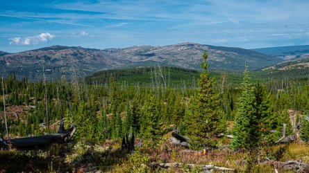
There were a few really nice views back down into the Thorofare before I was in some pretty dense forest for most of the day. I crossed lots of wet & muddy sections of trail and was starting to see grizzly tracks, the first few headed in the opposite direction, but as the afternoon went on I started to see lots of them going both ways. I did my best to stay alert and make plenty of noise. It was pretty much an uphill march through the woods, until the trail finally opened up into some nice meadows just before I reached Mariposa Lake around 3:00. The lake was quite a beautiful scene, and one of the few campsites I was unable to acquire for this trip. I got into site 6M4 on Plateau Creek around 4pm, having made pretty good time for the day.
While the campsite had plenty of nice flat tent spots with good tree coverage, great water access, pretty views, and a nice fire pit & food pole area, it also gave me a bit of a nervous feeling. The combination of the bear tracks right by camp, the fire pit having been dug out, the creek meandering all around, and just the overall feel of the terrain made it seem like a bear playground. To make things even more interesting, I got a message from Amber or my inreach telling me she'd successfully completed her one night solo trip in the park to Imperial Meadows, one of the first campsites we ever stayed at. She also informed me that she encountered a grizzly 50 ft off the trail on her way out!! That was all the information I had at the moment, so I was assuming she was alright, and hoping it wasn't too terrifying of an ordeal. I'd seen zero bears on this trip so far, and despite my nervous feeling it was a very quiet and uneventful night. I hiked around 10 miles, climbing 1800 ft.
Day 7: Big Game Ridge & the resident bears
When 7am rolled around it was obvious that I'd reached the coldest morning of the trip by far. I finally forced myself to get out of the tent around 8, I was down in a hole where I wouldn't have much sunlight to warm things up anytime soon. I knew I had another long tough day ahead of me, so I had to pack the tent up still damp from condensation, and make my way out around 10:00, a good hour later than I'd intended.
It was a day I was looking forward to though, I hadn't really seen any photos of the area I'd be covering today, but what I'd seen playing around on Google Earth made it look very interesting. Shortly after leaving camp I found myself at the Fox Creek patrol cabin, then climbing out of the gorgeous little valley just beyond it. After that I found myself climbing through the trees for a few hours without many views to be seen. Around 3:00 I found myself on some more open trail, and kept waiting for the big views as I made my way up every little hill I could see. Around 9,800' I was starting to feel the effects of the elevation and moving pretty slowly, I stopped to catch my breath for a minute, and heard something off to my right that sounded almost like a coyotes bark...
I looked up into a cluster of trees about 50-60' off the trail, and couldn't believe what I was seeing. There was a sow grizzly with two very large cubs! I immediately reached for the bear spray, and she stood up on her hind legs as I pulled it from the holster. She stared at me for a few seconds as I flipped the safety off, praying that she wouldn't head my way, even though I had time to react. She didn't waste much time heading down the ridge on the opposite side. I moved uphill quickly, bear spray in hand, keeping an eye in that direction and never saw another sign of them. I couldn't help but wonder how long she'd been watching me, or if I may have passed right on by having no idea they were so close, were it not for me cluelessly stopping right in front of them.
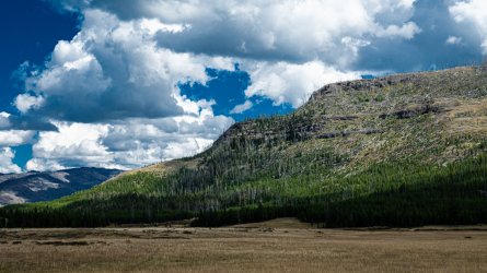
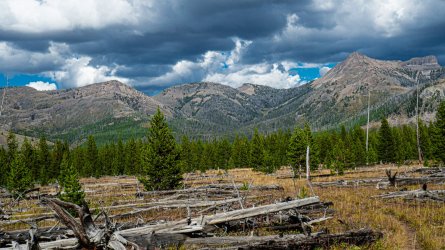
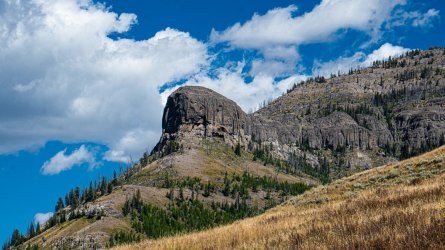
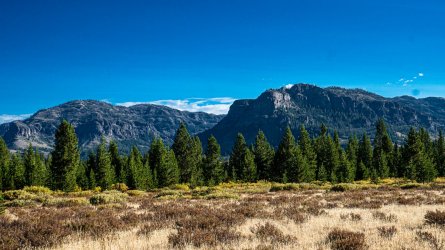
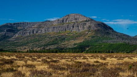
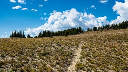
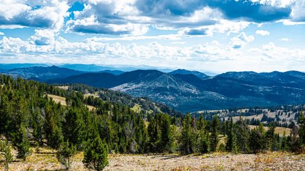
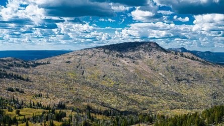
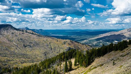
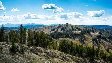
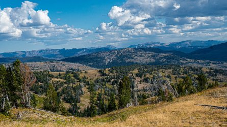
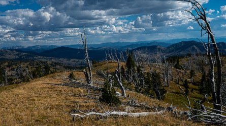
Around 4:00 I'd finally made it up high enough to get my first really big views for the day, and they were quite impressive. Looking north I could see Mt Hancock, Heart Lake, and even make out Yellowstone Lake off in the distance. South I could see all the way to the Tetons, clear as day. I found a spot to sit for a late lunch with a great view, checked my messages, and saw that Amber had just eaten a sandwich down by Yellowstone Lake, I thought it funny as I was looking right at the lake myself. I checked in, telling her how great the view was and that I'd be looking for camp soon, neglecting to mention the bear encounter. That would be best told face to face, when she could see I was alright. Now we'd both have a story to share. I wished I could've hung around up there a bit longer, and gotten more photos & video than what I did. It was very much a dessert like landscape as I made my way over the ridge; sandy, rocky, some lingering dead grass, and a graveyard of old dead trees.
As the trail joined Harebell Creek, the descent was quite steep through the old fire burn. I'd marked coordinates for an area where someone told me there was decent camping (I believe from this forum, so thanks for that) but had my eye out for anything I could find whenever the trail got near water. The first suitable camp spot I found was dead on what I had marked on my GPS, a small fire ring right off the trail with some wood unused by the last camper, and a flat spot just large enough for my tent behind some trees, hidden just a bit off the trail. I saw a couple of trees around that looked suitable for hanging my food, and around 6:30 began setting up for the night. There were a few pretty large deer hanging around in the hills next to camp, they didn't seem too bothered by my presence, slowly walking out of sight every time they caught a glimpse of me. I'd found a tiny flat spot in a very hilly landscape, it didn't give me much visibility in any direction, which I wasn't a huge fan of. Shortly after heading to bed I heard an elk bugle, followed by what I thought was a grizzly roaring... A few minutes later I heard it again, and it sounded more like another elk just making a low pitched grunting kind of sound. At least believing that made it much easier to fall asleep, as I heard the elk going crazy through the night. The day was about 11.5 miles, both climbing & dropping some 2,500'
Day 8: Harebell Creek to Snake River
I'd covered enough ground the day prior, that this was shaping up to be an easy 5-6 mile day to campsite 8C2, which my old guide book claimed was fantastic. I got up around 8, then started hiking around 10, still heading downhill pretty steeply and getting out of the fire burn into some live trees. Not long into my hike I'd gotten a message from Amber that she and her friends were hiking into 8C1 on the Snake River that day. Real time communication was a bit tedious, but we were able to establish that was only a few miles past my intended campsite and that I could plan to go a little further and meet them there that evening. So now I was looking at 10 miles for the day, but very much looking forward having a day to spend together before flying back home.
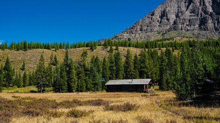
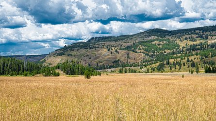
About an hour into the hike, I was at the Harebell patrol cabin. Beyond that I was mostly in the trees for the afternoon, with the trail occasionally opening up to a small meadow or nice scenic look through the hills. I crossed Colter Creek around 1pm, and ate my small rationed out lunch as my feet were drying on the other side. Half an hour later I was at my intended campsite for the night at Nine Mile Meadow, it was a beautiful spot indeed, and I was a little disappointed I wouldn't be staying long. Days had been long & hot, and I was starting to smell pretty ripe. I scrambled down to the water and took a short dip in the ice cold Snake River, glad to feel the sun in the heat of the day, the second I got out. I filled my water bottles up, lugged them back up the bank and proceeded to rinse my clothes off as best I could. I hung them in the sun by the bear boxes for a few minutes before throwing everything back on and continuing my hike. It really was a fantastic campsite, I hope to make my way back there someday.
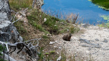
Once I got across the endless tall grass meadow the trail moved into the trees, with the river just out of sight, and the next few miles were fairly muddy. I spotted a handful of bear tracks, which had become the norm over the past few days. Around 4:00 I made my way out of the trees, as I started getting views of the river again, I could also smell the thermal features around. After stopping to photograph the marmot I'd spotted, I saw Amber & her friends just a few minutes after, sitting way out on the river off the trail. I hiked down to meet them all, happy to see her and realizing that we'd all been trying to meet up since 2020! She'd met them at a bookstore in the park that year, they all stayed in touch, & though she'd briefly visited them at another store in 2021, our plans to meet up on Slough Creek in 2022 were made impossible by the flood.
Storm clouds were looming overhead, so I collected water for the night while I was down there, and we headed up to the campsite where there would be some tree cover if needed. It never really did rain, and we all sat around until well after dark with lots of stories to tell about what we'd all been doing for the past week. I have to admit, I'd been apprehensive about having an in reach & staying connected when I've grown so accustomed to being cut off when I'm on the trail. I have to admit though, being able to coordinate days like this made it absolutely worthwhile.
By the way, Amber completed her first solo hike overnight to Imperial Meadows a few days before. She'd taken one of her girl friends out there in August, which was a pretty big deal in itself, and had decided she wanted to try it alone. She enjoyed the hike in, got there early, and loved being out there all day. Then when it got close to dark, she got a bit freaked out being out there alone, and didn't sleep so well. Once it was completely light out the next morning, she packed up and was in a hurry to get back to the car. As she got near Fairy Falls, she let out a nice loud "hey bear" and saw the head of a grizzly pop up about 50' in front of her! She told me that it quickly hurried off, not the same way she was headed, and she hiked on out of there as quickly as she could. I told her I was proud of her for going out there alone, and even more so to see she was back on the trail to meet me a few days after. I hiked 9.5 miles, dropping 2,000 ft.
Day 9: Out to Snake River TH
Sometime in the night it started to rain pretty heavily, and it was steadily coming down still when we woke that morning. Around 9, it finally let up to where we could all get out and start working on breakfast. The sun was starting to peak through, but it was chilly with mainly cloudy skies overhead, and looked like a long dreary day was certain. At least we only had around 5 miles or so back to the car. We started the hike out around 11, all with rain gear on, but an hour in it was starting to warm up and no sign of rain. We took a short snack break where everyone ditched their rain gear, and continued the muddy hike out through the woods. Those miles flew by quickly, and there weren't many views to be seen until we approached the crossing of the Snake, right by the trailhead.
As I took my shoes off, I realized that I was just about complete the 85 mile, 9 day journey that I'd decided on a year ago. This was the longest trip I'd done, in mileage or number of days, and somehow I wasn't ready for it to be over. I got behind the group for the last little bit, taking a few photos, and enjoying those last few minutes in the Yellowstone backcountry for the year. When we got back to the vehicles, I drug out the cooler and our little single burner stove. We used the remaining bread, cheese, tortillas & lunch meat Amber had to make whatever variations of grilled sandwiches and quesadillas we could come up with.
When the picnic was over, we all said goodbye, with tentative plans to hike together again next summer. We drove down to our campsite at Flagg Ranch, storm clouds were lurking yet again so we didn't bother setting up tents. After showering, we organized our packs & luggage for the flight home the next day, then we headed into Grand Teton on our way down to Jackson. Amber's birthday had passed on day 2 of my trip, and I promised her a belated birthday dinner anywhere she wanted. She had the elk chop from Gun Barrel, I had the bison prime rib, elk steak, and venison sausage dinner.
Last edited:

