Red Breaks and Cosmic Ashtray

alene

Member
Joined
Feb 24, 2012
Messages
42
anyone done this slot off Hole in the Rock Road? I"m anxious to check it out and photos of the "cosmic ashtray" look like it's pretty impressive. I'll be heading down next Friday to do the hike on Saturday, October 27. any tips or suggestions regarding?
 
I haven't done it but I've had it on my radar for awhile. From what I understand there are some climbing problems in the Red Breaks that have caused more than a few people some problems. ashergrey posted this trip report where his lady friend was unable to proceed. Looking at his GPS track it looks like the turned around after the fork that leads towards the Escavolcano so maybe he can share a bit more information on the climbs.
The old road used to cross Harris wash, pass the Escavolcano, and they connect to the Sheffield road. Im sure walking this route would be a cake walk but not very desirable due to the alternative of the red breaks slot but I would consider it for a loop option..
 
I have, sort of. I had to bail out because of weather. The loop route described on Summitpost is longer than it sounds and getting up over some of the obstacles in the lower slot can be tricky.

http://backcountrypost.com/forum/in...-bryce-canyon-march-24-27-2011.794/#post-8330

At this time of year the shortened daylight would be a major issue if you plan to do both Red Breaks and the Cosmic Ashtray. If you go, start early and keep a good pace.
 
I've done a route up the slots, excluding the west fork, and over the bench to the cosmic navel (ashtray).
taking the west fork in the slots takes one much further away from the cosmic navel, but is doable.
it takes some work to get through the lower slots & over the chockstones , so be prepared. best not to do it solo, as a little boost from a friend can help (i am only 5'5" so i had a heck of a time spanning in a couple of spots & needed a boost on one in order to get a good handgrip to pull myself up & over).
there is likely to still be a little bit of water in a few places from the rains last week.
Our route took the east fork up just past a very large tank that is in the middle of the wash & then once past it, we found the first point in which we could head up & over the southeastern bench. from the top of that bench, simply descend into the eastern wash & then up the relatively gentle slickrock slope that will be on your east/northeast. this will take you up to the cosmic navel.
you cannot enter the navel from that side, but if you head up & over the hill on your left once you are overlooking it, you can drop back down to the other rim & there are modern moki steps that allow access into the bowl.
we then walked southwest down the slickrock wash until it met up with the old Harris Wash road & then walked it back to the trailhead.
overall mileage for that route was at around 12 miles.
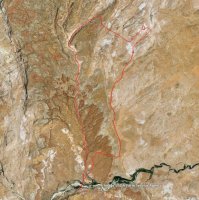
I'll make a map of the route we did and post it.
 
awesome, thanks, your map will be much appreciated. I was looking at the summitpost information and planning on marking points with my GPS. Is the route difficult to follow / find?

We have 4-5 people going so far and welcome others if interested. Those of us going have a good amount of slot canyon experience and will definitely be on the lookout for bad weather and have backup plans.
 
after mapping it, the mileage was more at about 10 miles.
my mapped route is a rough estimate. there is one spot where we had to go up the side of the bench to bypass a dryfall on the left in the east fork if i remember correctly. the route over the bench is approximate. it is pretty much a matter of finding the route that is most comfortable for you. heading all of the way up to the top domes adds mileage and it is more convoluted at the top than one would think. heading over the bench is the easier, more direct route.
red breaks.jpg
 
awesome, thanks, your map will be much appreciated. I was looking at the summitpost information and planning on marking points with my GPS. Is the route difficult to follow / find?

We have 4-5 people going so far and welcome others if interested. Those of us going have a good amount of slot canyon experience and will definitely be on the lookout for bad weather and have backup plans.

the route is pretty easy to follow. if you choose or happen to go to the top of the drainages, just head east/southeast towards that side of the mesa and you will be fine.
the walk back to the trailhead via the road is straightforward and for the most part flat, which felt great on my quads after all of the slot canyon efforts and the downhills coming off of the benches (it's never the uphills that get me).
i should also add that this was the first slot canyon I ever did. i also watched 127 hours the night before, which made it psychologically more interesting, but may not have been wise :rolleyes:.
i'd post a trip report, but i absentmindedly left my camera in the car that day....ooops!

i'd love to go with but I have an art opening in Boulder at the town hall that night & will be finishing up hanging the show that day.
the opening is from 5-7pm if you happen to be off the trail & in town by then & feel like stopping by.
 
also of note is that it IS possible, according to some of the hiking books, to bypass some of the obstacles by backtracking & bypassing the slots on the bench above on the right side looking up canyon. this could come in handy if any in the group can't make it over the chockstones. a few of those obstacles have rather loose branches & rocks that are in exactly the places where one wants to grab hold or place a foot. also, the bypass up the side of the dome is rather steep and is composed of what i call 'loose skin' sandstone - meaning the surface layer is flaky and a bit soft.
 
one more little note: the eastern most (exit) drainage is a very interesting little place. the floor of the wash looks like petrified multicolored mud flats & in spring after snow melt & in fall after monsoons, there are a lot of small almost marshy areas with a lot of birds & moss & grasses. at least there were when we went through in early april 2011.
 
Hi alene, I'm very interested in how your trip goes. This spot has been on my to do list for some time. I hope to visit it next spring or fall. Would be awesome if you'd post a trip report after you complete this little adventure.
Good input intuitive cat. Wow! What a TR ashergrey! You can probably look back on that one as a character builder.
 
Has anybody chosen the northern route to the cosmic ashtray?
I plan a 2 day backpacking trip in the next year.
TH is on Spencer Flat Rd near Big Horn Cyn.
Thx for your recommendations. :)
 
Has anybody chosen the northern route to the cosmic ashtray?
I plan a 2 day backpacking trip in the next year.
TH is on Spencer Flat Rd near Big Horn Cyn.
Thx for your recommendations. :)

the main issue with that route is that the end section of Old Sheffield/Spencer Flats road is extremely sandy once past where the southern right turn to the Red Breaks Drill Pad road heads off, as is a lot of the hike around that north end of Red Breaks.
bonus: not many people head through that pass & the area just north of Red Breaks towards the river is amazing.
it would be worth adding in an exploration of the parallel fracture canyons just north along the river which are locally referred to as First & Main. If I remember correctly, Kelsey refers to them in the non-technical guide to the CO Plateau as Spencer Canyon. It would be easy to hike over to the rim of the Escalante Canyon directly across from the confluence with The Gulch from that trailhead as well.
from what I have read (i have not done this route yet, but it is on my list) the best thing to do is park when you reach a slickrock pad along the road and walk from there instead of risking sand traps toward the end of the road.
Also, the main TH for Bighorn Canyon is nearly 4 miles west of the junction of the drill pad road & old sheffield road, so don't park there unless you really feel like walking an extra 8 miles down the road. there is a corral & slickrock area about halfway out the flats & just north of the 'Pyramid" dome that makes a good parking area if the road is too sandy beyond.

i terms of making sure you are headed in the right direction once you turn the corner of Red Breaks, the old Harris Wash/V road passes almost right underneath the 'cosmic ashtray', so as long as you skirt the edge of the mesa until you run into the road, you should have no route finding problems.

I was seriously thinking of doing a route at some point that would leave from the trailhead you are thinking of, head over to the sandslide where the old Harris Wash road descends to the river, head downstream to Harris Wash & then head up Harris Wash & around Red Breaks via a narrows/slot canyon that is just east of Tunnel Slot & then walking the old road back to the trailhead. it would be a seriously sandy slog for the last day though and came out at mileage of around 3o miles total - meaning more than just 2 days to be enjoyable.

if you remember to, message me close to the time when you plan to go and i can try to give you better road condition info, etc.
I spend a lot of my time in early spring out in that area & also know the ranchers who run cattle out there pretty well.
 
Thx a bunch for your recommendations, intuitive cat! :twothumbs:
I'm so happy.
I know about main issue of the end of the Spencer Flat.
I've been there a couple of times. It's a amazing area.
My major issue is the RV. That's the point that I have choose the little spot near Big Horn TH.
Landmarker is a cube looking rock, on the south side of the road.
The parking lot that you mentioned is a mile further east?
My pre plan is now:
Day1:
From one of the THs heading to the parallel fracture canyons towards to of Jamal's mentioned Ladder Route to the River and searching for a campsite.
Day2:
Exploring Escalante River area, mouth of The Gulch, etc.
Day3:
From Campsite to the 'cosmic ashtray', then northernly cross country back to the TH.

The whole loop via old Harris Wash, tunnel sounds very interesting. But I/we needs more than 3 days.
I do never rushing. I love to enjoy these kind of landscapes.
We are sandstone junkies too.
 
Anxious to hear more about this trip. The Red Breaks is definitely a cool area if the weather cooperates.

And wow... I hadn't read @ashergrey's trip report until now. Glad everything turned out ok for you guys.

Michael let me know if you need more info as your trip grows near. I can plot my exact course if you wish. When I was there this last May I managed ok solo with a big pack, but I really would not recommend it like that. A base camp in the northern area and then day-hike to the highlights would make it all much more enjoyable. It's possible to exit the main fork and enter the east fork. I did this just north of where the drainages come together. You need to have some good slickrock zen going on to get up the initial 5' or so to exit. The east drainage is a cool area all the way over to the volcano.

From the volcano I headed east to the Upper Sand Slide to the Escalante, so I didn't connect this to Allen's Ladder route farther north. And to clairfy, I just observed the Ladder route when I was there from the bypass which also gets one up/down from the river. All that said -- there are several ways which look pretty easy to connect these routes -- depending on how much up and down you want to do.

- Jamal
 
Jamal, thank you very much for your helpful reply and very friendly offer. :)
I start the next time a new thread for my questions to our hiking tour 2013.
 
yesterday I finally began putting together my trip report and then dreamt about the hike last night. That's how much I loved it! I'll have it up in a day or two.
 
Similar threads
Thread starter Title Forum Replies Date
Bill Big West Fork of Red Breaks to The Cosmic Navel Hiking & Camping 48
cmgz Red Breaks from Harris Wash Canyoneering 13
Dustin Gent Red Breaks via Spencer Creek Road General Discussion 1
George_Washington_Hayduke Possible to go up Red Breaks? Trip Planning 5
Writhdar Red Breaks Northeast & East Forks Loop? (Escalante area) General Discussion 3
piper01 Escalante Area Wandering: Red Breaks Hiking & Camping 0
powderglut Pt 2 Red Breaks and Willow Gulch Hiking & Camping 8
alene Red Breaks Big West Fork Canyoneering 11
TrektheWorld Red Deer Lake & Beyond Backpacking 10
NorthwestWanderer First time in the High Uintas | Red Castle SNEAK Loop | I give these mountains 5 out of 5 stars Backpacking 7
TheMountainRabbit Red's Meadow to Tuolumne Meadows via the High Route (Ansel Adams/Yosemite Wilderness) - August 2022 Backpacking 5
TeamJenkins17 Red Tops/Needle Creek Drainage Info Trip Planning 0
BJett Red River Gorge/Red Byrd Arch Packraft Trip - Kentucky Hiking & Camping 9
Stephanie B Our Intro to the Red Desert, September 14 - 16, 2020 Hiking & Camping 4
fossana Red Cliffs & Dixie NF fire-related trail/road closures (St George area) Trip Planning 1
wsp_scott Two kids and the Red River Gorge Backpacking 7
wsp_scott A year in the Red River Gorge Backpacking 15
Artemus Road Proposed to be Bulldozed through Red Cliffs Recreation Area General Discussion 7
wsp_scott Red River Gorge (KY) Backpacking 3
WasatchWill Red Castle vs Cirque of the Towers vs Titcomb Trip Planning 50
Ehouston24 Uintas Loop (Red Castle/Kings Peak) Trip Planning 14
Rockskipper Snowshed on Red Mountain Pass, Colorado, 3-16-19 General Discussion 7
b.stark Red River Gorge 2010 "From The Vault" Backpacking 5
fossana Red Reef loop Hiking & Camping 3
DrNed Red Castle Kings Peak Henry's Fork Take Two Backpacking 8
fossana Red Cliffs Après Work Scramble Hiking & Camping 3
J Red Rock(s) Canyon Natl.Conservation Area Hikes and Scrambles Nov. 15 and 16, 2017 Hiking & Camping 0
L Red Castle Lakes / Wilson Peak OR Rock Creek Basin Trip Planning 4
Ugly Wednesday Night's Red Pine Winter Sports 2
jdfut66 Red Castle Loop Backpacking 13
Tystevens Henry's Fork -- Red Castle loop from China Meadows Backpacking 2
Kootenai Red Castle recommendations? Trip Planning 1
Perry Red Castle Is Open for Business ... eeh .. Almost Backpacking 19
scatman Red Butte Canyon Rim-Walk - May 20, 2017 Hiking & Camping 10
AKay09 Red River Gorge/Clifty Wilderness Trip Planning 0
Stephanie Quick trip to Coyote Gulch via Red Well Trip Planning 4
danger02ward Dead horse lake with a visit to continent lake,reconnaissance lake, red knob pass, and allsop pass Backpacking 4
Perry Off Trail Porcupine Pass to Red Castle Lake Trip Planning 5
Kullaberg63 Indecision Peak, Red Rocks, NV Hiking & Camping 0
Perry Question About Number In Red Shown At Top of Main Page Questions, Suggestions & Support 2
Jackson Lower Red Castle Lake Backpacking 4
Ross Hiking/easy canyoneering partner for Bull Valley Gorge,Sand Wash (Red Cave) & other spots Trip Planning 0
Seldom Seen Anderson Red Butte Wilderness Hiking & Camping 3
IntrepidXJ Red Mountain Colors Hiking & Camping 4
BJett Hikesgiving 2015 in the Red River Gorge Backpacking 10
D John Muir Trail: Yosemite to Red's Meadow Backpacking 8
Red Rock Rangers Red Canyon Hiking & Camping 0
BJett Red River Gorge, Kentucky - Perseids Hiking & Camping 5
Bigred72 Red Pine Lake Backpacking 1
IntrepidXJ Red Mountain Pass Peaks Hiking & Camping 8

Similar threads

Back
Top