- Joined
- May 19, 2012
- Messages
- 2,017
When my wife and I first came through here we thought Government Trail area was the most beautiful stretch in Grand Gulch. We were kind of in a hurry, stopped at Big Man Panel (BTW there are numerous rock art panels in between Government Trail and Big Man Panel), but did not explore very much. I have since spent a lot of time in this section. When we decided to share this area with our son Government Trail was an easy way to get into the Gulch. About 3 miles across Polly's Mesa and a steep trail into Grand Gulch.
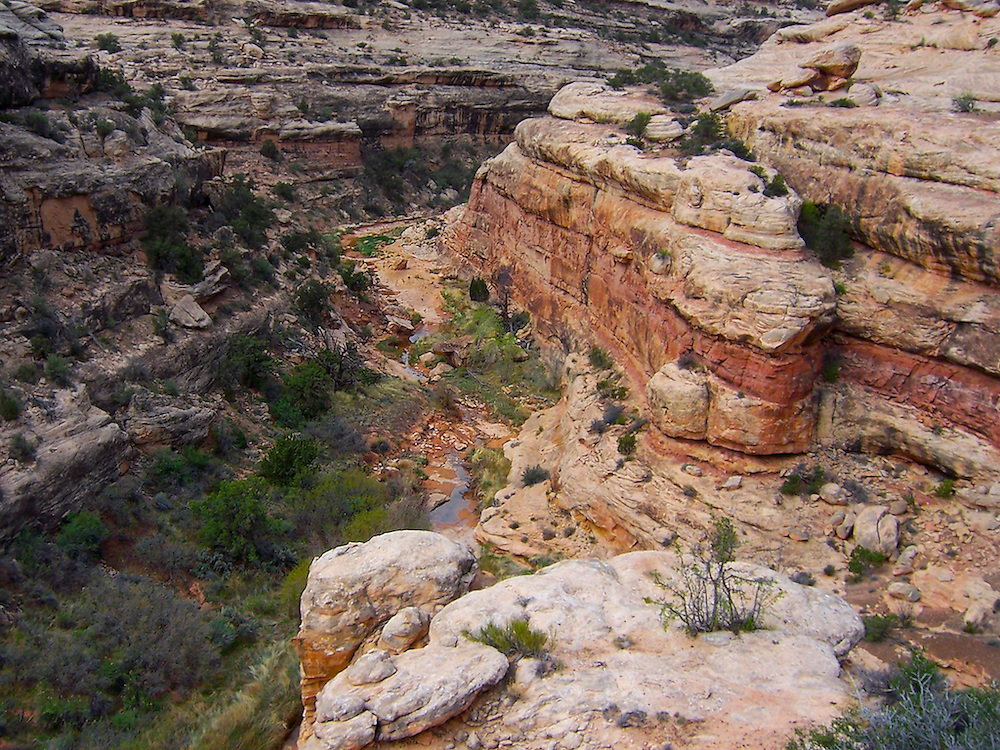
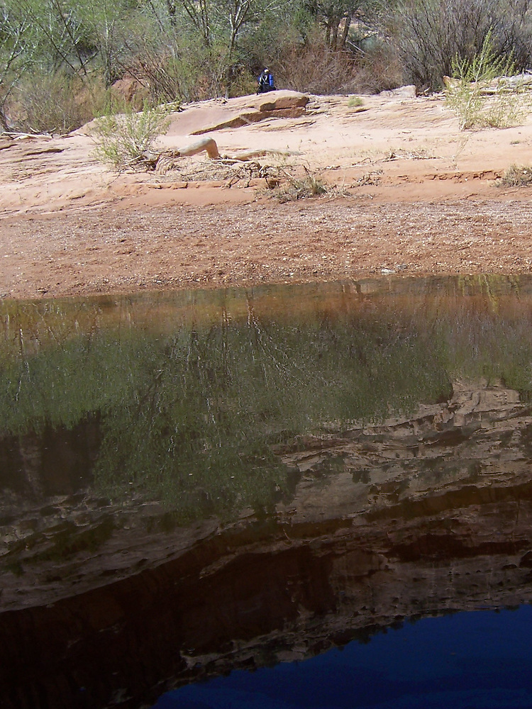
One of my favorite hikes from Government Trail is down Polly's Canyon (4 miles) into Grand Gulch, down a few miles to a nice pool (Big Pour Off Spring ?). Then back up Grand Gulch and out Government Trail. We have also done a loop using Government Trail, and out Deer Canyon then back to the car at the Government trailhead.
I have shots from 2 trips, one in the spring of 2006 and one in the fall of 2011.
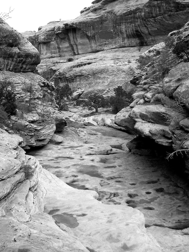
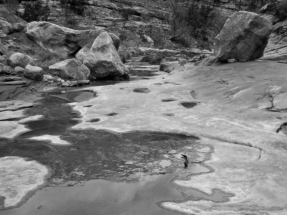
I have always sprinted down Polly's Canyon, but you could easily spend a couple of day's in here. Essentially the route is from the car park at Government Trail, head due east, not long you will see a small side canyon of Polly's. Contour down and enjoy the route, which follows a small trail, that was pretty spicy in spots if memory serves. It is easy to get stuck and have to bushwack further down canyon so look for low rock shelves on the sides to climb up to. Once you are stuck in that stuff it is easier to back up and out to the side so you can get by.
All of the ruins in this post are easily accessible from Government Trail, heading down canyon. See DAA's post for some excellent shots of this same area, and some images I don't have of ruins in Polly's.
View larger map.
LDC, Polly's from up above in 2006, right after a rainstorm:
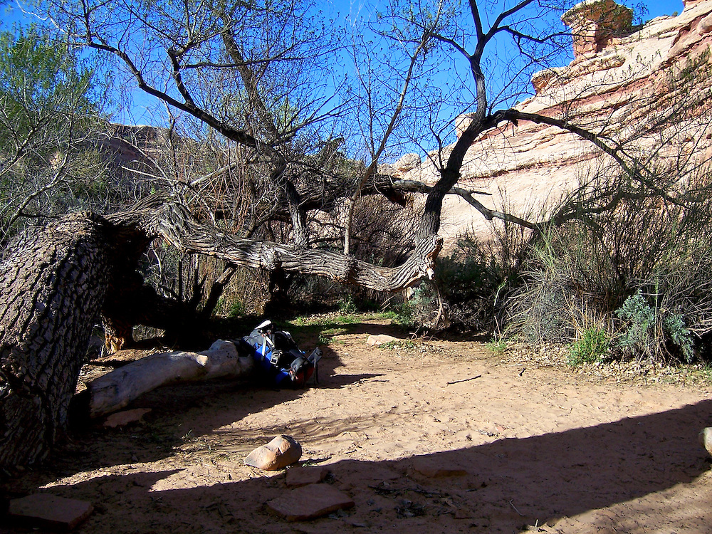
Camp spot at Polly's/Grand Gulch Junction:
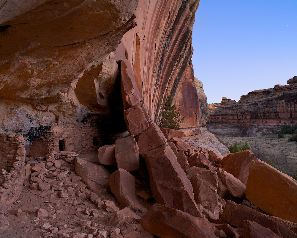
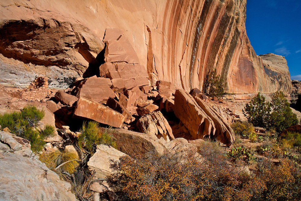
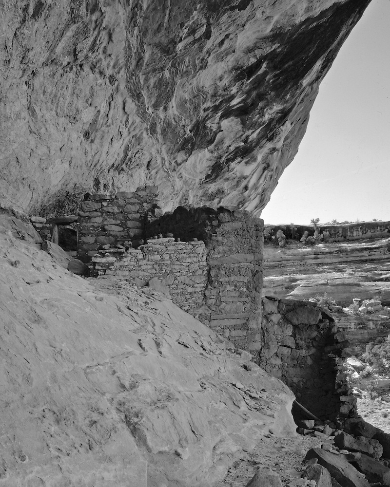
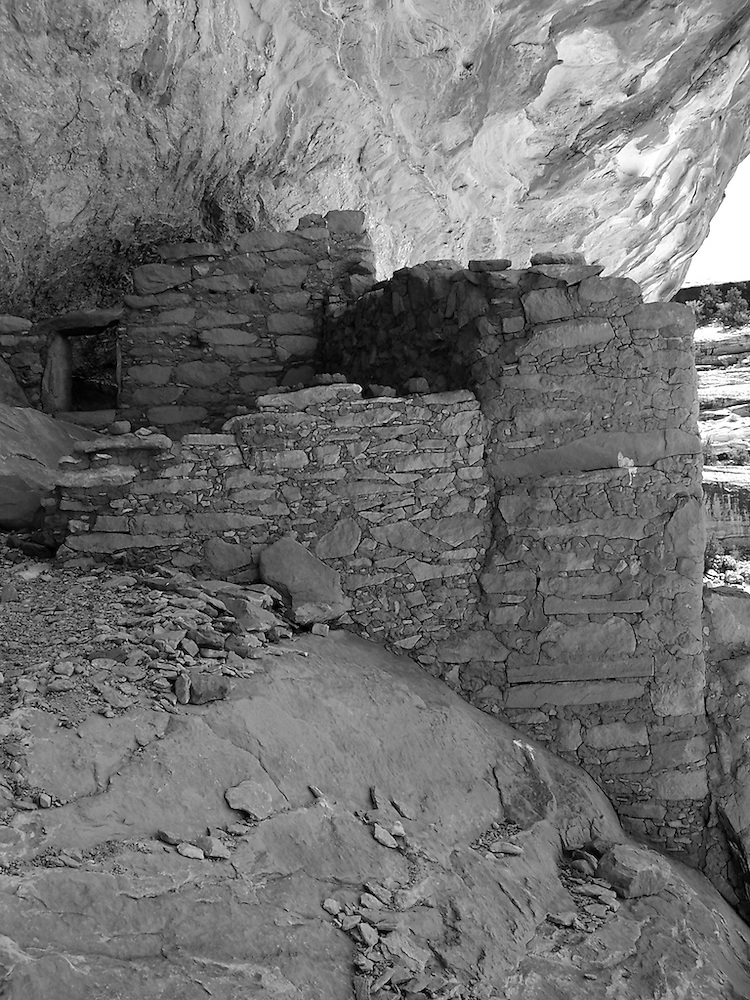
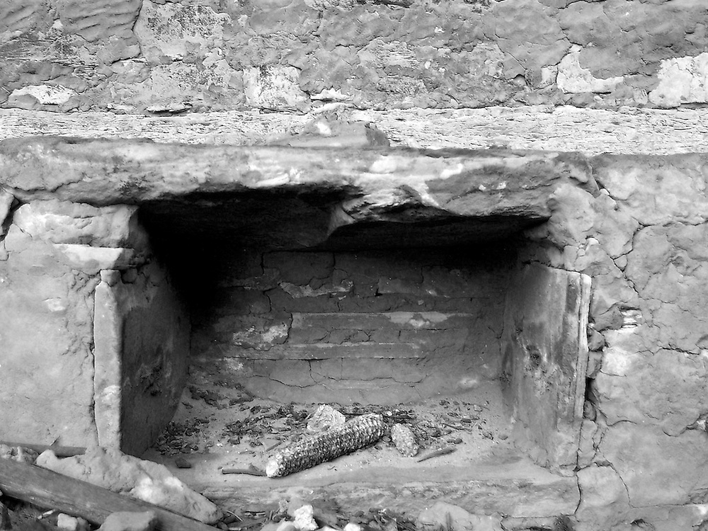
On that trip in 2006 I had no special place I wanted to go, other than down Polly's and back up Gov't. Trail. So when I happened upon this place it was a total surprise. I was blown away. You don't see this ruin until you are right next to it, as half of it is hidden behind the sloping rock wall on the right. When I got back home I found 1 reference to it on the internet (now there are probably more) so I christened it Hidden House (I have since, however, decided that ruins should not be named). From 2008:
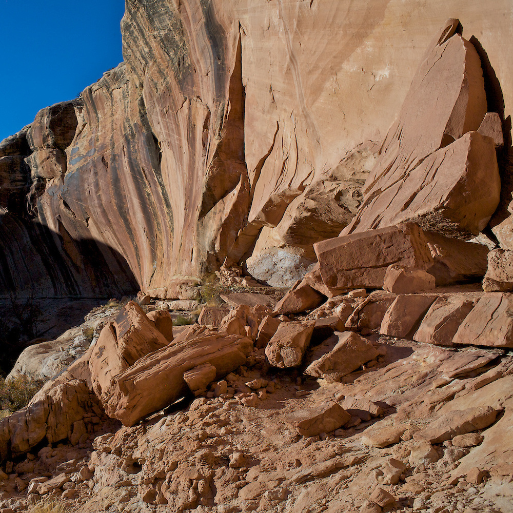
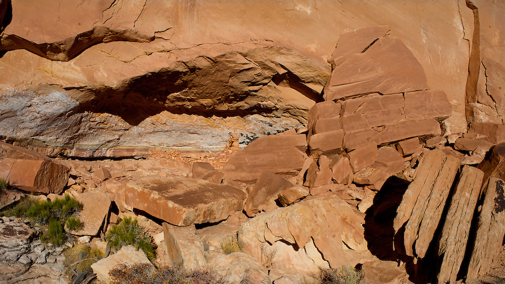
About half of the original structure has been destroyed (it looks intentional, maybe from the original excavators, whose writing is on the inside wall in pencil).
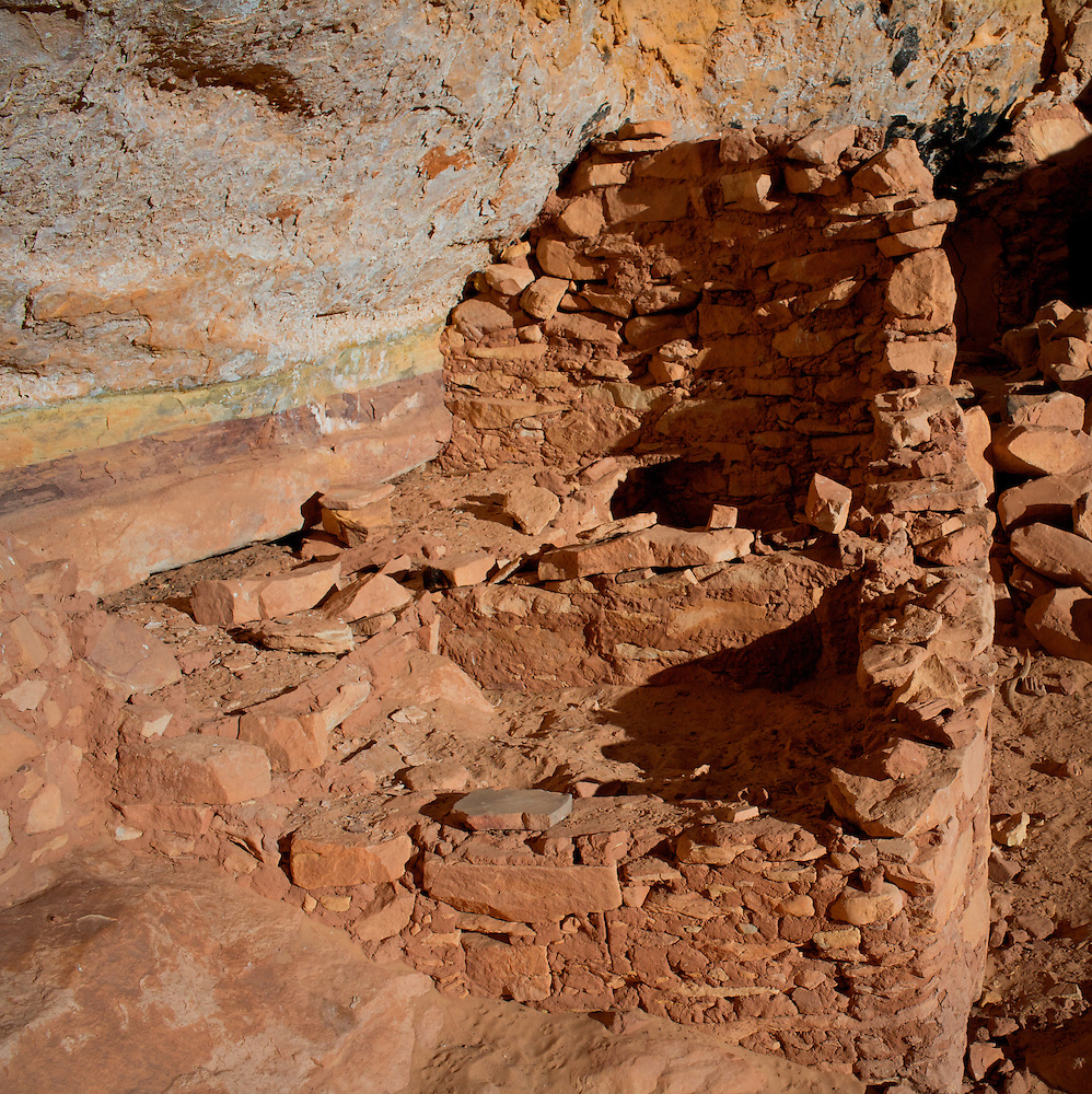
Above and below, the inside of the fin wall. If you look closely on the shot below you can see the pencil marks:
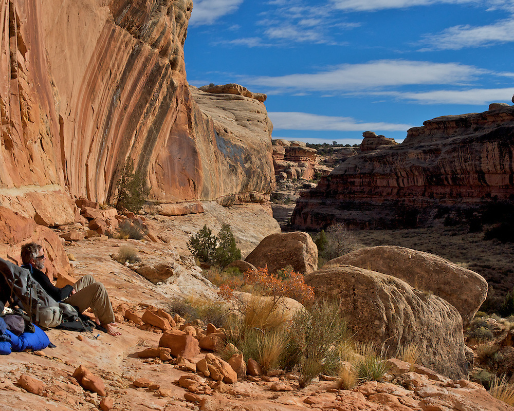
Lunch:
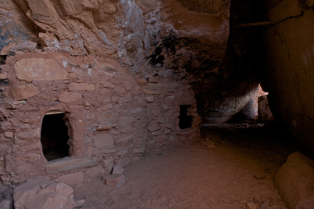
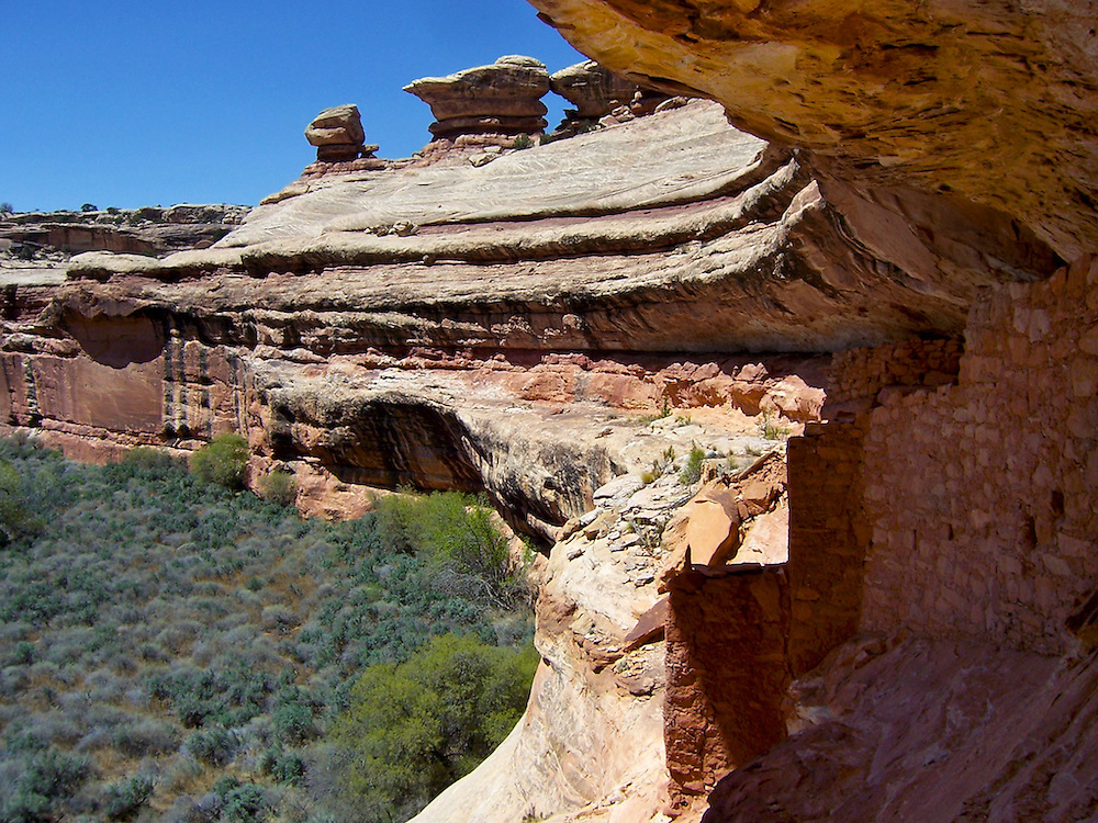
Heading down Grand Gulch, a very cool ruin with one of those defensive walls. Most people on this site would waltz right across this slope and through the door, but I am a coward. And there is a lot of exposure, you slip you die kind of thing. So when I am alone I have never attempted it. But the first time we came through here I did grow a pair and made it across, I remember mostly the far structure, which was amazingly intact sitting in it's own alcove, from 2006:
Another ruin a little further down. This is a shot from our first trip I think in 1982:
2006:
Camp at Big Pour Off Spring:
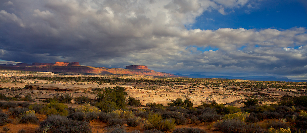
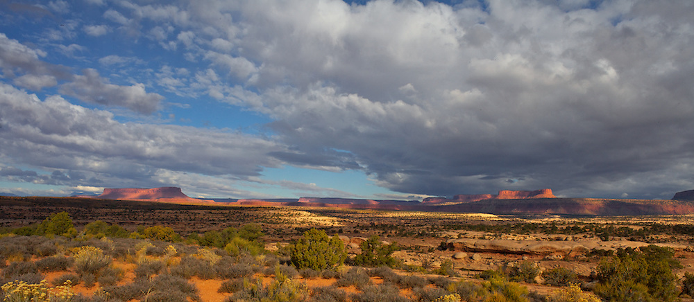
Hike back up Grand Gulch to the Government Trail, climb out and back 2.5 miles over Polly's Mesa to your car. It rained on me several times in 2011, with Polly's Canyon in the foreground:
The Government Trail is a great hike for kids (a little bit of exposure on the trail into Grand Gulch) but pretty short with a lot to see.
Featured image for home page:

Last edited:
") I'm sure that our packs will be a bit heavy at the start of the trip, so I'm glad to hear that descending into Polly's isn't too bad. Entering there would be a time saver. We're exiting on our last day at Kane Gulch, so we'll have a different camp each night as we work our way through the canyon. I'm so excited for this trip!
I'm sure that our packs will be a bit heavy at the start of the trip, so I'm glad to hear that descending into Polly's isn't too bad. Entering there would be a time saver. We're exiting on our last day at Kane Gulch, so we'll have a different camp each night as we work our way through the canyon. I'm so excited for this trip!