- Joined
- May 5, 2012
- Messages
- 1,731
"Are you lost?"
"No," I say, suppressing a laugh and resisting the urge to add the sarcastic rejoinder are you?
The man eyes me up and down, his gray mustache disguising an expression of disbelief. Incredulity flashes in his eyes.
I examine him right back. He's dressed head-to-toe in forest camouflage and seems perplexed by my sudden appearance in the brush. We're miles off trail, in a little-visited nook of the East Fork Bear River drainage.
We stand a comfortable distance apart, given the strangeness of our interaction. He's patting the more nervous of two fidgeting mules.
"Come over the pass from Baker Lake?" I ask.
"Yeah," he says.
"I came in that way too, saw your tracks up top. I'm going to head back out on the East Fork."
See, I know my geography. Definitely not lost.
"What are you doing up here?"
The tone of his voice is more guarded than hostile, as though he still doesn't believe me.
"Just exploring. You?"
"Here for the archery hunt. But the critters are nowhere to be found."
"Really? That's strange."
He's hardly listening. The pieces still aren't falling into place in his head. I can almost hear his thoughts: why would anyone come here except to shoot something? I try to look sympathetic, though in reality I'm rooting for the animals.
"There's a lake up there. It's deep. Full of tiger trout, too. You fishing?"
"Nah. But I'll go give it a look."

With a wave, I disengage and start up the rocky hill toward the unseen lake.
@Nick raised an alluring question about BR-44 in the comments on my trip report from Lake Lorena a couple of years back. The idea of slogging up to it from the trail to Priord Lake didn't light a fire under my feet. It wasn't until the concept of crossing over to it from the Boundary Creek drainage occurred to me that I endeavored to scout the little lake.
Scoping the route, it seemed perfectly evident I could reach the north ridge from Baker lake, as several people have mentioned taking that route to Lamotte Peak. Less certain was finding a safe path down the opposite side of the pass. It appeared possible on satellite imagery.
The plan, then, was to head up Boundary Creek, spend a night at Baker Lake, summit Lamotte on day two before dropping down to BR-44 and spending a second night there. On day three, I'd bushwhack down to the Priord Lake trail and hike back out of the East Fork.
But, as is so often the case in the Uintas, the weather wouldn't stand for it.
The parking lot at the East Fork trailhead was relatively busy on Saturday morning, though not excessively so for a holiday weekend. After dropping a car there, I turned around and walked backward to pass through the Hinckley Scout Ranch.
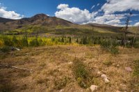
Years ago, this little inset of private land was called the East Fork of the Bear Scout Reservation. I spent several successive summers here both as a participant and leader of the now-defunct junior leadership training (JLT) courses run by the BSA. Each summer, as part of the program, leaders and participants alike invested grunt labor in improving the grounds. We cut and cleared dead fall. We improved the firebreak road, working in pounding rain with shovels and picks.
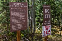
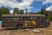
Now, the place is infested with Honey Buckets and overweight children unused to the effort of walking at an elevation of 9,000 feet above sea level. They get carted around from place to place in a bus.
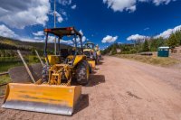
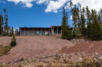
Pretty soon, visitors to the Reserve won't even have to spend time in that awful outdoor air. Construction is nearly complete on the Gordon B. Hinckley Bunker, a concrete monstrosity carved into the side of a hill and visible for miles around.
If I sound bitter about all of this, it's with good cause. The BSA has badly mismanaged this land. In 2002, scouts set the East Fork on fire, then denied responsibility for the conflagration. Though they were eventually required by the federal courts to pay a pittance in restitution, it's evident that in the decade since neither the BSA nor the LDS Church have made any significant investment in rehabbing the burn scar. Instead, they've invested in the construction of a huge eyesore out of keeping with the natural environment.
The old Boundary Creek trailhead doesn't even exist anymore, though a hiker with a keen eye can pick the footpath out among the twisted piles of burned-out pines and stunted aspen shoots.
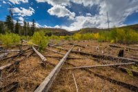
Wildfire destruction discourages a lot of visitation to Boundary Creek.
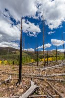
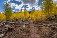
More than a decade after the fire, the aspens are still struggling to grow.
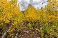
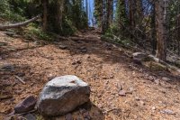
Looking back on the scar of the lodge. Blends right in, doesn't it? Fits well with the barren sticks of burned-out trees on Deadman Mountain.
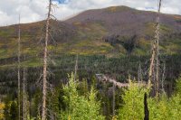
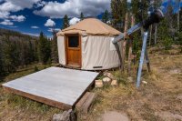
Most people who come here do so in winter, skinning up to the Boundary Creek yurt.
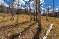
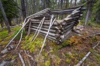
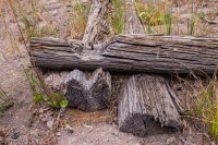
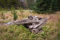
A good trail winds its way up to the split for Scow Lake, marked by the decaying remnants of an old tie hack camp.
Beyond that point, the trail grows more faint. The forest, untouched by the 2002 fire, closes in around you. The route marked on topographic maps disappears into thick underbrush.
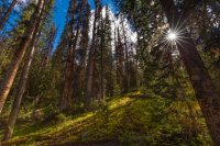
Unlike many other places in the East Fork, the upper reaches of Boundary Creek appear untrammeled by cattle. Ground cover is thick and vibrant.
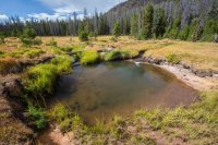
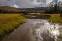
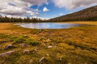
Midway to Baker Lake, the creek makes an abrupt pause in this little splash pool.
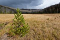
Beyond the meadow, only faint glimpses of the trail remain. Reaching the lake requires a bit of route finding. Thankfully, it's not overly complicated.
[PARSEHTML]<iframe src="http://www.mappingsupport.com/p/gmap4.php?q=https://dl.dropboxusercontent.com/u/3847512/GPS/Baker_Lake_ascent.kml&t=t4" frameborder="0" marginheight="0" scrolling="no" width="800" height="800"></iframe><br><br>[/PARSEHTML]
Clouds thickened. Wind started to howl. I pitched camp, bundled up and prepared dinner.
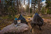
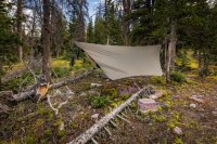
The sun dipped toward to the horizon. I went out to shoot some photos but found the placement of clouds inopportune for sunset.
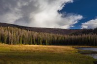
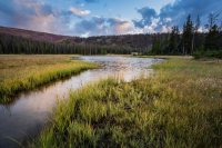
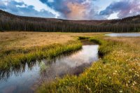
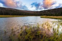
Darkness fell. A bit chilled, I crawled into the hammock and started to read. Then I tried to sleep. I say try because the wind made that impossible. Gusts came and went, flapping the tarp in fits of violence. The trees swayed. In my head, I kept seeing the wind uprooting one of the trees I was lashed to, dropping me to the ground and crushing me under the toppled trunk.
Long hours passed. Still the air swirled. I could hear it coming through the trees, whipping along their crowns before crashing into the taut nylon of my shelter. Spats of rain pattered against it, then blew away like droplets on the windshield of a speeding car on the interstate.
At one point, I climbed out into the dark to relieve myself and was surprised to see a cloudless sky full of stars.
Maybe, I mused, this will settle down by morning light.
No such luck. I rose at dawn, convinced I'd not slept a wink but aware that I must have at some point. Cold, blustery air still swirled. Gray clouds covered the sky. Rain continued to come in pulses.
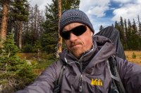
A summit of Lamotte looked out of the question. The only question was whether or not it was smarter to bag the rest of the route over to BR-44, or to brave it in spite of the risk of lightning on the exposed ridge.
By about 8 a.m., the skies opened a bit. I opted to make the climb over the saddle.
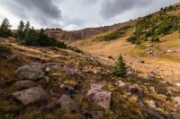
STOP BUYING MYLAR BALLOONS.
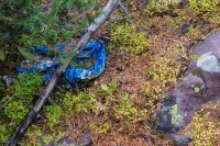
Keep going, almost there.
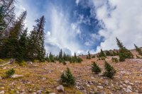
Looking north back down Boundary Creek, with Deadman Mountain visible over the saddle to the right.
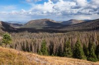
Wind on the ridge was fierce. I'd hoped to scout along the ridge's edge for the best place to descend.
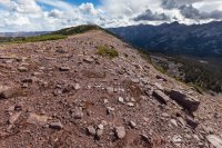
Gusts threatened to knock me off my feet. Luckily, a well-worn game trail descend from almost the exact same spot I topped out on the Baker Lake side.
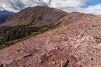
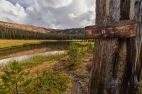
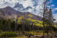
Lamotte Peak poked up on the horizon above the lake. The thick, dark clouds convinced me the decision not to run for the summit was a wise one.
Dropping to the relative shelter of the leeward slope, I scanned the route. Based on satellite imagery, I'd anticipated coming down a rock slide to the east. That option now appeared less appealing.
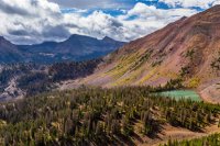
The game trail dropped out of sight, but I noted the presence of small hoof prints in the dirt. They were too small for horses. Mules, I figured. Sure enough, after working down the hill a bit farther, I saw a pair of animals tethered in a meadow.
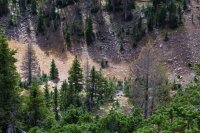
The route turned out to be a cakewalk. At the base of the pass, I had a brief and rather awkward conversation with a hunter — the only other person I'd encounter before rejoining the established trail along the East Fork.
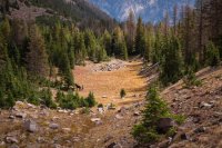
Then, it was time to recon BR-44.
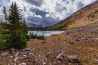
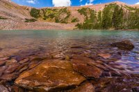
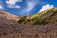
I found only one campsite, but a relatively clean one by Uintas standards. No decaying toilet paper wads. No cow pies rotting in the sun. A single campfire ring. Little known, lightly used.
This was where I'd intended to spend night two, but it was hardly noon and I still had plenty of energy. With Lamotte out of the picture and more bad weather evident on the horizon, I opted to at least start the hike out to the car.
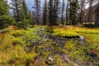
Soon after leaving BR-44, the worst of the weather hit. The sun disappeared and temperatures dipped.
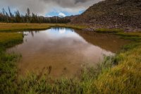
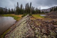
Hailstones pelted the ground.
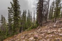
Within 20 minutes, the sun returned and skies opened. Rise and repeat. Wave after wave of hail pushed north across the region. I had to continually stop to put on my rain jacket, then stop to take it off again. The hailstones melted quickly. My shoes soaked through.
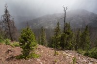
Then, something exceptionally odd occurred. My entire route down from BR-44 was way off trail, picking a path through open forest. In no place did I come across any sort of human trail.
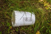
How, then, did I happen to stumble across this huge bucket just sitting right in the center of my path? With a measure of caution, I cracked the lid. It was half full of dirty water. No toxic sludge, no decomposed body parts. Who dropped it here and why? Was it a hunter's cache, long since raided and forgotten? Had it fallen out of an airplane?
The find presented something of a quandary. The old Boy Scout in me (hopefully of a higher order than of those now operating the East Fork camp) reasoned I had a responsibility to carry our the trash. On the other hand, it's doubtful anyone would even know if I just left it in place. I had at least another mile to go before reaching the trail, through a forest full of slick rocks and downed timber. Even then, I had another four miles or so to the car. The bucket was too big to strap to my pack. It had to be carried out by hand.
Grudgingly, I dumped out the water, grabbed the metal handle and stumbled my way downhill.
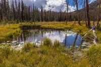
Toward the end of the trail, I ran into a beautiful big dog named Ruby and her two older humans. They questioned me about the bucket. Was I carrying fish? No. Why did I bring it then?
I described where I'd found it, expecting them to act astonished. Instead, the husband seemed a bit stoic. He asked some insightful questions about my route, revealing a good knowledge of the geography. Our conversation veered deeper into the conditions of the local trails, our frustration with the church and BSA over poor stewardship and population pressure on the western Uintas.
In the end, he thanked me for carting out the trash and suggested next time, I fill the bucket with more refuse along the way. Sadly, I'm sure there's plenty to find.
[PARSEHTML]<iframe src="http://www.mappingsupport.com/p/gmap4.php?q=https://dl.dropboxusercontent.com/u/3847512/GPS/Baker_pass.kml&t=t4" frameborder="0" marginheight="0" scrolling="no" width="800" height="800"></iframe><br><br>[/PARSEHTML]
"No," I say, suppressing a laugh and resisting the urge to add the sarcastic rejoinder are you?
The man eyes me up and down, his gray mustache disguising an expression of disbelief. Incredulity flashes in his eyes.
I examine him right back. He's dressed head-to-toe in forest camouflage and seems perplexed by my sudden appearance in the brush. We're miles off trail, in a little-visited nook of the East Fork Bear River drainage.
We stand a comfortable distance apart, given the strangeness of our interaction. He's patting the more nervous of two fidgeting mules.
"Come over the pass from Baker Lake?" I ask.
"Yeah," he says.
"I came in that way too, saw your tracks up top. I'm going to head back out on the East Fork."
See, I know my geography. Definitely not lost.
"What are you doing up here?"
The tone of his voice is more guarded than hostile, as though he still doesn't believe me.
"Just exploring. You?"
"Here for the archery hunt. But the critters are nowhere to be found."
"Really? That's strange."
He's hardly listening. The pieces still aren't falling into place in his head. I can almost hear his thoughts: why would anyone come here except to shoot something? I try to look sympathetic, though in reality I'm rooting for the animals.
"There's a lake up there. It's deep. Full of tiger trout, too. You fishing?"
"Nah. But I'll go give it a look."

With a wave, I disengage and start up the rocky hill toward the unseen lake.
@Nick raised an alluring question about BR-44 in the comments on my trip report from Lake Lorena a couple of years back. The idea of slogging up to it from the trail to Priord Lake didn't light a fire under my feet. It wasn't until the concept of crossing over to it from the Boundary Creek drainage occurred to me that I endeavored to scout the little lake.
Scoping the route, it seemed perfectly evident I could reach the north ridge from Baker lake, as several people have mentioned taking that route to Lamotte Peak. Less certain was finding a safe path down the opposite side of the pass. It appeared possible on satellite imagery.
The plan, then, was to head up Boundary Creek, spend a night at Baker Lake, summit Lamotte on day two before dropping down to BR-44 and spending a second night there. On day three, I'd bushwhack down to the Priord Lake trail and hike back out of the East Fork.
But, as is so often the case in the Uintas, the weather wouldn't stand for it.
The parking lot at the East Fork trailhead was relatively busy on Saturday morning, though not excessively so for a holiday weekend. After dropping a car there, I turned around and walked backward to pass through the Hinckley Scout Ranch.

Years ago, this little inset of private land was called the East Fork of the Bear Scout Reservation. I spent several successive summers here both as a participant and leader of the now-defunct junior leadership training (JLT) courses run by the BSA. Each summer, as part of the program, leaders and participants alike invested grunt labor in improving the grounds. We cut and cleared dead fall. We improved the firebreak road, working in pounding rain with shovels and picks.

Now, the place is infested with Honey Buckets and overweight children unused to the effort of walking at an elevation of 9,000 feet above sea level. They get carted around from place to place in a bus.

Pretty soon, visitors to the Reserve won't even have to spend time in that awful outdoor air. Construction is nearly complete on the Gordon B. Hinckley Bunker, a concrete monstrosity carved into the side of a hill and visible for miles around.

If I sound bitter about all of this, it's with good cause. The BSA has badly mismanaged this land. In 2002, scouts set the East Fork on fire, then denied responsibility for the conflagration. Though they were eventually required by the federal courts to pay a pittance in restitution, it's evident that in the decade since neither the BSA nor the LDS Church have made any significant investment in rehabbing the burn scar. Instead, they've invested in the construction of a huge eyesore out of keeping with the natural environment.

The old Boundary Creek trailhead doesn't even exist anymore, though a hiker with a keen eye can pick the footpath out among the twisted piles of burned-out pines and stunted aspen shoots.

Wildfire destruction discourages a lot of visitation to Boundary Creek.


More than a decade after the fire, the aspens are still struggling to grow.


Looking back on the scar of the lodge. Blends right in, doesn't it? Fits well with the barren sticks of burned-out trees on Deadman Mountain.

Most people who come here do so in winter, skinning up to the Boundary Creek yurt.


A good trail winds its way up to the split for Scow Lake, marked by the decaying remnants of an old tie hack camp.


Beyond that point, the trail grows more faint. The forest, untouched by the 2002 fire, closes in around you. The route marked on topographic maps disappears into thick underbrush.

Unlike many other places in the East Fork, the upper reaches of Boundary Creek appear untrammeled by cattle. Ground cover is thick and vibrant.

Midway to Baker Lake, the creek makes an abrupt pause in this little splash pool.

Beyond the meadow, only faint glimpses of the trail remain. Reaching the lake requires a bit of route finding. Thankfully, it's not overly complicated.


[PARSEHTML]<iframe src="http://www.mappingsupport.com/p/gmap4.php?q=https://dl.dropboxusercontent.com/u/3847512/GPS/Baker_Lake_ascent.kml&t=t4" frameborder="0" marginheight="0" scrolling="no" width="800" height="800"></iframe><br><br>[/PARSEHTML]
Clouds thickened. Wind started to howl. I pitched camp, bundled up and prepared dinner.


The sun dipped toward to the horizon. I went out to shoot some photos but found the placement of clouds inopportune for sunset.


Darkness fell. A bit chilled, I crawled into the hammock and started to read. Then I tried to sleep. I say try because the wind made that impossible. Gusts came and went, flapping the tarp in fits of violence. The trees swayed. In my head, I kept seeing the wind uprooting one of the trees I was lashed to, dropping me to the ground and crushing me under the toppled trunk.
Long hours passed. Still the air swirled. I could hear it coming through the trees, whipping along their crowns before crashing into the taut nylon of my shelter. Spats of rain pattered against it, then blew away like droplets on the windshield of a speeding car on the interstate.
At one point, I climbed out into the dark to relieve myself and was surprised to see a cloudless sky full of stars.
Maybe, I mused, this will settle down by morning light.
No such luck. I rose at dawn, convinced I'd not slept a wink but aware that I must have at some point. Cold, blustery air still swirled. Gray clouds covered the sky. Rain continued to come in pulses.

A summit of Lamotte looked out of the question. The only question was whether or not it was smarter to bag the rest of the route over to BR-44, or to brave it in spite of the risk of lightning on the exposed ridge.
By about 8 a.m., the skies opened a bit. I opted to make the climb over the saddle.

STOP BUYING MYLAR BALLOONS.

Keep going, almost there.

Looking north back down Boundary Creek, with Deadman Mountain visible over the saddle to the right.

Wind on the ridge was fierce. I'd hoped to scout along the ridge's edge for the best place to descend.

Gusts threatened to knock me off my feet. Luckily, a well-worn game trail descend from almost the exact same spot I topped out on the Baker Lake side.

Lamotte Peak poked up on the horizon above the lake. The thick, dark clouds convinced me the decision not to run for the summit was a wise one.
Dropping to the relative shelter of the leeward slope, I scanned the route. Based on satellite imagery, I'd anticipated coming down a rock slide to the east. That option now appeared less appealing.

The game trail dropped out of sight, but I noted the presence of small hoof prints in the dirt. They were too small for horses. Mules, I figured. Sure enough, after working down the hill a bit farther, I saw a pair of animals tethered in a meadow.

The route turned out to be a cakewalk. At the base of the pass, I had a brief and rather awkward conversation with a hunter — the only other person I'd encounter before rejoining the established trail along the East Fork.

Then, it was time to recon BR-44.


I found only one campsite, but a relatively clean one by Uintas standards. No decaying toilet paper wads. No cow pies rotting in the sun. A single campfire ring. Little known, lightly used.
This was where I'd intended to spend night two, but it was hardly noon and I still had plenty of energy. With Lamotte out of the picture and more bad weather evident on the horizon, I opted to at least start the hike out to the car.

Soon after leaving BR-44, the worst of the weather hit. The sun disappeared and temperatures dipped.


Hailstones pelted the ground.

Within 20 minutes, the sun returned and skies opened. Rise and repeat. Wave after wave of hail pushed north across the region. I had to continually stop to put on my rain jacket, then stop to take it off again. The hailstones melted quickly. My shoes soaked through.

Then, something exceptionally odd occurred. My entire route down from BR-44 was way off trail, picking a path through open forest. In no place did I come across any sort of human trail.

How, then, did I happen to stumble across this huge bucket just sitting right in the center of my path? With a measure of caution, I cracked the lid. It was half full of dirty water. No toxic sludge, no decomposed body parts. Who dropped it here and why? Was it a hunter's cache, long since raided and forgotten? Had it fallen out of an airplane?
The find presented something of a quandary. The old Boy Scout in me (hopefully of a higher order than of those now operating the East Fork camp) reasoned I had a responsibility to carry our the trash. On the other hand, it's doubtful anyone would even know if I just left it in place. I had at least another mile to go before reaching the trail, through a forest full of slick rocks and downed timber. Even then, I had another four miles or so to the car. The bucket was too big to strap to my pack. It had to be carried out by hand.
Grudgingly, I dumped out the water, grabbed the metal handle and stumbled my way downhill.

Toward the end of the trail, I ran into a beautiful big dog named Ruby and her two older humans. They questioned me about the bucket. Was I carrying fish? No. Why did I bring it then?
I described where I'd found it, expecting them to act astonished. Instead, the husband seemed a bit stoic. He asked some insightful questions about my route, revealing a good knowledge of the geography. Our conversation veered deeper into the conditions of the local trails, our frustration with the church and BSA over poor stewardship and population pressure on the western Uintas.
In the end, he thanked me for carting out the trash and suggested next time, I fill the bucket with more refuse along the way. Sadly, I'm sure there's plenty to find.

[PARSEHTML]<iframe src="http://www.mappingsupport.com/p/gmap4.php?q=https://dl.dropboxusercontent.com/u/3847512/GPS/Baker_pass.kml&t=t4" frameborder="0" marginheight="0" scrolling="no" width="800" height="800"></iframe><br><br>[/PARSEHTML]
Last edited:
