Mirror Plateau and the Lamar River Loop - Yellowstone National Park - July 7, 2016

scatman

Member
.
Joined
Dec 23, 2013
Messages
3,629
Mirror_Plateau_Loop.jpg
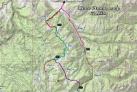
Trip overview map

Day 1 – Soda Fork Trailhead to campsite 3O1 on Opal Creek


I awoke on the morning of July 7th at 6:30 am at the Bridge Bay Campground in Yellowstone. I was hoping that I could sleep in just a touch after completing a twenty two mile day hike the day before and today was the day our group would start a seven day backpacking trip that would take us across the Mirror Plateau and down the Lamar River. Well, no such luck! The reason for my awakening this morning was a chewing sound along with a few noise clearing blows coming from outside of my tent. As the sun was just hitting my tent, I could see the silhouette of a giant bison head. A bull bison was grazing not more than a few inches from my tent. I lay there just hoping that he would not crush me. Needless to say, I couldn’t get back to sleep even after he wandered off to another campsite. It turns out that there are a few bison that hang around the campsite throughout the day.

After breakfast, we all drove to Canyon to pick up our official backcountry permit. Now our permit included two campsites that are not all that well known, they were campsites 3O1 on Opal Creek and 5P7 on upper Pelican Creek. These two sites are both off-trail sites and can only be occupied for fourteen nights (combined) between July 1st and August 14th for the year. These two sites were grandfathered in when the Park created the Bear Management Areas and are used mainly by outfitters bringing folks into the backcountry. After receiving our permit, the lady at the backcountry office supplied us with the GPS coordinates for each site and then we were off for the Soda Butte Trailhead located in the Lamar Valley. The trip would take us from the Soda Butte Trailhead along the Specimen Ridge Trail and up onto the Mirror Plateau. We would then proceed to bushwhack across the plateau and down to Pelican Creek. Next, we would off-trail travel down Raven Creek, then up and over Lovely Pass and into the Mist Creek Drainage. We then would follow Mist Creek down to the Lamar River and hike along the Lamar back to the trailhead.
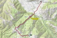
Mirror_Plateau_Loop_Day_01.jpg
Day 1 overview

Arriving at the trailhead, we quickly realized that this pullout was a pretty popular place and a couple of us had to wait for people to leave so that we could park our vehicles. This probably put us on the trail around 1:30 in the afternoon and we had two miles to go before our ford of the Lamar River.
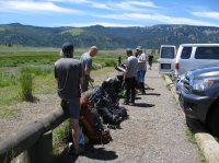
01.jpg
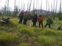
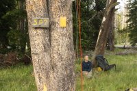
Getting our gear ready at the Soda Butte Trailhead
02.jpg
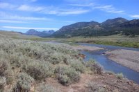
Looking northeast up Soda Butte Creek
03.jpg
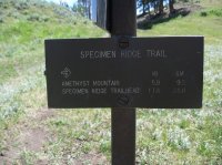
Trail junction sign for the Specimen Ridge Trail
04.jpg
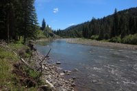
The Lamar River


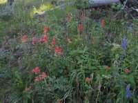
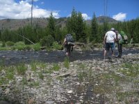
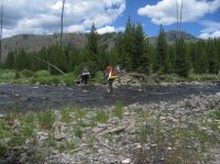
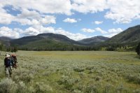
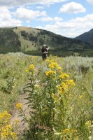
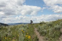
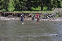
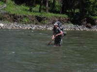
The river ford turned out to be a tricky one. While the water was between the knee and the waist, the current was fairly strong and the rocks on the bottom extremely slick. We took our time and eventually everyone made it across without incident though there were a few close calls. With our boots back on, we began our 2600 ft climb up to the top of Specimen Ridge. On our way up, and actually for the entire trip, the wildflowers were in full bloom. Lupine, paintbrush, penstemons, blue bells, geraniums and buckwheat were all showing off their colors for us.
05.jpg
@McGimpkins, @Joey and @Keith R. beginning to cross the Lamar
06.jpg
@Keith crossing the Lamar

07.jpg
Lupines and Paintbrush on our way up Specimen Ridge


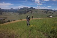
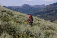
As we made our way through the first major switchback, Joey alerted us of a bear. It turns out that we had roused a sow and her cub off of their day bed next to the trail. The sow seemed to be extremely unsure of what she should do as she moved back and forth across the hillside. I believe that our group size of six people discouraged her from being more aggressive towards us. She and her cub eventually dashed up the hill and into the trees and out of our sight. We took a break under a nearby tree to discuss the encounter and fuel up for the rest of the climb.
08.jpg
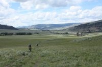
Making our way up Specimen Ridge with Soda Butte Creek in the distance (upper left)
09.jpg
@Joey on bear alert

10.jpg
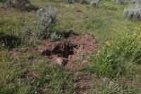
Grizzly dig on Specimen Ridge

11.jpg
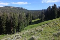
View from Specimen Ridge


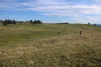
Once we finally made it to the top of the ridge, then we began our off-trail portion of our trip. Be broke off the Specimen Ridge Trail about one mile from Amethyst Mountain and began travelling towards an unnamed pond so that people could refill their water bottles if they wanted to. It turns out that the wind was blowing pretty hard up on the ridge and it had stirred up the water in the pond to where it was all muddy looking so we ended up passing on the refill. We then turned southeast towards the headwaters of Opal Creek. At this point we still had 2.5 mile to go to our campsite and the day was beginning to get a little long in the tooth.
12.jpg
The off-trail adventure begins - @McGimpkins is approaching an unnamed pond

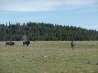
Just after leaving the pond, we ran into a large herd of bison that we had to negotiate through. After the bison, there was a herd of elk, then more bison and then more elk. The wildlife viewing up top, at least to this point, was tremendous and nearly nonstop all the way to camp.
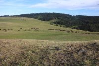
13.jpg
Herd of bison we encountered on the Mirror Plateau13_b.jpg

Only way through is straight through. Image courtesy of McGimkins


We arrived at camp as the sun set. This campsite 3O1 on Opal Creek is not to be missed. The view to the northeast looking up Soda Butte towards the northern boundary of the Park was tremendous, with the northern end of the Absarokas thrown in for good measure. There was no signpost for this campsite but the bear pole was obvious upon approach. As for the meadows surrounding our site, we had two lone bull bison to keep us company while we set up camp. As we ate dinner and turned in for the evening, we had the pleasure of hearing wolves howl.
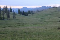
15.jpg
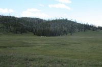
Dropping down into the Opal Creek Drainage


Day 2 – Campsite 3O1 on Opal Creek to Campsite 5P7 on Upper Pelican Creek


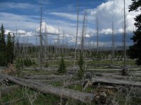
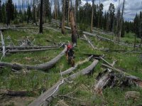
On our second day in the backcountry, we would be heading off-trail across the Mirror Plateau before passing Mirror Lake and then dropping down to Pelican Creek. We set off in a more or less southerly/southeasterly direction towards Mirror Lake. Most of the route on this day would take us through dead trees and downfall but once again, wildlife would be plentiful along our way.
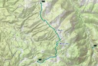
Mirror_Plateau_Loop_Day_02.jpg
Day 2 overview

16.jpg
View from campsite 3O1 in the morning
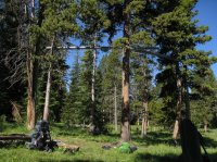
17.jpg
Bear poles at campsite 3O1


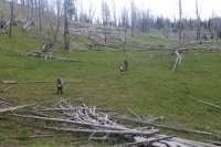
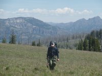
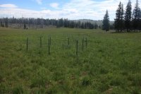
After making our way out of the Opal Creek drainage which was pleasant enough, we came upon some small fenced in areas where it looks like someone might be doing a study on native vegetation without any grazing pressure. Small chance that we would stumble upon them out in the sticks. After the enclosed area, the going got more difficult as we made our way along the plateau but we did get to see numerous elk and a couple of bull elk that were close by.
18_a.JPG
Leaving Opal Creek. Image courtesy of McGimkins
18_b.jpg
A small fenced in area on the Mirror Plateau
19.jpg
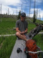
@Jon Carbaugh on break taking it all in
20.jpg
@Joey heading trough the downfall

21.jpg
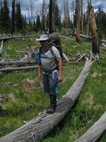
@McGimpkins showing off his balance beam technique
22.jpg
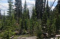
Bull elk in the burn

23.jpg
Straight ahead

24.jpg
Making our way


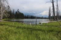
After a few hours, we began our descent towards Mirror Lake. I had bushwhacked up to this lake back in 2009 from Wapiti Lake and I was finding it hard to fathom that I was going to get to see it for a second time. I’m not sure what my backpacking partners thought of the lake but I found it quite charming and its remoteness gives it a bit of panache.
24_a.jpg
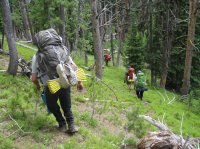
Heading down the ridge towards Mirror Lake
25.jpg
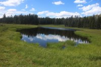
Unnamed pond just before Mirror Lake (this one is for you @Artemus !)
26.jpg
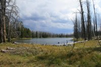
Mirror Lake

Mirror_Lake_2009.jpg
Mirror Lake back in 2009

27.jpg
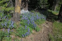
Lupine along Mirror Lake

28.jpg
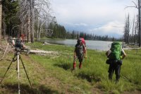
Film crew setting up at Mirror Lake

We worked our way around the east side of the lake, crossed the outlet which wasn’t much and then made our way along the southern end. Along the southern shore of the lake there is a small grassy corridor that runs in a southwesterly fashion where we picked up a bison trail that would take us all the way down to the meadows along headwaters of Timothy Creek. This trail though goes through some nasty downfall along its entire length and it wore me out to be constantly stepping over downed logs. Once we were at the headwaters of Timothy Creek, we crossed a small saddle to the Pelican Creek drainage and then it was just about a mile to our campsite.
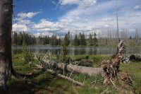
29.jpg
Other side of Mirror Lake

30.jpg
Working our way down to Pelican Creek
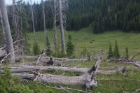
31.jpg
Elk herd and bison grazing in the meadows near the headwaters of Timothy Creek
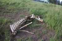
32.jpg
Elk carcass near our next campsite

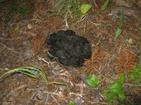
Once at camp (5P7), we quickly noticed four rather large piles of bear scat strategically deposited throughout the site. One by the bear pole, another near the eating area and a couple where one would set up their tents in the trees. We chose to avoid these and set up our tents on the edge of the meadow. It turned out to be a rather uneventful evening so after eating, I went to bed while the others enjoyed a nice campfire.
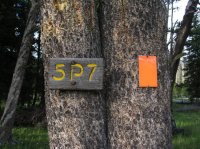
33.jpg
Campsite 5P7 on upper Pelican Creek

34.jpg
One of four large bear scat piles located throughout our campsite
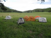
35.jpg
So we set up our tents at the meadow's edge


Day 3 – Day Hike from Campsite 5P7 to the Fern Lake Patrol Cabin and an off-trail Mud Pot


On day three, we were supposed to hike to the top of Pelican Cone but after the grueling previous day’s route we decided to do something a little easier so we hike down Pelican Creek to the Fern Lake Patrol Cabin and then a mile beyond the cabin to an off-trail mud pot.
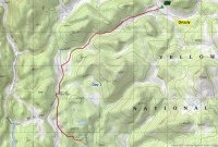
Mirror_Plateau_Loop_Day_03.jpg
Day 3 overview


Earlier that morning, a group of elk passed next to our campsite. We could hear then doing what I term as a “short bugle” while they tried to figure out what our tents were or why they were there.


There is actually a trail down Upper Pelican Creek and it ends just short of the official Pelican Creek Trail. We hopped on the trail which requires a number of creek crossings and followed it west. The willow thickets along the way were pretty and I hoped that we might get to see a moose but alas, no such luck. The trail ended abruptly just before reaching the Pelican Creek Trail and we had to descend a small grassy hill to pick up the maintained trail that leads to the Fern Lake Patrol Cabin.
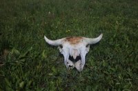
36.jpg
Bison skull along upper Pelican Creek
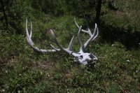
37.jpg
Elk skull and antlers along upper Pelican Creek
38.jpg
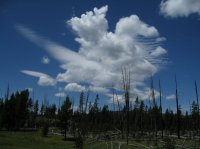
I thought this cloud looked pretty cool
39.jpg
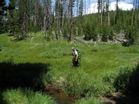
@Keith R. hiking along upper Pelican Creek


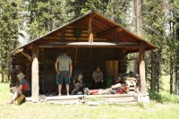
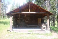
The cabin sits on a rise across Pelican Creek and after hiking up to it, we all took a long break on the front porch. I’ve always thought that it would be a lot of fun to stay at a patrol cabin for an extended period of time. While at the cabin, we decided to hike down the trail and see a large mud pot which was located about 50 yards off the trail. We had also contemplated hiking to Fern Lake or Tern Lake and White Lake but the mud pot ended up winning out.
40.jpg
Fern Creek Patrol Cabin

40_b.jpg
Chillin' at the patrol cabin. Image courtesy of Jon Carbaugh


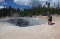
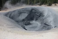
It was only just over a mile down the trail until we left it and made our way to the mud pot. I don’t believe that it has a name but it was quite impressive to watch. Everyone seemed to enjoy taking pictures and video of it.
41.jpg
Off-trail mud pot

42.jpg
@Joey filming the mud pot

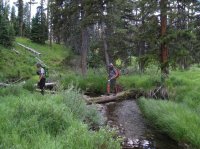
Our return trip to camp was uneventful but I did take some GPS points on the trail for future reference. At some point, someone had sewn some logs along the way. I thought it would be interesting to know how long ago that had been done.
43.jpg
Making our way back up Pelican Creek

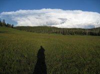
Eating dinner after returning to camp, things began to get interesting. First, on a small hill to the east of us and on the north side of the meadow, a lone wolf made his way across the hill and towards our campsite. Once it caught wind of us he stopped for a short period of time then continued on up the hill and out of sight. Not twenty minutes later, two coyotes following the same path as the wolf appeared. Of course they too stopped when they noticed us but at least they stuck around a little longer than the wolf had before they headed up into the trees.
44.jpg
My shadow in the meadows along upper Pelican Creek

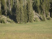
Thirty minutes after the coyotes had passed, a grizzly bear made its way out of the trees on the other side of the meadow. We watched him from the food prep area for a good ten minutes before he too became aware of our presence and strolled off into the trees. We wondered if this was the bear that had left his calling cards in our campsite. I think his presence made for a restless night ahead for a few of us.
45.JPG
Grizzly bear on the opposite side of the meadow - maybe it is the one that was leaving deposits at our campsite. Image courtesy of McGimkins


Day 4 – Campsite 5P7 to Campsite 3T2 on Mist Creek


Day four turned out to be a real doozy. I awoke at 7:30 in the morning to sunny skies over Pelican Creek. To the west of us though was a different story - large black ominous clouds were approaching. Keith was just finishing up his breakfast and I thought that I had time to eat and then pack my tent away before the storm hit. Of course, I was wrong! I got in between the two and both my breakfast and my tent got soaking wet.

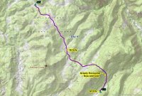
Our route on this day took us all the way up Pelican Creek at which point we would head over to the Raven Creek drainage, follow the creek down then jump over to the Buffalo Fork before heading up and over Lovely Pass. Once over the pass, we would drop down to Mist Creek and our campsite.
Mirror_Plateau_Loop_Day_04.jpg
Day 4 overview

As we made our way up Pelican Creek in the rain the going was quite marshy. Up until now, all of the bison that we had encountered on the plateau were very unsure of our group and would take off from us on approach. As we reached the high point between Pelican and Raven Creeks, there was a lone bull that would have none of that. He stood his ground and made us detour to get past him. Not before too long, we stopped in a stand of trees for a quick break. The trees offered us some protection from the driving rain but the longer I stood around without moving the colder I became. I needed to eat and keep moving.
46.jpg
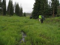
Hiking along the headwaters of Pelican Creek
47.jpg
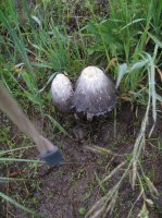
Mushrooms near the headwaters of Raven Creek
47_a.jpg
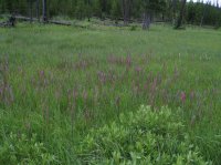
Elephant Heads along Raven Creek


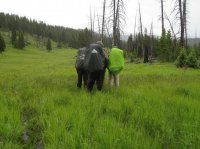
Fifty minutes after break, we spotted a grizzly bear grazing on the east side of Raven Creek. We stopped and watched him for a minute or two before he noticed us and headed off.
48.jpg
Watching grizzly on Raven Creek

Video courtesy of McGimkins, narrated be Joey

Video courtesy of McGimkins, narrated be Joey

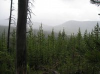
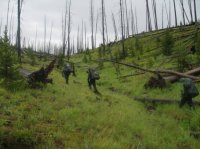
At 3.5 miles down the creek we broke off and headed east towards Buffalo Fork. This bushwhack took us through downfall and new growth all while pouring a cold rain. We summited what I termed “Deadman’s Knob” and from there we got our first glimpse of Lovely Pass in the distance - only a couple of miles away! As we broke out of the downfall, we were confronted with large marshy meadows just below Lovely Pass. We crossed the meadows and began our slow but steady hike up to the pass. While there was not much new growth to contend with on the northwest side of the pass, there was plenty of downfall to step over. Finally, we made it to the top and took a group picture before heading down the southeast side.
50.jpg
Lovely Pass in the distance. Viewed from Deadman's Knob
Video courtesy of McGimkins, narrated by Joey

51.jpg
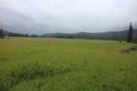
Large marshy meadows at the headwaters of Buffalo Fork
52.jpg
Heading up towards Lovely Pass

53.jpg
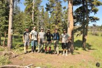
The Wrecking Crew on Lovely Pass


The southeast side turned out to be much worse than climbing up the opposite side plus everyone by this time was tired, cold and soaking wet from head to toe. About halfway down, Joey, the point man, spotted another sow with a cub right in the middle of the burn. The bears took off and left us to figure out how to proceed from there. Finally, we staggered out of the burn and found the Mist Creek Trail which would lead us to our campsite.

As we approached camp, @Jon Carbaugh ran into a grizzly about 30 yards off the trail. This would be the bear that would keep us company at our campsite for the next two days. As we were spread out on the trail, he sat down like a dog and proceeded to watch us go by before retreating into the woods.
Video courtesy of McGimkins

55.jpg
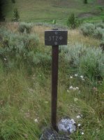
Signpost for campsite 3T2 on Mist Creek

Once at camp, with a lull in the rain, we set up our tents just before it let loose again. I crawled shivering into my sleeping bag and it took an hour for me to warm finally warm up. At the next break in the storm, I reluctantly left my sleeping bag and cooked dinner. We made a decision that if the weather was bad the next morning we would just hunker down and stay at this campsite.


Day 5 – Hunker Down and Stay Put


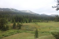
Woke up this morning at 8:30 to rain. Finally made it out of my tent around noon to eat some breakfast while there was a lull in the rain. According to Jon, it was a balmy 37 degrees. It had snowed just above us during the night and Lovely Pass was covered.
56.jpg
Snow on Lovely Pass

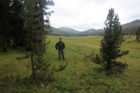
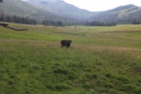
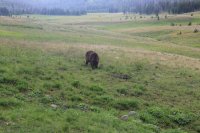
While our down day offered us the opportunity to dry wet clothes and gear, the real treat was being able to observe the grizzly bear that was nearby our campsite grazing along Mist Creek. As the afternoon went along, he was slowly making his way to the meadow’s edge which corresponded with our campsite. Of course this gave us all a wonderful opportunity to get some excellent photos and video as he continued to approach. At one point, we all had our bear spray drawn as he looked us over before going back to his usual routine. He never showed signs of being nervous or agitated towards us and he clearly hadn’t left any sign in our campsite so we just let him be. After seeing the grizzly try and run down elk in Hayden Valley six days before on our day hike, I couldn’t believe that I was getting another opportunity to observe a grizzly at such close range just being a bear. Two of the best moments in my backcountry experiences over the years.
57.jpg
Scatman with a grazing grizzly out in the meadow
58.jpg
He slowly made his way towards our tent sites.
59.jpg
Back to grazing


As evening approached the foul weather finally broke and everyone was looking forward to a sunny day tomorrow.


Day 6 – Campsite 3T2 to Campsite 3L9 on the Lamar River


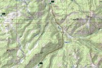
Hitting the trail on day six, I quickly noticed that I was out of energy. We were hiking down Mist Creek towards the Lamar River and I was struggling. Since we had laid over a day at 3T2, we were going to have to extend up the Lamar River in order to catch up to our schedule. Without knowing what was in store bushwhacking up the Lamar, I decided that I wouldn’t be able to get it done, so instead we hiked down the Lamar on the trail to campsite 3L9.
Mirror_Plateau_Loop_Day_06.jpg
Day 6 overview

60.jpg
Looking up towards Mist Creek Pass from our campsite


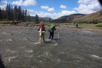
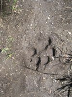
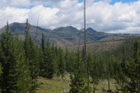
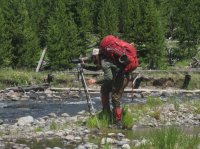
On our way down mist creek, we ran into some distinctive wolf prints in the mud along the trail. We also had wonderful views of snow capped Cathedral Peak, Pyramid Peak and Saddle Mountain as we made our way towards the Lamar. As we approached the Lamar, we first had to ford Mist Creek which had grown quite a bit from the small creek that the grizzly grazed by near our campsite. Once across Mist Creek, it was a short walk to ford the Lamar. After crossing, we took a break and enjoyed the meadows along the Lamar.
62.jpg
Wold Print on the Mist Creek Trail

61.jpg
View from the Mist Creek Trail (Pyramid Peak?)
63.jpg
View from the Mist Creek Trail

64.jpg
View from the Mist Creek Trail

65.jpg
@Keith fording Mist Creek

66.jpg
@McGimpkins and @Jon Carbaugh fording Mist Creek
67.jpg
@Joey in action at Mist Creek

68.jpg
@Jon Carbaugh and @Keith R. fording the Lamar River
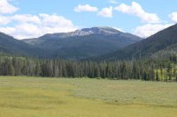
69.jpg
View from the Lamar River Meadows


With about five miles left to camp we headed down the trail arriving at camp just before dusk.
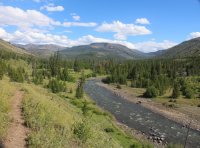
70.jpg
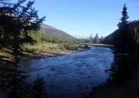
Looking back up the Lamar River

71.jpg
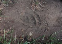
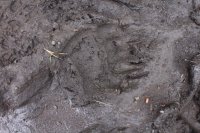
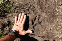
Bear track on the Lamar River Trail

72.jpg
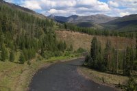
The Lamar River

73.jpg
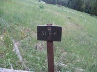
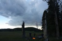
Our campsite for the night


Day 7 – Campsite 3L9 to the Soda Butte Trailhead


I got up early, somewhere around 5:30. It was cold and everything was frozen so my hot oatmeal seemed especially good to me. I was leaving camp early this morning because I was hiking slow and wasn’t sure if I left later that I would be able to get out of the backcountry. I knew the others would soon catch me on the trail and I wanted to get some miles behind me while it was cool. This could have been a mistake in hindsight but I was off. Joey and the two Keiths were contemplating heading up Miller Creek towards Hoodoo Basin instead of hiking out.
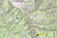
Mirror_Plateau_Loop_Day_07.jpg
Day 7 overview

74.jpg
Lamar River in the morning light


About a quarter mile down the trail from our neighboring campsite 3L8, I had just entered a corridor of new growth when I noticed a grizzly bear heading towards me, coming down a small hill and about to enter the same corridor of trees. Just before he made it to the trees, I let out a “Hey Bear!” He stopped, put his nose up in the air to give it a smell before lowering his head and continuing on straight towards me. At this point I was beginning to get a little nervous, so still holding my ground I again said “Hey Bear!!” Now, a good distance inside the trees, he looked up and saw me, which led him to begin to sway his head back and forth. I had my bear spray ready and continued to say in a mild mannered voice “Hey Bear!!!” He began popping his jaws and salivating all while continuing to rock his head back and forth. I continued to call out “Hey Bear” while thinking that I really needed to get going or I wasn’t going to make it to the trailhead in time for me to drive back to Salt Lake. And I’m sure he was thinking another morning jaunt ruined by this ridiculous human! After a continuous stream of “Hey Bears”, he turned and went off to my left into the new growth. At this point the Lamar River is just to the left of the trail and to the right is about ten feet of burn before a rather steep sloping hillside full of downfall and new trees that I really didn’t want to have to plow through. The problem was that I couldn’t see the bear once he went into the trees so I wasn’t sure exactly where he was nor could I guess his intent. So I stood there for perhaps five minutes still calling out “Hey Bear.” After that I made my way to the right through the burn and slowly paralleled the trail until I was out of the new growth - a very tense situation. I will say this though, the encounter had shot my adrenaline way up which helped me along the trail for the next few miles.
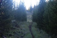
75.jpg
Grizzly bear coming down the hill and finally into the trees on the trail that made for some tense moments.
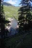
76.jpg
View of the Lamar River from the Lamar River Trail

Just after crossing Miller Creek, I ran into a trail crew that were heading up the creek. These were the first people, besides my group, that I had seen since day one. I told them about my bear encounter and they said that they had seen a grizzly down by the Calfee Patrol Cabin which was just down the river. “Wonderful,” I thought to myself. As I got closer to the cabin, there were grizzly tracks along the trail but I didn’t see the bear. A couple of more miles down the river, @McGimpkins and Jon caught up to me and we hiked the rest of the way to Cache Creek together.
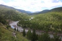
77.jpg
The Lamar River

78.jpg
Grizzly print on the Lamar River Trail near the Calfee Patrol Cabin
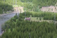
79.jpg
Calfee Patrol Cabin on the Lamar River
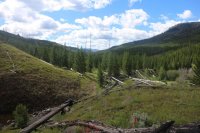
80.jpg
The Lamar River Trail

81.jpg
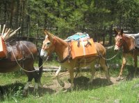
Mule train for supplying the trail crew I had run into earlier in the day


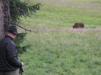
After fording Cache Creek, we were sitting along the northern bank putting our socks and boots back on when three bison began to cross the creek and head right towards us. Of course I’m pretty slow at getting my stuff back on which means I’m just ahead of the bison on the steep ascent out of the drainage. It was like I was leading three dogs down the trail. I chuckled to myself, thinking after all the bears we have run into, I’m going to get taken out by a bison near the trails end. It turns out they were more skittish than me or else I was moving so slowly at this point they probably thought I was a post.
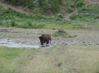
82_a.JPG
Bison crossing Cache Creek while I am still putting my socks and boots back on
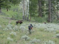
82.JPG
Follow me boys. Image courtesy of McGimpkins
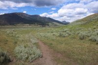
83.jpg
Back to the Lamar Valley

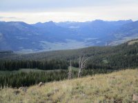
84.jpg
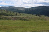
Looking back at the Opal Creek Drainage from the Lamar Valley


Arriving back at the trailhead, we changed our clothes, loaded up our gear and heading out to Ponds Bar and Grill in Island Park for beer and pizza. A fitting end to e great trip.

Thoughts - From a wildlife perspective, this was the best backpacking trip that I have ever done. It was almost non-stop from the time we left the trailhead to the time we arrived back at it at the end. Antelope, deer, elk, bison, bears, coyotes, hawks, sandhill cranes, an eagle and a lone wolf kept us company at one time or another along the way. And the joy of being able to see the elk and bison in herds at times was special. If you count the day hike through Hayden Valley and up to Cygnet Lakes the day before this trip, I saw twelve grizzly bears in eight days in the Yellowstone backcountry. That is more grizzlies than I have seen in the backcountry in my last twenty seven years of backpacking/hiking in bear country. Truly amazing! This trip comes highly recommended.

I would be remiss if I didn't give a shout-out to my backpacking partners on this trip. They let me lead them blindly through some tough terrain while never complaining, endure some really nasty weather on day four without killing me , not panicking when a large male grizzly decided to keep us company at our campsite on Mist Creek, and helping me along the trail the last two days when this old man was spent :moses:. Hopefully, when they get a chance, they will add some pictures/videos and their perspective of this week long adventure.
 
Holy cow, @scatman. What an excellent trip. I'm glad you all had an awesome time and got to see so much.

Thanks for putting in the time to write this.
 
love the report @scatman!! Thanks for sharing the adventure. Looks like @Joey had plenty of opportunity to get some awesome video footage on this trip. Some day I hope to have the chance to hike with all of you.
On a side note, staying in a NPS patrol cabin is awesome. I was fortunate enough to get to stay in the Savage River patrol cabin in Denali for 6 days (I volunteered as a backcountry observer during moose season) ... it was awesome to stay in such a historic building & to get to read all the ranger logs covering many years, including some entries by park superintendents.

Yes, Joey got plenty of footage. Hopefully he will add his report when he gets out of the backcountry.

I'm extremely jealous of your time at the patrol cabin in Denali! How many moose did you end up observing? I actually got to meet the Assistant Superintendent for Denali on top of Mount Olympus here in Sal Lake once. We swapped stories while I ate my lunch. He seemed like a great guy.

We didn't see all that many moose during our week out there ... 6 tops. No bears although there was plenty of scat around. It was mid-September & surprisingly warm (low 70s!) until our last day when it rained (snow in the higher elevations). And the NPS helicoptered us out ... my first ride in a 'copter & it was really something to see where we'd hiked in, etc., from the air. And on our way to the trail head at the beginning of the adventure, I was fortunate to get to see Denali relatively close for the first time. I have been to Alaska about 14 times over the past 18 years and I have only seen Denali three times from "nearby". More if I count the times I've flown over the mountain on the way to either Fairbanks or Anchorage.
 
@scatman -- thanks for another great adventure! It was a trip for the ages.

The wildlife on that trip was absolutely phenomenal. I doubt we'll ever see a trip like that again.

This fellow backpacker was very happy to reach Mirror Lake :)

The two nights at 5P7 was the highlight for sure!

The climb up specimen was a nightmare but the views from the top made it worth it. Next time I do Amethyst I'm approaching from the other direction (with a daypack). It's hard to grasp just far up we came from Soda Butte in the distance -- with full backpacks and 10 days of food!

IMG_1759.JPG

Well above Lamar Valley. You have to understand the area to really appreciate the perspective:

IMG_1762.JPG

How long were we sequestered at 3T2? 36 hours? I reached out from my tent at one point to film my neighbors' tents:


The bear at 3T2 was a one in a lifetime experience:

IMG_1793.JPG
 
I want to thank you for conveying how grueling it was and how spent you became. I read these report and most of the time I go "how the hell...." I truly respect and relate to exhaustion. Maybe you can explain the "hey bear" usage. @Jeffrey Chandler and I lean towards the roof raising holler but we get a kick out of videos with "hey bear". I suppose once contact has been made the holler would lose its effectiveness. I remember we came across a bear in Glacier (no more than 60 feet away, in front of us, it came around a corner of our trail) and it went up into the brush above us and we instantly reverted to "being in church" speech. We laughed about that reaction.
 
Last edited:
Awesome report Hugh! That was the trip of a lifetime, so much wildlife and some big challenges! Thanks for letting me tag along. I couldn't have picked a better trip to accompany you all on. I now fully understand the legend of the "Scatman"!! :twothumbs:

Here's the video I caught of the Mist Creek grizzly close encounter and you before I put down the camera and took out the bear spray. :)


Here is the video of our first grizzly encounter, just a couple of hours in on day 1. As soon as I zoom in they run up the hill behind you all.


@Keith here is the deer you spooked bouncing away.


The mud pots with a zoom in of Pelican Cone, our original destination for the day hike.


The 2 coyotes that visited on day 3.


The grizzly a little later that evening on day 3.


I'll try to see if I have some worthwhile pictures to add as well.
 
The only problem is that future trips will never live up to this one as far as wildlife is concerned. Of course if I could see a wolverine in the wild that might come close. :)
My son and I think we saw one in the Uintas last summer, actually. It was the right size and color., and seemed to have the cinnamon colored stripe. We only got a glimpse of it out of the corner of our eyes, and we never would otherwise have believed that it was actually a wolverine, except that I had literally just a week before read a report that some ranger-planted game cameras had spotted some in the area.

I think we got really lucky. They're hard to spot, even if you're in Alaska.
 
We didn't see all that many moose during our week out there ... 6 tops. No bears although there was plenty of scat around. It was mid-September & surprisingly warm (low 70s!) until our last day when it rained (snow in the higher elevations). And the NPS helicoptered us out ... my first ride in a 'copter & it was really something to see where we'd hiked in, etc., from the air. And on our way to the trail head at the beginning of the adventure, I was fortunate to get to see Denali relatively close for the first time. I have been to Alaska about 14 times over the past 18 years and I have only seen Denali three times from "nearby". More if I count the times I've flown over the mountain on the way to either Fairbanks or Anchorage.

@kwc - Now you have me doubly jealous with your helicopter ride! I'm hoping to make it to Denali after I retire. I'm not sure how much backpacking I'll be doing by then but I'd like to see it at least.
 
Last edited:
@Keith - Thanks for posting some of your pictures. I love the video from your tent in the rain at 3T2. I think I began to shiver again while watching it! :) I wonder what the bear was doing while we were hunkered down?

I think I have come to the sad realization that I can no longer carry ten days worth of food on my back anymore. :( Oh well, it happens to the best of us I guess.

Thanks for an amazing trip.
 
I want to thank you for conveying how grueling it was and how spent you became. I read these report and most of the time I go "how the hell...." I truly respect and relate to exhaustion. Maybe you can explain the "hey bear" usage. @Jeffrey Chandler and I lean towards the roof raising holler but we get a kick out of videos with "hey bear". I suppose once contact has been made the holler would lose its effectiveness. I remember we came across a bear in Glacier (no more than 60 feet away, in front of us, it came around a corner of our trail) and it went up into the brush above us and we instantly reverted to "being in church" speech. We laughed about that reaction.

I've had almost a month to contemplate my exhaustive state the last two days of this trip and while I can make lots of excuses the fact is I'm just getting older and my body is not responding to what I am asking it to do. When I had originally planned this trip (about 18 months ago), it was supposed to be a two week trip with in addition to what we completed, the last seven days would have been backpacking along the eastern boundary of the Park, down Cache Creek, up Pebble Creek and out through Slough Creek. After my Gros Ventres trip last year, I realized that I couldn't carry two weeks worth of provisions on my back anymore, particularly if a good portion of the trip was off-trail. So I cut this trip back to ten days and cut the mileage bushwhacking up the Lamar River down to 5 miles segments which I thought I'd be able to accomplish (turns out I couldn't). I think day two my have tilted the scale for me though. As I was planning our route, I tried to put our path through what appeared to be meadows on the imagery I was looking at but instead turned out to have an extreme amount of downfall that had to be stepped over and this took a toll on my knees that I never recovered from. At this point, I probably should have rested on day three instead of taking the day hike down to the Fern Lake Patrol Cabin. I knew that day four was going to test my stamina long before we went on the trip. Once we left Raven Creek and headed through the burn and marsh over what I refer to as Deadman's Knob, and on through Lovely Pass and down to our campsite, my knees had virtually stopped working. They weren't necessarily that sore, but I just couldn't get them to bend anymore at least not to the extent that I needed them to. Even though we had an unanticipated rest day due to the weather, I could tell that it wasn't enough for me. After hiking down Mist Creek to the Lamar on day six, I knew my only option was to head down river instead of bushwhacking up. My heart sank upon making that decision but it was for the best.

As for the "Hey Bear", it was just what I thought of at the moment. I spoke it just slightly louder than my normal talking voice and just kept repeating it until he turned off the trail and I had made my way past his turnoff point. This was the first time that I have had a close encounter while by myself in the backcountry. I've run point blank into grizzlies before but I have always had one or more people with me. In my mind the stakes seemed to be raised with this encounter and his agitated state had me extremely nervous to boot.
 
Awesome report Hugh! That was the trip of a lifetime, so much wildlife and some big challenges! Thanks for letting me tag along. I couldn't have picked a better trip to accompany you all on. I now fully understand the legend of the "Scatman"!! :twothumbs:

Thanks for sharing @Jon Carbaugh . It was great to have you join us on this trip. I'm glad you got some footage of the sow and cub when we were heading up Specimen Ridge. Is the video of the deer along Pelican Creek? I don't remember that one.
 
My son and I think we saw one in the Uintas last summer, actually. It was the right size and color., and seemed to have the cinnamon colored stripe. We only got a glimpse of it out of the corner of our eyes, and we never would otherwise have believed that it was actually a wolverine, except that I had literally just a week before read a report that some ranger-planted game cameras had spotted some in the area.

I think we got really lucky. They're hard to spot, even if you're in Alaska.

Wow! That is something special. I'll trade you a three grizzly sightings for your wolverine one. :) It seems like remember reading a couple of months ago that the one that had made it down to the Uintas had been recently killed by a rancher In Wyoming(?). Does this ring a bell?
 
Thanks for sharing @Jon Carbaugh . It was great to have you join us on this trip. I'm glad you got some footage of the sow and cub when we were heading up Specimen Ridge. Is the video of the deer along Pelican Creek? I don't remember that one.

Hey Hugh, yea that deer was along Pelican Creek on the day hike. Somewhere around the middle of the hike down to the patrol cabin. @Keith spoted it and I set up to film as he walked around and spooked it off.
 
View attachment 46311
Trip overview map

Day 1 – Soda Fork Trailhead to campsite 3O1 on Opal Creek


I awoke on the morning of July 7th at 6:30 am at the Bridge Bay Campground in Yellowstone. I was hoping that I could sleep in just a touch after completing a twenty two mile day hike the day before and today was the day our group would start a seven day backpacking trip that would take us across the Mirror Plateau and down the Lamar River. Well, no such luck! The reason for my awakening this morning was a chewing sound along with a few noise clearing blows coming from outside of my tent. As the sun was just hitting my tent, I could see the silhouette of a giant bison head. A bull bison was grazing not more than a few inches from my tent. I lay there just hoping that he would not crush me. Needless to say, I couldn’t get back to sleep even after he wandered off to another campsite. It turns out that there are a few bison that hang around the campsite throughout the day.

After breakfast, we all drove to Canyon to pick up our official backcountry permit. Now our permit included two campsites that are not all that well known, they were campsites 3O1 on Opal Creek and 5P7 on upper Pelican Creek. These two sites are both off-trail sites and can only be occupied for fourteen nights (combined) between July 1st and August 14th for the year. These two sites were grandfathered in when the Park created the Bear Management Areas and are used mainly by outfitters bringing folks into the backcountry. After receiving our permit, the lady at the backcountry office supplied us with the GPS coordinates for each site and then we were off for the Soda Butte Trailhead located in the Lamar Valley. The trip would take us from the Soda Butte Trailhead along the Specimen Ridge Trail and up onto the Mirror Plateau. We would then proceed to bushwhack across the plateau and down to Pelican Creek. Next, we would off-trail travel down Raven Creek, then up and over Lovely Pass and into the Mist Creek Drainage. We then would follow Mist Creek down to the Lamar River and hike along the Lamar back to the trailhead.

View attachment 46312
Day 1 overview

Arriving at the trailhead, we quickly realized that this pullout was a pretty popular place and a couple of us had to wait for people to leave so that we could park our vehicles. This probably put us on the trail around 1:30 in the afternoon and we had two miles to go before our ford of the Lamar River.

View attachment 46313
Getting our gear ready at the Soda Butte Trailhead

View attachment 46314
Looking northeast up Soda Butte Creek

View attachment 46315
Trail junction sign for the Specimen Ridge Trail

View attachment 46316
The Lamar River


The river ford turned out to be a tricky one. While the water was between the knee and the waist, the current was fairly strong and the rocks on the bottom extremely slick. We took our time and eventually everyone made it across without incident though there were a few close calls. With our boots back on, we began our 2600 ft climb up to the top of Specimen Ridge. On our way up, and actually for the entire trip, the wildflowers were in full bloom. Lupine, paintbrush, penstemons, blue bells, geraniums and buckwheat were all showing off their colors for us.

View attachment 46317
@McGimpkins, @Joey and @Keith R. beginning to cross the Lamar

View attachment 46318
@Keith crossing the Lamar

View attachment 46319
Lupines and Paintbrush on our way up Specimen Ridge


As we made our way through the first major switchback, Joey alerted us of a bear. It turns out that we had roused a sow and her cub off of their day bed next to the trail. The sow seemed to be extremely unsure of what she should do as she moved back and forth across the hillside. I believe that our group size of six people discouraged her from being more aggressive towards us. She and her cub eventually dashed up the hill and into the trees and out of our sight. We took a break under a nearby tree to discuss the encounter and fuel up for the rest of the climb.

View attachment 46320
Making our way up Specimen Ridge with Soda Butte Creek in the distance (upper left)

View attachment 46321
@Joey on bear alert

View attachment 46322
Grizzly dig on Specimen Ridge

View attachment 46323
View from Specimen Ridge


Once we finally made it to the top of the ridge, then we began our off-trail portion of our trip. Be broke off the Specimen Ridge Trail about one mile from Amethyst Mountain and began travelling towards an unnamed pond so that people could refill their water bottles if they wanted to. It turns out that the wind was blowing pretty hard up on the ridge and it had stirred up the water in the pond to where it was all muddy looking so we ended up passing on the refill. We then turned southeast towards the headwaters of Opal Creek. At this point we still had 2.5 mile to go to our campsite and the day was beginning to get a little long in the tooth.

View attachment 46324
The off-trail adventure begins - @McGimpkins is approaching an unnamed pond

Just after leaving the pond, we ran into a large herd of bison that we had to negotiate through. After the bison, there was a herd of elk, then more bison and then more elk. The wildlife viewing up top, at least to this point, was tremendous and nearly nonstop all the way to camp.

View attachment 46325
Herd of bison we encountered on the Mirror PlateauView attachment 46326

Only way through is straight through. Image courtesy of McGimkins


We arrived at camp as the sun set. This campsite 3O1 on Opal Creek is not to be missed. The view to the northeast looking up Soda Butte towards the northern boundary of the Park was tremendous, with the northern end of the Absarokas thrown in for good measure. There was no signpost for this campsite but the bear pole was obvious upon approach. As for the meadows surrounding our site, we had two lone bull bison to keep us company while we set up camp. As we ate dinner and turned in for the evening, we had the pleasure of hearing wolves howl.

View attachment 46327
Dropping down into the Opal Creek Drainage


Day 2 – Campsite 3O1 on Opal Creek to Campsite 5P7 on Upper Pelican Creek


On our second day in the backcountry, we would be heading off-trail across the Mirror Plateau before passing Mirror Lake and then dropping down to Pelican Creek. We set off in a more or less southerly/southeasterly direction towards Mirror Lake. Most of the route on this day would take us through dead trees and downfall but once again, wildlife would be plentiful along our way.

View attachment 46328
Day 2 overview

View attachment 46329
View from campsite 3O1 in the morning

View attachment 46330
Bear poles at campsite 3O1


After making our way out of the Opal Creek drainage which was pleasant enough, we came upon some small fenced in areas where it looks like someone might be doing a study on native vegetation without any grazing pressure. Small chance that we would stumble upon them out in the sticks. After the enclosed area, the going got more difficult as we made our way along the plateau but we did get to see numerous elk and a couple of bull elk that were close by.

View attachment 46331
Leaving Opal Creek. Image courtesy of McGimkins

View attachment 46332
A small fenced in area on the Mirror Plateau

View attachment 46333
@Jon Carbaugh on break taking it all in

View attachment 46334
@Joey heading trough the downfall

View attachment 46335
@McGimpkins showing off his balance beam technique

View attachment 46336
Bull elk in the burn

View attachment 46337
Straight ahead

View attachment 46338
Making our way


After a few hours, we began our descent towards Mirror Lake. I had bushwhacked up to this lake back in 2009 from Wapiti Lake and I was finding it hard to fathom that I was going to get to see it for a second time. I’m not sure what my backpacking partners thought of the lake but I found it quite charming and its remoteness gives it a bit of panache.

View attachment 46339
Heading down the ridge towards Mirror Lake

View attachment 46340
Unnamed pond just before Mirror Lake (this one is for you @Artemus !)

View attachment 46341
Mirror Lake

View attachment 46342
Mirror Lake back in 2009

View attachment 46343
Lupine along Mirror Lake

View attachment 46344
Film crew setting up at Mirror Lake

We worked our way around the east side of the lake, crossed the outlet which wasn’t much and then made our way along the southern end. Along the southern shore of the lake there is a small grassy corridor that runs in a southwesterly fashion where we picked up a bison trail that would take us all the way down to the meadows along headwaters of Timothy Creek. This trail though goes through some nasty downfall along its entire length and it wore me out to be constantly stepping over downed logs. Once we were at the headwaters of Timothy Creek, we crossed a small saddle to the Pelican Creek drainage and then it was just about a mile to our campsite.

View attachment 46345
Other side of Mirror Lake

View attachment 46347
Working our way down to Pelican Creek

View attachment 46348
Elk herd and bison grazing in the meadows near the headwaters of Timothy Creek

View attachment 46349
Elk carcass near our next campsite

Once at camp (5P7), we quickly noticed four rather large piles of bear scat strategically deposited throughout the site. One by the bear pole, another near the eating area and a couple where one would set up their tents in the trees. We chose to avoid these and set up our tents on the edge of the meadow. It turned out to be a rather uneventful evening so after eating, I went to bed while the others enjoyed a nice campfire.

View attachment 46350
Campsite 5P7 on upper Pelican Creek

View attachment 46351
One of four large bear scat piles located throughout our campsite

View attachment 46352
So we set up our tents at the meadow's edge


Day 3 – Day Hike from Campsite 5P7 to the Fern Lake Patrol Cabin and an off-trail Mud Pot


On day three, we were supposed to hike to the top of Pelican Cone but after the grueling previous day’s route we decided to do something a little easier so we hike down Pelican Creek to the Fern Lake Patrol Cabin and then a mile beyond the cabin to an off-trail mud pot.

View attachment 46353
Day 3 overview


Earlier that morning, a group of elk passed next to our campsite. We could hear then doing what I term as a “short bugle” while they tried to figure out what our tents were or why they were there.


There is actually a trail down Upper Pelican Creek and it ends just short of the official Pelican Creek Trail. We hopped on the trail which requires a number of creek crossings and followed it west. The willow thickets along the way were pretty and I hoped that we might get to see a moose but alas, no such luck. The trail ended abruptly just before reaching the Pelican Creek Trail and we had to descend a small grassy hill to pick up the maintained trail that leads to the Fern Lake Patrol Cabin.

View attachment 46354
Bison skull along upper Pelican Creek

View attachment 46355
Elk skull and antlers along upper Pelican Creek

View attachment 46356
I thought this cloud looked pretty cool

View attachment 46357
@Keith R. hiking along upper Pelican Creek


The cabin sits on a rise across Pelican Creek and after hiking up to it, we all took a long break on the front porch. I’ve always thought that it would be a lot of fun to stay at a patrol cabin for an extended period of time. While at the cabin, we decided to hike down the trail and see a large mud pot which was located about 50 yards off the trail. We had also contemplated hiking to Fern Lake or Tern Lake and White Lake but the mud pot ended up winning out.

View attachment 46358
Fern Creek Patrol Cabin

View attachment 46359
Chillin' at the patrol cabin. Image courtesy of Jon Carbaugh


It was only just over a mile down the trail until we left it and made our way to the mud pot. I don’t believe that it has a name but it was quite impressive to watch. Everyone seemed to enjoy taking pictures and video of it.

View attachment 46360
Off-trail mud pot

View attachment 46361
@Joey filming the mud pot

Our return trip to camp was uneventful but I did take some GPS points on the trail for future reference. At some point, someone had sewn some logs along the way. I thought it would be interesting to know how long ago that had been done.

View attachment 46362
Making our way back up Pelican Creek

Eating dinner after returning to camp, things began to get interesting. First, on a small hill to the east of us and on the north side of the meadow, a lone wolf made his way across the hill and towards our campsite. Once it caught wind of us he stopped for a short period of time then continued on up the hill and out of sight. Not twenty minutes later, two coyotes following the same path as the wolf appeared. Of course they too stopped when they noticed us but at least they stuck around a little longer than the wolf had before they headed up into the trees.

View attachment 46363
My shadow in the meadows along upper Pelican Creek

Thirty minutes after the coyotes had passed, a grizzly bear made its way out of the trees on the other side of the meadow. We watched him from the food prep area for a good ten minutes before he too became aware of our presence and strolled off into the trees. We wondered if this was the bear that had left his calling cards in our campsite. I think his presence made for a restless night ahead for a few of us.

View attachment 46364
Grizzly bear on the opposite side of the meadow - maybe it is the one that was leaving deposits at our campsite. Image courtesy of McGimkins


Day 4 – Campsite 5P7 to Campsite 3T2 on Mist Creek


Day four turned out to be a real doozy. I awoke at 7:30 in the morning to sunny skies over Pelican Creek. To the west of us though was a different story - large black ominous clouds were approaching. Keith was just finishing up his breakfast and I thought that I had time to eat and then pack my tent away before the storm hit. Of course, I was wrong! I got in between the two and both my breakfast and my tent got soaking wet.

Our route on this day took us all the way up Pelican Creek at which point we would head over to the Raven Creek drainage, follow the creek down then jump over to the Buffalo Fork before heading up and over Lovely Pass. Once over the pass, we would drop down to Mist Creek and our campsite.

View attachment 46365
Day 4 overview

As we made our way up Pelican Creek in the rain the going was quite marshy. Up until now, all of the bison that we had encountered on the plateau were very unsure of our group and would take off from us on approach. As we reached the high point between Pelican and Raven Creeks, there was a lone bull that would have none of that. He stood his ground and made us detour to get past him. Not before too long, we stopped in a stand of trees for a quick break. The trees offered us some protection from the driving rain but the longer I stood around without moving the colder I became. I needed to eat and keep moving.

View attachment 46366
Hiking along the headwaters of Pelican Creek

View attachment 46367
Mushrooms near the headwaters of Raven Creek

View attachment 46368
Elephant Heads along Raven Creek


Fifty minutes after break, we spotted a grizzly bear grazing on the east side of Raven Creek. We stopped and watched him for a minute or two before he noticed us and headed off.

View attachment 46369
Watching grizzly on Raven Creek

Video courtesy of McGimkins, narrated be Joey

Video courtesy of McGimkins, narrated be Joey

At 3.5 miles down the creek we broke off and headed east towards Buffalo Fork. This bushwhack took us through downfall and new growth all while pouring a cold rain. We summited what I termed “Deadman’s Knob” and from there we got our first glimpse of Lovely Pass in the distance - only a couple of miles away! As we broke out of the downfall, we were confronted with large marshy meadows just below Lovely Pass. We crossed the meadows and began our slow but steady hike up to the pass. While there was not much new growth to contend with on the northwest side of the pass, there was plenty of downfall to step over. Finally, we made it to the top and took a group picture before heading down the southeast side.

View attachment 46370
Lovely Pass in the distance. Viewed from Deadman's Knob

Video courtesy of McGimkins, narrated by Joey

View attachment 46371
Large marshy meadows at the headwaters of Buffalo Fork

View attachment 46372
Heading up towards Lovely Pass

View attachment 46373
The Wrecking Crew on Lovely Pass


The southeast side turned out to be much worse than climbing up the opposite side plus everyone by this time was tired, cold and soaking wet from head to toe. About halfway down, Joey, the point man, spotted another sow with a cub right in the middle of the burn. The bears took off and left us to figure out how to proceed from there. Finally, we staggered out of the burn and found the Mist Creek Trail which would lead us to our campsite.

As we approached camp, @Jon Carbaugh ran into a grizzly about 30 yards off the trail. This would be the bear that would keep us company at our campsite for the next two days. As we were spread out on the trail, he sat down like a dog and proceeded to watch us go by before retreating into the woods.

Video courtesy of McGimkins

View attachment 46374
Signpost for campsite 3T2 on Mist Creek

Once at camp, with a lull in the rain, we set up our tents just before it let loose again. I crawled shivering into my sleeping bag and it took an hour for me to warm finally warm up. At the next break in the storm, I reluctantly left my sleeping bag and cooked dinner. We made a decision that if the weather was bad the next morning we would just hunker down and stay at this campsite.


Day 5 – Hunker Down and Stay Put


Woke up this morning at 8:30 to rain. Finally made it out of my tent around noon to eat some breakfast while there was a lull in the rain. According to Jon, it was a balmy 37 degrees. It had snowed just above us during the night and Lovely Pass was covered.

View attachment 46375
Snow on Lovely Pass

While our down day offered us the opportunity to dry wet clothes and gear, the real treat was being able to observe the grizzly bear that was nearby our campsite grazing along Mist Creek. As the afternoon went along, he was slowly making his way to the meadow’s edge which corresponded with our campsite. Of course this gave us all a wonderful opportunity to get some excellent photos and video as he continued to approach. At one point, we all had our bear spray drawn as he looked us over before going back to his usual routine. He never showed signs of being nervous or agitated towards us and he clearly hadn’t left any sign in our campsite so we just let him be. After seeing the grizzly try and run down elk in Hayden Valley six days before on our day hike, I couldn’t believe that I was getting another opportunity to observe a grizzly at such close range just being a bear. Two of the best moments in my backcountry experiences over the years.

View attachment 46376
Scatman with a grazing grizzly out in the meadow

View attachment 46377
He slowly made his way towards our tent sites.

View attachment 46378
Back to grazing


As evening approached the foul weather finally broke and everyone was looking forward to a sunny day tomorrow.


Day 6 – Campsite 3T2 to Campsite 3L9 on the Lamar River


Hitting the trail on day six, I quickly noticed that I was out of energy. We were hiking down Mist Creek towards the Lamar River and I was struggling. Since we had laid over a day at 3T2, we were going to have to extend up the Lamar River in order to catch up to our schedule. Without knowing what was in store bushwhacking up the Lamar, I decided that I wouldn’t be able to get it done, so instead we hiked down the Lamar on the trail to campsite 3L9.

View attachment 46379
Day 6 overview

View attachment 46380
Looking up towards Mist Creek Pass from our campsite


On our way down mist creek, we ran into some distinctive wolf prints in the mud along the trail. We also had wonderful views of snow capped Cathedral Peak, Pyramid Peak and Saddle Mountain as we made our way towards the Lamar. As we approached the Lamar, we first had to ford Mist Creek which had grown quite a bit from the small creek that the grizzly grazed by near our campsite. Once across Mist Creek, it was a short walk to ford the Lamar. After crossing, we took a break and enjoyed the meadows along the Lamar.

View attachment 46381
Wold Print on the Mist Creek Trail

View attachment 46382
View from the Mist Creek Trail (Pyramid Peak?)

View attachment 46383
View from the Mist Creek Trail

View attachment 46384
View from the Mist Creek Trail

View attachment 46385
@Keith fording Mist Creek

View attachment 46386
@McGimpkins and @Jon Carbaugh fording Mist Creek

View attachment 46387
@Joey in action at Mist Creek

View attachment 46388
@Jon Carbaugh and @Keith R. fording the Lamar River

View attachment 46389
View from the Lamar River Meadows


With about five miles left to camp we headed down the trail arriving at camp just before dusk.

View attachment 46390
Looking back up the Lamar River

View attachment 46391
Bear track on the Lamar River Trail

View attachment 46392
The Lamar River

View attachment 46393
Our campsite for the night


Day 7 – Campsite 3L9 to the Soda Butte Trailhead


I got up early, somewhere around 5:30. It was cold and everything was frozen so my hot oatmeal seemed especially good to me. I was leaving camp early this morning because I was hiking slow and wasn’t sure if I left later that I would be able to get out of the backcountry. I knew the others would soon catch me on the trail and I wanted to get some miles behind me while it was cool. This could have been a mistake in hindsight but I was off. Joey and the two Keiths were contemplating heading up Miller Creek towards Hoodoo Basin instead of hiking out.

View attachment 46394
Day 7 overview

View attachment 46395
Lamar River in the morning light


About a quarter mile down the trail from our neighboring campsite 3L8, I had just entered a corridor of new growth when I noticed a grizzly bear heading towards me, coming down a small hill and about to enter the same corridor of trees. Just before he made it to the trees, I let out a “Hey Bear!” He stopped, put his nose up in the air to give it a smell before lowering his head and continuing on straight towards me. At this point I was beginning to get a little nervous, so still holding my ground I again said “Hey Bear!!” Now, a good distance inside the trees, he looked up and saw me, which led him to begin to sway his head back and forth. I had my bear spray ready and continued to say in a mild mannered voice “Hey Bear!!!” He began popping his jaws and salivating all while continuing to rock his head back and forth. I continued to call out “Hey Bear” while thinking that I really needed to get going or I wasn’t going to make it to the trailhead in time for me to drive back to Salt Lake. And I’m sure he was thinking another morning jaunt ruined by this ridiculous human! After a continuous stream of “Hey Bears”, he turned and went off to my left into the new growth. At this point the Lamar River is just to the left of the trail and to the right is about ten feet of burn before a rather steep sloping hillside full of downfall and new trees that I really didn’t want to have to plow through. The problem was that I couldn’t see the bear once he went into the trees so I wasn’t sure exactly where he was nor could I guess his intent. So I stood there for perhaps five minutes still calling out “Hey Bear.” After that I made my way to the right through the burn and slowly paralleled the trail until I was out of the new growth - a very tense situation. I will say this though, the encounter had shot my adrenaline way up which helped me along the trail for the next few miles.

View attachment 46396
Grizzly bear coming down the hill and finally into the trees on the trail that made for some tense moments.

View attachment 46397
View of the Lamar River from the Lamar River Trail

Just after crossing Miller Creek, I ran into a trail crew that were heading up the creek. These were the first people, besides my group, that I had seen since day one. I told them about my bear encounter and they said that they had seen a grizzly down by the Calfee Patrol Cabin which was just down the river. “Wonderful,” I thought to myself. As I got closer to the cabin, there were grizzly tracks along the trail but I didn’t see the bear. A couple of more miles down the river, @McGimpkins and Jon caught up to me and we hiked the rest of the way to Cache Creek together.

View attachment 46398
The Lamar River

View attachment 46399
Grizzly print on the Lamar River Trail near the Calfee Patrol Cabin

View attachment 46400
Calfee Patrol Cabin on the Lamar River

View attachment 46401
The Lamar River Trail

View attachment 46402
Mule train for supplying the trail crew I had run into earlier in the day


After fording Cache Creek, we were sitting along the northern bank putting our socks and boots back on when three bison began to cross the creek and head right towards us. Of course I’m pretty slow at getting my stuff back on which means I’m just ahead of the bison on the steep ascent out of the drainage. It was like I was leading three dogs down the trail. I chuckled to myself, thinking after all the bears we have run into, I’m going to get taken out by a bison near the trails end. It turns out they were more skittish than me or else I was moving so slowly at this point they probably thought I was a post.

View attachment 46403
Bison crossing Cache Creek while I am still putting my socks and boots back on

View attachment 46404
Follow me boys. Image courtesy of McGimpkins

View attachment 46405
Back to the Lamar Valley

View attachment 46406
Looking back at the Opal Creek Drainage from the Lamar Valley


Arriving back at the trailhead, we changed our clothes, loaded up our gear and heading out to Ponds Bar and Grill in Island Park for beer and pizza. A fitting end to e great trip.

Thoughts - From a wildlife perspective, this was the best backpacking trip that I have ever done. It was almost non-stop from the time we left the trailhead to the time we arrived back at it at the end. Antelope, deer, elk, bison, bears, coyotes, hawks, sandhill cranes, an eagle and a lone wolf kept us company at one time or another along the way. And the joy of being able to see the elk and bison in herds at times was special. If you count the day hike through Hayden Valley and up to Cygnet Lakes the day before this trip, I saw twelve grizzly bears in eight days in the Yellowstone backcountry. That is more grizzlies than I have seen in the backcountry in my last twenty seven years of backpacking/hiking in bear country. Truly amazing! This trip comes highly recommended.

I would be remiss if I didn't give a shout-out to my backpacking partners on this trip. They let me lead them blindly through some tough terrain while never complaining, endure some really nasty weather on day four without killing me , not panicking when a large male grizzly decided to keep us company at our campsite on Mist Creek, and helping me along the trail the last two days when this old man was spent :moses:. Hopefully, when they get a chance, they will add some pictures/videos and their perspective of this week long adventure.
I just saw Joey's video of this trip and with this narrative, I can't get it off my mind. At 64, I'm not sure if I'm up to it any more but ya gotta try while you're on the right side of the grass. Not sure is a meaningful and appropriate state of mind as long as action accompanies it. So I find myself digging into the maps, reading the NPS puzzle docs, and querying potential partners.

My impression is that this a trip you want to do in numbers. Six or so sounds about right. Solo would be a real bad idea.


Sent from my E6810 using Tapatalk
 
Similar threads
Thread starter Title Forum Replies Date
beaver-one Yellowstone advice: Lamar River - Pelican Valley - Mirror Plateau loop this summer Trip Planning 6
TheMountainRabbit Lamar River, Mirror Plateau, and Pelican Valley (Yellowstone NP) - mid-September 2020 Backpacking 28
scatman Invite Mirror Plateau - Upper Lamar River - Hoodoo Basin - Yellowstone National Park Meet Up (Members Only) 27
BobFink Mirror Plateau via Pelican Valley and Pelican Creek, July / August 2023 Backpacking 12
T How big are the Mirror Lake campgrounds in the Porkies? Trip Planning 6
Janice Mirror Lake Highway - Crowds? Recommendation? Trip Planning 4
DrNed 2019 Highline Planning - Leidy to Mirror Lake Trip Planning 75
Perry Mirror Lake-Highline Loop Hiking & Camping 0
Perry Dumb Question of the Day: Where is the northern gate on the Mirror Lake highway General Discussion 4
Perry Mirror Lake Highway Day Hike Suggestions Trip Planning 4
Parma Highline Trail, Whiterocks to Mirror Lake Hwy Backpacking 33
fossana 2024 CO Plateau conditions General Discussion 7
Jackson Bechler 4 (and the Pitchstone Plateau) Backpacking 19
Janice Lizard Head Plateau - overlook Upper Cathedral Lake? Trip Planning 15
westy Colorado Plateau spring Hiking & Camping 0
fossana CO Plateau nuisance flora/fauna conditions 2023 Trip Planning 13
F THE GOLDEN STAIRS, KAIPAROWITS PLATEAU, A SEQUEL Backpacking 9
RyanP Does knowing the geology of the CO Plateau give practical insight for trip planning? General Discussion 20
F Up on the Kaiparowits Plateau Backpacking 21
westy Beartooth plateau Backpacking 1
P Pitchstone Plateau water Backpacking 7
TrailScot Quite the Adventure, South of Moab, Across the Colorado Plateau, May 2019 - Part 4 Backpacking 17
TrailScot Quite the Adventure, South of Moab, Across the Colorado Plateau, May 2019 - Part 3 Backpacking 8
TrailScot Quite the Adventure - South of Moab, Across the Colorado Plateau, May 2019 - Part 2 Backpacking 14
TrailScot Quite the Adventure - South of Moab, Across the Colorado Plateau, May 2019 - Part 1 Backpacking 10
Titans COLORADO PLATEAU ROAD TRIP - November & December 2018. Hiking & Camping 21
fossana CO Plateau backpacking suggestions for spring run-off season Trip Planning 14
scatman Plateau Lake and Buffalo Meadows, Yellowstone National Park 7/27 - 7/30 Backpacking 18
B Trip Selection Help: Tumble Creek or Sanford-Dadina Plateau (WStE AK) Trip Planning 12
regehr Kaiparowits Plateau Trip Planning 7
IntrepidXJ Easter Weekend Around the Paria Plateau Hiking & Camping 1
IntrepidXJ Dome Plateau Hiking & Camping 4
BJett Cumberland Plateau - Obed/Big South Fork Hiking & Camping 7
John Goering Beartooth Mountains, Lake Plateau Backpacking 11
Joey Yellowstone's Pitchstone Plateau, Ferris Fork, Bechler Canyon Loop Backpacking 8
kansas October trip to Uncompahgre Plateau Trip Planning 14
John Goering Beartooth's Hellroaring Plateau Backpacking 10
hatchcanyon Dome Plateau (2009) Off Road 8
hatchcanyon Dome Plateau (2002) Off Road 3
scatman Pitchstone Plateau / Bechler River / Union Falls Loop - YNP - 8/3/14 Backpacking 23
Christian A Desert that's as sculptured as the Colorado Plateau General Discussion 2
Kristen M. Caldon Photo 3 strikes on Plateau Point Hiking & Camping 6
IntrepidXJ The Paria Plateau Hiking & Camping 10
IntrepidXJ Annular Solar Eclipse & The Paria Plateau Hiking & Camping 6
travel2walk Lamar River, Pelican Valley, & Speciman Ridge loop - Yellowstone, Jun 29 to Jul 3, 2021 Backpacking 15
BackpackingtheSierras Republic Pass Trail North Absaroka into Yellowstone Cache Creek and Lamar River Trip Planning 1
P June Lamar overnight Backpacking 1
swmalone Questions about Lamar Valley Hikes Trip Planning 9
H Yellowstone/Beartooths Mid-July - Lamar Valley or Bearthooths? Or something else? Trip Planning 6
Jon Carbaugh Yellowstone, Lamar River - August 2015 Backpacking 12

Similar threads

Back
Top