Embedding CalTopo Maps

SWEET!

Just wishing that Caltopo was still free... :( But I guess if I was creating such an awesome mapping tool, i'd like to have help paying for it as well...
 
??? I don't pay to use it... Did something change?

yes. just recently he transferred everything over to a subscription service. He still lets you have a free account, but it is very limited. Even the pay accounts limit some things that I was use to using.
 
Interestingly I have 11 maps and it shows the upper limit for a free account being 5. I could easily move many more to here - I like it that much.
 
I think I will go give him $20 to help out. What are the features you use and which ones were you used to using?

I love to research routes and plot routes. Doing that I can even collaborate with friends to both work on the same map.
 
Yeah. I have a lot of maps that are still "private" but I can not make anymore new "private" maps until I make others public.... I think I waht I will do going forward is make my maps public, but download a backup file. Earlier this year I had someone accidentally use and modify a caltopo map of mine that I spend lot of time on. Luckily I had save a back up, but I was pretty terrified when I logged on and saw that everything in my map was changed.
 
I think I will go give him $20 to help out. What are the features you use and which ones were you used to using?

I love to research routes and plot routes. Doing that I can even collaborate with friends to both work on the same map.

Some of it has to do with the PDF export. I enjoyed being able to export large PDF's. One awesome feature of Caltopo is that when you export a single PDF, it is laced with Geospatial information that can be used in the Avenza App. This allowed me to make large, custom, PDF's and import them into that app. Now I have to use smaller PDF printouts.
 
Yeah. I have a lot of maps that are still "private" but I can not make anymore new "private" maps until I make others public.... I think I waht I will do going forward is make my maps public, but download a backup file. Earlier this year I had someone accidentally use and modify a caltopo map of mine that I spend lot of time on. Luckily I had save a back up, but I was pretty terrified when I logged on and saw that everything in my map was changed.
I remember that now that you mention it.
 
Is that some kind of GIS program? Professional level?

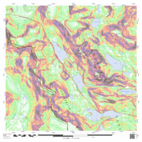
It's just an app on my phone that lets me use PDF's of my Caltopo maps to navigate. Lets say I am in the wind rivers and I am trying to get through the Alpine Lakes area. That area has no trails, so beforehand I make a Caltopo map overlaid with elevation shading to help me out.

In the Avenza app, I can upload a Caltopo PDF and use it to help me navigate. with my phone and that uploaded map, I can see exactly where I am because the PDF is laced with geospatial information.

Instead of paying extra $20/yr in my Backcountry Navigator app for that same elevation shading feature, I use to be able just make my own large PDF map with the elevation profile.

While I can still print smaller PDF's for free, it would be nice to be able to print the larger ones still... oh well.

upload_2015-11-20_11-47-44.png
 
Interesting use-case. I am such a strong user and advocate for GaiaGPS that this sounds much different than my use-case. I download all of the maps of three different layers before I head out to the boonies. Then I have all the data handy I need with me. I can switch between. Caltopo USGS topos, Google Terrain view and ESRI satellite layers with a simple toggle. It works really well and GAIA and those map layers are all free. GAIAGPS.com then stores all my mapping and acquired route data for me too. Their online map feature is pretty rudimentary compared to caltopo though. Other than that I love it.
 
Interesting use-case. I am such a strong user and advocate for GaiaGPS that this sounds much different than my use-case. I download all of the maps of three different layers before I head out to the boonies. Then I have all the data handy I need with me. I can switch between. Caltopo USGS topos, Google Terrain view and ESRI satellite layers with a simple toggle. It works really well and GAIA and those map layers are all free. GAIAGPS.com then stores all my mapping and acquired route data for me too. Their online map feature is pretty rudimentary compared to caltopo though. Other than that I love it.

I have heard great things about Gaia GPS. My only beef with it is that it cost so much. With CalTopo and Backcountry Navigator, I can do pretty much anything I want for the $10 it cost me to pay for the app. yeah.... im cheap.
 
Last edited:
Haha! $10 for a killer app that replaces a ~$300 GPS is not expensive!!

Gaia GPS: $19.99 + 39.99/yr for pro.
BackCountry Navigator: $11.99 + in app purchases for some maps

both cheaper than a GPS if you already own a smartphone :) Not a fan of the yearly subscription though. But BCN requires $20/yr for the topo shading feature that I like. That is why I was thrilled to find out that CalTopo maps work with the free Avenza PDF Maps for Android App. :wavespin:
I beta tested GAIA pro for them and got it free. Once that expired I reverted to the $10 app I bought 4 years ago. No subscription. Unlimited maps. Can't really beat it if you are talking even just about $$$. Everyone's usecase is different though so stick with what you like.
 
Back
Top