Eagle Rock Loop, Ouachita National Forest

Dan Adkison

Ninja
Joined
May 12, 2013
Messages
2
This is the second attempt of a three day backpacking trip I attempted to lead a group on last Spring. Unfortunately the first try ended in disaster after the first day due to most of the group being unprepared for such a trip. The second time around was a much better experience for 5 out of 10 that started the trail.

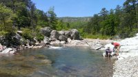
The Eagle Rock Loop is a 26.8 mile loop made up of 3 trails put together. It is rated as the toughest backpacking trail in Arkansas. There are around 8 ridges to go up and down and numerous stream crossings, some of which require taking off your boots and going through water up to knee deep. Most of the water crossings are able to be done without taking your boots off. Trekking poles make this a lot easier to do. The following picture is of the Little Missouri River which we cross multiple times throughout the hike. In some places the water is over your head deep and makes for some nice swimming stops.
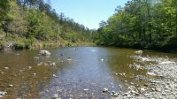
964808_642838745731076_1936652242_o.jpg

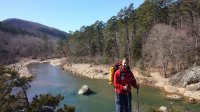
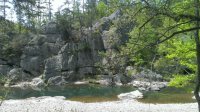
We started the loop the morning of April 25 around 1030 am with a goal of hiking about 7.5 miles to our first planned camping spot. This time we started going clockwise along the trail instead of counter clockwise like the previous year just in case something happened along the way. This way we could see part of the loop that we missed the previous year. The weather on day one was perfect, very few clouds, and a high in the low 70's. A few miles into the hike we came across a section of the Little Missouri River that made for a perfect stop for lunch and a swim in chilly water.
964843_642838632397754_1708584472_o.jpg

462480_642838459064438_277730765_o.jpg

The water here got to about 8-10 feet deep and was full of trout. A friend of mine tried his luck as fishing but was unsuccessful. We stayed here about an hour before moving on. Unfortunately one member of the group hurt his knee shortly after leaving this beautiful spot. Then soon after he hurt his knee another member of the group hurt his ankle. Due to the injured hikers we were forced to stop and make camp a little earlier than expected on day one. We ended up covering around 5.5 miles on day one.

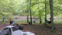
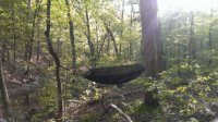
This was the first trip I have done using a hammock instead of a tent. Loved it!
478776_642838219064462_1883262834_o.jpg

Featured image for home page:
slide.jpg
 
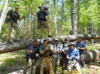
Another picture from day one. I'm the one on the tree with the sunglasses.

181197_642836042398013_658586263_n.jpg

We found a nice area near a stream to set up camp for the night. There are many areas along the trails that have been cleared for camping or you can use any area you find that is big enough for your group. Six out of 10 from the group brought hammocks so it was easy for us to set up camp wherever we liked. After setting up camp we had to come up with a plan to get the two injured hikers off the trail the next morning since they were not going to be able to continue. I will not go into that story here, it is a lengthy story in itself, but it was quite an adventure getting them picked up.

Our original plan to cover 7.5 miles on day one would have covered two of the six back to back ridges coming up on the next section of trail. Now we were faced with covering all six in one shot. I knew it would be tough for several in the group who were not in good shape for this.

Not long after starting the hike on day two the rains came and lasted almost all day, sometimes raining hard, with plenty of thunder and lightning. Luckily everyone came prepared for rain this year and we all suited up in our rain gear and pack covers. Unfortunately the rains and clouds ruined many good views and pictures along the section with all the ridges.

After a hard 5.5 mile hike with many steep ridges to go over we arrived at our destination we had selected to camp for that night. This is the same spot we reached last year before having to bail out on the loop due to injuries as well. It is a nice big camping area close to another stream. Just as we were arriving the rains finally let up and allowed us to set up camp before it started raining again. Somehow we managed to get a large fire going despite everything being wet. The fire made our night much better, it allowed us to warm up and dry off. We had about a two or three hour break from the rain that night, then just as we were deciding it was time to go to bed the rains started back up. It rained all night and for the first couple of hours the next day.

Again, day three started with rain off and on but cleared up in a couple of hours and it ended up being a very nice day. We planned on hiking about 8 miles this day which would leave us with a shorter hike the next day to get back to the cars and allow us to start our 5 hour drive home while it was still early in the day.

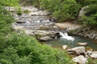
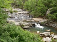
The 8 mile hike on day three was very nice after the rains stopped. The sky cleared up for the most part and the temp again was in the low 70's. Four miles into the hike we came across the Little Missouri Falls. It is not a big waterfall at all, the highest part maybe six feet tall but cascades down part of the river. It made for a very nice place to eat lunch and take another swim in the chilly water.

543574_460166913998261_1827055724_n.jpg

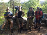
On day two, another member of our group hurt his knee on the ridges. When he woke up on day 3 he felt like he could continue hiking. He made it through the 8 miles we had planned to cover but when we reached our camp for that night he told us he was in too much pain and couldn't finish the loop. Fortunately there was a road very close by. One of the members of our group walked him to the road with the plan of trying to hitch a ride back to his car. Amazingly 3 others that were supposed to have started the hike with us but couldn't find the trail head just happened to drive by right as they reached the road. They gave him a ride back to his car. Two others who developed many blisters on the feet from wet socks and boots took a short cut back to the cars when we reached our campsite for our last night on the loop. This left us with five of the original ten who started the loop.

Camp site for our last night on the trail

919510_642838159064468_72712910_o.jpg

Our last day on the loop was only about 4 miles long with perfect weather. Here is a picture from on top of the last ridge we covered.

575222_642844599063824_268260985_n.jpg

The Eagle Rock Loop was challenging and a lot of fun. We are looking forward to planning a backpacking trip for the coming fall.
 
I can't believe this is the only thread on Eagle Rock Loop in the forums. That place is awesome! A group of 8 of us drove up from Austin and hiked it last October. It's a perfect 3 day trek: mountain vistas, lush greenery, clear water streams & rivers, trout fishing, and some challenging ascents and descents. One of the aspects I love most about it, is the fact it can be hiked any time of year. You spend 99% of the time walking through beautiful mountain forests or along shaded ridge lines. So, the sun never beats down on you. I rarely even broke a sweat, despite the, at times, difficult terrain.
 
Very cool! Never really thought of backpacking in Arkansas! Thanks for posting and welcome to BCP!
Arkansas is 2/3rds mountains, with lots of streams and rivers. It's an incredible place to go hiking! Both the Ozark Mountains and Ouachita National Forest offer breathtaking and challenging multi-day hikes. Plus, the river rafting is pretty fantastic there as well.
 
I've heard so many good things about Ouachita over the years; nice to see some photos of that area finally - thanks! My in-laws live in Oklahoma (Norman area), and I'm always trying to find excuses to avoid visiting that Dogforsaken place. But Ouachita is sort of "along the way", could be a good diversion to help tolerate a visit to the in-laws if we just have to go there.
 
Similar threads
Thread starter Title Forum Replies Date
LoneWolfOutdoors Eagle Rock Loop Trail in Arkansas Backpacking 6
Stephanie B Eagle Rock Shelter (Delta County, CO) Hiking & Camping 2
O Eagle Cap from China Cap to Meadow Mountain Backpacking 3
TrektheWorld Crater Lake and Lone Eagle Peak Backpacking 1
NorthwestWanderer 6 Day Eagle Cap Wilderness Odyssey | Cross Country Travel | The Highlight Highway Loop Backpacking 6
Mountain Wanderer First trip in to the Eagle Cap Wilderness Backpacking 10
NorthwestWanderer Eagle Cap Wilderness, Oregon (July 1 - July 3) Backpacking 5
IntrepidXJ Lone Eagle Cirque Backpacking 2
hatchcanyon San Rafael Swell: South Fork Eagle Canyon Off Road 2
Lisa Eagle Cap Wilderness, September 2014 Backpacking 17
Blake Merrell Canyoneering in Heaven.... eh, I mean Eagle Creek! Canyoneering 7
steve Gear Review Sea Eagle Fast Track 385 Inflatable Kayak Review Gear Reviews 44
hatchcanyon Fly with the Eagle Everything Else 16
TrailScot Hole-in-the-Rock Road - Escalante General Discussion 11
TrailScot Capitol Reef NP - 5 Day Backpacking Adventure from Chimney Rock to Burro Wash - October 2023 Backpacking 10
Jackson Little Rock Creek Backpacking 5
2eez4life Suggestions: Uintas Backpacking with some rock climbing routes Trip Planning 0
kwc Another Southern Adirondacks hike - Clockmill Pond and Rock Lake Hiking & Camping 0
R Pony Express Trail, Black Rock to Simpson Springs Hiking & Camping 3
XID_AZ Willow Gulch from Hole in the Rock Trip Planning 4
fossana Yellow Rock, Pollock Arch, Hackberry Canyon loop (GSENM) Hiking & Camping 10
F Who has been here? Ruin off Hole-in-the-Rock road General Discussion 4
napatony13 UNUSUAL ROCK ART STYLES Off Road 4
scatman Beartooth Wilderness - Flat Rock Lake Lollipop Loop - July 26, 2021 Backpacking 56
C Coyote Gulch via Chimney rock trail Trip Planning 0
napatony13 BISHOP BACKROADS ROCK ART Off Road 2
napatony13 SUCCESSFUL SLEUTHING-Nevada Rock Art Off Road 6
Henk Moab rock art vandalized General Discussion 1
J Bunch O' N. San Rafael Swell summit scrambles April 10-12, 2021 (now w/rock art) Hiking & Camping 3
J Dayhiking Moab's awesome geography, couple hikes to summits and rock art April 8-9, 2021 Hiking & Camping 0
scatman Castle Rock - April 3, 2021 Hiking & Camping 13
norwegianxplorer Preikestolen, Pulpit Rock, Hiking Norways most Iconic and spectacular Landmark & views, Lysefjord, Norway Hiking & Camping 1
Stephanie B Fishing (for Trout) and Hunting (for Rock Art) In and Near Capitol Reef National Park Hiking & Camping 7
T Status of Traffic - Hole in the rock road - Escalante - September? Trip Planning 2
fossana Wire Pass fire (impacting House Rock Rd/Buckskin Gulch) Trip Planning 3
Stephanie B Searchin' for Ruins and Rock Art in San Juan County, UT Hiking & Camping 6
NorthwestWanderer Backpacking the Pasayten Wilderness : Harts Pass, PCT, Windy Pass, Buffalo Pass, Foggy Pass, Jim Pass, Hulman Pass & Rock Pass Meadows Backpacking 3
NorthwestWanderer Waterfall Hikes & the death of my legendary Chevy Cobalt...in a rock slide. Hiking & Camping 8
Rockskipper Hiker seriously injured by rock at Fisher Towers General Discussion 12
Stephanie B Sand Island and Sand Dune Rock Art Hiking & Camping 1
b.stark Crack In Rock - Fall 2016 Backpacking 6
J Red Rock(s) Canyon Natl.Conservation Area Hikes and Scrambles Nov. 15 and 16, 2017 Hiking & Camping 0
L Red Castle Lakes / Wilson Peak OR Rock Creek Basin Trip Planning 4
BJett Shining Rock Wilderness Backpacking 10
Strawsome What is your favorite hike in the Escalante/Hole in the rock road area? General Discussion 6
Jimmy Hole in the Rock Car Camping Trip Planning 0
powderglut Toadstools and Hoodoos in the White Rock Valley Hiking & Camping 8
IntrepidXJ Album Hoodoos, Spires and other Rock Formations Photography 73
SKLund Spilling the Beans on Rock Art General Discussion 15
Rockskipper As ice thaws, rock avalanches on Southeast Alaska mountains are getting bigger General Discussion 0

Similar threads

Back
Top