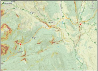
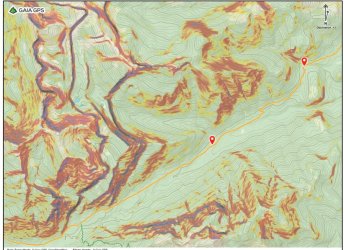
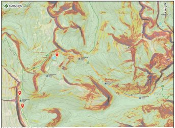
Below is part one of a 3 part report on my solo backpacking trip last summer in the Bob Marshall Wilderness.
WHAT ABOUT THE BOB?
On December 26th, 2022 my son Jackson was born. My wife and I adopted him as a newborn. From the very beginning we were eager to introduce him to the outdoors. Initially I hoped that we could do a 4 week family road trip to Wyoming the following summer. However, that plan ultimately seemed too ambitious, so we downsized the trip to 2 weeks of car camping in northern Michigan and Minnesota. That left me with 2 weeks of vacation.
My wife surprised me by suggesting that I take that time to go backpacking. I was stunned. She was willing to stay home and take care of the baby for 2 weeks while I did my thing? After nominating her for the Wife of the Year Award I started contemplating options. This was a rare opportunity. I wanted to do something BIG – something that I couldn’t do with a young child.
I considered numerous options. All of them were long, strenuous backpacking trips in vast wilderness areas. I seriously considered returning to the Teton Wilderness in Wyoming, as I have a lot more to explore there. Ultimately though, I decided to focus on an entirely new place. I’ve been curious about the Bob Marshall Wilderness in Montana for years. The Wilderness is massive, located just south of Glacier National Park. Its defining feature is The Chinese Wall, a 12 mile long escarpment of sheer 900’ cliffs. The wall would be a major tourist attraction if it weren’t deep in the wilderness. Reaching the wall requires a 20+ mile hike from the closest trailhead.
I knew that I needed to include the Chinese Wall in my trip. The Continental Divide Trail, which runs from Mexico to Canada, follows the base of it. Many people hike that stretch of trail. I wanted more though. I wanted to hike across the top.
First, I needed to find out if walking across the top is possible. After a bit of research, I found that it was. In fact, there is a trail to the summit of Haystack Mountain, which is the southern-most peak on the escarpment. However, the trail ends there. Hiking the length of the escarpment is entirely off-trail from that point. Most of it isn’t easy walking, either. There are numerous cliffs that have to be avoided, typically by taking long detours to the west. Those detours require significant descents to avoid the cliffs, followed by major climbs to regain the top of the wall. The north end of the wall ends abruptly, too. Getting down from there requires serious scrambling or a long, tedious bushwhack.
There are only two possible water sources along the route. The first, below Sphinx Peak, may be seasonal. The other is a small pond below Cliff Mountain. I figured that I would spend one night on top of the wall, most likely near one of those water sources.
After doing more research, I decided that the best approach would be from south to north. There are two options at the south end. The trail to Haystack Mountain is straightforward, but it requires a long descent from White River Pass before beginning the climb. There is also a more direct route from White River Pass, but it requires scrambling up two cliffs. I wasn’t sure if I would be able to do those scrambles while carrying a heavy pack. Ultimately I decided that the trail to Haystack Mountain would be the best choice for me.
At the north end, there is a scramble route that ends near Larch Hill Pass. However, getting to that point on the wall would require descending 1,200’ to the west before ascending back to the top of the wall. The 1,200’ descent is about half of the descent to the White River Trail. I decided that it would make more sense to continue bushwhacking down from there.
Once I had that figured out, it was time to plan out the other 12ish days. That meant figuring out how I wanted to approach the area, and what else I wanted to do. Most people hike to the Chinese Wall from the Benchmark Trailhead. That approach is 20+ miles, but it is the shortest and easiest approach. I considered starting there, but it didn’t look very exciting.
I looked at numerous other options. I researched most of the range, and I found numerous other destinations that sounded appealing. The Swan Range to the southwest and the Sawtooth Range to the northeast were intriguing. I definitely wanted to include Bungalow Mountain, as a trail traverses it, and it is possible to camp near the summit. And then the Trilobite Range to the north sounded great, too. The trick was finding the best route to include as many appealing areas as possible.
Eventually I settled on starting from the South Teton Trailhead, in the Sawtooth Range west of the town of Choteau. From there I could make a long loop starting and ending in the Sawtooth Range. The middle of the trip would feature the base of the Chinese Wall, the top of the wall, Bungalow Mountain, and the Trilobite Range. My rough plan:
Day 1: South Teton Trailhead to a campsite just west of Headquarters Pass
Day 2: Headquarters Pass to a campsite near Rock Creek
Day 3: Rock Creek to My Lake
Day 4: My Lake to the base of the Chinese Wall just south of the camping closure area
Day 5: Base of the Chinese Wall to Molly Creek beyond White River Pass
Day 6: Molly Creek to the top of the Chinese Wall and on to the pond below Cliff Mtn
Day 7: Pond below Cliff Mountain to the White River
Day 8: White River to the summit of Bungalow Mountain
Day 9: Bungalow Mountain to Pot Mountain
Day 10: Pot Mountain to Trilobite Lakes
Day 11: Trilobite Lakes to Dean Lake
Day 12: Dean Lake to Moonlight Peak
Day 13: Moonlight Peak to campsite west of Route Creek Pass
Day 14: Campsite west of Route Creek Pass to Lonesome Ridge Trailhead
It was a good plan, I think. I booked a flight to Bozeman, reserved a rental car, and booked a campsite at the Holter Lake Campground northeast of Helena for the first night. My wife-of-the-year nominee dehydrated a bunch of meals for me so that I could backpack for 14 days without resupplying.
A couple of weeks before my trip I found out that my friend Dave was on a road trip in the Rockies. His plans were flexible, and he decided to join me for the first part of my trip. We planned to meet at my campsite at Holter Lake on 7/29. He intended to backpack with me for the first day or two. I was thrilled to see Dave for the first time in years and to have some company for the start of the trip.
PART ONE: THE PRICE OF ADMISSION
My flights from Asheville to Dallas and from Dallas to Bozeman were smooth. In Bozeman I picked up bear spray and denatured alcohol for stove fuel. From there I drove to Helena, where I bought additional food for the trip and had dinner at McKenzie River Pizza Company. After dinner I drove to Holton Lake, where Dave was waiting for me. It was great catching up with him! He had just started his annual summer road trip. After a few days in Glacier National Park he had driven south to meet me. After our trip, he was planning to head to the Canadian Rockies.
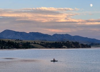
The Holton Lake Campground wasn’t very appealing. The tent campsites are in a big open area. The campsites are rather cramped, with undefined boundaries. We were basically surrounded by other campers. It was a little bit like tailgating before a concert, except that I was tired from traveling. The highlight of the evening was a nice sunset and catching up with Dave. Fortunately, it was quiet after dark, but that’s probably not always the case there. I won’t camp there again unless I’m desperate for a place to spend the night.
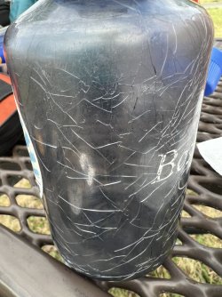
There were a couple of mishaps that first evening. First, I noticed that my plastic Nalgene-style bottle that I use for fuel was spiderwebbed with cracks. The cracks weren’t all the way through the plastic, but inside the material. It looked like it MIGHT hold together, but I couldn’t risk losing my fuel. I pitched it and picked up a Gatorade the next morning so I could use the bottle.
Worse, the zipper on my tent fly broke that night. My tent only has a single door, and there was no longer a way to close it. That was not ideal right before a 2 week backpacking trip deep in the wilderness. We were also in the middle of nowhere, so my options for repairing it were pretty limited. I ended up getting some paper clips from a gas station and bumming some safety pins from Dave. I was hopeful that they would get me through the trip.
HEADQUARTERS
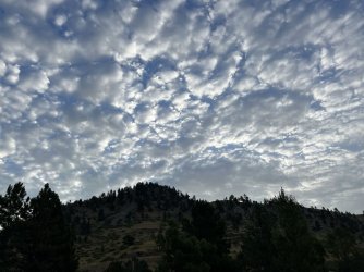
The next morning we packed up and drove north towards Choteau and the Sawtooth Range on the east side of the Bob Marshall Wilderness. Dave actually had a scale with him, which provided me with a rare opportunity to weight my pack before a big trip. Aside from the obvious gear I was carrying a spare battery for my phone, a lightweight solar panel to charge the battery, bear spray, and one bear canister. I got about half of my 14 days of food in the bear canister, with the intention of hanging the rest. Bear canisters aren’t required in the Bob Marshall Wilderness, but I was afraid that I wouldn’t be able to hang all of it early in the trip. Finding suitable tree limbs can be challenging, and I only had one length of cord. I did not bring my camp chair, mainly because I’d accidentally left it at home. I was a little sad about that, but not too sad. It weighs a pound by itself.
The base weight of my pack (without food and water) was 20.5 pounds. After adding 14 days of food and a quart of water it was up to 50.5 pounds. I thought that was pretty reasonable for 2 weeks. I’ve carried heavier packs on shorter trips.
Dave followed me to Choteau, where I ran a few last minute errands, called my wife, and picked up a sub for lunch. Afterwards we drove west into the Sawtooth Mountains. We stopped at the Lonesome Ridge Trailhead, where I planned to finish my trip. My original plan had been to walked the last couple of miles of South Fork Road to the South Teton Trailhead and then start up the trail to Headquarters Pass. I’d finish my trip in 2 weeks with the Lonesome Ridge Trail, ending at the car.
The Lonesome Ridge Trail doesn’t have a parking area. There is a wide spot along the road, with room for a couple of cars. It was adequate, I suppose, but I wasn’t thrilled with the idea of leaving the rental car there for 2 weeks. At that point it occurred to me that running a short shuttle was an option, since Dave was driving separately. I asked him if he would mind following me over to the Middle Fork Teton Trailhead at Cave Mountain Campground. He was fine with that, so we headed that way.
The two trailheads are only a few miles apart as the crow flies, but the driving distance was much longer, and on bumpy dirt roads. The round trip took over an hour, but the parking situation was a lot better. Best of all, we were able to skip the initial 2 mile road walk, and I could finish my trip without having to climb over Lonesome Ridge. I do wish that I’d thought to do this ahead of time, as we ended up running that shuttle in the most inefficient way possible.
After parking the car in an empty lot near the Cave Mountain Campground, I rode with Dave all the way to the end of South Fork Road. There is a small parking area there, which was pretty busy on a Sunday afternoon. That trailhead is also the starting point for a popular ½ day hike to Our Lake. We arrived at the same time as the afternoon thunderstorms. Neither of us was interested in starting in the rain, so we waited for the rain to pass. By the time we finally got started it was well into the afternoon. The good news is that we had less than 5 miles to go to reach my intended campsite on the far side of Headquarters Pass. The bad news is that almost all of that distance would be uphill. We would have to climb 2,200’ to the pass before dropping a short distance into a basin with good camping options.
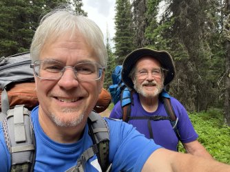
Dave and I hiked together for about 10 minutes to a junction with the side trail to Our Lake. There, Dave announced that he wasn’t ready for backpacking. He had been car camping and dayhiking, but he had planned to ease back into backpacking. Climbing 2,200’ in about 4 miles isn’t really the ideal way to do that. Unfortunately, I didn’t have much flexibility with my route. Regrettably, we decided to part ways. My mostly solo backpacking trip would be entirely solo after all.
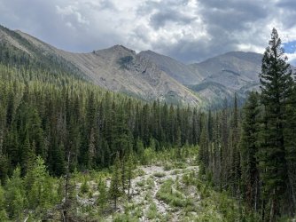
The 4 miles to Headquarters Pass was one of the most scenic parts of the trip. There were many nice views of Cave Mountain and other peaks back to the east. Wildflowers were abundant, and the trail passed a huge waterfall. I took my time, enjoying the scenery and pacing myself under my heavy load. The trail was pretty quiet for a Sunday afternoon. In fact, I only saw one group after passing the junction with the Our Lake Trail. That was late in the evening, on the far side of Headquarters Pass. I met a group that had started at My Lake early that morning. It was getting late, but they were determined to get burgers and beers that evening. I’m familiar with that that mindset, but I was glad that I wouldn’t be tempted to succumb to it for quite some time.
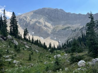
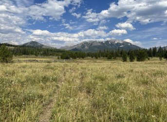
The best views on the first day were back to the east. From the pass, the view to the west is blocked by a parallel ridge. At that point I was just focused on finding a place to camp. After a rocky descent I reached a lovely meadow with scattered trees. It was a great spot, but the streambed was dry. I dropped my pack at a campsite and continued east down the trail in search of water. I had to hike an extra 10 minutes or so, but I eventually heard water flowing in the gully below me. The extra walk was a little inconvenient, but it was a great place to spend the first night otherwise.
IT'S NOT THE HUMIDITY, IT’S THE HEAT
My goal for day 2 was head towards My Lake and cover as much distance as possible. Could I cover the full 22 miles in one day? It would be great to get a day ahead of schedule, but it didn’t seem realistic with 13 days worth of food on my back.
I got up early but was slow breaking camp, as usual. I headed down the trail past the water source and entered the beginning of a large burned area. The burn covers most of the Headquarters Creek valley, from the North Fork of the Sun River most of the way to Headquarters Pass. That meant hours of drab scenery and no shade. It was unusually hot, too. I felt a bit of sympathy for the guys I had met the previous evening. They had hiked up the valley in the afternoon sun. It was bad enough heading down in the morning.
I met one large group of horsepackers along this trail. They were very friendly, and they mentioned a nice campsite along the creek with some living aspens a short distance ahead. That proved to be an ideal spot for lunch. It was really the only pleasant, shady spot along most of the trail.
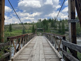
The hike improved as I neared the North Fork of the Sun River. The last mile or two featured some living trees and hazy views of the mountains to the west. I reached a trail junction on a hillside above the river, which provided a nice view of the water below. I turned south there and descended to a rock hop crossing of Headquarters Creek. A few minutes later I reached another junction, and a sturdy bridge over the river. I stopped there for a break and spent a few minutes checking out the aquatic wildlife.
The bridge featured a sign warning visitors to watch out for downed telephone lines, which was puzzling. Telephone lines? Deep in the Bob Marshall Wilderness? That seemed doubtful. There was also a sign announcing the boundary of the Sun River Game Preserve. Hunting is prohibited, with a minimum fine of $25. It was a very old sign.
There is a large campsite just downstream from the bridge, but there was a big group there. Also, it was only mid-afternoon, so it was really a little too early to stop. On the other hand, I was tempted to camp in the area, as I wasn’t sure if there would be many camping options once I started up the Rock Creek Trail.
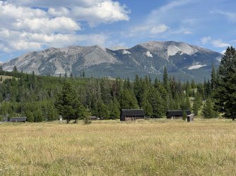
I followed the trail up a hill and away from the river. Before long I reached an unmarked junction with a trail that isn’t on the map. Curious, I followed it down to Gates Creek. It followed the stream briefly, before crossing it. I didn’t want to get my feet wet, so I backtracked to the main trail and followed it towards Gates Park. Before long I reached another junction. This time I headed north, towards the Gates Park Ranger Station. I passed through a gate and approached the ranger station, which is located in a large meadow. I ran into a fellow there on a horse that I initially thought was a ranger. It turns out that he was just a horsepacker that had stopped at the ranger station to repair a horseshoe. I asked him if he knew of any good campsites in the area. He suggested heading upstream along the North Fork of the Sun River, and he also mentioned a possible spot where the Rock Creek Trail / Continental Divide Trail (CDT) crosses Red Shale Creek.
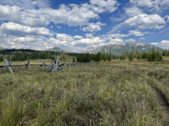
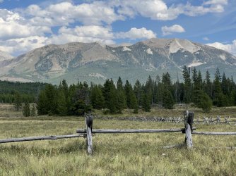
I didn’t want to head upstream along the river, as that would take me well out of the way. Instead I doubled back to the main trail and followed it through more meadows north of Gates Lake. I thought that the lake might offer some camping options, but it is very marshy. I did enjoy some nice views looking back towards the Sawtooth Range while I was wandering around. Trails run every which way in the Gates Park area, but most of them aren’t on the map. Staying on the correct route was challenging, but I eventually found the main trail heading towards Rock Creek.
I crested a hill and reached a junction with the Continental Divide Trail. A right turn there follows the CDT north towards Glacier National Park. I continued ahead on the CDT, heading south towards Rock Creek, My Lake, and the Chinese Wall. A steep descent brought me to Red Shale Creek. I could have camped there, but it would have been a cramped, lousy spot right next to the trail. It wasn’t nearly late enough to be that desperate. Rock hopping the creek was difficult due to the slippery rocks, but I made it across with mostly dry boots. After a short, steep climb I followed a relatively easy grade through thick forest. This stretch of trail roughly parallels Rock Creek, but generally stays well away from it.
Camping options were non-existent along this stretch. The map showed the trail crossing numerous tributaries over the next few miles, and I was hopeful that I would find a reasonable campsite at one of them. However, the first couple were swampy, and the forest was thick with undergrowth. I was tired and growing concerned when I passed an open area at the top of a steep hillside high above Miners Creek. That would have worked, but getting water would have required a steep bushwhack.
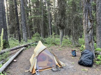
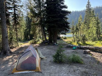
I hiked another ten minutes and found a small spot next to the trail. The trail crossed Miners Creek 50 yards beyond the campsite, offering easy access to water. The campsite itself was unremarkable, but convenient and comfortable. It was the definition of a 2 star campsite. Well, maybe 3 stars, considering the lack of other options.
I set up camp, finished my chores, and enjoyed a relaxing evening before heading to bed at sunset.
MY LAKE
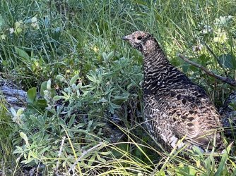
The morning of Day 3 was very similar to the afternoon of Day 2. It was a long plod through thick forest. Most of it was uninspiring, but there were occasional sightings of deer and grouse. Early on I passed a group of backpackers heading the other way. They said that they had camped along Rock Creek, but I didn’t notice any campsites or side trails heading towards it. After an hour or so I reached a rock hop crossing of Baldy Bear Creek. There is a fairly nice campsite here that is larger and more open than the one at Miners Creek. From there I marched through more dull forest for a couple of hours. I reached the Rock Creek ranger station around mid day. There wasn’t anyone around, so I had lunch on the front porch before getting water from the large tributary stream behind the building.
After lunch I rock hopped the stream and continued up the Rock Creek Trail. The trail began to climb, and I entered a minor gorge formed by an unnamed fork of Rock Creek. I passed below some cliffs, and it sounded like there was a waterfall far below. Unfortunately, the trail is high up on the hillside above the creek. Checking out the possible waterfall would’ve required a steep, gnarly bushwhack. I wasn’t interested in doing that with my pack on my back, and leaving my pack unattended in bear country wasn’t a good idea, either. I resisted the temptation and continued up the trail.
After a long, steady climb I reached a junction at Spotted Bear Pass. The pass is heavily wooded, so there were no views there. Continuing ahead would have taken me down into the Spotted Bear River valley. However, I continued to climb beyond the pass, heading up a sparsely wooded hillside. This area had burned in recent years, so there were some views of wooded ridges back to the east.
I reached another junction at the top of the climb. The Larch Hill Trail continues ahead, while the CDT drops down to My Lake. I reached the lake by late afternoon, which gave me time to relax and contemplate my options for the next few days.
My Lake is poorly named. Based on the vast number of large campsites near it, I’d guess that it is everyone’s lake. It looks like it is a popular destination for large horse parties. Oddly, there wasn’t anyone there when I arrived. A single CDT thru hiker did arrive late that evening and camped at an adjacent site, but it definitely wasn’t crowded.
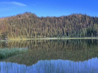
My Lake was a little disappointing. The view from shore was pleasant, but unspectacular. The lake itself was marshy, it and wasn’t appealing for swimming. That was too bad, as I had hoped for a refreshing dip after 3 hot days of backpacking. Its outlet stream was dry, and getting water along the marshy shore was challenging. I eventually found a rocky area with a fallen tree on the south side of the lake where it was possible to fill a pot without collecting a bunch of muck.
I used my Garmin In-reach to check the weather forecast that evening. It did not provide good news. The next day, Wednesday, would be hot and hazy again. Thursday looked cloudy, with thunderstorms and an extended period of rain moving in starting on Friday. That did not suit my schedule at all. My original plan had been to follow the CDT along the base of the Chinese Wall on Wednesday. I hoped to camp below the wall just south of the camping closure area Wednesday night. On Thursday I would hike down to the South Fork of the Sun River and follow it at least as far as Indian Creek. If I was up for a long day, I could continue up Indian Creek, over White River Pass, and down to a campsite on Molly Creek. If not, I’d spend Thursday night by the river and Friday night at Molly Creek. From there, I planned to hike up the trail to Haystack Mountain and begin my traverse of the top of the Chinese Wall.
The earliest that I could start my climb to the top of the Wall was on Friday – the day that severe thunderstorms were expected. I can’t imagine a scarier place in a thunderstorm than the top of that escarpment. Getting there sooner wasn’t realistic. Slowing my pace and heading up there afterwards wasn’t appealing, either. Rain and overcast skies were expected to linger through the weekend, and possibly into Monday. Killing several days waiting for better weather would mean dropping another part of the trip that I had planned. It would also mean an extended period of lounging in a tent with a broken door zipper. That would be uncomfortable at best, and dreadfully boring.
I debated my options for some time before I had an inspiration. What if I reversed my planned route? If I went backwards, I could reach the top of the Wall on Wednesday, and complete the traverse on Thursday, before the bad weather moved in. I could probably get across White River Pass Friday morning, before the thunderstorms. That would mean hiking along the base of the Wall in the rain, but that sounded a lot better than being on top in bad weather.
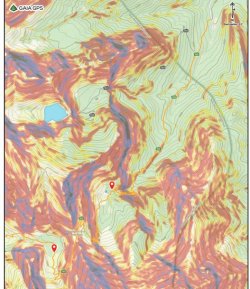
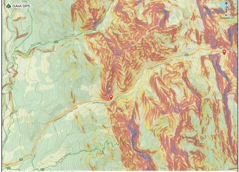
There were a couple of flaws in the revised plan. First, I’d have to hike the 2-3 miles of trail from Larch Hill Pass to the White River twice. That would be a little inconvenient, but at least it would be downhill both times. The more significant issue is that all of my research and planning was based on reaching the top of the Wall by the trail to Haystack Mountain and continuing north from there. Would I be able to find my way up to the top from the north end? The map suggested a couple of possible routes. I had planned to descend one of them, with my decision to be based on how it looked when I started. Going the other way, I’d have to pick one and commit to it.
By dinner time I’d decided to flip my route and head up the Wall the next day. I messaged my wife using my Garmin In Reach and let her know about my change in route. I went to bed at sunset, hoping to get up early the next morning.
WHAT ABOUT THE BOB?
On December 26th, 2022 my son Jackson was born. My wife and I adopted him as a newborn. From the very beginning we were eager to introduce him to the outdoors. Initially I hoped that we could do a 4 week family road trip to Wyoming the following summer. However, that plan ultimately seemed too ambitious, so we downsized the trip to 2 weeks of car camping in northern Michigan and Minnesota. That left me with 2 weeks of vacation.
My wife surprised me by suggesting that I take that time to go backpacking. I was stunned. She was willing to stay home and take care of the baby for 2 weeks while I did my thing? After nominating her for the Wife of the Year Award I started contemplating options. This was a rare opportunity. I wanted to do something BIG – something that I couldn’t do with a young child.
I considered numerous options. All of them were long, strenuous backpacking trips in vast wilderness areas. I seriously considered returning to the Teton Wilderness in Wyoming, as I have a lot more to explore there. Ultimately though, I decided to focus on an entirely new place. I’ve been curious about the Bob Marshall Wilderness in Montana for years. The Wilderness is massive, located just south of Glacier National Park. Its defining feature is The Chinese Wall, a 12 mile long escarpment of sheer 900’ cliffs. The wall would be a major tourist attraction if it weren’t deep in the wilderness. Reaching the wall requires a 20+ mile hike from the closest trailhead.
I knew that I needed to include the Chinese Wall in my trip. The Continental Divide Trail, which runs from Mexico to Canada, follows the base of it. Many people hike that stretch of trail. I wanted more though. I wanted to hike across the top.
First, I needed to find out if walking across the top is possible. After a bit of research, I found that it was. In fact, there is a trail to the summit of Haystack Mountain, which is the southern-most peak on the escarpment. However, the trail ends there. Hiking the length of the escarpment is entirely off-trail from that point. Most of it isn’t easy walking, either. There are numerous cliffs that have to be avoided, typically by taking long detours to the west. Those detours require significant descents to avoid the cliffs, followed by major climbs to regain the top of the wall. The north end of the wall ends abruptly, too. Getting down from there requires serious scrambling or a long, tedious bushwhack.
There are only two possible water sources along the route. The first, below Sphinx Peak, may be seasonal. The other is a small pond below Cliff Mountain. I figured that I would spend one night on top of the wall, most likely near one of those water sources.
After doing more research, I decided that the best approach would be from south to north. There are two options at the south end. The trail to Haystack Mountain is straightforward, but it requires a long descent from White River Pass before beginning the climb. There is also a more direct route from White River Pass, but it requires scrambling up two cliffs. I wasn’t sure if I would be able to do those scrambles while carrying a heavy pack. Ultimately I decided that the trail to Haystack Mountain would be the best choice for me.
At the north end, there is a scramble route that ends near Larch Hill Pass. However, getting to that point on the wall would require descending 1,200’ to the west before ascending back to the top of the wall. The 1,200’ descent is about half of the descent to the White River Trail. I decided that it would make more sense to continue bushwhacking down from there.
Once I had that figured out, it was time to plan out the other 12ish days. That meant figuring out how I wanted to approach the area, and what else I wanted to do. Most people hike to the Chinese Wall from the Benchmark Trailhead. That approach is 20+ miles, but it is the shortest and easiest approach. I considered starting there, but it didn’t look very exciting.
I looked at numerous other options. I researched most of the range, and I found numerous other destinations that sounded appealing. The Swan Range to the southwest and the Sawtooth Range to the northeast were intriguing. I definitely wanted to include Bungalow Mountain, as a trail traverses it, and it is possible to camp near the summit. And then the Trilobite Range to the north sounded great, too. The trick was finding the best route to include as many appealing areas as possible.
Eventually I settled on starting from the South Teton Trailhead, in the Sawtooth Range west of the town of Choteau. From there I could make a long loop starting and ending in the Sawtooth Range. The middle of the trip would feature the base of the Chinese Wall, the top of the wall, Bungalow Mountain, and the Trilobite Range. My rough plan:
Day 1: South Teton Trailhead to a campsite just west of Headquarters Pass
Day 2: Headquarters Pass to a campsite near Rock Creek
Day 3: Rock Creek to My Lake
Day 4: My Lake to the base of the Chinese Wall just south of the camping closure area
Day 5: Base of the Chinese Wall to Molly Creek beyond White River Pass
Day 6: Molly Creek to the top of the Chinese Wall and on to the pond below Cliff Mtn
Day 7: Pond below Cliff Mountain to the White River
Day 8: White River to the summit of Bungalow Mountain
Day 9: Bungalow Mountain to Pot Mountain
Day 10: Pot Mountain to Trilobite Lakes
Day 11: Trilobite Lakes to Dean Lake
Day 12: Dean Lake to Moonlight Peak
Day 13: Moonlight Peak to campsite west of Route Creek Pass
Day 14: Campsite west of Route Creek Pass to Lonesome Ridge Trailhead
It was a good plan, I think. I booked a flight to Bozeman, reserved a rental car, and booked a campsite at the Holter Lake Campground northeast of Helena for the first night. My wife-of-the-year nominee dehydrated a bunch of meals for me so that I could backpack for 14 days without resupplying.
A couple of weeks before my trip I found out that my friend Dave was on a road trip in the Rockies. His plans were flexible, and he decided to join me for the first part of my trip. We planned to meet at my campsite at Holter Lake on 7/29. He intended to backpack with me for the first day or two. I was thrilled to see Dave for the first time in years and to have some company for the start of the trip.
PART ONE: THE PRICE OF ADMISSION
My flights from Asheville to Dallas and from Dallas to Bozeman were smooth. In Bozeman I picked up bear spray and denatured alcohol for stove fuel. From there I drove to Helena, where I bought additional food for the trip and had dinner at McKenzie River Pizza Company. After dinner I drove to Holton Lake, where Dave was waiting for me. It was great catching up with him! He had just started his annual summer road trip. After a few days in Glacier National Park he had driven south to meet me. After our trip, he was planning to head to the Canadian Rockies.
The Holton Lake Campground wasn’t very appealing. The tent campsites are in a big open area. The campsites are rather cramped, with undefined boundaries. We were basically surrounded by other campers. It was a little bit like tailgating before a concert, except that I was tired from traveling. The highlight of the evening was a nice sunset and catching up with Dave. Fortunately, it was quiet after dark, but that’s probably not always the case there. I won’t camp there again unless I’m desperate for a place to spend the night.
There were a couple of mishaps that first evening. First, I noticed that my plastic Nalgene-style bottle that I use for fuel was spiderwebbed with cracks. The cracks weren’t all the way through the plastic, but inside the material. It looked like it MIGHT hold together, but I couldn’t risk losing my fuel. I pitched it and picked up a Gatorade the next morning so I could use the bottle.
Worse, the zipper on my tent fly broke that night. My tent only has a single door, and there was no longer a way to close it. That was not ideal right before a 2 week backpacking trip deep in the wilderness. We were also in the middle of nowhere, so my options for repairing it were pretty limited. I ended up getting some paper clips from a gas station and bumming some safety pins from Dave. I was hopeful that they would get me through the trip.
HEADQUARTERS

The next morning we packed up and drove north towards Choteau and the Sawtooth Range on the east side of the Bob Marshall Wilderness. Dave actually had a scale with him, which provided me with a rare opportunity to weight my pack before a big trip. Aside from the obvious gear I was carrying a spare battery for my phone, a lightweight solar panel to charge the battery, bear spray, and one bear canister. I got about half of my 14 days of food in the bear canister, with the intention of hanging the rest. Bear canisters aren’t required in the Bob Marshall Wilderness, but I was afraid that I wouldn’t be able to hang all of it early in the trip. Finding suitable tree limbs can be challenging, and I only had one length of cord. I did not bring my camp chair, mainly because I’d accidentally left it at home. I was a little sad about that, but not too sad. It weighs a pound by itself.
The base weight of my pack (without food and water) was 20.5 pounds. After adding 14 days of food and a quart of water it was up to 50.5 pounds. I thought that was pretty reasonable for 2 weeks. I’ve carried heavier packs on shorter trips.
Dave followed me to Choteau, where I ran a few last minute errands, called my wife, and picked up a sub for lunch. Afterwards we drove west into the Sawtooth Mountains. We stopped at the Lonesome Ridge Trailhead, where I planned to finish my trip. My original plan had been to walked the last couple of miles of South Fork Road to the South Teton Trailhead and then start up the trail to Headquarters Pass. I’d finish my trip in 2 weeks with the Lonesome Ridge Trail, ending at the car.
The Lonesome Ridge Trail doesn’t have a parking area. There is a wide spot along the road, with room for a couple of cars. It was adequate, I suppose, but I wasn’t thrilled with the idea of leaving the rental car there for 2 weeks. At that point it occurred to me that running a short shuttle was an option, since Dave was driving separately. I asked him if he would mind following me over to the Middle Fork Teton Trailhead at Cave Mountain Campground. He was fine with that, so we headed that way.
The two trailheads are only a few miles apart as the crow flies, but the driving distance was much longer, and on bumpy dirt roads. The round trip took over an hour, but the parking situation was a lot better. Best of all, we were able to skip the initial 2 mile road walk, and I could finish my trip without having to climb over Lonesome Ridge. I do wish that I’d thought to do this ahead of time, as we ended up running that shuttle in the most inefficient way possible.
After parking the car in an empty lot near the Cave Mountain Campground, I rode with Dave all the way to the end of South Fork Road. There is a small parking area there, which was pretty busy on a Sunday afternoon. That trailhead is also the starting point for a popular ½ day hike to Our Lake. We arrived at the same time as the afternoon thunderstorms. Neither of us was interested in starting in the rain, so we waited for the rain to pass. By the time we finally got started it was well into the afternoon. The good news is that we had less than 5 miles to go to reach my intended campsite on the far side of Headquarters Pass. The bad news is that almost all of that distance would be uphill. We would have to climb 2,200’ to the pass before dropping a short distance into a basin with good camping options.
Dave and I hiked together for about 10 minutes to a junction with the side trail to Our Lake. There, Dave announced that he wasn’t ready for backpacking. He had been car camping and dayhiking, but he had planned to ease back into backpacking. Climbing 2,200’ in about 4 miles isn’t really the ideal way to do that. Unfortunately, I didn’t have much flexibility with my route. Regrettably, we decided to part ways. My mostly solo backpacking trip would be entirely solo after all.
The 4 miles to Headquarters Pass was one of the most scenic parts of the trip. There were many nice views of Cave Mountain and other peaks back to the east. Wildflowers were abundant, and the trail passed a huge waterfall. I took my time, enjoying the scenery and pacing myself under my heavy load. The trail was pretty quiet for a Sunday afternoon. In fact, I only saw one group after passing the junction with the Our Lake Trail. That was late in the evening, on the far side of Headquarters Pass. I met a group that had started at My Lake early that morning. It was getting late, but they were determined to get burgers and beers that evening. I’m familiar with that that mindset, but I was glad that I wouldn’t be tempted to succumb to it for quite some time.

The best views on the first day were back to the east. From the pass, the view to the west is blocked by a parallel ridge. At that point I was just focused on finding a place to camp. After a rocky descent I reached a lovely meadow with scattered trees. It was a great spot, but the streambed was dry. I dropped my pack at a campsite and continued east down the trail in search of water. I had to hike an extra 10 minutes or so, but I eventually heard water flowing in the gully below me. The extra walk was a little inconvenient, but it was a great place to spend the first night otherwise.
IT'S NOT THE HUMIDITY, IT’S THE HEAT
My goal for day 2 was head towards My Lake and cover as much distance as possible. Could I cover the full 22 miles in one day? It would be great to get a day ahead of schedule, but it didn’t seem realistic with 13 days worth of food on my back.
I got up early but was slow breaking camp, as usual. I headed down the trail past the water source and entered the beginning of a large burned area. The burn covers most of the Headquarters Creek valley, from the North Fork of the Sun River most of the way to Headquarters Pass. That meant hours of drab scenery and no shade. It was unusually hot, too. I felt a bit of sympathy for the guys I had met the previous evening. They had hiked up the valley in the afternoon sun. It was bad enough heading down in the morning.
I met one large group of horsepackers along this trail. They were very friendly, and they mentioned a nice campsite along the creek with some living aspens a short distance ahead. That proved to be an ideal spot for lunch. It was really the only pleasant, shady spot along most of the trail.
The hike improved as I neared the North Fork of the Sun River. The last mile or two featured some living trees and hazy views of the mountains to the west. I reached a trail junction on a hillside above the river, which provided a nice view of the water below. I turned south there and descended to a rock hop crossing of Headquarters Creek. A few minutes later I reached another junction, and a sturdy bridge over the river. I stopped there for a break and spent a few minutes checking out the aquatic wildlife.
The bridge featured a sign warning visitors to watch out for downed telephone lines, which was puzzling. Telephone lines? Deep in the Bob Marshall Wilderness? That seemed doubtful. There was also a sign announcing the boundary of the Sun River Game Preserve. Hunting is prohibited, with a minimum fine of $25. It was a very old sign.
There is a large campsite just downstream from the bridge, but there was a big group there. Also, it was only mid-afternoon, so it was really a little too early to stop. On the other hand, I was tempted to camp in the area, as I wasn’t sure if there would be many camping options once I started up the Rock Creek Trail.
I followed the trail up a hill and away from the river. Before long I reached an unmarked junction with a trail that isn’t on the map. Curious, I followed it down to Gates Creek. It followed the stream briefly, before crossing it. I didn’t want to get my feet wet, so I backtracked to the main trail and followed it towards Gates Park. Before long I reached another junction. This time I headed north, towards the Gates Park Ranger Station. I passed through a gate and approached the ranger station, which is located in a large meadow. I ran into a fellow there on a horse that I initially thought was a ranger. It turns out that he was just a horsepacker that had stopped at the ranger station to repair a horseshoe. I asked him if he knew of any good campsites in the area. He suggested heading upstream along the North Fork of the Sun River, and he also mentioned a possible spot where the Rock Creek Trail / Continental Divide Trail (CDT) crosses Red Shale Creek.
I didn’t want to head upstream along the river, as that would take me well out of the way. Instead I doubled back to the main trail and followed it through more meadows north of Gates Lake. I thought that the lake might offer some camping options, but it is very marshy. I did enjoy some nice views looking back towards the Sawtooth Range while I was wandering around. Trails run every which way in the Gates Park area, but most of them aren’t on the map. Staying on the correct route was challenging, but I eventually found the main trail heading towards Rock Creek.
I crested a hill and reached a junction with the Continental Divide Trail. A right turn there follows the CDT north towards Glacier National Park. I continued ahead on the CDT, heading south towards Rock Creek, My Lake, and the Chinese Wall. A steep descent brought me to Red Shale Creek. I could have camped there, but it would have been a cramped, lousy spot right next to the trail. It wasn’t nearly late enough to be that desperate. Rock hopping the creek was difficult due to the slippery rocks, but I made it across with mostly dry boots. After a short, steep climb I followed a relatively easy grade through thick forest. This stretch of trail roughly parallels Rock Creek, but generally stays well away from it.
Camping options were non-existent along this stretch. The map showed the trail crossing numerous tributaries over the next few miles, and I was hopeful that I would find a reasonable campsite at one of them. However, the first couple were swampy, and the forest was thick with undergrowth. I was tired and growing concerned when I passed an open area at the top of a steep hillside high above Miners Creek. That would have worked, but getting water would have required a steep bushwhack.
I hiked another ten minutes and found a small spot next to the trail. The trail crossed Miners Creek 50 yards beyond the campsite, offering easy access to water. The campsite itself was unremarkable, but convenient and comfortable. It was the definition of a 2 star campsite. Well, maybe 3 stars, considering the lack of other options.
I set up camp, finished my chores, and enjoyed a relaxing evening before heading to bed at sunset.
MY LAKE
The morning of Day 3 was very similar to the afternoon of Day 2. It was a long plod through thick forest. Most of it was uninspiring, but there were occasional sightings of deer and grouse. Early on I passed a group of backpackers heading the other way. They said that they had camped along Rock Creek, but I didn’t notice any campsites or side trails heading towards it. After an hour or so I reached a rock hop crossing of Baldy Bear Creek. There is a fairly nice campsite here that is larger and more open than the one at Miners Creek. From there I marched through more dull forest for a couple of hours. I reached the Rock Creek ranger station around mid day. There wasn’t anyone around, so I had lunch on the front porch before getting water from the large tributary stream behind the building.
After lunch I rock hopped the stream and continued up the Rock Creek Trail. The trail began to climb, and I entered a minor gorge formed by an unnamed fork of Rock Creek. I passed below some cliffs, and it sounded like there was a waterfall far below. Unfortunately, the trail is high up on the hillside above the creek. Checking out the possible waterfall would’ve required a steep, gnarly bushwhack. I wasn’t interested in doing that with my pack on my back, and leaving my pack unattended in bear country wasn’t a good idea, either. I resisted the temptation and continued up the trail.
After a long, steady climb I reached a junction at Spotted Bear Pass. The pass is heavily wooded, so there were no views there. Continuing ahead would have taken me down into the Spotted Bear River valley. However, I continued to climb beyond the pass, heading up a sparsely wooded hillside. This area had burned in recent years, so there were some views of wooded ridges back to the east.
I reached another junction at the top of the climb. The Larch Hill Trail continues ahead, while the CDT drops down to My Lake. I reached the lake by late afternoon, which gave me time to relax and contemplate my options for the next few days.
My Lake is poorly named. Based on the vast number of large campsites near it, I’d guess that it is everyone’s lake. It looks like it is a popular destination for large horse parties. Oddly, there wasn’t anyone there when I arrived. A single CDT thru hiker did arrive late that evening and camped at an adjacent site, but it definitely wasn’t crowded.
My Lake was a little disappointing. The view from shore was pleasant, but unspectacular. The lake itself was marshy, it and wasn’t appealing for swimming. That was too bad, as I had hoped for a refreshing dip after 3 hot days of backpacking. Its outlet stream was dry, and getting water along the marshy shore was challenging. I eventually found a rocky area with a fallen tree on the south side of the lake where it was possible to fill a pot without collecting a bunch of muck.
I used my Garmin In-reach to check the weather forecast that evening. It did not provide good news. The next day, Wednesday, would be hot and hazy again. Thursday looked cloudy, with thunderstorms and an extended period of rain moving in starting on Friday. That did not suit my schedule at all. My original plan had been to follow the CDT along the base of the Chinese Wall on Wednesday. I hoped to camp below the wall just south of the camping closure area Wednesday night. On Thursday I would hike down to the South Fork of the Sun River and follow it at least as far as Indian Creek. If I was up for a long day, I could continue up Indian Creek, over White River Pass, and down to a campsite on Molly Creek. If not, I’d spend Thursday night by the river and Friday night at Molly Creek. From there, I planned to hike up the trail to Haystack Mountain and begin my traverse of the top of the Chinese Wall.
The earliest that I could start my climb to the top of the Wall was on Friday – the day that severe thunderstorms were expected. I can’t imagine a scarier place in a thunderstorm than the top of that escarpment. Getting there sooner wasn’t realistic. Slowing my pace and heading up there afterwards wasn’t appealing, either. Rain and overcast skies were expected to linger through the weekend, and possibly into Monday. Killing several days waiting for better weather would mean dropping another part of the trip that I had planned. It would also mean an extended period of lounging in a tent with a broken door zipper. That would be uncomfortable at best, and dreadfully boring.
I debated my options for some time before I had an inspiration. What if I reversed my planned route? If I went backwards, I could reach the top of the Wall on Wednesday, and complete the traverse on Thursday, before the bad weather moved in. I could probably get across White River Pass Friday morning, before the thunderstorms. That would mean hiking along the base of the Wall in the rain, but that sounded a lot better than being on top in bad weather.
There were a couple of flaws in the revised plan. First, I’d have to hike the 2-3 miles of trail from Larch Hill Pass to the White River twice. That would be a little inconvenient, but at least it would be downhill both times. The more significant issue is that all of my research and planning was based on reaching the top of the Wall by the trail to Haystack Mountain and continuing north from there. Would I be able to find my way up to the top from the north end? The map suggested a couple of possible routes. I had planned to descend one of them, with my decision to be based on how it looked when I started. Going the other way, I’d have to pick one and commit to it.
By dinner time I’d decided to flip my route and head up the Wall the next day. I messaged my wife using my Garmin In Reach and let her know about my change in route. I went to bed at sunset, hoping to get up early the next morning.

