Vegan.Hiker
Member
- Joined
- Jul 5, 2014
- Messages
- 2,099
McAfee Knob / George Washington National Forest / Shenandoah National Park
Jul 16th to 19th, 2015
I'd be lying if I said this was one of my favorite trips. That's not a strike against Virginia, most of this trip was botched by poor planning, poor timing with the weather, and some brutal humidity. But that's just how hiking goes; you have to take the good breaks with the bad ones.
Thursday evening when I left work, got in the car which had been packed the night before and checked the weather forecast one last time. I had my workable plans to the north, to the west, and to the south. I ended up deciding to head south to Virginia, and I embarked on the long 7 hour drive.
Due to some traffic along the way, a foray off the thruway to find some food, and a few gas/bathroom breaks, I didn't arrive at the parking lot for the Appalachian Trail/McAfee Knob trailhead until a little before 2:00 a.m. The plan was to sleep in the back of the car or pitch a tent and sleep until the morning. However, with the humidity it was tough to sleep. After a failed hour-long attempt at sleeping, I decided to just hit the trail in the dark. By 3:30 a.m., I was on the Appalachian Trail with the idea of making it to McAfee Knob before sunrise. Plus, I figured this would put me ahead of schedule by knocking out an 8.5 mile hike out before 9 a.m. In the end though, forgoing a night of sleep proved to be a mistake as I struggled to feel well-rested throughout the rest of the trip.
I only slept for about an hour and a half before I woke up and made the boneheaded decision to start hiking in the dark at 3:30 a.m.
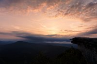
I made it to McAfee Knob by around 5:30 as the sun was coming up. It was a little too cloudy for a truly magnificent sunrise, but it was a pretty cool sight nonetheless. I sat on the rocks, took some pics, laid down for a while, ate some breakfast, and even nodded off a few times.
The sun trying hard to make it through the thick clouds on the horizon at McAfee Knob
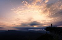
I took pretty much the same shot a few minutes later after another hiker arrived, put his pack down, and walked towards the edge. I got a shot of him looking out which I thought was pretty cool.
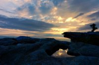
McAfee Knob
I got back to the trailhead around 9:00 a.m. and started driving the hour and a half north towards the George Washington National Forest where I had planned on doing some more hiking along the AT. However, my lack of sleep had caught up with me on the drive. Fearing that it was too dangerous to continue driving while feeling sleep deprived, I pulled off the highway into a town called Lexington, Virginia. I pulled into the parking lot of a grocery store and parked off in the corner, re-inflated my thermarest and took about a 2 hour nap in the back of the suv. When I awoke, I crawled out the rear hatch, and brushed my teeth off in the bushes at the edge of the parking lot. I then noticed a woman sitting in her car who was watching. I waved hello and smiled but got nothing but a blank stare. In retrospect, I’m pretty sure she thought I was down on my luck and living out of my car. I was able to find a vegan eatery in Lexington called the Counter Culture Café, something I hadn’t expected to find this far south. I grabbed lunch, got some food to-go for later that night and headed off to Mount Pleasant in the George Washington National Forest.
I quickly learned that the George Washington National Forest is really off the beaten path. It was several miles down a dirt road and no other cars were to be found.
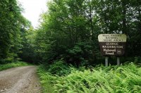
The trails to the summit of Mount Pleasant were indeed quite pleasant, however, it had gotten cloudier throughout the day and I could see clouds faintly blowing through the trees of the forest. Mount Pleasant has two overlooks near the summit which are supposed to be among the best views in Virginia. I wasn’t worried about hiking in the rain, but I did fear that the summit would be socked in with clouds. Unfortunately, this is exactly what transpired when I made it to the summit. Zero visibility as I stood in the middle of endless clouds. I’ve been lucky to have been in some key spots on flawless days, so I was overdue for this type of thing. No big deal. This is the reality of hiking I told myself.
Some of the nice and easy trail leading to Mount Pleasant
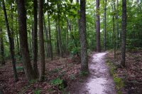
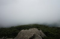
Not exactly the stunning vista from the summit of Mount Pleasant I had hoped for. Luckily though, the scenic treasures you guys have out west that I’ve been fortunate to glimpse haven’t jaded me yet. I still got pleasure from taking a simple, quiet stroll through the woods.
The next morning I got up early as it was time to head further north to Shenandoah National Park. The forecast called for thunderstorms throughout the day, with higher chances later in the day, so I hauled ass to get there as early as possible. After stopping at the Rockfish Gap entrance to get my backcountry permit, I parked at the Blackrock summit parking lot, and headed out yet again on the AT. I headed south on the AT, several miles past Blackrock summit, past the side trail to the Blackrock hut, down to a trail called the Riprap trail. I was heading towards a viewpoint called Chimney Rock, but Mother Nature told me once again that a nice view would not be in the cards for me as it started to downpour hard for the next hour or so. I trudged on to Chimney Rock because… well, what the hell else was there to do. Eventually, I returned back on the AT to the side trail to the Blackrock hut. This is where I would be spending the night. By the time I had gotten there the weather had cleared up quite nicely. I wasn’t sure whether to be happy about this, or annoyed that I had poorly timed my hiking with the weather yet again. My hike certainly would have been a lot nicer if I had decided to hike later in the day.
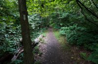
The AT and all other trails are clearly marked in Shenandoah
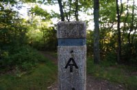
They are also very well maintained and well groomed. Even during a thunderstorm, the water never pooled too badly on the trail. I was quite impressed.
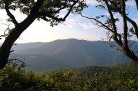
A rare clear view to be had this day.
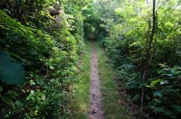
Just in case you’ve ever wondered why the AT has been dubbed the green tunnel
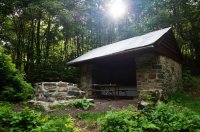
The Blackrock hut where I spent the night
I shared the shelter with an AT thru-hiker and another couple (also AT thru-hikers) pitched their tent next to the shelter but hung out with us. I didn’t expect to see thru-hikers in this far south so late in the season, but one was going another 30 days then finishing up next year due to his late start. The couple had plans to flip-flop due to their late start. When they get to Harpers Ferry (the unofficial midpoint of the AT in West Virginia) they would be taking a plane to Maine and hiking southbound back to Harpers Ferry in order to evade the winter in the northern states but still complete the hike in one year.
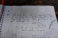
I was the first to arrive at the shelter and read through the shelter log. One of the more recent entries got my attention.
I took a spot on the wraparound bunk ledge
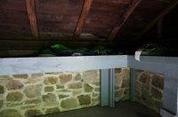
After setting up, which really involved just taking my air mattress, sleeping bag, and exped out, I ate dinner then decided to slackpack back up to Blackrock summit to check out the sunset.
Blackrock summit is a rocky talus summit.
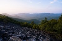
I scrambled up the boulders and hung out until the sun went down
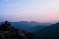
A dramatic sunset never materialized, but I was just happy to be on a summit with clear skies, and without rain. Besides, the view was still beautiful and the humidity had dissipated a little as well. The hour I spent relaxing on Blackrock summit made the miles of trudging through a thunderstorm feel totally worth it
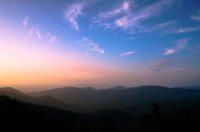
The next morning, I drove up Skyline drive, the scenic road through Shenandoah National Park, and stopped to hike Hawksbill Mountain, the highest mountain in the park. Along the way, there were some nice overlooks to stop at as well.
The view from Hawksbill Mountain
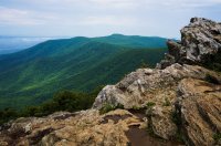
A few other shots, some taken while hiking and some taken from Skyline Drive.
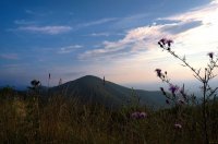
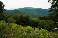
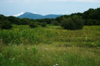
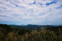
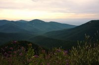
A tunnel along Skyline Drive
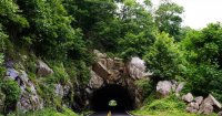
So to be perfectly honest, this wasn’t all that spectacular of a trip and Shenandoah didn’t win a place in my heart amongst the Whites, the ADK’s and the few places I’ve visited out west. For one, even though the AT runs about 100 miles through Shenandoah, it never gets too far from Skyline drive (the trail crossed it several times in the section I hiked), so it doesn’t have much of a "wilderness" feel to it. However, it’s a beautiful park, and I would definitely return with my wife in the Fall, maybe stay at one of the campgrounds within the park and do some day hiking with her. I bet the foliage is spectacular there in the Fall.
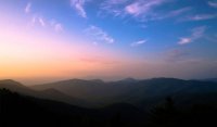
Featured image for home page:
Jul 16th to 19th, 2015
I'd be lying if I said this was one of my favorite trips. That's not a strike against Virginia, most of this trip was botched by poor planning, poor timing with the weather, and some brutal humidity. But that's just how hiking goes; you have to take the good breaks with the bad ones.
Thursday evening when I left work, got in the car which had been packed the night before and checked the weather forecast one last time. I had my workable plans to the north, to the west, and to the south. I ended up deciding to head south to Virginia, and I embarked on the long 7 hour drive.
Due to some traffic along the way, a foray off the thruway to find some food, and a few gas/bathroom breaks, I didn't arrive at the parking lot for the Appalachian Trail/McAfee Knob trailhead until a little before 2:00 a.m. The plan was to sleep in the back of the car or pitch a tent and sleep until the morning. However, with the humidity it was tough to sleep. After a failed hour-long attempt at sleeping, I decided to just hit the trail in the dark. By 3:30 a.m., I was on the Appalachian Trail with the idea of making it to McAfee Knob before sunrise. Plus, I figured this would put me ahead of schedule by knocking out an 8.5 mile hike out before 9 a.m. In the end though, forgoing a night of sleep proved to be a mistake as I struggled to feel well-rested throughout the rest of the trip.
I only slept for about an hour and a half before I woke up and made the boneheaded decision to start hiking in the dark at 3:30 a.m.

I made it to McAfee Knob by around 5:30 as the sun was coming up. It was a little too cloudy for a truly magnificent sunrise, but it was a pretty cool sight nonetheless. I sat on the rocks, took some pics, laid down for a while, ate some breakfast, and even nodded off a few times.
The sun trying hard to make it through the thick clouds on the horizon at McAfee Knob

I took pretty much the same shot a few minutes later after another hiker arrived, put his pack down, and walked towards the edge. I got a shot of him looking out which I thought was pretty cool.

McAfee Knob

I got back to the trailhead around 9:00 a.m. and started driving the hour and a half north towards the George Washington National Forest where I had planned on doing some more hiking along the AT. However, my lack of sleep had caught up with me on the drive. Fearing that it was too dangerous to continue driving while feeling sleep deprived, I pulled off the highway into a town called Lexington, Virginia. I pulled into the parking lot of a grocery store and parked off in the corner, re-inflated my thermarest and took about a 2 hour nap in the back of the suv. When I awoke, I crawled out the rear hatch, and brushed my teeth off in the bushes at the edge of the parking lot. I then noticed a woman sitting in her car who was watching. I waved hello and smiled but got nothing but a blank stare. In retrospect, I’m pretty sure she thought I was down on my luck and living out of my car. I was able to find a vegan eatery in Lexington called the Counter Culture Café, something I hadn’t expected to find this far south. I grabbed lunch, got some food to-go for later that night and headed off to Mount Pleasant in the George Washington National Forest.
I quickly learned that the George Washington National Forest is really off the beaten path. It was several miles down a dirt road and no other cars were to be found.

The trails to the summit of Mount Pleasant were indeed quite pleasant, however, it had gotten cloudier throughout the day and I could see clouds faintly blowing through the trees of the forest. Mount Pleasant has two overlooks near the summit which are supposed to be among the best views in Virginia. I wasn’t worried about hiking in the rain, but I did fear that the summit would be socked in with clouds. Unfortunately, this is exactly what transpired when I made it to the summit. Zero visibility as I stood in the middle of endless clouds. I’ve been lucky to have been in some key spots on flawless days, so I was overdue for this type of thing. No big deal. This is the reality of hiking I told myself.
Some of the nice and easy trail leading to Mount Pleasant

Not exactly the stunning vista from the summit of Mount Pleasant I had hoped for. Luckily though, the scenic treasures you guys have out west that I’ve been fortunate to glimpse haven’t jaded me yet. I still got pleasure from taking a simple, quiet stroll through the woods.

The next morning I got up early as it was time to head further north to Shenandoah National Park. The forecast called for thunderstorms throughout the day, with higher chances later in the day, so I hauled ass to get there as early as possible. After stopping at the Rockfish Gap entrance to get my backcountry permit, I parked at the Blackrock summit parking lot, and headed out yet again on the AT. I headed south on the AT, several miles past Blackrock summit, past the side trail to the Blackrock hut, down to a trail called the Riprap trail. I was heading towards a viewpoint called Chimney Rock, but Mother Nature told me once again that a nice view would not be in the cards for me as it started to downpour hard for the next hour or so. I trudged on to Chimney Rock because… well, what the hell else was there to do. Eventually, I returned back on the AT to the side trail to the Blackrock hut. This is where I would be spending the night. By the time I had gotten there the weather had cleared up quite nicely. I wasn’t sure whether to be happy about this, or annoyed that I had poorly timed my hiking with the weather yet again. My hike certainly would have been a lot nicer if I had decided to hike later in the day.
The AT and all other trails are clearly marked in Shenandoah

They are also very well maintained and well groomed. Even during a thunderstorm, the water never pooled too badly on the trail. I was quite impressed.

A rare clear view to be had this day.

Just in case you’ve ever wondered why the AT has been dubbed the green tunnel

The Blackrock hut where I spent the night

I shared the shelter with an AT thru-hiker and another couple (also AT thru-hikers) pitched their tent next to the shelter but hung out with us. I didn’t expect to see thru-hikers in this far south so late in the season, but one was going another 30 days then finishing up next year due to his late start. The couple had plans to flip-flop due to their late start. When they get to Harpers Ferry (the unofficial midpoint of the AT in West Virginia) they would be taking a plane to Maine and hiking southbound back to Harpers Ferry in order to evade the winter in the northern states but still complete the hike in one year.
I was the first to arrive at the shelter and read through the shelter log. One of the more recent entries got my attention.

I took a spot on the wraparound bunk ledge

After setting up, which really involved just taking my air mattress, sleeping bag, and exped out, I ate dinner then decided to slackpack back up to Blackrock summit to check out the sunset.
Blackrock summit is a rocky talus summit.

I scrambled up the boulders and hung out until the sun went down

A dramatic sunset never materialized, but I was just happy to be on a summit with clear skies, and without rain. Besides, the view was still beautiful and the humidity had dissipated a little as well. The hour I spent relaxing on Blackrock summit made the miles of trudging through a thunderstorm feel totally worth it

The next morning, I drove up Skyline drive, the scenic road through Shenandoah National Park, and stopped to hike Hawksbill Mountain, the highest mountain in the park. Along the way, there were some nice overlooks to stop at as well.
The view from Hawksbill Mountain

A few other shots, some taken while hiking and some taken from Skyline Drive.


A tunnel along Skyline Drive

So to be perfectly honest, this wasn’t all that spectacular of a trip and Shenandoah didn’t win a place in my heart amongst the Whites, the ADK’s and the few places I’ve visited out west. For one, even though the AT runs about 100 miles through Shenandoah, it never gets too far from Skyline drive (the trail crossed it several times in the section I hiked), so it doesn’t have much of a "wilderness" feel to it. However, it’s a beautiful park, and I would definitely return with my wife in the Fall, maybe stay at one of the campgrounds within the park and do some day hiking with her. I bet the foliage is spectacular there in the Fall.
Featured image for home page:

Last edited:
