- Joined
- Aug 9, 2007
- Messages
- 12,962
September 2011
As I've whittled away at my bucket list of destination in the Uintas over the years, there have been two that always seemed to get pushed back; Red Castle and Little East Fork Black's Fork. I always envisioned Red Castle as being too busy, meanwhile Little East Fork as being so remote and rugged that I would want to dedicate at least 3 days to it. So I guess it's kind of surprising that I knocked out both of them in the span of about 33 hours over Labor Day weekend.
I had marked my calendar for Red Castle over Labor Day months earlier but as the date approached, everyone that was thinking of coming along could no longer make it. I had just done the Winds with Jake a week earlier and we decided to save the trip.
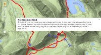
My initial plan was just to do an out and back from the East Fork Blacks Fork Trailhead via the Bald Mountain route. It is an unusual and much more strenuous route to Red Castle than the traditional China Meadows Route that most people take. Below is a map of the route we took on this trip with my GPS tracks recorded.
View larger map.
From the East Fork Blacks Fork Trailhead (EFBF), the trail climbs sharply up some steep switchbacks, nearly 1000 feet in elevation before reaching the High Uintas wilderness boundary where the trail flattens out again for a bit before a reaching the junction towards Bald Mountain.
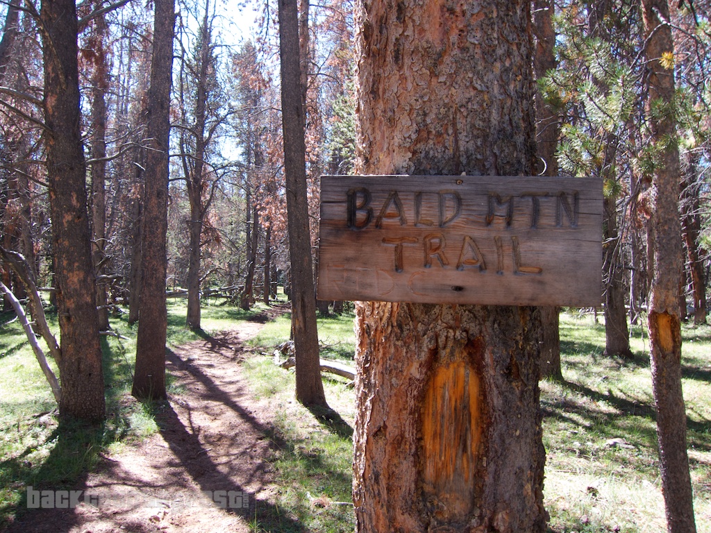
The trail winds gradually up the flanks of Bald Mountain through a grassy, park-like section of forest.
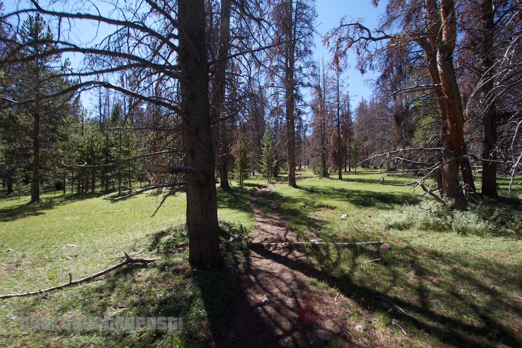
But eventually the trees start to dissipate and the terrain becomes more open as elevation is gained.
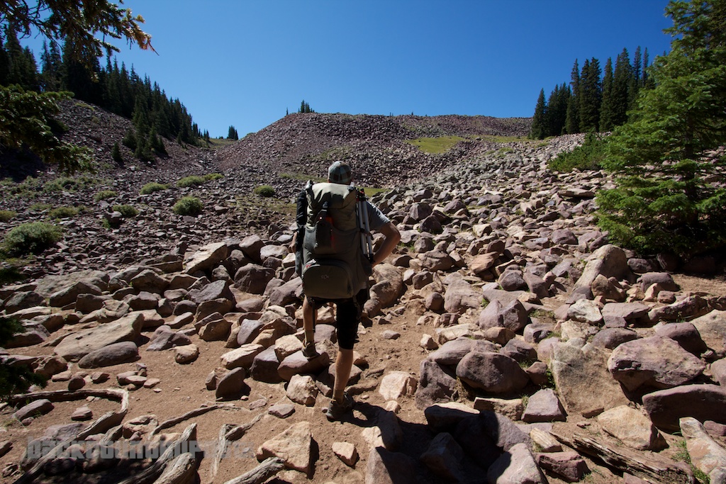
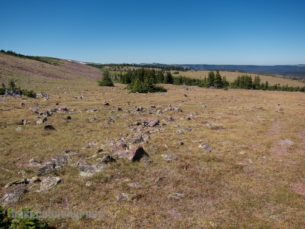
The views become expansive as the trail rises above treeline. The path becomes faint at this point but its easy to follow if you keep your eye out for the occasional cairn or worn section.
The trail stays to the north of the peak where an incredible view of Bald Lake eventually comes into view.
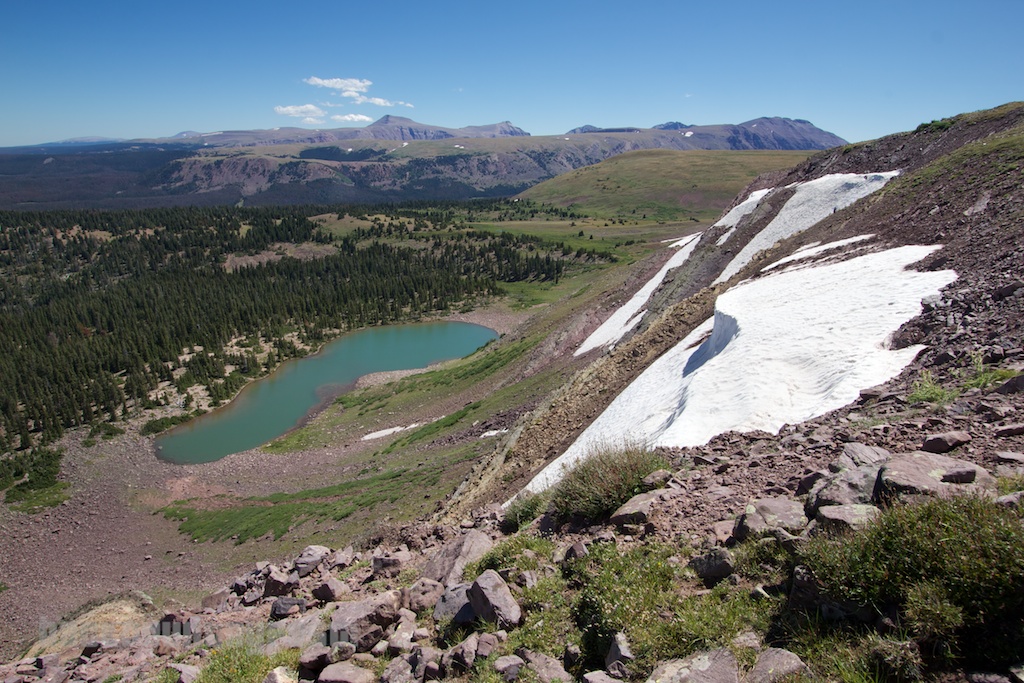
Audra and I camped at Bald Lake several years ago but we accessed it from the West Fork Smith's Fork trailhead. See that trip report here: Bald Lake, Uintas, June 2007. We ran into a group that had camped there but had hiked in over the top of Bald Mountain over EFBF like we did on this trip. It's a more scenic and slightly shorter route than coming up from West Fork Smith's Fork but much more strenuous.
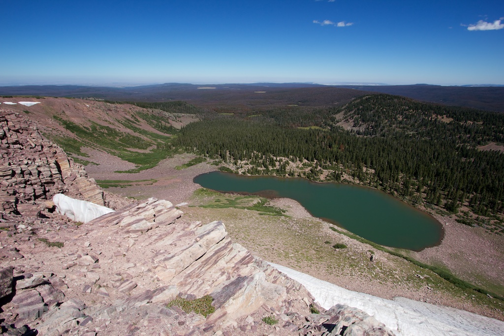
We stopped for a lunch break at the top of the cliff above Bald Lake before moving on.
After Bald Mountain, the trail traverses across the high, barren landscape between Smith's Fork and Black's fork. It's all well above treeline and quite mesmerizing to hike through.
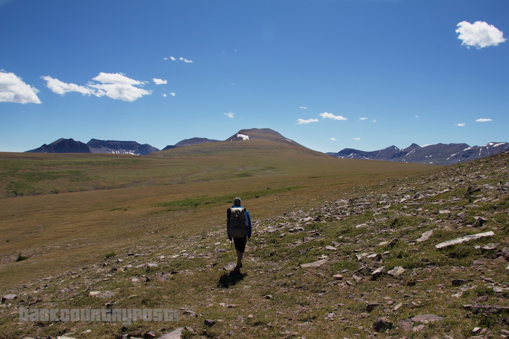
The distances don't look like much due to the lack of scale but it is really a huge area.
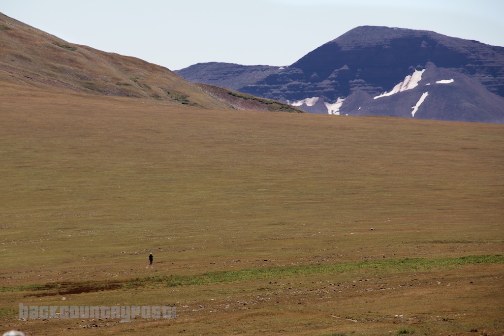
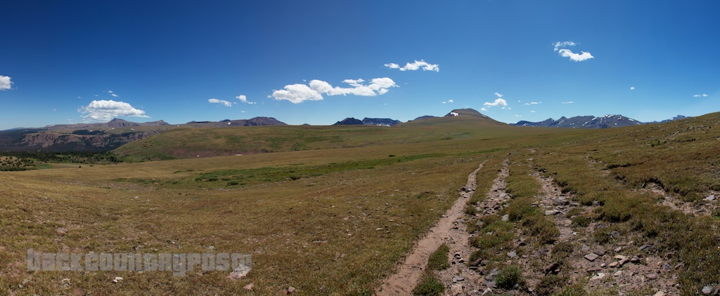
After a couple miles of walking over the open tundra, the trail begins its descent into East Fork Smith's Fork, and Red Castle.
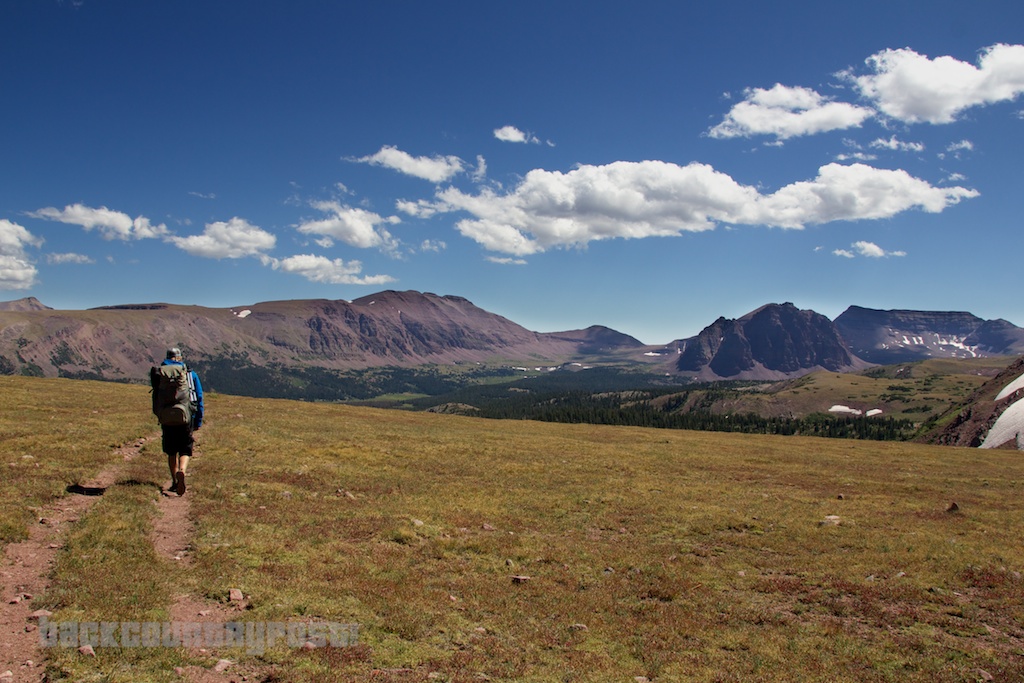
Looking up into the Red Castle area. Red Castle is the prominent peak in the center, Wilson Peak is to the right of that and the pass we will eventually cross over is just to the right of Wilson Peak.
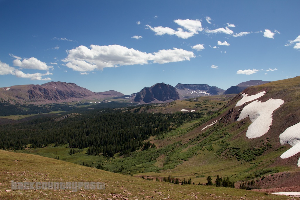
The trail down into East Fork Smith's Fork was a little hard to follow. It appeared that there had been some land slides, likely from the heavy snow year. There were still some good sized drifts in the area. We stopped to fill up out water, the first good opportunity along the trail since the beginning of the hike. After which we started heading down in the direction of Red Castle. We kind of lost the trail for a while. We should have descended into the meadow as you can see on the map, instead of traversing along the ridge. After a few miles of ups and downs we finally made it to the junction with the main trail just below Lower Red Castle Lake.
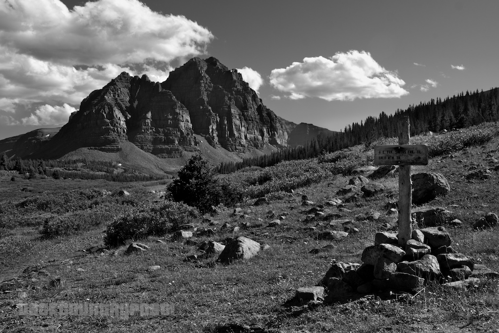
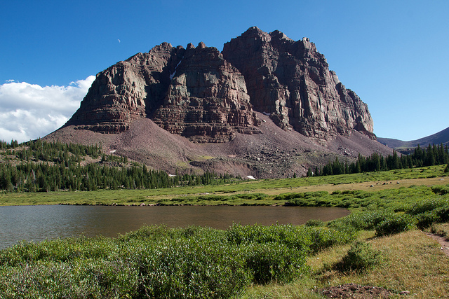
By the time we made it to Red Castle the GPS was reporting nearly 10.25 miles for the day with a lot of elevation to get up and over Bald Mountain. I would have been happy to stop and camp here for the night but it didn't look very good. The lake itself looked pretty shallow and surrounded by bushes and the few campsites we saw were taken. We figured the photo ops would be better up high as well. Here's a few shots of Lower Red Castle Lake to give you an idea.
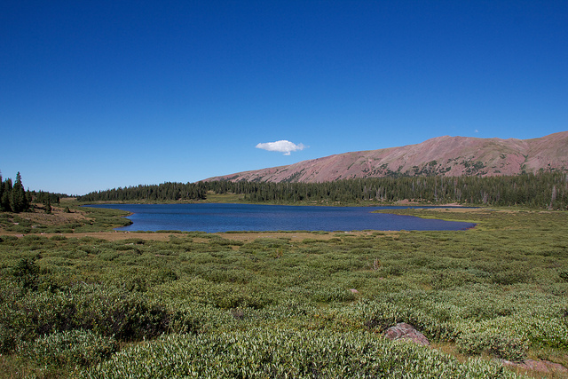
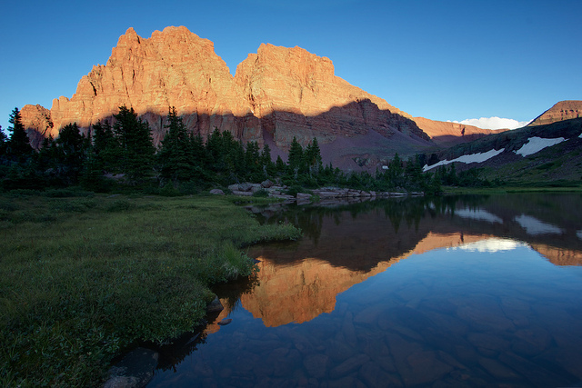
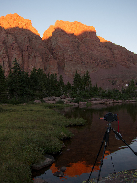
So we decided to keep hiking towards Red Castle Lake to find a campsite. We wanted to have a campfire so we figured we would just find something at the edge of tree line before ascending the ledge up to the lake. We found a nice shallow lake (no fish) that was just below the ledge that worked out perfectly. There was one other group camped there on the west end of the lake so we setup at the east end. We setup camp and had dinner in time to watch the alpenglow roll up Red Castle.
My camera in time lapse mode. I'm still working on getting something decent from this. Deflickering is my issue. Anyone know how I can pull that off without expensive software?
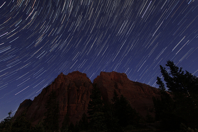
I setup for some star trails while there was still a bit of light on the Red Castle and then let it run into the night.
A time lapse of the alpenglow from the moon as it moves up Red Castle.
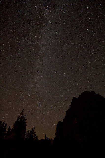
The Milky Way over Red Castle
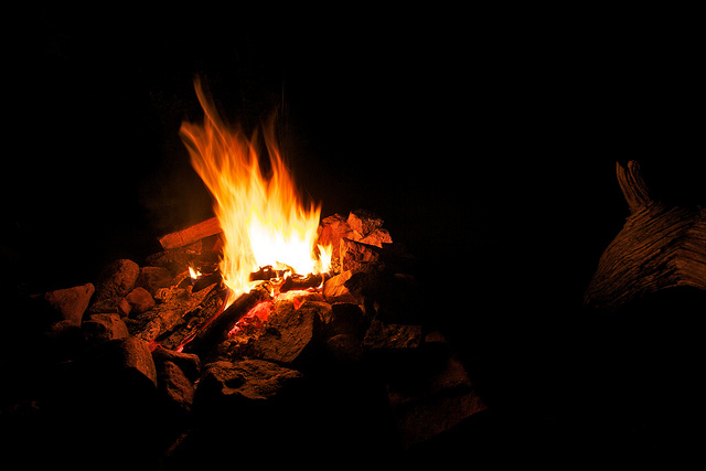
We sat around the fire letting the cameras work until a little after midnight.
The next morning we were off to Red Castle Lake to find a route over the pass and to the south side of the Uinta Range.
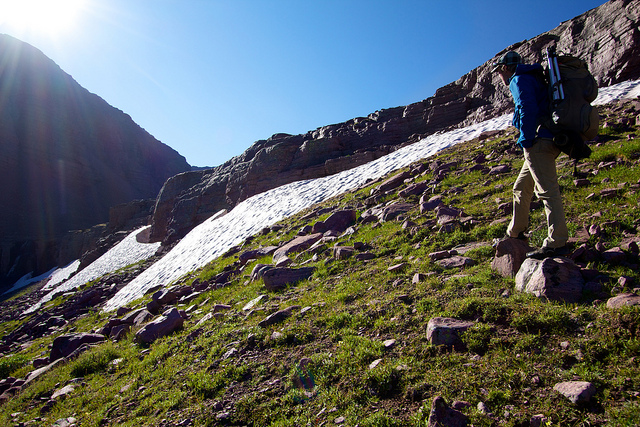
The proper trail to Red Castle bypasses the ledge to the west of where we camped but we decided to do a little bit of scrambling. It was easy but Jake decided to take the more exposed route.
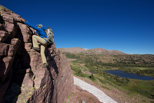
Looking back down from the ledge at Red Castle Lake. Lower Red Castle Lake can be seen in the distance. Our unnamed lake on the left.
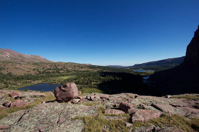
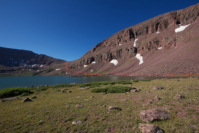
Red Castle Lake was surprisingly large and completely devoid of any trees. It would be a great place for fly fishing but not so good for camping unless the weather is stable and you don't mind not having a fire. The trail ends here according to the maps so we were not in route-finding mode. I knew that others had used this pass so I figured there must be a decent way to it but it appeared that there would be a great deal of boulder hopping involved. The red line in this photo shows the route we will take to get to the pass.
 [/url]
Well surprise, surprise! As we made it to the first scree slope we found an old trail through it. It was good in spots, not so good in others but still much better than nothing at all. I believe it was there for people to hike to Upper Red Castle Lake.
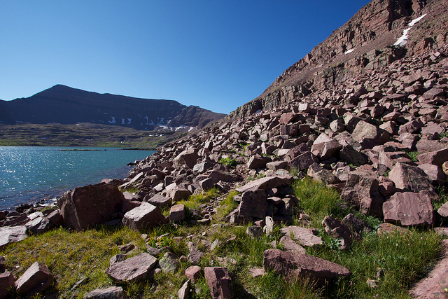
Looking back from where we had come, about half way along Red Castle Lake.
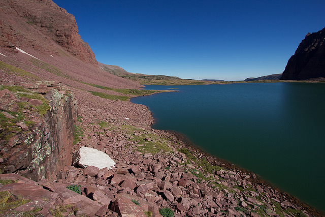
Finally past the main Red Castle Lake. It's hard to describe how big that lake really is. I measured it on Google Earth and it is about 4,600 feet from corner to corner and 3,200 feet from side to side. So basically about 10 and a half foot ball fields across and 15 diagonally. Wow. Doesn't look like it in the photo, does it?
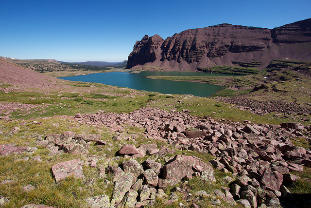
Looking up at the pass as we climbed on. This is another good illustration of scale. It doesn't look that bad, but if you look closely, you can see Jake up ahead of me. He is right where the grass line meets the rock line, about 1/3 of the way in from the left and just a bit above half way up the photo.
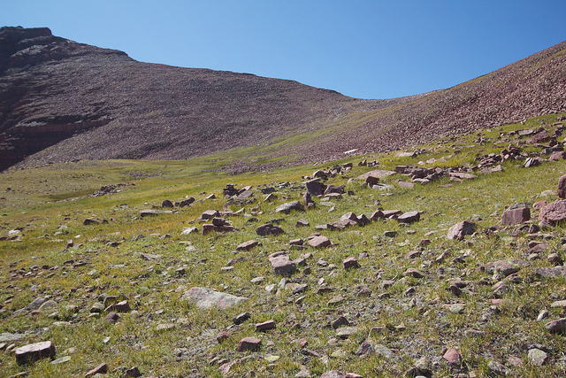
Finally on the pass! 12,170 feet above sea level, the high point of the route.
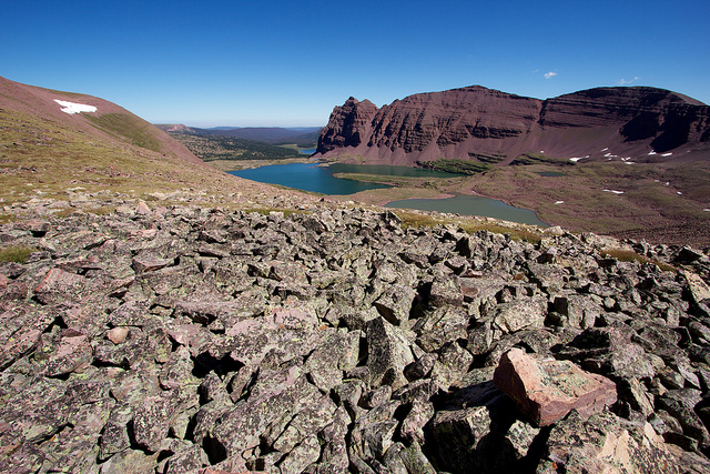
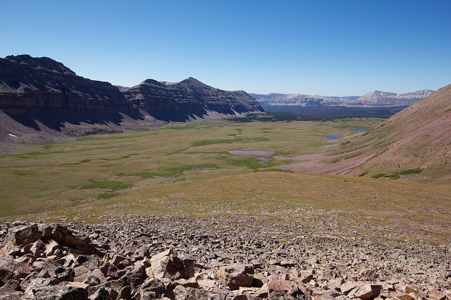
Looking off the other side of the pass into the Lakefork Drainage and Oweep Creek. The Highline Trail runs right through the middle of all of that.
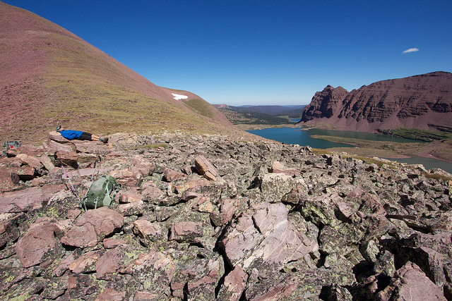
Jake stretching out on the pass.
 [/url]
We made it onto the pass just before noon, still plenty of time to make it up over the next pass and still find camp. So we decided to head down towards Squaw Pass before stopping for lunch. The descent was easy until a steep section after the bench below the pass. It was quite steep here and the rocks were very loose. I think there could be better ways through this, see my map for notes.
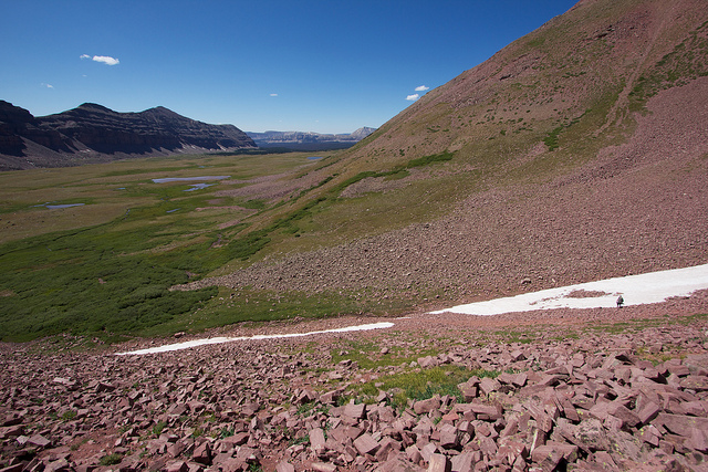
A view of the steep, crumbly slope as I descended it.
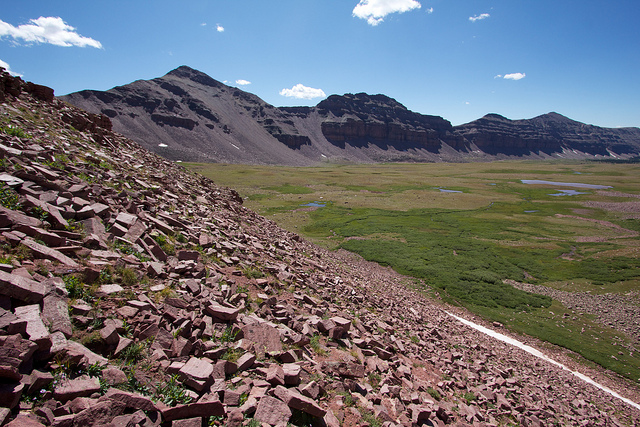
It took about an hour of wandering through the open tundra before we made it to the next pass. We were planning on reaching the lake below Squaw Pass before stopping for lunch but when we got there, we realized that we would have to lose about 200 feet of elevation. The problem is that the proper trail up to Squaw Pass was on the other side of the lake so in order to get to the trail we had to lose the elevation. But instead of doing that, we decided we would try scrambling up to the pass on the east side where there is no trail. It kind of looked like it was doable from where we were. If you can see the tiny cliff band leading to the pass, it appeared there was a bit of a trail over it.
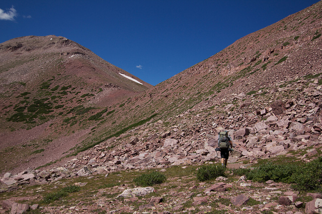
And sure enough, a few hundred feet up the slope, we found a very nice old trail.
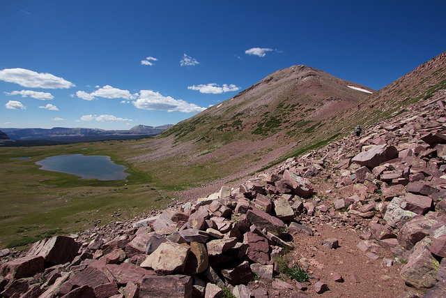
But it didn't last for long. It disintegrated more and more as we got closer to the pass.
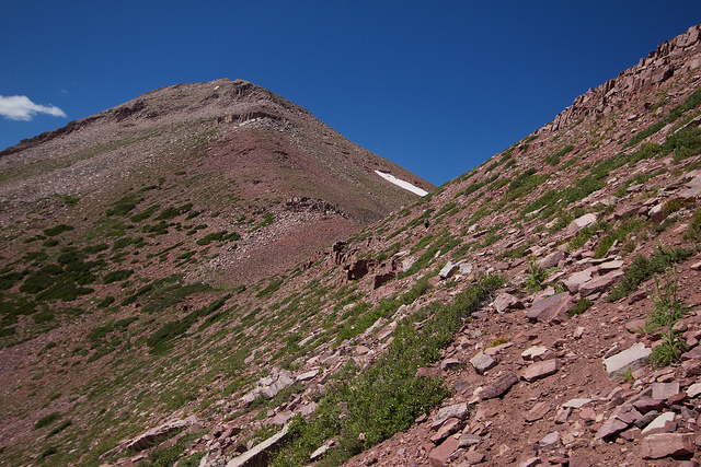
Eventually the trail was completely gone and the going got pretty rough. The slope was as steep as it could get and still hold dirt. There were several chutes that were pretty well blown clear of all rocks and anything that you could gain traction on that were particularly scary to cross. The small cliff band below added to the excitement, along with several large boulders that went crashing down as we crossed. But eventually it mellowed out and we were on the pass. This shot was taken as I made it back to good, stable footing after the worst section.
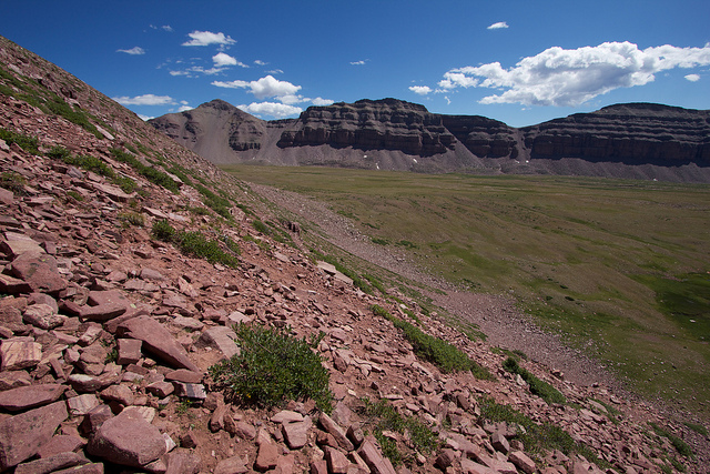
Looking down into Little East Fork from on top of Squaw Pass
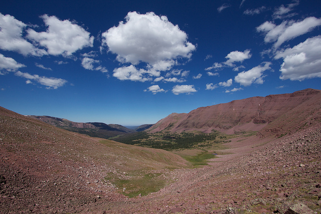 [/url]
Looking into Lakefork Drainage and Oweep Creek from Squaw Pass
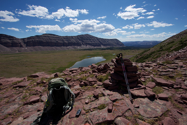
We sat on top of Squaw Pass and had some lunch. It was while we sat there that the idea of hiking all the way out came up. Looking down into Little East Fork, it was clear that we would be stream camping unless we wanted to hike all the way down and then all the way back up the other side of the valley to get to one of the unnamed lakes. That didn't sound all that appealing. We figured we might have 7-8 miles from there to the the truck so the decision was made. We would book it out of there and hopefully be back to Salt Lake not long after sunset. We started down from Squaw Pass at 2pm.
This is a view of the west bench of Little East Fork where most of the lakes are. The trail stays on the opposite side of the canyon for the first 3 miles from the pass before finally dropping into the canyon bottom.
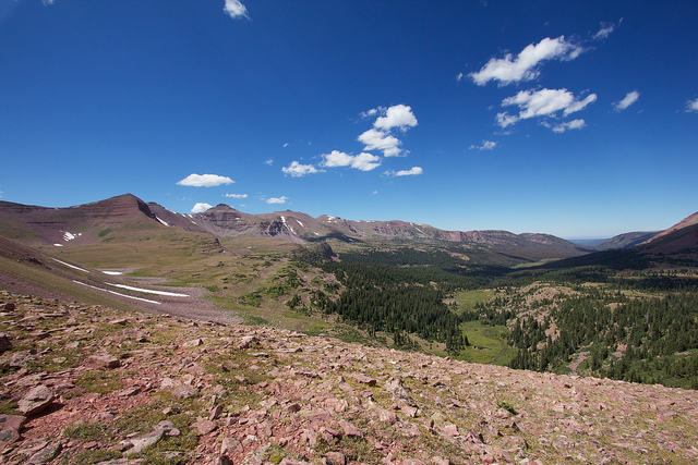
The east bench of Little East Fork. No lakes up here but it would still be a pretty place to camp with the exception of the sheep in the area.
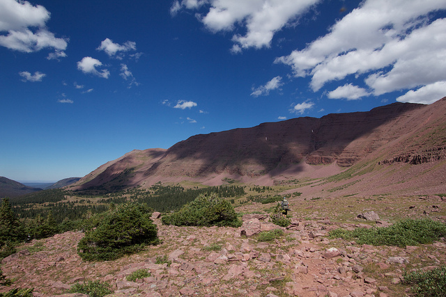
Those first 3 miles down from the pass were rough. We stopped for some water and I couldn't help but think we were making a poor decision to try to hike out that same day. I had been feeling pretty good on the pass, we were only 4 miles into the day then although it was 4 miles over two large passes. The thing that was really killing me was the trail through Little East fork. It is TOTAL CRAP! I've ranted about grazing in the past and you're about to hear it again.
It seems that at least 90% of the traffic through Little East Fork is in the form of sheep and the sheep herders. As a result, the trail is completely and utterly trashed. Every section that ever gets muddy was torn up by hoof prints, making the travel extremely hard on the feet and ankles. I'm perplexed as to why this is legal in a WILDERNESS area and even more perplexed that every time I bitch about this I always get some asshole telling me that ranchers were up there first, blah blah. So to the asshole that wants to feed me that line; save it.
Is the idea of designating a piece of land as a federally protected wilderness area not to keep it pristine and in its natural state? So why in the hell is it okay to send hundreds of sheep and cows up the trail to eat everything on the mountain, shit all over the place and be so loud that they can be heard a mile away? If I were to hire a group of people to go into the wilderness and pick every flower in the forest so I could sell them at the market, would that be okay? Oh, and those people will be defecating IN the trail and screaming constantly, hope ya'll don't mind!
In comparison to the horrendous amounts of cow shit all over the Allsop Lake area, this wasn't bad. But it's still ridiculous. There is so much open space in this country that is not designated as a Wilderness area, use it!
/Rant Off
Back to the trip report. So like I said, the trail sucked. We made it 3 miles down from the pass and I was already wishing we hadn't made the decision to hike out but Jake was pretty into it still so I kept with it. I have to admit, sleeping in my own bed and the idea of a full day at home sounded nice. With all the trips lately I feel like I'm hardly there anymore.
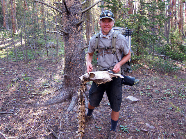
The rest of the hike was largely uneventful. I thought for sure we would see some wildlife in Little East Fork for how rarely it is used but the best we saw was this huge Moose skeleton on the side of the trail. CORRECTION: A reader on my blog told me that this is actually a horse skeleton.
The last few miles were particularly rough. Remember how I said we figured 7-8 miles from the pass to the truck? Well about 7-8 miles down the canyon we were still a long way from the truck.
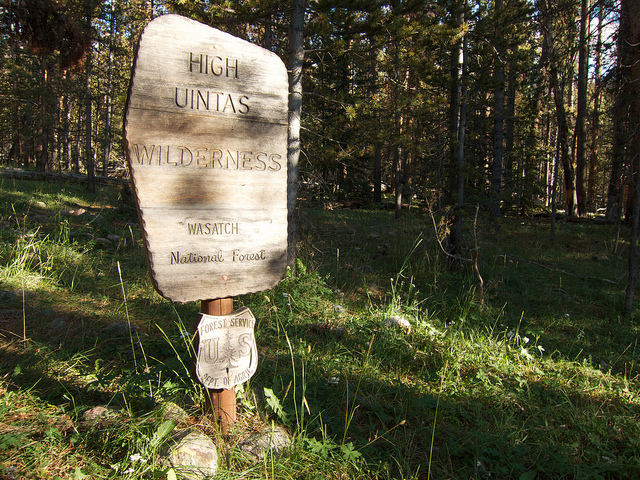
Part of it was our poor estimation but another part is that the trail on the topo doesn't match up well to the trail in reality for the last mile or two. It just seemed to keep going and going, my feet hurt like they've never hurt before. We finally made it back to the trailhead just as the daylight was starting to fade. So much for seeing the sunset as we drove down Parley's into Salt Lake.
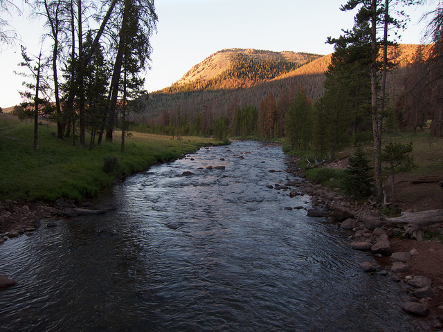
We ended up putting down over 14 miles that second day and going over two large passes. The big descent and rough condition of the Little East Fork trail only made it feel like more. It was a beautiful and scenic route. It totaled to 26 miles with more than 6,800 feet of elevation gain. We completed it in less than 33 hours. In retrospect I would have definitely camped in Little East Fork along the stream that second night. There were plenty of good spots along the meadows, maybe we would have even seen a live moose if we'd stuck around! Shoulda, coulda, woulda...
As I've whittled away at my bucket list of destination in the Uintas over the years, there have been two that always seemed to get pushed back; Red Castle and Little East Fork Black's Fork. I always envisioned Red Castle as being too busy, meanwhile Little East Fork as being so remote and rugged that I would want to dedicate at least 3 days to it. So I guess it's kind of surprising that I knocked out both of them in the span of about 33 hours over Labor Day weekend.
I had marked my calendar for Red Castle over Labor Day months earlier but as the date approached, everyone that was thinking of coming along could no longer make it. I had just done the Winds with Jake a week earlier and we decided to save the trip.
My initial plan was just to do an out and back from the East Fork Blacks Fork Trailhead via the Bald Mountain route. It is an unusual and much more strenuous route to Red Castle than the traditional China Meadows Route that most people take. Below is a map of the route we took on this trip with my GPS tracks recorded.
View larger map.
From the East Fork Blacks Fork Trailhead (EFBF), the trail climbs sharply up some steep switchbacks, nearly 1000 feet in elevation before reaching the High Uintas wilderness boundary where the trail flattens out again for a bit before a reaching the junction towards Bald Mountain.

The trail winds gradually up the flanks of Bald Mountain through a grassy, park-like section of forest.

But eventually the trees start to dissipate and the terrain becomes more open as elevation is gained.

The views become expansive as the trail rises above treeline. The path becomes faint at this point but its easy to follow if you keep your eye out for the occasional cairn or worn section.

The trail stays to the north of the peak where an incredible view of Bald Lake eventually comes into view.

Audra and I camped at Bald Lake several years ago but we accessed it from the West Fork Smith's Fork trailhead. See that trip report here: Bald Lake, Uintas, June 2007. We ran into a group that had camped there but had hiked in over the top of Bald Mountain over EFBF like we did on this trip. It's a more scenic and slightly shorter route than coming up from West Fork Smith's Fork but much more strenuous.
We stopped for a lunch break at the top of the cliff above Bald Lake before moving on.

After Bald Mountain, the trail traverses across the high, barren landscape between Smith's Fork and Black's fork. It's all well above treeline and quite mesmerizing to hike through.

The distances don't look like much due to the lack of scale but it is really a huge area.


After a couple miles of walking over the open tundra, the trail begins its descent into East Fork Smith's Fork, and Red Castle.

Looking up into the Red Castle area. Red Castle is the prominent peak in the center, Wilson Peak is to the right of that and the pass we will eventually cross over is just to the right of Wilson Peak.

The trail down into East Fork Smith's Fork was a little hard to follow. It appeared that there had been some land slides, likely from the heavy snow year. There were still some good sized drifts in the area. We stopped to fill up out water, the first good opportunity along the trail since the beginning of the hike. After which we started heading down in the direction of Red Castle. We kind of lost the trail for a while. We should have descended into the meadow as you can see on the map, instead of traversing along the ridge. After a few miles of ups and downs we finally made it to the junction with the main trail just below Lower Red Castle Lake.

By the time we made it to Red Castle the GPS was reporting nearly 10.25 miles for the day with a lot of elevation to get up and over Bald Mountain. I would have been happy to stop and camp here for the night but it didn't look very good. The lake itself looked pretty shallow and surrounded by bushes and the few campsites we saw were taken. We figured the photo ops would be better up high as well. Here's a few shots of Lower Red Castle Lake to give you an idea.


So we decided to keep hiking towards Red Castle Lake to find a campsite. We wanted to have a campfire so we figured we would just find something at the edge of tree line before ascending the ledge up to the lake. We found a nice shallow lake (no fish) that was just below the ledge that worked out perfectly. There was one other group camped there on the west end of the lake so we setup at the east end. We setup camp and had dinner in time to watch the alpenglow roll up Red Castle.

My camera in time lapse mode. I'm still working on getting something decent from this. Deflickering is my issue. Anyone know how I can pull that off without expensive software?

I setup for some star trails while there was still a bit of light on the Red Castle and then let it run into the night.

A time lapse of the alpenglow from the moon as it moves up Red Castle.
The Milky Way over Red Castle

We sat around the fire letting the cameras work until a little after midnight.

The next morning we were off to Red Castle Lake to find a route over the pass and to the south side of the Uinta Range.

The proper trail to Red Castle bypasses the ledge to the west of where we camped but we decided to do a little bit of scrambling. It was easy but Jake decided to take the more exposed route.

Looking back down from the ledge at Red Castle Lake. Lower Red Castle Lake can be seen in the distance. Our unnamed lake on the left.

Red Castle Lake was surprisingly large and completely devoid of any trees. It would be a great place for fly fishing but not so good for camping unless the weather is stable and you don't mind not having a fire. The trail ends here according to the maps so we were not in route-finding mode. I knew that others had used this pass so I figured there must be a decent way to it but it appeared that there would be a great deal of boulder hopping involved. The red line in this photo shows the route we will take to get to the pass.

Well surprise, surprise! As we made it to the first scree slope we found an old trail through it. It was good in spots, not so good in others but still much better than nothing at all. I believe it was there for people to hike to Upper Red Castle Lake.

Looking back from where we had come, about half way along Red Castle Lake.

Finally past the main Red Castle Lake. It's hard to describe how big that lake really is. I measured it on Google Earth and it is about 4,600 feet from corner to corner and 3,200 feet from side to side. So basically about 10 and a half foot ball fields across and 15 diagonally. Wow. Doesn't look like it in the photo, does it?

Looking up at the pass as we climbed on. This is another good illustration of scale. It doesn't look that bad, but if you look closely, you can see Jake up ahead of me. He is right where the grass line meets the rock line, about 1/3 of the way in from the left and just a bit above half way up the photo.

Finally on the pass! 12,170 feet above sea level, the high point of the route.

Looking off the other side of the pass into the Lakefork Drainage and Oweep Creek. The Highline Trail runs right through the middle of all of that.

Jake stretching out on the pass.

We made it onto the pass just before noon, still plenty of time to make it up over the next pass and still find camp. So we decided to head down towards Squaw Pass before stopping for lunch. The descent was easy until a steep section after the bench below the pass. It was quite steep here and the rocks were very loose. I think there could be better ways through this, see my map for notes.

A view of the steep, crumbly slope as I descended it.

It took about an hour of wandering through the open tundra before we made it to the next pass. We were planning on reaching the lake below Squaw Pass before stopping for lunch but when we got there, we realized that we would have to lose about 200 feet of elevation. The problem is that the proper trail up to Squaw Pass was on the other side of the lake so in order to get to the trail we had to lose the elevation. But instead of doing that, we decided we would try scrambling up to the pass on the east side where there is no trail. It kind of looked like it was doable from where we were. If you can see the tiny cliff band leading to the pass, it appeared there was a bit of a trail over it.

And sure enough, a few hundred feet up the slope, we found a very nice old trail.

But it didn't last for long. It disintegrated more and more as we got closer to the pass.

Eventually the trail was completely gone and the going got pretty rough. The slope was as steep as it could get and still hold dirt. There were several chutes that were pretty well blown clear of all rocks and anything that you could gain traction on that were particularly scary to cross. The small cliff band below added to the excitement, along with several large boulders that went crashing down as we crossed. But eventually it mellowed out and we were on the pass. This shot was taken as I made it back to good, stable footing after the worst section.

Looking down into Little East Fork from on top of Squaw Pass

Looking into Lakefork Drainage and Oweep Creek from Squaw Pass

We sat on top of Squaw Pass and had some lunch. It was while we sat there that the idea of hiking all the way out came up. Looking down into Little East Fork, it was clear that we would be stream camping unless we wanted to hike all the way down and then all the way back up the other side of the valley to get to one of the unnamed lakes. That didn't sound all that appealing. We figured we might have 7-8 miles from there to the the truck so the decision was made. We would book it out of there and hopefully be back to Salt Lake not long after sunset. We started down from Squaw Pass at 2pm.
This is a view of the west bench of Little East Fork where most of the lakes are. The trail stays on the opposite side of the canyon for the first 3 miles from the pass before finally dropping into the canyon bottom.

The east bench of Little East Fork. No lakes up here but it would still be a pretty place to camp with the exception of the sheep in the area.

Those first 3 miles down from the pass were rough. We stopped for some water and I couldn't help but think we were making a poor decision to try to hike out that same day. I had been feeling pretty good on the pass, we were only 4 miles into the day then although it was 4 miles over two large passes. The thing that was really killing me was the trail through Little East fork. It is TOTAL CRAP! I've ranted about grazing in the past and you're about to hear it again.
It seems that at least 90% of the traffic through Little East Fork is in the form of sheep and the sheep herders. As a result, the trail is completely and utterly trashed. Every section that ever gets muddy was torn up by hoof prints, making the travel extremely hard on the feet and ankles. I'm perplexed as to why this is legal in a WILDERNESS area and even more perplexed that every time I bitch about this I always get some asshole telling me that ranchers were up there first, blah blah. So to the asshole that wants to feed me that line; save it.
Is the idea of designating a piece of land as a federally protected wilderness area not to keep it pristine and in its natural state? So why in the hell is it okay to send hundreds of sheep and cows up the trail to eat everything on the mountain, shit all over the place and be so loud that they can be heard a mile away? If I were to hire a group of people to go into the wilderness and pick every flower in the forest so I could sell them at the market, would that be okay? Oh, and those people will be defecating IN the trail and screaming constantly, hope ya'll don't mind!
In comparison to the horrendous amounts of cow shit all over the Allsop Lake area, this wasn't bad. But it's still ridiculous. There is so much open space in this country that is not designated as a Wilderness area, use it!
/Rant Off
Back to the trip report. So like I said, the trail sucked. We made it 3 miles down from the pass and I was already wishing we hadn't made the decision to hike out but Jake was pretty into it still so I kept with it. I have to admit, sleeping in my own bed and the idea of a full day at home sounded nice. With all the trips lately I feel like I'm hardly there anymore.
The rest of the hike was largely uneventful. I thought for sure we would see some wildlife in Little East Fork for how rarely it is used but the best we saw was this huge Moose skeleton on the side of the trail. CORRECTION: A reader on my blog told me that this is actually a horse skeleton.

The last few miles were particularly rough. Remember how I said we figured 7-8 miles from the pass to the truck? Well about 7-8 miles down the canyon we were still a long way from the truck.

Part of it was our poor estimation but another part is that the trail on the topo doesn't match up well to the trail in reality for the last mile or two. It just seemed to keep going and going, my feet hurt like they've never hurt before. We finally made it back to the trailhead just as the daylight was starting to fade. So much for seeing the sunset as we drove down Parley's into Salt Lake.

We ended up putting down over 14 miles that second day and going over two large passes. The big descent and rough condition of the Little East Fork trail only made it feel like more. It was a beautiful and scenic route. It totaled to 26 miles with more than 6,800 feet of elevation gain. We completed it in less than 33 hours. In retrospect I would have definitely camped in Little East Fork along the stream that second night. There were plenty of good spots along the meadows, maybe we would have even seen a live moose if we'd stuck around! Shoulda, coulda, woulda...

