fossana
Member
- Joined
- Jan 11, 2018
- Messages
- 913
Logistics
Start/end: Park along Hwy 93 between Hwy 168 and I-15 roughly at 36.68827, -114.92635.
Mileage: ~7.2 miles
Elevation gain: ~2,750'
Difficulty: class 3 (not 4 as noted by Boone)
Navigation: Helpful to be able to have some route-finding skills, infrequent cairns. See Jim Boone's site for waypoints.
Filterable water: seasonal
Designation: Wilderness Area (Arrow Canyon)
Fees: none
Annoyances: cat claw acacia (Senegalia greggii)
Nearest town/gas: Moapa, NV or the truck-stop at I-15 x 93
Date hiked: 09 Mar 2019
More info: Bird and Hike (Jim Boone), HW Stockman, Peakbagger, Courtney Purcell's Rambles & Scrambles book
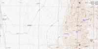
General Route & Map
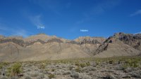
From the highway walk cross-county, under the power lines aiming for the wide drainage S of point 2-64. Boulder-hop up the drainage, taking the left (northern) fork up a series of pour-offs. It is also possible to leave the drainage before the pour-offs and head more directly toward the gully. The pour-offs are more interesting though (direct route class 4, alternate possible). Below the white towering cliff band cut left (north) into the gully. Scramble up the gully to the top. Go right (east/ESE) below a short black cliff band (false summit) to a saddle. Head N to the true summit, guarded by a 3rd class ramp. Once on the summit plateau the northern most summit is the true one. If you would rather slog through screen than downclimb (or want to do the link-up), it's possible to traverse to and descend Hidden Peak instead of reversing the route.
Trip Report
Once again everything was soaked around Zion from the week's storms, so I started looking over the border for drier options with rock less friable when wet. While digging around online I came across the Peak 5146 in the Arrow Canyon Wilderness, which was reported to have a 4th class route with fun scrambling. Having thoroughly enjoyed Moapa Peak, I decided to check it out.
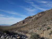
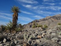
I parked along 93 and headed out. Despite the close proximity to the Mormon Mountains, the vegetation is more spare. This made for relatively easy walking (minus the occasional acacia shrub) to reach the mouth of the drainage. The drainage was slower going with some boulder hopping.
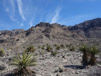
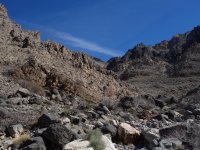
Instead of continuing in the drainage (as per the beta) I cut up more directly to the mouth of the gully, then started the fun scramble up the gully. Looking back across 93 I could see the snow-capped peaks of the higher Sheep Range.
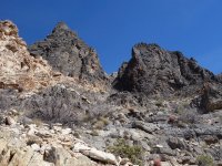
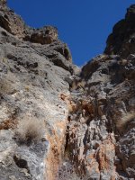
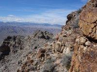
After topping out the gully I saw the first cairn. I carefully traversed the loose, steep hillside below the false summit to reach the saddle. At the saddle the route turned north to the final summit plateau. I could see the route over to Hidden Peak, the alternate way down.
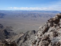
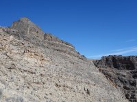
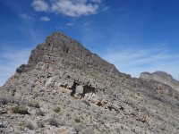
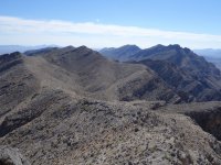
A short, blocky third class scramble took me to the top of the summit lump, then I traversed to the northern true summit. From the top there was an expansive 360 view. After a quick lunch, I headed down, still taking in the views to the E. At the saddle I pulled out the beta to look at the Hidden Peak descent, but the scree sounded less appealing than downclimbing the somewhat chossy gully.
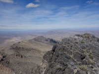
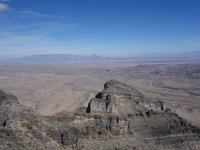
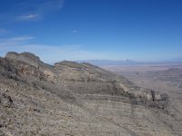
As I headed down the gully the afternoon lighting brought out the colors in the rock.
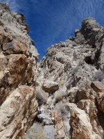
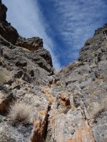
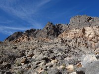
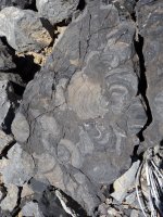
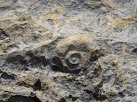
I decided to take the water course down this time, a better choice with less choss and more fossils.
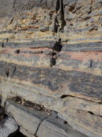
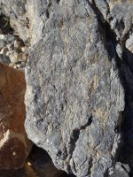
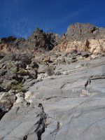
Near the bottom of the water course I hit a short steep section that I wasn't sure would go, and I didn't want to try the polished section to my right. Fortunately, holds appeared once I downclimbed lower. I dropped into the wash and boulder-hopped out.
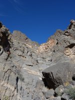
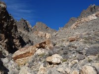
Leaving the wash it was once again easy walking under the power lines and back to my car. No note from NV DoT and no broken windows. Success!
Start/end: Park along Hwy 93 between Hwy 168 and I-15 roughly at 36.68827, -114.92635.
Mileage: ~7.2 miles
Elevation gain: ~2,750'
Difficulty: class 3 (not 4 as noted by Boone)
Navigation: Helpful to be able to have some route-finding skills, infrequent cairns. See Jim Boone's site for waypoints.
Filterable water: seasonal
Designation: Wilderness Area (Arrow Canyon)
Fees: none
Annoyances: cat claw acacia (Senegalia greggii)
Nearest town/gas: Moapa, NV or the truck-stop at I-15 x 93
Date hiked: 09 Mar 2019
More info: Bird and Hike (Jim Boone), HW Stockman, Peakbagger, Courtney Purcell's Rambles & Scrambles book
General Route & Map
From the highway walk cross-county, under the power lines aiming for the wide drainage S of point 2-64. Boulder-hop up the drainage, taking the left (northern) fork up a series of pour-offs. It is also possible to leave the drainage before the pour-offs and head more directly toward the gully. The pour-offs are more interesting though (direct route class 4, alternate possible). Below the white towering cliff band cut left (north) into the gully. Scramble up the gully to the top. Go right (east/ESE) below a short black cliff band (false summit) to a saddle. Head N to the true summit, guarded by a 3rd class ramp. Once on the summit plateau the northern most summit is the true one. If you would rather slog through screen than downclimb (or want to do the link-up), it's possible to traverse to and descend Hidden Peak instead of reversing the route.


Trip Report
Once again everything was soaked around Zion from the week's storms, so I started looking over the border for drier options with rock less friable when wet. While digging around online I came across the Peak 5146 in the Arrow Canyon Wilderness, which was reported to have a 4th class route with fun scrambling. Having thoroughly enjoyed Moapa Peak, I decided to check it out.
I parked along 93 and headed out. Despite the close proximity to the Mormon Mountains, the vegetation is more spare. This made for relatively easy walking (minus the occasional acacia shrub) to reach the mouth of the drainage. The drainage was slower going with some boulder hopping.


Instead of continuing in the drainage (as per the beta) I cut up more directly to the mouth of the gully, then started the fun scramble up the gully. Looking back across 93 I could see the snow-capped peaks of the higher Sheep Range.


After topping out the gully I saw the first cairn. I carefully traversed the loose, steep hillside below the false summit to reach the saddle. At the saddle the route turned north to the final summit plateau. I could see the route over to Hidden Peak, the alternate way down.


A short, blocky third class scramble took me to the top of the summit lump, then I traversed to the northern true summit. From the top there was an expansive 360 view. After a quick lunch, I headed down, still taking in the views to the E. At the saddle I pulled out the beta to look at the Hidden Peak descent, but the scree sounded less appealing than downclimbing the somewhat chossy gully.


As I headed down the gully the afternoon lighting brought out the colors in the rock.


I decided to take the water course down this time, a better choice with less choss and more fossils.


Near the bottom of the water course I hit a short steep section that I wasn't sure would go, and I didn't want to try the polished section to my right. Fortunately, holds appeared once I downclimbed lower. I dropped into the wash and boulder-hopped out.


Leaving the wash it was once again easy walking under the power lines and back to my car. No note from NV DoT and no broken windows. Success!


Last edited:
