- Joined
- Aug 21, 2018
- Messages
- 735
August 11, 2023 -- Day Three.
I was looking forward to day three. Our goal today was to make it to Yellowstone Campsite 6Y2 about 9.5 miles away, but I hoped to squeeze in one of my adjustments to Hugh's master plan about halfway in. Actually camping at 6Y2 was an adjustment to Hugh's plans, but I'll elaborate more on that later.
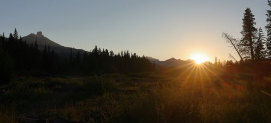
Before tomorrow, and even before halfway thru today was the morning sunrise near Turret Mountain.
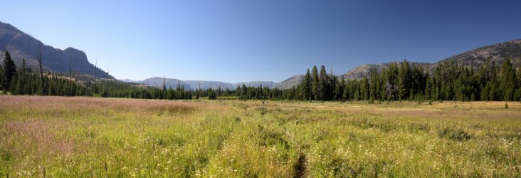
A lot of today's hiking took place in the flat bottom of the Thorofare.
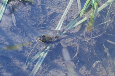
A surprising amount of amphibians call this area home.
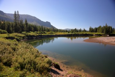
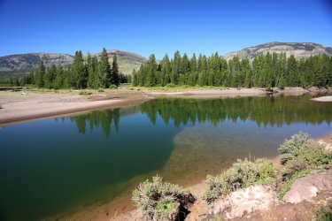
After about a mile and a half the Yellowstone River meandered its way over to the Thorofare Trail. If I remember correct the riverbank may have eroded away part of the trail near here.
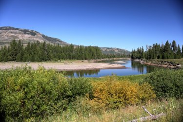
Our river view was short lived and we soon found ourselves back in the willows.
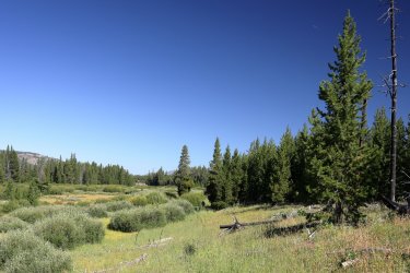
Looking over toward Two Ocean Plateau.
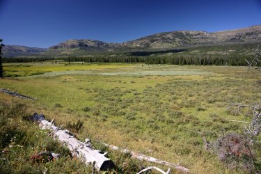
A couple hikers for some scale.

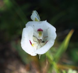
More Mariposa Lilies along the way.
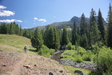
Approaching Cliff Creek. . . and potentially adjustment number two.
Now normally I'm a guy that likes to check out backcountry thermal features on a Yellowstone adventure. The Thorofare does not appear to hold an abundance of those, so for this trip I had to find another reason to lure the rest of the team off trail. Waterfalls seemed like a good alternative, and it just so happened that a large waterfall exists on Cliff Creek upstream from the trail crossing: Mist of the Trident Falls.
I suggested a visit to Mist of the Trident Falls to Hugh back in the planning stages of this trip. He thought that was a reasonable request provided we had the time and energy to do so. . . and so many months (maybe even a year) later here we were. It was near mid-day, the weather was nice, and both Scott and Hugh were game to check out the falls. Bob has seen many a waterfall in his day and in his own words "when you've seen one, you've seen them all." He elected to pass on the side trip up to the falls and volunteered to keep an eye on our packs -- a very honorable gesture (unless he planned on raiding our snacks while we were away).
We set Bob up on a nice sittin' log not far from the trail and Hugh, Scott, and I headed off armed with little more than cameras and bear spray. A trip report months ago by @Fungi covered a similar visit to the falls; we used his recommendation of following the open slopes North of Cliff Creek to access the waterfall. Our route involved some steep side hilling -- you can just make out @scatman 's hat in this picture (center right).
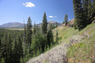
Our chosen route to the falls was steep, but hearing the sound of crashing water kept us going. Some loose rocks here, some downfall there, a bit of a drop off everywhere. . . a glimpse of cascading, agitated water was like a flame and I was the moth fluttering towards it. Somehow Hugh, Scott, and I each took a separate path down to the falls. I ended up working my way to the pool at the bottom of the main plunge. All those hours of studying Google Earth, looking at maps, and reading guide books about this waterfall had led up to this moment. . . and it did not disappoint!
The main fall is about 80 feet tall. The sight of falling water, the roar as it crashed on the rocks, the spray of the mist. . . this was a multi-sensory experience.
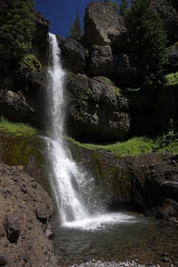
Hugh eventually found his way down to where I was. That is his finger in the upper right corner.
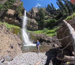
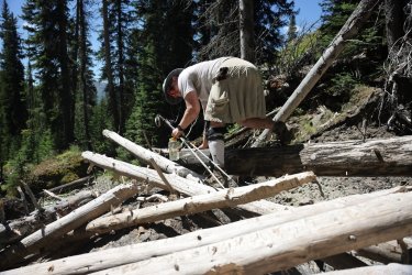
An interesting conglomerate forms much of the terrain surrounding the falls. There is also a large log jam to navigate to access the plunge pool. Hugh chose to climb over it on our way to the next viewpoint.
Mist of the Trident Falls has a series of drops associated with it. This view involved crossing Cliff Creek and squeezing thru some thick groups of pine trees.
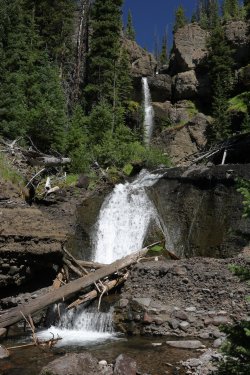
I could have spent half a day here. Maybe an entire day. But we were on a schedule, so 20ish minutes would have to do. Months of dreaming of a location just to spend 20 minutes there in person. . . it was still worth it. Now I just have to plan to go back.
A quick YouTube video to add some movement and sound:
Hugh and I had lost track of Scott (he was ok). To get back to the trail we sort of backtracked our approach but climbed higher this time, near the brink of the main falls. Looking further upstream Cliff Creek flows thru a fun little canyon and more falling water exists.
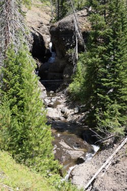
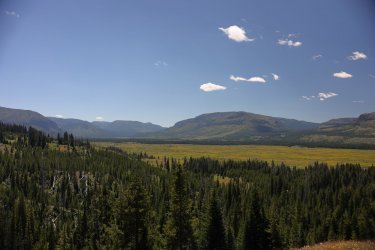
The view of the Thorofare from above the falls was worth the climb.
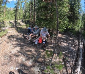
When we returned to Bob we found Scott with him. Somehow we never crossed paths after that initial scatter towards the waterfall. My pack appeared to be just as I left it so I don't think @Bob nibbled on any of my trail snacks, but he did have a sly smile on his face so you never know.
Having a sunscreen break upon our return from the falls.
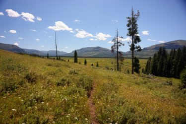
Scott leading the way from Cliff Creek. You might mistake him for a tree in the center of the picture.
Looking back towards the rock formations around Cliff Creek.
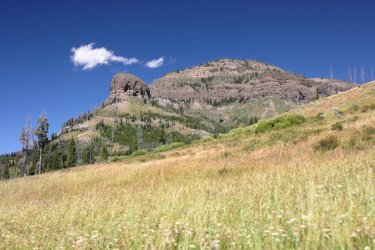
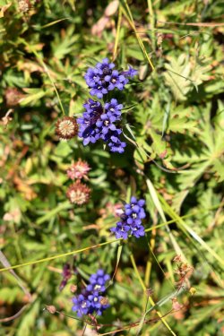
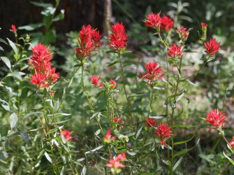
Wildflowers were still in abundance. There was also quite a crop of clover growing. It put forth a subtle, sweet smell that reminded me of our hayfields back home.
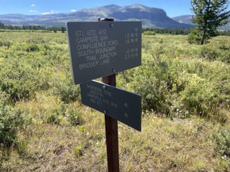
So close to the Thorofare Ranger Station. . . but that destination would have to wait until tomorrow. We still had two plus miles to 6Y2.
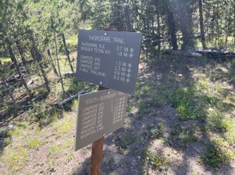
Getting closer.
Waterfall aside, the next four pictures are some of my favorites from day three.
Scott leading us West towards campsite 6Y2.
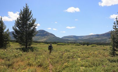
Looking South towards Hawk's Rest.
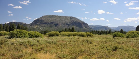
Looking back East towards the Trident.
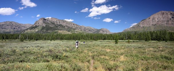
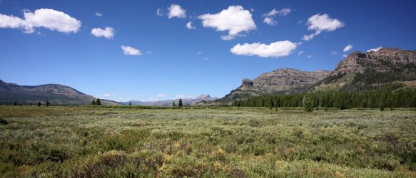
Finally, looking North up the Thorofare.
The trail to campsite 6Y2 incorporated a crossing of Thorofare Creek.
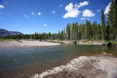
The best spot for the shot is in the creek of course.
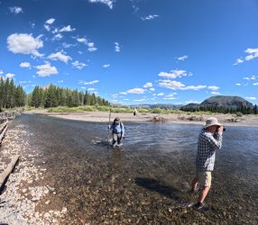
Hugh wanted to make sure we did not drop into any holes before he crossed.
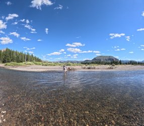
Tomorrow's destination -- Thorofare Creek Valley -- in the distance. Getting these three guys to stagger out evenly for a good trail picture was like herding cats.
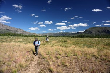
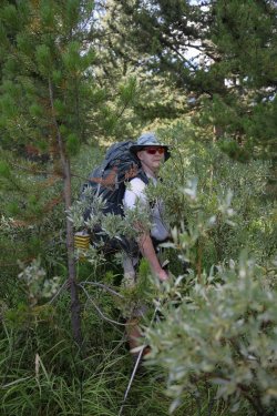
The trail to 6Y2 was easy going. . . until it was not. Brush was thick in places.
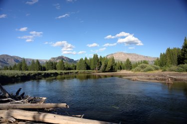
Back at the Yellowstone River. This is/was our campsite view. Somehow, I neglected to take a picture of my tent at 6Y2, probably because I set it up backwards with the door facing a log. It was on this day that I found my Sharpie marker and wrote "door" on the proper side of the tent footprint.
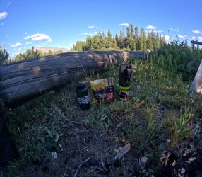
Spicy Sausage Bolognese for day three dinner. A little BCP love too.
Scott ate his supper on the riverbank while the rest of us sat around the unlit campfire. Hugh is either really deep in thought or having a stare down contest with the camera. Bob is just hungry.
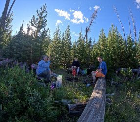
Hugh and Bob went to bed early as tomorrow was potentially going to be a long day. The original plan was to hike to a campsite in the Teton Wilderness somewhere near Hidden Creek, but somehow someone other than myself made some adjustments to the master plan (more on that later). One way or another they needed their rest, so after they turned in for the night Scott and I sat out on the river bank watching for wildlife.
Our patience was rewarded when Scott's sharp eyes noticed a leafy branch floating down the river. . . with a head carrying it! A beaver was swimming right by us. When it finally noticed us taking its picture it dove into the river with a serious tail smack splash. We'd see him pop his head up now and again a short time later.
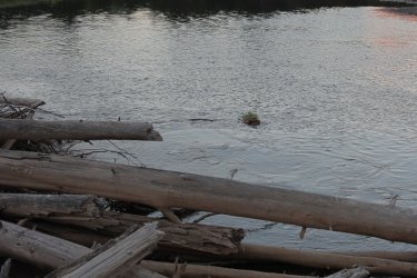
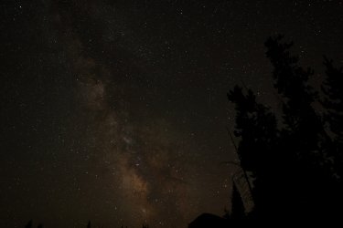
Scott and I headed for our tents when it seemed the beaver had moved on. I returned to the river bank several hours later to give an attempt at some astrophotography. One of the benefits of being 30 miles from civilization was the lack of light pollution.
Not the best picture or angle, but I was using a log as a tripod.
Track from Day Three.
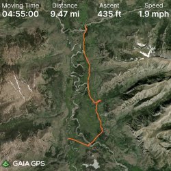
At the beginning of this post I mentioned that campsite 6Y2 was an adjustment to Hugh's plan. Someone familiar with the territory might also point out we hiked out of our way to the East, when tomorrow we will be hiking back West. It will all make sense when I post about day four. At least I hope it will.
I was looking forward to day three. Our goal today was to make it to Yellowstone Campsite 6Y2 about 9.5 miles away, but I hoped to squeeze in one of my adjustments to Hugh's master plan about halfway in. Actually camping at 6Y2 was an adjustment to Hugh's plans, but I'll elaborate more on that later.
Before tomorrow, and even before halfway thru today was the morning sunrise near Turret Mountain.

A lot of today's hiking took place in the flat bottom of the Thorofare.

A surprising amount of amphibians call this area home.

After about a mile and a half the Yellowstone River meandered its way over to the Thorofare Trail. If I remember correct the riverbank may have eroded away part of the trail near here.


Our river view was short lived and we soon found ourselves back in the willows.

Looking over toward Two Ocean Plateau.

A couple hikers for some scale.

More Mariposa Lilies along the way.

Approaching Cliff Creek. . . and potentially adjustment number two.

Now normally I'm a guy that likes to check out backcountry thermal features on a Yellowstone adventure. The Thorofare does not appear to hold an abundance of those, so for this trip I had to find another reason to lure the rest of the team off trail. Waterfalls seemed like a good alternative, and it just so happened that a large waterfall exists on Cliff Creek upstream from the trail crossing: Mist of the Trident Falls.
I suggested a visit to Mist of the Trident Falls to Hugh back in the planning stages of this trip. He thought that was a reasonable request provided we had the time and energy to do so. . . and so many months (maybe even a year) later here we were. It was near mid-day, the weather was nice, and both Scott and Hugh were game to check out the falls. Bob has seen many a waterfall in his day and in his own words "when you've seen one, you've seen them all." He elected to pass on the side trip up to the falls and volunteered to keep an eye on our packs -- a very honorable gesture (unless he planned on raiding our snacks while we were away).
We set Bob up on a nice sittin' log not far from the trail and Hugh, Scott, and I headed off armed with little more than cameras and bear spray. A trip report months ago by @Fungi covered a similar visit to the falls; we used his recommendation of following the open slopes North of Cliff Creek to access the waterfall. Our route involved some steep side hilling -- you can just make out @scatman 's hat in this picture (center right).

Our chosen route to the falls was steep, but hearing the sound of crashing water kept us going. Some loose rocks here, some downfall there, a bit of a drop off everywhere. . . a glimpse of cascading, agitated water was like a flame and I was the moth fluttering towards it. Somehow Hugh, Scott, and I each took a separate path down to the falls. I ended up working my way to the pool at the bottom of the main plunge. All those hours of studying Google Earth, looking at maps, and reading guide books about this waterfall had led up to this moment. . . and it did not disappoint!
The main fall is about 80 feet tall. The sight of falling water, the roar as it crashed on the rocks, the spray of the mist. . . this was a multi-sensory experience.

Hugh eventually found his way down to where I was. That is his finger in the upper right corner.

An interesting conglomerate forms much of the terrain surrounding the falls. There is also a large log jam to navigate to access the plunge pool. Hugh chose to climb over it on our way to the next viewpoint.

Mist of the Trident Falls has a series of drops associated with it. This view involved crossing Cliff Creek and squeezing thru some thick groups of pine trees.

I could have spent half a day here. Maybe an entire day. But we were on a schedule, so 20ish minutes would have to do. Months of dreaming of a location just to spend 20 minutes there in person. . . it was still worth it. Now I just have to plan to go back.
A quick YouTube video to add some movement and sound:
Hugh and I had lost track of Scott (he was ok). To get back to the trail we sort of backtracked our approach but climbed higher this time, near the brink of the main falls. Looking further upstream Cliff Creek flows thru a fun little canyon and more falling water exists.

The view of the Thorofare from above the falls was worth the climb.

When we returned to Bob we found Scott with him. Somehow we never crossed paths after that initial scatter towards the waterfall. My pack appeared to be just as I left it so I don't think @Bob nibbled on any of my trail snacks, but he did have a sly smile on his face so you never know.

Having a sunscreen break upon our return from the falls.

Scott leading the way from Cliff Creek. You might mistake him for a tree in the center of the picture.

Looking back towards the rock formations around Cliff Creek.

Wildflowers were still in abundance. There was also quite a crop of clover growing. It put forth a subtle, sweet smell that reminded me of our hayfields back home.


So close to the Thorofare Ranger Station. . . but that destination would have to wait until tomorrow. We still had two plus miles to 6Y2.

Getting closer.

Waterfall aside, the next four pictures are some of my favorites from day three.
Scott leading us West towards campsite 6Y2.

Looking South towards Hawk's Rest.

Looking back East towards the Trident.

Finally, looking North up the Thorofare.

The trail to campsite 6Y2 incorporated a crossing of Thorofare Creek.

The best spot for the shot is in the creek of course.

Hugh wanted to make sure we did not drop into any holes before he crossed.

Tomorrow's destination -- Thorofare Creek Valley -- in the distance. Getting these three guys to stagger out evenly for a good trail picture was like herding cats.

The trail to 6Y2 was easy going. . . until it was not. Brush was thick in places.

Back at the Yellowstone River. This is/was our campsite view. Somehow, I neglected to take a picture of my tent at 6Y2, probably because I set it up backwards with the door facing a log.
 It was on this day that I found my Sharpie marker and wrote "door" on the proper side of the tent footprint.
Spicy Sausage Bolognese for day three dinner. A little BCP love too.

Scott ate his supper on the riverbank while the rest of us sat around the unlit campfire. Hugh is either really deep in thought or having a stare down contest with the camera. Bob is just hungry.


Hugh and Bob went to bed early as tomorrow was potentially going to be a long day. The original plan was to hike to a campsite in the Teton Wilderness somewhere near Hidden Creek, but somehow someone other than myself made some adjustments to the master plan (more on that later). One way or another they needed their rest, so after they turned in for the night Scott and I sat out on the river bank watching for wildlife.
Our patience was rewarded when Scott's sharp eyes noticed a leafy branch floating down the river. . . with a head carrying it! A beaver was swimming right by us. When it finally noticed us taking its picture it dove into the river with a serious tail smack splash. We'd see him pop his head up now and again a short time later.

Scott and I headed for our tents when it seemed the beaver had moved on. I returned to the river bank several hours later to give an attempt at some astrophotography. One of the benefits of being 30 miles from civilization was the lack of light pollution.
Not the best picture or angle, but I was using a log as a tripod.

Track from Day Three.

At the beginning of this post I mentioned that campsite 6Y2 was an adjustment to Hugh's plan. Someone familiar with the territory might also point out we hiked out of our way to the East, when tomorrow we will be hiking back West. It will all make sense when I post about day four. At least I hope it will.
Last edited:

