- Joined
- Aug 21, 2018
- Messages
- 738
Day Nine. August 17, 2023.
I did not have a least favorite day on this trip, but if I had to pick the least best day it would be day nine. At day nine all my adjustments to Hugh's plan, all the unexplored territory, and all the must see areas had been completed, explored, or seen. It reminded me of taking a long road trip and the feeling experienced when it came time to make the drive back home. The return drive passed thru some interesting and often beautiful areas, but they were overshadowed by the places I had already been. The drive was still "vacation" but felt a little bit like work too.
A second least best part to day nine was our loss of @Bob . While Scott, Hugh, and I planned on camping one more night before reaching the trailhead at Brooks Lake, Bob intended to hike the full distance out today and make his way back home. I was at least comforted by the fact that this was his plan from the beginning and my antics/picture taking did not influence him to bail early.
Finally, there was the situation with @scatman . All was not well when it came to the delicate balance of the Scatster's internal plumbing. Was it the result of a defective Steri-Pen? Could it be Bob's Sock Water Revenge? A contaminated Circus Peanut? (Unlikely). Whatever the case Hugh was not feeling like his normal, jovial self and it is difficult (for me) to have a good time when a member of the group is not having a good time. I did my best to keep the glass half full around Hugh, but it really did not matter how full it was. Even the smallest sip from my glass of optimism would go right thru him.
Today's first picture is of @Bob leaving us. We thought there might be a chance of catching him somewhere on the trail but he must have skipped the usual trailside naps. This was the last we saw of him.
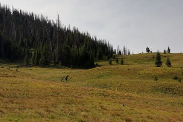
Looking back down the drainage to the South Buffalo Fork. We hiked in from there yesterday.
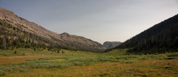
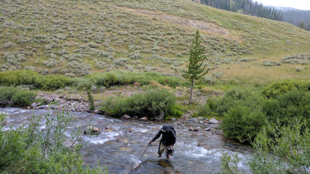
The same view as Hugh conquers the hill between last night's campsite and the drainage to Cub Creek.
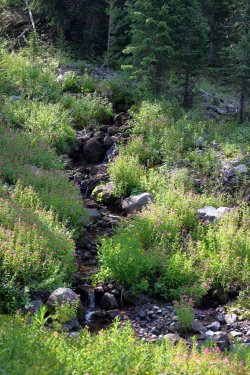
Plenty of beauty on day nine, including this flower lined waterway trickling in the same general direction we were walking.
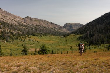
The views down Cub Creek surpassed those on day one during our hike down the Thorofare. Somehow I took more pictures on day one.
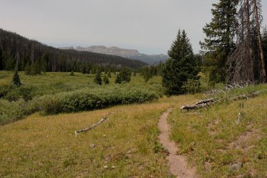
Hugh is one tough cookie. He kept his normal pace even though he was not feeling well.
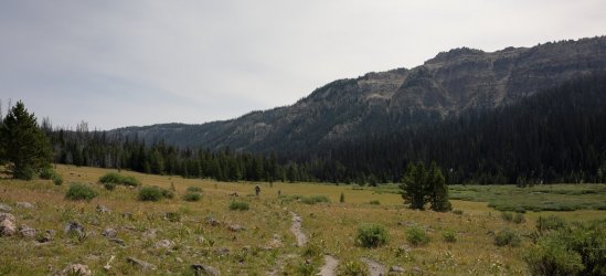
Day nine wildflowers. Scarlet Paintbrush is one of may favorites. This could be the least best paintbrush picture I took.
If you have read previous installments of this trip report you may recall that I have a lengthy stride and on occasion find myself ahead of my companions on the trail. Such was the case during a portion of our hike down Cub Creek. I would walk a distance ahead, then stop to catch my breath (usually in a shady spot) until I could see Scott or Hugh on the trail behind me. I was able to walk at my own pace, take frequent rest stops out of the sun, and even allowed a chance animal encounter or two. This had been a good system. . . up to today.
My quick pace had consequences about halfway into today's hike though. I walked ahead and after about 10 minutes from my last Scott sighting I stopped under a shady pine to wait for the others. A short time later Scott emerged from the trees and we decided to wait for Hugh to catch up. We waited. Five minutes turned to ten (or longer) and we started to become concerned for @scatman 's well being. We drew straws and I dropped my pack in order to walk back down the trail to find Hugh (did I win or did I lose? ). I walked a couple hundred yards and every so often would yell "Hugh!" in as loud a voice as I could muster. Finally, after bellowing out enough noise to scare wildlife for miles around, I heard a frustrated "WHAT!" in reply. At least that is what I think he said. The good news was that Hugh was alive. The bad news was he did not sound happy. Via shout back and forth Hugh asked if I was on the high trail or low trail. I yelled back that I was on the high trail (I did not know there was a low trail, but he sounded like he was lower than my position). All I heard back was a curse word. . . then silence.
After some worrisome minutes, I met Hugh in person on the "high" trail. In a perfect storm of coincidence Hugh had encountered what must have been a fork in the trail -- leading to a high and a low trail near Cub Creek. Earlier in the day we (as a group) looked at the trails shown on the cell phone map and there was a South turning spur trail along Cub Creek we considered taking as a shortcut. This spur was much farther ahead of us, but Hugh thought we passed it and that Scott and I must have taken the shortcut. He says he saw a boot print on the lower trail. Perhaps it was Bob's?
I have hiked with Hugh for several years now. While we have not yet developed uninhibited mental telepathy, I hope Hugh knows I would never encounter a fork in the trail and continue on without him knowing the direction. I blame my lack of noticing the fork (I should have waited there) for the confusion. That and Bob's boot print. On the bright side the gang was back together and we could continue towards our destination. It goes without saying that I did not wander too far from Hugh and Scott in unknown territory for the rest of the trip.
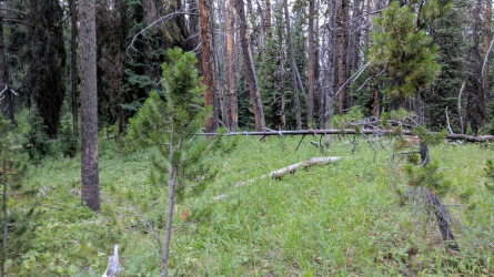
I think this picture was taken near the location of those tense moments on Cub Creek. This would be the high trail.
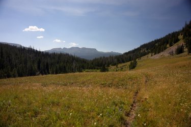
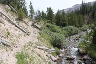
A little later in the day. The main trail starts to climb the ridge to the North of the creek.
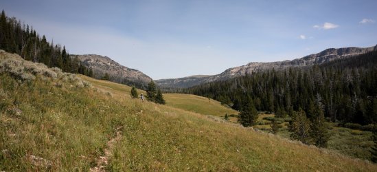
Looking down on Cub Creek.
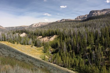
Another view upstream. Note that both Scott and Hugh are visible.
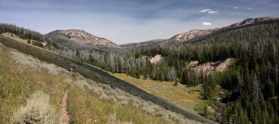
We never did take the shortcut/spur trail. No obvious path was visible where it was supposed to be and the line on the cell phone map led us to a drop down a very steep portion of the hill. The last thing I wanted to do was lead Hugh down a potential dead end/treacherous path when he was not feeling well, so we stuck with what we knew and followed the main, official trail.
Taking the long way to our campsite.
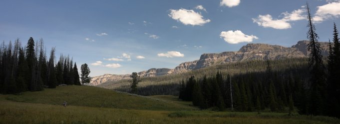
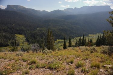
The ridge above Cub Creek provided a nice view of where we wanted to be. We could see several CDT hiker tents setup in the green, grassy area at the center of the picture.
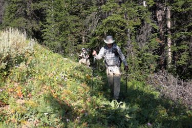
The last picture of Scott and Hugh I have for day nine as we made our way down to Cub Creek. I knew my normal campsite photo session would be the last thing Hugh would want to participate in, so the camera stayed packed away.
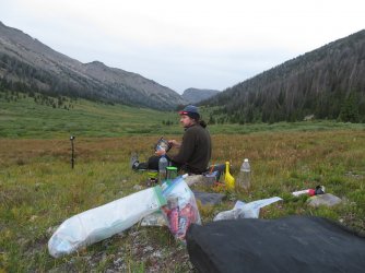
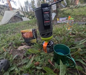
I did take this picture of day nine's dinner. Day nine may have been our least best campsite.
This brings day nine to a close. We covered a good chunk of ground that would set us up for an easy walk to the trailhead on day ten. Bob was in our thoughts and we hoped he made it to his truck at a reasonable hour. Hugh was obviously exhausted and for good reason. I knew he was tough but today he was on another level of resilience. I'm not sure how I would perform if I was his situation. . . but I hope to never find out. We encountered some of the first people we had seen in days. Most were nice and chatted for a few minutes, some were like walking zombies that barely acknowledged our presence. I already missed having the trail and wilderness to ourselves and knew I would have to acclimate back to the world of people soon. Not just yet though. I intended to sleep well and enjoy my last night in the Teton Wilderness, even if it was the least best one.
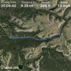
Track for Day Nine:
Day Ten: August 18, 2023.
The best part of day ten was that @scatman was starting to feel better. The worst part of day ten was that we'd be finishing our grand Yellowstone/Teton Wilderness trip. All good things have an ending, right? I suppose that is so another good thing can have a beginning.
It had rained a good amount over the night, some of the first precipitation we had encountered since day one. I'd like to think it was the Teton Wilderness shedding tears of sadness over our departure. I hope it was not tears of happiness.
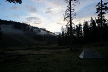
A foggy morning view up Cub Creek.
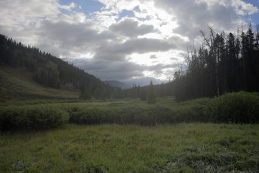
A similar view a little later in the morning.
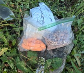
Before packing everything up, I took this picture of all the food I had left after ten days. Half a bag of Circus Peanuts, three quarters a bag of almonds, and a pouch of freeze dried ice cream. I could have made it for at least two more nights!
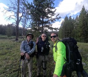
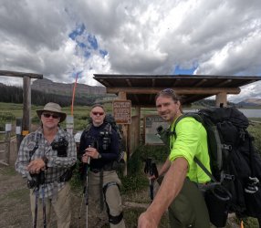
Group picture before leaving camp. The gang is back together and feeling good. Not sure why I chose to wear sunglasses on this one. At least @scatman is smiling.
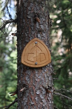
The walk to the Brooks Lake Trailhead follows a portion of the Continental Divide Trail. Hugh say's we are CDTers now.
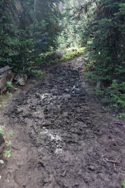
The rain had left its mark on the trail and several nice mudholes lined the path forward.
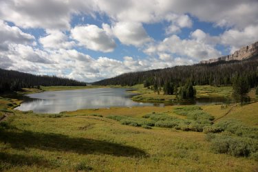
We climbed thru dense forest, crossed the Continental Divide, and emerged from the Teton Wilderness to a nice view of Upper Brooks Lake.
The valley leading to Brooks Lake held the first man made buildings we had seen since the Thorofare Patrol Cabin.
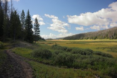
The Subaru is that-a-way!
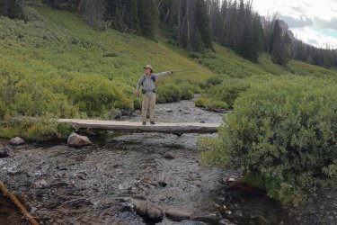
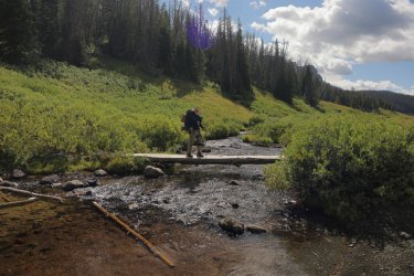
Hugh making his crossing of Brooks Lake Creek.
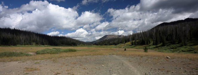
One last look back at the Teton Wilderness. I do hope I get to return one day.
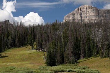
Squint just right and you might be able to make out a guy in a kilt sitting on that porch. That is what I see anyway.
The final descent to Brooks Lake. Nice to see Hugh back in the middle of the pack again.
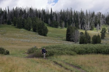
Brooks Lake. Looks lovely, doesn't it?
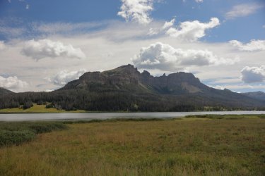
Our chariot awaits!
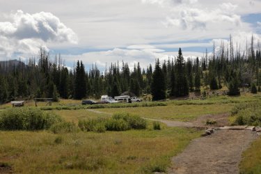
Hugh is ready to drive us back to Yellowstone. . . if only he can remember where he put the keys.
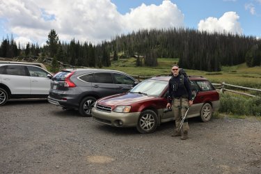
One last group shot (minus Bob of course) at the finish line.
Hugh and the Subaru drove us thru some scenic territory on the way to the Tetons and Signal Mountain Lodge. This was my first time passing thru this part of Wyoming and I was happy to be a passenger to take in the views. Getting out of the car at Signal Mountain was more difficult than expected; apparently sitting in a Subaru was not a position that one experiences in the wilderness. I managed to get the kinks out and made it to the table at the restaurant. An order for the "Mountain of Nachos" was promptly placed in addition to my request for a side of garlic fries.
Allow me to treat you to my favorite picture from day 10.
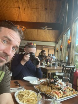
I wonder what the poor guy in the background is looking at on his phone.
We cleaned our plates and continued on to retrieve our rental car then stay in an Old Faithful cabin for the night. Hugh went to bed early while Scott and I caught the sunset on the Upper Geyser Basin boardwalk. Our return to civilization was official.
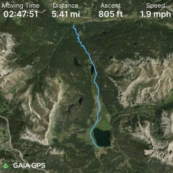
The GPS Track for Day 10 (the hiking part anyway) and them some final thoughts to follow.
In summary, this was an amazing trip. Although I hope it is not, it could be a once in a lifetime adventure that I will be forever grateful to have experienced. I was pleased that I had trained/planned in a way that allowed me to cross the finish line with confidence. I consumed nearly all my food (the Circus Peanuts did not make it to Brooks Lake) and put almost everything I had packed to use. At no point did I feel like I was missing, forgetting, or wanting something I did not bring with me. The only items I carried but did not need/use were two camera batteries, my pack cover, and my rain jacket. I was happy to carry the rain jacket/pack cover and not need them though. My feet are back to normal but I do not think my knees are quite there yet. Perhaps a couple more months of being in sloth-mode will help with that.
I could not have asked for better trail companions. Hugh, Scott, and Bob are some of the most pleasant, knowledgeable, and entertaining people a person could spend time in the backcountry with. I'd jump at the chance to plan another trip with any of them if the opportunity presented itself. Hidden Creek, Turner Fork, the trail at the bottom of Mojo Pass, the base of Bob's Waterfall. . . there are some boxes we left unchecked this time around. Hugh says he is hanging up the hiking boots for any future long trips; maybe we can convince him to participate in an extended medium length trip instead.
Thank You Hugh, Scott, and Bob for inviting me along and allowing me to experience something exceptional. I always say the best part of travel is retrospect. These trip reports support that idea but not completely because nothing will surpass being where we were in the moment. Seeing, hearing, smelling, feeling, and tasting (if you count Bob's sock water) Yellowstone's Thorofare and the Teton Wilderness was amazing. Hugh likes to sum up his trips with a single word to describe the entire experience. Such a word has been linked to some of our adventures in the past, but I cannot think of a more fitting title to bestow on those ten days in August. They were, without question, truly Epic.
Thanks for reading. The End!
I did not have a least favorite day on this trip, but if I had to pick the least best day it would be day nine. At day nine all my adjustments to Hugh's plan, all the unexplored territory, and all the must see areas had been completed, explored, or seen. It reminded me of taking a long road trip and the feeling experienced when it came time to make the drive back home. The return drive passed thru some interesting and often beautiful areas, but they were overshadowed by the places I had already been. The drive was still "vacation" but felt a little bit like work too.
A second least best part to day nine was our loss of @Bob . While Scott, Hugh, and I planned on camping one more night before reaching the trailhead at Brooks Lake, Bob intended to hike the full distance out today and make his way back home. I was at least comforted by the fact that this was his plan from the beginning and my antics/picture taking did not influence him to bail early.
Finally, there was the situation with @scatman . All was not well when it came to the delicate balance of the Scatster's internal plumbing. Was it the result of a defective Steri-Pen? Could it be Bob's Sock Water Revenge? A contaminated Circus Peanut? (Unlikely). Whatever the case Hugh was not feeling like his normal, jovial self and it is difficult (for me) to have a good time when a member of the group is not having a good time. I did my best to keep the glass half full around Hugh, but it really did not matter how full it was. Even the smallest sip from my glass of optimism would go right thru him.
Today's first picture is of @Bob leaving us. We thought there might be a chance of catching him somewhere on the trail but he must have skipped the usual trailside naps. This was the last we saw of him.

Looking back down the drainage to the South Buffalo Fork. We hiked in from there yesterday.

The same view as Hugh conquers the hill between last night's campsite and the drainage to Cub Creek.

Plenty of beauty on day nine, including this flower lined waterway trickling in the same general direction we were walking.

The views down Cub Creek surpassed those on day one during our hike down the Thorofare. Somehow I took more pictures on day one.

Hugh is one tough cookie. He kept his normal pace even though he was not feeling well.

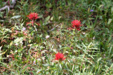
Day nine wildflowers. Scarlet Paintbrush is one of may favorites. This could be the least best paintbrush picture I took.

If you have read previous installments of this trip report you may recall that I have a lengthy stride and on occasion find myself ahead of my companions on the trail. Such was the case during a portion of our hike down Cub Creek. I would walk a distance ahead, then stop to catch my breath (usually in a shady spot) until I could see Scott or Hugh on the trail behind me. I was able to walk at my own pace, take frequent rest stops out of the sun, and even allowed a chance animal encounter or two. This had been a good system. . . up to today.
My quick pace had consequences about halfway into today's hike though. I walked ahead and after about 10 minutes from my last Scott sighting I stopped under a shady pine to wait for the others. A short time later Scott emerged from the trees and we decided to wait for Hugh to catch up. We waited. Five minutes turned to ten (or longer) and we started to become concerned for @scatman 's well being. We drew straws and I dropped my pack in order to walk back down the trail to find Hugh (did I win or did I lose?
After some worrisome minutes, I met Hugh in person on the "high" trail. In a perfect storm of coincidence Hugh had encountered what must have been a fork in the trail -- leading to a high and a low trail near Cub Creek. Earlier in the day we (as a group) looked at the trails shown on the cell phone map and there was a South turning spur trail along Cub Creek we considered taking as a shortcut. This spur was much farther ahead of us, but Hugh thought we passed it and that Scott and I must have taken the shortcut. He says he saw a boot print on the lower trail. Perhaps it was Bob's?
I have hiked with Hugh for several years now. While we have not yet developed uninhibited mental telepathy, I hope Hugh knows I would never encounter a fork in the trail and continue on without him knowing the direction. I blame my lack of noticing the fork (I should have waited there) for the confusion. That and Bob's boot print. On the bright side the gang was back together and we could continue towards our destination. It goes without saying that I did not wander too far from Hugh and Scott in unknown territory for the rest of the trip.
I think this picture was taken near the location of those tense moments on Cub Creek. This would be the high trail.

A little later in the day. The main trail starts to climb the ridge to the North of the creek.

Looking down on Cub Creek.

Another view upstream. Note that both Scott and Hugh are visible.

We never did take the shortcut/spur trail. No obvious path was visible where it was supposed to be and the line on the cell phone map led us to a drop down a very steep portion of the hill. The last thing I wanted to do was lead Hugh down a potential dead end/treacherous path when he was not feeling well, so we stuck with what we knew and followed the main, official trail.
Taking the long way to our campsite.

The ridge above Cub Creek provided a nice view of where we wanted to be. We could see several CDT hiker tents setup in the green, grassy area at the center of the picture.

The last picture of Scott and Hugh I have for day nine as we made our way down to Cub Creek. I knew my normal campsite photo session would be the last thing Hugh would want to participate in, so the camera stayed packed away.

I did take this picture of day nine's dinner. Day nine may have been our least best campsite.

This brings day nine to a close. We covered a good chunk of ground that would set us up for an easy walk to the trailhead on day ten. Bob was in our thoughts and we hoped he made it to his truck at a reasonable hour. Hugh was obviously exhausted and for good reason. I knew he was tough but today he was on another level of resilience. I'm not sure how I would perform if I was his situation. . . but I hope to never find out. We encountered some of the first people we had seen in days. Most were nice and chatted for a few minutes, some were like walking zombies that barely acknowledged our presence. I already missed having the trail and wilderness to ourselves and knew I would have to acclimate back to the world of people soon. Not just yet though. I intended to sleep well and enjoy my last night in the Teton Wilderness, even if it was the least best one.
Track for Day Nine:

Day Ten: August 18, 2023.
The best part of day ten was that @scatman was starting to feel better. The worst part of day ten was that we'd be finishing our grand Yellowstone/Teton Wilderness trip. All good things have an ending, right? I suppose that is so another good thing can have a beginning.
It had rained a good amount over the night, some of the first precipitation we had encountered since day one. I'd like to think it was the Teton Wilderness shedding tears of sadness over our departure. I hope it was not tears of happiness.
A foggy morning view up Cub Creek.

A similar view a little later in the morning.

Before packing everything up, I took this picture of all the food I had left after ten days. Half a bag of Circus Peanuts, three quarters a bag of almonds, and a pouch of freeze dried ice cream. I could have made it for at least two more nights!

Group picture before leaving camp. The gang is back together and feeling good. Not sure why I chose to wear sunglasses on this one. At least @scatman is smiling.

The walk to the Brooks Lake Trailhead follows a portion of the Continental Divide Trail. Hugh say's we are CDTers now.

The rain had left its mark on the trail and several nice mudholes lined the path forward.

We climbed thru dense forest, crossed the Continental Divide, and emerged from the Teton Wilderness to a nice view of Upper Brooks Lake.

The valley leading to Brooks Lake held the first man made buildings we had seen since the Thorofare Patrol Cabin.

The Subaru is that-a-way!

Hugh making his crossing of Brooks Lake Creek.

One last look back at the Teton Wilderness. I do hope I get to return one day.

Squint just right and you might be able to make out a guy in a kilt sitting on that porch. That is what I see anyway.

The final descent to Brooks Lake. Nice to see Hugh back in the middle of the pack again.

Brooks Lake. Looks lovely, doesn't it?

Our chariot awaits!

Hugh is ready to drive us back to Yellowstone. . . if only he can remember where he put the keys.

One last group shot (minus Bob of course) at the finish line.

Hugh and the Subaru drove us thru some scenic territory on the way to the Tetons and Signal Mountain Lodge. This was my first time passing thru this part of Wyoming and I was happy to be a passenger to take in the views. Getting out of the car at Signal Mountain was more difficult than expected; apparently sitting in a Subaru was not a position that one experiences in the wilderness. I managed to get the kinks out and made it to the table at the restaurant. An order for the "Mountain of Nachos" was promptly placed in addition to my request for a side of garlic fries.
Allow me to treat you to my favorite picture from day 10.

I wonder what the poor guy in the background is looking at on his phone.
We cleaned our plates and continued on to retrieve our rental car then stay in an Old Faithful cabin for the night. Hugh went to bed early while Scott and I caught the sunset on the Upper Geyser Basin boardwalk. Our return to civilization was official.
The GPS Track for Day 10 (the hiking part anyway) and them some final thoughts to follow.

In summary, this was an amazing trip. Although I hope it is not, it could be a once in a lifetime adventure that I will be forever grateful to have experienced. I was pleased that I had trained/planned in a way that allowed me to cross the finish line with confidence. I consumed nearly all my food (the Circus Peanuts did not make it to Brooks Lake) and put almost everything I had packed to use. At no point did I feel like I was missing, forgetting, or wanting something I did not bring with me. The only items I carried but did not need/use were two camera batteries, my pack cover, and my rain jacket. I was happy to carry the rain jacket/pack cover and not need them though. My feet are back to normal but I do not think my knees are quite there yet. Perhaps a couple more months of being in sloth-mode will help with that.
I could not have asked for better trail companions. Hugh, Scott, and Bob are some of the most pleasant, knowledgeable, and entertaining people a person could spend time in the backcountry with. I'd jump at the chance to plan another trip with any of them if the opportunity presented itself. Hidden Creek, Turner Fork, the trail at the bottom of Mojo Pass, the base of Bob's Waterfall. . . there are some boxes we left unchecked this time around. Hugh says he is hanging up the hiking boots for any future long trips; maybe we can convince him to participate in an extended medium length trip instead.
Thank You Hugh, Scott, and Bob for inviting me along and allowing me to experience something exceptional. I always say the best part of travel is retrospect. These trip reports support that idea but not completely because nothing will surpass being where we were in the moment. Seeing, hearing, smelling, feeling, and tasting (if you count Bob's sock water) Yellowstone's Thorofare and the Teton Wilderness was amazing. Hugh likes to sum up his trips with a single word to describe the entire experience. Such a word has been linked to some of our adventures in the past, but I cannot think of a more fitting title to bestow on those ten days in August. They were, without question, truly Epic.
Thanks for reading. The End!

