- Joined
- Aug 21, 2018
- Messages
- 735
Day Eight: August 16, 2023.
Hugh said we needed an early start on day eight. Today we would be climbing up to a mysterious place called the Buffalo Plateau. I always envisioned a plateau as a raised area of land that was more or less flat. I was about to learn that that is not always the case. We would also be hiking our longest distance today and needed all daylight mid-August would provide.
Our route up the plateau was known; we just had to climb the hillside next to our campsite. I believe our route down the plateau was still in a state of flux as of this morning. Hugh's plan had us descending an uncharted route down the treacherous Turner Fork. Bob declared that he was going to skip that nonsense and hike down another drainage farther across the plateau. I know Hugh really wanted to earn his Turner Fork Merit Badge and when he asked my opinion I told him I'd gladly follow him down any path he might choose. I might grumble a bit as we descended steep ravines and stepped over endless downfall, but I'd still gladly follow . This area was a completely new experience for me so it was difficult to have a preference. . . I was along for the ride (or walk?) where ever our path took us.
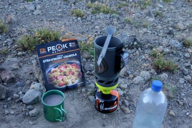
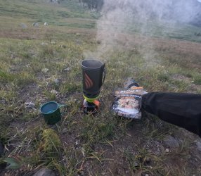
Breakfast before sunrise. Peak says to add cold water to the strawberry granola, but I add hot water on chilly mornings.
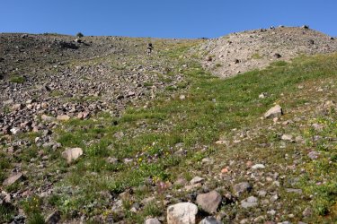
Hugh was not kidding when he said he was making an early start. He blazed the trail up to the plateau.
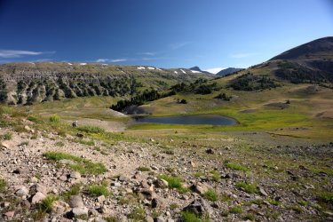
The view behind us as we climbed the hill. Our campsite is/was the small, light yellow patch above the pond near the center/left in the picture.
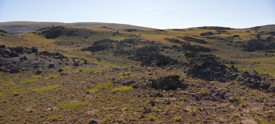
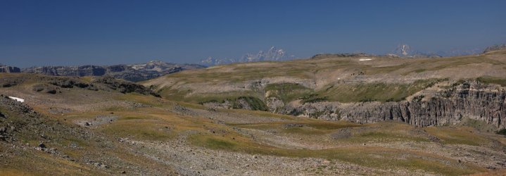
The Buffalo Plateau. Rocky and barren, at first it might seem like there is not a lot to see.
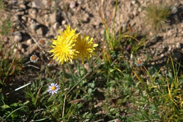
But look down and you'll notice stands of sturdy alpine flowers thriving in this harsh environment.
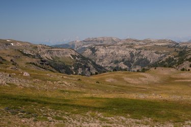
Then look to the West and you can see the Tetons! I was just now realizing how far South we had walked at this moment. I think that is the Lost Creek drainage between us and the Tetons.
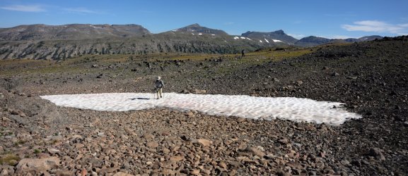
Our route took us across vast snowfields. I made it across safely even without micro-spikes.
Those peaks in the distance look familiar. . .
Panoramas were one of the best ways to capture the ribbon of detail between the empty sky and rocky plateau.
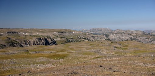
I believe this was the small pond that indicated we had reached Turner Fork, which loomed large in the distance.
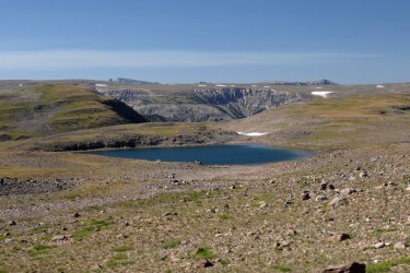
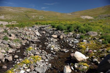
We stopped for a sunscreen break at this lovely rivulet that eventually drains down Turner Fork. This may have been the spot where we finalized which route to take down the plateau. @wsp_scott also spent some time taking pictures of a hummingbird moth around here that I'm looking forward to seeing.
Turner Fork Pros: 1. Fulfills @scatman 's dream. 2. Suspect great scenery. 3. Navigating Turner's Fork would mean we were equals to the group from The Catholic Girls School of Wyoming (Hugh has crossed paths with them before).
Turner Fork Cons: Unknown terrain, probably no trail. Difficult to know how long it will take to traverse. This could be considered a pro by some.
Bob's Route Pros: 1. A wider canyon suggesting an easier descent. 2. Suspect great scenery. 3. Bob says there is a trail. It should be noted that @Bob is snowed in his house like eight months out of the year and I imagine he spends a lot of that time on Google Earth scoping out routes/potential trails. If he says there is a trail there is a good chance it could be there.
Bob's Route Cons: It is not Turner Fork.
Once we factored in the time of day and where we needed to be with the daylight we had left @Bob 's route was chosen. Some memories of the bushwhack to Mojo Pass may have also had some influence; Turner Fork could very well be worse. We committed ourselves to traversing what is to be officially known going forward as "Bob's Canyon." We climbed the hill leading away from Turner Fork and did not look back. . . except to take some pictures of Younts Peak that is.
View looking back West from the top of the hill above the Turner Fork drainage.
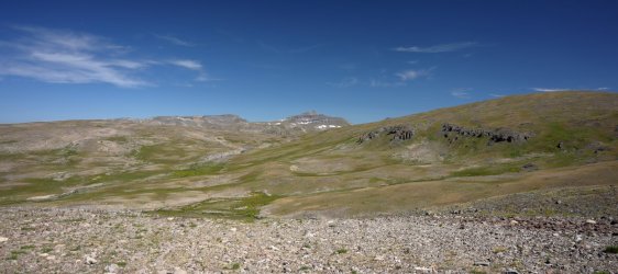
The route to Bob's Canyon meant that we had to cross more of the Buffalo Plateau. Several surprises presented themselves to us, including vibrant patches of wildflowers.
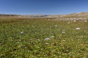
Amazing views of the Tetons.
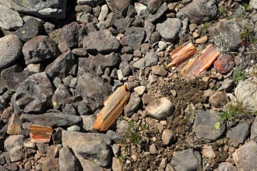
And bits of a petrified forest.
Favorite picture of day eight. The Tetons just look better with a little bit of Bob, don't you think?
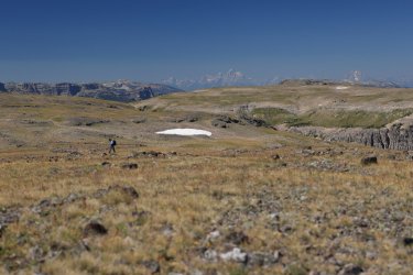
Nearing the edge of Bob's Canyon, scouting the best way down. The Washakie Wilderness is somewhere behind that slope in the center of the picture.
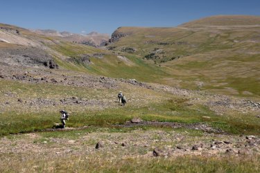
The descent from the plateau was precipitous but doable. A view down Bob's Canyon once the steep part was over. Our next sunscreen break was alongside the creek near this spot and it felt more like a sun-bake break due to the lack of shade.
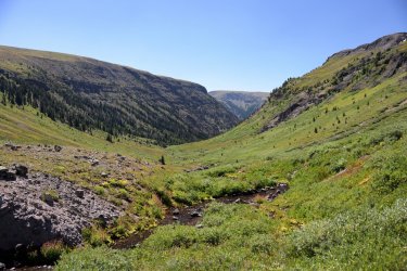
By now it had become tradition for one of us to yell out "Trail!" if we had somehow lost the trail but then found our way back to it. . . or if we were in an area without a trail but found one anyway. In this case it appeared we found Bob's Trail in Bob's Canyon.
Trail!
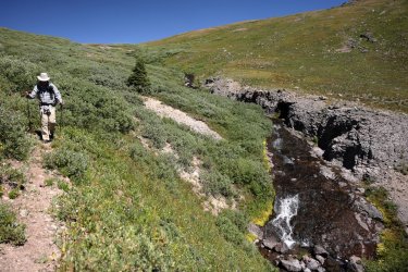
Bob's Trail in Bob's Canyon followed Bob's Creek closely early on.
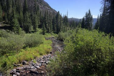
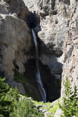
One of the highlights of Bob's Canyon was Bob's Waterfall. It was easily visible from Bob's Trail.
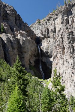
I wanted to see if there was a nice swimming hole at the base of Bob's Falls, but time was passing quickly and we had to keep moving. Maybe next time.
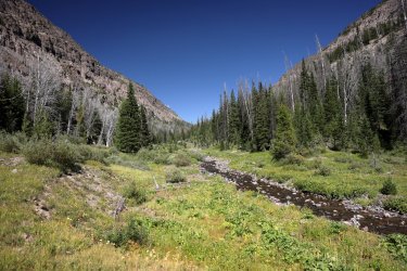
Looking back up Bob's Canyon. I think I can just make out Scott's hat above the willows on the left.
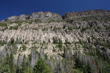
The many layers of geologic history in Bob's Canyon fascinated me. I had to be careful not to trip over a rock or root as I tended to look up more than I was looking down.
All good things must come to an end, and eventually Bob's Trail faded away as we approached a burned area at the mouth of Bob's Canyon. We worked our way thru the burn and found ourselves at the South Buffalo Fork.
One last picture of @Bob as he exits Bob's Canyon.
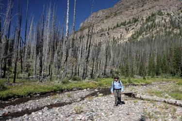
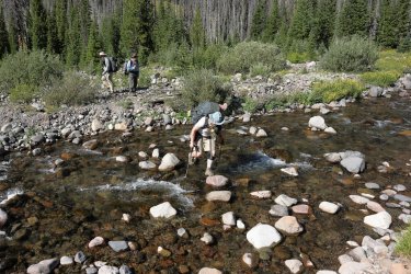
Crossing the South Buffalo Fork took a hop, skip, and a jump.
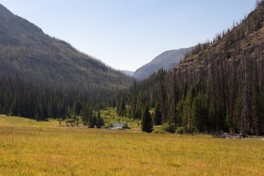
A downstream view of the South Buffalo Fork. We gave consideration to camping here, but after some discussion continued up the trail. I don't know if I was hallucinating as we began to climb thru the forest, but I have memories of a chipmunk charging at me down the trail, running between my legs, then vanishing into the trees as fast as it appeared. Scott was nearby and I recall him making some kind of soccer reference.
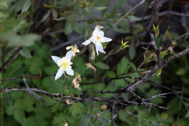
My first (and only) columbine sighting of the trip. It looked a little rough, but it probably thought the same of me.
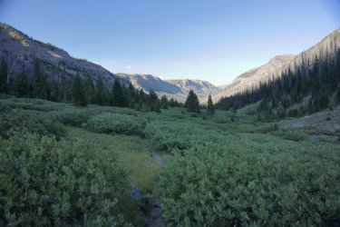
Forest gave way to willows as we progressed on the South Fork Buffalo Trail. The lack of my companions in this picture makes me think this is an up valley view.
Time ticked away and we found ourselves chasing the sun. The temperature had dropped and I would have liked to feel its warmth in camp, but sunlight dropped behind the hillside before we could catch it. We set up camp somewhere on the hill where light/dark meet in this picture.
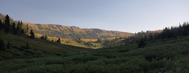
Looking back down the valley we had hiked up. Our campsite was adorned with many wildflowers and many holes/soft spots probably left behind by some kind of rodent.
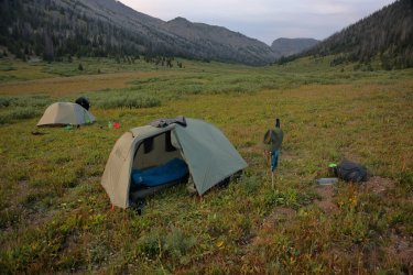
Night eight dinner with a view of camp in the distance.
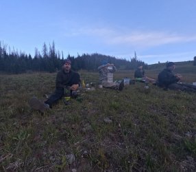
Everyone must have been too tired and hungry to worry about taking pictures. Sometime after this picture was taken a lone deer walked out of the trees behind us and froze for a minute or two. I would not know what to do if I saw the likes of this bunch either.
Day eight was another top notch day. The views from the Buffalo Plateau were the highlight, with everything in Bob's Canyon being a close second. Sadly this would be our last night with Bob. In the morning he planned on packing up and making the long trek to the Brooks Lake Trailhead while Hugh, Scott, and I had one more night planned in the wilderness. I retired to my tent early. The adventures of the day must have taken their toll as I remember sleeping soundly. . . I did not even try taking night sky pictures this evening.
Our epic adventure was beginning to near its end. I will try to summarize days nine and ten in one last post to conclude what was intended to be a simple trip report. That changed about halfway thru day one. Days nine and ten had their ups and downs. . . you will have to read the final post in the series to see if I'm talking about more than just topography.
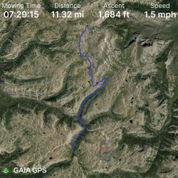
GPS Track for Day Eight.
Hugh said we needed an early start on day eight. Today we would be climbing up to a mysterious place called the Buffalo Plateau. I always envisioned a plateau as a raised area of land that was more or less flat. I was about to learn that that is not always the case. We would also be hiking our longest distance today and needed all daylight mid-August would provide.
Our route up the plateau was known; we just had to climb the hillside next to our campsite. I believe our route down the plateau was still in a state of flux as of this morning. Hugh's plan had us descending an uncharted route down the treacherous Turner Fork. Bob declared that he was going to skip that nonsense and hike down another drainage farther across the plateau. I know Hugh really wanted to earn his Turner Fork Merit Badge and when he asked my opinion I told him I'd gladly follow him down any path he might choose. I might grumble a bit as we descended steep ravines and stepped over endless downfall, but I'd still gladly follow
Breakfast before sunrise. Peak says to add cold water to the strawberry granola, but I add hot water on chilly mornings.

Hugh was not kidding when he said he was making an early start. He blazed the trail up to the plateau.

The view behind us as we climbed the hill. Our campsite is/was the small, light yellow patch above the pond near the center/left in the picture.

The Buffalo Plateau. Rocky and barren, at first it might seem like there is not a lot to see.

But look down and you'll notice stands of sturdy alpine flowers thriving in this harsh environment.

Then look to the West and you can see the Tetons! I was just now realizing how far South we had walked at this moment. I think that is the Lost Creek drainage between us and the Tetons.

Our route took us across vast snowfields. I made it across safely even without micro-spikes.
Those peaks in the distance look familiar. . .

Panoramas were one of the best ways to capture the ribbon of detail between the empty sky and rocky plateau.

I believe this was the small pond that indicated we had reached Turner Fork, which loomed large in the distance.

We stopped for a sunscreen break at this lovely rivulet that eventually drains down Turner Fork. This may have been the spot where we finalized which route to take down the plateau. @wsp_scott also spent some time taking pictures of a hummingbird moth around here that I'm looking forward to seeing.

Turner Fork Pros: 1. Fulfills @scatman 's dream. 2. Suspect great scenery. 3. Navigating Turner's Fork would mean we were equals to the group from The Catholic Girls School of Wyoming (Hugh has crossed paths with them before).
Turner Fork Cons: Unknown terrain, probably no trail. Difficult to know how long it will take to traverse. This could be considered a pro by some.
Bob's Route Pros: 1. A wider canyon suggesting an easier descent. 2. Suspect great scenery. 3. Bob says there is a trail. It should be noted that @Bob is snowed in his house like eight months out of the year and I imagine he spends a lot of that time on Google Earth scoping out routes/potential trails. If he says there is a trail there is a good chance it could be there.
Bob's Route Cons: It is not Turner Fork.
Once we factored in the time of day and where we needed to be with the daylight we had left @Bob 's route was chosen. Some memories of the bushwhack to Mojo Pass may have also had some influence; Turner Fork could very well be worse. We committed ourselves to traversing what is to be officially known going forward as "Bob's Canyon." We climbed the hill leading away from Turner Fork and did not look back. . . except to take some pictures of Younts Peak that is.
View looking back West from the top of the hill above the Turner Fork drainage.

The route to Bob's Canyon meant that we had to cross more of the Buffalo Plateau. Several surprises presented themselves to us, including vibrant patches of wildflowers.

Amazing views of the Tetons.

And bits of a petrified forest.

Favorite picture of day eight. The Tetons just look better with a little bit of Bob, don't you think?

Nearing the edge of Bob's Canyon, scouting the best way down. The Washakie Wilderness is somewhere behind that slope in the center of the picture.

The descent from the plateau was precipitous but doable. A view down Bob's Canyon once the steep part was over. Our next sunscreen break was alongside the creek near this spot and it felt more like a sun-bake break due to the lack of shade.

By now it had become tradition for one of us to yell out "Trail!" if we had somehow lost the trail but then found our way back to it. . . or if we were in an area without a trail but found one anyway. In this case it appeared we found Bob's Trail in Bob's Canyon.
Trail!

Bob's Trail in Bob's Canyon followed Bob's Creek closely early on.

One of the highlights of Bob's Canyon was Bob's Waterfall. It was easily visible from Bob's Trail.

I wanted to see if there was a nice swimming hole at the base of Bob's Falls, but time was passing quickly and we had to keep moving. Maybe next time.

Looking back up Bob's Canyon. I think I can just make out Scott's hat above the willows on the left.

The many layers of geologic history in Bob's Canyon fascinated me. I had to be careful not to trip over a rock or root as I tended to look up more than I was looking down.

All good things must come to an end, and eventually Bob's Trail faded away as we approached a burned area at the mouth of Bob's Canyon. We worked our way thru the burn and found ourselves at the South Buffalo Fork.
One last picture of @Bob as he exits Bob's Canyon.

Crossing the South Buffalo Fork took a hop, skip, and a jump.

A downstream view of the South Buffalo Fork. We gave consideration to camping here, but after some discussion continued up the trail. I don't know if I was hallucinating as we began to climb thru the forest, but I have memories of a chipmunk charging at me down the trail, running between my legs, then vanishing into the trees as fast as it appeared. Scott was nearby and I recall him making some kind of soccer reference.

My first (and only) columbine sighting of the trip. It looked a little rough, but it probably thought the same of me.

Forest gave way to willows as we progressed on the South Fork Buffalo Trail. The lack of my companions in this picture makes me think this is an up valley view.

Time ticked away and we found ourselves chasing the sun. The temperature had dropped and I would have liked to feel its warmth in camp, but sunlight dropped behind the hillside before we could catch it. We set up camp somewhere on the hill where light/dark meet in this picture.

Looking back down the valley we had hiked up. Our campsite was adorned with many wildflowers and many holes/soft spots probably left behind by some kind of rodent.

Night eight dinner with a view of camp in the distance.

Everyone must have been too tired and hungry to worry about taking pictures.

Day eight was another top notch day. The views from the Buffalo Plateau were the highlight, with everything in Bob's Canyon being a close second. Sadly this would be our last night with Bob. In the morning he planned on packing up and making the long trek to the Brooks Lake Trailhead while Hugh, Scott, and I had one more night planned in the wilderness. I retired to my tent early. The adventures of the day must have taken their toll as I remember sleeping soundly. . . I did not even try taking night sky pictures this evening.

Our epic adventure was beginning to near its end. I will try to summarize days nine and ten in one last post to conclude what was intended to be a simple trip report. That changed about halfway thru day one. Days nine and ten had their ups and downs. . . you will have to read the final post in the series to see if I'm talking about more than just topography.
GPS Track for Day Eight.

Last edited:

