- Joined
- Jul 23, 2013
- Messages
- 1,666
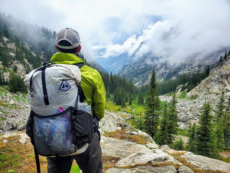
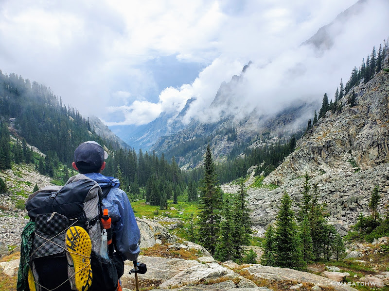
Our first rain after being out for 5 days, and then a whole bunch more would highlight Day 6 along the Wind River High Route.
Wednesday - July 28, 2021
Day 6: Titcomb Basin to Beaver Park
MILES: 17 | GAIN: 2,569 ft
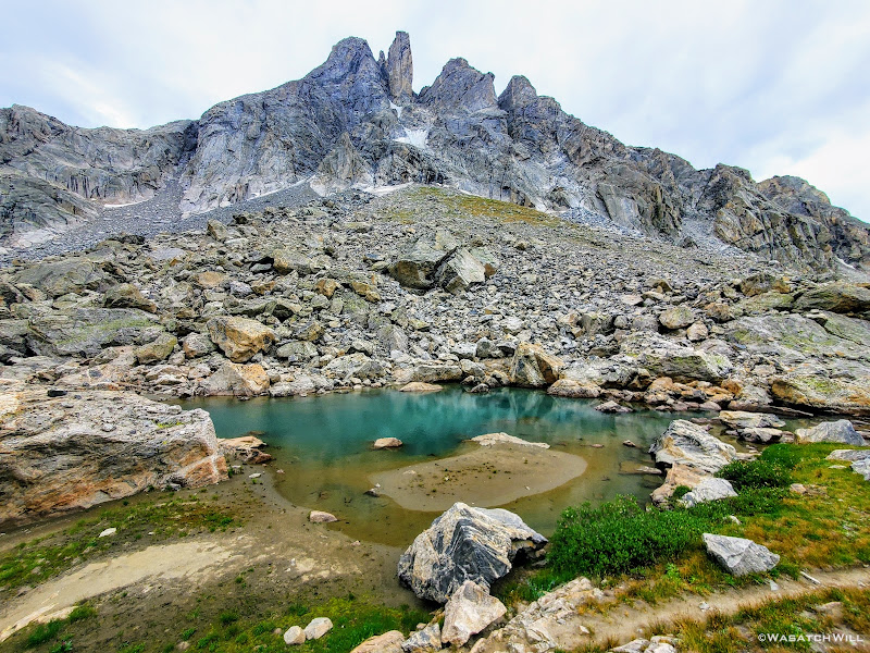
During the course of the night going into the sixth day of this trip, we got hit with our first rain. It was nothing too hard nor for too long. The cloud cover however made for warm conditions through the night. In fact, it ended up being the warmest night of the trip, so warm that I shed off most of my sleeping bag. The base layers I was wearing along with my pad proved to be the only insulation I'd need to keep warm through this particular night.
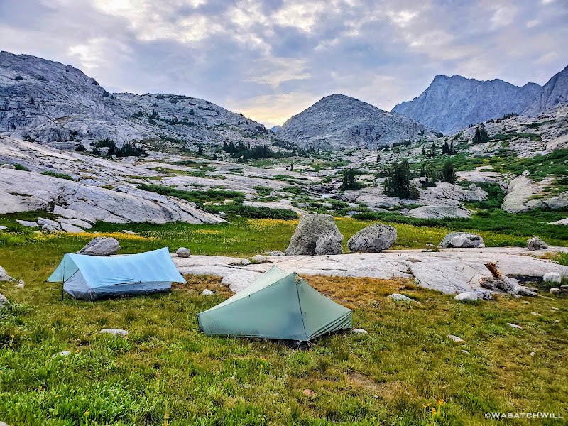
Morning near Titcomb, Mount Harrower above right
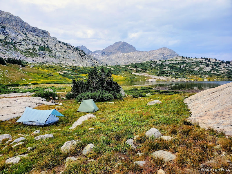
Mount Lester as viewed from camp
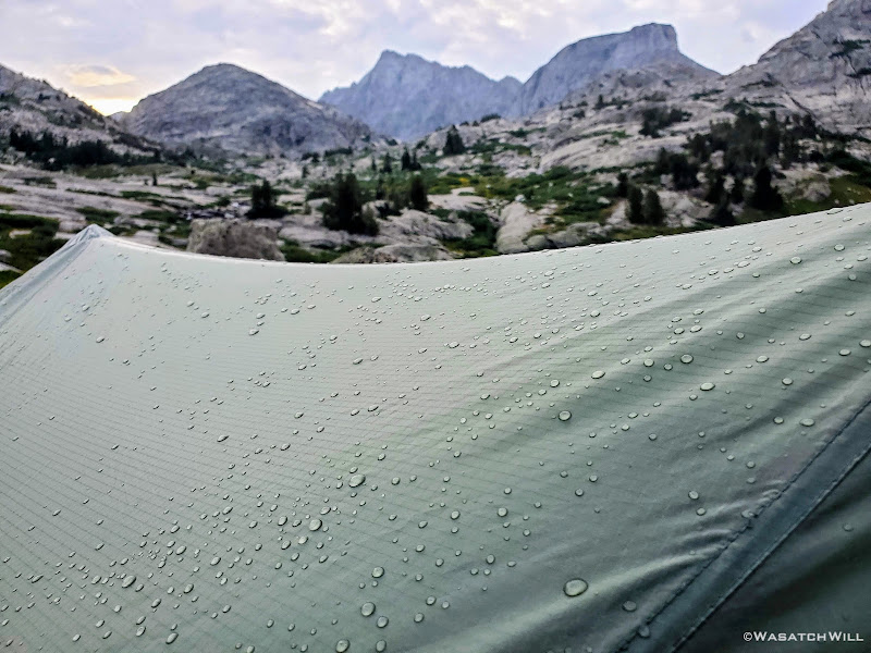
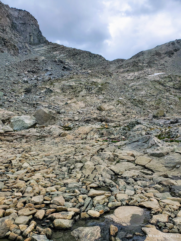
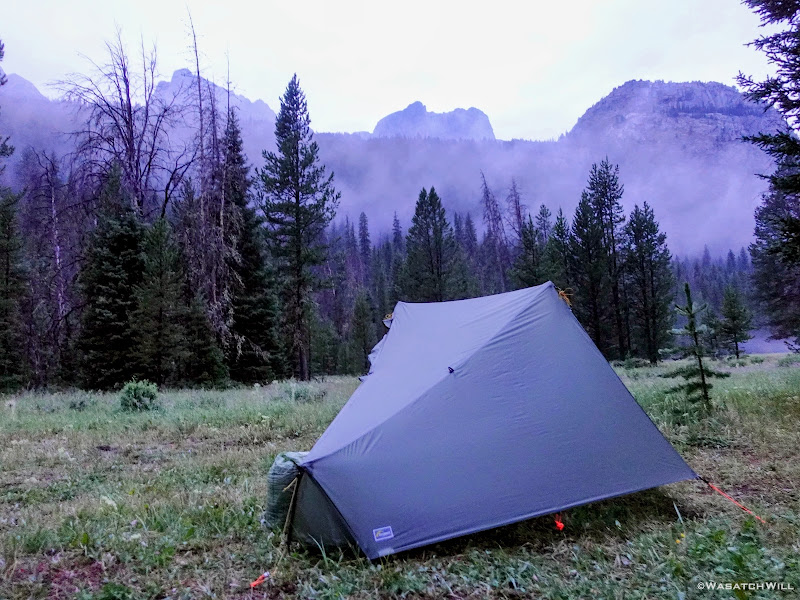
Raindrops cling to my Tarptent Notch
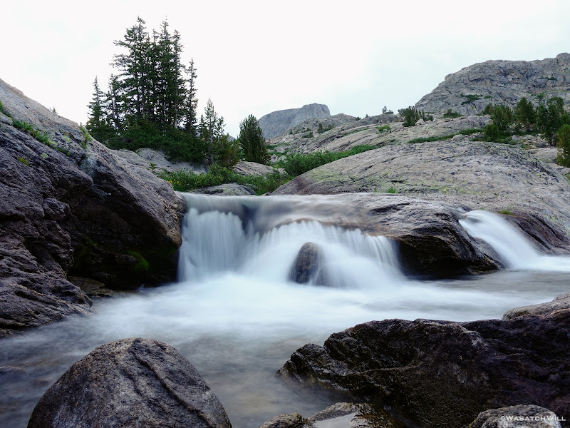
Small cascades near camp
Once we were awake and out, we had a big decision to make: Go forth with our original plan to head upward through Titcomb Basin and then up and over Knapsack Col, or bail on that and head down around Island Lake, link up with the Highline trail, and take that straight down to the Green River.
Still feeling a bit battered and bruised from the extra strenuous day before, it wasn't as bad for either of us as it was going to bed. Blake and I were both feeling much more refreshed and in good enough condition to press forward with the former. Yes, Blake's ankle was somehow up to the task as well. The only other thing in question before committing to that was the weather. Well...as the sun arose, the cloud cover quickly dissipated, giving way to clear blue skies.
Knapsack Col was a go! Up into Titcomb we went.
Blake ventures on up into Titcomb Basin
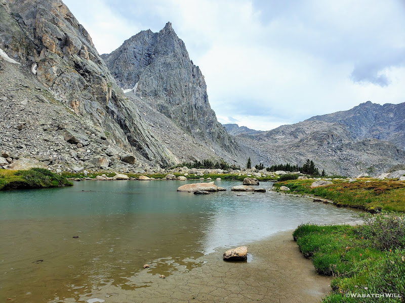
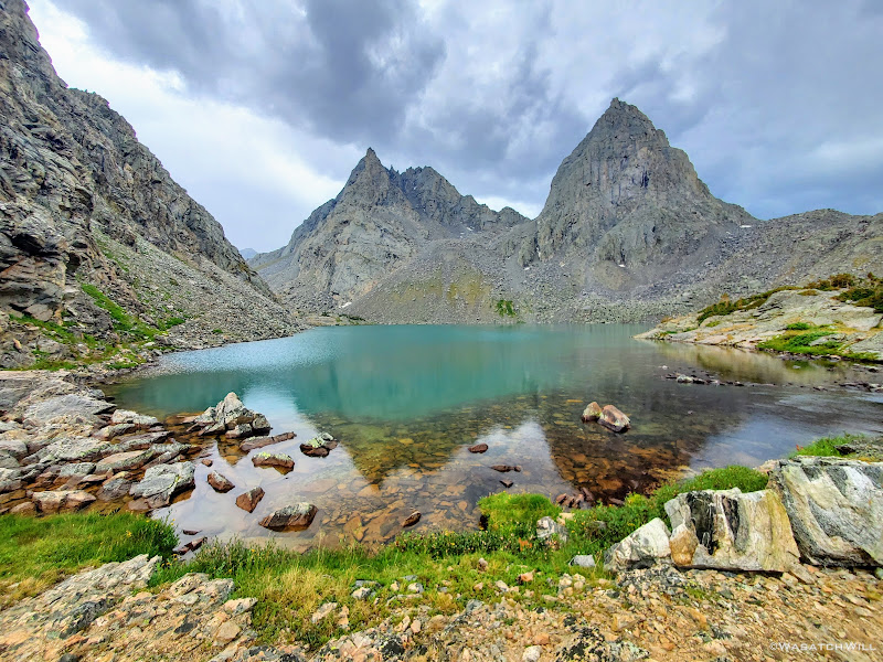
The majestic spires of Titcomb come into full view
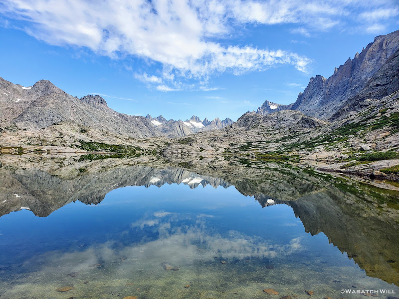
Titcomb reflection from the lower lake
Blake moves ahead toward the upper lake
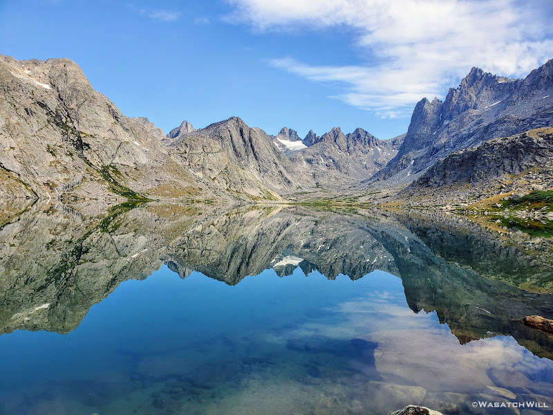
Titcomb reflection from upper lake
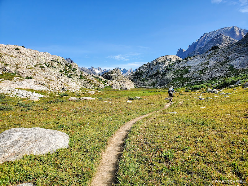
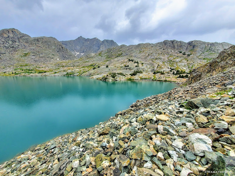
Along the trail into Titcomb we were joined by a handful of other hikers and encountered numerous more both on the trail and around the lakes. Quite a contrast from the prior days since leaving the area of Cirque of the Towers and Shadow Lake. However, after passing both of the Titcomb Lakes, the crowds vanished with them. Once again however, we could feel the temperature quickly rising, and a sweat fest ensued. Indeed, it was setting up to be another hot day, at least for now. What happened to the storm scheduled for today according to the forecast we were given? Well, there was no sign of it in sight...yet.
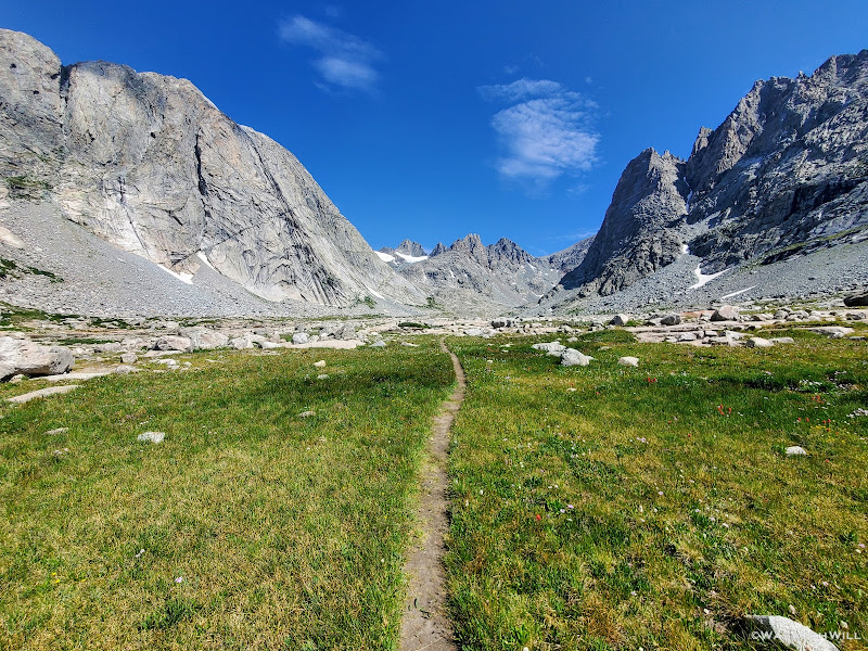
Trail in upper Titcomb with Bobs Towers straight ahead, Buttress at left, Helen at right
Woodrow Wilson, Sphinx, Bob's Towers, and Mariam dominate the ridgeline ahead
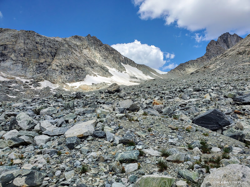
Of course, the whole way up through Titcomb Basin inhibits views of the horizon all around, but particularly the West, where most storms tend to track from. Now at the rocky slopes leading up to Knapsack Col, we jumped into the talus and scree and pressed forward, ever upward.
Knapsack Col comes into view
Twins Glacier
As we neared the top, the clouds we had been expecting began to appear over the ridge. Nothing too dramatic yet though. So close now, we kept going.
Blake on the way up Knapsack, Sacagawea behind, Twins Glacier along the right
Mount Helen (left), Sacagawea (middle), and Twins Glacier resting along the Buttress (right)
There would be one brief snowfield to cross...or whatever was left of a glacier underfoot.
Snowfield at the base of Knapsack Col
Following the snow was a very steep but relatively short stretch of talus to scramble up.
Scrambling up through the talus
A short while later, we had fully ascended the east side of the pass. As usual, the top presented some tasteful views. Back behind us rested Twins Glacier, with Mount Helen and Sacajawea out beyond.
Looking back down from Knapsack Col with Mount Helen, Sacagawea and Twins Glacier all in view
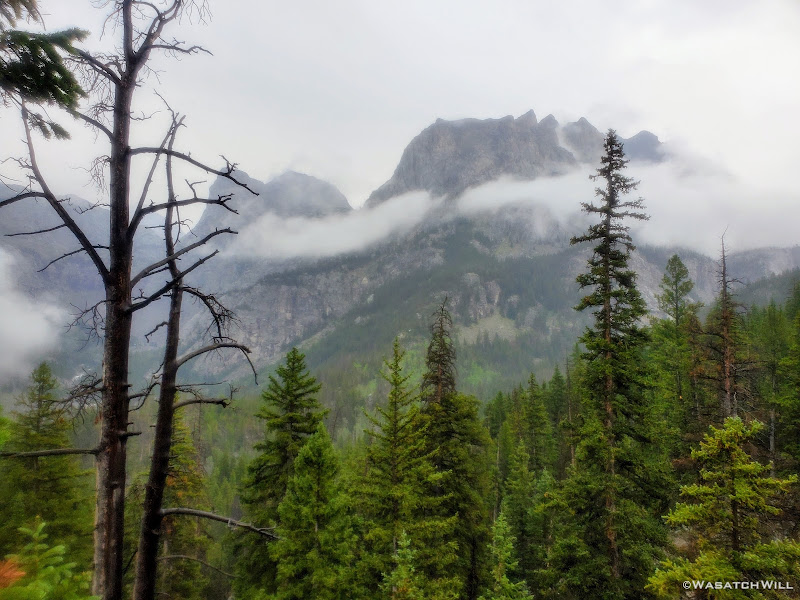
Ahead of us stood the ridgeline consisting of Mount Arrowhead, Bow Mountain, Brimstone Mountain, Sulphur Peak, and Stroud Glacier resting beneath them all.
View west from Knapsack, Arrowhead Peak, Bow Mountain, Sulphur, and Whitecap on right
Closer view west from Knapsack, Sulphur Peak (left) and Whitecap (right)
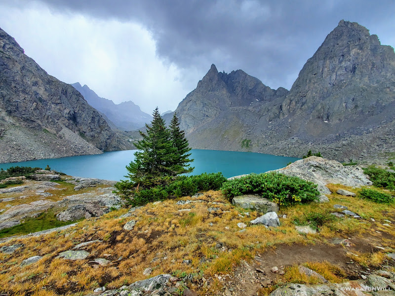
Seeing all the clouds gathering, we didn't linger long. Down the other side we went. As if the walk through Titcomb Basin wasn't beautiful enough, little did we know just how beautiful the next couple miles would be en route to Peak Lake.
Blake leads the way down Knapsack, Arrowhead, Bow, Sulphur Peak and Stroud Glacier up ahead
Looking back up west side of Knapsack
Parry's Primrose flowers with Arrowhead, Bow, and Sulphur Peak beyond
Arrowhead Peak, Bow Mountain, Sulphur Peak and Stroud Glacier
Shortly after coming off Knapsack Col, we crossed over what seemed to be small pools of water emerging from beneath some rocks we had to cross over. This was the birthplace of the Green River. I paused for a moment and marveled at how such a small trickle emerging out of the rocks here was destined to become a much bigger river downstream in just a few miles. And then from there, it would only continue to grow bigger as it flowed all the way down to Flaming Gorge at the border of Wyoming and Utah. And from there, onward through Utah until it would join forces with the mighty Colorado River in the heart of Canyonlands National Park. From there...Lake Powell, and then through the Grand Canyon, to Lake Mead, and finally...perhaps some farmer's field just shy reaching the Earth's largest ocean, the Pacific.
Here lies the source of the Green River
Stepping out onto the rocks to cross the starting point of the Green River (photo by Blake)
Blake continues the way west, Sulphur Peak above left
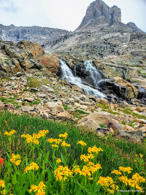
First falls of the Green River
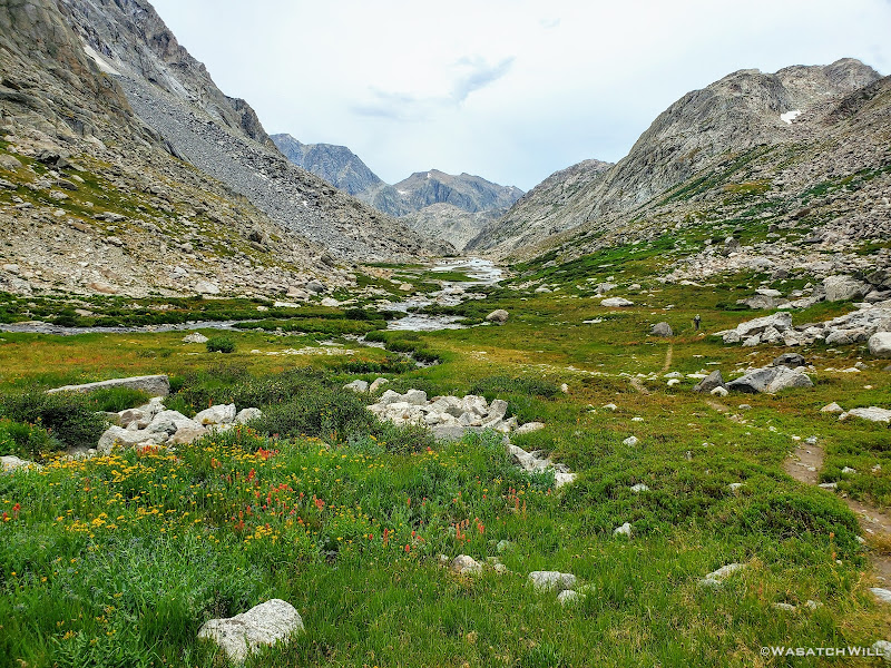
Back down into some tundra
Once down out of the rocks, we found ourselves surrounded by numerous wildflowers.
Arrowleaf Groundsel
A busy bee

Butterfly
So many flowers!
Even an unexpected waterfall showed up to the scene. Absolutely breathtaking!
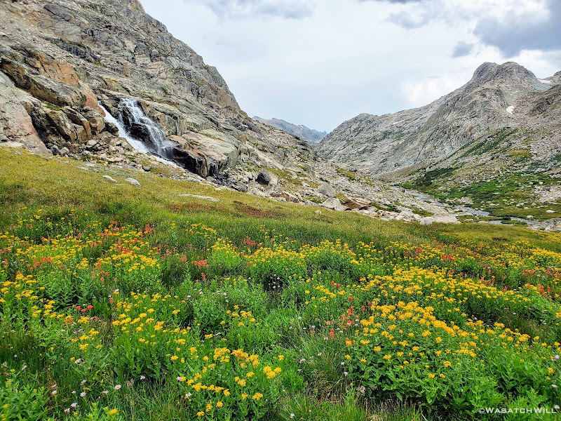
Waterfall and flowers
Waterfall
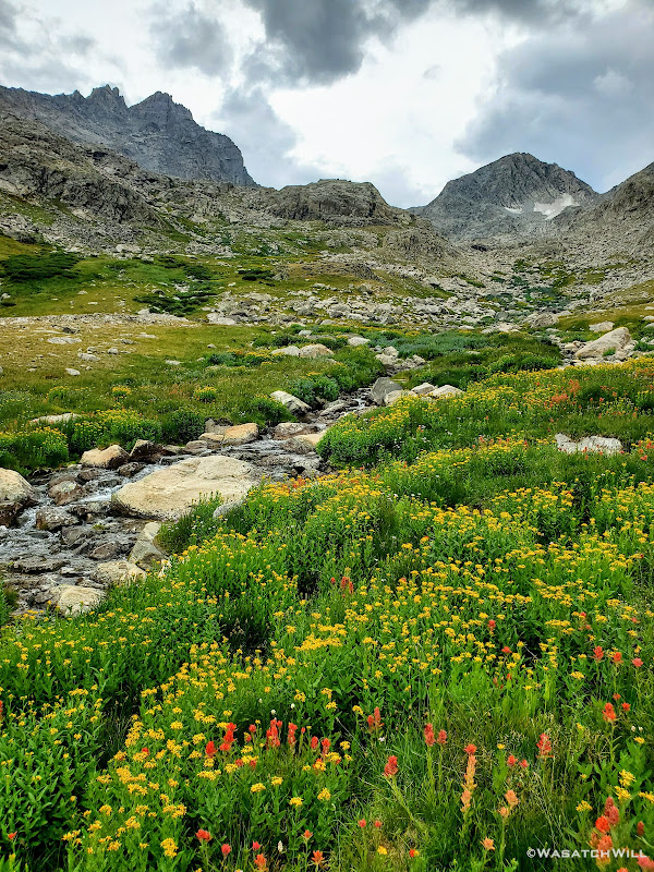
Looking upstream along the upper Green River
Looking downstream along the upper Green River
Looking back up trail at American Legion Peak
Highway to Heaven
Green River flows beside Sulphur Peak
Back into some flowers alongside the Green River
The Green River takes on its namesake beneath Sulphur Peak
As we got close to Peak Lake, rain drops began to fall. Only lightly though...for now.
Stroud Peak comes into view alongside a tarn
As we got passed and around Sulphur Peak, Peak Lake came into view down in the distance.
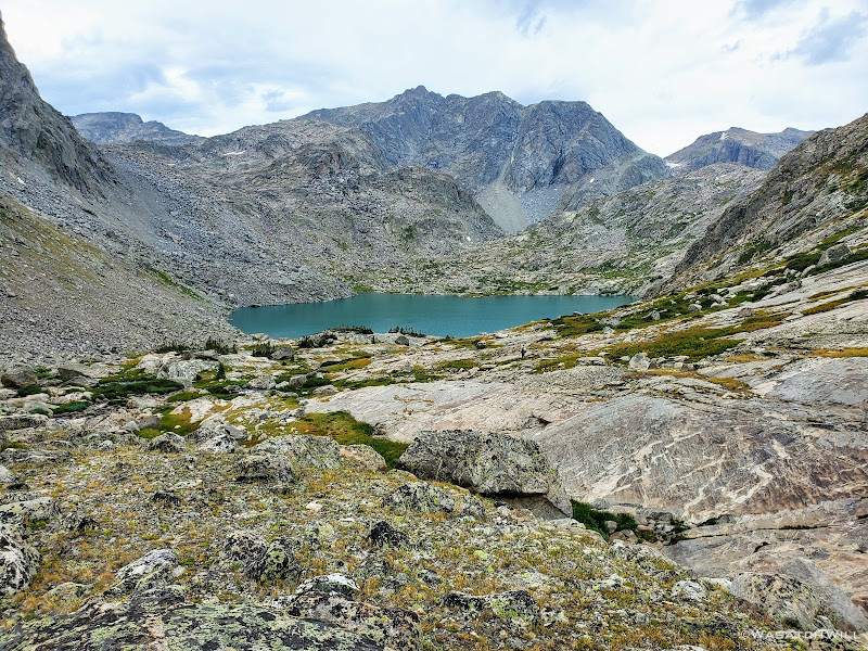
Peak Lake with Mount Oeneis above and beyond
Once at the shore of Peak Lake, we pulled over to enjoy some lunch just as the light rain had backed off for a bit.
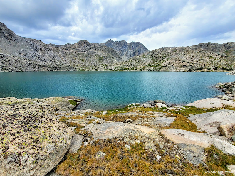
Peak Lake
We combed through another steep slope of rock to get around the other side of the lake and pick up the trail that would take us over Cube Rock Pass.
Rounding around Peak Lake
As we rounded Peak Lake and crossed over its outlet, the clouds above us grew ever more ominous.
Peak Lake with Sulphur Peak and Stroud Peak above
Peak Lake from beneath Cube Rock Pass
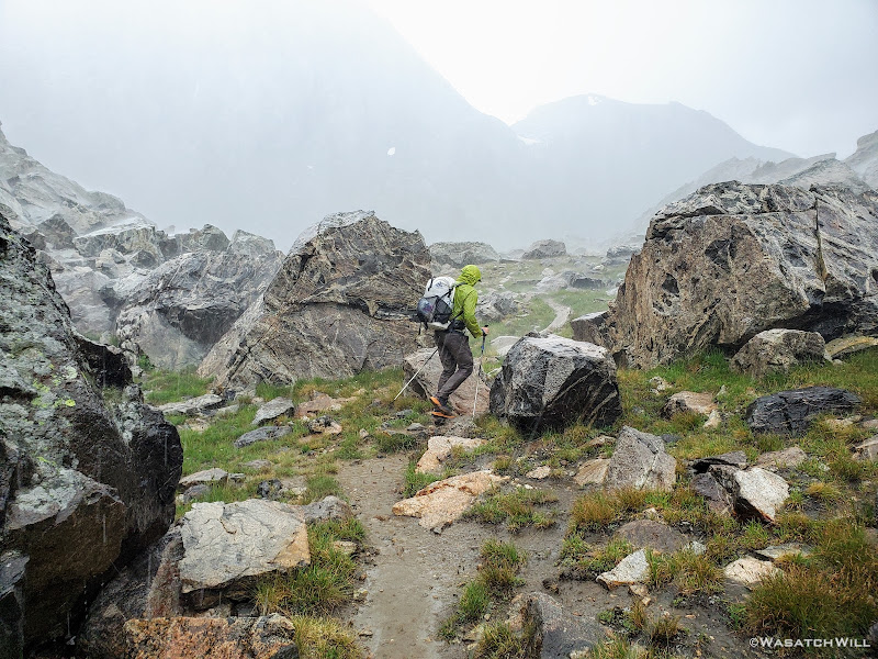
If we could just get over Cube Rock Pass, which was really quite tame relative to every other pass we had conquered thus far, we'd be able to descend down to treeline pretty quickly...or so we thought. After all, according to the map, we were now back on an official trail. Right as we were ascending the pass however, the clouds opened, and not in a gentle-parting way, but in a dump-everything-they've-got on us sort of way. Within the span of just a couple minutes, the trail we were now seemingly flash flooded into a little creek by as much as 4 to 6 inches in spots as the rain and some light hail gushed down about as hard as I ever remember experiencing in the backcountry. Then an occasional flash of light bounced around us. Then the thunder. Yikes!!!
Caught in a storm atop Cube Rock Pass
As if the lightning threat wasn't enough to make us nervous, two huge boulders came tumbling down from the cliffs of Mount Oeneis above and across the canyon as we rounded the corner to begin the descent down the other side of the pass. I now kept my eyes and ears wide open for any such activity that could possibly happen on the side of the canyon we had to descend.
And to add to all that, much to our dismay, the easy to follow trail we had so briefly enjoyed quickly transitioned into another sea of rock. Even very large rock for a bit. Massive boulders would appear among all the talus we were forced to go through, some as large as we'd ever seen along the whole route, that being as big as large vans, sheds, even tiny homes. We had to hop over, scramble over, and otherwise negotiate our way around some of these larger ones. Add wet, slippery and uneven rocks to the list of the other aforementioned hazards we now had to deal with all at the same time.
The rains continue down the other side of Cube Rock Pass
Looking back up the canyon from the trail down Cube Rock Pass
With the rains now lightening up, Blake moves ahead through the final section of the larger talus
Coming down through wet and slick talus (photo by Blake)
Stepping out of the last of the talus (photo by Blake)
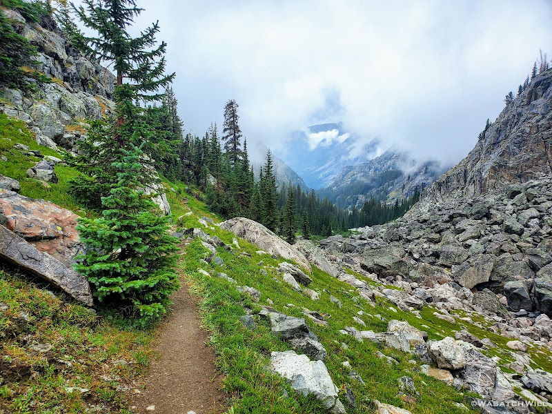
After a escaping the rocks unscathed, our shoes embraced sweet soft grass and an actual trail once again. Not only that but the storm had calmed, the rain had now lightened up, the lightning and thunder now farther back in the distance. Here the mood quickly transitioned from one of angst and anxiety to one of a reverent and pleasant peace and a calm, quiet stillness. All we could do now was stand there and watch in awe as a mystical blanket of clouds rolled away as if Heaven itself was parting a veil to reveal a beautiful gentle trail to guide us onward and grant us admission.
We had survived what would be the last stretch and the most treacherous stretch of talus for us along the whole of the route. And it was now paying off with rich and wondrous scenic rewards. What a place it was to be as the storm lifted.
Taking in the calm after the storm
Mystical Trail
Looking back up into the clouds
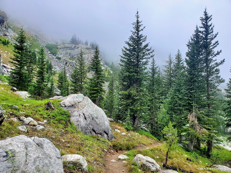
Alas we continued down the trail and into the trees. The atmosphere remained magical.
The payoff
Into the trees
Raindrops glisten on a spruce's needles
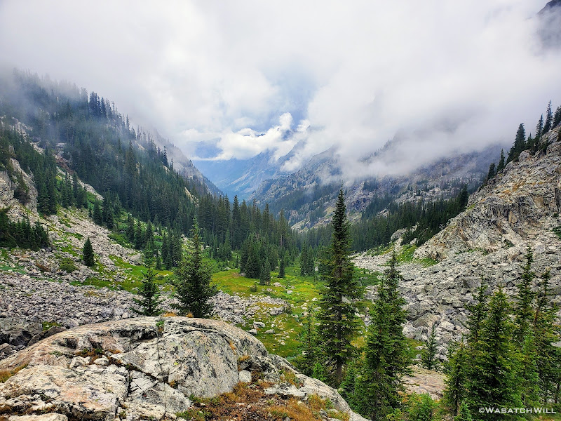
A few moments later and we were treated to an amazing overlook where we could stop and watch the clouds continue to roll across the canyon below.
Another Heavenly view
Blake soaks in the view
And then it was my turn (photo by Blake)
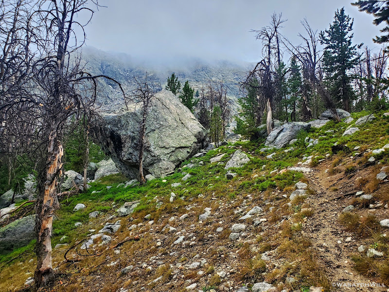
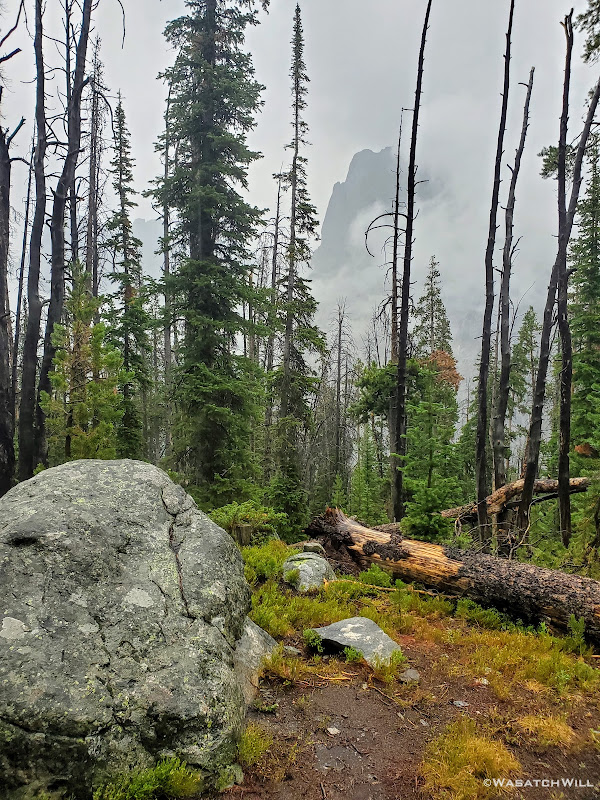
As we continued to make our way downward, we eventually arrived in a meadow where the trail leveled off significantly and then took us through a dense section of forest. It was an amazing contrast to see so many lush, lively and healthy looking trees as compared to that found in the Uinta Mountains back home in Utah. Most all of the forested areas of the Uinta range has been or is currently in the process of being devastated by an infestation of pine beetles, if they haven't already been burned out by recent wildfires.
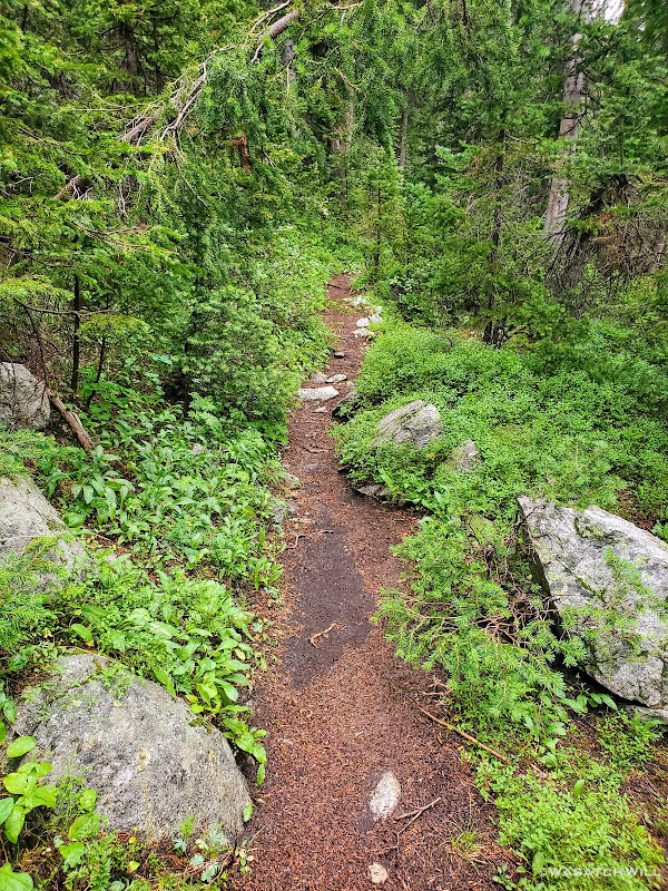
Back into the trees
Somewhere along the way up and over Vista Pass, our final pass and only forested pass of the route, we ran into quite another obstacle course with a bunch of blowdown laying across the trail. Apparently trail crews hadn't managed to reach this section of trail yet to clear it of the debris that resulted from the previous year's big wind event that took place all along the Wind River Range.
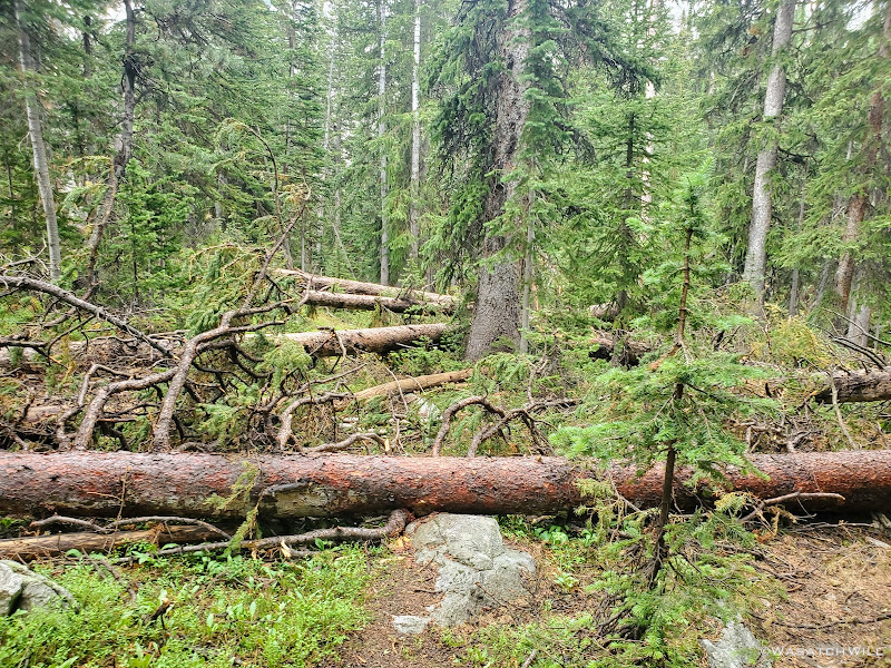
Casualties from the previous year's wind event
Once through all the deadfall, we quickly arrived at the top of Cube Rock Pass and watched as a misty fog danced across the surface of of a large tarn.
A rare patch of dead trees along the crest of Vista Pass
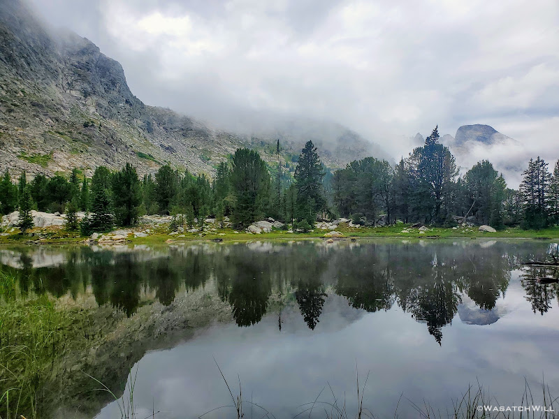
Fog dances across a tarn at Vista Pass
We had plans to camp somewhere along the top of Vista Pass, but there was much daylight left and we figured we ought to use it to close the distance between us and the trailhead so we could a shorter day on the morrow. Or, at least we could push on to Trail Creek Park and camp there for the night.
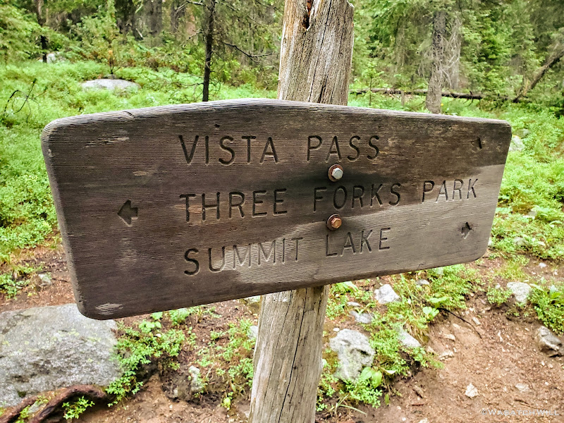
Trail Sign
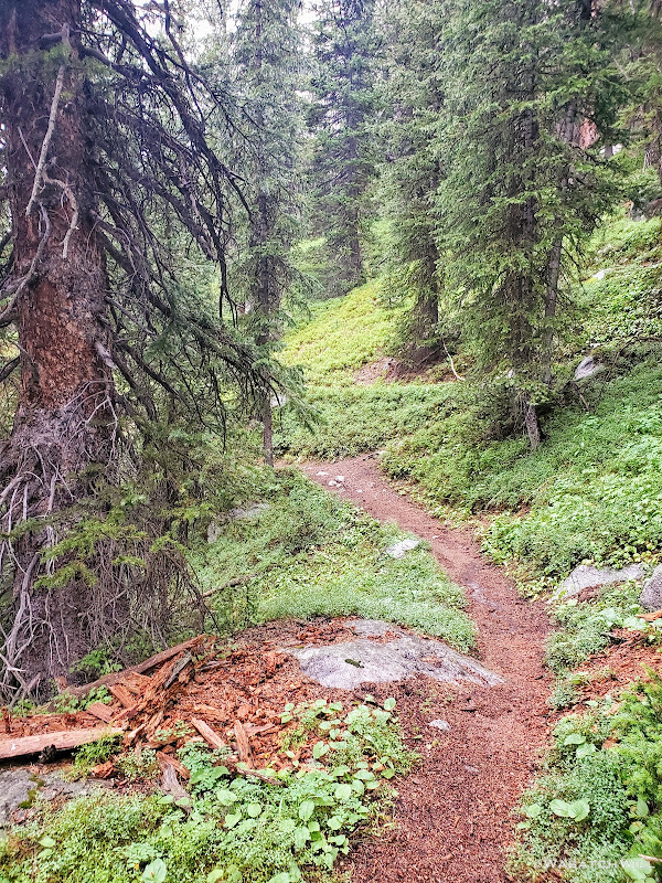
Unfortunately, when we arrived at Trail Creek Park, it was occupied. There setting up camp themselves was a youthful group with a mix of contemporary camp gear and a few horses or mules. While a bit disappointed and now quite exhausted, we forged ahead, taking it as yet another opportunity to move ever closer toward our ending point that was awaiting our arrival on the following day. From here on out, we'd remain in rather dense forest, only interrupted by the occasional meadow or other clearing to give much of any view.
Soft and smooth trail through the forest
Shrouded mountain
As we continued on, we observed that there were numerous trees that had been laying across the trail that looked and smelt like they had been freshly cut allowing passageway through each of them. I became convinced that the group we had passed by at Trail Creek was in fact a trail crew working for the Forest Service. I was no longer disappointed that they had taken over Trail Creek Park. They had been working hard and certainly deserved to have an early rest themselves at that choice site. Had it not been for them, the trail would have been much worse for much longer than the bit we had encountered back on the other side of Vista Pass. Perfect timing that certainly served to benefit us. Perfect timing indeed!
Clouds pull further back to reveal more of the mountains across the canyon
We had now turned our attention to Three Forks Park where we hoped there might be some nice campsites nearby. It turned out there wasn't. What there had been was all closed off by the USFS stating that the sites were in the process of recovering, being rehabilitated, being restored or rejuvenated. One of those 'R' words anyway. Now even more exhausted, we continued to carry on, fingers crossed that Beaver Park further on down trail would serve to be more hospitable and friendly to us.
At one point a resident squirrel dined on some dinner while we could only look forward to eating ours just as soon as we could find a suitable spot to set up camp.
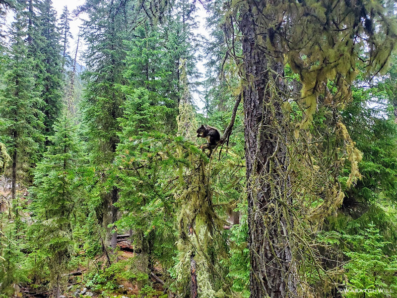
A squirrel enjoys an evening meal
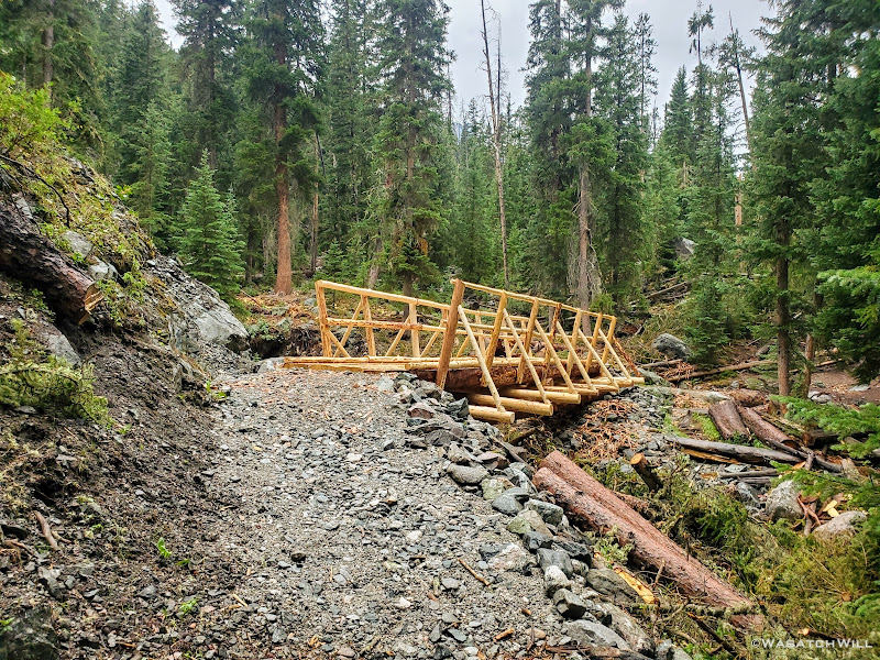
A newly installed bridge
The Green River, now much bigger and stronger
Green River
A stray creek briefly split off from the Green River
At last, after hiking seventeen miles from the confluence of Indian and Titcomb Basins, we arrived at Beaver Park. We were now just 10 miles away from my car, assuming all had gone well with the shuttle company to get it moved from Big Sandy to Green River Lakes at some point earlier in the week. There at Beaver Flat, some fine sites revealed themselves, beckoning us to set up our tents.
The skies had remained overcast since the storm got us earlier in the afternoon. The landscape remained thoroughly soaked with patches of misty fog continuing to linger low in the valley. In other words, there was never any evening sunshine to help dry things up a bit. Despite the overnight rain the previous night, our tents had remained free of condensation having been able to set up on dry ground before the rain moved in on us.
This night was sure to be a different story though. There would be condensation. Boy, would there ever be condensation. And there was simply no escaping it. Whatever. Bring it on! All that mattered now was a warm meal followed by a restful sleep in dry clothes and a warm dry sleeping bag. And that we did. That we enjoyed. The final day of this trip now loomed just a few hours away.
Beaver Park with SquareTop Mountain and Granite Peak both rising up along the left
Bring on the condensation!
To be continued...
Need to catch up?...
WRHR: DAY 1 - BIG SANDY TO CIRQUE OF THE TOWERS
WRHR: DAY 2 - CIRQUE OF THE TOWERS TO DESOLATION VALLEY
WRHR: DAY 3 - DESOLATION VALLEY TO HALLS LAKE
WRHR: DAY 4 - HALLS LAKE TO CAMP LAKE
WRHR: DAY 5 - CAMP LAKE TO TITCOMB BASIN
Wednesday - July 28, 2021
Day 6: Titcomb Basin to Beaver Park
MILES: 17 | GAIN: 2,569 ft
During the course of the night going into the sixth day of this trip, we got hit with our first rain. It was nothing too hard nor for too long. The cloud cover however made for warm conditions through the night. In fact, it ended up being the warmest night of the trip, so warm that I shed off most of my sleeping bag. The base layers I was wearing along with my pad proved to be the only insulation I'd need to keep warm through this particular night.
Morning near Titcomb, Mount Harrower above right
Mount Lester as viewed from camp
Raindrops cling to my Tarptent Notch
Small cascades near camp
Once we were awake and out, we had a big decision to make: Go forth with our original plan to head upward through Titcomb Basin and then up and over Knapsack Col, or bail on that and head down around Island Lake, link up with the Highline trail, and take that straight down to the Green River.
Still feeling a bit battered and bruised from the extra strenuous day before, it wasn't as bad for either of us as it was going to bed. Blake and I were both feeling much more refreshed and in good enough condition to press forward with the former. Yes, Blake's ankle was somehow up to the task as well. The only other thing in question before committing to that was the weather. Well...as the sun arose, the cloud cover quickly dissipated, giving way to clear blue skies.
Knapsack Col was a go! Up into Titcomb we went.
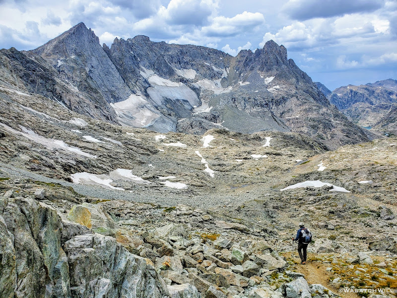
Blake ventures on up into Titcomb Basin
The majestic spires of Titcomb come into full view
Titcomb reflection from the lower lake
Blake moves ahead toward the upper lake
Titcomb reflection from upper lake
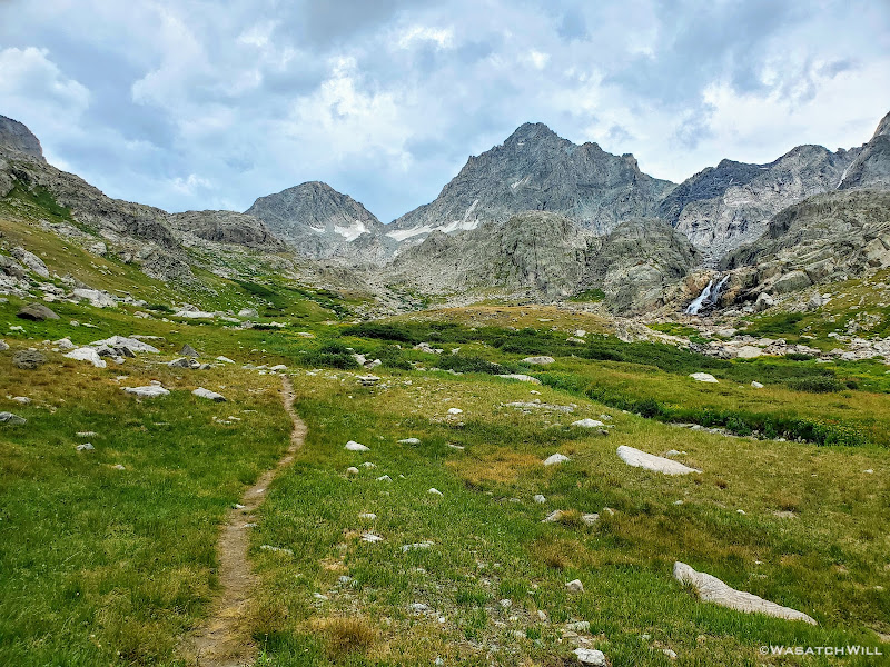
Along the trail into Titcomb we were joined by a handful of other hikers and encountered numerous more both on the trail and around the lakes. Quite a contrast from the prior days since leaving the area of Cirque of the Towers and Shadow Lake. However, after passing both of the Titcomb Lakes, the crowds vanished with them. Once again however, we could feel the temperature quickly rising, and a sweat fest ensued. Indeed, it was setting up to be another hot day, at least for now. What happened to the storm scheduled for today according to the forecast we were given? Well, there was no sign of it in sight...yet.
Trail in upper Titcomb with Bobs Towers straight ahead, Buttress at left, Helen at right
Woodrow Wilson, Sphinx, Bob's Towers, and Mariam dominate the ridgeline ahead
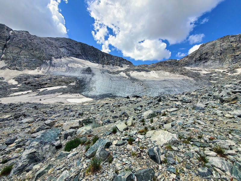
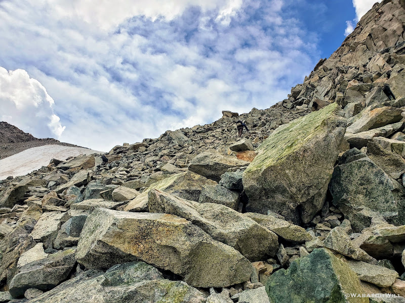
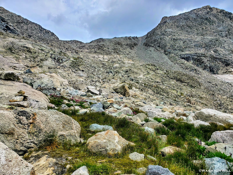
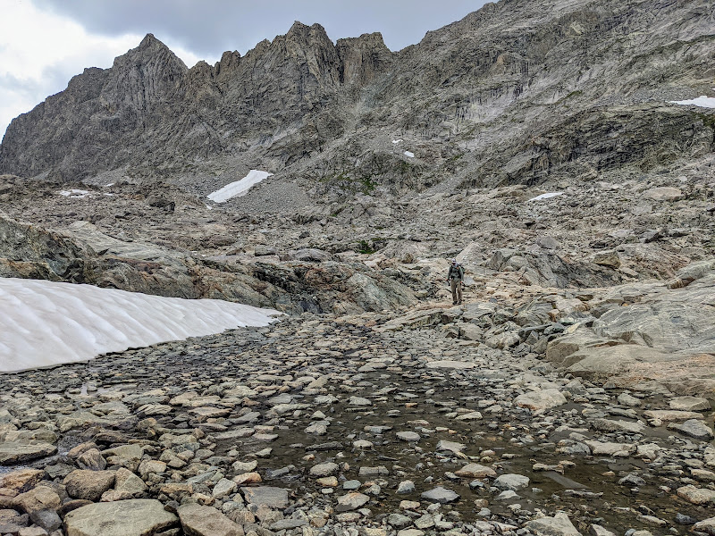
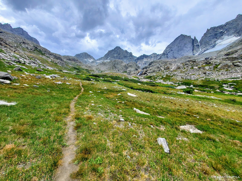
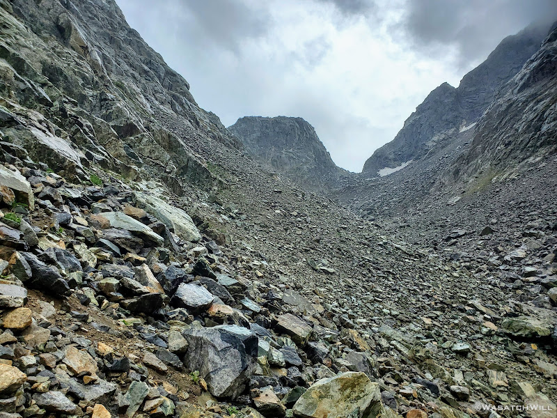
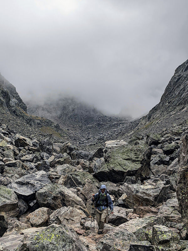
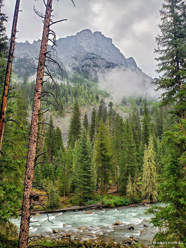
Of course, the whole way up through Titcomb Basin inhibits views of the horizon all around, but particularly the West, where most storms tend to track from. Now at the rocky slopes leading up to Knapsack Col, we jumped into the talus and scree and pressed forward, ever upward.
Knapsack Col comes into view
Twins Glacier
As we neared the top, the clouds we had been expecting began to appear over the ridge. Nothing too dramatic yet though. So close now, we kept going.
Blake on the way up Knapsack, Sacagawea behind, Twins Glacier along the right
Mount Helen (left), Sacagawea (middle), and Twins Glacier resting along the Buttress (right)
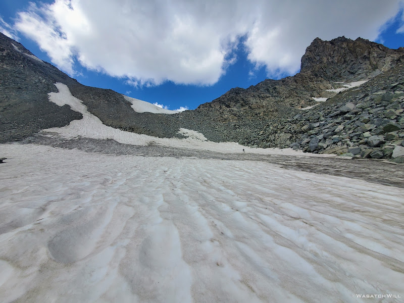
There would be one brief snowfield to cross...or whatever was left of a glacier underfoot.
Snowfield at the base of Knapsack Col
Following the snow was a very steep but relatively short stretch of talus to scramble up.
Scrambling up through the talus
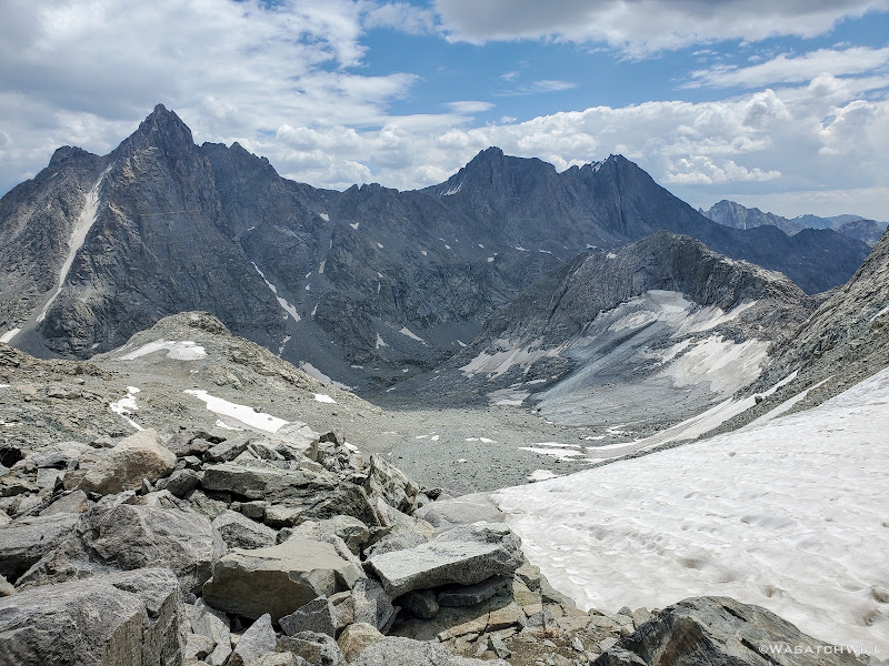
A short while later, we had fully ascended the east side of the pass. As usual, the top presented some tasteful views. Back behind us rested Twins Glacier, with Mount Helen and Sacajawea out beyond.
Looking back down from Knapsack Col with Mount Helen, Sacagawea and Twins Glacier all in view
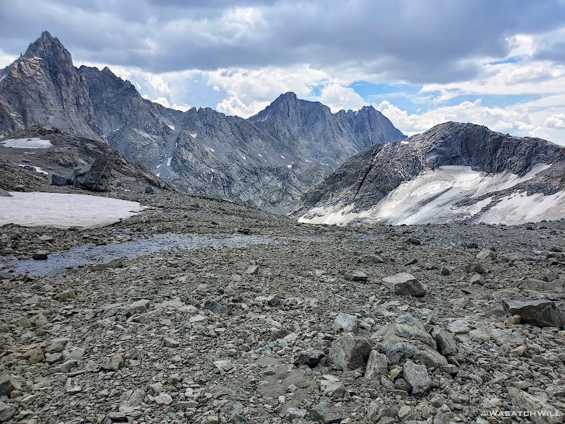
Ahead of us stood the ridgeline consisting of Mount Arrowhead, Bow Mountain, Brimstone Mountain, Sulphur Peak, and Stroud Glacier resting beneath them all.
View west from Knapsack, Arrowhead Peak, Bow Mountain, Sulphur, and Whitecap on right
Closer view west from Knapsack, Sulphur Peak (left) and Whitecap (right)
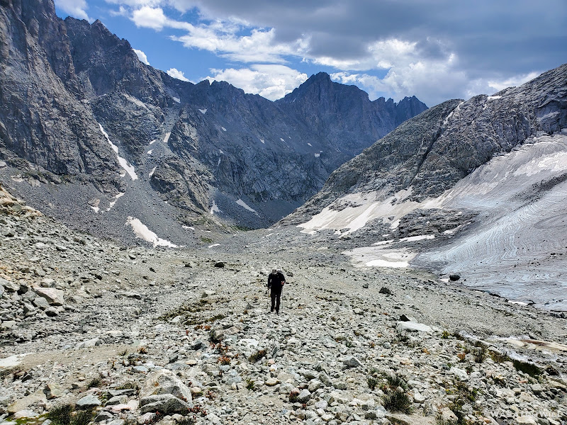
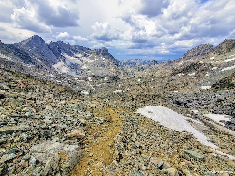
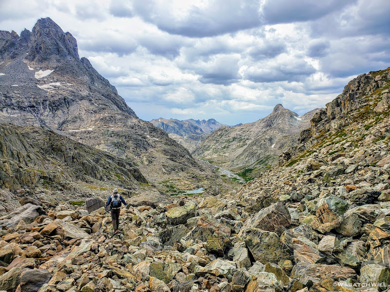
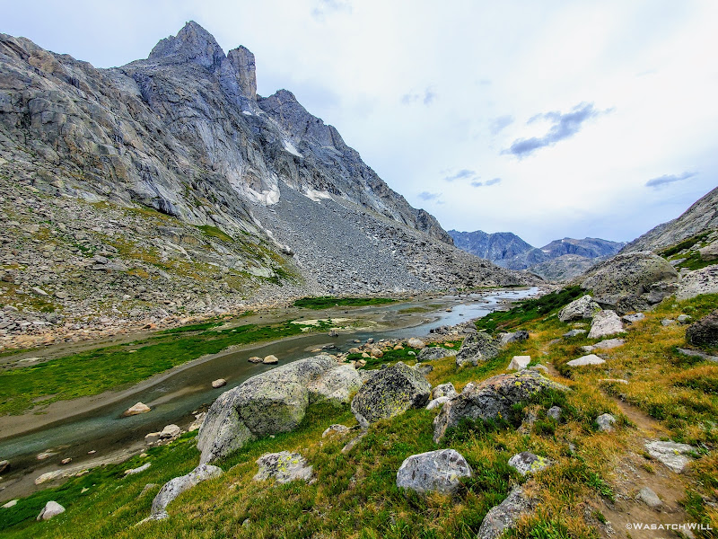
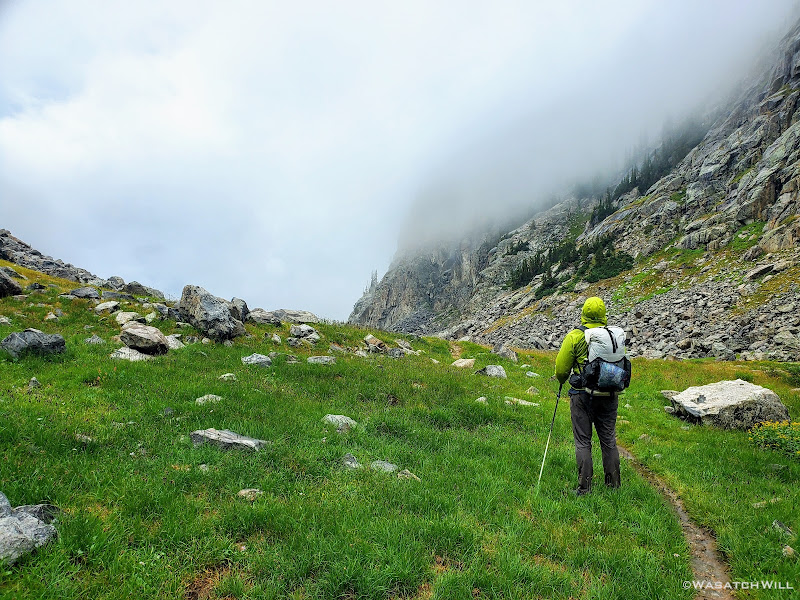
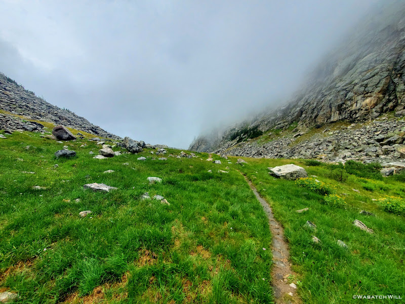
Seeing all the clouds gathering, we didn't linger long. Down the other side we went. As if the walk through Titcomb Basin wasn't beautiful enough, little did we know just how beautiful the next couple miles would be en route to Peak Lake.
Blake leads the way down Knapsack, Arrowhead, Bow, Sulphur Peak and Stroud Glacier up ahead
Looking back up west side of Knapsack
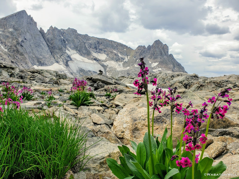
Parry's Primrose flowers with Arrowhead, Bow, and Sulphur Peak beyond
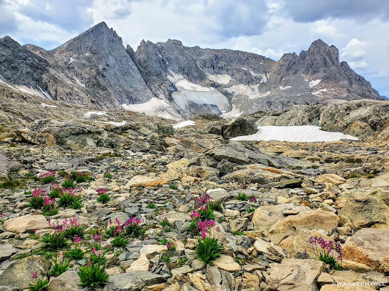
Arrowhead Peak, Bow Mountain, Sulphur Peak and Stroud Glacier
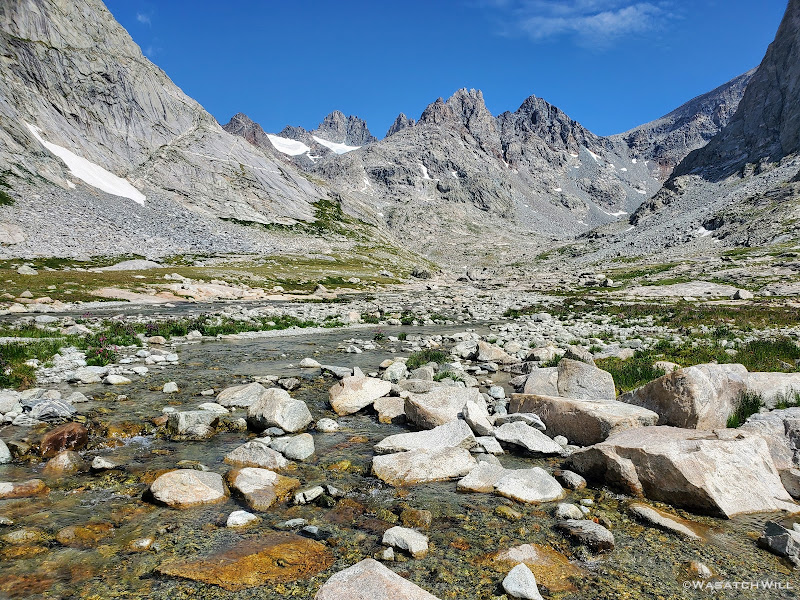
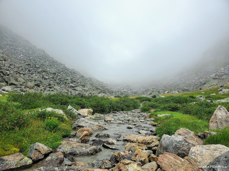
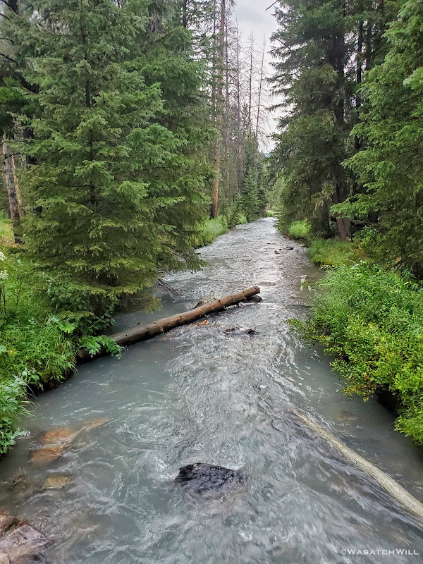
Shortly after coming off Knapsack Col, we crossed over what seemed to be small pools of water emerging from beneath some rocks we had to cross over. This was the birthplace of the Green River. I paused for a moment and marveled at how such a small trickle emerging out of the rocks here was destined to become a much bigger river downstream in just a few miles. And then from there, it would only continue to grow bigger as it flowed all the way down to Flaming Gorge at the border of Wyoming and Utah. And from there, onward through Utah until it would join forces with the mighty Colorado River in the heart of Canyonlands National Park. From there...Lake Powell, and then through the Grand Canyon, to Lake Mead, and finally...perhaps some farmer's field just shy reaching the Earth's largest ocean, the Pacific.
Here lies the source of the Green River
Stepping out onto the rocks to cross the starting point of the Green River (photo by Blake)
Blake continues the way west, Sulphur Peak above left
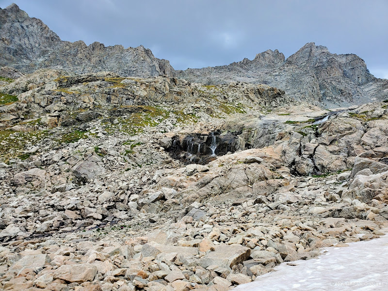
First falls of the Green River
Back down into some tundra
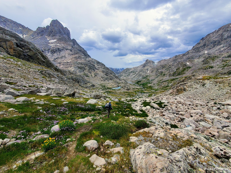
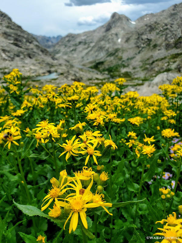
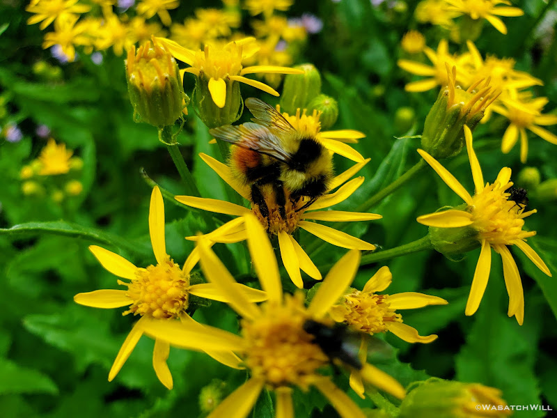
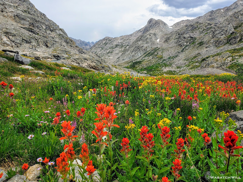
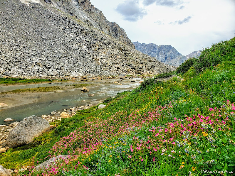
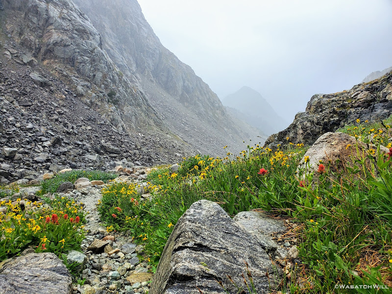
Once down out of the rocks, we found ourselves surrounded by numerous wildflowers.
Arrowleaf Groundsel
A busy bee
Butterfly
So many flowers!
Even an unexpected waterfall showed up to the scene. Absolutely breathtaking!
Waterfall and flowers
Waterfall
Looking upstream along the upper Green River
Looking downstream along the upper Green River
Looking back up trail at American Legion Peak
Highway to Heaven
Green River flows beside Sulphur Peak
Back into some flowers alongside the Green River
The Green River takes on its namesake beneath Sulphur Peak
As we got close to Peak Lake, rain drops began to fall. Only lightly though...for now.
Stroud Peak comes into view alongside a tarn
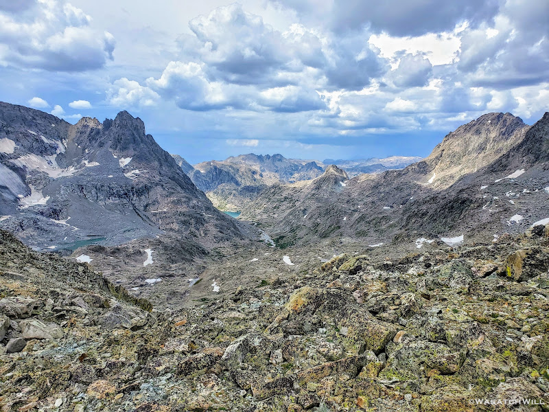
As we got passed and around Sulphur Peak, Peak Lake came into view down in the distance.
Peak Lake with Mount Oeneis above and beyond
Once at the shore of Peak Lake, we pulled over to enjoy some lunch just as the light rain had backed off for a bit.
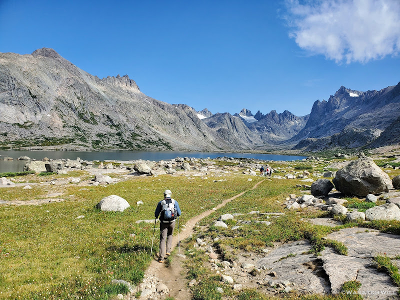
Peak Lake
We combed through another steep slope of rock to get around the other side of the lake and pick up the trail that would take us over Cube Rock Pass.
Rounding around Peak Lake
As we rounded Peak Lake and crossed over its outlet, the clouds above us grew ever more ominous.
Peak Lake with Sulphur Peak and Stroud Peak above
Peak Lake from beneath Cube Rock Pass
If we could just get over Cube Rock Pass, which was really quite tame relative to every other pass we had conquered thus far, we'd be able to descend down to treeline pretty quickly...or so we thought. After all, according to the map, we were now back on an official trail. Right as we were ascending the pass however, the clouds opened, and not in a gentle-parting way, but in a dump-everything-they've-got on us sort of way. Within the span of just a couple minutes, the trail we were now seemingly flash flooded into a little creek by as much as 4 to 6 inches in spots as the rain and some light hail gushed down about as hard as I ever remember experiencing in the backcountry. Then an occasional flash of light bounced around us. Then the thunder. Yikes!!!
Caught in a storm atop Cube Rock Pass
As if the lightning threat wasn't enough to make us nervous, two huge boulders came tumbling down from the cliffs of Mount Oeneis above and across the canyon as we rounded the corner to begin the descent down the other side of the pass. I now kept my eyes and ears wide open for any such activity that could possibly happen on the side of the canyon we had to descend.
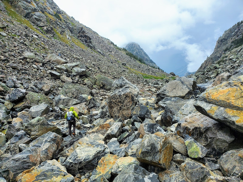
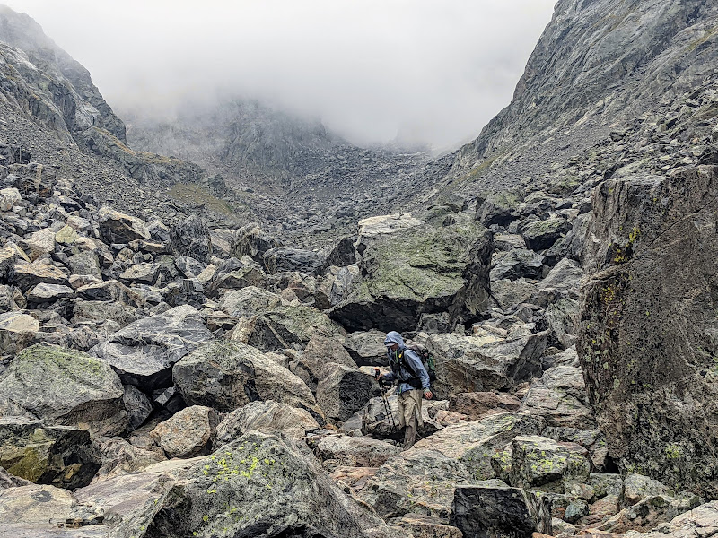
And to add to all that, much to our dismay, the easy to follow trail we had so briefly enjoyed quickly transitioned into another sea of rock. Even very large rock for a bit. Massive boulders would appear among all the talus we were forced to go through, some as large as we'd ever seen along the whole route, that being as big as large vans, sheds, even tiny homes. We had to hop over, scramble over, and otherwise negotiate our way around some of these larger ones. Add wet, slippery and uneven rocks to the list of the other aforementioned hazards we now had to deal with all at the same time.
The rains continue down the other side of Cube Rock Pass
Looking back up the canyon from the trail down Cube Rock Pass
With the rains now lightening up, Blake moves ahead through the final section of the larger talus
Coming down through wet and slick talus (photo by Blake)
Stepping out of the last of the talus (photo by Blake)
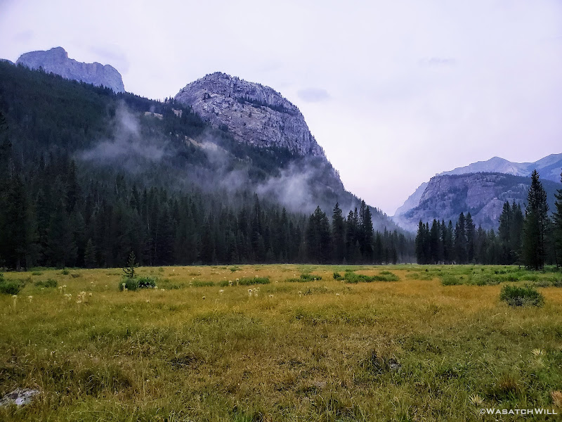
After a escaping the rocks unscathed, our shoes embraced sweet soft grass and an actual trail once again. Not only that but the storm had calmed, the rain had now lightened up, the lightning and thunder now farther back in the distance. Here the mood quickly transitioned from one of angst and anxiety to one of a reverent and pleasant peace and a calm, quiet stillness. All we could do now was stand there and watch in awe as a mystical blanket of clouds rolled away as if Heaven itself was parting a veil to reveal a beautiful gentle trail to guide us onward and grant us admission.
We had survived what would be the last stretch and the most treacherous stretch of talus for us along the whole of the route. And it was now paying off with rich and wondrous scenic rewards. What a place it was to be as the storm lifted.
Taking in the calm after the storm
Mystical Trail
Looking back up into the clouds
Alas we continued down the trail and into the trees. The atmosphere remained magical.
The payoff
Into the trees
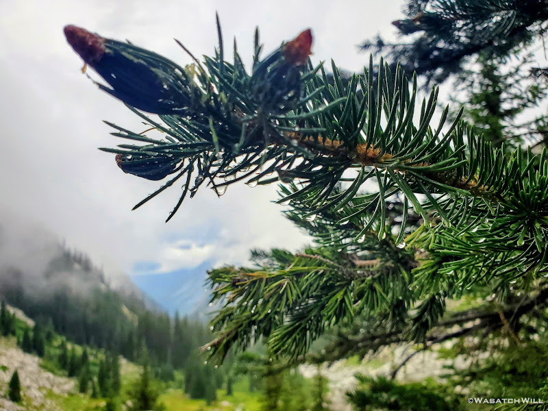
Raindrops glisten on a spruce's needles
A few moments later and we were treated to an amazing overlook where we could stop and watch the clouds continue to roll across the canyon below.
Another Heavenly view
Blake soaks in the view
And then it was my turn (photo by Blake)
As we continued to make our way downward, we eventually arrived in a meadow where the trail leveled off significantly and then took us through a dense section of forest. It was an amazing contrast to see so many lush, lively and healthy looking trees as compared to that found in the Uinta Mountains back home in Utah. Most all of the forested areas of the Uinta range has been or is currently in the process of being devastated by an infestation of pine beetles, if they haven't already been burned out by recent wildfires.
Back into the trees
Somewhere along the way up and over Vista Pass, our final pass and only forested pass of the route, we ran into quite another obstacle course with a bunch of blowdown laying across the trail. Apparently trail crews hadn't managed to reach this section of trail yet to clear it of the debris that resulted from the previous year's big wind event that took place all along the Wind River Range.
Casualties from the previous year's wind event
Once through all the deadfall, we quickly arrived at the top of Cube Rock Pass and watched as a misty fog danced across the surface of of a large tarn.
A rare patch of dead trees along the crest of Vista Pass
Fog dances across a tarn at Vista Pass
We had plans to camp somewhere along the top of Vista Pass, but there was much daylight left and we figured we ought to use it to close the distance between us and the trailhead so we could a shorter day on the morrow. Or, at least we could push on to Trail Creek Park and camp there for the night.
Trail Sign
Unfortunately, when we arrived at Trail Creek Park, it was occupied. There setting up camp themselves was a youthful group with a mix of contemporary camp gear and a few horses or mules. While a bit disappointed and now quite exhausted, we forged ahead, taking it as yet another opportunity to move ever closer toward our ending point that was awaiting our arrival on the following day. From here on out, we'd remain in rather dense forest, only interrupted by the occasional meadow or other clearing to give much of any view.
Soft and smooth trail through the forest
Shrouded mountain
As we continued on, we observed that there were numerous trees that had been laying across the trail that looked and smelt like they had been freshly cut allowing passageway through each of them. I became convinced that the group we had passed by at Trail Creek was in fact a trail crew working for the Forest Service. I was no longer disappointed that they had taken over Trail Creek Park. They had been working hard and certainly deserved to have an early rest themselves at that choice site. Had it not been for them, the trail would have been much worse for much longer than the bit we had encountered back on the other side of Vista Pass. Perfect timing that certainly served to benefit us. Perfect timing indeed!
Clouds pull further back to reveal more of the mountains across the canyon
We had now turned our attention to Three Forks Park where we hoped there might be some nice campsites nearby. It turned out there wasn't. What there had been was all closed off by the USFS stating that the sites were in the process of recovering, being rehabilitated, being restored or rejuvenated. One of those 'R' words anyway. Now even more exhausted, we continued to carry on, fingers crossed that Beaver Park further on down trail would serve to be more hospitable and friendly to us.
At one point a resident squirrel dined on some dinner while we could only look forward to eating ours just as soon as we could find a suitable spot to set up camp.
A squirrel enjoys an evening meal
A newly installed bridge
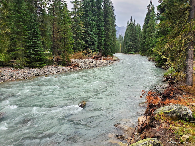
The Green River, now much bigger and stronger
Green River
A stray creek briefly split off from the Green River
At last, after hiking seventeen miles from the confluence of Indian and Titcomb Basins, we arrived at Beaver Park. We were now just 10 miles away from my car, assuming all had gone well with the shuttle company to get it moved from Big Sandy to Green River Lakes at some point earlier in the week. There at Beaver Flat, some fine sites revealed themselves, beckoning us to set up our tents.
The skies had remained overcast since the storm got us earlier in the afternoon. The landscape remained thoroughly soaked with patches of misty fog continuing to linger low in the valley. In other words, there was never any evening sunshine to help dry things up a bit. Despite the overnight rain the previous night, our tents had remained free of condensation having been able to set up on dry ground before the rain moved in on us.
This night was sure to be a different story though. There would be condensation. Boy, would there ever be condensation. And there was simply no escaping it. Whatever. Bring it on! All that mattered now was a warm meal followed by a restful sleep in dry clothes and a warm dry sleeping bag. And that we did. That we enjoyed. The final day of this trip now loomed just a few hours away.
Beaver Park with SquareTop Mountain and Granite Peak both rising up along the left
Bring on the condensation!
To be continued...
Need to catch up?...
WRHR: DAY 1 - BIG SANDY TO CIRQUE OF THE TOWERS
WRHR: DAY 2 - CIRQUE OF THE TOWERS TO DESOLATION VALLEY
WRHR: DAY 3 - DESOLATION VALLEY TO HALLS LAKE
WRHR: DAY 4 - HALLS LAKE TO CAMP LAKE
WRHR: DAY 5 - CAMP LAKE TO TITCOMB BASIN
Last edited:
")