- Joined
- Jul 23, 2013
- Messages
- 1,666
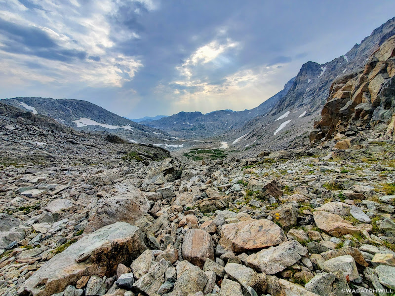
Scramble over talus, climb up a rise, go around a lake, traverse across snow or ice,...wash, rinse and repeat. Such was the pattern for much of Day 5 along this Wind River high route.
Tuesday - July 27, 2021
MILES: 10.5 | GAIN: 2,717 ft
Day five...AKA...Alpine Lakes Day. This was the day I had been most anxious about but also among one of the days I was most looking forward to. How would the weather be on us? Would it be blazing hot and sunny again or would we get caught in our first storm of the trip before making it over either of the two passes we needed to get over to get to Indian and Titcomb Basin? Just how heinous and tedious was it to move through the basin holding the Alpine Lakes. Was it as bad as its reputation makes it out to be? What of Knifepoint Glacier awaiting us on the other side? What were its conditions like? And perhaps most importantly now...How was Blake's ankle going to be after his mishap with it the day before?
Well, all those questions and then some were about to be answered as the day dragged on....
When we awoke, red clouds were drifting over Douglas Peak. You know what they say..."Red in the morning, sailors take warning. Red at night, sailors' delight." Ummm...uh oh.
Red clouds over Douglas Peak
As soon as the sun was fully up though, the clouds almost instantly disappeared, giving way to a mostly clear sky yet again.
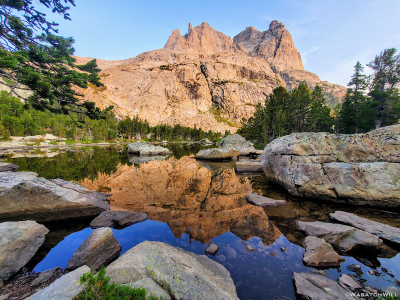
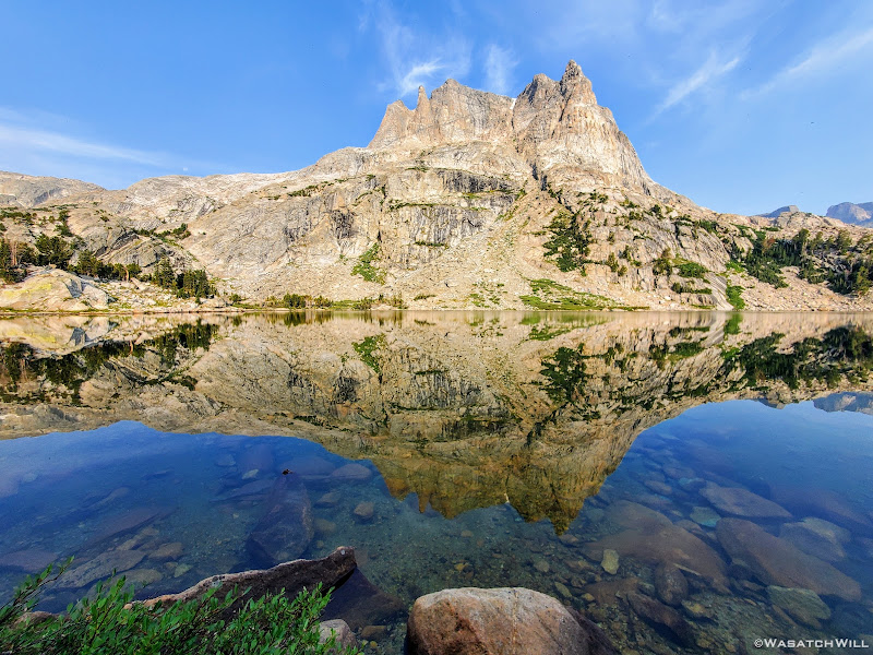
Douglas Peak reflects on a nearby tarn
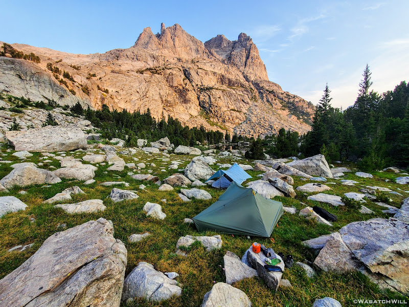
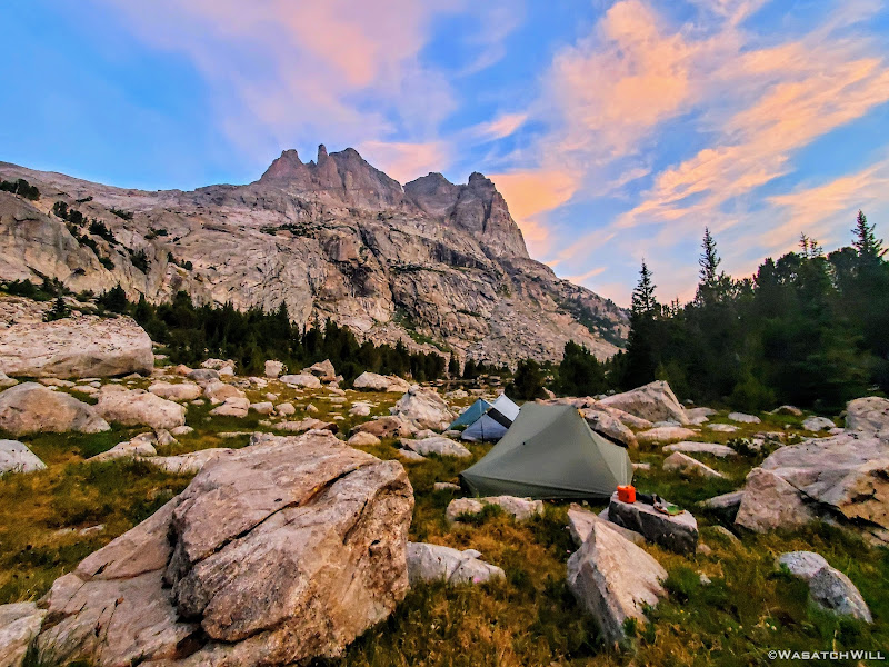
Bluer skies above camp
Given the situation with Blake's ankle from the day before and what was on our agenda for this new day, it should be known that I, being a person of faith, had prayed the night before on behalf of Blake that his ankle would be strong enough to get through the rest of the route and if not, at least back out to safety. And really, that was the most important of what I could ask for, that we'd have the wisdom to make good decisions and the strength and ability to stay safe. Whether we turned back around from here or not, we would have to go over two big passes to get to either of the nearest trailheads along with at least some boulder hopping.
Well, on this morning, Blake's ankle, while not looking great, was a go. He assured me that it looked worse than it felt and that he was feeling confident he could continue ahead as planned. So, not wanting to delay any further, we packed up and got going just before 8AM. Fingers were crossed we wouldn't end up regretting that we did not break camp two hours sooner. Our first mile of the day would take us around Camp Lake, across its outlet, up a short rise, and over to a small nameless lake where the on-ramp for our entry into Alpine Lakes basin awaited us.
Douglas Peak and Douglas Lake
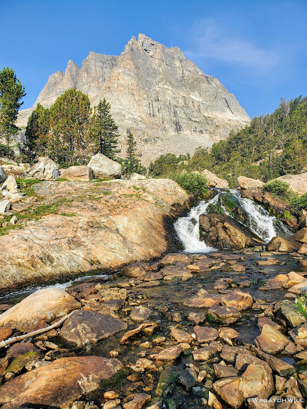
Waterfall along outlet of Douglas Lake
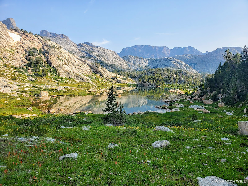
Small nameless lake
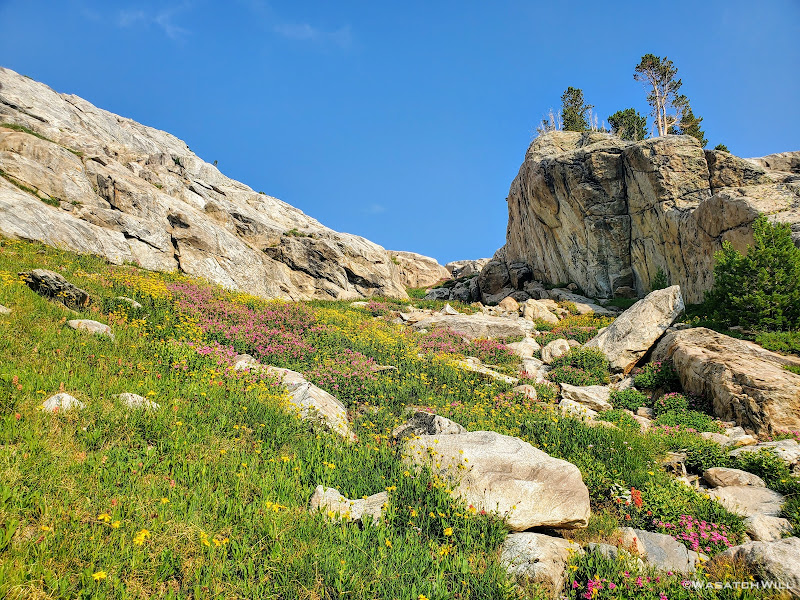
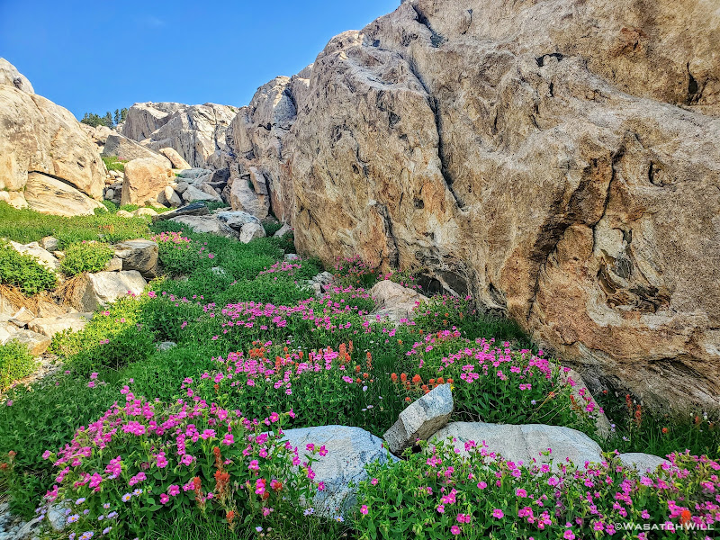
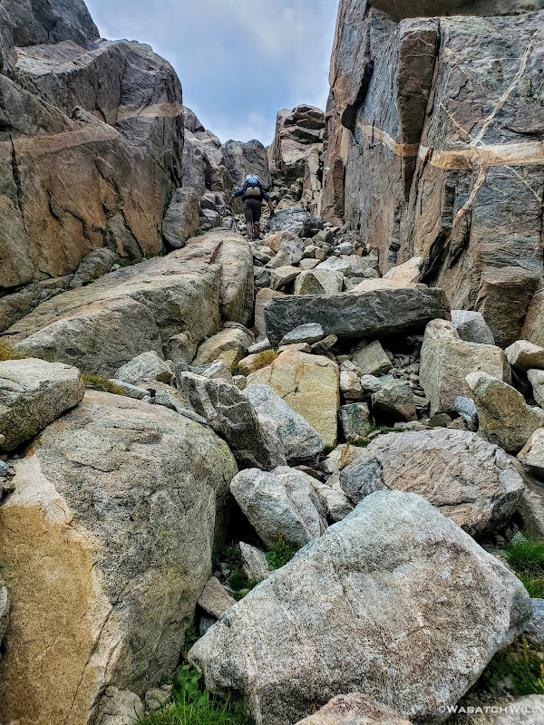
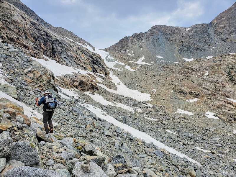
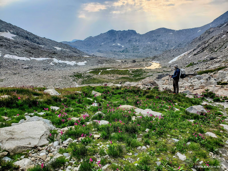
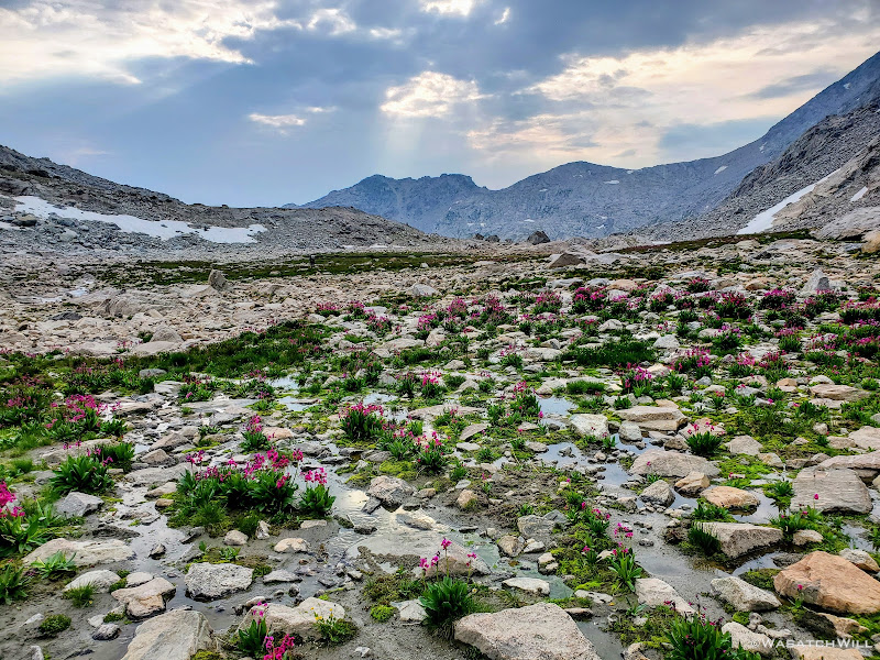
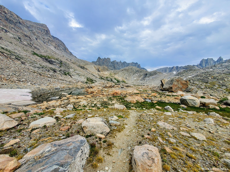
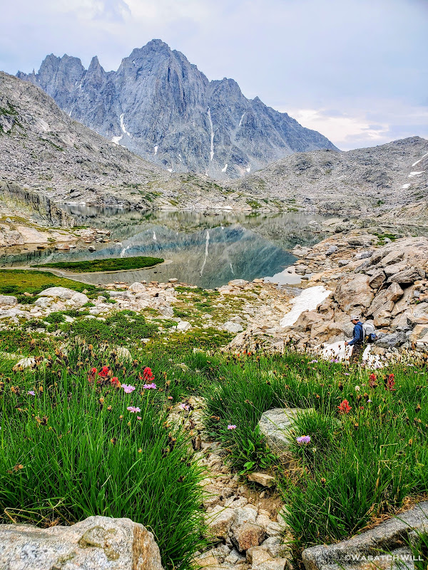
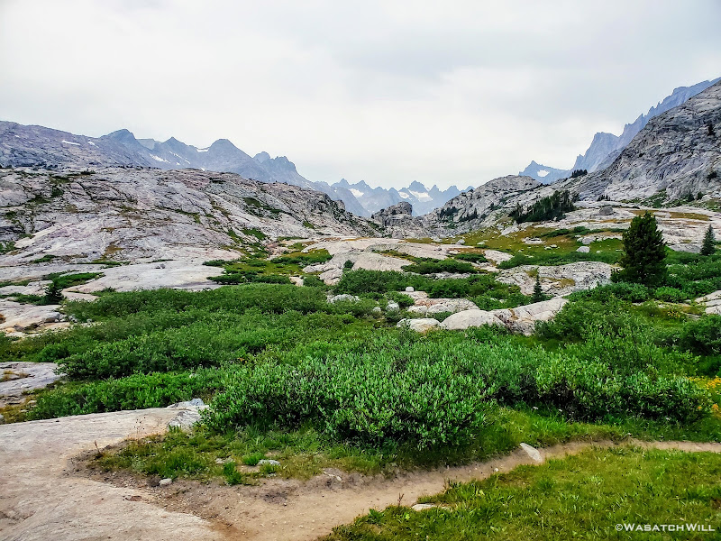
The trail that had led us toward Camp Lake continued along its eastern shore and around to its outlet. Across the outlet, we had a bit of trouble looking for any established pathway up the short rise we had to gain. Eventually we stumbled into what became a use trail that took us the rest of the way over to the small nameless lake where it then vanished into big granite slabs and ramps that would officially take us up into Alpine Lakes Basin. We probed them for a moment and found a weakness in them, a little mini canyon of sorts, that allowed us to prolong having to get up on the granite itself just a little bit more. While we mostly just chose it because it appeared to be a path of least resistance, it also turned out to be filled with flowers which gave it a beautiful and colorful accent.
Flowers blanket the ground beneath the slabs. Bonus points if you can find Blake in this photo! (hint: click to enlarge)
Into the flower carpeted corridor. More bonus points if you can find where Blake has moved to in this photo!
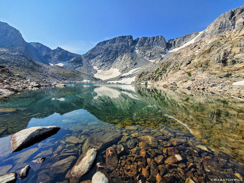
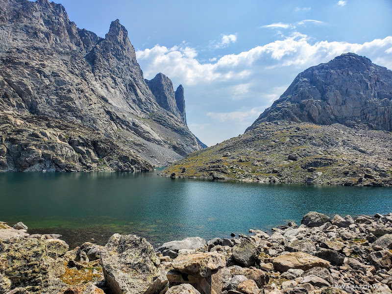
But it didn't go for long. At the end was a pile of rock rubble we scrambled up to get onto the steep granite slabs which we'd use as ramps to continue gaining in elevation. Fortunately they were as dry as could be so the traction under our feet was great. As we worked our way up, the views to the side and behind us really started to open up. To the east was the Fortress (a large and impressive granite butte that even looked a bit like Utah's Factory Butte from one angle) and then below that, the edge and outlet of the lower Alpine Lake (Lake 10895) came into view. While our eyes were growing with more excitement, our lungs were not.
The Fortress (top left) stands guard above granite ramp leading up to Alpine Lakes
The lower lake comes into view beneath The Fortress
Looking back down the rises we had gained
Once we crested over the slabs, we had a brief stretch of relief where the ground leveled out. Here, our lungs were now able to enjoy a few moments of excitement too.
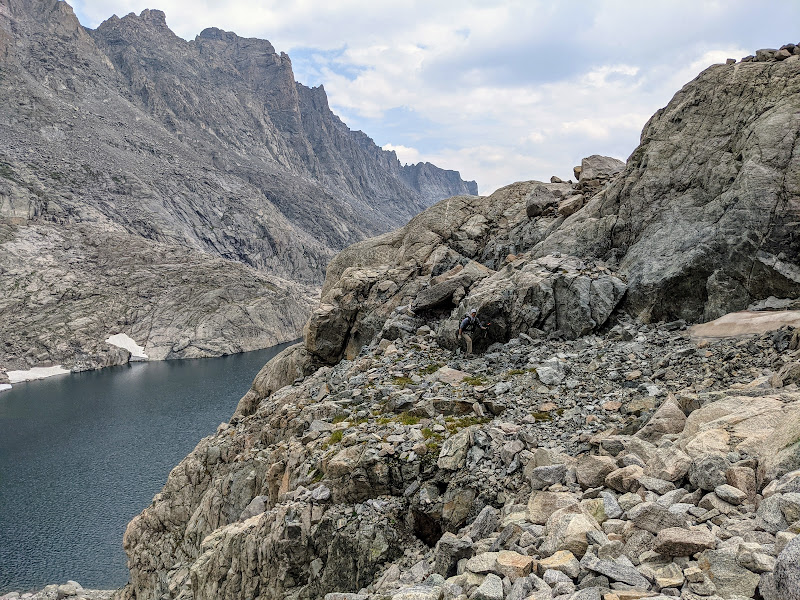
We now had three points of direction we could travel. To our right, we could head over to the outlet of the lower lake, cross over it, and stay true to the original Dixon/Wilson route. However, once around to the north side of the lake, there would be a ledge that would require a short class 4 downclimb to maintain progress. Option two lied straight ahead, where we could go straight to the southern shoreline of the lake and follow it around the south side before turning a corner to head more northerly along its west side. However, that too was certain to present a challenge, requiring some some careful scrambling along a little cliffy section that stood a good chance to force us into the lake itself for a waist-high wader for some 20, 30, or maybe even 40 feet. And to our left, was our final option: Head uphill over a small pass to bypass both of the other options and join up with the southern shoreline of the lower lake further to the west. We opted for the latter choice.
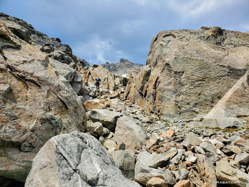
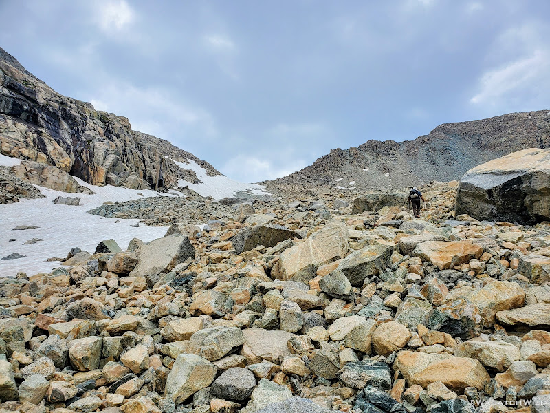
Blake continued on for a bit while I sought out a good spot to top off my water. I was able to wander out to a small creek to do that before rejoining Blake for some more uphill action. This time, instead of smooth granite slabs to continue taking us up however, it was back to talus and tundra. Not so bad, but we were now just eager to get over it and be done with it so we could start making some real progress up through the basin.
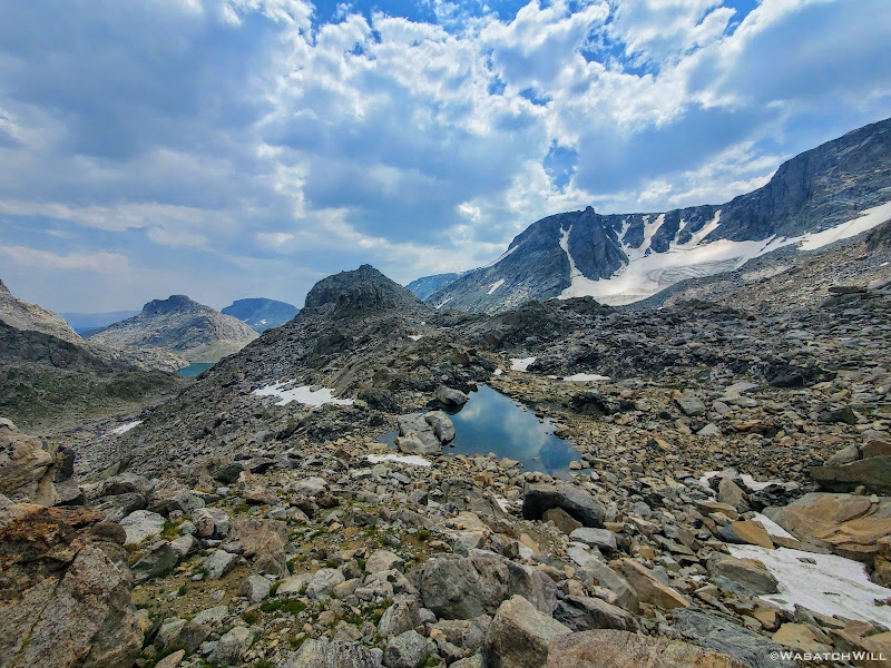
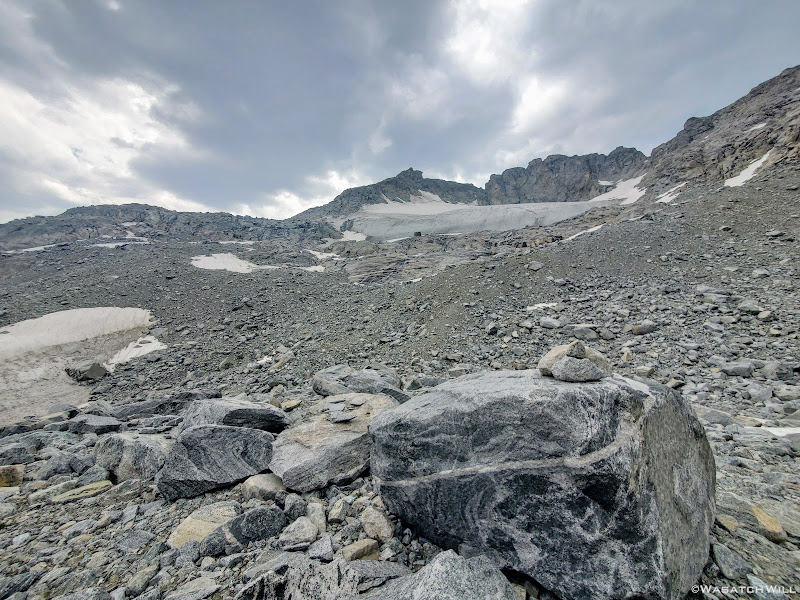
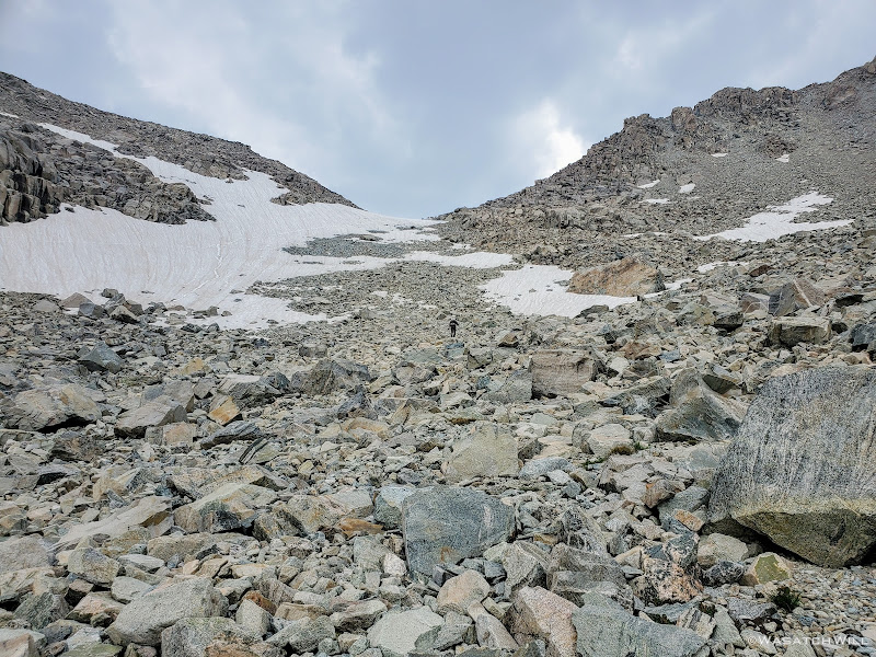
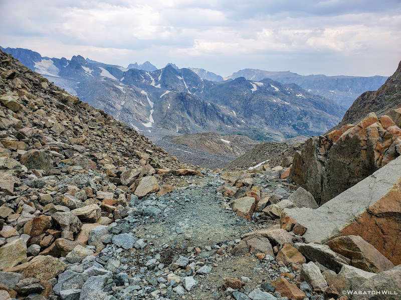
'Alpine Lakes Pass' as many refer to it by, or even just 'Alpine Pass' as I prefer to call it, was now four miles away across a mostly barren and desolate basin. It was the first of the two major passes that stood between us our goal for the day. With no trail to follow we were once again left to pick our own way around three large alpine lakes (literally!) and a handful of tarns both big and small. In between and all around these various bodies of water sat virtually nothing but tons and tons of talus, some scree, some snow, and a moraine. Intermixed with some of all that were a few patches of grassy tundra and granite slabs here and there to give our feet any sort of relief in the rough and unforgiving terrain that now lay ahead of us.
Arriving at the top of a small pass
Once across the small pass, we were faced with our first of many large sections of rock hopping to come. We carefully traversed and descended the talus gradually until it terminated at the outlet of a large tarn. From there we had a beautiful view back up over Douglas Pass and what we would have descended had we taken a Skurka detour there over 'Douglas Pass' rather than around Douglas Peak and and Camp Lake.
Large tarn with Douglas Pass beyond
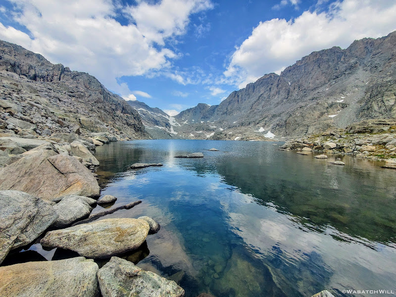
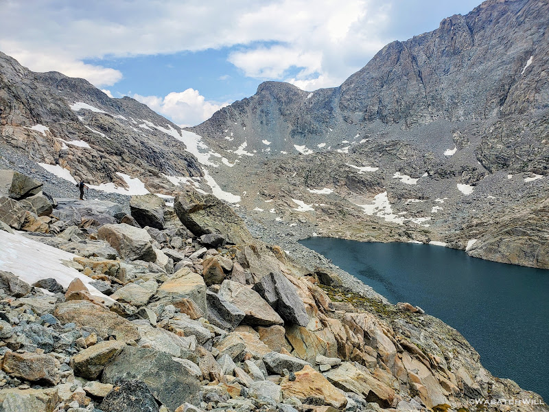
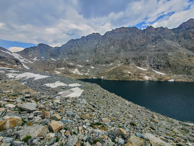
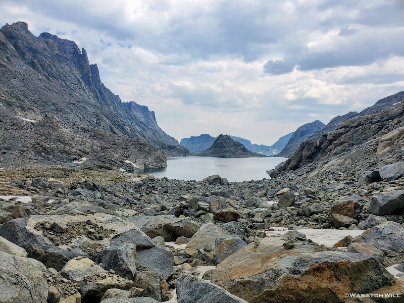
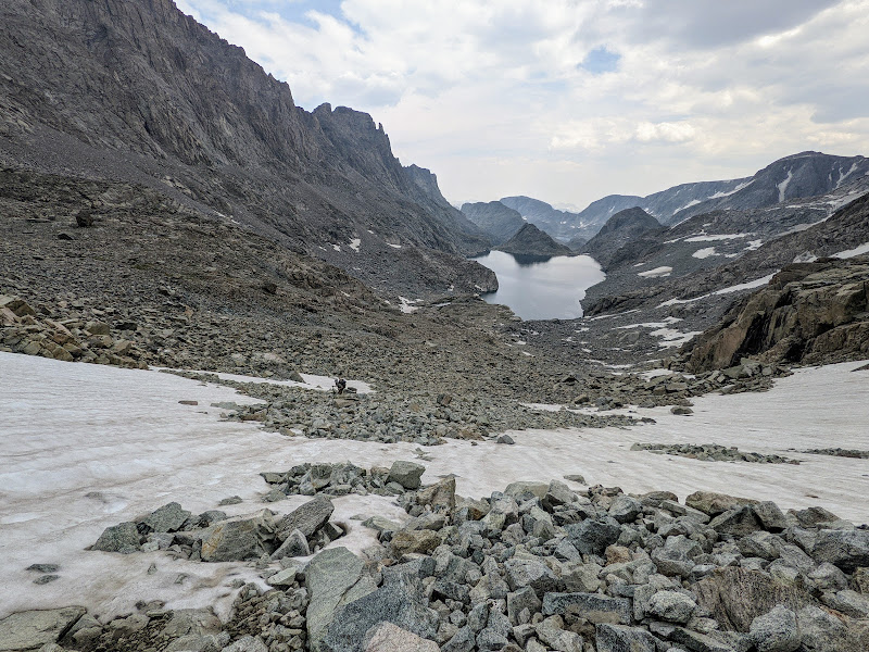
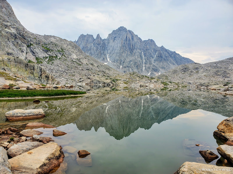
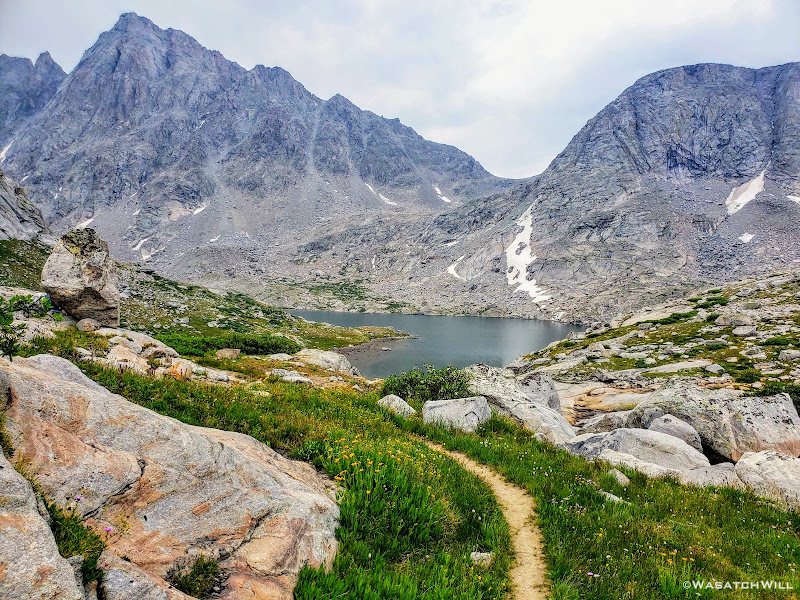
There at the tarn's outlet we crossed over and then followed it down to its junction with the lower and larger of the Alpine Lakes, Lake 10895. It was there that we got our first real good wide open view of Alpine Pass way out in the distance.
Look toward Alpine Pass from the edge of the lower lake
Rounding the corner of the lower lake, Brown Cliffs begin to come into view (upper right horizon)
Getting around the first big lake was not too terrible. It was really just long and monotonous hopping over more typical talus only interrupted by one brief snowfield to cross over. The snow had just enough time under the morning sun to soften up enough and allow good footholds on it. As usual, extra care was required getting on and off of it. I have found that the edges of snowfields and drifts laying atop a pile of talus, such as this one was, are usually the softest and most dangerous at their edges where the potential and risk for post holing, falling through, and jamming your foot/leg into the rocks underneath is much greater.
Snowfield to cross
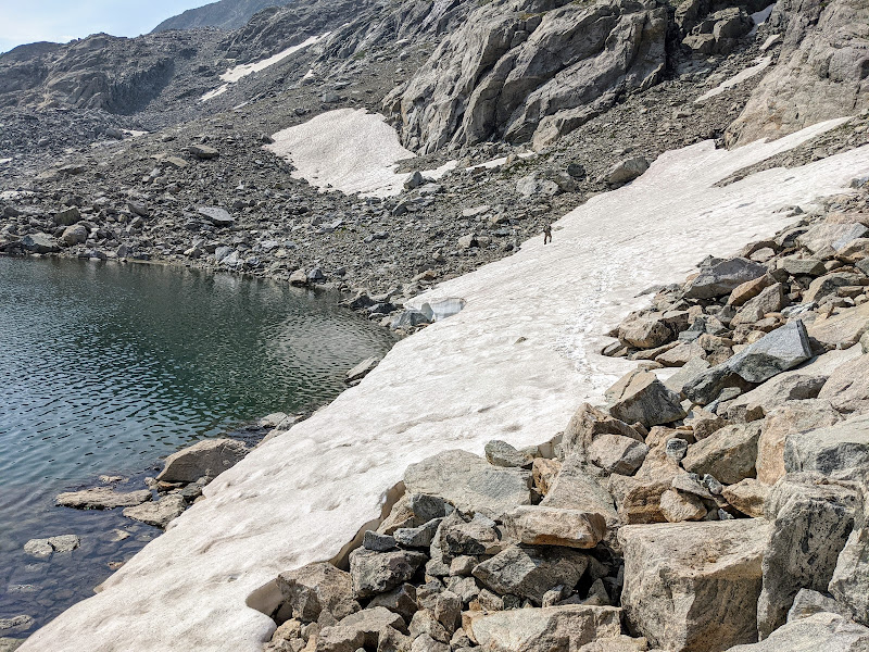
Crossing over the snowfield (photo by Blake)
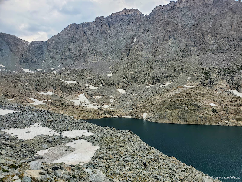
Aqua blue tarn with Brown Cliffs above and beyond
Having passed the larger and lower lake, our sights were now set on getting to the middle lake, or Lake 10988. Here we'd enjoy some of those rare grassy patches of tundra, giving our hardworking legs and feet some brief recesses between more fields of large rocks, even larger boulders, and an occasional slab of granite.
Blake making his way over talus above the lower lake
It was now about high noon and the sun was really heating things up again. We had been so eager to get through this basin we had neglected to pull over for any sort of snack break since leaving camp. We were now running on empty and getting low on water again so it was with great joy when we pulled over for a lunch break at the middle lake.
If ever there was a spot that took me back to the mountains of New Zealand while hiking this route, this was it. This greenish-blue middle lake within Alpine Lakes Basin as it laid right up against the jagged Brown Cliffs with patches of grass in various shades of green woven throughout the rocks all around it had its very own unique charm. Indeed, this "middle lake" took me back to "Middle Earth".
The middle lake comes into view with Brown Cliffs above
How did we get to New Zealand and Middle Earth?
While having lunch we noticed some clouds starting to build up in the sky, particularly out to the southwest, the direction from which summer storms often flow from out here in the mountain west. Just as we felt like we were making good progress on the day, I started to grow a little more nervous again and again I asked, (whether to myself or aloud, I do not remember) Were we now going to get hit with our first storm after being lit up by the sun all day for our first four days out? This would not be an ideal place for that to happen for there wasn't much to retreat to in order to reduce the risk of any lightning strikes. I attempted to pull down a weather forecast on my InReach, but for whatever reason it would not pull anything in for the weather. Odd, I thought. There was still enough blue sky around and my device confirmed it had a good satellite signal connection. So to further test that signal connection, I sent a message out to my wife back at home and asked her to get on mountain-forecast.com and look up the current forecast for Fremont Peak, a peak I knew was listed on that website and wasn't very far away as the crow flies. The outbound message was sent followed by a unique beep that confirmed it was successfully carried up to the satellite. Then...we waited.
Some number of minutes later my device beeped again, this time for my inbox. Success! Per my wife, it was reported that the area was only due to be cloudy and overcast through the rest of the day with showers not moving in until overnight followed by a good chance of thundershowers the following afternoon.
And just like that, the growing cloud cover went from a dreaded fright to a welcome sight. Can you say: Goodbye, hot afternoon sun!?
So it was with renewed zeal we mounted our packs back on and made our way up to the uppermost lake, following the course of one of the uppermost reaches of Bull Lake Creek. We ended up staying to the left, that is, west of it, knowing we'd just be rounding the upper lake around its western side as we had with its siblings.
In hindsight, it had turned out to not be the best way. We ended up scrambling through some of the largest boulders we'd ever encounter on this trip trying to gain the next rise where the uppermost lake rested. It turned out to be quite an obstacle course and slowed us down considerably. As we were picking our way through, over, and around the ginormous rocks, some being the size of large automobiles and even tiny homes, we heard some voices trailing behind us. We paused and looked back to see what appeared to be the same group of four we had encountered the previous two days down below and beginning to work their own way up. However, they were not following right behind us. They had crossed over the creek and were heading up its north side. It turned out that there were no such large boulders on that side. Only grassy slopes and rocky ramps with much smaller rocks and boulders littering that side. Doh!!! I made a mental note of that in case I ever find myself combing through this semi-treacherous place again.
Giving up on the climb up through the boulders that only seemed to be growing in size and scale the higher up we got, we veered off our initial course and scrambled our way along the straightest line we could manage back toward the creek, ultimately crossing over ourselves just below the outlet to come up onto a nice little bench at the edge of the lake. We dropped down for another break and collect a bit more water.
Standing at the edge of the upper lake looking up at Alpine Pass
As we sat at the water's edge, a couple of other guys came down out of the rocks from above the lake and stopped for a bit of a break themselves. They had just come over from the area we were heading for and so we exchanged a little bit of route beta with each other. I don't remember whether they were doing the same route, only in reverse, or if they were just doing some large loop that coursed through Alpine Lakes. What I do remember is that they informed us of the way they had come around the lake, going considerably high where they gained a high snow drift to traverse over and slide back down before descending to the lake. To stay along the shore they said would require some serious scrambling and some potentially sketchy class 3 bits to keep from dropping into the lake. There were definitely a couple of spots we did not like the looks of along the base of some cliffs and very steep talus rising up from the west side of the lake further to the north. Heading around the east side of the lake looked even less viable. And I certainly had not read or seen any writes up or videos of others who'd come through this basin of ever going around that side of the lake. So we kept our eyes looking along the west side.
We then told them to cross the outlet and head down from the lake along the opposite side we had mostly come up. They in turn also let us know that Knifepoint Glacier, which awaited us on the other side of Alpine Pass, was not very sketchy at all. That was another key point along the route I was a little concerned about, having never had the experience of stepping foot on a true glacier before.
We wished each other well as we actually criss-crossed each other in getting across opposite sides of the creek. Strangely, the other group we had seen behind us down below never caught up with us. In fact, we never saw them again and wondered if they had actually got concerned about the gathering clouds themselves, decided to turn around and/or make an early camp back down by the middle lake. Or maybe they just pulled over to take a prolonged break before gaining the high lake. Either way, we'd not see another soul until much later in the day.
Blake and I said farewell to the lakeshore as we found a little bit of use path winding its way up the rocky hillside immediately above the outlet of the lake. It was pretty steep at first but backed off for a little bit after rising about a hundred feet or so. We stepped over a bunch more talus as we rounded past a small tarn lying high up in the rocks and then out across another patch of snow.
Small tarn in the rocks above the upper lake
Snowfield in rocks above upper lake
From the direction we were coming from it became apparent that we actually had two viable ways up and over the final rise we needed to go over in order to make it around to the other side of the lake where the base of Alpine Pass stood waiting for us. One was of course to follow the footsteps and slide marks of the other two guys we had just seen as they went further up what would become a steep snowbank, especially on the other side. The other way was up through a weakness in the ledge beneath the snowbank where it became another little mini canyon of sorts. It was littered with rubble that we were able to treat as stairs, albeit a loose spot or two.
Scrambling up another corridor
It finally flattened out into a neat little corridor with rock walls continuing to guide us on either side.
High up in a rocky maze
At the end, it joined up the large snowbank that had been draped over the top of this rise along its western edge. At this point we found ourselves exceptionally high above the lake now and things got really steep and loose looking straight ahead and below us. Because of this, things looked more treacherous than they ever had to this point. We even turned around thinking we had reached a dead end in a maze of rock we now found ourselves in, went back up into and onto the rock and sought out any other way we could find down. Nothing better appeared.
So, we resorted to returning to the snow. To head north again, we had to descend, er, perform a controlled slide down a steep downslope to get back down into the talus below. It still wasn't looking great because now we were looking down a steep and slippery looking chute straight below us. Blake proceeded down a couple short little ledges immediately below us and then scouted out around a blind corner while I stayed back and crossed my fingers and marveled at how well his ankle had been holding up thus far. A moment later, he returned and reported that he was able to sight out a nice and gradual (i.e. stable) line along the contour of the rocky slope out to the left and then into a soft yet somewhat stable looking moraine well below a small glacier clinging high up above.
More great news! I proceeded to follow.
Blake enjoys a view high above the upper lake
Blake back down into some more rocks above the upper lake
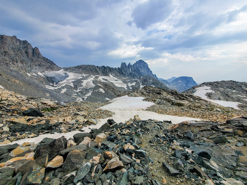
Wider shot with Alpine Pass, Brown Cliffs and the upper lake
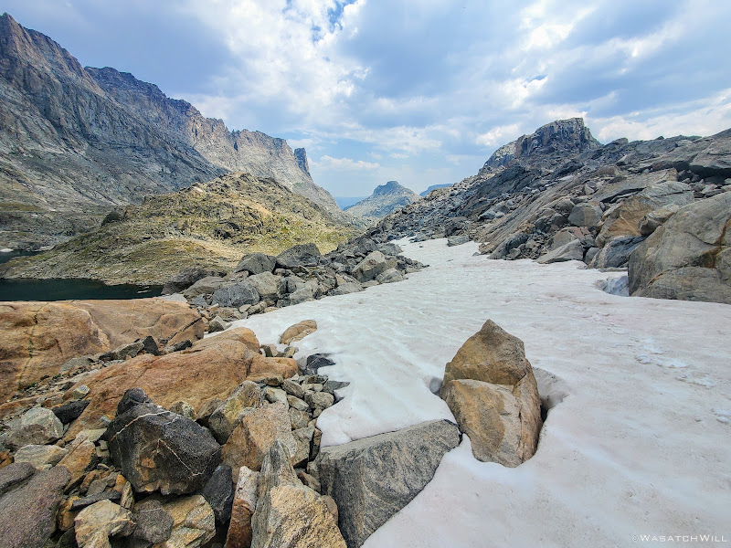
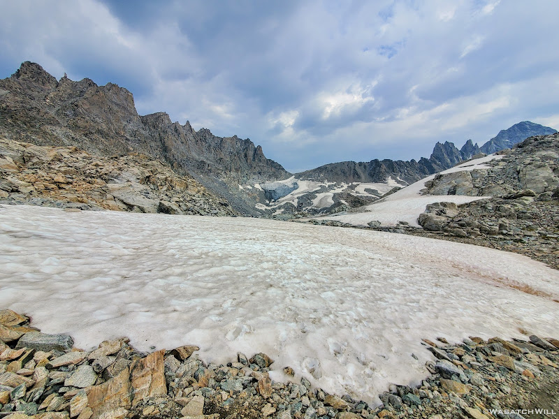
Once we hit the moraine we took a line of more gradual descent down to even more stable and level rock down below that served as a bridge along a ridge over the lower half of the moraine. Along that ridge would also be yet another stretch of snow to cross over. As we got back down into the rocks a couple cairns appeared. Cool! Or not...
Generally I'm not a fan of cairns, even in areas like this where it can be so tricky to find viable and safe routes through, but at the same time I respect how they can be useful at times help keep others on established routes and from getting themselves into some potentially dangerous situations. However, they are certainly not always consistent and reliable though. One should be prepared to not rely on them when they are encountered, especially in a place like this. It's still important to know your capabilities and comfort level. It's also a good skill to practice and develop being able to read and interpret rough and wild terrain as you encounter it, both near and far. And yet, these cairns had a calming presence about them. Was it the gloomy clouds high overhead? Was it the lack of color all around now? No...it, was simply that they confirmed we were indeed on a viable route and the crux of the day was now likely behind us for nothing between here and the pass looked all that ominous anymore.
A rare cairn on a large rock with small glacier beyond and clouds looming overhead
Blake treads through more snow
Looking back over a cliffy spot we had successfully bypassed
Getting closer to the pass

A small waterfall pierces through the snow above
A look back out across the upper lake
There was one unfortunate incident that took place between the cairns and Alpine Pass though. While I had pulled out my main water bottle to get a drink, raindrops were falling from the sky, so I set my water bottle down on a large rock where one of the cairns sat atop so I could then pull out my rain jacket, or at least have it more handy just in case. Welp, after slinging my pack back onto my back and looking back toward the pass in doing so, my attention immediately returned to progressing to the pass with Blake still ahead now fast closing in on the base of it. Thus in my desires to continue catching up, I neglected to grab back my water bottle and walked away without it. I hadn't realized this until we pulled over one final time at a waterfall along the bottom of the pass where we stopped for another snack break and to refill our water.
I didn't panic because I knew I had a collapsible Platypus bottle I had packed along as a spare. Boy was I glad I had packed that along now, but I also felt really bad about leaving something that could now be seen as trash behind. Normally I would have have hiked or ran back out to retrieve it. After all, it was probably only a half mile back. However, we had just come down a good bit of elevation over the last quarter mile to get where we were and that whole half mile to go back to my bottle and back again would have put us back nearly an hour with that kind of terrain. I reasoned that given the cairns and that we certainly wouldn't be the last people to pass through there anytime soon, somebody was bound to notice it and pack it out with them...hopefully. It was a Gatorade bottle, half-full of water, with a big fat orange cap on it so it'd be hard to miss, even if it got blown off the rock by a gust of wind and landed next to it, which it most certainly would.
If anyone out there reading this is researching a trip through here this next year for themselves, please feel free to reach out. I'm willing to share GPS coordinates to the spot I think I left the bottle at so you can see double check for me to see if it by chance is still there when you pass by. If somehow it is, please do pick it up and pack it out for me and help cleanse me of my guilt.
Small waterfall at the base of the Alpine Pass
Having recharged ourselves as best as we could, we stared up at the pass above us. We had gained so much elevation already since we had left the edge of the last lake that it really wasn't all that bad looking at all now. It couldn't have been much more than a half mile to the top and didn't appear super steep at all. Just a lot more talus to wander through. Up we went.
Blake begins to advance up the pass
Further along up the pass
Blake now trailing behind
Looking back down over Alpine Lakes from near the top of the pass
Even though the pass certainly wasn't among the most challenging passes I've ever done with respect to the terrain and slope angle, it was still a grind. We had now been thoroughly beat up by the long rocky grind it had already been just to get to the pass. And there was more of the like to come. But before that, we'd revel in the sense of achievement we now felt as we gained the top of Alpine Pass. We had made it through the long and grueling Alpine Lakes Basin.
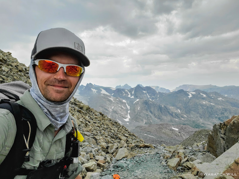
Alpine Pass selfie
The view north from Alpine Pass, prominent Mt Warren visible on the far horizon
Even knowing that the travel would be slow going along Alpine Lakes, I still figured we should at least be able to cover one mile per hour and with breaks, arrive at the top of the pass, just five miles from where we had camped, by no later than 2pm. It was now almost 4pm, nearly two hours past due. We did not linger long at the top.
Blake descends down the north side of the pass
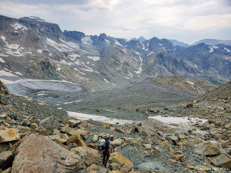
As we got further down the other side of the pass, the views ahead grew wider and soon gave usa our first sight of our next big challenge to come: A traverse across Knifepoint Glacier followed by a sluggish gain up Indian Pass.
Indian Pass and the far edge of Knife Point Glacier comes into view
Full view of Knifepoint Glacier and Indian Pass
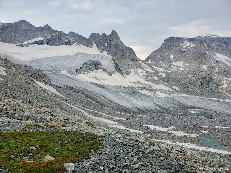
Zoom shot of Knifepoint Glacier and Indian Basin
Once we had started drifting further away from Alpine Pass, the terrain became more and more crumbly beneath our feet. In between and under all the talus was very soft and loose and muddy moraine silt and other debris left behind from the receding glacier up ahead. It was not nearly as stable feeling as the moraine remnants we had recently come across just prior to coming over Alpine Pass. We had to be extra cautious and careful with our footing because the rocks across here were not nearly as stable and secure making the terrain ripe for a rolled ankle myself or worse.
With Blake having left his microspikes back at home, we had been wondering how hard or how tricky it would be to traverse up and over the glacier without any such traction aid under his feet. We knew that with enough sun, the surface would probably be slushy enough to get reasonably good footing without any kind of traction accessories underfoot, but even so, it would be very inefficient. We knew of others who had successfully done this in favor of not carrying the weight of microspikes, crampons, or the like with them. Yet others have not only packed along spikes or crampons but ice axes and helmets as well only to have never really used them along the whole route. I suppose one can never be too sure if heading out in the early season or after a big snow year and it's always better to be safer than sorry. As already mentioned earlier in this series, I had reasoned that spikes, or in my case, some Hillsound Trail Crampons could prove useful and make the snow and ice travel more efficient and so I justified the extra weight of them. I also figured that my trekking poles would be sufficient as hand supports to help keep myself upright, providing additional assistive traction and thus further secure my footing.
At any rate, there simply had not been much sunlight that had gotten through the clouds all afternoon. We had reasoned that in a worst case scenario, given our lack of experience and familiarity with this glacier or any like unto it, that I could traverse up 50 feet or so, then strip off my spikes and toss/slide them down to him on a 50 foot length of lightweight cord we had with us. He could then put them on and catch up and we could repeat the process until the chore was complete. It wouldn't have been any more efficient than attempting it with bare outsoles, but it was an option. We'd just have to see when we got there and take it as it came.
A little further toward the glacier, we pulled over to soak up more of the big view that laid before us and sight out a line to nearest edge of the glacier that looked both safe and efficient. As we were doing so, something in my gut, in my conscience, whatever you want to call it gave me a feeling, an urge to look back behind me, not back up toward the pass we had just come down from but out in some rocks further below and in a slightly different direction. There, about 50 feet in the distance, something caught the corner of my eye. Something unnatural and out of place appeared to be sitting upon a rock within the sea of countless rocks strewn all over the mountain. I squinted but still couldn't make out exactly what it was. So I approached it. Once I was about 30 feet away it became a little more distinct.
A lost crampon?...If so, will it be of any aid to Blake?
I kept stepping closer. There on a rock sat not just one, but a complete set of two Black Diamond crampons. They appeared to be in pretty good shape too. I looked all around. There was no visible sign or sound of anyone else anywhere I could see. No other gear to be found anywhere near them either. More thoughts and questions raced through my mind...
Who would just leave their crampons like that? Did they belong to either of the guys we had seen at the upper lake we had just come from? Nah...they didn't mention anything about using or having lost any such crampons. Was it someone else who had taken a break there, removed them from their pack for a moment and then walked off without them much like I had just done with my water bottle? Or were they intentionally left behind by someone desperate to ditch any weight they could from their pack, regardless of the cost or value, after they had served their purpose?
How long had they been sitting there? And what were the odds of us stopping that close to them and then having them catch my attention in the corner of my eye the way that they did? Was it just a lucky coincidence?
Perhaps...but I felt it was something more than just a coincidence.
Whatever the reason was or how they got there, they were there and nobody else was and so I reached down, picked them up and walked them over to Blake. He checked the fit and yep, they were a match. He secured them onto his pack and we each approached the glacier with a little bit more confidence.
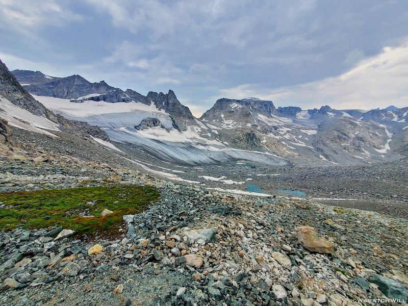
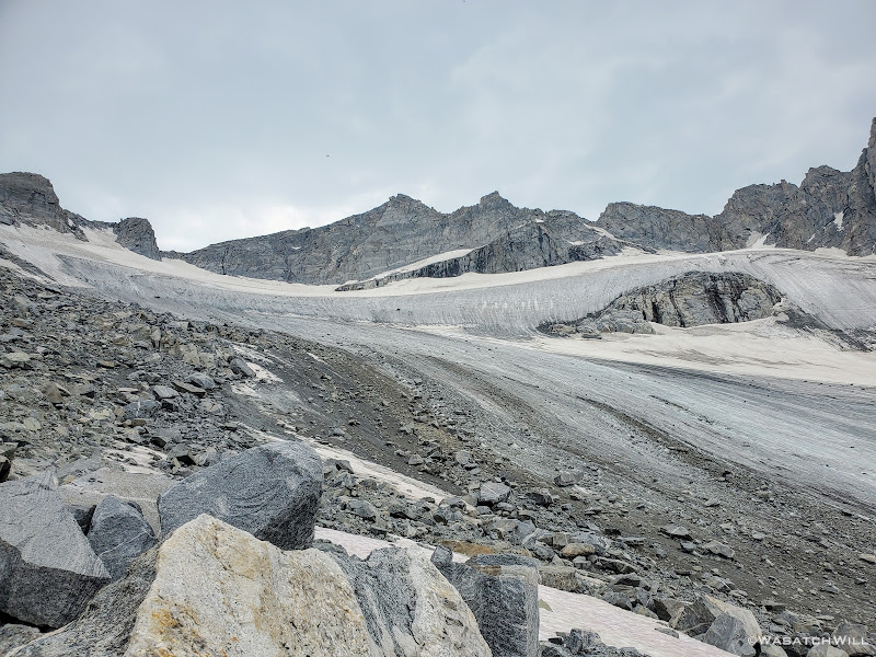
After much more careful route finding and following along the line we had visualised, we finally arrived at the edge of the glacier. There, sizeable sheets of fairly solid ice with chunks of rock, some silt, pockets of shallow pools of water, and slush here and there rose above us, all of it being divided by numerous streams of melt water flowing and carving its way down and through the ice all across its expanse. It appeared to be a rather shallow sheet of ice with no crevices or suncups to deal with, not that we had be nervous about encountering such with this glacier.
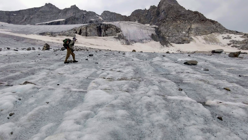
We put on our respective pairs of crampons and began our voyage up and across. With the first steps I was immediately glad I had packed along my "spikes". The walking instantly became the easiest and most efficient walking we had done since leaving the trail back by Camp Lake. It was certainly steep but not scary steep. It probably could have been done without any traction aids, but indeed it would have been much slower requiring more careful footing. Instead, Knifepoint Glacier was now another joyous treat to walk on and over. Yes, I thoroughly enjoyed it!
Standing at the edge of Knifepoint
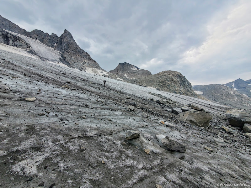
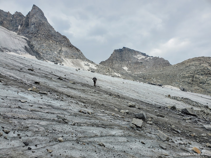
Blake swiftly ascending up the glacier
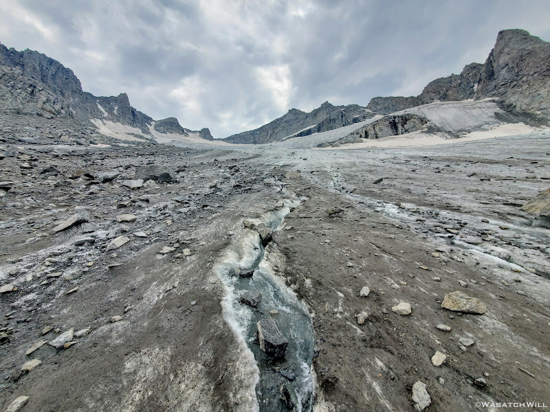
One of many streams ripping through the glacier. Is this how crevaces are formed on larger glaciers?
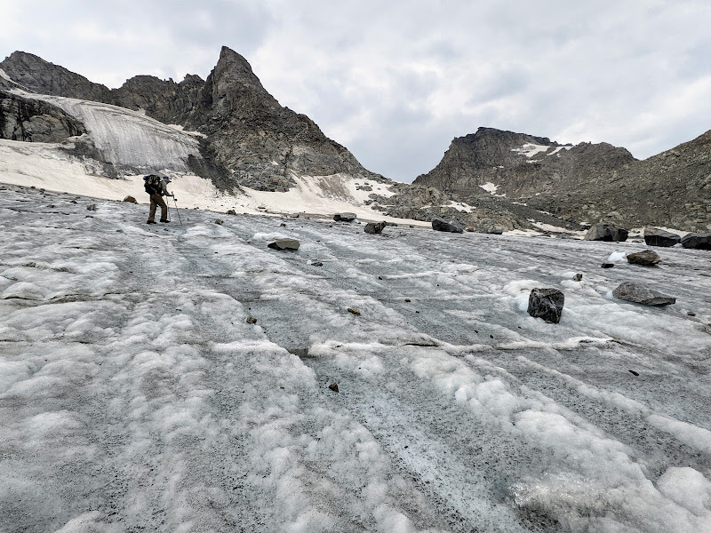
Making my way over the glacier (photo by Blake)
Blake moves along toward Indian Pass
Almost to the end of the glacier
But all good things must come to an end, or so it seems. Such was the case with our now beloved glacier. Having reached the other edge, we now had to remove our crampons and get back into the rocks. Not just rocks, but more loose rocks mixed with more soft and muddy moraine debris. Needless to say, the initial rise from the edge of the glacier up toward Indian Pass was quite steep and quite difficult to get much good footing with.
Indeed, it really was sluggish at first, but eventually it got more stable and the slope less steep, until step after step, we all but collapsed at the top of Indian Basin. Almost everything that had made the day so hard, so difficult, and so challenging was now all behind us. It wasn't that there was any specific spot really did us in. It was simply the overall endurance and stamina that was required to get from point A to point B, from Camp Lake to Indian Pass, and it took what felt like all of the stamina we had. I could not imagine how much harder it would have been with a blazing hot sun bearing down on us all afternoon. Instead, the cloud cover had served to keep us cool on what had been the most physically taxing and mentally grueling seven mile stretch I have ever hiked.
Looking back over the glacier to Alpine Pass
View east from the top of Indian Pass
View west from the top of Indian Pass
At the top of Indian Pass, Blake decided to leave the newfound crampons there, paying it forward for perhaps another fellow backpacker who might find them to be helpful.
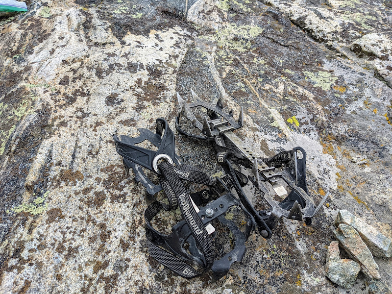
The Crampons
Now out ahead of us lied Indian Basin, and at the end of it, Titcomb Basin. Both bucket list destinations I had longed to see, wanting tosee what all the hype was about them. Just as exciting was the fact that we'd be back on a trail all the way down. Down we went, eager to settle into a site to set up camp somewhere out beyond.
Beginning the descent down Indian Pass with Harrower Peak out to the left
Knifepoint Mountain (left), Harrower Glacier, Harrower Peak (middle), and Elephant Head (left)
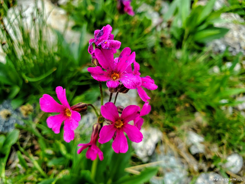
Parry's Primrose
Harrower Peak and glacier
Knifepoint Mountain (left) and another snowfield we had to come across
Looking further down Indian Basin
Considering the price we had just paid to get to this point, it all became worth it now. The light of the falling sun filtering out through the clouds, sending rays out across the horizon just made the whole landscape feel like something out of a magical movie. Just absolutely stunning, beautiful, and wondrous. There was so much color and greenery again. Grassy meadows, flowers, bright blue tarns and lakes, and so forth. For the second night in a row we were privileged to enjoy a blissful and heavenly experience to cap our day as we finished out the final miles. It was all balm for our brains, helping to take our minds off our battered and beaten legs and feet, nay...our whole bodies.
Alpine paradise
A crystal clear stream flowing next to the trail
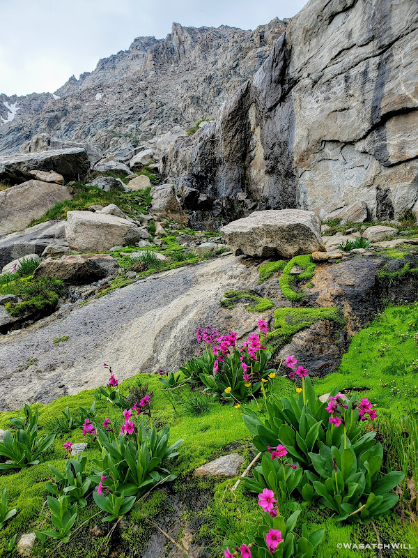
Parry's Primrose beneath a small waterfall
A small valley full of Parry's Primrose flowers
Fremont Peak comes into view
A random and unnecessary cairn
Turquoise pool beneath Jackson Peak
Looking back up trail at KnifePoint Mountain (middle) and Harrower Peak (right)
Blake hikes ahead toward the lakes out in the distance
A large meadow of flowers with lakes down below and Elephant Head above (left)
Blake follows the trail with a brief change of direction to the northwest
Indian Basin flowers and Jackson Peak
Now heading southward, Elephant Head beyond
Knifepoint Mountain and Harrower Peak back in view
Harrower Peak and Elephant Head from above Lake 11008
Harrower Peak from across Lake 11008
Lake 11008 reflection of Harrower
11008 Island
View of Lake 10813 beneath Harrower Peak (left) and Elephant Head (right)
About halfway down Indian Basin, when we reached the lakes it holds, we began to encounter people again. And this time it wasn't just a few, but many, camping all around the nameless lakes to be found there in the basin and all the way down from there. We had pulled over at Lake 11008 for a brief break en route down through the basin, not to eat anything this time, but to treat our feet. Blake was starting to suffer a bit more, his ankle now flaring up again with a bit more irritation. When he revealed his ankle, it was now very red and marked with purple all over. He also had some hot spots and blisters on his feet to attend to. In fact, both of us had actually developed some significant hot spots that we weren't able to keep up with and so both of us had developed some pretty gnarly blisters from all the rocky and uneven terrain we had just come through. Meanwhile, Blake would go on to walk the rest of the day with a slight limp and a slower pace. He was able to manage the pain with some Vitamin I.
The blissful experience we had enjoyed hiking down through the upper half of the basin started to turn into some moments of frustration when all of the few spots I had marked out on my map ahead of time for potential camp spots all turned out to be occupied. That meant we had to keep heading downward, even reaching the junction with Titcomb Basin before the landscape began to open up again and spread out.
A peek into Titcomb Basin
Now with precious little light left again, we went into desperation mode for finding a campsite. We could have veered up into Titcomb, but given how many folks we saw up in Indian Basin we figured it would be pretty crowded up there too. Island Lake, while only a mile away now, felt too far. No doubt it would have been a struggle to find a vacant spot this late in the day there too. We ended pulling over at a small-ish lake that sits at the lower edge of Titcomb Basin and just above Island Lake, Lake 10467. There I had spied an open grassy flat some 300 feet back from the lake and behind a small thicket of trees, a site some 1700 feet lower in elevation than Indian Pass. We hastily got our tents and beds set up just in time to have dinner in the dark again. Only afterwards had we realized another group had ended up near the same spot, not much more than 200 feet away from us. Oops. Even at 200 feet away, I felt like we were camping on top of them and hoped they weren't too bothered by it. At least we had the thicket of trees along with a little rise in elevation to keep our camps mostly out of view from each other.
As for the morrow, we'd have another big decision to make. Would we be able to continue staying true to our course and head up through Titcomb Basin, then up and over Knapsack Col to Peak Lake and beyond or would we need to backoff and take an easier way out via Island Lake and Jean Lakes to progress ahead to the trailhead at Green River Lakes still some 27+ miles away. Or, would we have to call a different audible and exit out at Elkhart Park just about 13 miles away and figure out how to get my car back from there. Whatever the choice ended up being, it would all be determined by Blake's ankle, the overall feeling of our bodies collectively, and of course, the weather.
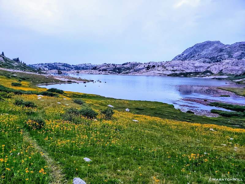
Lake 10467
Now, in closing this day's report out, I don't typically appeal to my personal faith in such trip reports, but this was a day where it would be hard for me to deny and not acknowledge having some divine providence in our favor. I know that it can be a highly controversial subject for so many. So many others have radically different experiences that make it incredibly hard for them to develop or hold onto any sort of spiritual faith or feel any sense of divine or eternal purpose to life. For others they just can't find any reasonable or logical purpose to believe in any kind of divinity. And yet for others, it's just all too confusing that it's just not worth putting much belief in anything or anyone beyond themselves.
And that's all understandable, something I strive to empathize with. I know many people's prayers seemingly go unanswered leading them to doubt what faith they may have had earlier on in life. Terrible things of all kinds have happened and still happen to good people. So much in life and what happens in this world can be so cruel sometimes, unjust and unfair. So I get it. I'm not looking to preach or convert any non-believers reading this. But I do have my own reasons for still believing, for still maintaining my faith, even when life can be so hard, and when at times things don't make sense, and even after so many of my own prayers so often seem to go unanswered as well, or at least not in ways I think they should be. But at the end of this particular day, I was especially grateful for what I perceived to be an answered prayer, indeed one that very much went the way I had hoped it would and more: most notably the strength of Blake's ankle holding up, the change in weather that helped to keep us cool along the most difficult stretch of the route, and of course the crampons that seemingly showed up out of nowhere. I will happily, and thankfully, take such days when I can get them because no doubt, there will be more days ahead where I won't always get what I want.
Suffice it to say, it had been a hard day, even the most demanding, most laborious, most strenuous and tortuous day I have ever experienced, both physically and mentally, among all my backpacking trips I have ever undertaken to date...and yet, through all the pain and exhaustion, I fell asleep feeling an incredible amount of spiritual rejuvenation and fulfillment in ways only such a challenging day in the backcountry could do, surrounded by what I believe to be some incredible, amazing, majestic and beautiful creations of God via natural processes, including both evolution and erosion, set in motion so - so - long - ago.
To be continued...
Need to catch up?...
WRHR: DAY 1 - BIG SANDY TO CIRQUE OF THE TOWERS
WRHR: DAY 2 - CIRQUE OF THE TOWERS TO DESOLATION VALLEY
WRHR: DAY 3 - DESOLATION VALLEY TO HALLS LAKE
WRHR: DAY 4 - HALLS LAKE TO CAMP LAKE
Tuesday - July 27, 2021
MILES: 10.5 | GAIN: 2,717 ft
Day five...AKA...Alpine Lakes Day. This was the day I had been most anxious about but also among one of the days I was most looking forward to. How would the weather be on us? Would it be blazing hot and sunny again or would we get caught in our first storm of the trip before making it over either of the two passes we needed to get over to get to Indian and Titcomb Basin? Just how heinous and tedious was it to move through the basin holding the Alpine Lakes. Was it as bad as its reputation makes it out to be? What of Knifepoint Glacier awaiting us on the other side? What were its conditions like? And perhaps most importantly now...How was Blake's ankle going to be after his mishap with it the day before?
Well, all those questions and then some were about to be answered as the day dragged on....
When we awoke, red clouds were drifting over Douglas Peak. You know what they say..."Red in the morning, sailors take warning. Red at night, sailors' delight." Ummm...uh oh.
Red clouds over Douglas Peak
As soon as the sun was fully up though, the clouds almost instantly disappeared, giving way to a mostly clear sky yet again.
Douglas Peak reflects on a nearby tarn
Bluer skies above camp
Given the situation with Blake's ankle from the day before and what was on our agenda for this new day, it should be known that I, being a person of faith, had prayed the night before on behalf of Blake that his ankle would be strong enough to get through the rest of the route and if not, at least back out to safety. And really, that was the most important of what I could ask for, that we'd have the wisdom to make good decisions and the strength and ability to stay safe. Whether we turned back around from here or not, we would have to go over two big passes to get to either of the nearest trailheads along with at least some boulder hopping.
Well, on this morning, Blake's ankle, while not looking great, was a go. He assured me that it looked worse than it felt and that he was feeling confident he could continue ahead as planned. So, not wanting to delay any further, we packed up and got going just before 8AM. Fingers were crossed we wouldn't end up regretting that we did not break camp two hours sooner. Our first mile of the day would take us around Camp Lake, across its outlet, up a short rise, and over to a small nameless lake where the on-ramp for our entry into Alpine Lakes basin awaited us.
Douglas Peak and Douglas Lake
Waterfall along outlet of Douglas Lake
Small nameless lake
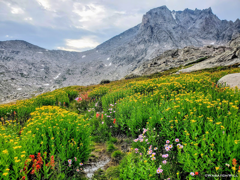
The trail that had led us toward Camp Lake continued along its eastern shore and around to its outlet. Across the outlet, we had a bit of trouble looking for any established pathway up the short rise we had to gain. Eventually we stumbled into what became a use trail that took us the rest of the way over to the small nameless lake where it then vanished into big granite slabs and ramps that would officially take us up into Alpine Lakes Basin. We probed them for a moment and found a weakness in them, a little mini canyon of sorts, that allowed us to prolong having to get up on the granite itself just a little bit more. While we mostly just chose it because it appeared to be a path of least resistance, it also turned out to be filled with flowers which gave it a beautiful and colorful accent.
Flowers blanket the ground beneath the slabs. Bonus points if you can find Blake in this photo! (hint: click to enlarge)
Into the flower carpeted corridor. More bonus points if you can find where Blake has moved to in this photo!
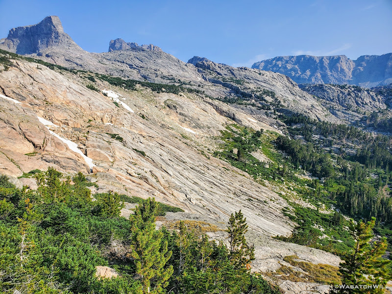
But it didn't go for long. At the end was a pile of rock rubble we scrambled up to get onto the steep granite slabs which we'd use as ramps to continue gaining in elevation. Fortunately they were as dry as could be so the traction under our feet was great. As we worked our way up, the views to the side and behind us really started to open up. To the east was the Fortress (a large and impressive granite butte that even looked a bit like Utah's Factory Butte from one angle) and then below that, the edge and outlet of the lower Alpine Lake (Lake 10895) came into view. While our eyes were growing with more excitement, our lungs were not.
The Fortress (top left) stands guard above granite ramp leading up to Alpine Lakes
The lower lake comes into view beneath The Fortress
Looking back down the rises we had gained
Once we crested over the slabs, we had a brief stretch of relief where the ground leveled out. Here, our lungs were now able to enjoy a few moments of excitement too.
We now had three points of direction we could travel. To our right, we could head over to the outlet of the lower lake, cross over it, and stay true to the original Dixon/Wilson route. However, once around to the north side of the lake, there would be a ledge that would require a short class 4 downclimb to maintain progress. Option two lied straight ahead, where we could go straight to the southern shoreline of the lake and follow it around the south side before turning a corner to head more northerly along its west side. However, that too was certain to present a challenge, requiring some some careful scrambling along a little cliffy section that stood a good chance to force us into the lake itself for a waist-high wader for some 20, 30, or maybe even 40 feet. And to our left, was our final option: Head uphill over a small pass to bypass both of the other options and join up with the southern shoreline of the lower lake further to the west. We opted for the latter choice.
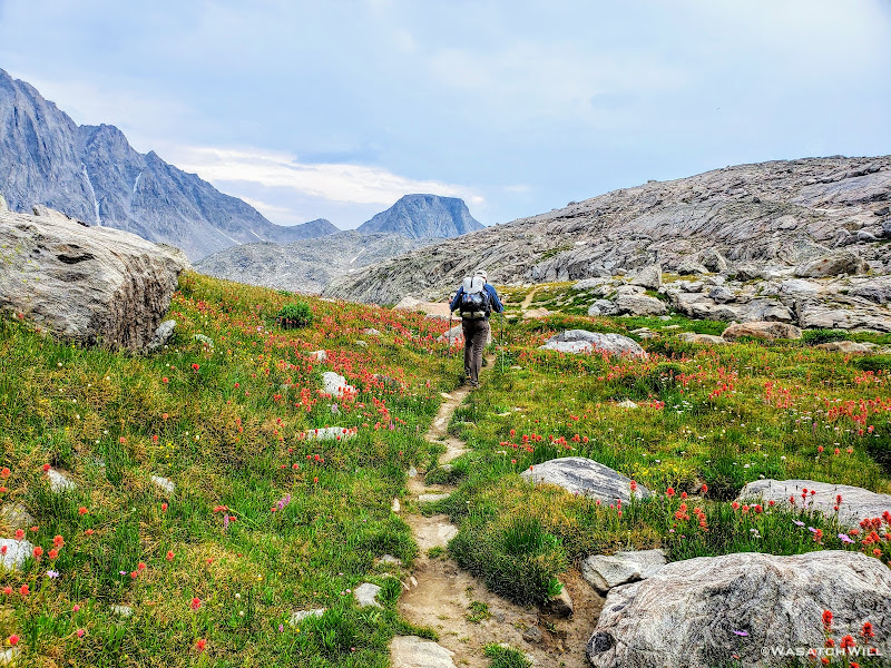
Blake continued on for a bit while I sought out a good spot to top off my water. I was able to wander out to a small creek to do that before rejoining Blake for some more uphill action. This time, instead of smooth granite slabs to continue taking us up however, it was back to talus and tundra. Not so bad, but we were now just eager to get over it and be done with it so we could start making some real progress up through the basin.
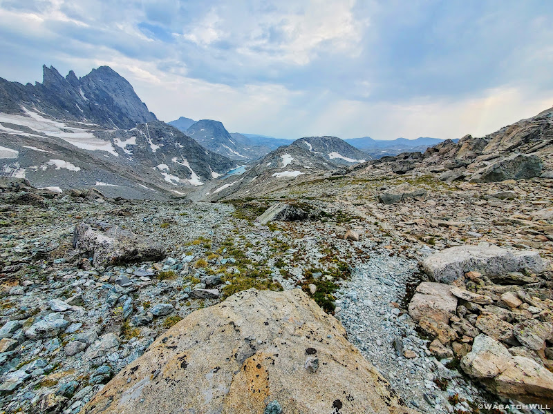
'Alpine Lakes Pass' as many refer to it by, or even just 'Alpine Pass' as I prefer to call it, was now four miles away across a mostly barren and desolate basin. It was the first of the two major passes that stood between us our goal for the day. With no trail to follow we were once again left to pick our own way around three large alpine lakes (literally!) and a handful of tarns both big and small. In between and all around these various bodies of water sat virtually nothing but tons and tons of talus, some scree, some snow, and a moraine. Intermixed with some of all that were a few patches of grassy tundra and granite slabs here and there to give our feet any sort of relief in the rough and unforgiving terrain that now lay ahead of us.
Arriving at the top of a small pass
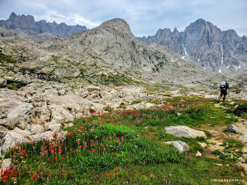
Once across the small pass, we were faced with our first of many large sections of rock hopping to come. We carefully traversed and descended the talus gradually until it terminated at the outlet of a large tarn. From there we had a beautiful view back up over Douglas Pass and what we would have descended had we taken a Skurka detour there over 'Douglas Pass' rather than around Douglas Peak and and Camp Lake.
Large tarn with Douglas Pass beyond
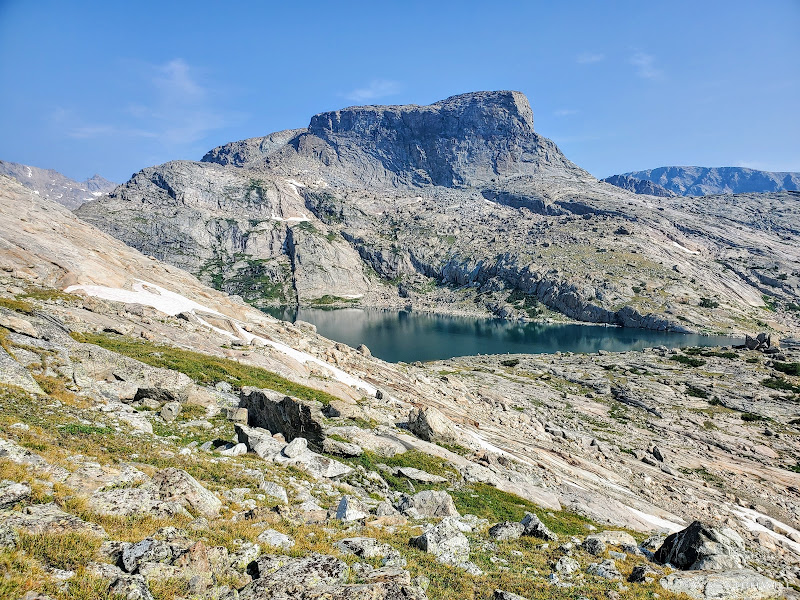
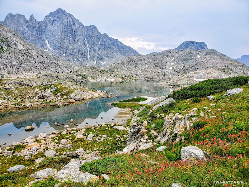
There at the tarn's outlet we crossed over and then followed it down to its junction with the lower and larger of the Alpine Lakes, Lake 10895. It was there that we got our first real good wide open view of Alpine Pass way out in the distance.
Look toward Alpine Pass from the edge of the lower lake
Rounding the corner of the lower lake, Brown Cliffs begin to come into view (upper right horizon)
Getting around the first big lake was not too terrible. It was really just long and monotonous hopping over more typical talus only interrupted by one brief snowfield to cross over. The snow had just enough time under the morning sun to soften up enough and allow good footholds on it. As usual, extra care was required getting on and off of it. I have found that the edges of snowfields and drifts laying atop a pile of talus, such as this one was, are usually the softest and most dangerous at their edges where the potential and risk for post holing, falling through, and jamming your foot/leg into the rocks underneath is much greater.
Snowfield to cross
Crossing over the snowfield (photo by Blake)
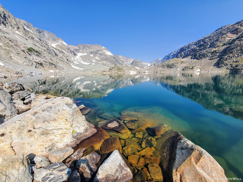
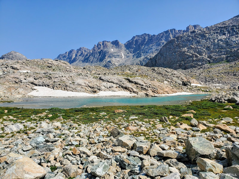
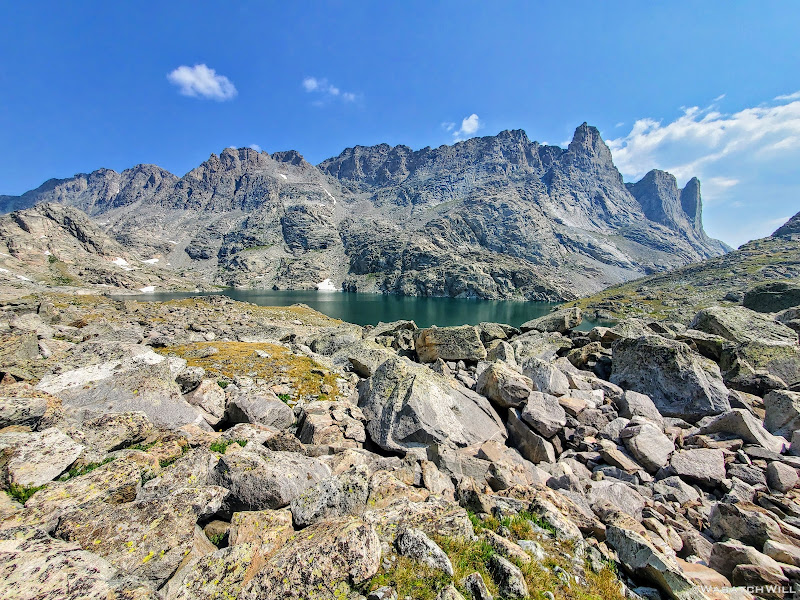
Aqua blue tarn with Brown Cliffs above and beyond
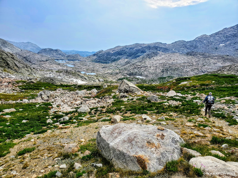
Having passed the larger and lower lake, our sights were now set on getting to the middle lake, or Lake 10988. Here we'd enjoy some of those rare grassy patches of tundra, giving our hardworking legs and feet some brief recesses between more fields of large rocks, even larger boulders, and an occasional slab of granite.
Blake making his way over talus above the lower lake
It was now about high noon and the sun was really heating things up again. We had been so eager to get through this basin we had neglected to pull over for any sort of snack break since leaving camp. We were now running on empty and getting low on water again so it was with great joy when we pulled over for a lunch break at the middle lake.
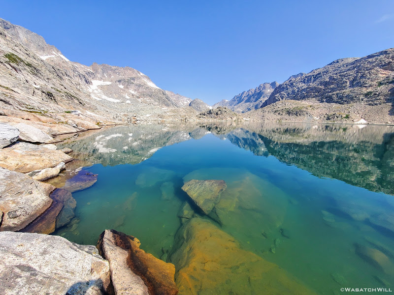
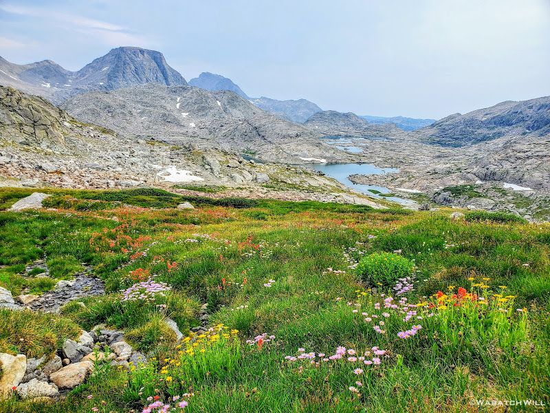
If ever there was a spot that took me back to the mountains of New Zealand while hiking this route, this was it. This greenish-blue middle lake within Alpine Lakes Basin as it laid right up against the jagged Brown Cliffs with patches of grass in various shades of green woven throughout the rocks all around it had its very own unique charm. Indeed, this "middle lake" took me back to "Middle Earth".
The middle lake comes into view with Brown Cliffs above
How did we get to New Zealand and Middle Earth?
While having lunch we noticed some clouds starting to build up in the sky, particularly out to the southwest, the direction from which summer storms often flow from out here in the mountain west. Just as we felt like we were making good progress on the day, I started to grow a little more nervous again and again I asked, (whether to myself or aloud, I do not remember) Were we now going to get hit with our first storm after being lit up by the sun all day for our first four days out? This would not be an ideal place for that to happen for there wasn't much to retreat to in order to reduce the risk of any lightning strikes. I attempted to pull down a weather forecast on my InReach, but for whatever reason it would not pull anything in for the weather. Odd, I thought. There was still enough blue sky around and my device confirmed it had a good satellite signal connection. So to further test that signal connection, I sent a message out to my wife back at home and asked her to get on mountain-forecast.com and look up the current forecast for Fremont Peak, a peak I knew was listed on that website and wasn't very far away as the crow flies. The outbound message was sent followed by a unique beep that confirmed it was successfully carried up to the satellite. Then...we waited.
Some number of minutes later my device beeped again, this time for my inbox. Success! Per my wife, it was reported that the area was only due to be cloudy and overcast through the rest of the day with showers not moving in until overnight followed by a good chance of thundershowers the following afternoon.
And just like that, the growing cloud cover went from a dreaded fright to a welcome sight. Can you say: Goodbye, hot afternoon sun!?
So it was with renewed zeal we mounted our packs back on and made our way up to the uppermost lake, following the course of one of the uppermost reaches of Bull Lake Creek. We ended up staying to the left, that is, west of it, knowing we'd just be rounding the upper lake around its western side as we had with its siblings.
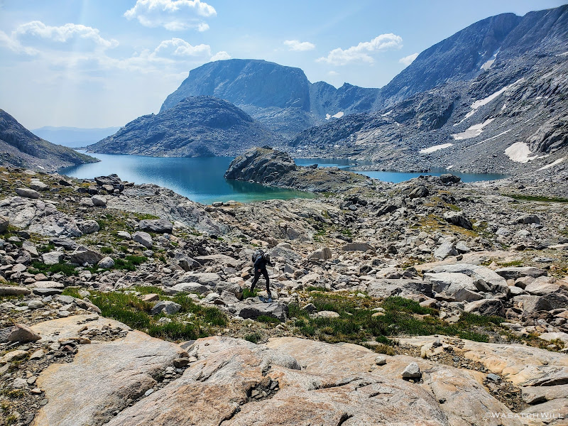
In hindsight, it had turned out to not be the best way. We ended up scrambling through some of the largest boulders we'd ever encounter on this trip trying to gain the next rise where the uppermost lake rested. It turned out to be quite an obstacle course and slowed us down considerably. As we were picking our way through, over, and around the ginormous rocks, some being the size of large automobiles and even tiny homes, we heard some voices trailing behind us. We paused and looked back to see what appeared to be the same group of four we had encountered the previous two days down below and beginning to work their own way up. However, they were not following right behind us. They had crossed over the creek and were heading up its north side. It turned out that there were no such large boulders on that side. Only grassy slopes and rocky ramps with much smaller rocks and boulders littering that side. Doh!!! I made a mental note of that in case I ever find myself combing through this semi-treacherous place again.
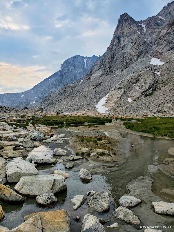
Giving up on the climb up through the boulders that only seemed to be growing in size and scale the higher up we got, we veered off our initial course and scrambled our way along the straightest line we could manage back toward the creek, ultimately crossing over ourselves just below the outlet to come up onto a nice little bench at the edge of the lake. We dropped down for another break and collect a bit more water.
Standing at the edge of the upper lake looking up at Alpine Pass
As we sat at the water's edge, a couple of other guys came down out of the rocks from above the lake and stopped for a bit of a break themselves. They had just come over from the area we were heading for and so we exchanged a little bit of route beta with each other. I don't remember whether they were doing the same route, only in reverse, or if they were just doing some large loop that coursed through Alpine Lakes. What I do remember is that they informed us of the way they had come around the lake, going considerably high where they gained a high snow drift to traverse over and slide back down before descending to the lake. To stay along the shore they said would require some serious scrambling and some potentially sketchy class 3 bits to keep from dropping into the lake. There were definitely a couple of spots we did not like the looks of along the base of some cliffs and very steep talus rising up from the west side of the lake further to the north. Heading around the east side of the lake looked even less viable. And I certainly had not read or seen any writes up or videos of others who'd come through this basin of ever going around that side of the lake. So we kept our eyes looking along the west side.
We then told them to cross the outlet and head down from the lake along the opposite side we had mostly come up. They in turn also let us know that Knifepoint Glacier, which awaited us on the other side of Alpine Pass, was not very sketchy at all. That was another key point along the route I was a little concerned about, having never had the experience of stepping foot on a true glacier before.
We wished each other well as we actually criss-crossed each other in getting across opposite sides of the creek. Strangely, the other group we had seen behind us down below never caught up with us. In fact, we never saw them again and wondered if they had actually got concerned about the gathering clouds themselves, decided to turn around and/or make an early camp back down by the middle lake. Or maybe they just pulled over to take a prolonged break before gaining the high lake. Either way, we'd not see another soul until much later in the day.
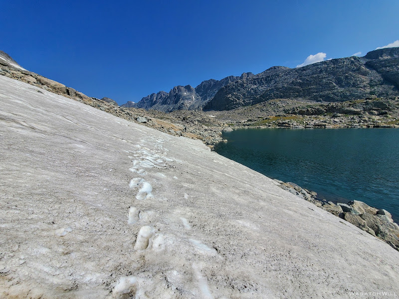
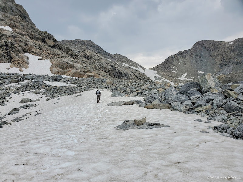
Blake and I said farewell to the lakeshore as we found a little bit of use path winding its way up the rocky hillside immediately above the outlet of the lake. It was pretty steep at first but backed off for a little bit after rising about a hundred feet or so. We stepped over a bunch more talus as we rounded past a small tarn lying high up in the rocks and then out across another patch of snow.
Small tarn in the rocks above the upper lake
Snowfield in rocks above upper lake
From the direction we were coming from it became apparent that we actually had two viable ways up and over the final rise we needed to go over in order to make it around to the other side of the lake where the base of Alpine Pass stood waiting for us. One was of course to follow the footsteps and slide marks of the other two guys we had just seen as they went further up what would become a steep snowbank, especially on the other side. The other way was up through a weakness in the ledge beneath the snowbank where it became another little mini canyon of sorts. It was littered with rubble that we were able to treat as stairs, albeit a loose spot or two.
Scrambling up another corridor
It finally flattened out into a neat little corridor with rock walls continuing to guide us on either side.
High up in a rocky maze
At the end, it joined up the large snowbank that had been draped over the top of this rise along its western edge. At this point we found ourselves exceptionally high above the lake now and things got really steep and loose looking straight ahead and below us. Because of this, things looked more treacherous than they ever had to this point. We even turned around thinking we had reached a dead end in a maze of rock we now found ourselves in, went back up into and onto the rock and sought out any other way we could find down. Nothing better appeared.
So, we resorted to returning to the snow. To head north again, we had to descend, er, perform a controlled slide down a steep downslope to get back down into the talus below. It still wasn't looking great because now we were looking down a steep and slippery looking chute straight below us. Blake proceeded down a couple short little ledges immediately below us and then scouted out around a blind corner while I stayed back and crossed my fingers and marveled at how well his ankle had been holding up thus far. A moment later, he returned and reported that he was able to sight out a nice and gradual (i.e. stable) line along the contour of the rocky slope out to the left and then into a soft yet somewhat stable looking moraine well below a small glacier clinging high up above.
More great news! I proceeded to follow.
Blake enjoys a view high above the upper lake
Blake back down into some more rocks above the upper lake
Wider shot with Alpine Pass, Brown Cliffs and the upper lake
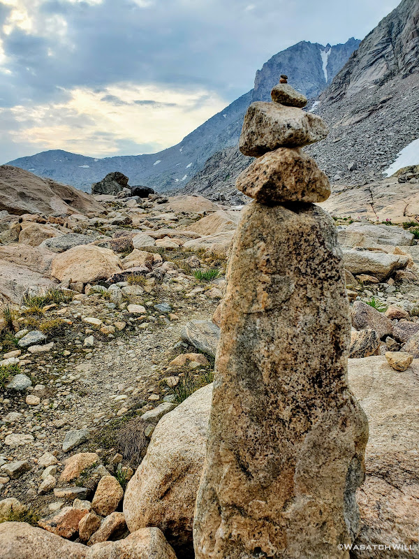
Once we hit the moraine we took a line of more gradual descent down to even more stable and level rock down below that served as a bridge along a ridge over the lower half of the moraine. Along that ridge would also be yet another stretch of snow to cross over. As we got back down into the rocks a couple cairns appeared. Cool! Or not...
Generally I'm not a fan of cairns, even in areas like this where it can be so tricky to find viable and safe routes through, but at the same time I respect how they can be useful at times help keep others on established routes and from getting themselves into some potentially dangerous situations. However, they are certainly not always consistent and reliable though. One should be prepared to not rely on them when they are encountered, especially in a place like this. It's still important to know your capabilities and comfort level. It's also a good skill to practice and develop being able to read and interpret rough and wild terrain as you encounter it, both near and far. And yet, these cairns had a calming presence about them. Was it the gloomy clouds high overhead? Was it the lack of color all around now? No...it, was simply that they confirmed we were indeed on a viable route and the crux of the day was now likely behind us for nothing between here and the pass looked all that ominous anymore.
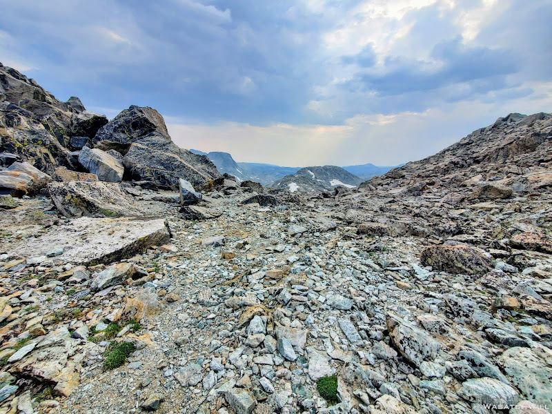
A rare cairn on a large rock with small glacier beyond and clouds looming overhead
Blake treads through more snow
Looking back over a cliffy spot we had successfully bypassed
Getting closer to the pass
A small waterfall pierces through the snow above
A look back out across the upper lake
There was one unfortunate incident that took place between the cairns and Alpine Pass though. While I had pulled out my main water bottle to get a drink, raindrops were falling from the sky, so I set my water bottle down on a large rock where one of the cairns sat atop so I could then pull out my rain jacket, or at least have it more handy just in case. Welp, after slinging my pack back onto my back and looking back toward the pass in doing so, my attention immediately returned to progressing to the pass with Blake still ahead now fast closing in on the base of it. Thus in my desires to continue catching up, I neglected to grab back my water bottle and walked away without it. I hadn't realized this until we pulled over one final time at a waterfall along the bottom of the pass where we stopped for another snack break and to refill our water.
I didn't panic because I knew I had a collapsible Platypus bottle I had packed along as a spare. Boy was I glad I had packed that along now, but I also felt really bad about leaving something that could now be seen as trash behind. Normally I would have have hiked or ran back out to retrieve it. After all, it was probably only a half mile back. However, we had just come down a good bit of elevation over the last quarter mile to get where we were and that whole half mile to go back to my bottle and back again would have put us back nearly an hour with that kind of terrain. I reasoned that given the cairns and that we certainly wouldn't be the last people to pass through there anytime soon, somebody was bound to notice it and pack it out with them...hopefully. It was a Gatorade bottle, half-full of water, with a big fat orange cap on it so it'd be hard to miss, even if it got blown off the rock by a gust of wind and landed next to it, which it most certainly would.
If anyone out there reading this is researching a trip through here this next year for themselves, please feel free to reach out. I'm willing to share GPS coordinates to the spot I think I left the bottle at so you can see double check for me to see if it by chance is still there when you pass by. If somehow it is, please do pick it up and pack it out for me and help cleanse me of my guilt.
Small waterfall at the base of the Alpine Pass
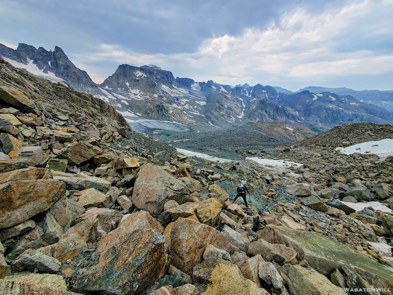
Having recharged ourselves as best as we could, we stared up at the pass above us. We had gained so much elevation already since we had left the edge of the last lake that it really wasn't all that bad looking at all now. It couldn't have been much more than a half mile to the top and didn't appear super steep at all. Just a lot more talus to wander through. Up we went.
Blake begins to advance up the pass
Further along up the pass
Blake now trailing behind
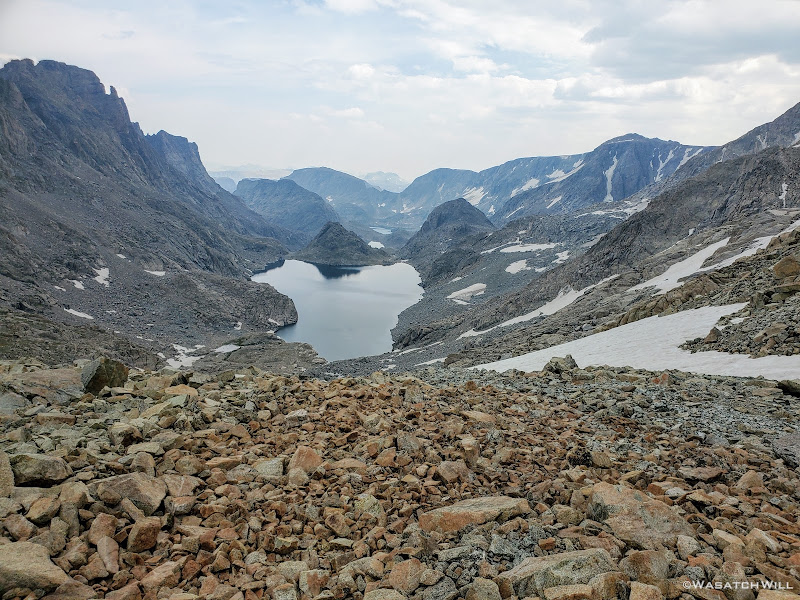
Looking back down over Alpine Lakes from near the top of the pass
Even though the pass certainly wasn't among the most challenging passes I've ever done with respect to the terrain and slope angle, it was still a grind. We had now been thoroughly beat up by the long rocky grind it had already been just to get to the pass. And there was more of the like to come. But before that, we'd revel in the sense of achievement we now felt as we gained the top of Alpine Pass. We had made it through the long and grueling Alpine Lakes Basin.
Alpine Pass selfie
The view north from Alpine Pass, prominent Mt Warren visible on the far horizon
Even knowing that the travel would be slow going along Alpine Lakes, I still figured we should at least be able to cover one mile per hour and with breaks, arrive at the top of the pass, just five miles from where we had camped, by no later than 2pm. It was now almost 4pm, nearly two hours past due. We did not linger long at the top.
Blake descends down the north side of the pass
As we got further down the other side of the pass, the views ahead grew wider and soon gave usa our first sight of our next big challenge to come: A traverse across Knifepoint Glacier followed by a sluggish gain up Indian Pass.
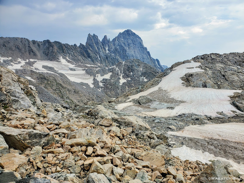
Indian Pass and the far edge of Knife Point Glacier comes into view
Full view of Knifepoint Glacier and Indian Pass
Zoom shot of Knifepoint Glacier and Indian Basin
Once we had started drifting further away from Alpine Pass, the terrain became more and more crumbly beneath our feet. In between and under all the talus was very soft and loose and muddy moraine silt and other debris left behind from the receding glacier up ahead. It was not nearly as stable feeling as the moraine remnants we had recently come across just prior to coming over Alpine Pass. We had to be extra cautious and careful with our footing because the rocks across here were not nearly as stable and secure making the terrain ripe for a rolled ankle myself or worse.
With Blake having left his microspikes back at home, we had been wondering how hard or how tricky it would be to traverse up and over the glacier without any such traction aid under his feet. We knew that with enough sun, the surface would probably be slushy enough to get reasonably good footing without any kind of traction accessories underfoot, but even so, it would be very inefficient. We knew of others who had successfully done this in favor of not carrying the weight of microspikes, crampons, or the like with them. Yet others have not only packed along spikes or crampons but ice axes and helmets as well only to have never really used them along the whole route. I suppose one can never be too sure if heading out in the early season or after a big snow year and it's always better to be safer than sorry. As already mentioned earlier in this series, I had reasoned that spikes, or in my case, some Hillsound Trail Crampons could prove useful and make the snow and ice travel more efficient and so I justified the extra weight of them. I also figured that my trekking poles would be sufficient as hand supports to help keep myself upright, providing additional assistive traction and thus further secure my footing.
At any rate, there simply had not been much sunlight that had gotten through the clouds all afternoon. We had reasoned that in a worst case scenario, given our lack of experience and familiarity with this glacier or any like unto it, that I could traverse up 50 feet or so, then strip off my spikes and toss/slide them down to him on a 50 foot length of lightweight cord we had with us. He could then put them on and catch up and we could repeat the process until the chore was complete. It wouldn't have been any more efficient than attempting it with bare outsoles, but it was an option. We'd just have to see when we got there and take it as it came.
A little further toward the glacier, we pulled over to soak up more of the big view that laid before us and sight out a line to nearest edge of the glacier that looked both safe and efficient. As we were doing so, something in my gut, in my conscience, whatever you want to call it gave me a feeling, an urge to look back behind me, not back up toward the pass we had just come down from but out in some rocks further below and in a slightly different direction. There, about 50 feet in the distance, something caught the corner of my eye. Something unnatural and out of place appeared to be sitting upon a rock within the sea of countless rocks strewn all over the mountain. I squinted but still couldn't make out exactly what it was. So I approached it. Once I was about 30 feet away it became a little more distinct.
A lost crampon?...If so, will it be of any aid to Blake?
I kept stepping closer. There on a rock sat not just one, but a complete set of two Black Diamond crampons. They appeared to be in pretty good shape too. I looked all around. There was no visible sign or sound of anyone else anywhere I could see. No other gear to be found anywhere near them either. More thoughts and questions raced through my mind...
Who would just leave their crampons like that? Did they belong to either of the guys we had seen at the upper lake we had just come from? Nah...they didn't mention anything about using or having lost any such crampons. Was it someone else who had taken a break there, removed them from their pack for a moment and then walked off without them much like I had just done with my water bottle? Or were they intentionally left behind by someone desperate to ditch any weight they could from their pack, regardless of the cost or value, after they had served their purpose?
How long had they been sitting there? And what were the odds of us stopping that close to them and then having them catch my attention in the corner of my eye the way that they did? Was it just a lucky coincidence?
Perhaps...but I felt it was something more than just a coincidence.
Whatever the reason was or how they got there, they were there and nobody else was and so I reached down, picked them up and walked them over to Blake. He checked the fit and yep, they were a match. He secured them onto his pack and we each approached the glacier with a little bit more confidence.
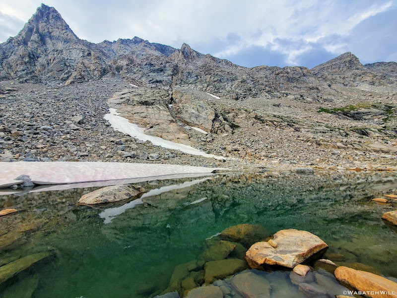
After much more careful route finding and following along the line we had visualised, we finally arrived at the edge of the glacier. There, sizeable sheets of fairly solid ice with chunks of rock, some silt, pockets of shallow pools of water, and slush here and there rose above us, all of it being divided by numerous streams of melt water flowing and carving its way down and through the ice all across its expanse. It appeared to be a rather shallow sheet of ice with no crevices or suncups to deal with, not that we had be nervous about encountering such with this glacier.
We put on our respective pairs of crampons and began our voyage up and across. With the first steps I was immediately glad I had packed along my "spikes". The walking instantly became the easiest and most efficient walking we had done since leaving the trail back by Camp Lake. It was certainly steep but not scary steep. It probably could have been done without any traction aids, but indeed it would have been much slower requiring more careful footing. Instead, Knifepoint Glacier was now another joyous treat to walk on and over. Yes, I thoroughly enjoyed it!
Standing at the edge of Knifepoint
Blake swiftly ascending up the glacier
One of many streams ripping through the glacier. Is this how crevaces are formed on larger glaciers?
Making my way over the glacier (photo by Blake)
Blake moves along toward Indian Pass
Almost to the end of the glacier
But all good things must come to an end, or so it seems. Such was the case with our now beloved glacier. Having reached the other edge, we now had to remove our crampons and get back into the rocks. Not just rocks, but more loose rocks mixed with more soft and muddy moraine debris. Needless to say, the initial rise from the edge of the glacier up toward Indian Pass was quite steep and quite difficult to get much good footing with.
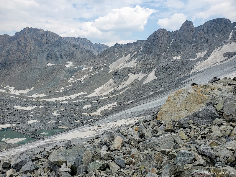
Indeed, it really was sluggish at first, but eventually it got more stable and the slope less steep, until step after step, we all but collapsed at the top of Indian Basin. Almost everything that had made the day so hard, so difficult, and so challenging was now all behind us. It wasn't that there was any specific spot really did us in. It was simply the overall endurance and stamina that was required to get from point A to point B, from Camp Lake to Indian Pass, and it took what felt like all of the stamina we had. I could not imagine how much harder it would have been with a blazing hot sun bearing down on us all afternoon. Instead, the cloud cover had served to keep us cool on what had been the most physically taxing and mentally grueling seven mile stretch I have ever hiked.
Looking back over the glacier to Alpine Pass
View east from the top of Indian Pass
View west from the top of Indian Pass
At the top of Indian Pass, Blake decided to leave the newfound crampons there, paying it forward for perhaps another fellow backpacker who might find them to be helpful.
The Crampons
Now out ahead of us lied Indian Basin, and at the end of it, Titcomb Basin. Both bucket list destinations I had longed to see, wanting tosee what all the hype was about them. Just as exciting was the fact that we'd be back on a trail all the way down. Down we went, eager to settle into a site to set up camp somewhere out beyond.
Beginning the descent down Indian Pass with Harrower Peak out to the left
Knifepoint Mountain (left), Harrower Glacier, Harrower Peak (middle), and Elephant Head (left)
Parry's Primrose
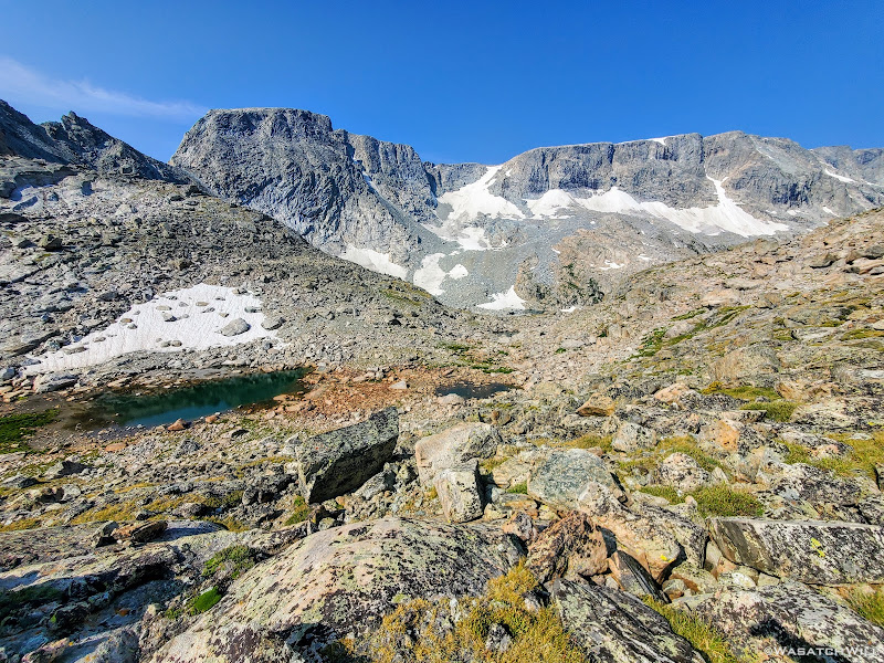
Harrower Peak and glacier
Knifepoint Mountain (left) and another snowfield we had to come across
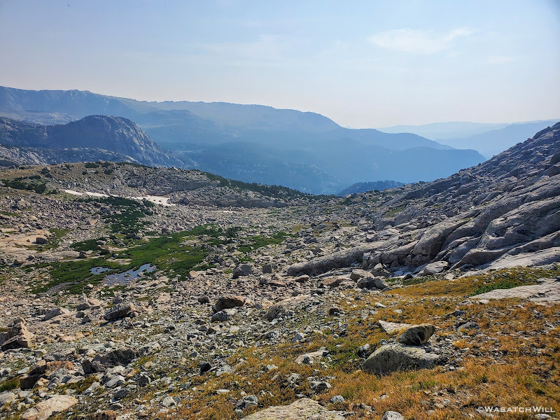
Looking further down Indian Basin
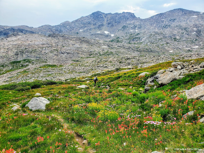
Considering the price we had just paid to get to this point, it all became worth it now. The light of the falling sun filtering out through the clouds, sending rays out across the horizon just made the whole landscape feel like something out of a magical movie. Just absolutely stunning, beautiful, and wondrous. There was so much color and greenery again. Grassy meadows, flowers, bright blue tarns and lakes, and so forth. For the second night in a row we were privileged to enjoy a blissful and heavenly experience to cap our day as we finished out the final miles. It was all balm for our brains, helping to take our minds off our battered and beaten legs and feet, nay...our whole bodies.
Alpine paradise
A crystal clear stream flowing next to the trail
Parry's Primrose beneath a small waterfall
A small valley full of Parry's Primrose flowers
Fremont Peak comes into view
A random and unnecessary cairn
Turquoise pool beneath Jackson Peak
Looking back up trail at KnifePoint Mountain (middle) and Harrower Peak (right)
Blake hikes ahead toward the lakes out in the distance
A large meadow of flowers with lakes down below and Elephant Head above (left)
Blake follows the trail with a brief change of direction to the northwest
Indian Basin flowers and Jackson Peak
Now heading southward, Elephant Head beyond
Knifepoint Mountain and Harrower Peak back in view
Harrower Peak and Elephant Head from above Lake 11008
Harrower Peak from across Lake 11008
Lake 11008 reflection of Harrower
11008 Island
View of Lake 10813 beneath Harrower Peak (left) and Elephant Head (right)
About halfway down Indian Basin, when we reached the lakes it holds, we began to encounter people again. And this time it wasn't just a few, but many, camping all around the nameless lakes to be found there in the basin and all the way down from there. We had pulled over at Lake 11008 for a brief break en route down through the basin, not to eat anything this time, but to treat our feet. Blake was starting to suffer a bit more, his ankle now flaring up again with a bit more irritation. When he revealed his ankle, it was now very red and marked with purple all over. He also had some hot spots and blisters on his feet to attend to. In fact, both of us had actually developed some significant hot spots that we weren't able to keep up with and so both of us had developed some pretty gnarly blisters from all the rocky and uneven terrain we had just come through. Meanwhile, Blake would go on to walk the rest of the day with a slight limp and a slower pace. He was able to manage the pain with some Vitamin I.
The blissful experience we had enjoyed hiking down through the upper half of the basin started to turn into some moments of frustration when all of the few spots I had marked out on my map ahead of time for potential camp spots all turned out to be occupied. That meant we had to keep heading downward, even reaching the junction with Titcomb Basin before the landscape began to open up again and spread out.
A peek into Titcomb Basin
Now with precious little light left again, we went into desperation mode for finding a campsite. We could have veered up into Titcomb, but given how many folks we saw up in Indian Basin we figured it would be pretty crowded up there too. Island Lake, while only a mile away now, felt too far. No doubt it would have been a struggle to find a vacant spot this late in the day there too. We ended pulling over at a small-ish lake that sits at the lower edge of Titcomb Basin and just above Island Lake, Lake 10467. There I had spied an open grassy flat some 300 feet back from the lake and behind a small thicket of trees, a site some 1700 feet lower in elevation than Indian Pass. We hastily got our tents and beds set up just in time to have dinner in the dark again. Only afterwards had we realized another group had ended up near the same spot, not much more than 200 feet away from us. Oops. Even at 200 feet away, I felt like we were camping on top of them and hoped they weren't too bothered by it. At least we had the thicket of trees along with a little rise in elevation to keep our camps mostly out of view from each other.
As for the morrow, we'd have another big decision to make. Would we be able to continue staying true to our course and head up through Titcomb Basin, then up and over Knapsack Col to Peak Lake and beyond or would we need to backoff and take an easier way out via Island Lake and Jean Lakes to progress ahead to the trailhead at Green River Lakes still some 27+ miles away. Or, would we have to call a different audible and exit out at Elkhart Park just about 13 miles away and figure out how to get my car back from there. Whatever the choice ended up being, it would all be determined by Blake's ankle, the overall feeling of our bodies collectively, and of course, the weather.
Lake 10467
Now, in closing this day's report out, I don't typically appeal to my personal faith in such trip reports, but this was a day where it would be hard for me to deny and not acknowledge having some divine providence in our favor. I know that it can be a highly controversial subject for so many. So many others have radically different experiences that make it incredibly hard for them to develop or hold onto any sort of spiritual faith or feel any sense of divine or eternal purpose to life. For others they just can't find any reasonable or logical purpose to believe in any kind of divinity. And yet for others, it's just all too confusing that it's just not worth putting much belief in anything or anyone beyond themselves.
And that's all understandable, something I strive to empathize with. I know many people's prayers seemingly go unanswered leading them to doubt what faith they may have had earlier on in life. Terrible things of all kinds have happened and still happen to good people. So much in life and what happens in this world can be so cruel sometimes, unjust and unfair. So I get it. I'm not looking to preach or convert any non-believers reading this. But I do have my own reasons for still believing, for still maintaining my faith, even when life can be so hard, and when at times things don't make sense, and even after so many of my own prayers so often seem to go unanswered as well, or at least not in ways I think they should be. But at the end of this particular day, I was especially grateful for what I perceived to be an answered prayer, indeed one that very much went the way I had hoped it would and more: most notably the strength of Blake's ankle holding up, the change in weather that helped to keep us cool along the most difficult stretch of the route, and of course the crampons that seemingly showed up out of nowhere. I will happily, and thankfully, take such days when I can get them because no doubt, there will be more days ahead where I won't always get what I want.
Suffice it to say, it had been a hard day, even the most demanding, most laborious, most strenuous and tortuous day I have ever experienced, both physically and mentally, among all my backpacking trips I have ever undertaken to date...and yet, through all the pain and exhaustion, I fell asleep feeling an incredible amount of spiritual rejuvenation and fulfillment in ways only such a challenging day in the backcountry could do, surrounded by what I believe to be some incredible, amazing, majestic and beautiful creations of God via natural processes, including both evolution and erosion, set in motion so - so - long - ago.
To be continued...
Need to catch up?...
WRHR: DAY 1 - BIG SANDY TO CIRQUE OF THE TOWERS
WRHR: DAY 2 - CIRQUE OF THE TOWERS TO DESOLATION VALLEY
WRHR: DAY 3 - DESOLATION VALLEY TO HALLS LAKE
WRHR: DAY 4 - HALLS LAKE TO CAMP LAKE
Last edited:
")

