- Joined
- Jul 23, 2013
- Messages
- 1,666
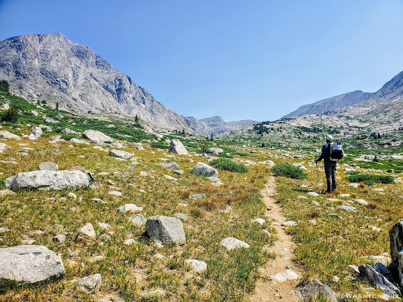
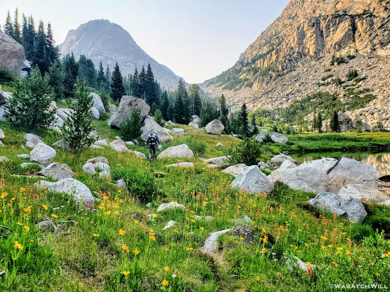
A whole lot of cross-country route-finding, a walk across Europe, followed by two more passes would take us through Day 4 along this Wind River high route.
Monday - July 26, 2021
MILES: 13 | GAIN: 2,717 ft
Another blissful, cozy, and comfy sleep. Another morning waking up to bluebird skies. Day four was now upon us and that meant this would be a hallmark day. We had now reached the halfway mark in our journey for duration of time and were now destined to reach the halfway mark in miles by the day's end.
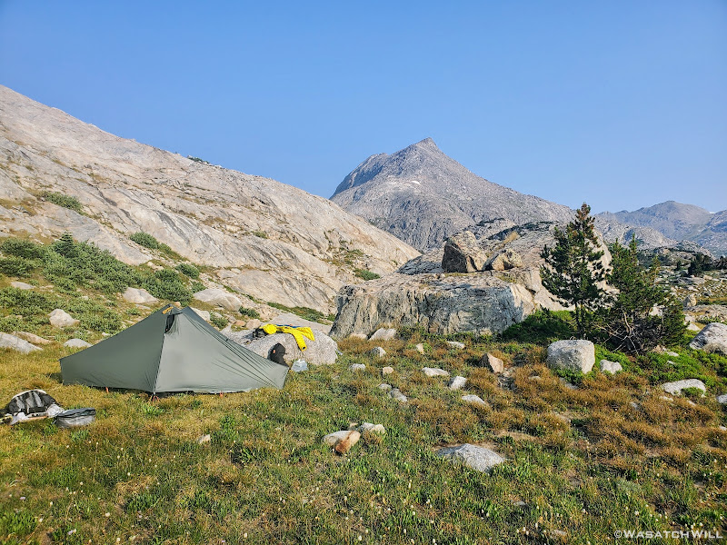
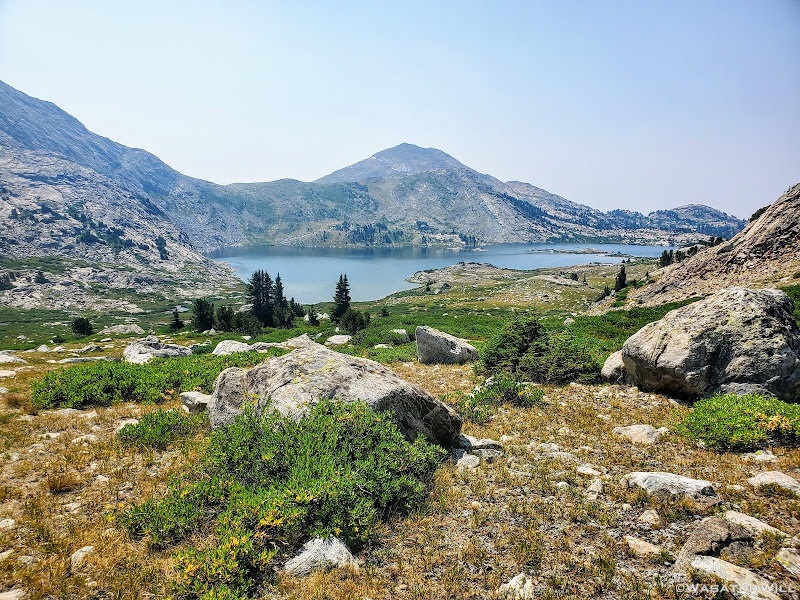
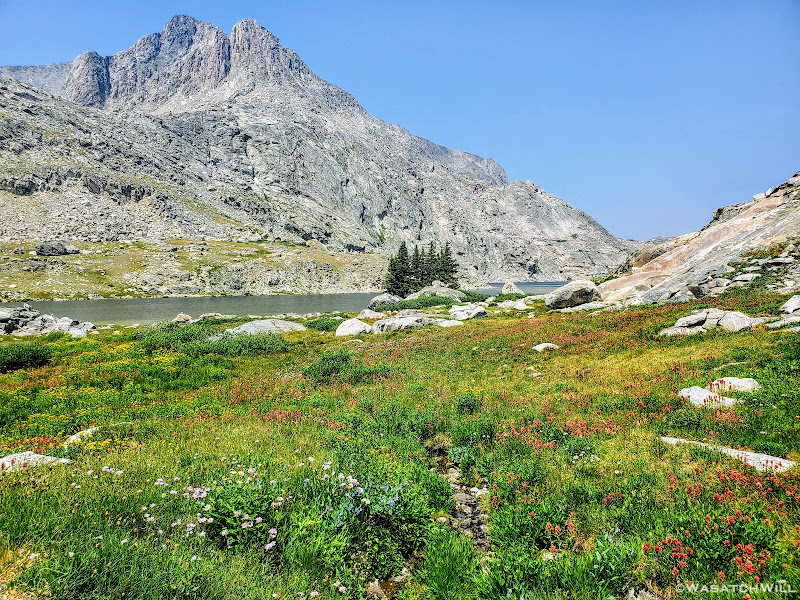
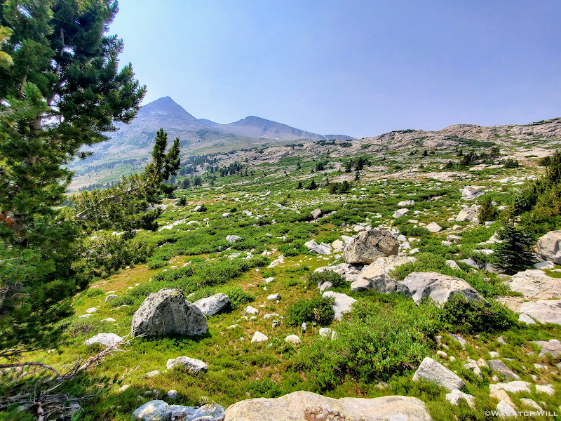
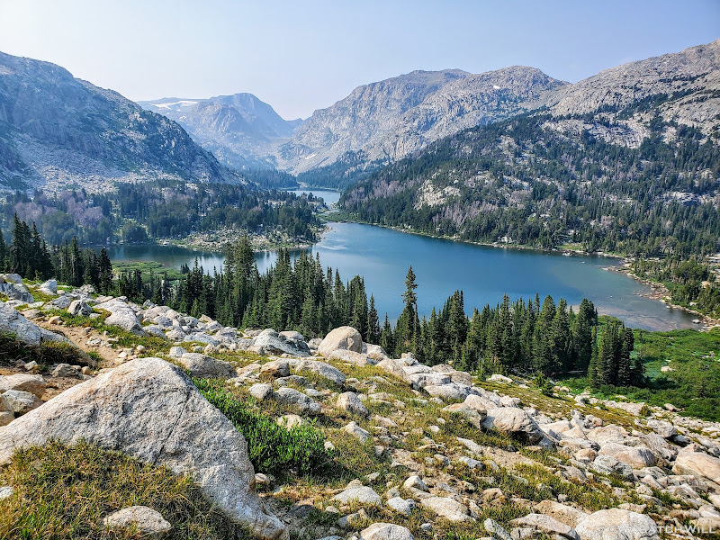
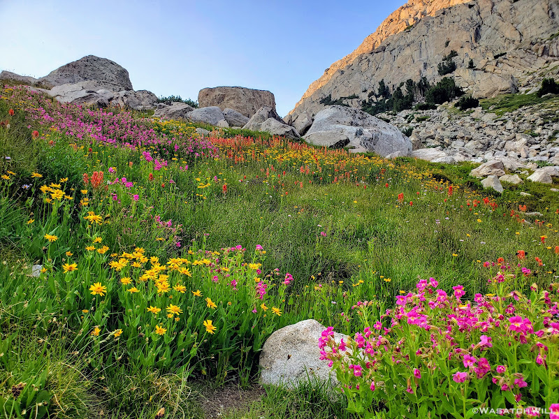
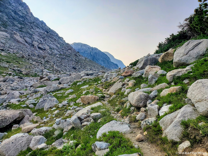
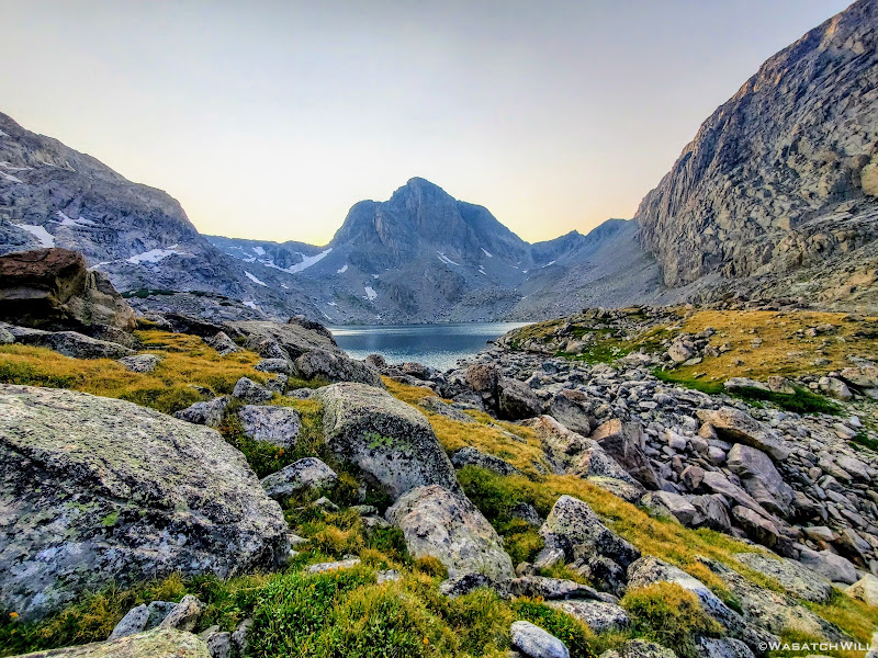
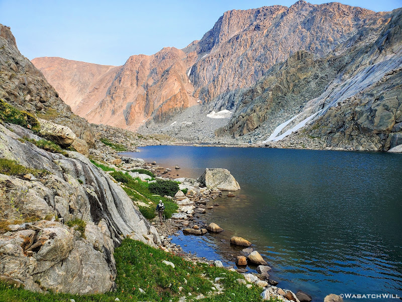
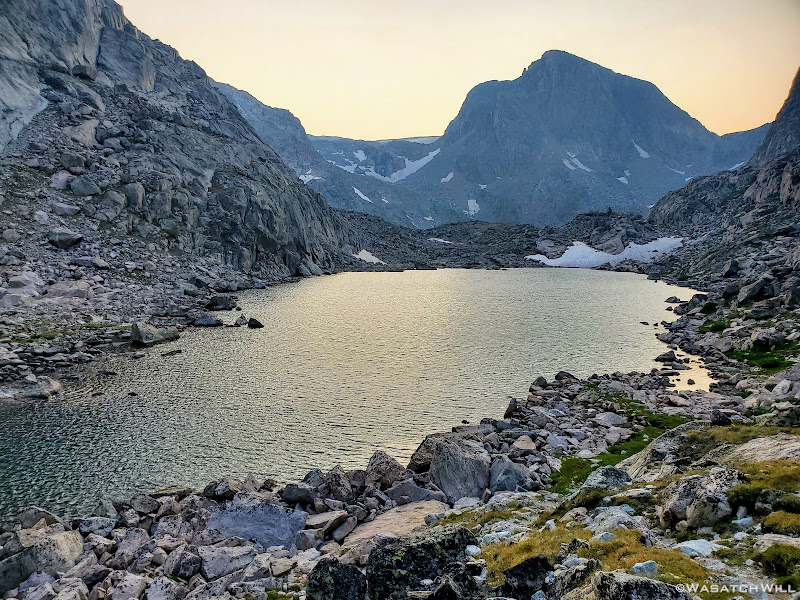
Morning at Halls Lake Camp
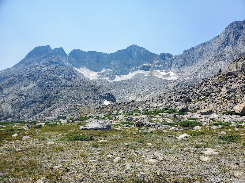
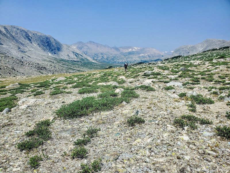
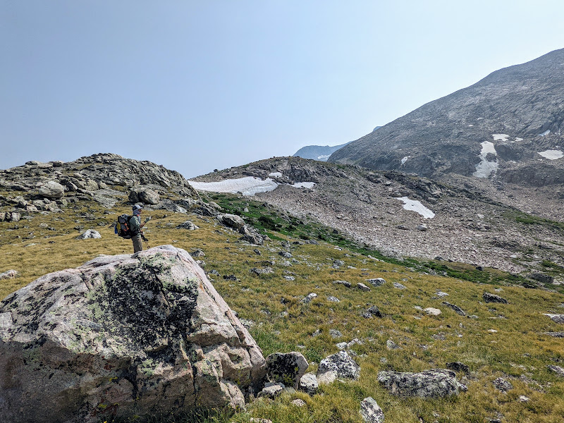
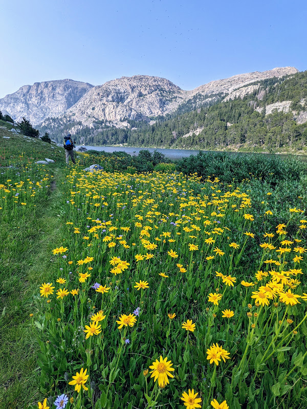
Upon finishing our morning routines, we set off for yet another day of progress along this Wind River high route. We followed the outlet of Halls Lake for a short while before crossing over and charting a cross-country course toward Europe. No, not that Europe. Remember? Europe Canyon, as mentioned in Day Three.
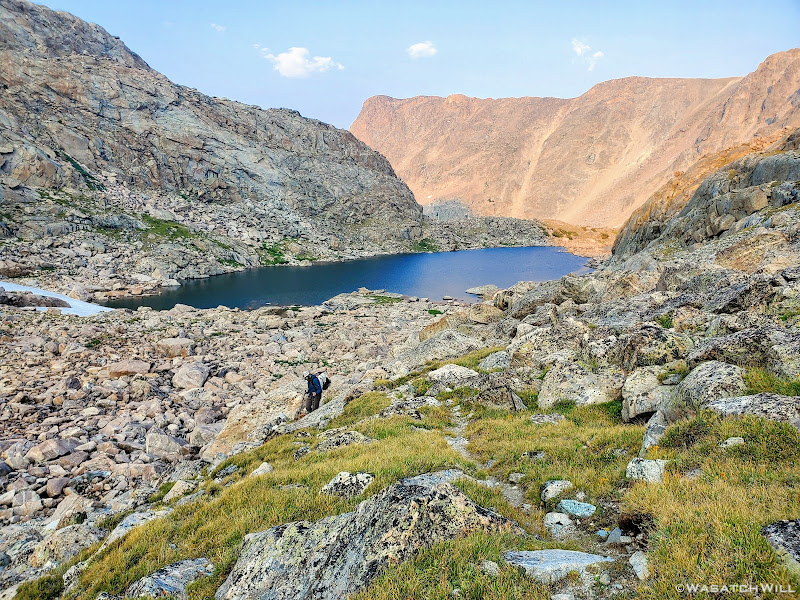
Dropping over a small ledge near Halls Lake (photo by Blake)
Checking out the landscape downstream from Halls Lake (photo by Blake)
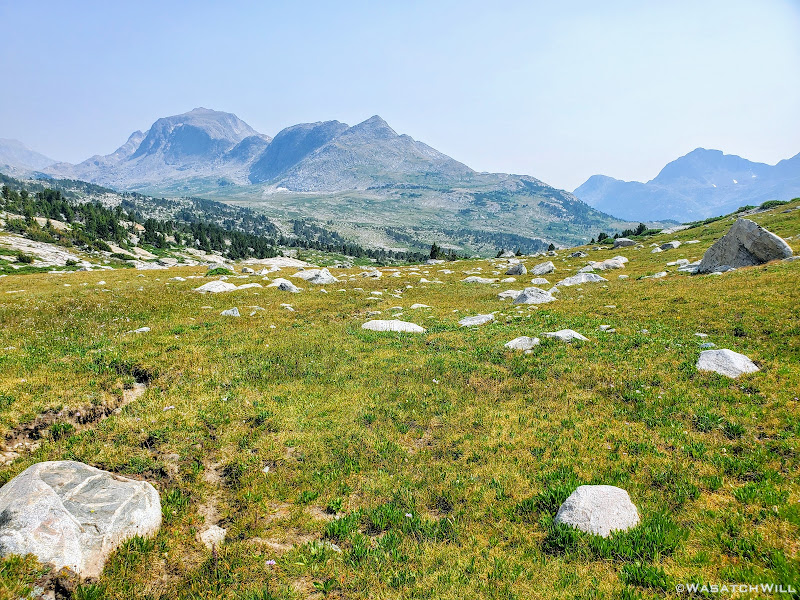
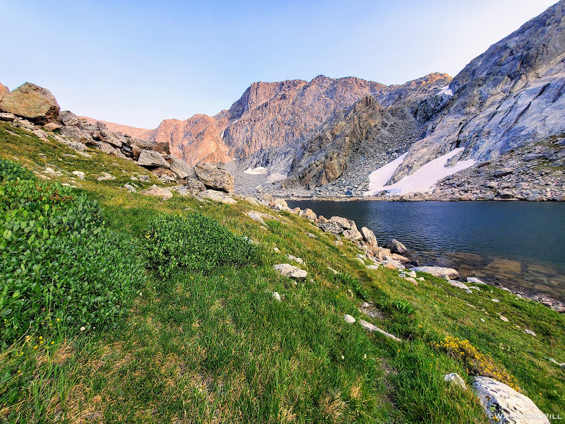
Traveling cross-country toward Europe Canyon, Mount Victor in the distance
There had been no sign of the other group we had passed by at Halls Lake the night before, who had then moved on ahead of our camp after they finished their dinner. They had certainly looked like the sort of group to get going at the crack of dawn each day so it was not surprising for them to have already vanished from the area.
From the creek flowing out of Halls Lake, we had to pick our way up a rise and then across some rocky tundra where it leveled out. Just prior to arriving at Europe Canyon we had to descend down to another nameless lake. Again, there were many of these nameless lakes along the route. By Uinta standards, many of these nameless lakes were quite big for being high mountain lakes. They'd easily be among the middle-sized to larger of the lakes to be found in the Uintas. Not so in the Winds. As was discovered the prior day, lakes like Middle Fork Lake would dwarf the larger of the lakes to be found in the High Uintas Wilderness, chief among them being Grandaddy Lake, Red Castle Lake, and Lake Atwood. Of course there are even larger lakes just outside of the Uintas Wilderness boundary, such as Moon Lake, but those larger lakes have to credit their larger sizes to man-made dams which has converted them into actual reservoirs.
As for these large nameless lakes in the Wind River Mountains, maybe they just ran out of names on account of how numerous the total number of lake there are to be found in the range and so some of the more remote ones were left without. While that's likely not the actual reason, I actually enjoy encountering significant looking landmarks with no official name from time to time. Sometimes it makes the landscape feel just a little bit more remote, a little bit more wild, a little bit more wondrous.
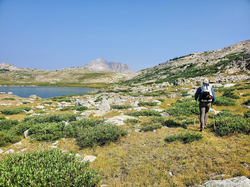
However, when it comes to such nameless lakes and often nameless peaks too, you can simply reference an adequate topo map, such as those published by the USGS, and often find an elevation printed for on these lakes and peaks. Or are they zip codes? No, no, they're definitely elevations. Thus in write-ups like this, the author will simply refer to such lakes or peaks by that labeled elevation when given. So, keeping to that pattern, after hiking just over two miles from Halls Lake, you could say we were now gazing out over what many would simply refer to as Lake 10542. Not only that, we were now officially standing at the brink of Europe...Canyon.
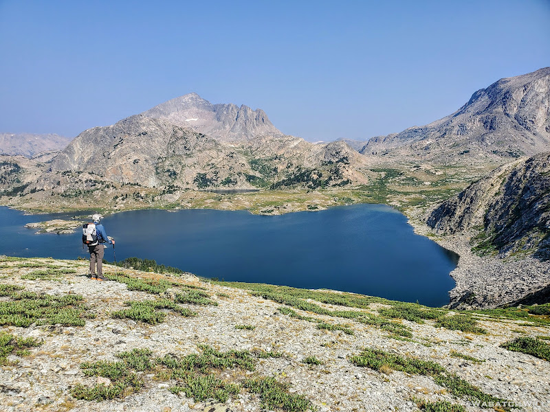
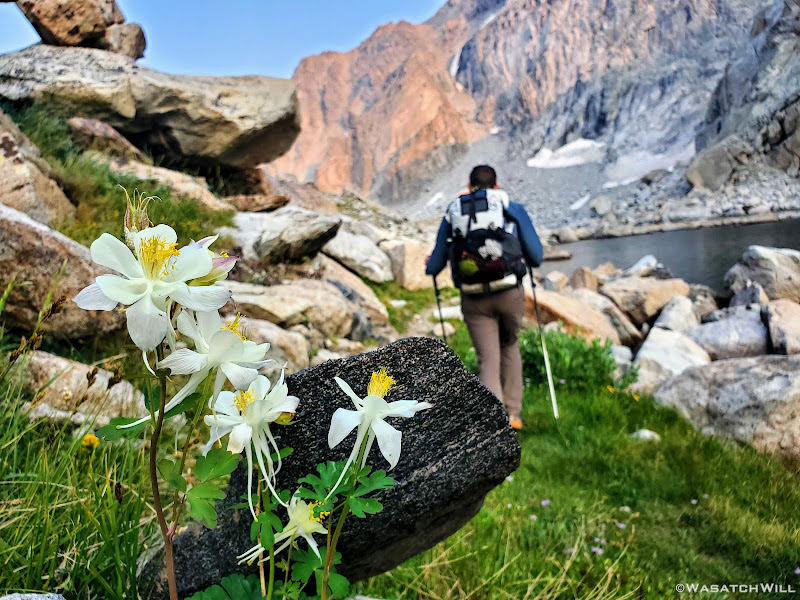
At the edge of Europe Canyon, Blake surveys the scene from above Lake 10542; Mt. Victor beyond
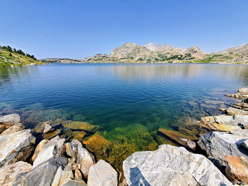
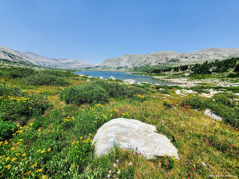
Once we arrived at the shoreline of the lake, we dropped down for a mid-morning snack break. Being yet another curiously hot day, we soaked our shirts, hats, buffs, feet and so forth to give ourselves some relief. Still wasn't brave enough, or crazy enough, or desperate enough, or tough enough to jump all the way into the frigid cold water.
A curious fish or two had seemingly come up to check us out as we sat upon the rocks at water's edge. Was it a coveted Golden Trout? Indeed, I believe it was. Oh how I wish I had my fishing pole now!
While not native to the Winds (Golden Trout originate from California, specifically the southern end of the Sierra Range), there are now numerous lakes in the Wind Rivers and elsewhere in Wyoming along with other Western State fisheries where they have been introduced and successfully survived, though more often as a mixed breed now, having bred with previously existing species of trout in these non-native locations.
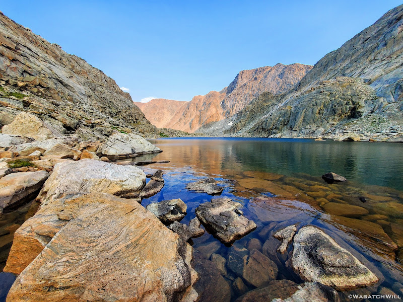
Lake 10542
Moving on, we now had to scramble over another rock slide, aka more talus, to stay along the short-side of the lake in getting to the Europe Canyon trail.
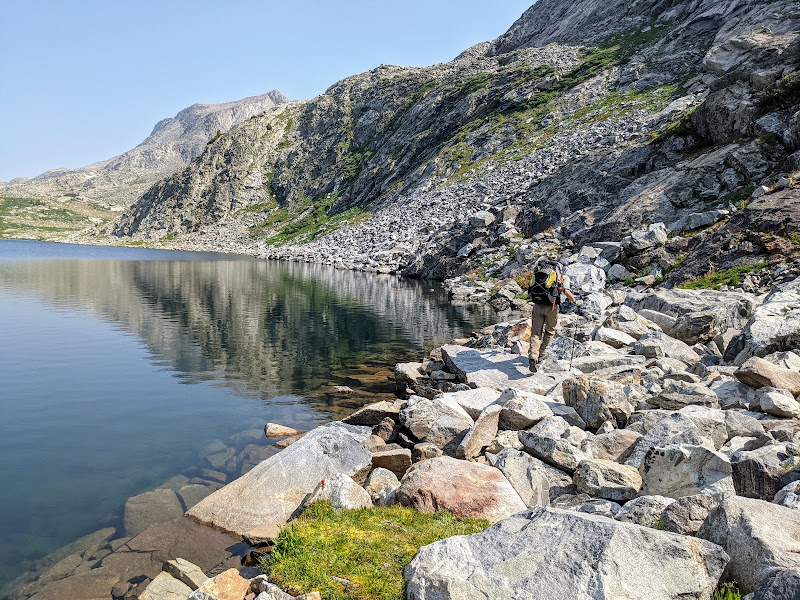
Crossing the talus at Lake 10542 (photo by Blake)
And then, there it was! We had intercepted the Europe Canyon Trail. Ok, that alone wasn't all that exciting but here again, we now had two options to choose from. We could follow the trail up to Europe Pass along the Continental Divide whereby we could relink with Skurka's route and follow the ridge bordering the Wind River Reservation, leading to a class 3 scramble up to a knife-edge ridge and ultimately up onto Europe Peak at 12, 259 feet high. From there, we'd be able to ride the Continental Divide all the way down to the Golden Lakes Basin. Our other option was to remain true to the Dixon/Wilson route and cut straight across the trail continuing a northwestward cross-country approach to Long Lake.
As tempting as it was to head up Europe Canyon and take on Europe Peak from there, considering the skies were still completely cloudless, we chose the more conservative option and went for Long Lake or simply Lake 10683 depending on map of choice. It would also spare us between one and two extra miles and Long Lake seemed like it would be a fun adventure to get around too.
Note: Sometimes there happens to be lakes and peaks that have a more formal name on one map, such as those by CalTopo while the same landmark will only be labeled with only its elevation on the USGS maps. And as far as these elevation labels go, even those can be inconsistent at times between the USGS and the U.S. Forest Service adaptations of the USGS map sets. Sometimes a few hundred feet off from each other. I have found that the USGS maps tend to be more accurate with their elevation labels in such instances. For example, Long Lake is indeed named Long Lake on CalTopo. It is simply 10683 on the USGS map, but drops way down to 10147 on the USFS's topo map. Nearby contour lines and their given measurements will confirm that the USGS label is more accurate.
Blake gazes up Europe Canyon
A look back at Lake 10542 with Mount Medina beyond
Along the way to Long Lake, I stumbled into what I then thought was a really unique rock. For obvious reasons I gave it the name: Dalmatian Rock.
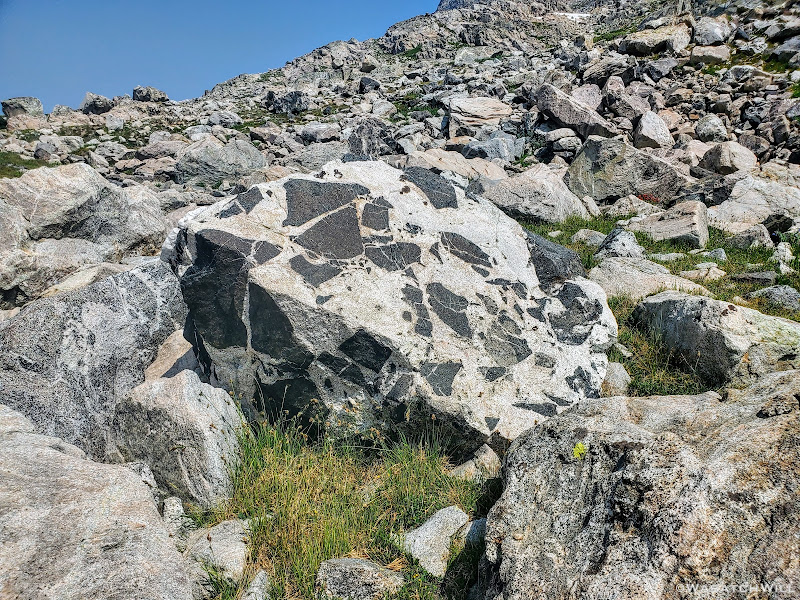
'Dalmatian Rock'
Blake (right horizon) moves ahead toward Long Lake and Mt. Victor
Less than a half mile from Europe Canyon, we now had Long Lake in view. What had been mostly a grassy stroll from Europe to Long Lake instantly turned into a nice stretch of talus with a few cliff bands below to steer clear of. We stayed higher for the first parts around the lake to stay above the cliff bands, picking our way through some mostly stable talus, which even included a little bit of light class 3ish scrambling if I remember right.
Long Lake comes into view alongside Mt. Victor
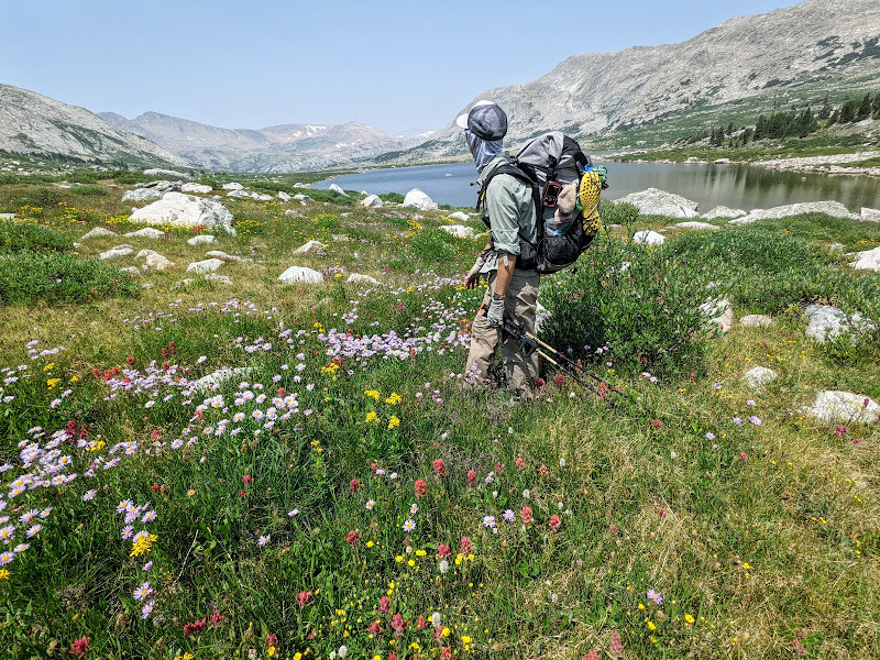
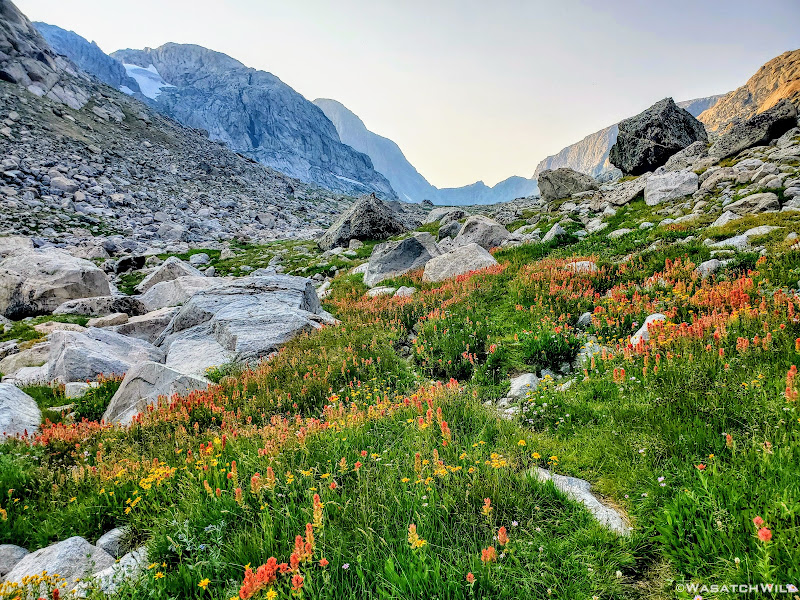
Somewhere between a third and halfway around the lake, we descended down into a grassy meadow full of flowers. There was also a small isolated grove of trees at the edge of the lake beyond the meadow. While looking out of place, these trees certainly added to the scene. From there, we'd follow a mix of more grassy slopes, rock, talus, and scree to get to the other end of the lake.
A field of flowers at Long Lake
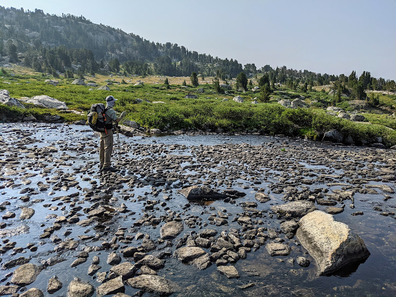
Once at the end of the lake we'd rise up along side of the creek feeding Long Lake soon crossing over it.
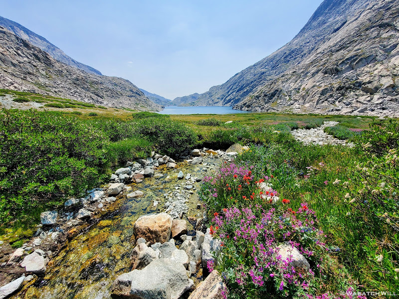
Looking back down over Long Lake from above its inlet
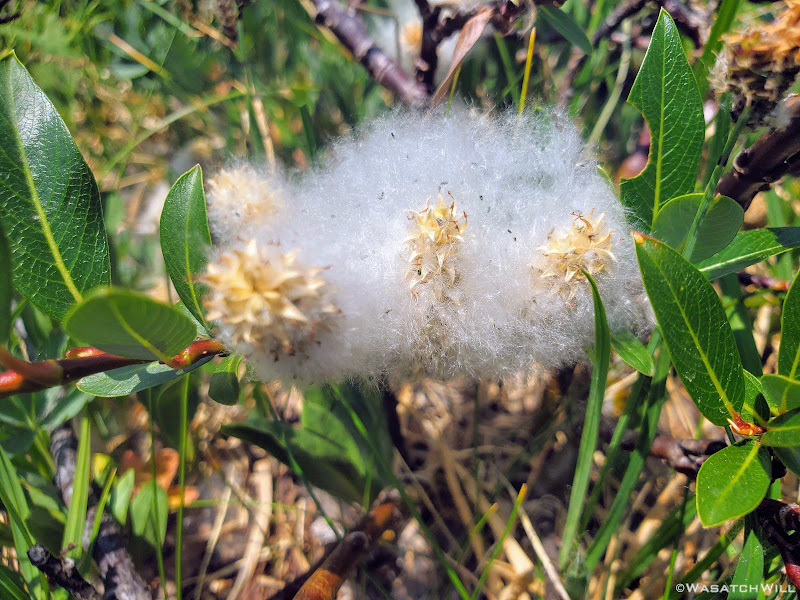
A puff of Willow seeds
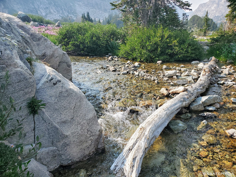
We had paused for a water refill at the creek where we crossed and then continued heading up the rise until it crested over and back down continuing toward the west. Perhaps this spot would qualify as another pass by geographical or geological standards but regardless, it was a very gentle gain to its top. I did not count it on the day's total tally of passes.
Pass or not, it provided a nice view back of Mount Victor and its attendant glacier. To the east rose Europe Peak. Here, another route up to Europe Peak sat ahead of us. It also would have been a much milder approach up it from here, but also a little over another mile and a half out of the way.
Wide view of Long Lake and Mount Victor
Mount Victor and its attendant glacier
Europe Peak
Rather than taking the time to actually bag the peak, we could have also spared ourselves the roughly one and a half mile round trip it would take to bag the peak upon reaching the ridge and just head immediately northward along the Continental Divide. Even just gaining the ridge and walking it down toward Golden Lakes Basin would have promised some thrilling views and the weather was certainly still favorable to do so.
However it would take more effort to do that too. Our feet were already feeling pretty beat up, achy, and sore. Instead we kept course for the next lake, Lake 10555, or more elegantly, Glacier Lake according to other maps, perhaps named for the nearby glacier on Mount Victor. We were extra eager to get there too, for now, it was lunchtime. I do now have a strong desire to return to this area some time and walk that ridge from Europe Peak to Hay Pass.
Blake begins the descent toward Glacier Lake
Closing in on Glacier Lake
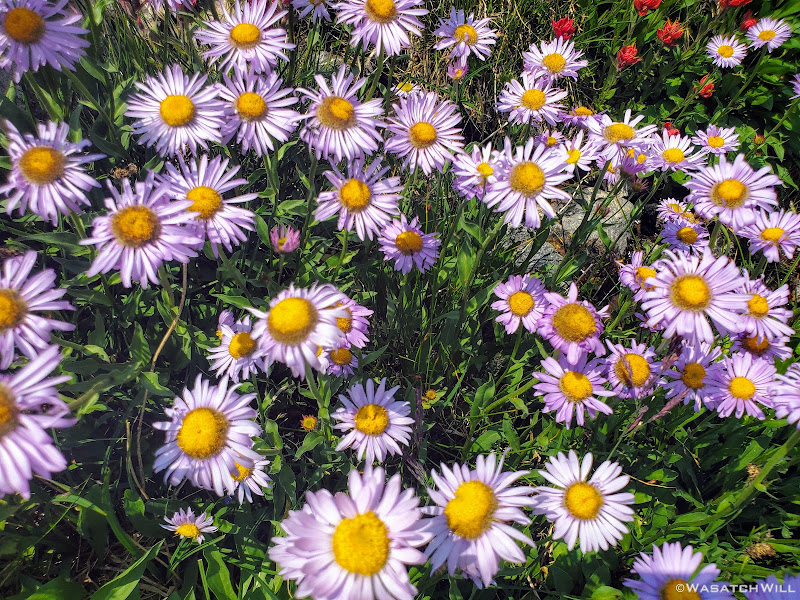
Subalpine Daisy/Fleabane
Treading lightly through the flowers at Glacier Lake (photo by Blake)
While it certainly felt longer, given the scale of the area, it was only about three-fourths of a mile down a gradual descent of tundra with low lying Willows and rocks followed by large patches of flowers to arrive at Glacier Lake. We took a much deserved break to have lunch, rest our feet, and cool down once more for a bit.
Glacier Lake
From Glacier Lake, it would be a bit of a slog to get over to North Fork Boulder Creek and our first major pass of the day, Hay Pass. For that stretch we exchanged the hard, rough talus and the grassy tundra for uneven soft and spongy ground plagued with marshy bogs. We did well to keep our shoes dry for a while, Blake even moved higher up for a stretch, but eventually I reasoned the challenge to keep shoes dry wasn't worth it anymore. If my feet were already going to be wet from sweat on the inside of my shoes, despite being well ventilated non-waterproof shoes, there was no more sense in trying to keep the outside of my shoes dry. The cold water I now allowed to seep through my shoes as I walked over this wet and spongy grassland felt amazing! Why did I ever try to avoid it?, I asked myself. Must just be a habit.
Once we reached the other end of the boggy valley, Lake 10322 came into view down below Round Top Mountain. Rather than continue descending towards it, we turned toward the right where would seek a trail up over Hay Pass.
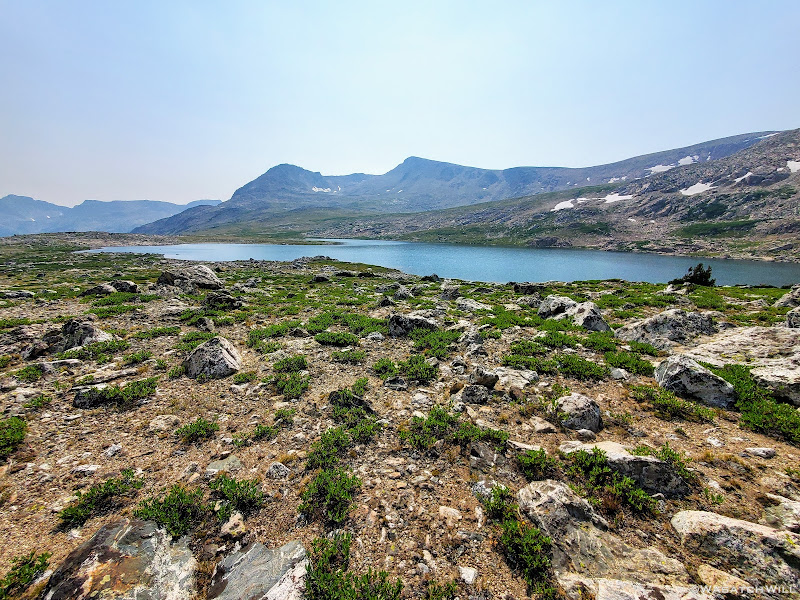
Lake 10322 comes into view along North Fork Boulder Creek with Round Top Mountain above
Seeking out the trail up toward Hay Pass, Round Top Mountain beyond
Looking west down the North Fork Boulder Creek drainage
For the first time all day, we'd join up with an official trail that would take us up and over. Another large nameless lake appeared off to our left along the way. It's given elevation: 10755.
Officially on the Hay Pass Trail
Lake 10755 with Round Top Mountain above and beyond
In fact, the trail had flattened out so much and even dipped down a bit to cross over the creek draining out of the lake that it made me wonder for a moment if we had already crested over the top of the pass. Nope. Like a false summit, one could call this a false pass. There was still a bit more gain to acquire before we could say we were over Hay Pass.
Fortunately it was another very tame pass, the grade of the trail all the way up it remaining fairly mild.
Taking in the views from atop Hay Pass (photo by Blake)
At Hay Pass or shortly below it, Skurka's route briefly rejoins the Dixon/Wilson route after having departed from it back at Middle Fork Lake. Hay Pass also marked the 3rd time we'd cross over the Continental Divide. I hadn't taken any thought of the Divide the prior two times at Jackass Pass and Texas Pass. Those were so early in our trip I was still just full of excitement to be venturing out as we were. Here, I took a moment to think about what standing on the Divide meant.
Looking west, all the water flowing off the western slopes below us would find its way to the Green River, the very same Green that goes onto flow into Flaming Gorge Reservoir at the border with Utah and then beyond. In Utah, the Green River goes on to join forces with the Colorado River in Canyonlands National Park. From there, the mighty Colorado River makes its way into Lake Powell for a layover before spilling out and carving itself ever deeping into the great Grand Canyon before slowing down once more for yet another layover at Lake Mead. From Lake Mead it's on to Lake Mohave to Lake Havasu and finally out to the Pacific Ocean via the Gulf of California. Or so it once ran. Just prior to the Gulf of California and the greater Pacific Ocean, what's left of the Colorado at that point is diverted into more canals to satisfy demand for water in communities along the borders between California, Arizona and Mexico.
Looking east, all the waters ahead of us would make their way down to Bull Lake Creek, to the Wind River...er...Wyoming Canal. And if lucky, some might even be allowed to move on to the Bighorn River where in Montana it joins the Yellowstone River, which in turn links up with the Missouri River, and then ultimately the mighty Mississippi River. Of course, that goes on to flow out into the Gulf of Mexico and ultimately the Atlantic Ocean.
I thought that was rather amazing as I stood there and pondered all that. Wow! If only it were possible to carve my initials into a couple small sticks and track their ride in opposite directions across the country from here. Of course, such an attempt would only be in vain as both sent either way would certainly get trapped and/or beached somewhere along the way long before they could reach the end of the river flows. Oh well.
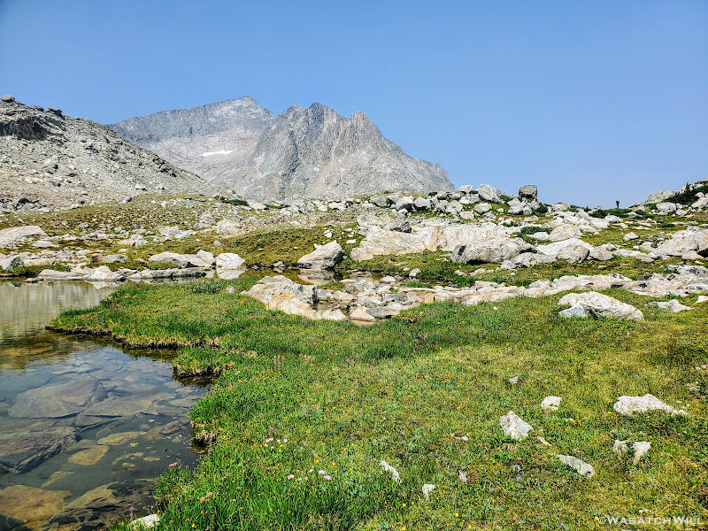
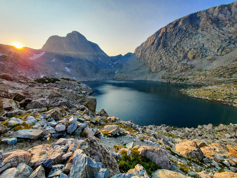
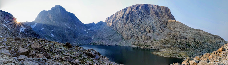
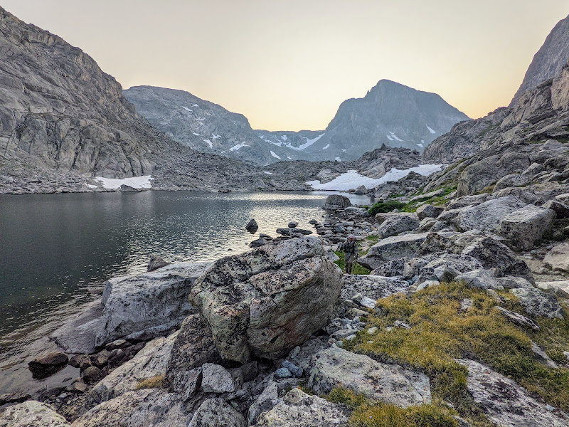
A few moments after cresting over Hay Pass, we set our eyes upon beautiful Dennis Lake. I found myself amazed by the sheer cliffs and the clinging patch of snow coming down from Dennis Peak, forming a wall at the southwestern edge of the lake. Further over was a long cascading waterfall stair-stepping its way down the rocks and boulders to feed the lake. Further out beyond stood Angel Peak and Angel Pass. It was an amazing view indeed.
Dennis Lake with Angel Peak on the far horizon
Moving ahead along the trail above Dennis Lake (photo by Blake)
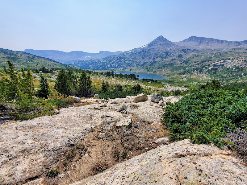
As the trail continued northward high above Dennis Lake, Golden Lakes soon appeared out in the distance nestled alongside Mount Quintet.
Alpine Lakes Basin and Mount Quintet come into view to the north (photo by Blake)
Nearly a thousand feet in elevation and just over one mile in distance sat between Hay Pass and Golden Lakes. Needless to say, it was quite a descent to get to Golden Lakes. The trail remained well trodden all the way down, but even so, I was once again grateful to be descending the north side rather than ascending it.
Throughout each day, Blake and I would take turns getting out ahead of each other on occasion and then wait for the other to catch up. Usually this would be at particularly picturesque spots. I had taken the lead on the descent down to Golden Lakes. When I pulled over near the first or lower Golden Lake, it had turned into an unusually long wait. When Blake finally arrived, he informed me he had somehow stumbled a bit somewhere along the way down and rolled onto his ankle pretty good. Thankfully it didn't seem so bad to completely cripple him and cut the trip short, but he was definitely experiencing some significant pain from it. With a good dose of ibuprofen, he reckoned he could keep on going. We kept on trekking.
Golden Lakes Basin
We again refilled on water at the inlet to the lower lake after crossing over on a convenient log.
Creek crossing at inlet of the lower Golden Lake
On the other side of the creek stood a dense field of fireweed along the banks of the creek. Bees and other nectar loving insects were buzzing away among them.
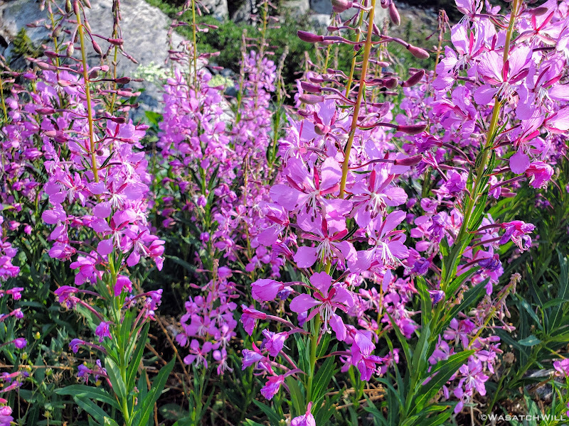
Fireweed
Following the trail through the fireweed and alongside the creek, it eventually pulled away and led us on over to the middle lake, Lake Louise. There the fireweed of the lower lake had now transitioned to a field of golden yellow arnicas. It was fitting to be at Golden Lakes with such bright yellow flowers as the sun was dropping down the sky and approaching golden hour. Golden Lakes seem to have a reputation for having a certain charm to them and indeed, this basin lived up to it. There was very much something charming along this string of lakes.
Arnica flowers, Lake Louise, and Mount Quintet
Following the trail through the arnicas at Lake Louise (photo by Blake)
Continuing up Middle Fork Bull Lake Creek, there would be one more named lake in this triple header chain of lakes so close to each other: Upper Golden Lake.
Middle Fork Bull Lake Creek between Lake Louise and Upper Golden Lake
Just prior to reaching Upper Golden Lake, we ended up having our only encounter with any other humans for the day. There sitting on a very large rock, er, boulder, in the middle of the creek was a group of four. They turned out to be the same four we had passed by while they were having their dinner the night before near Halls Lake.
As assumed, they had risen early and got going as soon as they could earlier in the morning. In fact, they had actually taken the opportunity to take the Europe Canyon Trail up to Europe Pass to pick up the Skurka route up to Europe Peak and down the Continental Divide as mentioned earlier above. Now I was a bit envious. They described it as amazing.
They had now set up their camp in the upper end of a really nice flat adjacent to the creek there. Their plan was to continue on up above Upper Golden Lake in the morning and then choose between Douglas Pass or swing around by Camp Lake before taking on the lengthy and grueling Alpine Lakes Basin, as per its own reputation. We bid them adieu for the second time in as many nights and continued on up to Upper Golden. Wherever we camped tonight, we'd now be a step ahead of them.
Upper Golden Lake
At Upper Golden Lake, there were a good handful of other flats up in the trees above it that would have served us as some terrific campsites. Getting late in the day now and being quite tired, it became very, very tempting to lay up in one of those sites. With Blake now having incurred an injury to his ankle, it was even more justified to do so. We strongly considered it. It was such a beautiful and calming place to be too, with numerous streams and creeks and even a nearby roaring waterfall all flowing into the lake across the other side. Indeed, this was a haven of soothing white noise. However, our target for the day had been Camp Lake, well beyond another major pass rising nearly another thousand feet up above the northern inlet of Upper Golden Lake and about two more miles away.
Upper Golden Lake and Mount Quintet
Saxifraga Odontoloma or Micranthes Odontoloma, aka Brook Saxifrage
I was more than willing to pull over and call it good for the day but the ibuprofen was kicking in well now for Blake and he felt confident in his ability to continue on. So continue on we did, briefly pulling over along the other side of the lake for one last little rest, a water bottle refill and a snack to fuel up for the big pass that now stood a stone's throw away.
Once again, we found ourselves surrounded by a beautiful array of flowers that would only continue in several patches alongside a babbling brook all the way up the pass.
Blake charges ahead for the final pass of the day
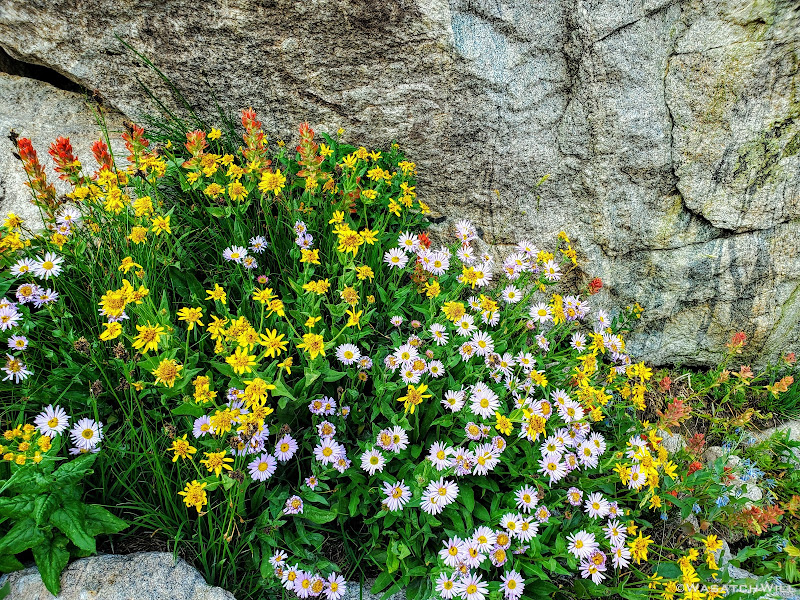
Paintbrush, Arnicas, and Subalpine Daisy
In between the patches of flowers, the trail would disappear into piles of boulders and talus to step across and over and then reappear wherever it could reasonably do so. To my surprise, there was also several more dalmatian rocks all the way up as well.
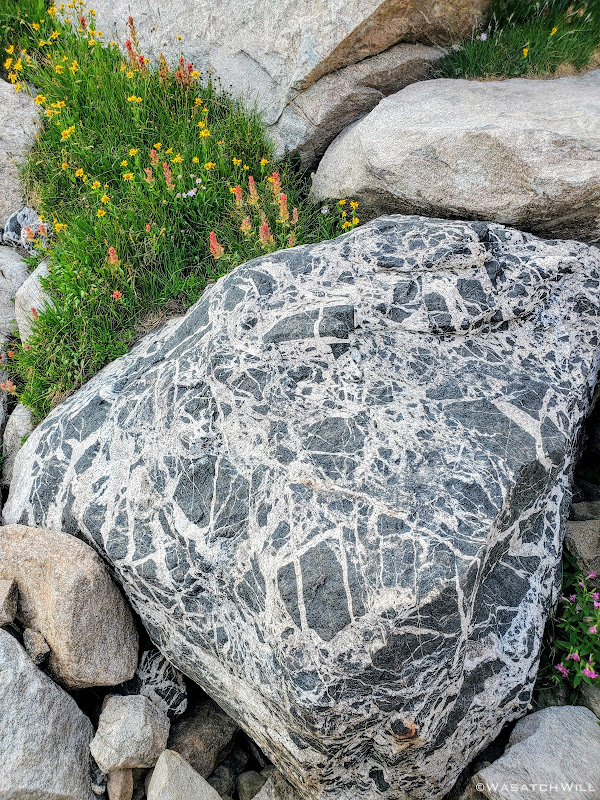
Another dalmatian rock
But oh, the flowers, now glowing ever so slightly with the magical golden light of alpenglow reflecting off the high peaks above. Oh my! Oh wow! What beauty! Is this Heaven!? Seriously...My inquiring mind yearned to know...
As hard as it was to leave behind the great campsites down at Upper Golden Lake below, those regrets had now been thoroughly washed away. It was now a treat, a privilege, a reward, a blessing to be able to hike up this pass with such enchanted light and colors now surrounding us.
A field of Arnicas, Paintbrush, and Monkeyflowers
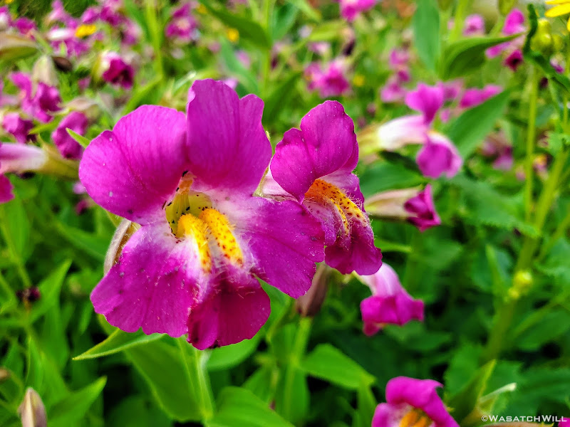
Lewis Monkeyflower
Pausing in the talus to look back down across Golden Lakes Basin (photo by Blake)
Alpenglow lights up Mount Quintet above the pass
Almost to the top
A patch of Paintbrush flowers near the top of the pass
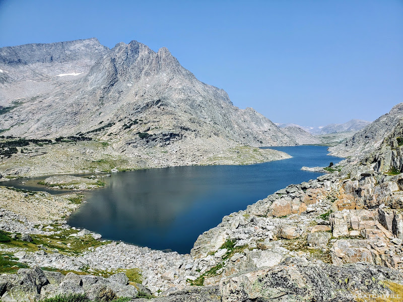
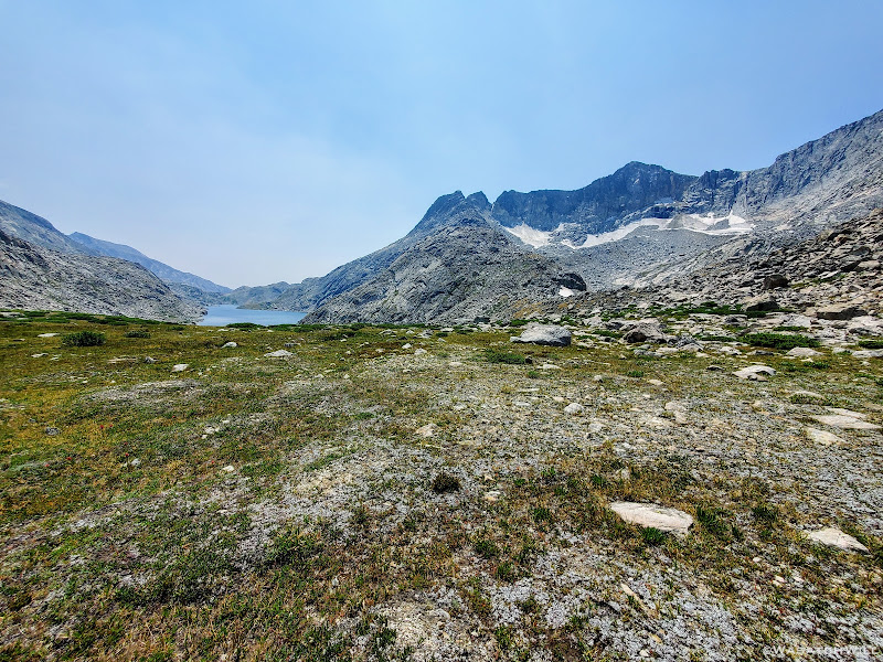
Brimming with pure joy and awe, little did we know how much more there was to come as we crossed over the other side of this nameless and enchanted pass. From near the top of the pass, now in another sea of talus, our eyes now feasted upon yet another stunning scene before us. There the sun re-appeared to us, but for a moment, only to set for good behind a nameless peak sitting across from yet another nameless lake, or 10787.
WOW! WOW! WOW!
Not everything here reamined nameless though. To the right of the nameless peak was the unofficially named Douglas Pass. To the right above that pass rose the officially named Douglas Peak. One might as well just refer to the lake here as Douglas Lake, unofficially, of course.
Sunset at 10787
Lake 10787 cradled beneath Douglas Peak and Douglas Pass
Now, we were just being spoiled silly. We had been privileged to walk through and behold some amazing scenes prior to this pass, but in the moment, this seemed to have blown all of that out of the water. This instantly became one of the most memorable and scenic stretches of the whole trip and yet there would be more such stretches in the days to follow. We had now entered into the heart of what I believe to be some of the very best the Winds have to offer and some of the most remote terrain to be found in all the range.
Looking back across 10787, the nameless peak above it, and Douglas Pass (right)
At the outlet of 10787, the Skurka route again briefly diverges away from the Dixon/Wilson route to pursue the more strenuous Douglas Pass and thereby offering up yet another shortcut to what lies behind, this time to get into Alpine Lakes Basin. We continued to take the lengthier way that would take us around Douglas Peak and then seek to establish our camp near Camp Lake to stage up for an entry into the notorious Alpine Lakes Basin the following morning.
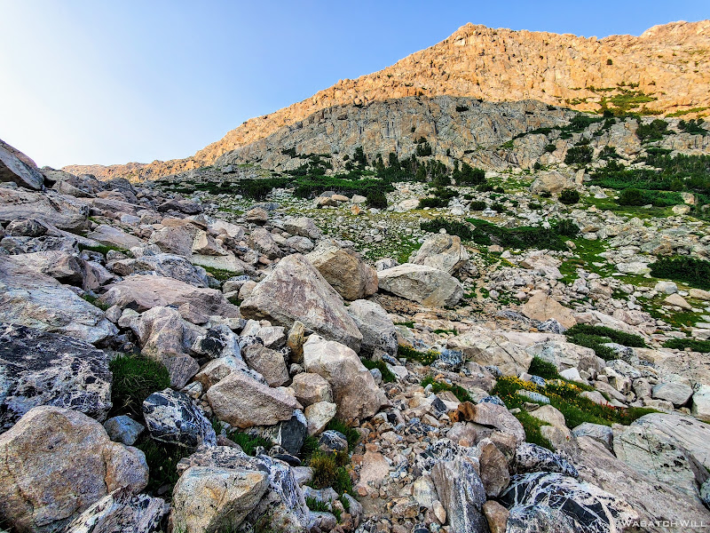
To do so would require skirting around yet another nameless lake, this time one unworthy of even an elevation label on the map.
Dropping into more talus above a truly nameless lake
To get around to the other side where the trail continued would require traversing a large lingering snow bank that descended all the way to the lake's edge. To attempt the other side of the lake would have taken us over even more tedious talus and forced us into a dead end of impassable cliffs and ledges at the edge of the lake.
Blake had neglected to pack any sort of traction aids, but the snowfield was soft enough to not really require such aid. However, I had packed my Hilsound Trail Crampons or simply "spikes" as I call them on account of them being more comparable to the popular Kahtoola Microspikes rather than being actual crampons as used on mountaineering expeditions. I figured I might as well make use of them here in order to be more efficient and sure-footed crossing over and down the snow bank.
A minute or two later and we were sitting at the edge of the lake where I tucked my 'spikes' back into my pack. We then followed intermittent sections of talus and trail to get around the lake.
At the edge of the nameless lake with Mount Quintet above
Looking back at the snowbank we had come across and dropped down from
Blake makes his way along the lake, Mount Quintet above
Myself, trailing along by the lake (photo by Blake)
The trail cuts across a grassy slope by the lake
Some Colorado Columbines step into the spotlight
Looking back down over the nameless lake and the nameless peak above and beyond
A steep snowbank clings to the base of Mount Quintet at the lake's outlet
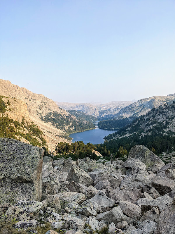
There was one more small rise above the outlet of the lake where we were treated to a view of Camp Lake out below in the distance. Fast running out of daylight now, with another three quarters of a mile to go with a five hundred foot descent, I put my camera away for a final time and headed down.
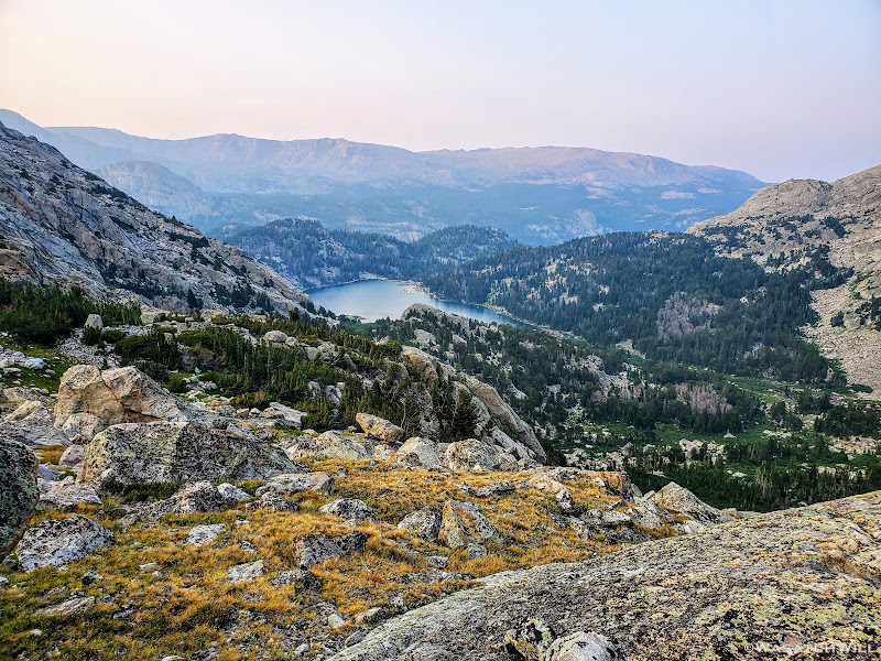
Camp Lake and the Bull Lake Creek drainage comes into view
Near the inlet of Camp Lake we pulled up and found a suitable spot to camp. We hastily set up our tents and retrieved more water just ahead of losing all light left in the sky. It would be our latest dinner yet, completely in the dark. Blake's ankle was now quite swollen. Not good considering what was on tap for the morrow. Hoping for the best, we cleaned up and jumped into our beds.
While the entire Wind River Range is now considered grizzly territory, thus making it important to take all appropriate precautions anywhere in the range, I believe the spot we were now camped in for this night was especially so. Apparently the Bull Lake Creek drainage along the eastern side of the range are some of the most favored areas for Wind River grizzly bears and Camp Lake sits right alongside the main fork of Bull Lake Creek and flows out into it. Knowing we had taken every reasonable precaution, I wasn't terribly anxious. However, I did sleep with my bear spray a little closer to me this night.
It was important to get a good sleep this night. Why? A daunting jaunt across Alpine Lakes Basin awaited us the next day.
To be continued...
Need to catch up?...
WRHR: DAY 1 - BIG SANDY TO CIRQUE OF THE TOWERS
WRHR: DAY 2 - CIRQUE OF THE TOWERS TO DESOLATION VALLEY
WRHR: DAY 3 - DESOLATION VALLEY TO HALLS LAKE
Monday - July 26, 2021
MILES: 13 | GAIN: 2,717 ft
Another blissful, cozy, and comfy sleep. Another morning waking up to bluebird skies. Day four was now upon us and that meant this would be a hallmark day. We had now reached the halfway mark in our journey for duration of time and were now destined to reach the halfway mark in miles by the day's end.
Morning at Halls Lake Camp
Upon finishing our morning routines, we set off for yet another day of progress along this Wind River high route. We followed the outlet of Halls Lake for a short while before crossing over and charting a cross-country course toward Europe. No, not that Europe. Remember? Europe Canyon, as mentioned in Day Three.
Dropping over a small ledge near Halls Lake (photo by Blake)
Checking out the landscape downstream from Halls Lake (photo by Blake)
Traveling cross-country toward Europe Canyon, Mount Victor in the distance
There had been no sign of the other group we had passed by at Halls Lake the night before, who had then moved on ahead of our camp after they finished their dinner. They had certainly looked like the sort of group to get going at the crack of dawn each day so it was not surprising for them to have already vanished from the area.
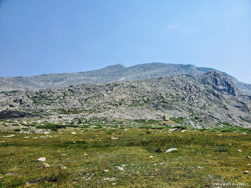
From the creek flowing out of Halls Lake, we had to pick our way up a rise and then across some rocky tundra where it leveled out. Just prior to arriving at Europe Canyon we had to descend down to another nameless lake. Again, there were many of these nameless lakes along the route. By Uinta standards, many of these nameless lakes were quite big for being high mountain lakes. They'd easily be among the middle-sized to larger of the lakes to be found in the Uintas. Not so in the Winds. As was discovered the prior day, lakes like Middle Fork Lake would dwarf the larger of the lakes to be found in the High Uintas Wilderness, chief among them being Grandaddy Lake, Red Castle Lake, and Lake Atwood. Of course there are even larger lakes just outside of the Uintas Wilderness boundary, such as Moon Lake, but those larger lakes have to credit their larger sizes to man-made dams which has converted them into actual reservoirs.
As for these large nameless lakes in the Wind River Mountains, maybe they just ran out of names on account of how numerous the total number of lake there are to be found in the range and so some of the more remote ones were left without. While that's likely not the actual reason, I actually enjoy encountering significant looking landmarks with no official name from time to time. Sometimes it makes the landscape feel just a little bit more remote, a little bit more wild, a little bit more wondrous.
However, when it comes to such nameless lakes and often nameless peaks too, you can simply reference an adequate topo map, such as those published by the USGS, and often find an elevation printed for on these lakes and peaks. Or are they zip codes? No, no, they're definitely elevations. Thus in write-ups like this, the author will simply refer to such lakes or peaks by that labeled elevation when given. So, keeping to that pattern, after hiking just over two miles from Halls Lake, you could say we were now gazing out over what many would simply refer to as Lake 10542. Not only that, we were now officially standing at the brink of Europe...Canyon.
At the edge of Europe Canyon, Blake surveys the scene from above Lake 10542; Mt. Victor beyond
Once we arrived at the shoreline of the lake, we dropped down for a mid-morning snack break. Being yet another curiously hot day, we soaked our shirts, hats, buffs, feet and so forth to give ourselves some relief. Still wasn't brave enough, or crazy enough, or desperate enough, or tough enough to jump all the way into the frigid cold water.
A curious fish or two had seemingly come up to check us out as we sat upon the rocks at water's edge. Was it a coveted Golden Trout? Indeed, I believe it was. Oh how I wish I had my fishing pole now!
While not native to the Winds (Golden Trout originate from California, specifically the southern end of the Sierra Range), there are now numerous lakes in the Wind Rivers and elsewhere in Wyoming along with other Western State fisheries where they have been introduced and successfully survived, though more often as a mixed breed now, having bred with previously existing species of trout in these non-native locations.
Lake 10542
Moving on, we now had to scramble over another rock slide, aka more talus, to stay along the short-side of the lake in getting to the Europe Canyon trail.
Crossing the talus at Lake 10542 (photo by Blake)
And then, there it was! We had intercepted the Europe Canyon Trail. Ok, that alone wasn't all that exciting but here again, we now had two options to choose from. We could follow the trail up to Europe Pass along the Continental Divide whereby we could relink with Skurka's route and follow the ridge bordering the Wind River Reservation, leading to a class 3 scramble up to a knife-edge ridge and ultimately up onto Europe Peak at 12, 259 feet high. From there, we'd be able to ride the Continental Divide all the way down to the Golden Lakes Basin. Our other option was to remain true to the Dixon/Wilson route and cut straight across the trail continuing a northwestward cross-country approach to Long Lake.
As tempting as it was to head up Europe Canyon and take on Europe Peak from there, considering the skies were still completely cloudless, we chose the more conservative option and went for Long Lake or simply Lake 10683 depending on map of choice. It would also spare us between one and two extra miles and Long Lake seemed like it would be a fun adventure to get around too.
Note: Sometimes there happens to be lakes and peaks that have a more formal name on one map, such as those by CalTopo while the same landmark will only be labeled with only its elevation on the USGS maps. And as far as these elevation labels go, even those can be inconsistent at times between the USGS and the U.S. Forest Service adaptations of the USGS map sets. Sometimes a few hundred feet off from each other. I have found that the USGS maps tend to be more accurate with their elevation labels in such instances. For example, Long Lake is indeed named Long Lake on CalTopo. It is simply 10683 on the USGS map, but drops way down to 10147 on the USFS's topo map. Nearby contour lines and their given measurements will confirm that the USGS label is more accurate.
Blake gazes up Europe Canyon
A look back at Lake 10542 with Mount Medina beyond
Along the way to Long Lake, I stumbled into what I then thought was a really unique rock. For obvious reasons I gave it the name: Dalmatian Rock.
'Dalmatian Rock'
Blake (right horizon) moves ahead toward Long Lake and Mt. Victor
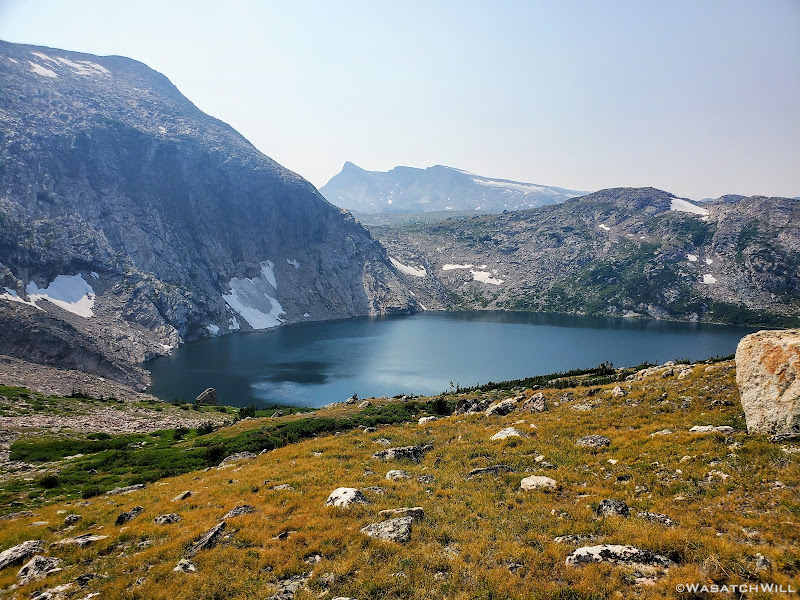
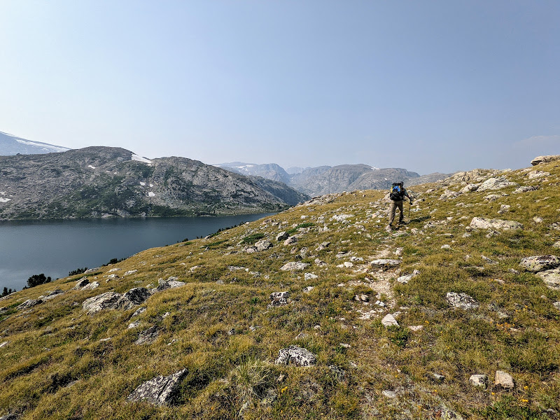
Less than a half mile from Europe Canyon, we now had Long Lake in view. What had been mostly a grassy stroll from Europe to Long Lake instantly turned into a nice stretch of talus with a few cliff bands below to steer clear of. We stayed higher for the first parts around the lake to stay above the cliff bands, picking our way through some mostly stable talus, which even included a little bit of light class 3ish scrambling if I remember right.
Long Lake comes into view alongside Mt. Victor
Somewhere between a third and halfway around the lake, we descended down into a grassy meadow full of flowers. There was also a small isolated grove of trees at the edge of the lake beyond the meadow. While looking out of place, these trees certainly added to the scene. From there, we'd follow a mix of more grassy slopes, rock, talus, and scree to get to the other end of the lake.
A field of flowers at Long Lake
Once at the end of the lake we'd rise up along side of the creek feeding Long Lake soon crossing over it.
Looking back down over Long Lake from above its inlet
A puff of Willow seeds
We had paused for a water refill at the creek where we crossed and then continued heading up the rise until it crested over and back down continuing toward the west. Perhaps this spot would qualify as another pass by geographical or geological standards but regardless, it was a very gentle gain to its top. I did not count it on the day's total tally of passes.
Pass or not, it provided a nice view back of Mount Victor and its attendant glacier. To the east rose Europe Peak. Here, another route up to Europe Peak sat ahead of us. It also would have been a much milder approach up it from here, but also a little over another mile and a half out of the way.
Wide view of Long Lake and Mount Victor
Mount Victor and its attendant glacier
Europe Peak
Rather than taking the time to actually bag the peak, we could have also spared ourselves the roughly one and a half mile round trip it would take to bag the peak upon reaching the ridge and just head immediately northward along the Continental Divide. Even just gaining the ridge and walking it down toward Golden Lakes Basin would have promised some thrilling views and the weather was certainly still favorable to do so.
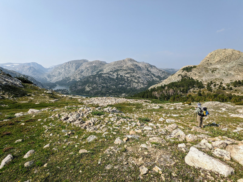
However it would take more effort to do that too. Our feet were already feeling pretty beat up, achy, and sore. Instead we kept course for the next lake, Lake 10555, or more elegantly, Glacier Lake according to other maps, perhaps named for the nearby glacier on Mount Victor. We were extra eager to get there too, for now, it was lunchtime. I do now have a strong desire to return to this area some time and walk that ridge from Europe Peak to Hay Pass.
Blake begins the descent toward Glacier Lake
Closing in on Glacier Lake
Subalpine Daisy/Fleabane
Treading lightly through the flowers at Glacier Lake (photo by Blake)
While it certainly felt longer, given the scale of the area, it was only about three-fourths of a mile down a gradual descent of tundra with low lying Willows and rocks followed by large patches of flowers to arrive at Glacier Lake. We took a much deserved break to have lunch, rest our feet, and cool down once more for a bit.
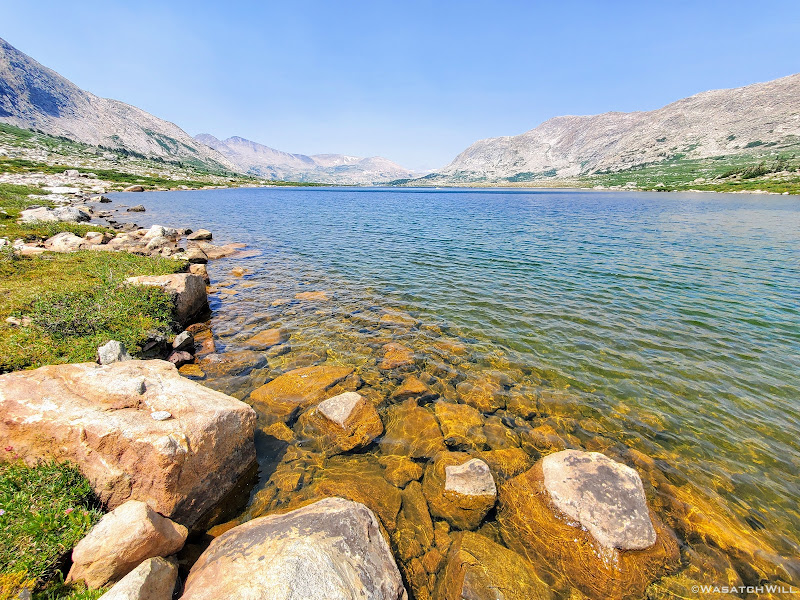
Glacier Lake
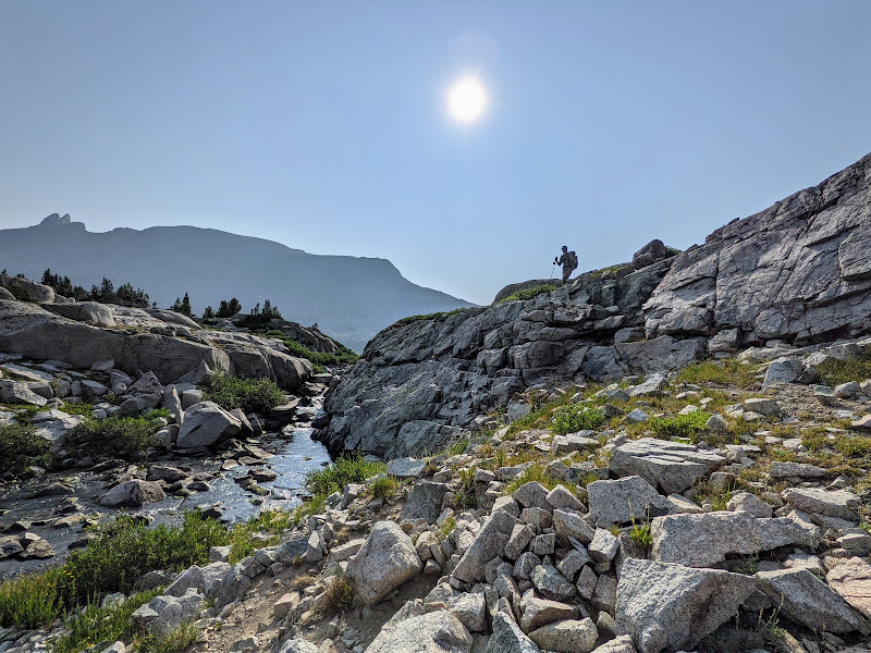
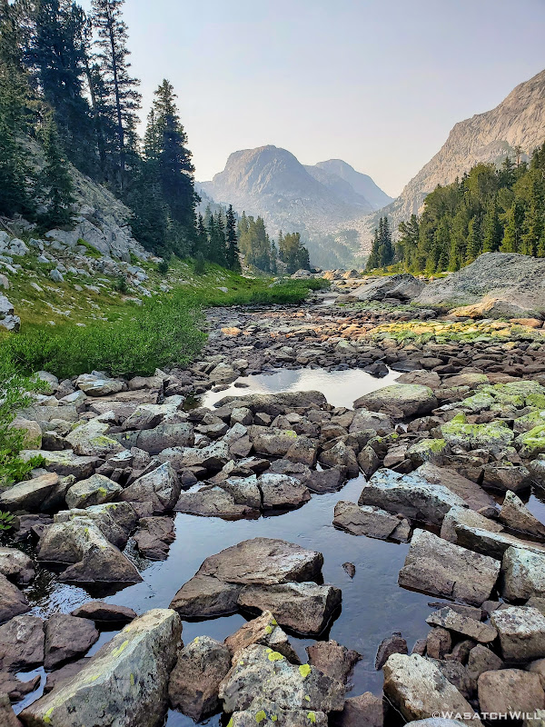
From Glacier Lake, it would be a bit of a slog to get over to North Fork Boulder Creek and our first major pass of the day, Hay Pass. For that stretch we exchanged the hard, rough talus and the grassy tundra for uneven soft and spongy ground plagued with marshy bogs. We did well to keep our shoes dry for a while, Blake even moved higher up for a stretch, but eventually I reasoned the challenge to keep shoes dry wasn't worth it anymore. If my feet were already going to be wet from sweat on the inside of my shoes, despite being well ventilated non-waterproof shoes, there was no more sense in trying to keep the outside of my shoes dry. The cold water I now allowed to seep through my shoes as I walked over this wet and spongy grassland felt amazing! Why did I ever try to avoid it?, I asked myself. Must just be a habit.
Once we reached the other end of the boggy valley, Lake 10322 came into view down below Round Top Mountain. Rather than continue descending towards it, we turned toward the right where would seek a trail up over Hay Pass.
Lake 10322 comes into view along North Fork Boulder Creek with Round Top Mountain above
Seeking out the trail up toward Hay Pass, Round Top Mountain beyond
Looking west down the North Fork Boulder Creek drainage
For the first time all day, we'd join up with an official trail that would take us up and over. Another large nameless lake appeared off to our left along the way. It's given elevation: 10755.
Officially on the Hay Pass Trail
Lake 10755 with Round Top Mountain above and beyond
In fact, the trail had flattened out so much and even dipped down a bit to cross over the creek draining out of the lake that it made me wonder for a moment if we had already crested over the top of the pass. Nope. Like a false summit, one could call this a false pass. There was still a bit more gain to acquire before we could say we were over Hay Pass.
Fortunately it was another very tame pass, the grade of the trail all the way up it remaining fairly mild.
Taking in the views from atop Hay Pass (photo by Blake)
At Hay Pass or shortly below it, Skurka's route briefly rejoins the Dixon/Wilson route after having departed from it back at Middle Fork Lake. Hay Pass also marked the 3rd time we'd cross over the Continental Divide. I hadn't taken any thought of the Divide the prior two times at Jackass Pass and Texas Pass. Those were so early in our trip I was still just full of excitement to be venturing out as we were. Here, I took a moment to think about what standing on the Divide meant.
Looking west, all the water flowing off the western slopes below us would find its way to the Green River, the very same Green that goes onto flow into Flaming Gorge Reservoir at the border with Utah and then beyond. In Utah, the Green River goes on to join forces with the Colorado River in Canyonlands National Park. From there, the mighty Colorado River makes its way into Lake Powell for a layover before spilling out and carving itself ever deeping into the great Grand Canyon before slowing down once more for yet another layover at Lake Mead. From Lake Mead it's on to Lake Mohave to Lake Havasu and finally out to the Pacific Ocean via the Gulf of California. Or so it once ran. Just prior to the Gulf of California and the greater Pacific Ocean, what's left of the Colorado at that point is diverted into more canals to satisfy demand for water in communities along the borders between California, Arizona and Mexico.
Looking east, all the waters ahead of us would make their way down to Bull Lake Creek, to the Wind River...er...Wyoming Canal. And if lucky, some might even be allowed to move on to the Bighorn River where in Montana it joins the Yellowstone River, which in turn links up with the Missouri River, and then ultimately the mighty Mississippi River. Of course, that goes on to flow out into the Gulf of Mexico and ultimately the Atlantic Ocean.
I thought that was rather amazing as I stood there and pondered all that. Wow! If only it were possible to carve my initials into a couple small sticks and track their ride in opposite directions across the country from here. Of course, such an attempt would only be in vain as both sent either way would certainly get trapped and/or beached somewhere along the way long before they could reach the end of the river flows. Oh well.
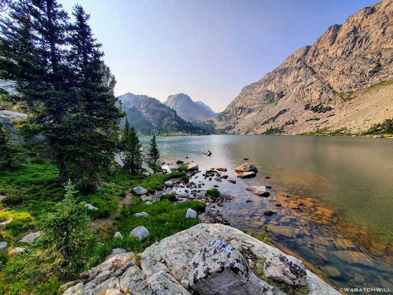
A few moments after cresting over Hay Pass, we set our eyes upon beautiful Dennis Lake. I found myself amazed by the sheer cliffs and the clinging patch of snow coming down from Dennis Peak, forming a wall at the southwestern edge of the lake. Further over was a long cascading waterfall stair-stepping its way down the rocks and boulders to feed the lake. Further out beyond stood Angel Peak and Angel Pass. It was an amazing view indeed.
Dennis Lake with Angel Peak on the far horizon
Moving ahead along the trail above Dennis Lake (photo by Blake)
As the trail continued northward high above Dennis Lake, Golden Lakes soon appeared out in the distance nestled alongside Mount Quintet.
Alpine Lakes Basin and Mount Quintet come into view to the north (photo by Blake)
Nearly a thousand feet in elevation and just over one mile in distance sat between Hay Pass and Golden Lakes. Needless to say, it was quite a descent to get to Golden Lakes. The trail remained well trodden all the way down, but even so, I was once again grateful to be descending the north side rather than ascending it.
Throughout each day, Blake and I would take turns getting out ahead of each other on occasion and then wait for the other to catch up. Usually this would be at particularly picturesque spots. I had taken the lead on the descent down to Golden Lakes. When I pulled over near the first or lower Golden Lake, it had turned into an unusually long wait. When Blake finally arrived, he informed me he had somehow stumbled a bit somewhere along the way down and rolled onto his ankle pretty good. Thankfully it didn't seem so bad to completely cripple him and cut the trip short, but he was definitely experiencing some significant pain from it. With a good dose of ibuprofen, he reckoned he could keep on going. We kept on trekking.
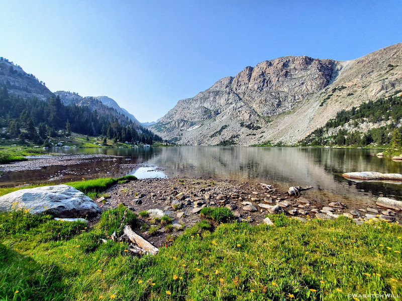
Golden Lakes Basin
We again refilled on water at the inlet to the lower lake after crossing over on a convenient log.
Creek crossing at inlet of the lower Golden Lake
On the other side of the creek stood a dense field of fireweed along the banks of the creek. Bees and other nectar loving insects were buzzing away among them.
Fireweed
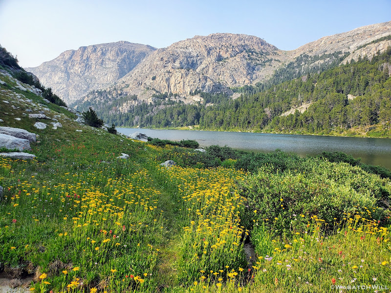
Following the trail through the fireweed and alongside the creek, it eventually pulled away and led us on over to the middle lake, Lake Louise. There the fireweed of the lower lake had now transitioned to a field of golden yellow arnicas. It was fitting to be at Golden Lakes with such bright yellow flowers as the sun was dropping down the sky and approaching golden hour. Golden Lakes seem to have a reputation for having a certain charm to them and indeed, this basin lived up to it. There was very much something charming along this string of lakes.
Arnica flowers, Lake Louise, and Mount Quintet
Following the trail through the arnicas at Lake Louise (photo by Blake)
Continuing up Middle Fork Bull Lake Creek, there would be one more named lake in this triple header chain of lakes so close to each other: Upper Golden Lake.
Middle Fork Bull Lake Creek between Lake Louise and Upper Golden Lake
Just prior to reaching Upper Golden Lake, we ended up having our only encounter with any other humans for the day. There sitting on a very large rock, er, boulder, in the middle of the creek was a group of four. They turned out to be the same four we had passed by while they were having their dinner the night before near Halls Lake.
As assumed, they had risen early and got going as soon as they could earlier in the morning. In fact, they had actually taken the opportunity to take the Europe Canyon Trail up to Europe Pass to pick up the Skurka route up to Europe Peak and down the Continental Divide as mentioned earlier above. Now I was a bit envious. They described it as amazing.
They had now set up their camp in the upper end of a really nice flat adjacent to the creek there. Their plan was to continue on up above Upper Golden Lake in the morning and then choose between Douglas Pass or swing around by Camp Lake before taking on the lengthy and grueling Alpine Lakes Basin, as per its own reputation. We bid them adieu for the second time in as many nights and continued on up to Upper Golden. Wherever we camped tonight, we'd now be a step ahead of them.
Upper Golden Lake
At Upper Golden Lake, there were a good handful of other flats up in the trees above it that would have served us as some terrific campsites. Getting late in the day now and being quite tired, it became very, very tempting to lay up in one of those sites. With Blake now having incurred an injury to his ankle, it was even more justified to do so. We strongly considered it. It was such a beautiful and calming place to be too, with numerous streams and creeks and even a nearby roaring waterfall all flowing into the lake across the other side. Indeed, this was a haven of soothing white noise. However, our target for the day had been Camp Lake, well beyond another major pass rising nearly another thousand feet up above the northern inlet of Upper Golden Lake and about two more miles away.
Upper Golden Lake and Mount Quintet
Saxifraga Odontoloma or Micranthes Odontoloma, aka Brook Saxifrage
I was more than willing to pull over and call it good for the day but the ibuprofen was kicking in well now for Blake and he felt confident in his ability to continue on. So continue on we did, briefly pulling over along the other side of the lake for one last little rest, a water bottle refill and a snack to fuel up for the big pass that now stood a stone's throw away.
Once again, we found ourselves surrounded by a beautiful array of flowers that would only continue in several patches alongside a babbling brook all the way up the pass.
Blake charges ahead for the final pass of the day
Paintbrush, Arnicas, and Subalpine Daisy
In between the patches of flowers, the trail would disappear into piles of boulders and talus to step across and over and then reappear wherever it could reasonably do so. To my surprise, there was also several more dalmatian rocks all the way up as well.
Another dalmatian rock
But oh, the flowers, now glowing ever so slightly with the magical golden light of alpenglow reflecting off the high peaks above. Oh my! Oh wow! What beauty! Is this Heaven!? Seriously...My inquiring mind yearned to know...
As hard as it was to leave behind the great campsites down at Upper Golden Lake below, those regrets had now been thoroughly washed away. It was now a treat, a privilege, a reward, a blessing to be able to hike up this pass with such enchanted light and colors now surrounding us.
A field of Arnicas, Paintbrush, and Monkeyflowers
Lewis Monkeyflower
Pausing in the talus to look back down across Golden Lakes Basin (photo by Blake)
Alpenglow lights up Mount Quintet above the pass
Almost to the top
A patch of Paintbrush flowers near the top of the pass
Brimming with pure joy and awe, little did we know how much more there was to come as we crossed over the other side of this nameless and enchanted pass. From near the top of the pass, now in another sea of talus, our eyes now feasted upon yet another stunning scene before us. There the sun re-appeared to us, but for a moment, only to set for good behind a nameless peak sitting across from yet another nameless lake, or 10787.
WOW! WOW! WOW!
Not everything here reamined nameless though. To the right of the nameless peak was the unofficially named Douglas Pass. To the right above that pass rose the officially named Douglas Peak. One might as well just refer to the lake here as Douglas Lake, unofficially, of course.
Sunset at 10787
Lake 10787 cradled beneath Douglas Peak and Douglas Pass
Now, we were just being spoiled silly. We had been privileged to walk through and behold some amazing scenes prior to this pass, but in the moment, this seemed to have blown all of that out of the water. This instantly became one of the most memorable and scenic stretches of the whole trip and yet there would be more such stretches in the days to follow. We had now entered into the heart of what I believe to be some of the very best the Winds have to offer and some of the most remote terrain to be found in all the range.
Looking back across 10787, the nameless peak above it, and Douglas Pass (right)
At the outlet of 10787, the Skurka route again briefly diverges away from the Dixon/Wilson route to pursue the more strenuous Douglas Pass and thereby offering up yet another shortcut to what lies behind, this time to get into Alpine Lakes Basin. We continued to take the lengthier way that would take us around Douglas Peak and then seek to establish our camp near Camp Lake to stage up for an entry into the notorious Alpine Lakes Basin the following morning.
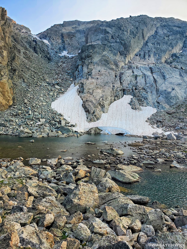
To do so would require skirting around yet another nameless lake, this time one unworthy of even an elevation label on the map.
Dropping into more talus above a truly nameless lake
To get around to the other side where the trail continued would require traversing a large lingering snow bank that descended all the way to the lake's edge. To attempt the other side of the lake would have taken us over even more tedious talus and forced us into a dead end of impassable cliffs and ledges at the edge of the lake.
Blake had neglected to pack any sort of traction aids, but the snowfield was soft enough to not really require such aid. However, I had packed my Hilsound Trail Crampons or simply "spikes" as I call them on account of them being more comparable to the popular Kahtoola Microspikes rather than being actual crampons as used on mountaineering expeditions. I figured I might as well make use of them here in order to be more efficient and sure-footed crossing over and down the snow bank.
A minute or two later and we were sitting at the edge of the lake where I tucked my 'spikes' back into my pack. We then followed intermittent sections of talus and trail to get around the lake.
At the edge of the nameless lake with Mount Quintet above
Looking back at the snowbank we had come across and dropped down from
Blake makes his way along the lake, Mount Quintet above
Myself, trailing along by the lake (photo by Blake)
The trail cuts across a grassy slope by the lake
Some Colorado Columbines step into the spotlight
Looking back down over the nameless lake and the nameless peak above and beyond
A steep snowbank clings to the base of Mount Quintet at the lake's outlet
There was one more small rise above the outlet of the lake where we were treated to a view of Camp Lake out below in the distance. Fast running out of daylight now, with another three quarters of a mile to go with a five hundred foot descent, I put my camera away for a final time and headed down.
Camp Lake and the Bull Lake Creek drainage comes into view
Near the inlet of Camp Lake we pulled up and found a suitable spot to camp. We hastily set up our tents and retrieved more water just ahead of losing all light left in the sky. It would be our latest dinner yet, completely in the dark. Blake's ankle was now quite swollen. Not good considering what was on tap for the morrow. Hoping for the best, we cleaned up and jumped into our beds.
While the entire Wind River Range is now considered grizzly territory, thus making it important to take all appropriate precautions anywhere in the range, I believe the spot we were now camped in for this night was especially so. Apparently the Bull Lake Creek drainage along the eastern side of the range are some of the most favored areas for Wind River grizzly bears and Camp Lake sits right alongside the main fork of Bull Lake Creek and flows out into it. Knowing we had taken every reasonable precaution, I wasn't terribly anxious. However, I did sleep with my bear spray a little closer to me this night.
It was important to get a good sleep this night. Why? A daunting jaunt across Alpine Lakes Basin awaited us the next day.
To be continued...
Need to catch up?...
WRHR: DAY 1 - BIG SANDY TO CIRQUE OF THE TOWERS
WRHR: DAY 2 - CIRQUE OF THE TOWERS TO DESOLATION VALLEY
WRHR: DAY 3 - DESOLATION VALLEY TO HALLS LAKE
Last edited:


")