- Joined
- Jul 23, 2013
- Messages
- 1,666
Two passes with a whole lot of off-trail and cross-country navigation, lots of talus hopping, and some bushwhacking would set the stage for Day Three.
After some convincing at the urgent request of @Bob, I now present to all of you fellow BCP friends: DAY THREE.")
Sunday - July 25, 2021
MILES: 10.5 | GAIN: 2,749 ft
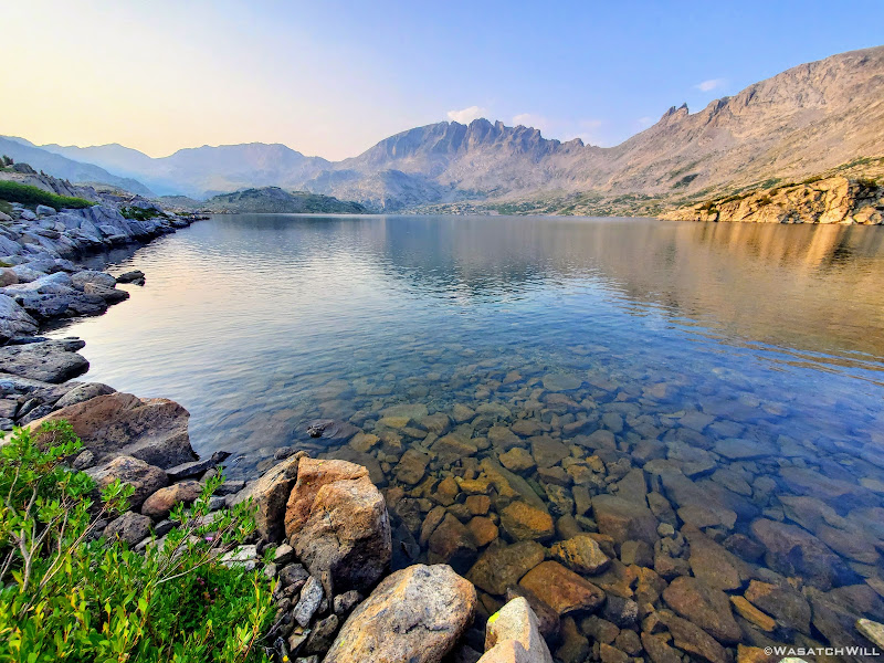
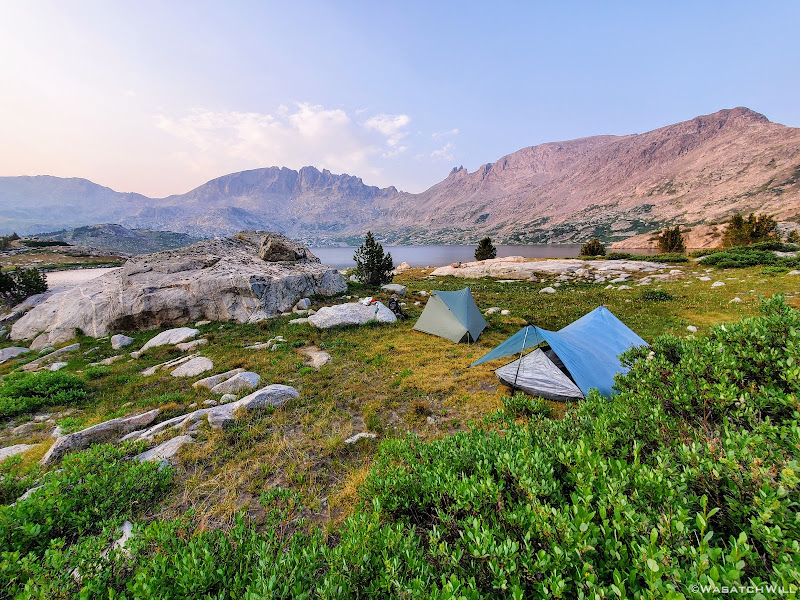
After another calm night's sleep I awoke just before dawn to set a timelapse of the sun's first light to hit Ambush Peak as it painted it top down. With camera set, I returned to my tent to catch another good hour of sleep or so.
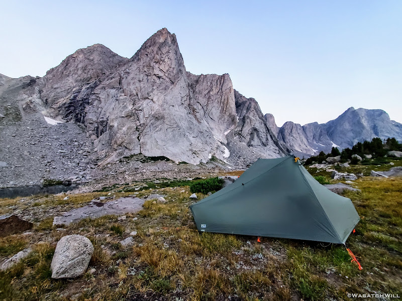
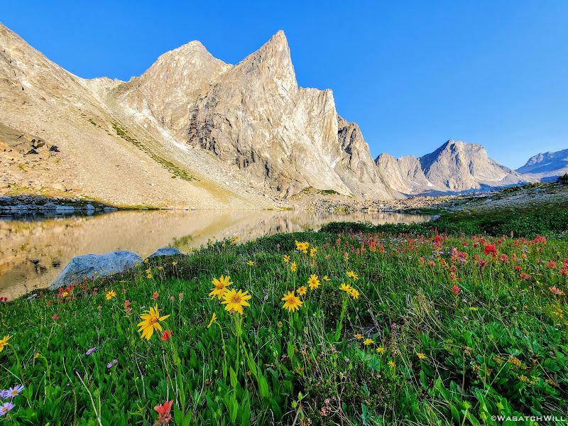
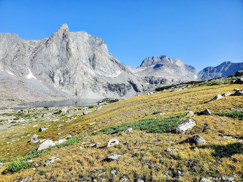
Ambush Peak and my tent, just before sunrise
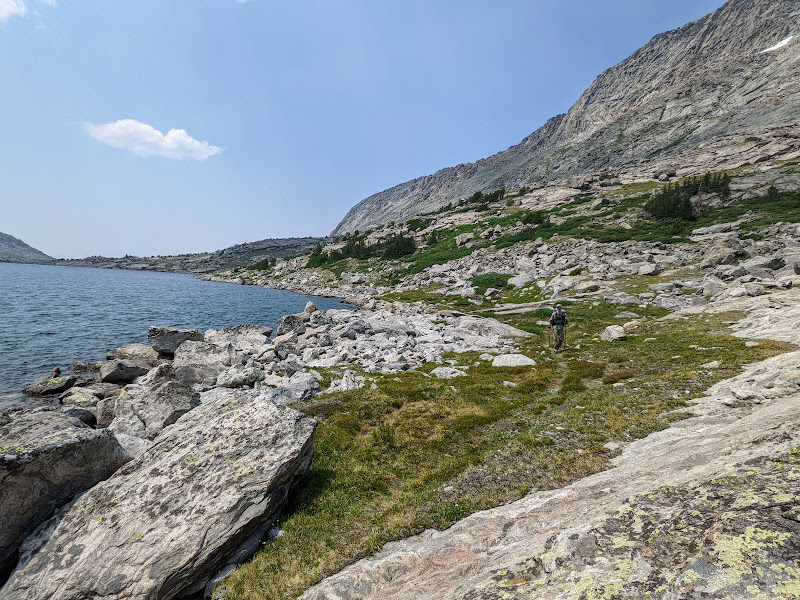
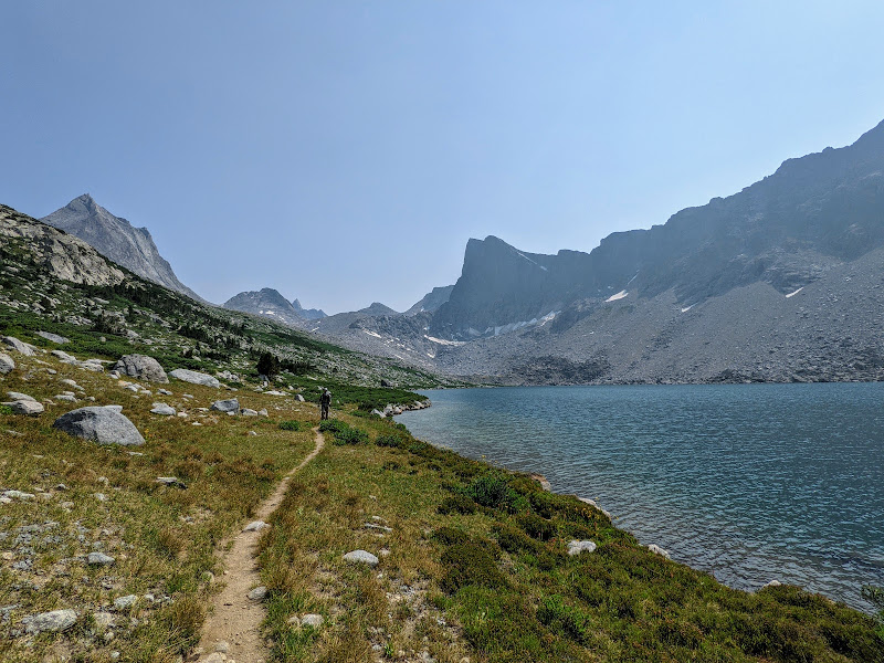
Now that the sun was out, I arose once more and took the opportunity to head down the lake below and walked out to its outlet on the opposite end. I noticed one other camp nearby so I was careful to not disturb them and keep my distance. From here, I started working my way back up to my own camp. But not without taking several photos of Ambush Peak along the way back. It was all just so beautiful.
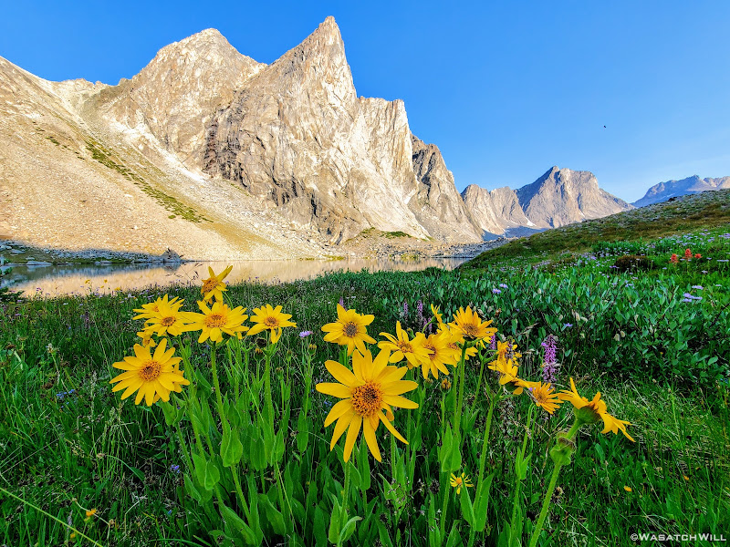
Arnicas happily await some morning sunshine
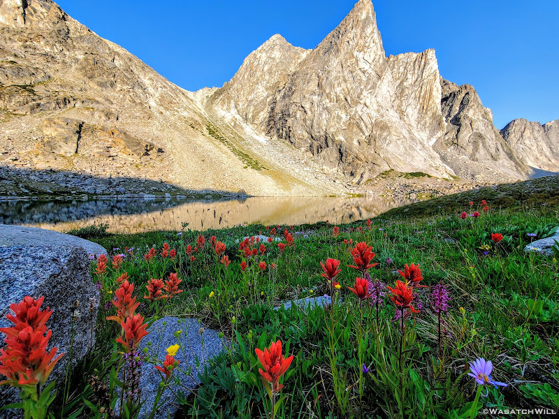
Not to be left out, Paintbrush and Elephant Heads get into the mix
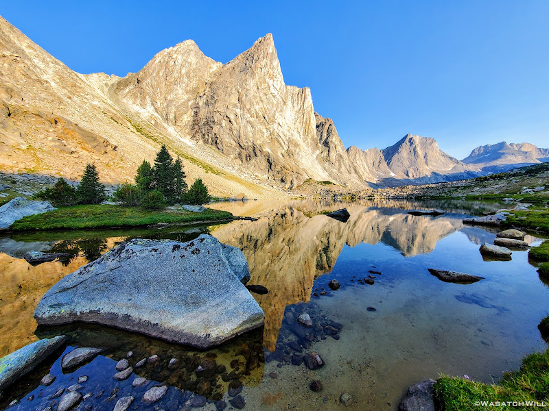
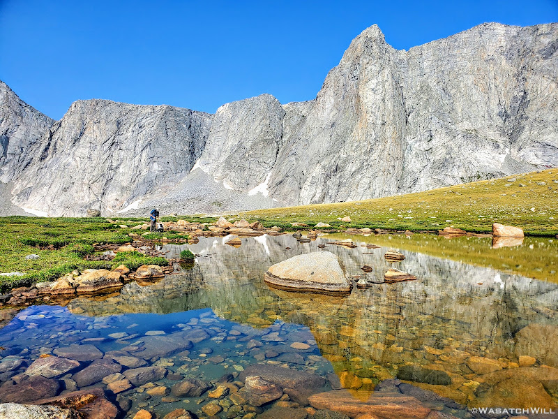
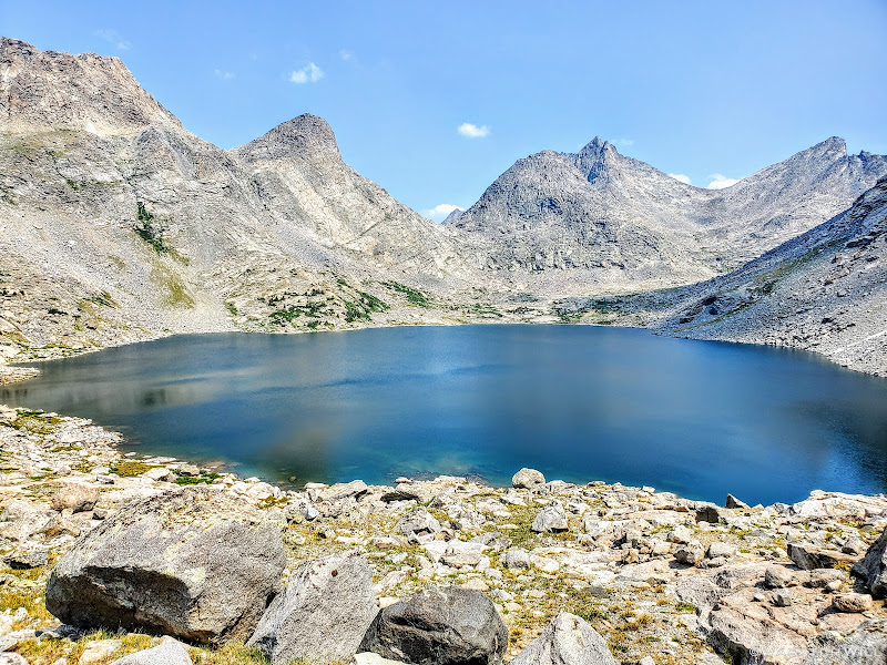
Ambush Peak reflects in a nameless lake
Arnicas and Paintbrush
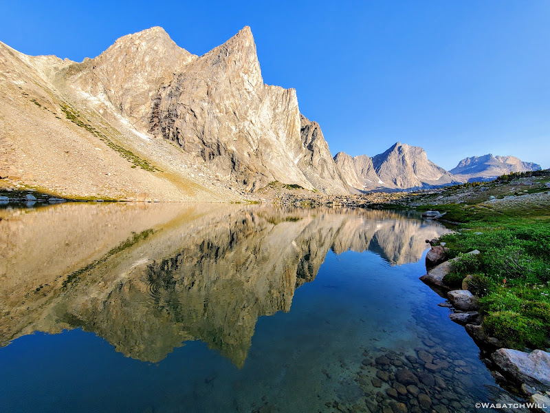
Another reflection of Ambush Peak atop the nameless lake
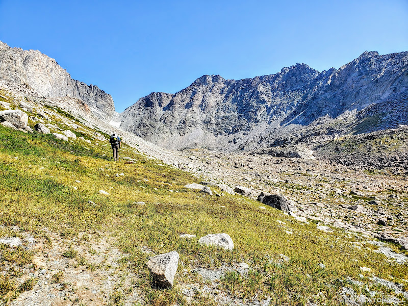
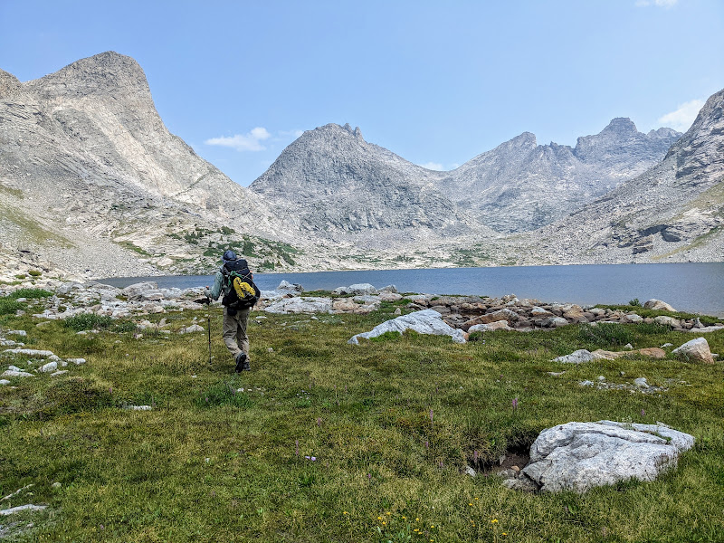
Once back at camp, my body was now warmed by the sun and loosened up by the morning wander. Blake was now up too. We retrieved our food, had breakfast, and broke camp. With two passes and most of the day's miles being off-trail, we knew this day would become our most challenging day of the trip thus far. Our intended destination for this day was Europe...the Canyon that is.
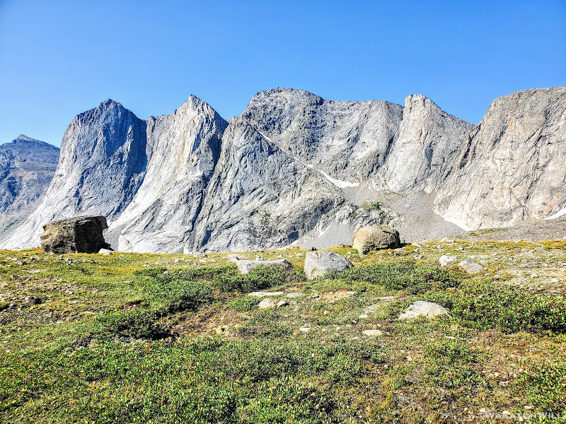
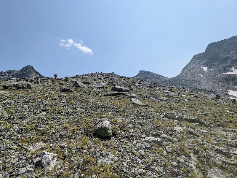
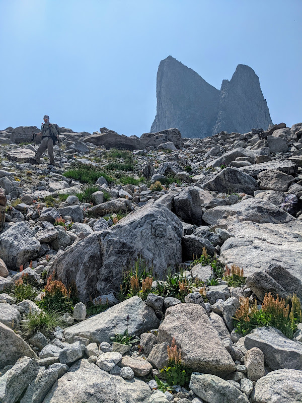
Onward we went. Our first pass had no official name to it. For many, it's simply referred to as Raid Pass or Raid Peak Pass after Raid Peak rising up immediately south of it. For others, it carries the moniker of PITA Pass. Confused yet? Don't worry, there will be more of that to come. Even so, it shouldn't take much thinking to figure out that latter acronym.
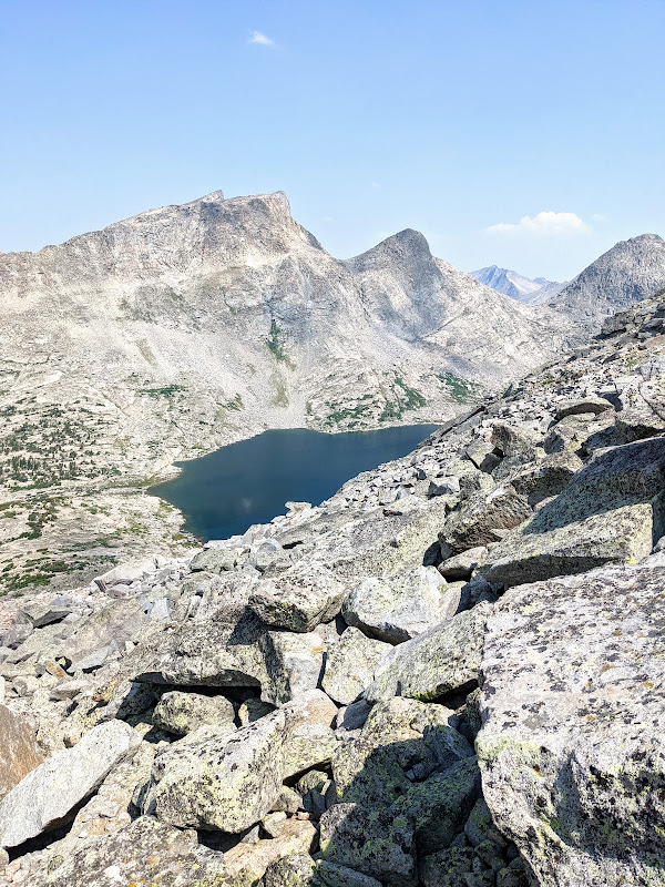
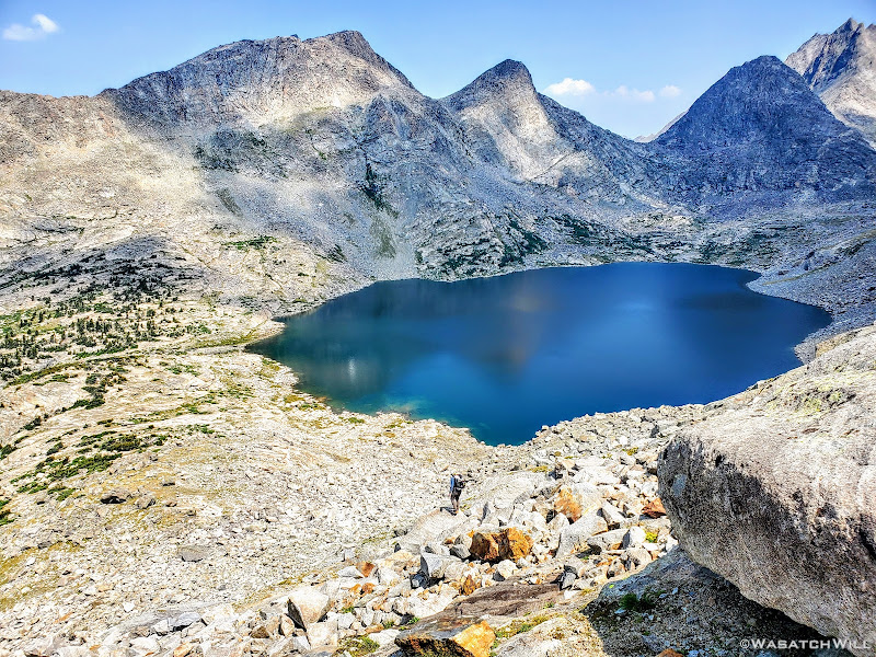
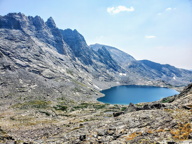
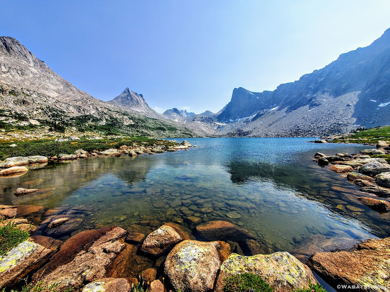
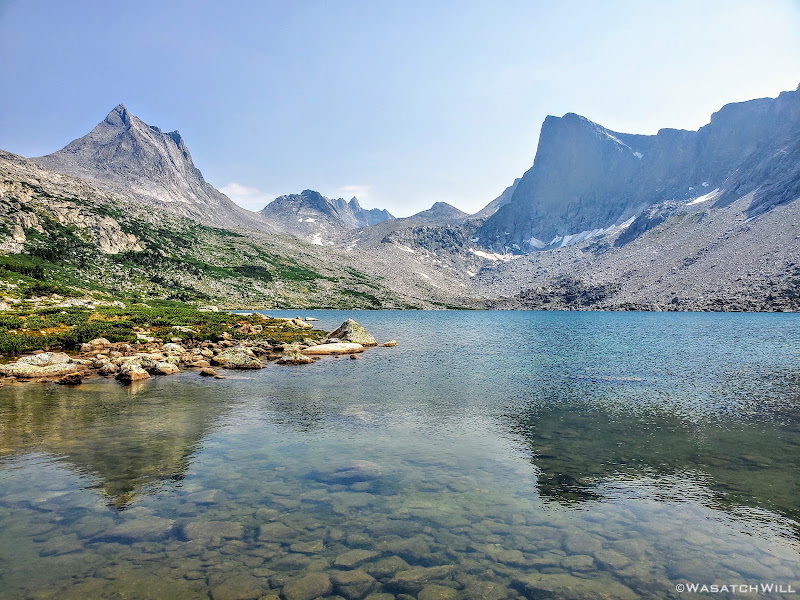
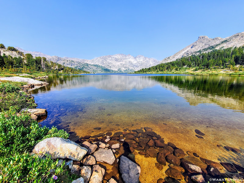
Raid Peak and Mount Bonneville rise up in the distance across another nameless lake
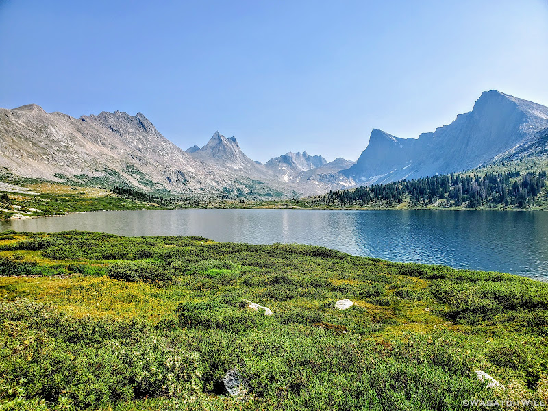
Before gaining the upcoming pass, we'd first gain a couple of high benches overlooking this intimate valley.
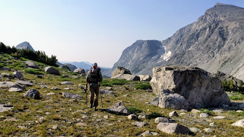
Up on top of the first bench (photo by Blake)
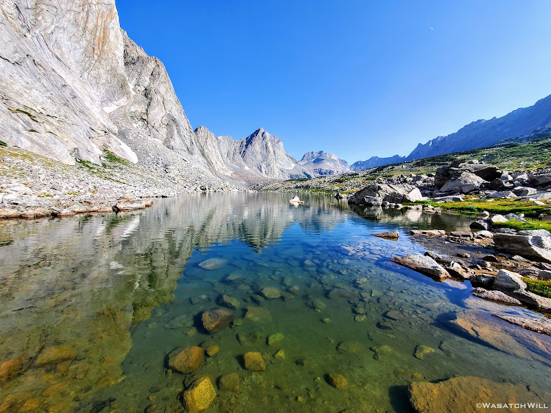
Soon the uppermost lake of the valley came into view.
Yet another nameless lake comes into view beneath Raid Peak
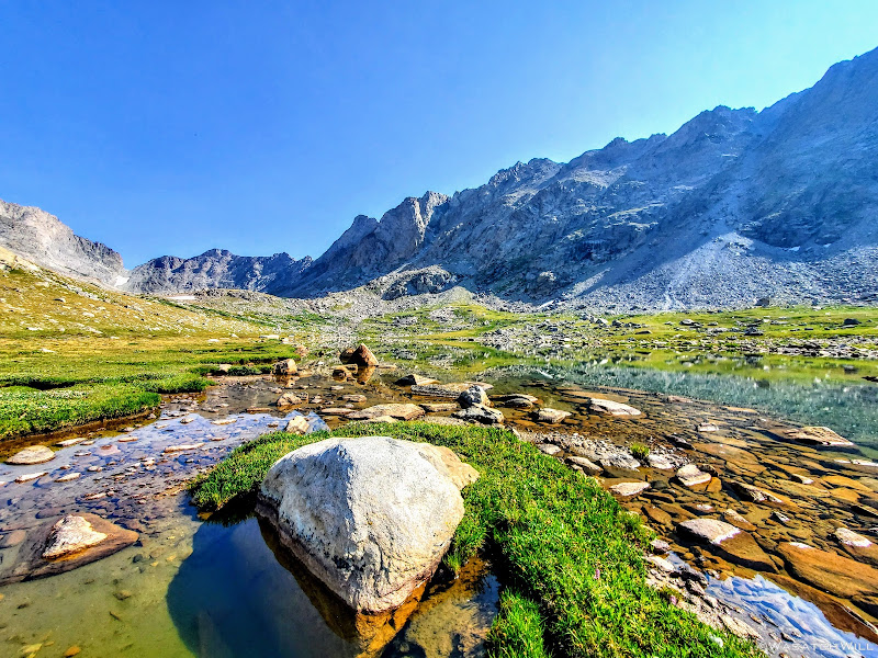
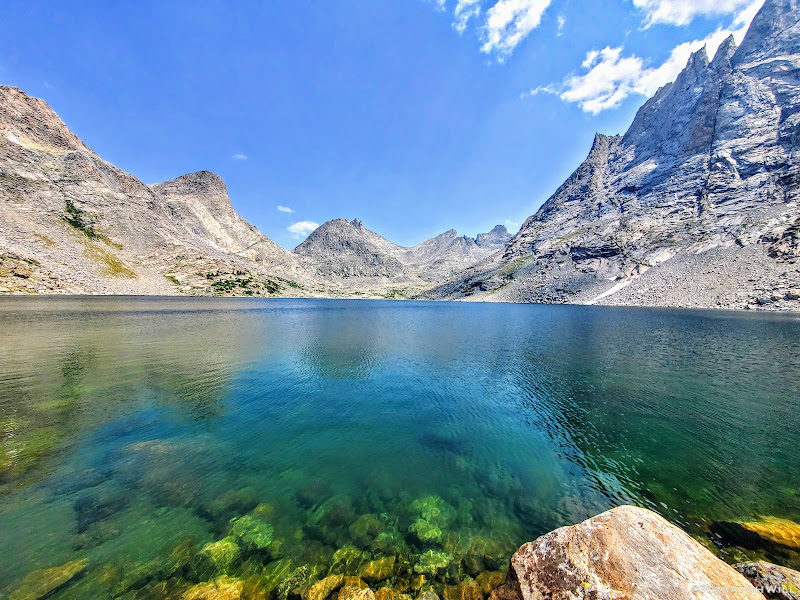
Sitting up on the first bench we had risen to was a beautiful little lake or large tarn. We pulled over here to catch our breath for a moment and to top off our water bottles.
Pulling over at the tarn (photo by Blake)
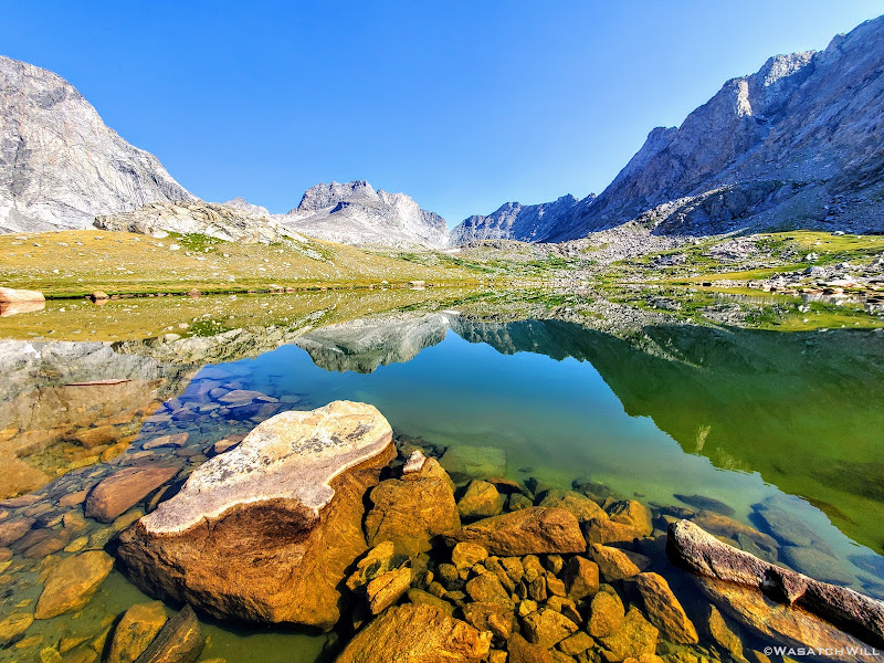
Mount Bonneville reflection across the greenish tarn
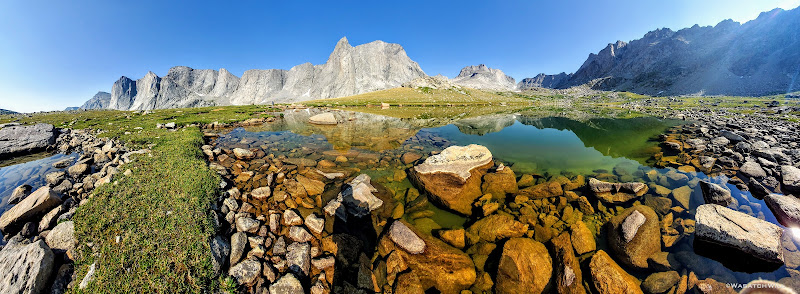
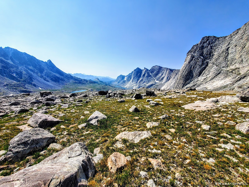
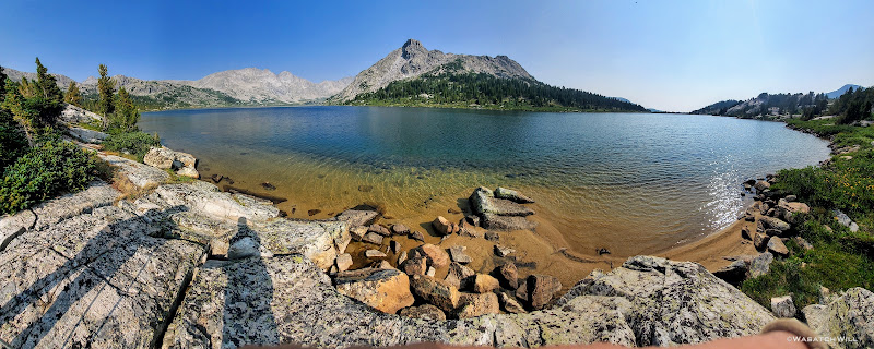
A panoramic view of upper East Fork
Blake filters water with Raid Peak behind
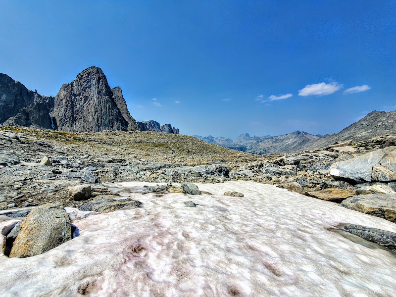
Ambush Peak. If you look closely, you might be able to make out a marmot resting by a large rock. (hint: toward the right)
Vibrant green hues dominated the area around the tarn
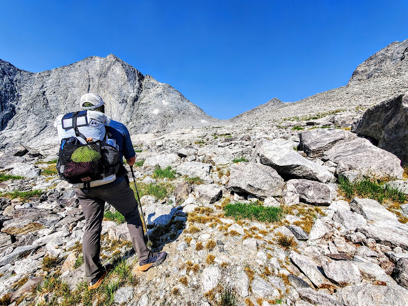
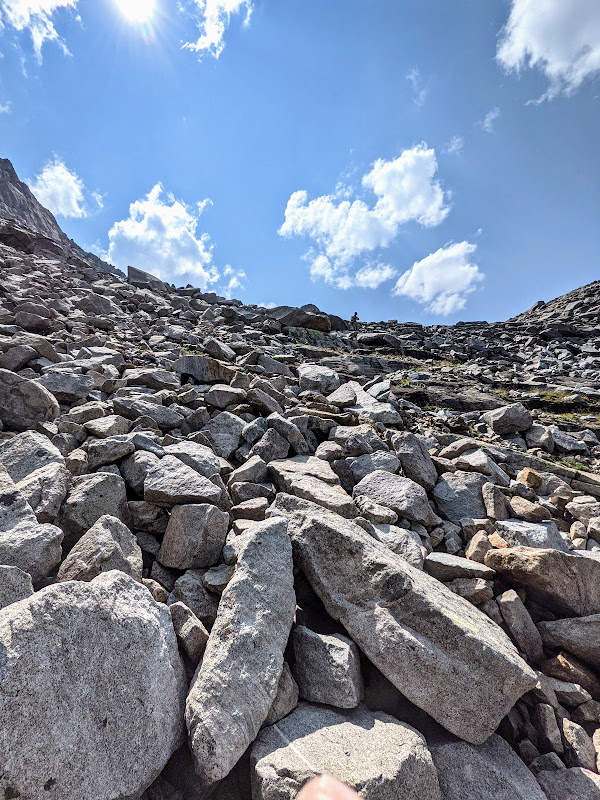
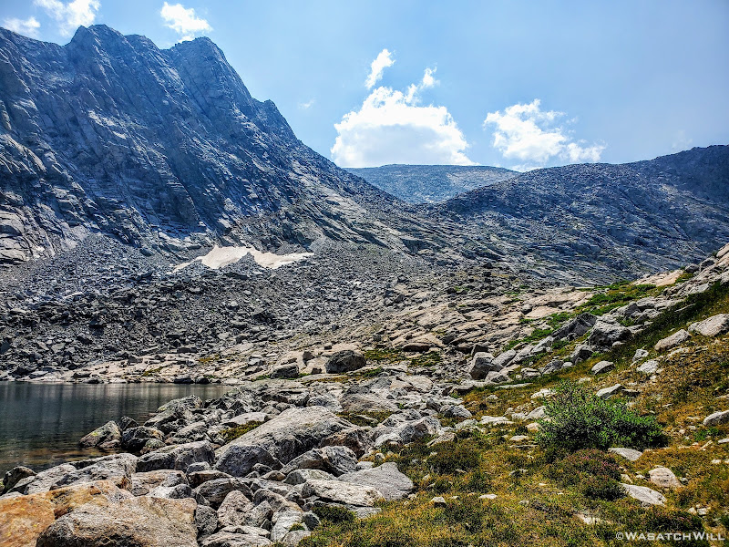
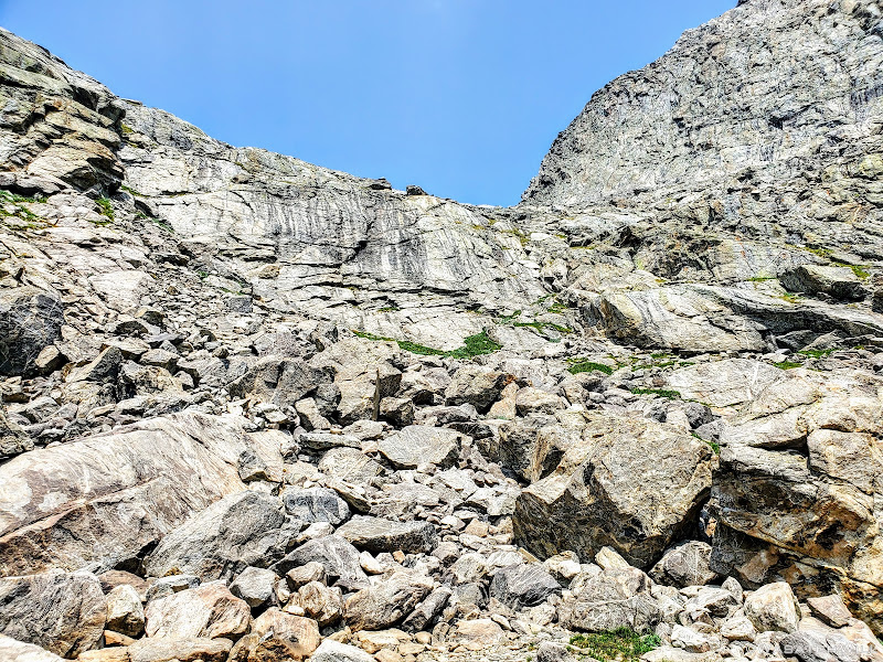
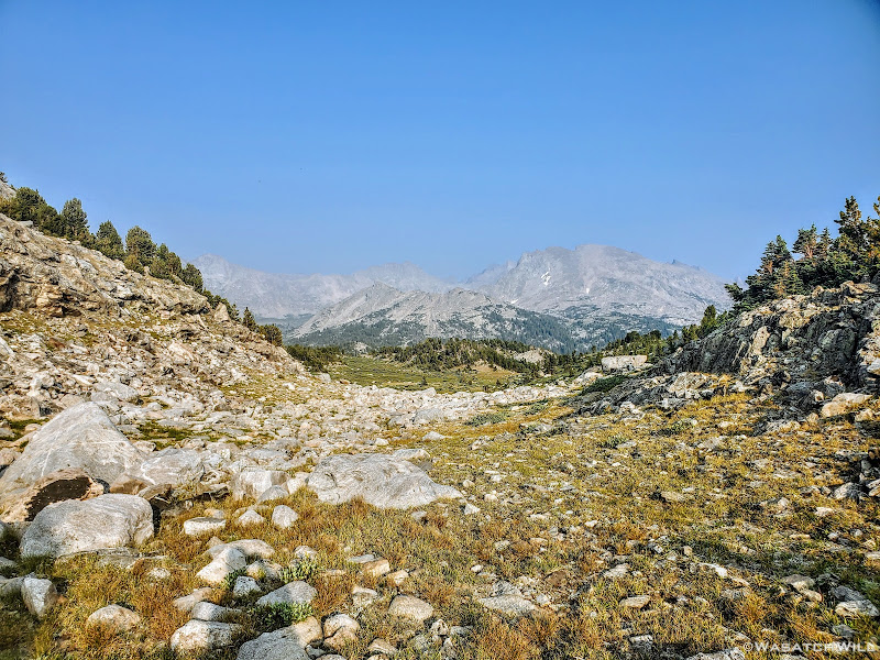
It was now time to gain the next bench and then forge our way over and through a long field of talus that would take us up over the pass. There would be an occasional patch of tundra scattered throughout to give us brief recesses from the talus.
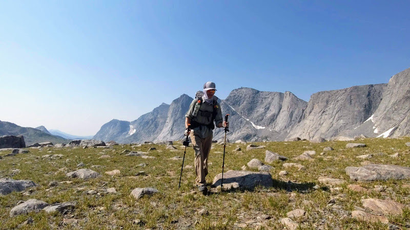
Moving along (photo by Blake)
In theory, there was another pass ahead directly to the north of us that may well have worked but we still chose to keep to the better known pass, now to the west of us.
Blake begins to gain the next bench, with the rejected pass straight ahead
A view south down the East Fork from the uppermost bench
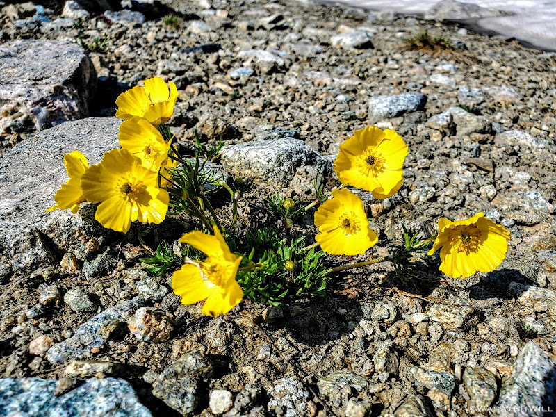
Alpine Buttercups clinging to life in an otherwise desolate wasteland
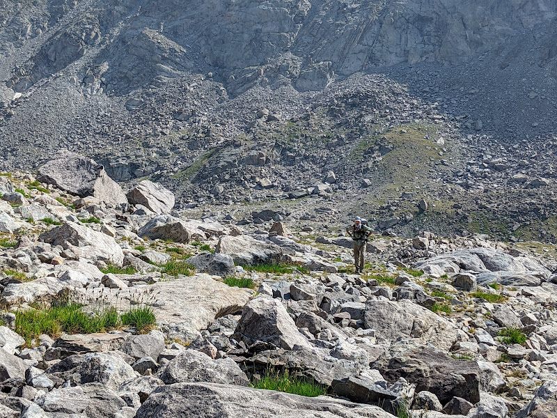
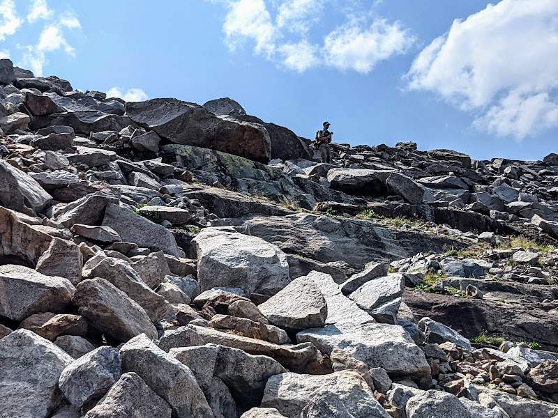
Getting into the talus (photo by Blake)
Blake surveys the field of talus that lies in wait ahead.
Another view to the south
Somewhere along the way through all the talus, we ran into another group of guys on their way down, having come up and over from the opposite direction. I believe they were trekking out a large loop through the area.
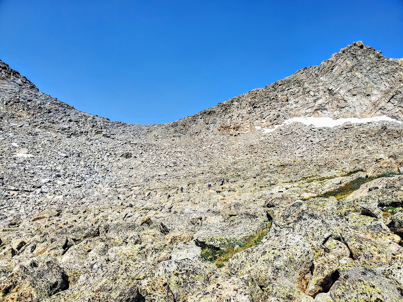
Raid/PITA Pass with a group of fellow backpackers among the talus ahead
We finished out the scramble through all the talus and finally arrived at the top of the pass. Indeed, this pass had become a bit of a PITA. Not as much from all the talus, though that was certainly tedious enough, but even more so from the sun now much higher overhead. By now the midday heat was really escalating and wouldn't drop off much until later in the evening. This would become the theme not only for today but throughout much of our trip.
Usually, escaping to the higher elevations of the mountains provides a good bit of relief from the hot summer temperatures that blast the lower valleys where most of the communities lie, both urban and rural. It did not feel so with this trip. In fact, it didn't feel much cooler than it did sitting out in my own backyard. While it's certainly normal to sweat when exerting a lot of effort such as we had to get up to this pass, even with cooler temperatures, the higher heat only contributed more to what would become our daily sweat fests. Unfortunately, there was very little to no breeze to help out with it either.
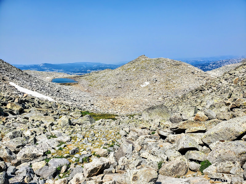
View west from Raid/PITA Pass
While enjoying a nice rest, an older fella soon caught up with us. He turned out to be one that wasn't camped far from us. He was from back east and was out on an annual adventure trip. He had no set schedule or fixed route he was trying to complete. Of course he had some general idea, but his main objective was simply fishing. He would pull over at any lake that looked promising on his map and when he got bored with one, he'd move on to the next one that looked promising. He was certainly no stranger to the Winds through, having visited them for several trips before.
All rested up, we wished the man well and parted as we started our descent down the other side of the pass. Not far down we encountered a young couple who were working their way up. They too were in the middle of a loop route in the area.
Just after that, we had a choice to make. We could keep to the Dixon route and continue heading west, further down the mini mountain canyon, ultimately coming out on a ridge we'd have to work our way down down before circling back up through the Bonneville Basin or we could turn immediately to the north where another small pass sat. One where we could take what I called a "Skurka shortcut". No doubt others had been using this little shortcut long before him, but in the context of hiking what was mostly to be Dixon's high route and this being one of the few points where Skurka's diverged from Dixon's for a bit, it seemed appropriate to call it that in the moment.
This shortcut would save us from having to regain over 300 feet in elevation, but more than that, it would save us two miles. Of course, we chose the shortcut. It would be a good scramble getting down. The descent consisted of mostly more talus, approaching a nearly 45 degree grade at times. A lot of it was loose and unstable in spots so extra careful footing and evaluation of lines down were required. There were a few small 10 to 15 foot cliff bands to figure our way around too. Nothing that would likely kill you if you slipped off one of them but certainly enough to seriously injure yourself and bring the trip to an abrupt end. Eventually we found a suitable solid rock ramp a little off to the east of us that allowed us to finish out the steepest parts of the descent and bypass the remaining cliff bands.
The main lake within the chain of Bonneville Lakes comes into view from atop the 'Skurka shortcut'
Blake well on his way down now, our next pass sitting across the lake
Descending through talus and rocky ramps (photo by Blake)
Seeking a line down, or taking in a view, or taking a photo, or all of the above...(photo by Blake)
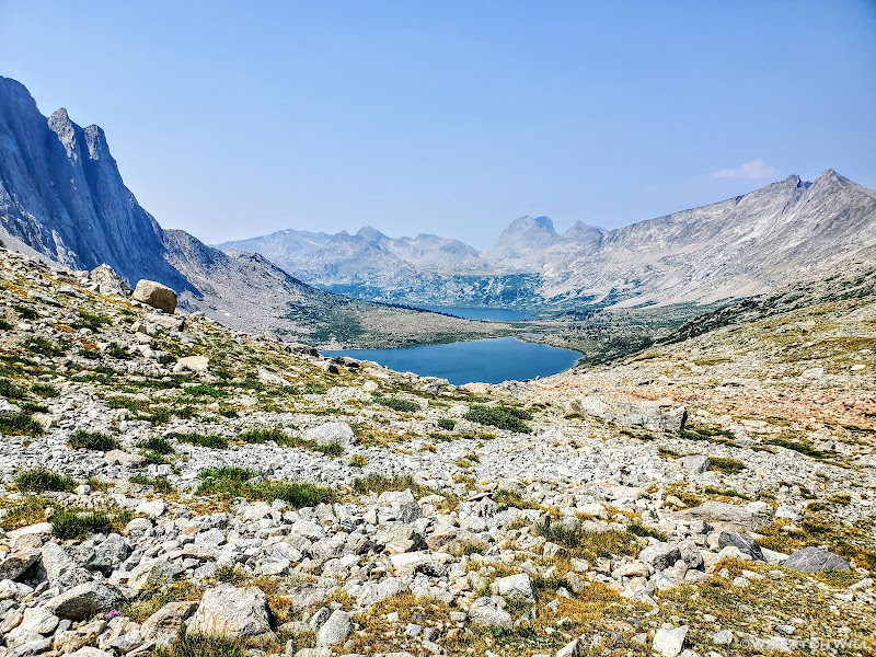
Bonneville Lake(s) and our next pass out beyond
There at the end of our descent sat the largest of the Bonneville Lakes. Thirsty from the continued heat, we doused our shirts, Buffs, and hat with its cold clear water and filtered out some to drink. As we continued to rest up for another moment, our friend from the top of the pass rejoined us. There he'd remain for a while to try the fishing here. Blake and I would bid adieu to him one last time and circumnavigate around the northern shoreline to stage up for the second and final major pass of the day. Yes, just like that, we'd be crossing up and over yet another pass now less than a mile away.
Bonneville Lake(s) up close with the Twin Lions peaks out beyond
A look back up the shortcut we had just come down
Heading around the lake (photo by Blake)
Now trailing Blake around the lake (photo by Blake)
Right between the lake and our next pass, we pulled over at the lake to have our lunch, soak our feet for a bit and recharge. With very few clouds anywhere in sight, there was no threat to any afternoon storms we'd have to race or wait out.
Rested and rejuvenated it was now time to head over.
The pass, while not very high up from where we stood beneath it, certainly much less to gain than the one we had just come over, still looked a bit daunting. With what vertical there was to gain, it was obviously much steeper. There also stood a sizeable cliff, maybe about 40 feet or so, to get around and above.
This pass also has no official name. Many call it Sentry Pass or Sentry Peak Pass for some reason, though with this one, there's no Sentry Peak that I can see anywhere nearby on the maps. Maybe someone else out there took it upon themselves to unofficially name the 11,925 foot peak along its eastern flank Sentry Peak. Still, others have chosen to simply refer to it as Bonneville Pass. Or maybe that was only the doing of @Bob? Who can really know? Oh well, no point in arguing over a name. It can remain nameless for all I care. Gotta get over it all the same.
Let the scrambling begin...
Sentry/Bonneville Pass
It turned out that the pass had looked much more intimidating than it really was. There were solid chunks of rock that served as steps interspersed with soft grassy benches and ramps up and around the right side of the cliff and enabled us to gain the top of the pass in rather short order. And while it may have been short and sweet, it still taxed my lungs and legs for a bit.
Looking back down over Bonneville Basin from near the top of Sentry/Bonneville Pass
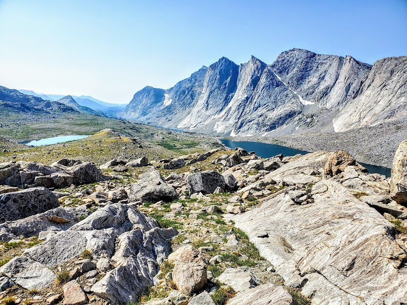
Cresting over the other side of the pass, the prominent Pronghorn Peak, with its 700 foot sheer vertical walls, immediately came into view. Knowing there was a gem of a lake to behold at its base, we made our way over to the ridge that stood ahead between us and the peak, vailing said lake.
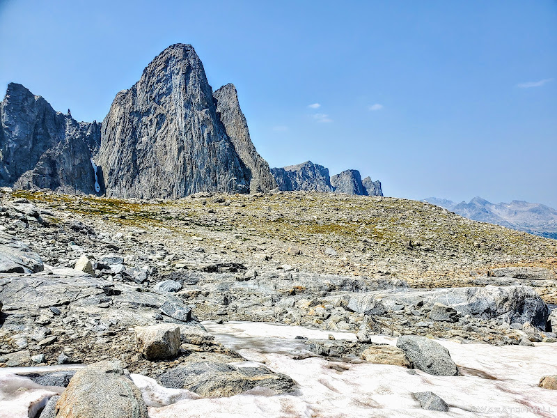
Pronghorn Peak comes into view beyond the ridge
But first, a brief snowfield to cut across
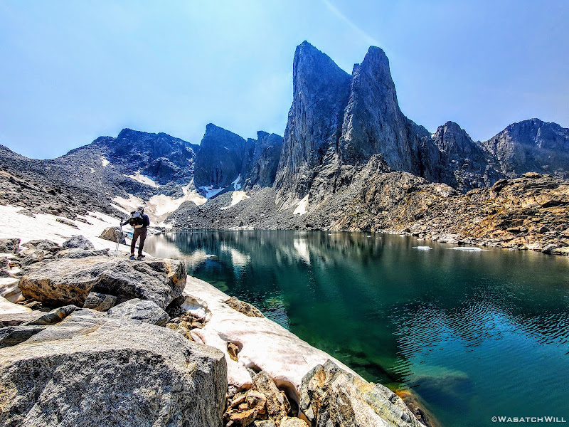
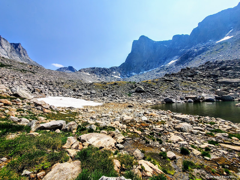
Once on the ridge we were treated to one of the most anticipated sights I had been looking forward to on today's agenda. There, cradled beneath Pronghorn Peak, lied Donna Lake.
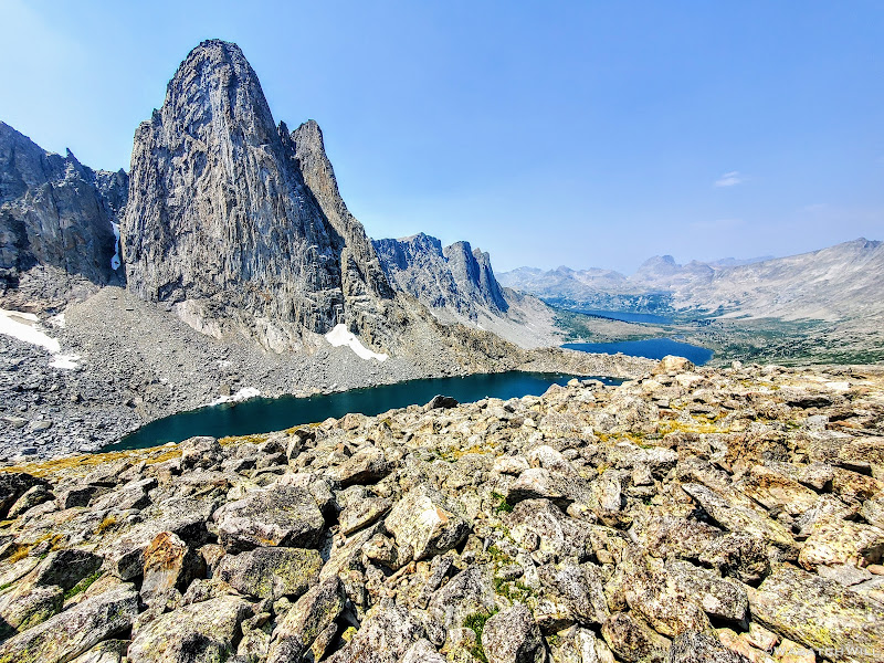
Donna Lake comes into view beneath Pronghorn Peak, Lee Lake and Middle Fork Lake out beyond
We continued along the top of the ridge, continually taking in the panoramic view to our left while being careful not to roll our ankles in the mix of rocks and tundra that made up the ridge.
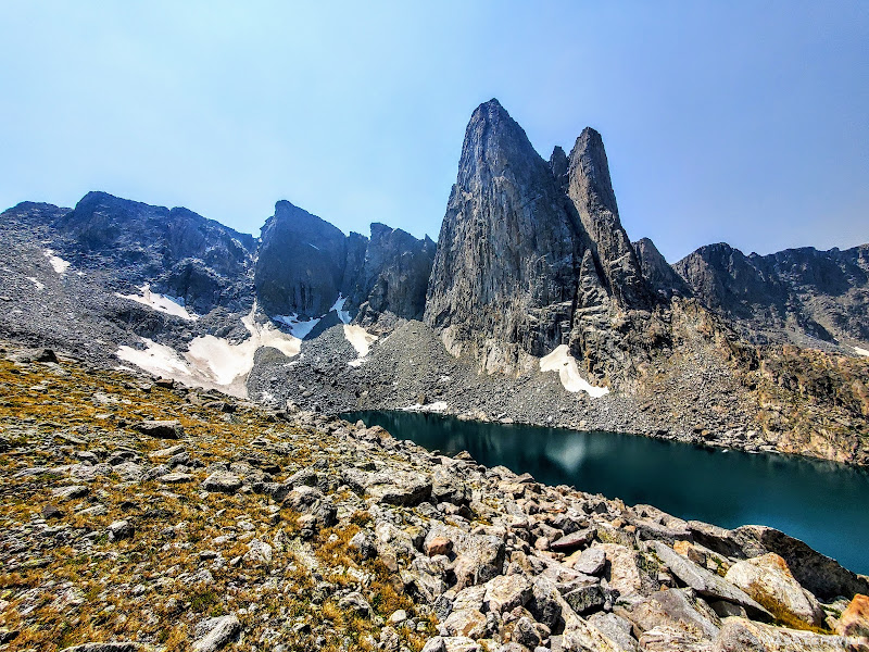
Pronghorn Peak spires above Donna Lake
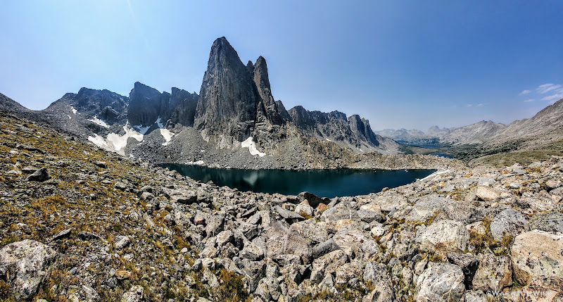
Donna Lake and Pronghorn Peak panorama
Coming down off the ridge (photo by Blake)
Soon we'd descend the ridge down to the lake's outlet and there, we'd stand in awe as we gazed up at this serene and tranquil alpine lake, hidden high up in its very own little glacially carved cirque.
"Donna, do you believe in love at first sight? Because I think I'm in love with you," I thought to myself. Apologies to my wife, Jessica.
Blake stands among greatness
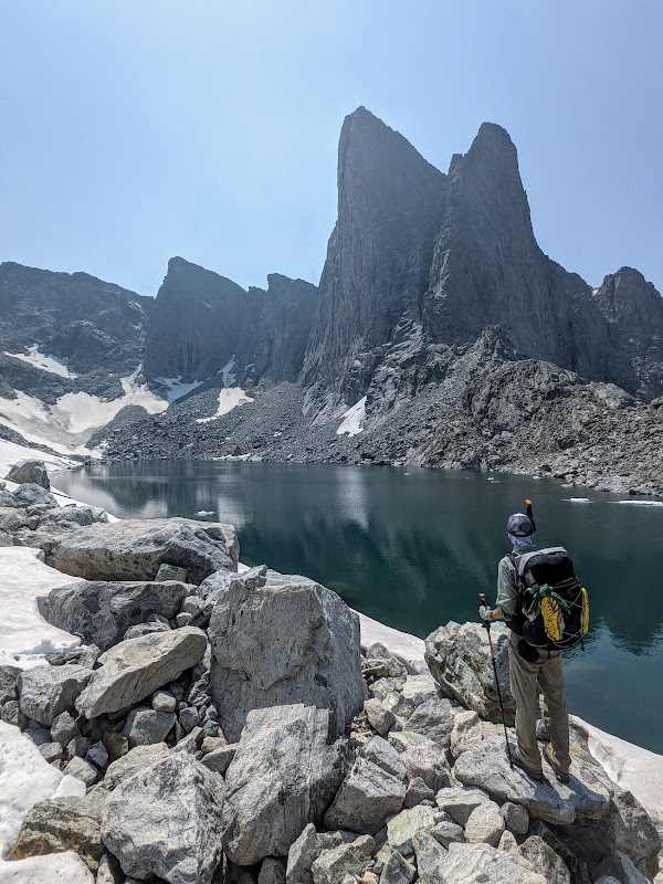
Is that a trekking pole or snorkel? Indeed, it was almost tempting to jump in. Almost. (photo by Blake)
Unfortunately, the sun was now high up and moving westward now so the angle of light made it difficult to get any really good pictures. Being here earlier in the morning would have certainly presented better lighting conditions for photography.
Wishing we could have stayed longer, we bid Donna a good day and goodbye. Once we turned our backs on her, I was already missing her. Donna's lowly and distant brother...boyfriend...estranged husband...???, Lee Lake, awaited us next. Hmmm...nearby Noel might have something to say about that.
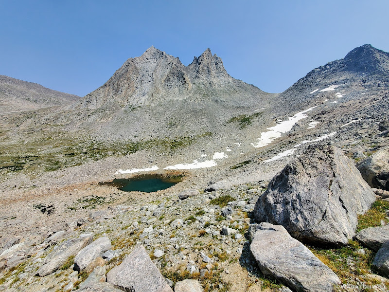
A small tarn sits out beneath Nylon Peak
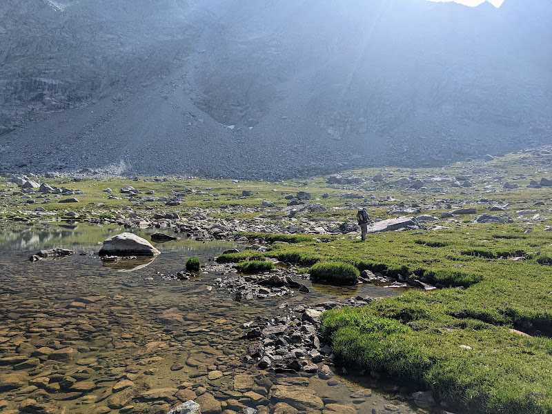
Regardless, it would be a long and grueling descent to get down to Lee Lake. Or so it seemed. I typically don't use grueling to describe descents, but again, it was really hot, especially this day. And any activity, up or downward, was enough to send the sweat glands into a frenzy. There was also a lot more talus and scree to be careful with. I became very thankful we were descending this side of this pass rather than going the other way. It would have been long and laborious.
Descending more talus and tundra from Donna Lake. Goodbye Donna!
Closing in on Lee Lake
Finally back on flat ground at the shore of Lee Lake, we stripped our shirts, hats, and Buffs off to drench them in Lee's luxurious water and then in turn ourselves. I found a nice rock to sit on along the shoreline and again stripped off my shoes and socks to soak my feet for a moment.
Ahhhhhhh!
Of course, as quick as the relief came to my burning and achy feet, came the bone-tingling discomfort of the icy cold water. Yeah...my feet, nay, my whole body is pretty sensitive to cold water. A moment was all my feet needed to get the relief I sought for them.
With all the heat, and all the sweat, we were having to drink abundantly to remain hydrated. I'd usually pop in a Nuun electrolyte tablet into my water bottle every afternoon. On this day, I think I used two...maybe even three. Spread out over the day of course rather than all at once.
Fortunately for us, water was very abundant throughout these mountains, despite what had been a very weak and dry winter for much of the West coming into this summer.
Back on flat land at the edge of Lee Lake
We suited back up and continued the day's journey as we wound our way around the rest of Lee Lake following a use trail that would lead us along.
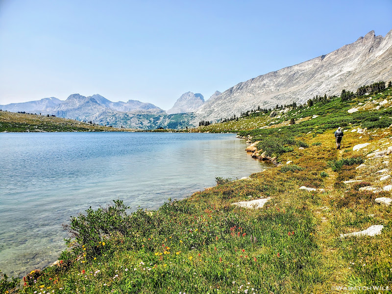
Blake follows a use trail around Lee Lake
Trailing along around Lee Lake (photo by Blake)
By now the smoky air had begun to take its toll on the views. When we reached the outlet of Lee Lake, we looked back to take in another view I was highly anticipating. It was certainly a very pleasant view indeed, but the smoke that had been invading the air also had taken its toll once more on the now distant mountains out beyond, namely, Nylon Peak, Pronghorn Peak, and everything in between we had just come through.
What's that song by the late Nat King Cole? Those Lazy, Hazy, Crazy Days of Summer.
Well, he was certainly right about the hazy part. Unfortunately, such has become the new norm out west here due to the ongoing droughts and wildfires that have become so prevalent in recent years. It's bad enough putting up with all the hazy inversions we have to deal with in the winter time where I live along the Wasatch Front of Utah, but at least you can escape that for a bit by driving or hiking up to higher elevations to get above it or simply just driving away from the Wasatch valleys either of which will get you some fresh air and clear skies. There's no escaping smoke though. It will permeate the air even at higher elevations.
A summer bummer.
The view back across Lee Lake
Lee Lake with Nylon Peak (left) and Pronghorn Peak (right) out beyond
From Lee Lake it was a hop, skip, and a jump following the outlet of Lee Lake to the inlet of Middle Fork Lake. There was a group camped up above Lee Lake on little rise to the east. Might have had some goats or horses too. Looked like quite a camp.
At Middle Fork, we were greeted by a lot of bushes to push through. Eventually another fisherman/use trail showed up, much to our relief. If I remember right, that would be followed by a bit more bushwhacking, then more trail again.
As we got further around the lake, the trail became more defined, for the most part. This would be the only trail of any significant length we'd travel on this day.
Now looking back across Middle Fork Lake
Middle Fork pano
While the trail served as a rare treat for our feet for this day, Middle Fork Lake turned out to be absolutely huge. And long. Very, very long. Right about two miles in length to be exact. Combined with the bushwhacking at the beginning of it, it took what felt like a very long time to get around it. But make it around we did. Once at the other end near the outlet, we took another good rest.
Middle Fork Lake with Kagevah Peak across the other side
It was now late enough in the day to warrant breaking out dinner if we wanted to, but we chose to save it for camp. We now turned our attention back off trail to get to Halls Lake. We knew now we would not be making it out to Europe Canyon before dark considering it was all off trail to get there, but Halls Lake sat halfway between here and there and would serve as a nice consolation prize. Just shy of three miles to reach Halls, we knew we could probably make it there with enough light to spare for setting up camp and making dinner.
Just above Middle Fork there was quite a marshy area to work our way through and around. Somehow we managed to keep our shoes dry and finally worked our way out of it and away from it. We gained a little rise that served as a small pass to get us over into the Halls drainage.
Looking back over the marsh we escaped, Walt Bailey and Dragon Head Peaks out in the smoky haze
Just prior to Halls Lake was yet another beautiful nameless lake, one of many such lakes we'd encounter along this route. Its surface was as smooth and still as glass. Goes to show how still the air had remained that day. Again...very little breeze was ever encountered thus keeping things hot and even a bit muggy.
In skirting around that lake, we'd have our last encounter with anybody for the day. A group of four who were also hiking a high route. They were in the midst of doing more of a mix between the Dixon and the Skurka routes as published. They too were going northbound but had pulled over for dinner. Their plan was to go a little bit past Halls Lake and then settle down for the night.
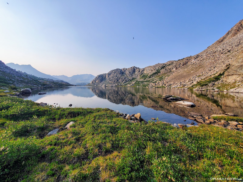
The glassy lake
Another shot across the glassy lake, this time with some small waves from a rare breeze
We continued on and then there it was. Halls Lake. We pulled up onto a grassy flat a couple hundred feet from the lake and set up our camp. We then had our dinner behind another large rock protruding from the ground next to camp that served as yet another great back rest with a splendid view of Halls Lake and the surrounding mountains in front of us, including Halls Mountain straight across the lake and the Pipe Organ further along the right, waving to the other group we had just passed as they now passed us by.
The sun had now set and dusk came quickly. After dinner we tied up our food and closed out the day with another good sleep in our tents.
Halls Camp, night three

Halls Lake pano with Halls Mountain straight ahead
Are you happy now, @Bob?")
To be continued...
WRHR: DAY 1 - BIG SANDY TO CIRQUE OF THE TOWERS
WRHR: DAY 2 - CIRQUE OF THE TOWERS TO DESOLATION VALLEY
After some convincing at the urgent request of @Bob, I now present to all of you fellow BCP friends: DAY THREE.
Sunday - July 25, 2021
MILES: 10.5 | GAIN: 2,749 ft
After another calm night's sleep I awoke just before dawn to set a timelapse of the sun's first light to hit Ambush Peak as it painted it top down. With camera set, I returned to my tent to catch another good hour of sleep or so.
Ambush Peak and my tent, just before sunrise
Now that the sun was out, I arose once more and took the opportunity to head down the lake below and walked out to its outlet on the opposite end. I noticed one other camp nearby so I was careful to not disturb them and keep my distance. From here, I started working my way back up to my own camp. But not without taking several photos of Ambush Peak along the way back. It was all just so beautiful.
Arnicas happily await some morning sunshine
Not to be left out, Paintbrush and Elephant Heads get into the mix
Ambush Peak reflects in a nameless lake
Arnicas and Paintbrush
Another reflection of Ambush Peak atop the nameless lake
Once back at camp, my body was now warmed by the sun and loosened up by the morning wander. Blake was now up too. We retrieved our food, had breakfast, and broke camp. With two passes and most of the day's miles being off-trail, we knew this day would become our most challenging day of the trip thus far. Our intended destination for this day was Europe...the Canyon that is.
Onward we went. Our first pass had no official name to it. For many, it's simply referred to as Raid Pass or Raid Peak Pass after Raid Peak rising up immediately south of it. For others, it carries the moniker of PITA Pass. Confused yet? Don't worry, there will be more of that to come. Even so, it shouldn't take much thinking to figure out that latter acronym.
Raid Peak and Mount Bonneville rise up in the distance across another nameless lake
Before gaining the upcoming pass, we'd first gain a couple of high benches overlooking this intimate valley.
Up on top of the first bench (photo by Blake)
Soon the uppermost lake of the valley came into view.
Yet another nameless lake comes into view beneath Raid Peak
Sitting up on the first bench we had risen to was a beautiful little lake or large tarn. We pulled over here to catch our breath for a moment and to top off our water bottles.
Pulling over at the tarn (photo by Blake)
Mount Bonneville reflection across the greenish tarn
A panoramic view of upper East Fork
Blake filters water with Raid Peak behind
Ambush Peak. If you look closely, you might be able to make out a marmot resting by a large rock. (hint: toward the right)
Vibrant green hues dominated the area around the tarn
It was now time to gain the next bench and then forge our way over and through a long field of talus that would take us up over the pass. There would be an occasional patch of tundra scattered throughout to give us brief recesses from the talus.
Moving along (photo by Blake)
In theory, there was another pass ahead directly to the north of us that may well have worked but we still chose to keep to the better known pass, now to the west of us.
Blake begins to gain the next bench, with the rejected pass straight ahead
A view south down the East Fork from the uppermost bench
Alpine Buttercups clinging to life in an otherwise desolate wasteland
Getting into the talus (photo by Blake)
Blake surveys the field of talus that lies in wait ahead.
Another view to the south
Somewhere along the way through all the talus, we ran into another group of guys on their way down, having come up and over from the opposite direction. I believe they were trekking out a large loop through the area.
Raid/PITA Pass with a group of fellow backpackers among the talus ahead
We finished out the scramble through all the talus and finally arrived at the top of the pass. Indeed, this pass had become a bit of a PITA. Not as much from all the talus, though that was certainly tedious enough, but even more so from the sun now much higher overhead. By now the midday heat was really escalating and wouldn't drop off much until later in the evening. This would become the theme not only for today but throughout much of our trip.
Usually, escaping to the higher elevations of the mountains provides a good bit of relief from the hot summer temperatures that blast the lower valleys where most of the communities lie, both urban and rural. It did not feel so with this trip. In fact, it didn't feel much cooler than it did sitting out in my own backyard. While it's certainly normal to sweat when exerting a lot of effort such as we had to get up to this pass, even with cooler temperatures, the higher heat only contributed more to what would become our daily sweat fests. Unfortunately, there was very little to no breeze to help out with it either.
View west from Raid/PITA Pass
While enjoying a nice rest, an older fella soon caught up with us. He turned out to be one that wasn't camped far from us. He was from back east and was out on an annual adventure trip. He had no set schedule or fixed route he was trying to complete. Of course he had some general idea, but his main objective was simply fishing. He would pull over at any lake that looked promising on his map and when he got bored with one, he'd move on to the next one that looked promising. He was certainly no stranger to the Winds through, having visited them for several trips before.
All rested up, we wished the man well and parted as we started our descent down the other side of the pass. Not far down we encountered a young couple who were working their way up. They too were in the middle of a loop route in the area.
Just after that, we had a choice to make. We could keep to the Dixon route and continue heading west, further down the mini mountain canyon, ultimately coming out on a ridge we'd have to work our way down down before circling back up through the Bonneville Basin or we could turn immediately to the north where another small pass sat. One where we could take what I called a "Skurka shortcut". No doubt others had been using this little shortcut long before him, but in the context of hiking what was mostly to be Dixon's high route and this being one of the few points where Skurka's diverged from Dixon's for a bit, it seemed appropriate to call it that in the moment.
This shortcut would save us from having to regain over 300 feet in elevation, but more than that, it would save us two miles. Of course, we chose the shortcut. It would be a good scramble getting down. The descent consisted of mostly more talus, approaching a nearly 45 degree grade at times. A lot of it was loose and unstable in spots so extra careful footing and evaluation of lines down were required. There were a few small 10 to 15 foot cliff bands to figure our way around too. Nothing that would likely kill you if you slipped off one of them but certainly enough to seriously injure yourself and bring the trip to an abrupt end. Eventually we found a suitable solid rock ramp a little off to the east of us that allowed us to finish out the steepest parts of the descent and bypass the remaining cliff bands.
The main lake within the chain of Bonneville Lakes comes into view from atop the 'Skurka shortcut'
Blake well on his way down now, our next pass sitting across the lake
Descending through talus and rocky ramps (photo by Blake)
Seeking a line down, or taking in a view, or taking a photo, or all of the above...(photo by Blake)
Bonneville Lake(s) and our next pass out beyond
There at the end of our descent sat the largest of the Bonneville Lakes. Thirsty from the continued heat, we doused our shirts, Buffs, and hat with its cold clear water and filtered out some to drink. As we continued to rest up for another moment, our friend from the top of the pass rejoined us. There he'd remain for a while to try the fishing here. Blake and I would bid adieu to him one last time and circumnavigate around the northern shoreline to stage up for the second and final major pass of the day. Yes, just like that, we'd be crossing up and over yet another pass now less than a mile away.
Bonneville Lake(s) up close with the Twin Lions peaks out beyond
A look back up the shortcut we had just come down
Heading around the lake (photo by Blake)
Now trailing Blake around the lake (photo by Blake)
Right between the lake and our next pass, we pulled over at the lake to have our lunch, soak our feet for a bit and recharge. With very few clouds anywhere in sight, there was no threat to any afternoon storms we'd have to race or wait out.
Rested and rejuvenated it was now time to head over.
The pass, while not very high up from where we stood beneath it, certainly much less to gain than the one we had just come over, still looked a bit daunting. With what vertical there was to gain, it was obviously much steeper. There also stood a sizeable cliff, maybe about 40 feet or so, to get around and above.
This pass also has no official name. Many call it Sentry Pass or Sentry Peak Pass for some reason, though with this one, there's no Sentry Peak that I can see anywhere nearby on the maps. Maybe someone else out there took it upon themselves to unofficially name the 11,925 foot peak along its eastern flank Sentry Peak. Still, others have chosen to simply refer to it as Bonneville Pass. Or maybe that was only the doing of @Bob? Who can really know? Oh well, no point in arguing over a name. It can remain nameless for all I care. Gotta get over it all the same.
Let the scrambling begin...
Sentry/Bonneville Pass
It turned out that the pass had looked much more intimidating than it really was. There were solid chunks of rock that served as steps interspersed with soft grassy benches and ramps up and around the right side of the cliff and enabled us to gain the top of the pass in rather short order. And while it may have been short and sweet, it still taxed my lungs and legs for a bit.
Looking back down over Bonneville Basin from near the top of Sentry/Bonneville Pass
Cresting over the other side of the pass, the prominent Pronghorn Peak, with its 700 foot sheer vertical walls, immediately came into view. Knowing there was a gem of a lake to behold at its base, we made our way over to the ridge that stood ahead between us and the peak, vailing said lake.
Pronghorn Peak comes into view beyond the ridge
But first, a brief snowfield to cut across
Once on the ridge we were treated to one of the most anticipated sights I had been looking forward to on today's agenda. There, cradled beneath Pronghorn Peak, lied Donna Lake.
Donna Lake comes into view beneath Pronghorn Peak, Lee Lake and Middle Fork Lake out beyond
We continued along the top of the ridge, continually taking in the panoramic view to our left while being careful not to roll our ankles in the mix of rocks and tundra that made up the ridge.
Pronghorn Peak spires above Donna Lake
Donna Lake and Pronghorn Peak panorama
Coming down off the ridge (photo by Blake)
Soon we'd descend the ridge down to the lake's outlet and there, we'd stand in awe as we gazed up at this serene and tranquil alpine lake, hidden high up in its very own little glacially carved cirque.
"Donna, do you believe in love at first sight? Because I think I'm in love with you," I thought to myself. Apologies to my wife, Jessica.
Blake stands among greatness
Is that a trekking pole or snorkel? Indeed, it was almost tempting to jump in. Almost. (photo by Blake)
Unfortunately, the sun was now high up and moving westward now so the angle of light made it difficult to get any really good pictures. Being here earlier in the morning would have certainly presented better lighting conditions for photography.
Wishing we could have stayed longer, we bid Donna a good day and goodbye. Once we turned our backs on her, I was already missing her. Donna's lowly and distant brother...boyfriend...estranged husband...???, Lee Lake, awaited us next. Hmmm...nearby Noel might have something to say about that.
A small tarn sits out beneath Nylon Peak
Regardless, it would be a long and grueling descent to get down to Lee Lake. Or so it seemed. I typically don't use grueling to describe descents, but again, it was really hot, especially this day. And any activity, up or downward, was enough to send the sweat glands into a frenzy. There was also a lot more talus and scree to be careful with. I became very thankful we were descending this side of this pass rather than going the other way. It would have been long and laborious.
Descending more talus and tundra from Donna Lake. Goodbye Donna!
Closing in on Lee Lake
Finally back on flat ground at the shore of Lee Lake, we stripped our shirts, hats, and Buffs off to drench them in Lee's luxurious water and then in turn ourselves. I found a nice rock to sit on along the shoreline and again stripped off my shoes and socks to soak my feet for a moment.
Ahhhhhhh!
Of course, as quick as the relief came to my burning and achy feet, came the bone-tingling discomfort of the icy cold water. Yeah...my feet, nay, my whole body is pretty sensitive to cold water. A moment was all my feet needed to get the relief I sought for them.
With all the heat, and all the sweat, we were having to drink abundantly to remain hydrated. I'd usually pop in a Nuun electrolyte tablet into my water bottle every afternoon. On this day, I think I used two...maybe even three. Spread out over the day of course rather than all at once.
Fortunately for us, water was very abundant throughout these mountains, despite what had been a very weak and dry winter for much of the West coming into this summer.
Back on flat land at the edge of Lee Lake
We suited back up and continued the day's journey as we wound our way around the rest of Lee Lake following a use trail that would lead us along.
Blake follows a use trail around Lee Lake
Trailing along around Lee Lake (photo by Blake)
By now the smoky air had begun to take its toll on the views. When we reached the outlet of Lee Lake, we looked back to take in another view I was highly anticipating. It was certainly a very pleasant view indeed, but the smoke that had been invading the air also had taken its toll once more on the now distant mountains out beyond, namely, Nylon Peak, Pronghorn Peak, and everything in between we had just come through.
What's that song by the late Nat King Cole? Those Lazy, Hazy, Crazy Days of Summer.
Well, he was certainly right about the hazy part. Unfortunately, such has become the new norm out west here due to the ongoing droughts and wildfires that have become so prevalent in recent years. It's bad enough putting up with all the hazy inversions we have to deal with in the winter time where I live along the Wasatch Front of Utah, but at least you can escape that for a bit by driving or hiking up to higher elevations to get above it or simply just driving away from the Wasatch valleys either of which will get you some fresh air and clear skies. There's no escaping smoke though. It will permeate the air even at higher elevations.
A summer bummer.
The view back across Lee Lake
Lee Lake with Nylon Peak (left) and Pronghorn Peak (right) out beyond
From Lee Lake it was a hop, skip, and a jump following the outlet of Lee Lake to the inlet of Middle Fork Lake. There was a group camped up above Lee Lake on little rise to the east. Might have had some goats or horses too. Looked like quite a camp.
At Middle Fork, we were greeted by a lot of bushes to push through. Eventually another fisherman/use trail showed up, much to our relief. If I remember right, that would be followed by a bit more bushwhacking, then more trail again.
As we got further around the lake, the trail became more defined, for the most part. This would be the only trail of any significant length we'd travel on this day.
Now looking back across Middle Fork Lake
Middle Fork pano
While the trail served as a rare treat for our feet for this day, Middle Fork Lake turned out to be absolutely huge. And long. Very, very long. Right about two miles in length to be exact. Combined with the bushwhacking at the beginning of it, it took what felt like a very long time to get around it. But make it around we did. Once at the other end near the outlet, we took another good rest.
Middle Fork Lake with Kagevah Peak across the other side
It was now late enough in the day to warrant breaking out dinner if we wanted to, but we chose to save it for camp. We now turned our attention back off trail to get to Halls Lake. We knew now we would not be making it out to Europe Canyon before dark considering it was all off trail to get there, but Halls Lake sat halfway between here and there and would serve as a nice consolation prize. Just shy of three miles to reach Halls, we knew we could probably make it there with enough light to spare for setting up camp and making dinner.
Just above Middle Fork there was quite a marshy area to work our way through and around. Somehow we managed to keep our shoes dry and finally worked our way out of it and away from it. We gained a little rise that served as a small pass to get us over into the Halls drainage.
Looking back over the marsh we escaped, Walt Bailey and Dragon Head Peaks out in the smoky haze
Just prior to Halls Lake was yet another beautiful nameless lake, one of many such lakes we'd encounter along this route. Its surface was as smooth and still as glass. Goes to show how still the air had remained that day. Again...very little breeze was ever encountered thus keeping things hot and even a bit muggy.
In skirting around that lake, we'd have our last encounter with anybody for the day. A group of four who were also hiking a high route. They were in the midst of doing more of a mix between the Dixon and the Skurka routes as published. They too were going northbound but had pulled over for dinner. Their plan was to go a little bit past Halls Lake and then settle down for the night.
The glassy lake
Another shot across the glassy lake, this time with some small waves from a rare breeze
We continued on and then there it was. Halls Lake. We pulled up onto a grassy flat a couple hundred feet from the lake and set up our camp. We then had our dinner behind another large rock protruding from the ground next to camp that served as yet another great back rest with a splendid view of Halls Lake and the surrounding mountains in front of us, including Halls Mountain straight across the lake and the Pipe Organ further along the right, waving to the other group we had just passed as they now passed us by.
The sun had now set and dusk came quickly. After dinner we tied up our food and closed out the day with another good sleep in our tents.
Halls Camp, night three
Halls Lake pano with Halls Mountain straight ahead
Are you happy now, @Bob?
To be continued...
WRHR: DAY 1 - BIG SANDY TO CIRQUE OF THE TOWERS
WRHR: DAY 2 - CIRQUE OF THE TOWERS TO DESOLATION VALLEY
Last edited:


 He's been known to wander the Winds throughout the summer months.