We were supposed to do the Southern Traverse (and a partial one at that, from Iceberg Lake to Tebay Lake) but after getting into some truly demoralizing bushwhacking, we called it at Bremner. The plan was to do a shorter backpack at Denali to take up the rest of the time we had in Alaska, but after waking up borderline hypothermic the morning we were to start hiking, I called that one off (cold nights with lots of deep river crossings sounded like a bad idea to me when I was already having trouble with the cold). So, the trip went almost in no way according to plan after the first week or so, but the benefit was that we got to road trip around Alaska for a week and see more of what the state had to offer than we otherwise would have. I have no idea when I'll ever get back up there, so I felt OK with how the trip ended up even though I really hate calling off or shortening backpacking trips.
This trip report will only cover the 7-day backpack in Wrangell-St Elias. It was a rather short route at roughly 30 miles, and we did it in 5 hiking days, spending 2 nights at the Bremner mining camp. It was one of the most physically demanding hikes I have ever done. Thankfully the elevation was low, generally around 4000-5000ish ft. I can't imagine doing a similar hike to this one at 10k plus. Usually on long hikes, every day I feel stronger as the daily hiking whips me into shape. Not so on this trip, every day felt just as hard, sometimes harder, than the days before.
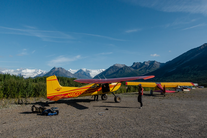
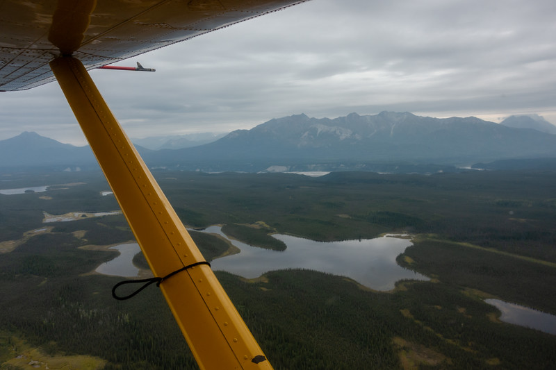
The trip begins with a flight from McCarthy to Iceberg Lake.
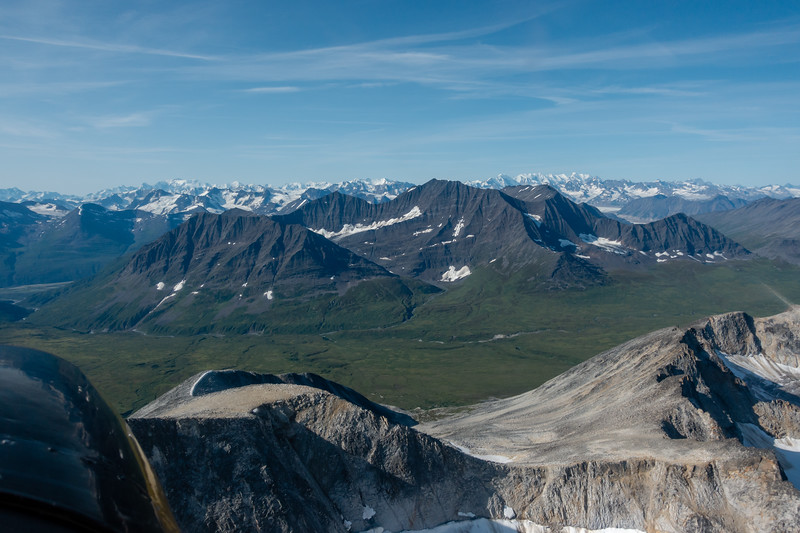
I never got a good picture of it, but due to the clear skies we were able to see all the way out to Mt Logan and Mount St Elias during the flight in. (They are not shown in this picture, but the mountains were endless)
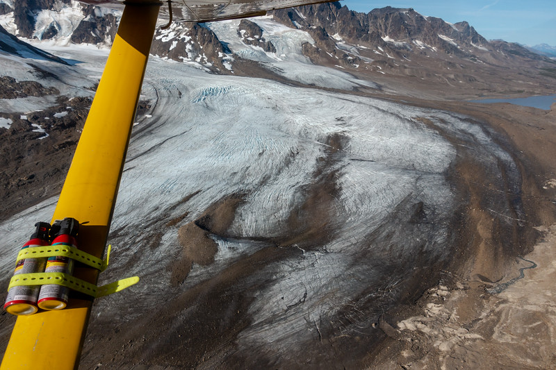
We crossed this large glacier on the first day. In the lower 48 it would be a national treasure, with its own park, nature documentaries, guide services, etc. In Alaska, it is just another unnamed glacier.
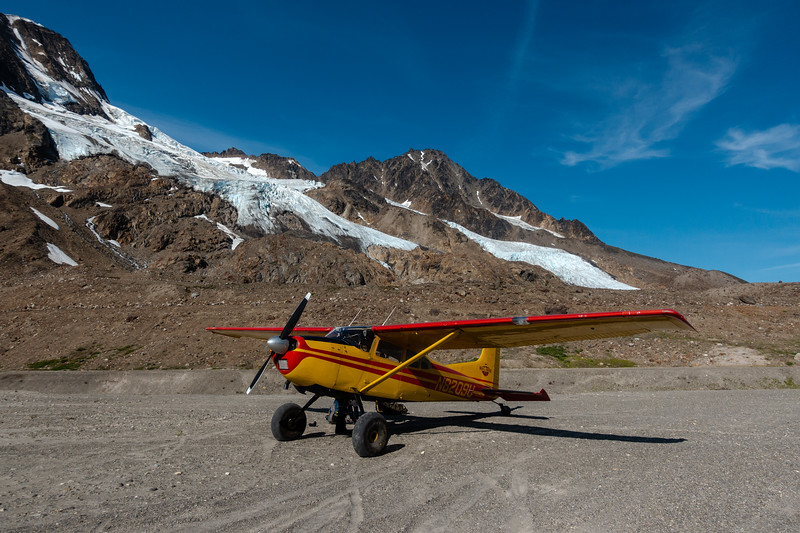
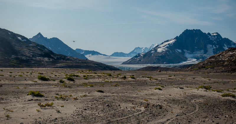
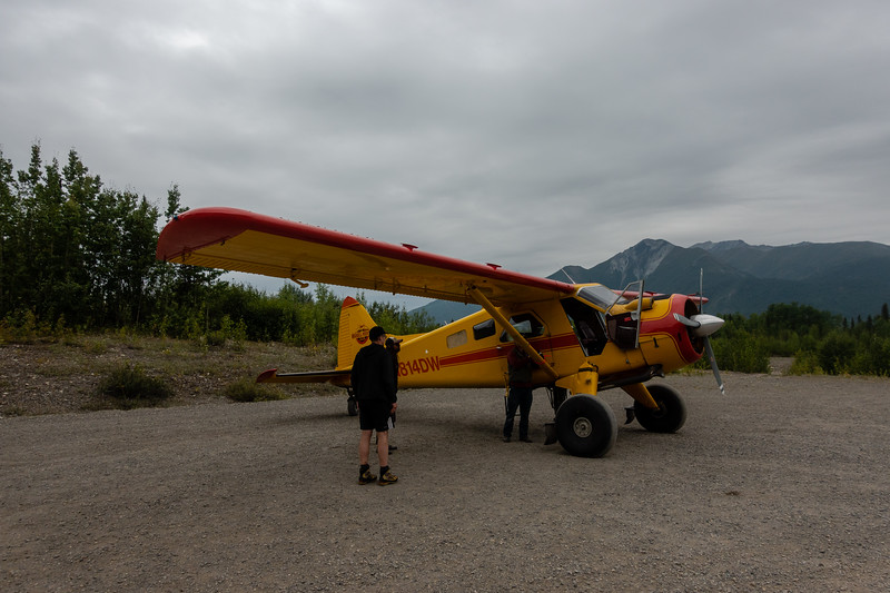
The landing strip at Iceberg Lake is a moonscape dust field with glaciers hanging on the peaks above.
The little Cessna 185 heading back home. The glaciers in the distance are tributary glaciers to the massive Tana Glacier.
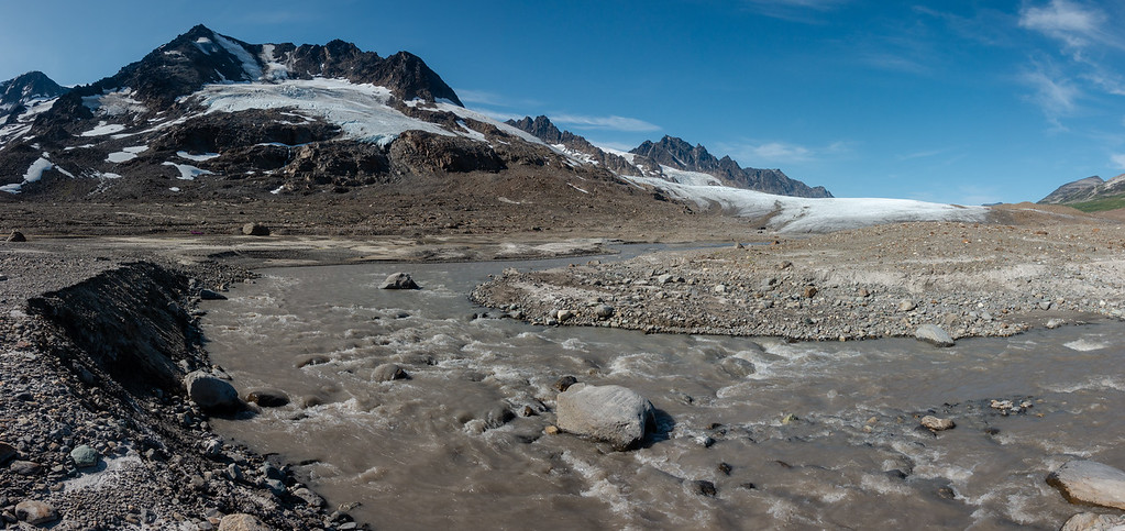
On the way up the Iceberg Lake valley toward the unnamed glacier.
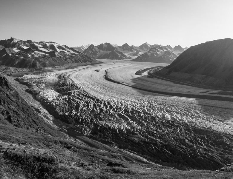
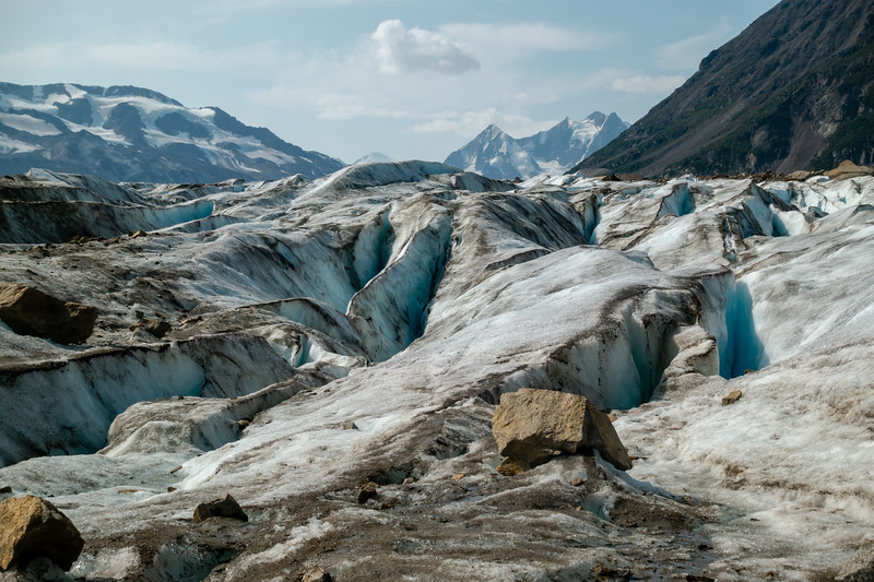
This was the first properly large glacier I had been on. I've hiked on a couple smaller ones in the Winds, but they don't really compare with this.
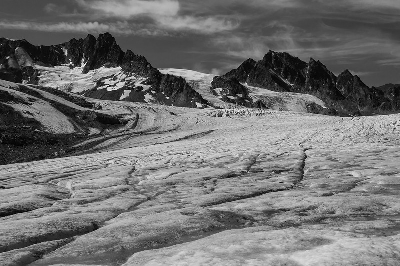
Why do glaciers look so good in black and white?
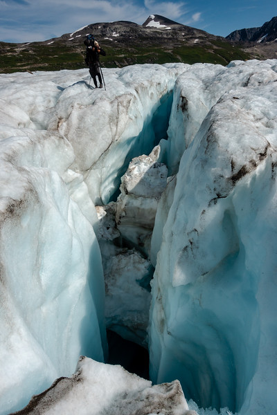
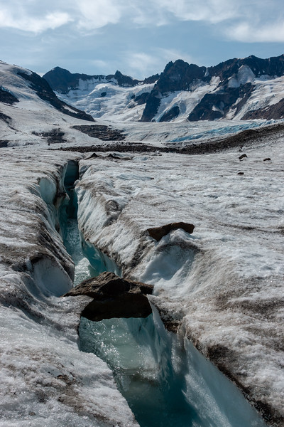
We meandered around the glacier for a long time, wandering from moulin to crevasse to meltwater stream.
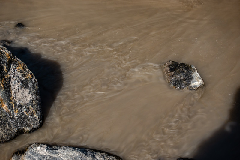
Much of the glacial meltwater we saw had this strange metal-flake paint effect to it. Possibly high content of ground up mica?
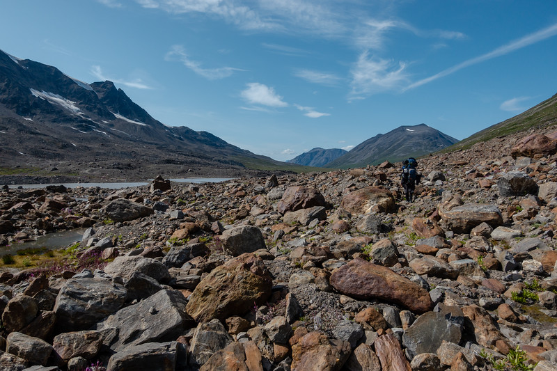
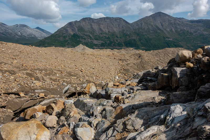
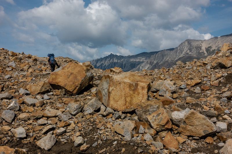
Getting off the glacier entailed several miles of hiking on moraines of varying stability and composition.
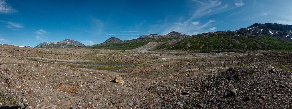
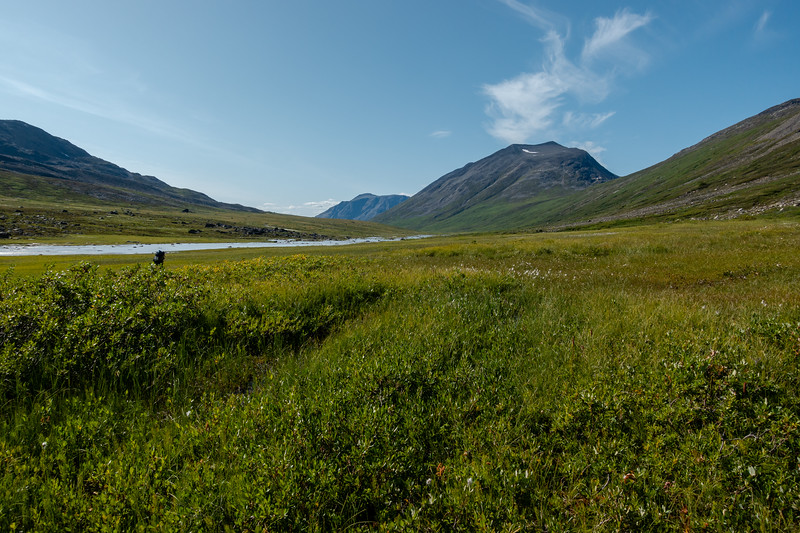
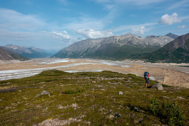
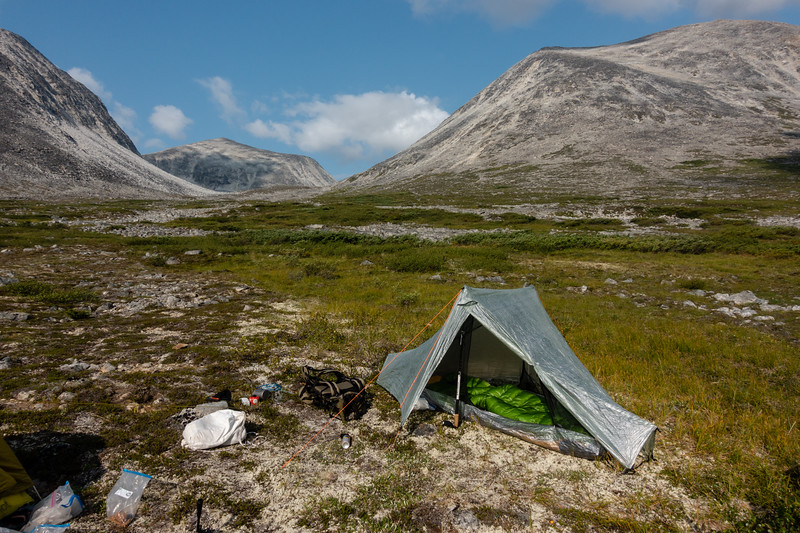
After getting off the moraine, it's an easy hike down a squishy, springy valley to find a spot suitable for camp.
Evening light here is very pretty, and lasts for hours. The light would begin to get good around 6-6:30PM, and sunset was around 10PM.
Day 2, the first pass of the "seven" passes.
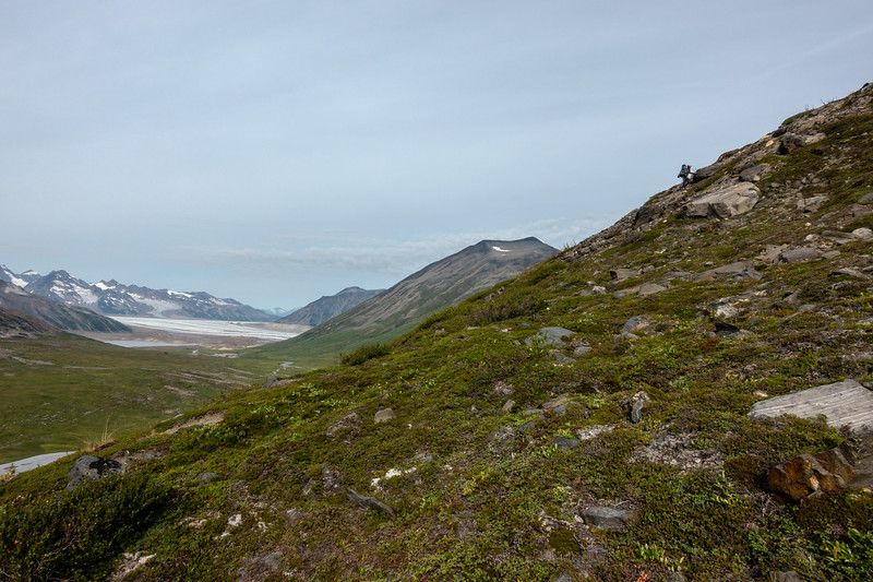
The hike begins with a relentlessly steep 1000ft or so climb up the side of the valley. The views are good from up here, though.
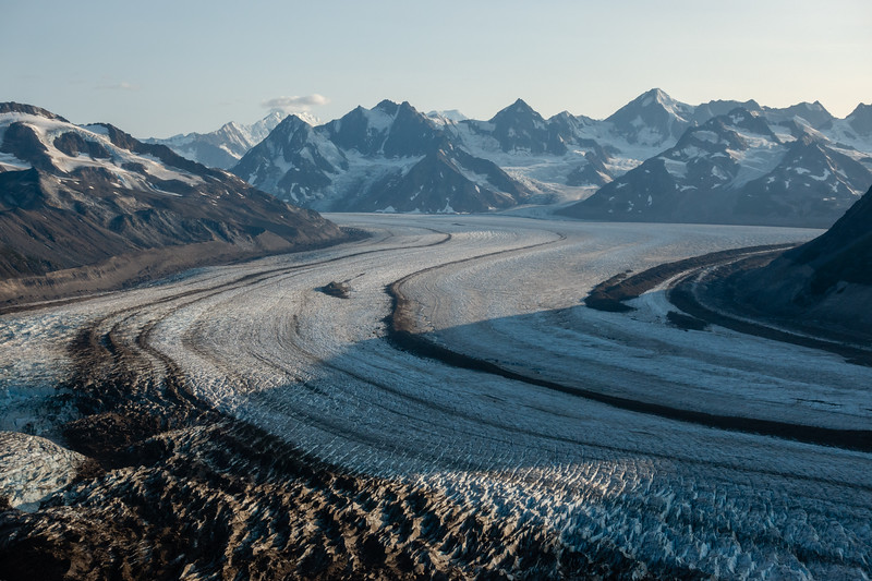
We get our first good views of the Bremner Glacier.
Over the pass, on to the other side. The terrain through the pass reminded us of high Winds or Beartooths country a bit. The views out ahead betrayed that we were not in the lower 48 though.
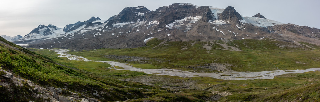
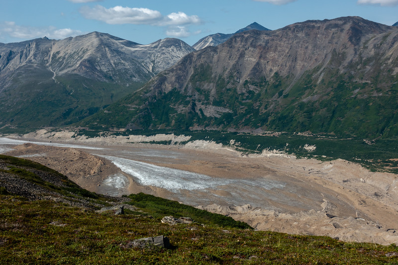
The toe of one of the lobes of Bremner Glacier. The next day's hike would take us up the valley on the far side of the glacier.
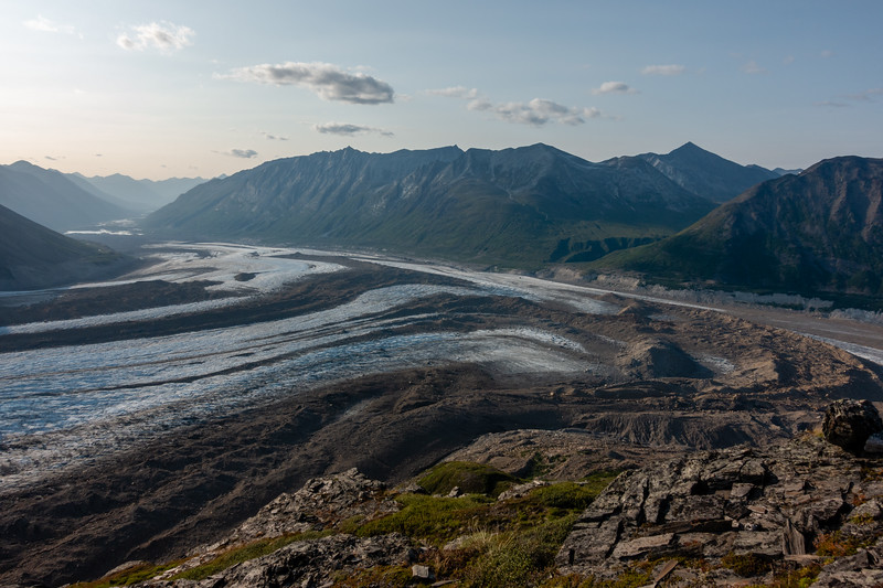
As we rounded the mountain, more glacier came into view. The next day we would spend a few hours crossing the glacier in the area shown in the photo.
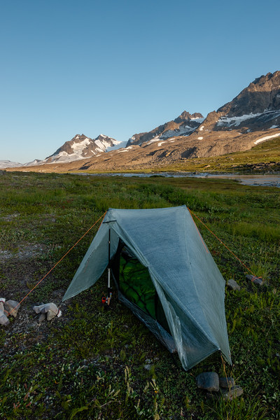
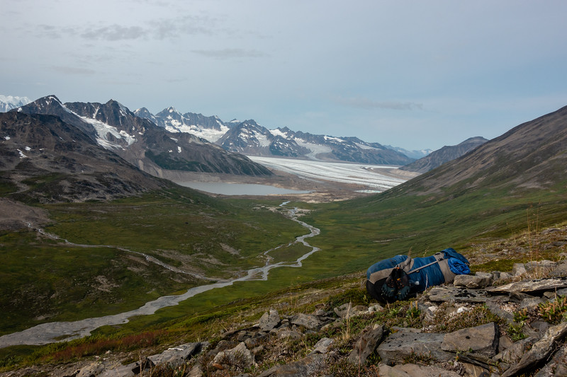
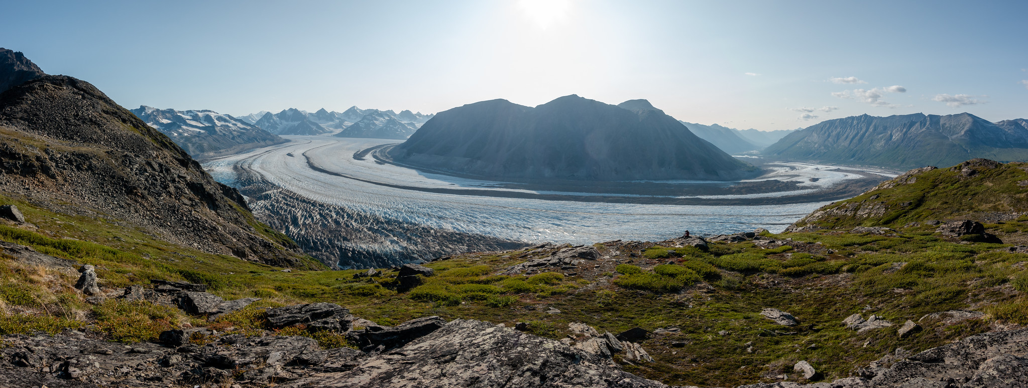
After setting up camp in a hanging valley, we headed up to a viewpoint I had scoped on maps/Google Earth. It did not disappoint. It exceeded all expectations and wrapped straight around into pure wonder and amazement.
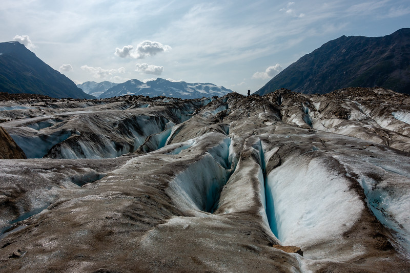
Day 3 involved getting down to the glacier, crossing it, and climbing up a valley on the other side.
The downclimb is quite difficult and brushy, and since the glacier has receded considerably in recent years, getting onto it involves some seriously gnarly rock and moraine hopping. At the edge of the glacier, melting and collapsing ice formations were also considerable hazards. The first glacier we crossed was, apart from trickling meltwater, silent. This glacier seemed to constantly talk. Rockfalls, icefalls, and other noises that made it seem to be a living behemoth creature. We were able to hear them from up on the viewpoint the evening before, and now got to hear them up close.
Crevasses were prolific on this glacier, and it required some work to avoid them.
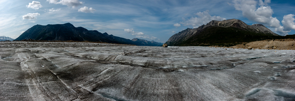
The other big challenge was navigating the maze of medial moraines on the surface of the glacier. I used pictures taken the evening before to help us keep our bearings as we crossed. Some of these were very large, and they were all quite unstable. We did our best to avoid the large ones (some looked maybe 50-75 feet tall? Hard to say, perspective is warped in this big country).
That single rock in the distance was about 30ft around.
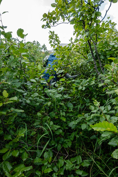
At this point we made a major navigational mistake that caused us to call the trip at Bremner instead of continuing on. Route info gathered beforehand says take the eastern side of this valley. We thought the Western side looked fine. It is not.
We spent a couple hours swimming though brush like this, then another couple afterward in brush that gradually shortened. It was probably around 4 hours to do maybe 1.5 miles. At one point in brush like that in the picture, I stepped about 24 inches from a large hornet nest and got bitten quite a few times before being able to thrash far enough away through the brush to get away from the angry bugs.
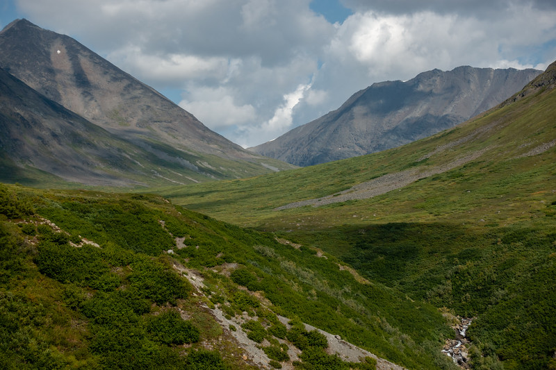
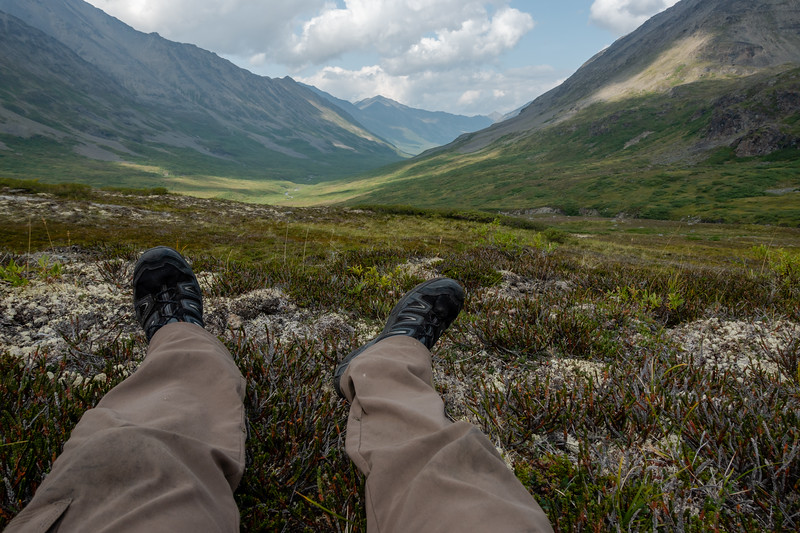
Didn't take many pics at camp that evening, although it was a nice evening. I was exhausted. Cleaned some of the blood and sweat off in the creek, had supper, and turned in for the night. The campsite view was amazing though. This valley seemed like it should be teeming with caribou.
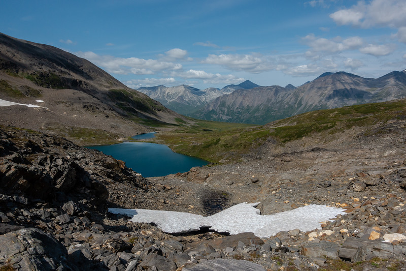
Day 4-second of the "seven" passes.
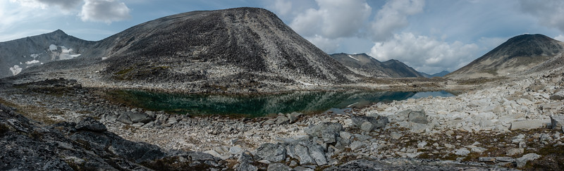
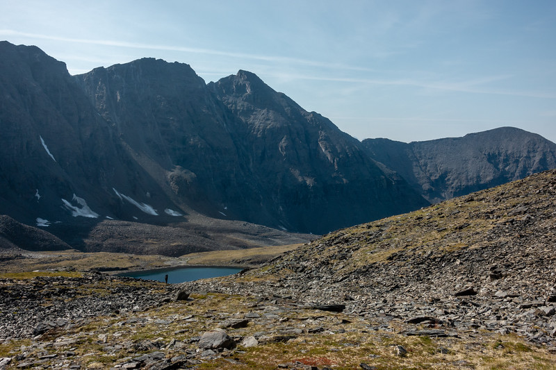
This pass was fairly mild with elevation, but involved seemingly endless rock hopping. It very much reminded us of high Winds or Beartooth country. These beautiful high lakes get me excited because in the Winds and Beartooths, they often hold fish. No fish here though, this lake is naturally fishless and I'm fine with it staying that way. On the way up this pass, we met a couple that were doing the Southern Traverse in the opposite direction we were headed. They were the first people we had seen since the glacier near Iceberg Lake, where we saw 7 people at a distance.
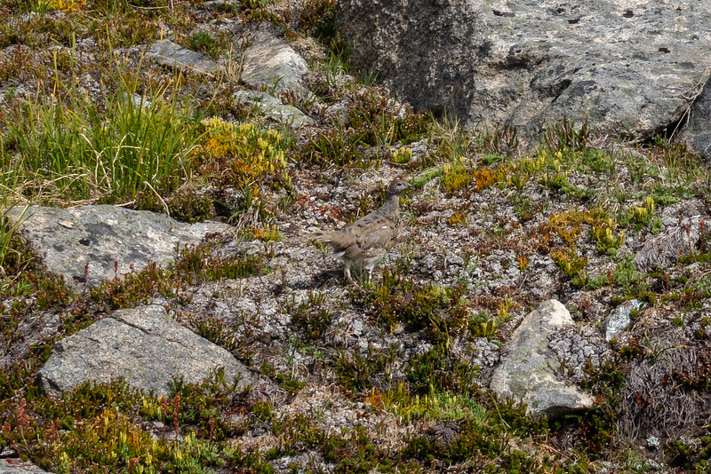
From this pass on, we saw a lot of ptarmigan.
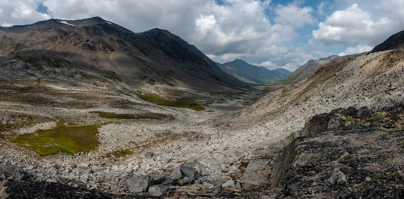
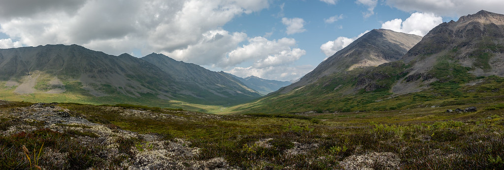
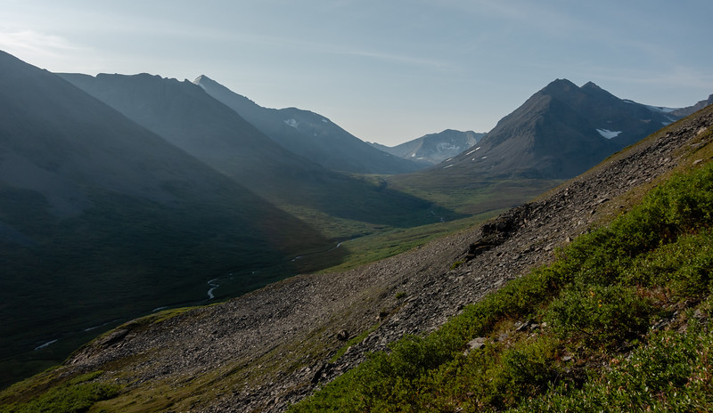
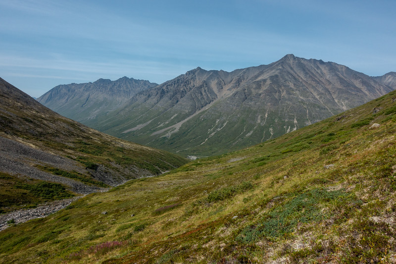
The far side of the pass drops into the Monahan Creek valley.
We took a long break at a confluence of Monahan Creek's valley and another major valley. We would end up camping very near this spot, after spending a bunch of time wandering around lower down in the valley. We found the creek water lower down very silty, so we came back up to some clear springs to have good water.
While at camp that evening, we spotted a grizzly bear working its way up Monahan Creek. It had been downwind in the valley below us, and I supposed it smelled us and decided to clear out on up the valley. We watched it for probably 45 minutes or more as it worked its way on up the valley and over the divide to another valley, passing within 300 yards of camp at one point. I didn't take any pictures as my camera didn't have a long enough lens to really make it worthwhile.
Day 5 - third of the "seven" passes
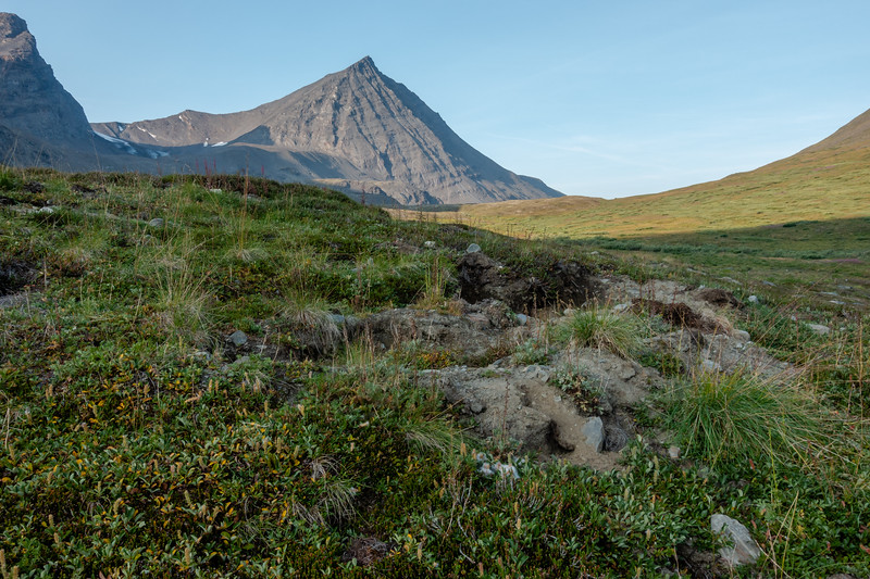
Not my best picture of them, but there were bear diggings EVERYWHERE. Not just in this valley, but in many others as well. We also noticed grizzly bear tracks on the moraines along Bremner Glacier a couple days before. They seem to wander around the entirety of the landscape.
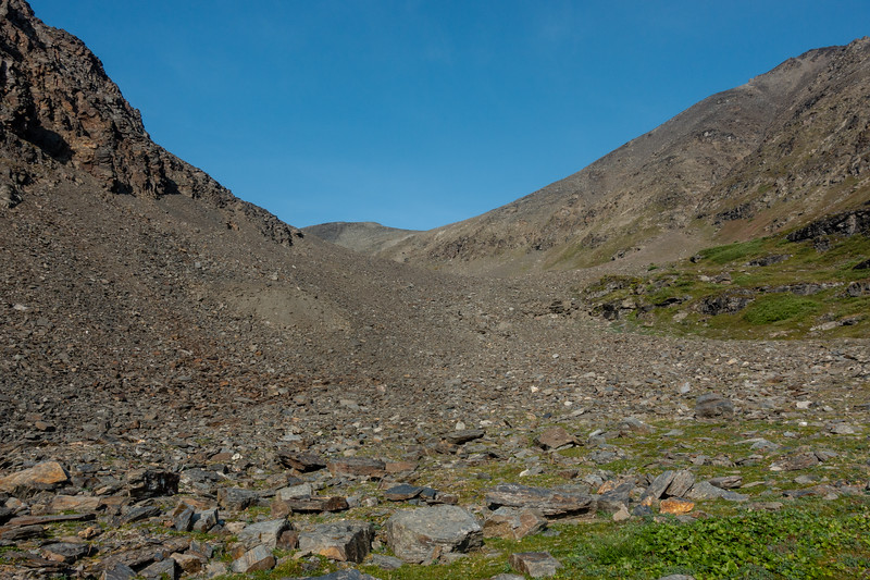
The day started with some quite tough sidehilling to stay above the thick brush in the lower elevations of the valley.
Then it's up about another 2000ft to the highest and toughest pass of the hike. It is brutally steep and all scree.
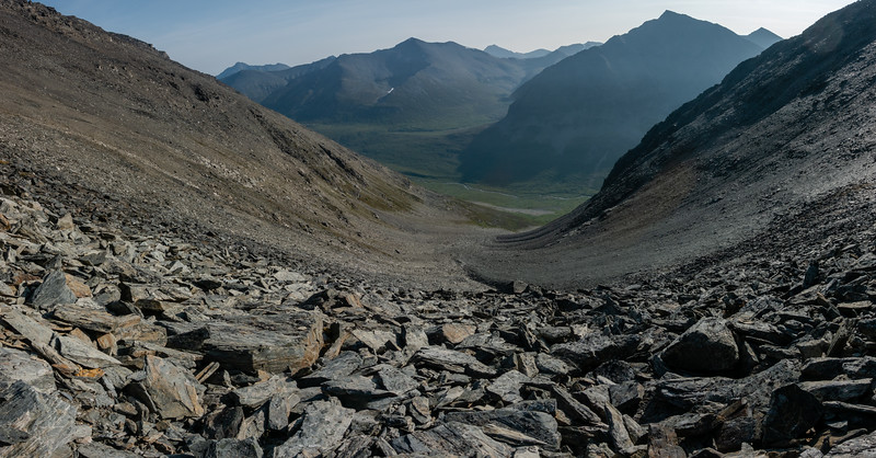
The views from the top are incredible though.
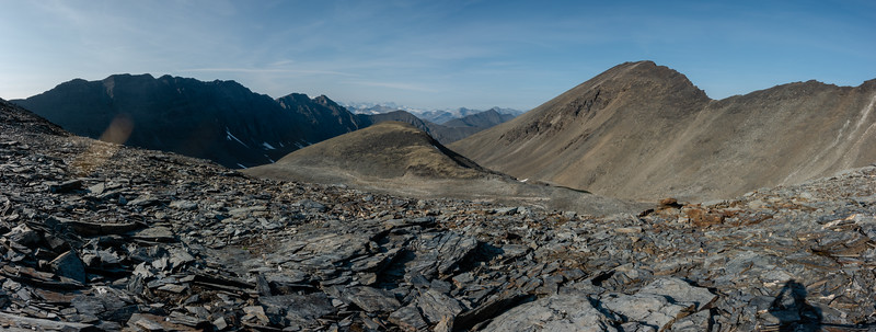
There's more scree coming down the other side for quite some time, but eventually you get below it and just do a lot of sidehilling again.
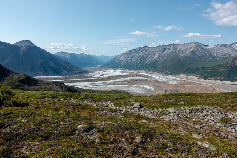
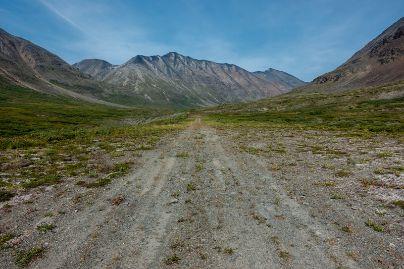
Golconda Creek valley in view--Bremner is not too far away now.
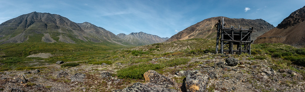
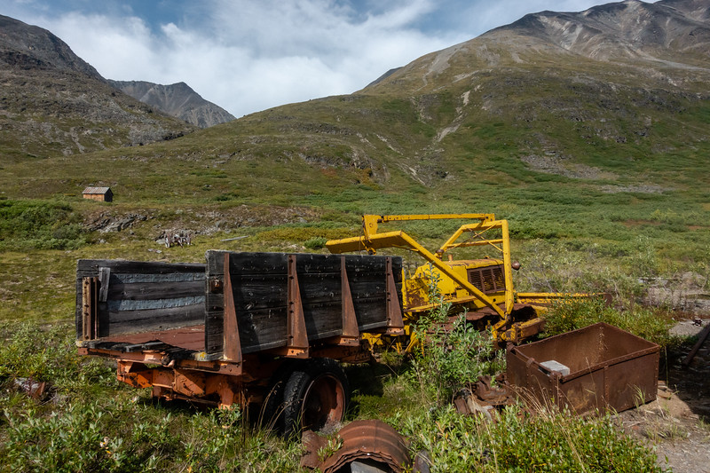
After a couple miles of sidehilling through terrain varying from grassy pastures to more scree, you begin finding the old mining equipment.
The airstrip at Bremner. Much less sandy than the Iceberg strip, but it's pretty short and is a "one way in, one way out" strip.
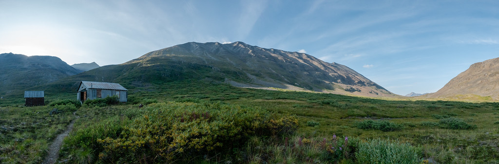
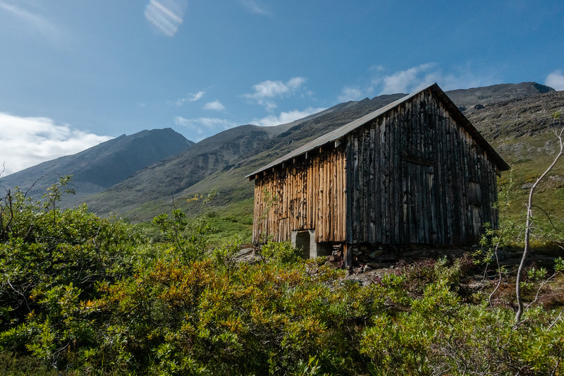
The Bremner mining camp is a fascinating place. Miners tried to get enough gold out of these mountains to turn a profit. I think the main activity was from the 1920s to the early 1940s. Some of the equipment they built out here was quite impressive, including a hydroelectric powerplant and an ore refining mill. Many of the buildings remain, and the park service has done stabilization work on many of them. A couple of the main cabins are maintained well enough for people to stay in, and they are stocked with some supplies, displays of artifacts, and a pretty surprising number of books and board games. When we arrived a lady was staying in the large cabin, but graciously moved to the smaller one and let Joey and I stay in the big cabin.
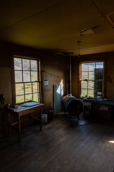
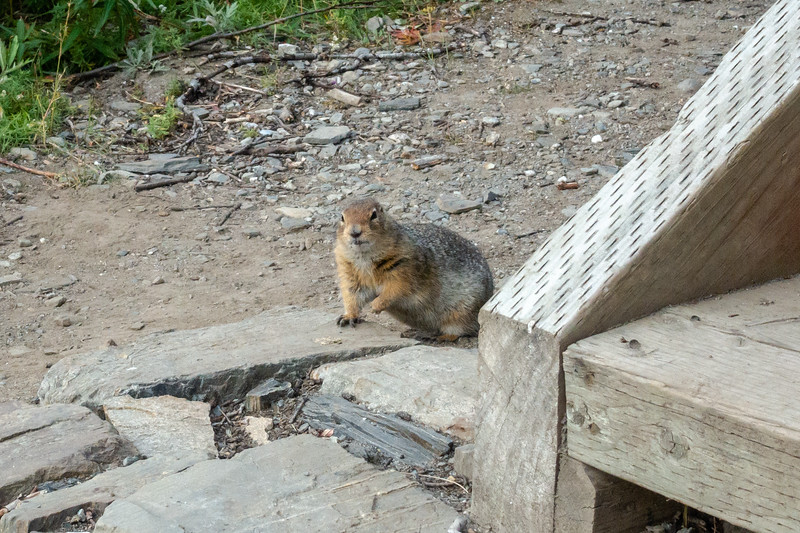
Home for a couple nights. A very peaceful place. Lots of ground squirrels.
The ground squirrels here are numerous and bold. I had to chase one back out of the cabin after one invited itself in while the door was left open.
Day 6 - Exploring the Mining Camp
We mostly took day 6 as a rest day. Did a ton of reading. A lot of sitting outside the cabin watching the light change on the mountains. A lot of enjoying not having to slog through difficult scree, brush, passes, etc.
Dozer and wagon.
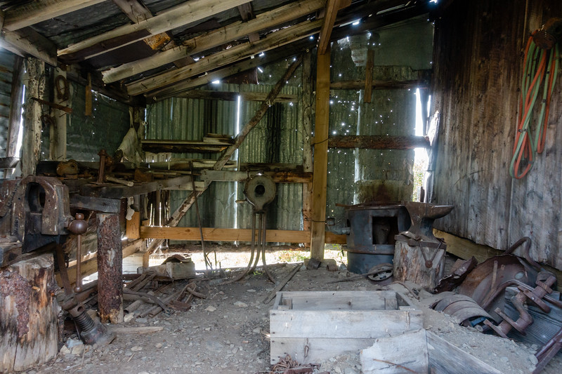
Blacksmith shop.
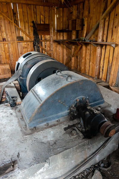
Hydroelectric generator.
Generator building.
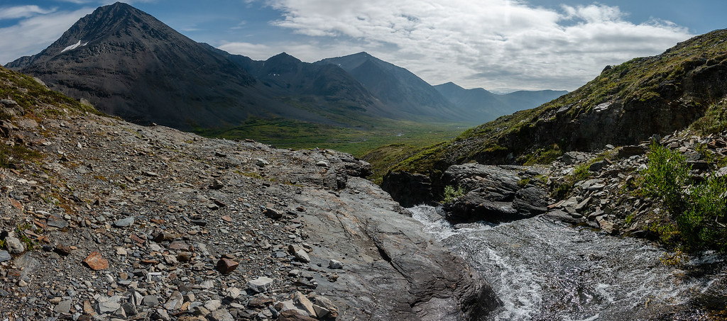
I climbed to some falls above the valley to sit and enjoy the view for a while. May have cleaned a bit of sweat and grime off myself while here as well.
Day 7 - Fly out
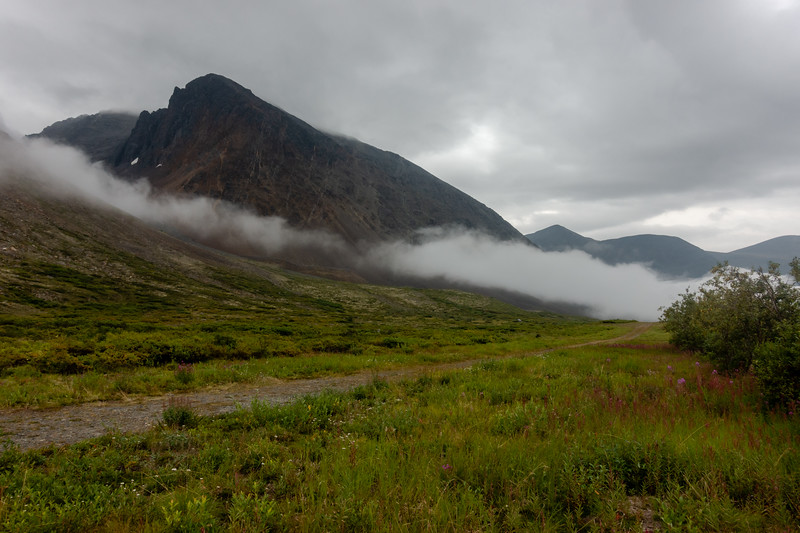
The next day the weather looked grim. A solid overcast had moved in, occasionally dropping drizzly rain. More concerningly, fog was moving into the valley from the North and threatening to envelope the runway. We hiked down to the airstrip anyway, hoping for a break in the fog. About 15 minutes before the plain was to arrive, the strip was socked in-no chance for a landing. But minutes before the plane came in the fog moved back just enough. The pilot landed and we frantically loaded everything in the plane and took off, just making it out. The rest of the flight was uneventful.
We arrived at McCarthy, thus ending the trip. I should note that on the flight out, there were four of us as passengers on the plane. Myself and Joey, the lady staying at Bremner, and an Australian man who had done the Seven Pass Route just behind us.
")