Ben
Member
- Joined
- Sep 12, 2014
- Messages
- 1,873
In july my parents told me that they were going to a geocaching event in Seattle in august. So it crossed my mind that perhaps i should catch a ride with them and do some backpacking. They said they could handle that. So i cleared some time off of work.
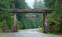
I hadn't planned to do the Wonderland Trail this year, but it seemed the obvious choice when the opportunity came up. It wasn't far out of my ride's way, and was a stop they'd enjoy making any way. Also i'd never done it. Also it has a huge mental appeal to me. The Wonderland Trail goes 93 miles all the way around Mount Rainier, within the national park of the same name. You have to camp in designated sites along the trail, and reservations for sites close in march each year. Fortunately, only 70% of permits are reservable, leaving the other 30% available on a first come first served basis. I was slightly concerned about acquiring one of the walk up permits, because they are made available a day in advance of when any trip starts, creating a possibility of all the permits being taken by the time i arrived, forcing me to wait. Which i came prepared for. But the whole process actually turned out to be extremely easy and agreeable. I went to the backcountry office, said that i wanted to hike, and the ranger there printed me out a list of all the camps that were full for the next four days. Told me to figure out an itinerary based on that that worked for me, and then come back and see if the whole thing worked for them. They also had a very helpful map with mileages between each camp and trail junction. So a few minutes later i was able to get my permit, with only one hitch. In the time that I had been planning, the camp i wanted for the first night had filled up, so I had to settle for the next one along the trail. This seemed unfortunate at the time, but ended up working in my favor later.
The itinerary i ended up with called for seven days, ranging from 11 to 17 miles each day. The cumulative elevation gain for the whole trail is around 23,000' so a little more than 3,000' on average each day. I'd done 70 miles in four days with comparable elevation a week and a half before to make sure that i'd be good for this.
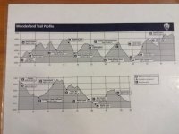
I started at the end of the bottom of this profile and hiked right to left. Starting at Longmire.
14.5 miles to Nickel Creek
11 miles to Summerland
14 miles to Granite Creek
12.1 miles to Cataract Valley (not on the profile, along the Spray Park trail)
16.8 miles to Golden Lakes
12 miles to South Puyallup
12 miles back to Longmire
The first days was 14.5 miles, 3.5 longer than i'd wanted because of my intended camp filling up at the last minute. I started hiking at 330pm. That's the problem getting a ride from my parents, they don't move so fast. But i hiked the 14.5 miles in 5 hours, and got to my camp at 830, just before a flash light became necessary. The first day was pretty easy. Good grades along the south side of the mountain. Not many good views, it was cloudy the whole day, but thankfully no rain. It had rained a fair deal the day before. I heard at the backcountry office that some people had concluded their trips early because of it. Any way, a short ways from Longmire the trail crosses the Nisqually River on a log bridge, and follows the Paradise River a ways, before ascending over a divide, past Reflection Lakes to Stevens Canyon. There were Reflections of no thing but clouds in the lakes. Narada Falls along the Paradise River was nice. An other decent falls along the descent into Stevens Canyon, may be Martha Falls. Eventually i crossed Stevens Creek and started the ascent back out. The point where the trail crosses the creek is interesting, the water narrows between some rocks, and it's a fair sized creek. Along the hike up from the canyon (not really a canyon) i came past Box Canyon, which is some thing special. The Muddy Fork of the Cowlitz River has cut straight down into the rock 180' below where the bridge crosses it, and less than 20' wide at the top. I saw a lot of trees on this long, low, cloudy day. Hardly any people, i was hiking late.
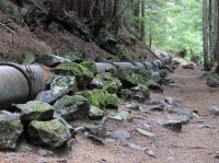
random ancient pipeline along the trail. near paradise river. it was made of boards with metal rings.
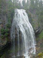
Narada Falls
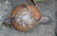
snail. about the size of a silver dollar, in Stevens Canyon.
Second day, woke up late from the late night before. Every thing was pretty gray.
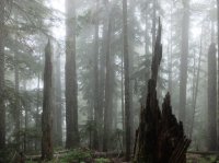 I still had to go up in spite of the elevation i'd gained at the end of the first day. Long ascent up the Cowlitz Divide. I saw a bear along the way there. It ran across the trail ahead of me, I think because of all the noise a pair of hikers ahead of me were making. Also, bears sound funny when they run, like a horse with soft feet. It ran down across the trail, looked back up at me, and then walked off into the mist.
 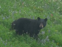 This was my first hike carrying bear spray, on account of a pair of bears i saw in Grand Teton while solo hiking there. I have no idea how effective it is against bears, but it's good at making me worry a little bit less. eventually the trail levels off some what before Indian Bar, but about that time was when it started raining. It never rained hard, but it never really quite stopped either, so in spite of my pitiful rain gear, i ended up soaked before too long. I was not at all happy with my rain gear this trip. It's an issue that will have to be revisited in the future. Indian Bar had a shelter that i stopped in to see if the rain would let up at all. It didn't really, but i made some good momentary friends here for a couple hours. Every one with the same idea.
 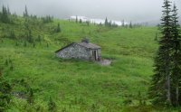 The shelter is actually the group camp site, but there was no group in it. A few people were planning on staying there if no group arrived. The idea was some what appealing, not hiking the remaining 4.5 miles in the rain, but it left the possibility of having to hike 4.5 extra miles in the rain the next day if the weather didn't improve. It was supposed to improve, but that doesn't really mean any thing. 19 miles the next day would have been doable, but not very desirable. So after a couple hours of good company and just sitting around munching i went back out into the wet, and over Panhandle Gap, and onto Summerland.

An other late arrival at camp, setting up a tent still wet from the night before. Things didn't end up drying all the way out until day five or six. I was glad i only ended up doing 11 miles this day since i didn't get the first night's camp that i'd wanted. I imagine that Indian Bar, Summerland, and PanhandleGap are all very scenic with less cloud cover. As it was, i could hardly see any thing. Visibility might've been a couple hundred yards.
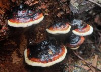 these things were every where. the whole way around.
The third day i got up and out of Summerland, and moved quick all the way down Frying Pan Creek, and then over to White River. The river was a sight, though it was more gray. Much more gray. I saw a fair number of people heading up from the Frying Pan trail head toward Summerland. I made slower time up from White River to Sunrise. Long uphill through a lot of trees, but i was pretty much entirely alone. Sunrise was nice. Got my first view of the sun for maybe ten seconds there. The view was starting to increase, but the clouds remained. From Sunrise up a little, and over more to Granite Creek Camp. Through Berkeley Park. This was a nice quiet stretch above tree line with very few people. I liked it. The fog made it my own world, very close. This stretch might actually have been less enjoyable with out all the cloud. About 14 miles this day.
The next morning the most amazing thing happened. There were blue skies. I was overjoyed. I headed down from Granite Creek to the toe of the Winthrop Glacier, and on the way i finally got my first views of the mountain.
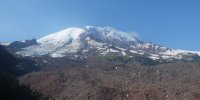 The glacier ends up buried in all those rocks in the picture. I like it there, i thought it was nice. After crossing Winthrop Creek, and the West Fork White River, i went up to Mystic Lake. It's unfortunate that you can't see Rainier fully from the lake, there is a rise in between, but there are good views the other direction, toward Old Desolate.

From Mystic Lake, up a little more to good views of the mountain, before heading back down into the drainage of the Carbon River, which i could see from far away was still full of fog. Clear views for miles around and beyond, and one valley full of fog, right in front of me. I was dismayed. But oh well. Fog started below 5000', and shortened sight again. But there was a really fantastic suspension bridge over the Carbon River.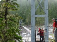 The small sign advises only one person on the bridge at a time, and insists that you DO NOT BOUNCE OR SWAY BRIDGE! I loved it. Fantastic bridge. There is one other suspension bridge along the trail, i think at Tahoma Creek. Most crossings are merely large logs with a hand rail built along one side. I understand that the Carbon Glacier is not far from the river crossing, but i saw no thing of it for the fog.
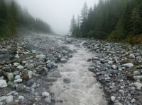
view from the bridge.
From the Carbon River i left the Wonderland Trail proper to go through Spray Park. I haven't seen the alternative, but i believe this option to be entirely worth it. The trail i took up from Carbon River was the wettest, muddiest that i traveled that trip. I hiked up to Cataract Valley Camp, 12 miles for the day, and set up camp mid after noon. Spent time writing in my journal there, a noisy boy scout troop was in a site near by. I can't blame them, they were all probably 12 to 14.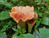
along the way up above Carbon River.
I left Cataract Valley on day five, and hiked up more. Going up was most of the trip, and the rest of it was going down. The terrain expanding from Mt Rainier makes for no flat trails. Radiating ridges divided by deep glacial valleys. Any way, i went up by Mist Park and Seattle Park seeing almost no one till i approached the crest of the trail there. A few permanent snow fields, as there were in Panhandle Gap, but these ones were larger.
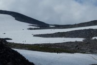
Good views. There were a lot more people in Spray Park on the other side, but i can see why, it was gorgeous. It was the nicest of the parks that i saw the whole way. Parks are what they call the open meadows there.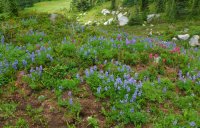
Spray Park
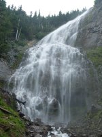
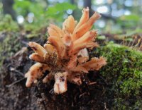
Spray Falls, on the way down to Mowich. After i rejoined the Wonderland Trail near Mowich Lake (which i didn't see, .2 miles away) i saw almost no one. I crossed the North Mowich River, and then came to the South Mowich, where the log crossing had been washed out when i started the loop. Fortunately, i had found out the day before that a new log had just been put in. It was still obviously running high. There were a few rivers i came to on this trip where you could hear the occasional muted thuds of the glacial rivers moving boulders in their beds. So i was glad i didn't have to try to ford. In stead i took off my shirt and basked in the sun shine out of the trees in the river's clearing. The rivers around Rainier have more stone yards than gravel bars. Any way. Between the Mowich Rivers i came across the ghost pipe, and beyond them i found even more exotic looking fungus than i had previously seen.
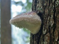
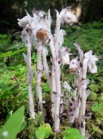
ghost pipe. it's a flowering plant that lacks chlorophyll, getting it's nutrients from a fungus in stead. pretty crazy. each stalk produces one flower.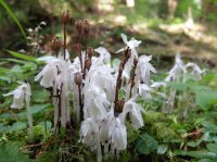 also ghost pipe. i had to ask a ranger about i picture i took to find out what it was. i saw hardly any of them, and only in the one location.
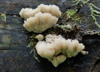
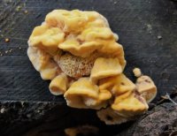
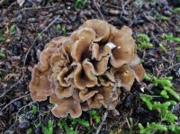
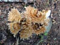
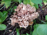 From South Mowich River it was a ways up and over to Golden Lakes, almost 17 miles for the fifth day.
My last two days were short, about 12 miles or less each. From Golden Lakes, which was a nice site, i hiked down to the North Puyallup River, up and through Klapatche Park, and back down to camp at the South Puyallup River. An other really nice site. Uneventful day, good views of the mountain from the ridge, and from the river.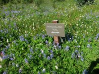 Klapatche Park
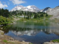 St Andrews Lake i think.
Some of the last day was very scenic before i got too low, and too close to Longmire. Reasonable hiking, i crested three ridges, but they were getting smaller this day. The views of Tahoma Glacier once i got above the South Puyallup River were fantastic. Emerald Ridge it's called.
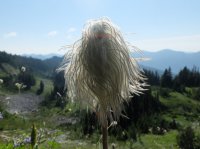
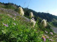
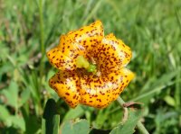
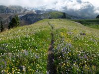 Emerald Ridge, Rainier in the low clouds.
Great trip, i remember it better than i thought of it at the time. A lot of up and down, but it keeps the scenery changing, which is nice. A looooot of trees in the lower sections, not much else to see there. But i'd do it again, and hope to have better views along the sections that were so over cast this trip.
Peace.
Featured image for home page:

I hadn't planned to do the Wonderland Trail this year, but it seemed the obvious choice when the opportunity came up. It wasn't far out of my ride's way, and was a stop they'd enjoy making any way. Also i'd never done it. Also it has a huge mental appeal to me. The Wonderland Trail goes 93 miles all the way around Mount Rainier, within the national park of the same name. You have to camp in designated sites along the trail, and reservations for sites close in march each year. Fortunately, only 70% of permits are reservable, leaving the other 30% available on a first come first served basis. I was slightly concerned about acquiring one of the walk up permits, because they are made available a day in advance of when any trip starts, creating a possibility of all the permits being taken by the time i arrived, forcing me to wait. Which i came prepared for. But the whole process actually turned out to be extremely easy and agreeable. I went to the backcountry office, said that i wanted to hike, and the ranger there printed me out a list of all the camps that were full for the next four days. Told me to figure out an itinerary based on that that worked for me, and then come back and see if the whole thing worked for them. They also had a very helpful map with mileages between each camp and trail junction. So a few minutes later i was able to get my permit, with only one hitch. In the time that I had been planning, the camp i wanted for the first night had filled up, so I had to settle for the next one along the trail. This seemed unfortunate at the time, but ended up working in my favor later.
The itinerary i ended up with called for seven days, ranging from 11 to 17 miles each day. The cumulative elevation gain for the whole trail is around 23,000' so a little more than 3,000' on average each day. I'd done 70 miles in four days with comparable elevation a week and a half before to make sure that i'd be good for this.

I started at the end of the bottom of this profile and hiked right to left. Starting at Longmire.
14.5 miles to Nickel Creek
11 miles to Summerland
14 miles to Granite Creek
12.1 miles to Cataract Valley (not on the profile, along the Spray Park trail)
16.8 miles to Golden Lakes
12 miles to South Puyallup
12 miles back to Longmire
The first days was 14.5 miles, 3.5 longer than i'd wanted because of my intended camp filling up at the last minute. I started hiking at 330pm. That's the problem getting a ride from my parents, they don't move so fast. But i hiked the 14.5 miles in 5 hours, and got to my camp at 830, just before a flash light became necessary. The first day was pretty easy. Good grades along the south side of the mountain. Not many good views, it was cloudy the whole day, but thankfully no rain. It had rained a fair deal the day before. I heard at the backcountry office that some people had concluded their trips early because of it. Any way, a short ways from Longmire the trail crosses the Nisqually River on a log bridge, and follows the Paradise River a ways, before ascending over a divide, past Reflection Lakes to Stevens Canyon. There were Reflections of no thing but clouds in the lakes. Narada Falls along the Paradise River was nice. An other decent falls along the descent into Stevens Canyon, may be Martha Falls. Eventually i crossed Stevens Creek and started the ascent back out. The point where the trail crosses the creek is interesting, the water narrows between some rocks, and it's a fair sized creek. Along the hike up from the canyon (not really a canyon) i came past Box Canyon, which is some thing special. The Muddy Fork of the Cowlitz River has cut straight down into the rock 180' below where the bridge crosses it, and less than 20' wide at the top. I saw a lot of trees on this long, low, cloudy day. Hardly any people, i was hiking late.

random ancient pipeline along the trail. near paradise river. it was made of boards with metal rings.

Narada Falls

snail. about the size of a silver dollar, in Stevens Canyon.
Second day, woke up late from the late night before. Every thing was pretty gray.
 I still had to go up in spite of the elevation i'd gained at the end of the first day. Long ascent up the Cowlitz Divide. I saw a bear along the way there. It ran across the trail ahead of me, I think because of all the noise a pair of hikers ahead of me were making. Also, bears sound funny when they run, like a horse with soft feet. It ran down across the trail, looked back up at me, and then walked off into the mist.
  This was my first hike carrying bear spray, on account of a pair of bears i saw in Grand Teton while solo hiking there. I have no idea how effective it is against bears, but it's good at making me worry a little bit less. eventually the trail levels off some what before Indian Bar, but about that time was when it started raining. It never rained hard, but it never really quite stopped either, so in spite of my pitiful rain gear, i ended up soaked before too long. I was not at all happy with my rain gear this trip. It's an issue that will have to be revisited in the future. Indian Bar had a shelter that i stopped in to see if the rain would let up at all. It didn't really, but i made some good momentary friends here for a couple hours. Every one with the same idea.
  The shelter is actually the group camp site, but there was no group in it. A few people were planning on staying there if no group arrived. The idea was some what appealing, not hiking the remaining 4.5 miles in the rain, but it left the possibility of having to hike 4.5 extra miles in the rain the next day if the weather didn't improve. It was supposed to improve, but that doesn't really mean any thing. 19 miles the next day would have been doable, but not very desirable. So after a couple hours of good company and just sitting around munching i went back out into the wet, and over Panhandle Gap, and onto Summerland.
An other late arrival at camp, setting up a tent still wet from the night before. Things didn't end up drying all the way out until day five or six. I was glad i only ended up doing 11 miles this day since i didn't get the first night's camp that i'd wanted. I imagine that Indian Bar, Summerland, and PanhandleGap are all very scenic with less cloud cover. As it was, i could hardly see any thing. Visibility might've been a couple hundred yards.
 these things were every where. the whole way around.
The third day i got up and out of Summerland, and moved quick all the way down Frying Pan Creek, and then over to White River. The river was a sight, though it was more gray. Much more gray. I saw a fair number of people heading up from the Frying Pan trail head toward Summerland. I made slower time up from White River to Sunrise. Long uphill through a lot of trees, but i was pretty much entirely alone. Sunrise was nice. Got my first view of the sun for maybe ten seconds there. The view was starting to increase, but the clouds remained. From Sunrise up a little, and over more to Granite Creek Camp. Through Berkeley Park. This was a nice quiet stretch above tree line with very few people. I liked it. The fog made it my own world, very close. This stretch might actually have been less enjoyable with out all the cloud. About 14 miles this day.
The next morning the most amazing thing happened. There were blue skies. I was overjoyed. I headed down from Granite Creek to the toe of the Winthrop Glacier, and on the way i finally got my first views of the mountain.
 The glacier ends up buried in all those rocks in the picture. I like it there, i thought it was nice. After crossing Winthrop Creek, and the West Fork White River, i went up to Mystic Lake. It's unfortunate that you can't see Rainier fully from the lake, there is a rise in between, but there are good views the other direction, toward Old Desolate.
From Mystic Lake, up a little more to good views of the mountain, before heading back down into the drainage of the Carbon River, which i could see from far away was still full of fog. Clear views for miles around and beyond, and one valley full of fog, right in front of me. I was dismayed. But oh well. Fog started below 5000', and shortened sight again. But there was a really fantastic suspension bridge over the Carbon River.
 The small sign advises only one person on the bridge at a time, and insists that you DO NOT BOUNCE OR SWAY BRIDGE! I loved it. Fantastic bridge. There is one other suspension bridge along the trail, i think at Tahoma Creek. Most crossings are merely large logs with a hand rail built along one side. I understand that the Carbon Glacier is not far from the river crossing, but i saw no thing of it for the fog.
view from the bridge.
From the Carbon River i left the Wonderland Trail proper to go through Spray Park. I haven't seen the alternative, but i believe this option to be entirely worth it. The trail i took up from Carbon River was the wettest, muddiest that i traveled that trip. I hiked up to Cataract Valley Camp, 12 miles for the day, and set up camp mid after noon. Spent time writing in my journal there, a noisy boy scout troop was in a site near by. I can't blame them, they were all probably 12 to 14.

along the way up above Carbon River.
I left Cataract Valley on day five, and hiked up more. Going up was most of the trip, and the rest of it was going down. The terrain expanding from Mt Rainier makes for no flat trails. Radiating ridges divided by deep glacial valleys. Any way, i went up by Mist Park and Seattle Park seeing almost no one till i approached the crest of the trail there. A few permanent snow fields, as there were in Panhandle Gap, but these ones were larger.

Good views. There were a lot more people in Spray Park on the other side, but i can see why, it was gorgeous. It was the nicest of the parks that i saw the whole way. Parks are what they call the open meadows there.

Spray Park

Spray Falls, on the way down to Mowich. After i rejoined the Wonderland Trail near Mowich Lake (which i didn't see, .2 miles away) i saw almost no one. I crossed the North Mowich River, and then came to the South Mowich, where the log crossing had been washed out when i started the loop. Fortunately, i had found out the day before that a new log had just been put in. It was still obviously running high. There were a few rivers i came to on this trip where you could hear the occasional muted thuds of the glacial rivers moving boulders in their beds. So i was glad i didn't have to try to ford. In stead i took off my shirt and basked in the sun shine out of the trees in the river's clearing. The rivers around Rainier have more stone yards than gravel bars. Any way. Between the Mowich Rivers i came across the ghost pipe, and beyond them i found even more exotic looking fungus than i had previously seen.


ghost pipe. it's a flowering plant that lacks chlorophyll, getting it's nutrients from a fungus in stead. pretty crazy. each stalk produces one flower.
 also ghost pipe. i had to ask a ranger about i picture i took to find out what it was. i saw hardly any of them, and only in the one location.


 From South Mowich River it was a ways up and over to Golden Lakes, almost 17 miles for the fifth day.
My last two days were short, about 12 miles or less each. From Golden Lakes, which was a nice site, i hiked down to the North Puyallup River, up and through Klapatche Park, and back down to camp at the South Puyallup River. An other really nice site. Uneventful day, good views of the mountain from the ridge, and from the river.
 Klapatche Park
 St Andrews Lake i think.
Some of the last day was very scenic before i got too low, and too close to Longmire. Reasonable hiking, i crested three ridges, but they were getting smaller this day. The views of Tahoma Glacier once i got above the South Puyallup River were fantastic. Emerald Ridge it's called.


 Emerald Ridge, Rainier in the low clouds.
Great trip, i remember it better than i thought of it at the time. A lot of up and down, but it keeps the scenery changing, which is nice. A looooot of trees in the lower sections, not much else to see there. But i'd do it again, and hope to have better views along the sections that were so over cast this trip.
Peace.
Featured image for home page:

Last edited:

 Lucky it was at half-height... 5000'