b.stark
Forever Wandering
- Joined
- Apr 8, 2015
- Messages
- 1,298
As part of my continuing posting of old trips (to keep me busy/out of trouble, and you all possibly entertained) here is what is probably my most epic trip so far. Three of us set out on a mostly off trail route in the northern Wind River Range. It wasn't super long on miles, but was long on off trail wild adventure. Also long on snow travel. 6 days long, high altitude, some brutal days, and a lot of walking into the unknown (not much info on the route we chose at the time).
So, here we go.
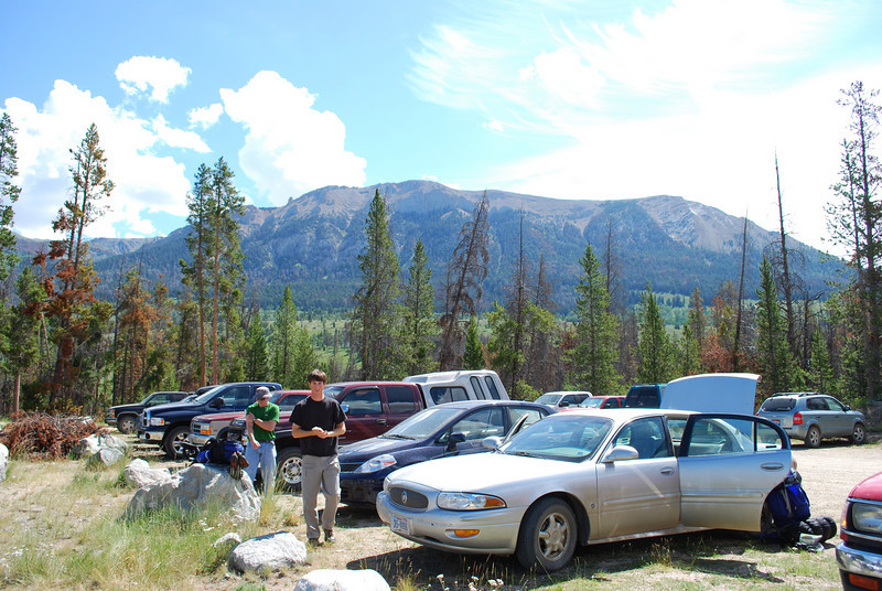
We started and ended the loop at the Green River trailhead. I recall finding the drive in really amazing, though in subsequent trips up there I haven't been quite as impressed (it's still a neat drive, just doesn't match my original memory).
Obligatory trailhead shot (Yes, I drove a Buick to the trailhead).
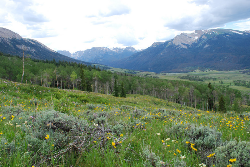
The beginning of our route involved climbing over the ridge between the Green River and the Roaring Fork (our first camp would be on the Roaring Fork). It was an incredible carpet of flowers the whole hike up to the top, through meadows and aspen groves. It was a really scenic bit of trail.
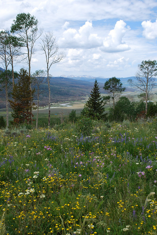
The view somewhere before cresting the ridge. If I recall, once we hit timber after topping the ridge, the mosquitoes were atrocious. They would be atrocious anywhere below treeline for the rest of the trip.
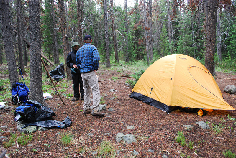
Camp on the first night, set up hastily as storms rolled in. Our gear back in these days wasn't so great--heavy tent, lots of garbage bags for waterproofing.... our stove was a single burner Coleman propane stove that screwed on top of 1lb propane canisters! But we had youth going for us, at least.
The original goal for day 2 was the vicinity of Dad's Lake, but, spoiler alert, that did not happen. Day 1 was the only easy day of the trip, and the rest all had some pretty good challenges.
There's supposed to be trail for a good portion of the way up the Roaring Fork Valley. However, somewhere around Alexander Park, the trail just disappeared, and we were left to find our own way. USGS maps also show a trail up to Native Lake, which we never saw as we passed by in the bottom of the valley. As we continued up, the Roaring Fork lived up to its name, and became a serious challenge to cross. At one point one of the group got about halfway across then turned back--too fast and deep. We had to search for a better spot, but did eventually find one to get to the side we wanted to be on.
Alexander Park. Beautiful place. Not much for trail though!
This is roughly near the Native Lake outlet stream, in the area where the map shows a trail. We never found one. We did speak to a few people who were either headed to or out from Native Lake (I no longer remember which)
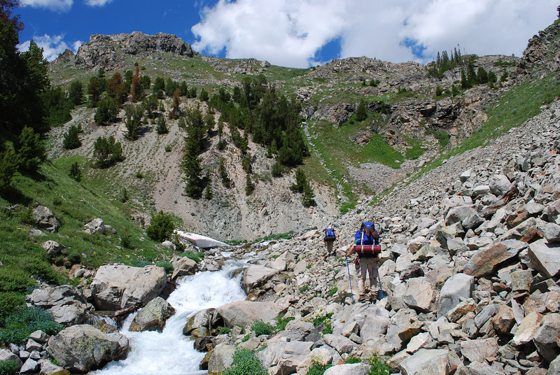
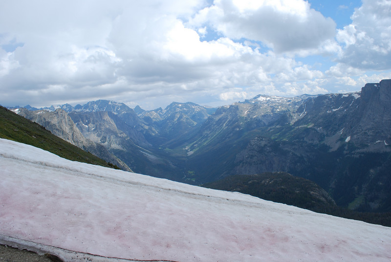
We continued on up the Roaring Fork, nearing the treeline. The valley narrows and gets steeper and rockier as you go. Just beyond where this pic was taken, the stream turns right and becomes walled in badly. We were unable to cross, because the stream was ROARING, and couldn't find a safe way to continue without crossing. So, we had to turn back and choose an alternate. We had anticipated this might happen, so headed to an alternate destination for the night: Crescent Lake.
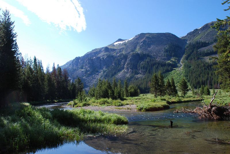
On our way toward Crescent, we stumbled upon some old outfitter trails and a camp, then found good trail going up the valley leading to Crescent. The views were outstanding when the trail got into some above treeline meadows.
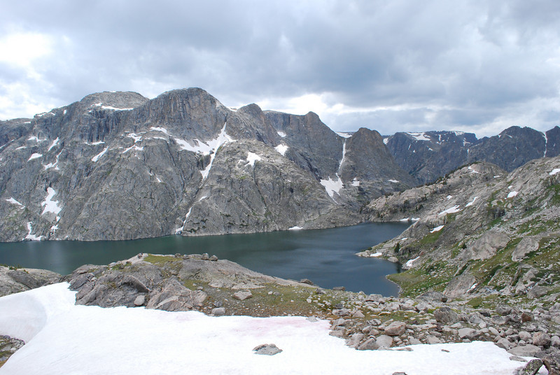
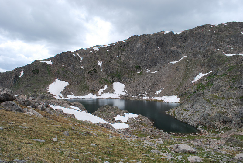
We arrived at Crescent, and found it incredibly scenic. Again we were dodging storms. The mileage wasn't super big this day, but they were hard earned miles. I went to bed pretty early. We would not drop below treeline again until our last day.
The 3rd day, we were headed to a lake that is on some maps called "Rocking Horse" in the upper Bear Basin.
Morning at Crescent
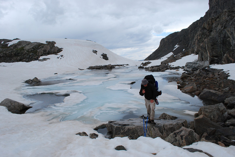
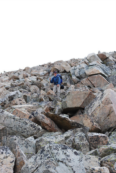
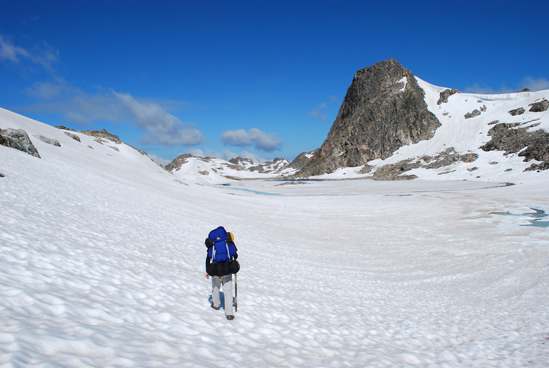
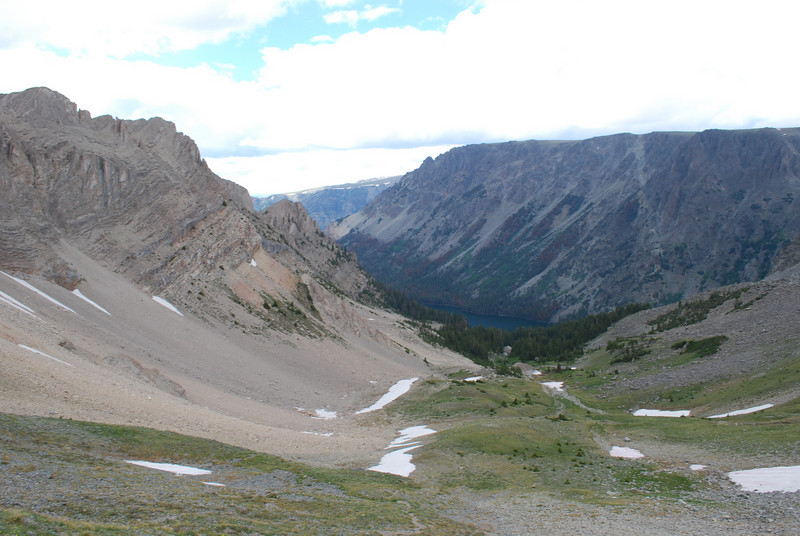
There was a ton of rock scrambling, snow travel, and skirting tarns on our route. There's really no good way across this country--it's all very rough. We did, interestingly, meet a large NOLS group up here (maybe 30ish people?). That was unexpected in this rough country.
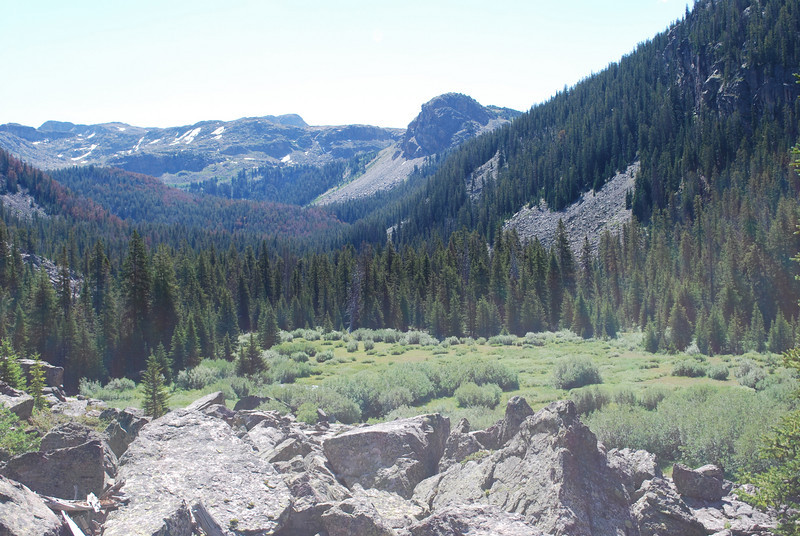
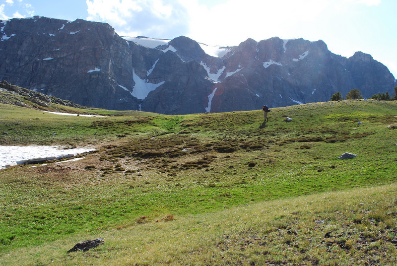
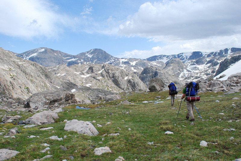
Good views of Osborn Mountain as we gained elevation
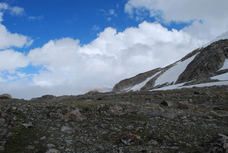
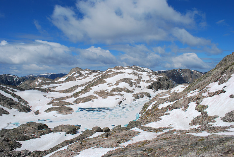
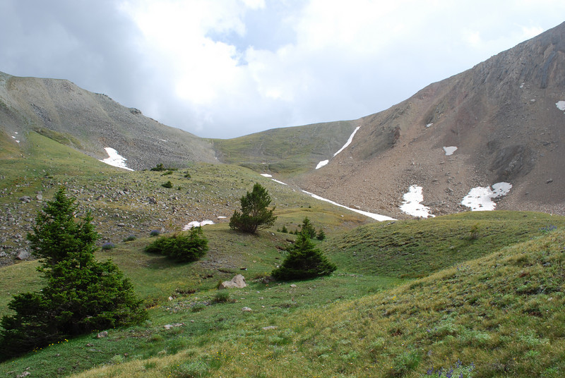
Um... yeah, you just walk through there somewhere
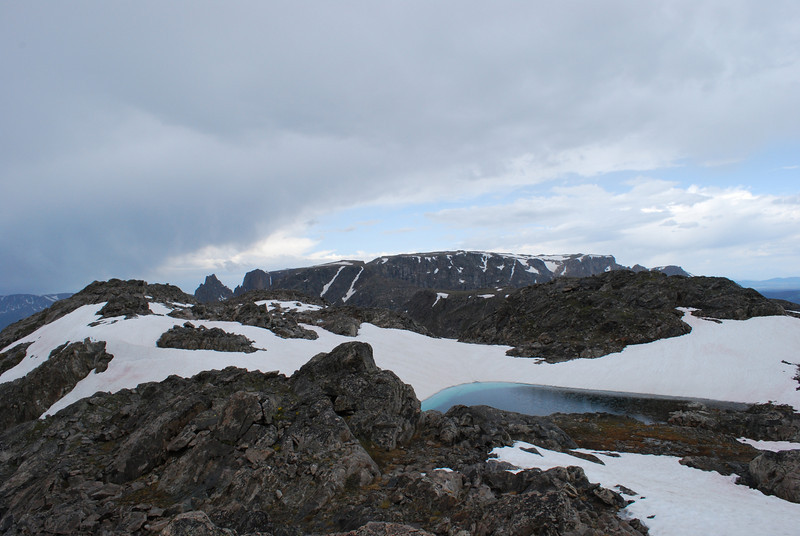
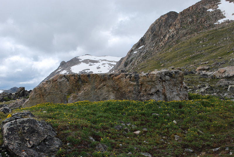
There's one very nice meadowy saddle above Bear Lake and its large basin. It's very incongruous to the rest of the terrain.
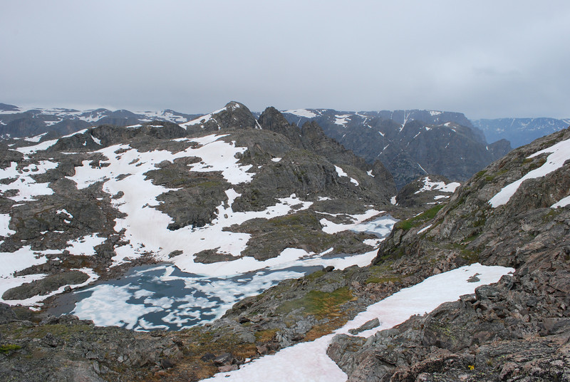
Once you drop into the basin around Bear Lake, you are committed to some serious ankle-busting sidehilling.
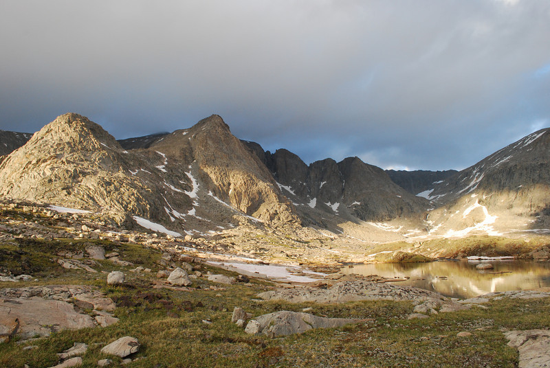
As we neared the upper basin and Rocking Horse, we got socked in by a brutal thunderstorm. We waited for quite a while behind a boulder, but seeing it not wanting to let up one bit, we braved the conditions and continued on. We hastily found a place to pitch the tent and set to work at it. No idea what the winds really were, but definitely 40+ mph with no such thing as shelter from it--certainly no trees and not really even any good boulders to hide behind. Somehow we got the tent up and staked it down and tied it down in every way possible. Not long after we got that done and got in the tent, the storm blew past. Felt a bit stupid having risked setting up the tent in that kind of weather (and possibly losing grip on it then watching it blow off over the continental divide). But the evening sunlight was amazing, and the basin is a place of wild beauty not matched by many other places.
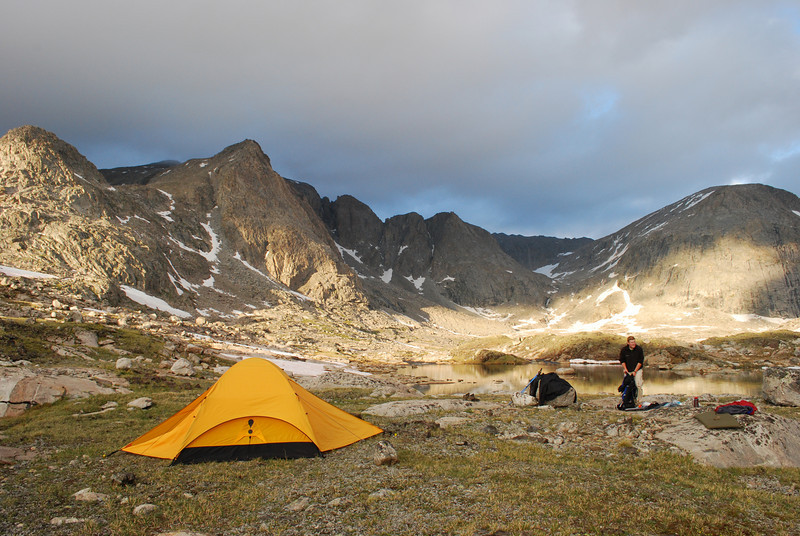
Camp at Rocking Horse
In the previous two pictures you can maybe see a bit of a hanging valley with a waterfall coming out of it. If you know what you're looking for. We intended to climb up onto the divide via that valley. Crazy, but I like routes with that kind of madness.
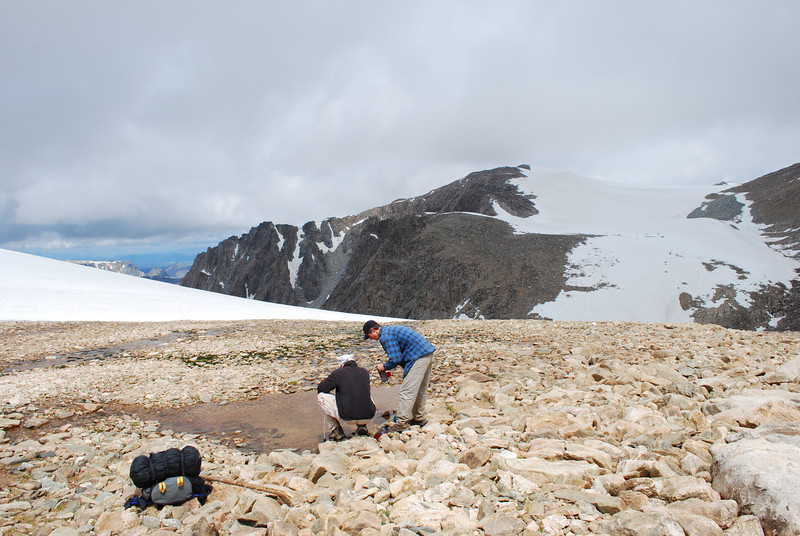
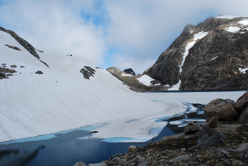
The nights above treeline were brutally cold. After each night lakes had skiffs of ice on them in the mornings. Water bottles iced up overnight. But we got up, forced some oatmeal down our throats, and started out hiking super early. For one to beat storms, and also to warm ourselves up.
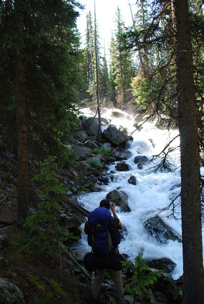
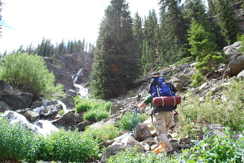
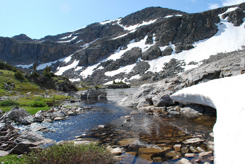
Headed up toward the Divide. The feeder stream to Rocking Horse flows over some awesome slabs.
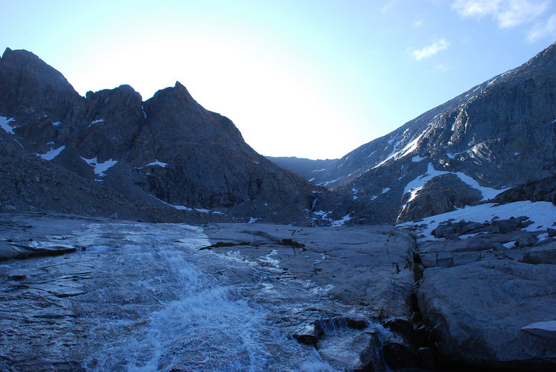
The climb up along the falls was sketchy at best. It was probably the most challenging part of getting up to the divide.
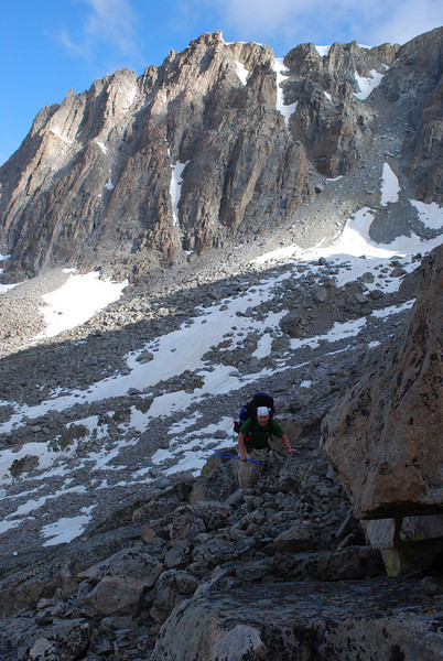
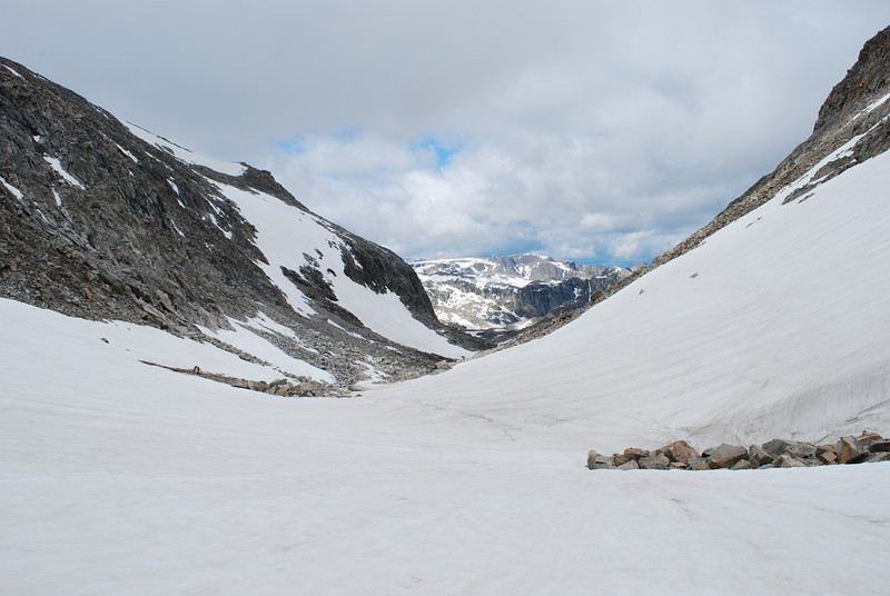
The hanging valley itself was very neat. And FULL of snow. It was quite frozen on the surface, and we did not have ice axes or crampons. If we'd had those, it would have been a simple walk up to the divide up one of the gullies filled with snow. Since we didn't have that equipment, we had to scramble up on the rocks.
The way out is up!
My facial expression says what I thought about the climb. Challenging, to say the least. Previous night's camp was by the lake to the right of me.
Water was amazingly not at all in short supply up along the high divide ridge. We found it everywhere. Places that had any kind of soil were actually quite boggy.
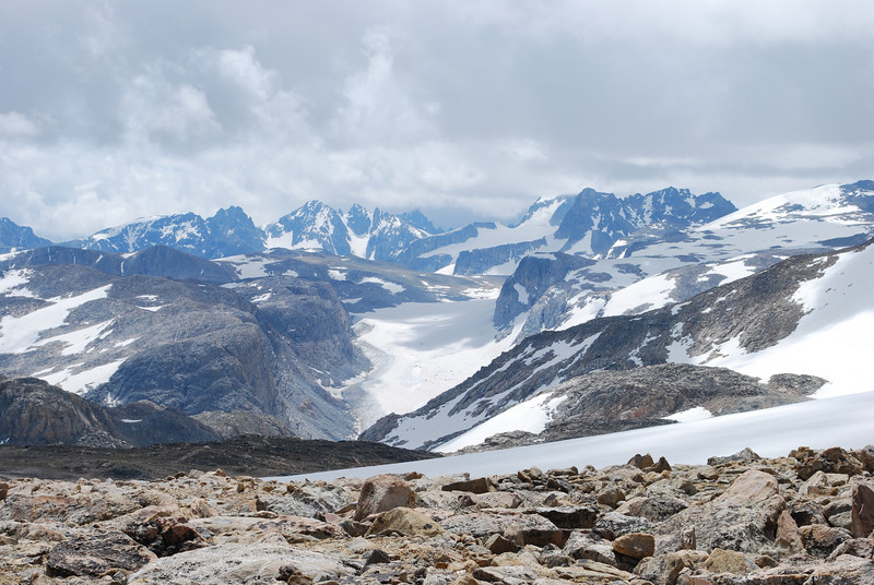
As we hiked along the divide, we were treated to some great views of high Wind River Range scenery. Gannett, Grasshopper Glacier, and lots of other stuff I can't name off the top of my head.
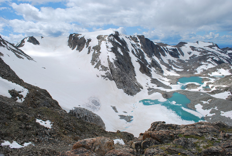
Connie Glacier
Our camp for the night would be in the saddle between Sourdough and Grasshopper Glaciers. It's a very barren spot.
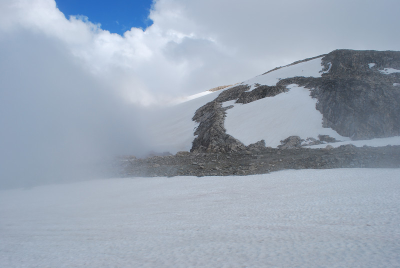
Our fifth day began with fog. Fog and rain. We were badly fogged in, in some country that requires visibility to get anywhere. We did not have GPS at all in those days, so no leaning on that for navigation (I wouldn't try to even navigate just by GPS in this country with as bad of visibility as we had that morning). Eventually we admitted defeat by the weather--we were stuck for the day. It was very cold. The fog "breathed" in and out of the valley toward Grasshopper Glacier as the wind gusted.
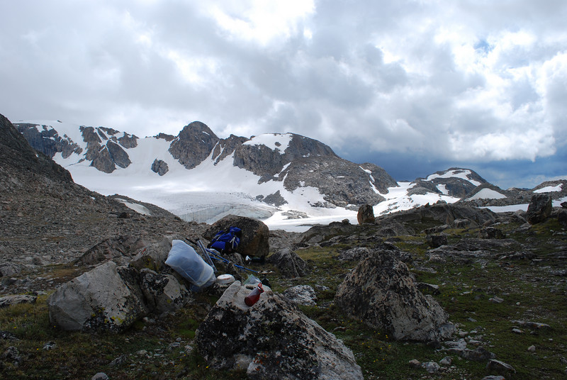
Barren, cold campsite.
We noticed unusually lush growth of vegetation around this rock, and found it to be a veritable marmot paradise--their droppings created the richer soil conditions that allowed plants to comparatively thrive around it.
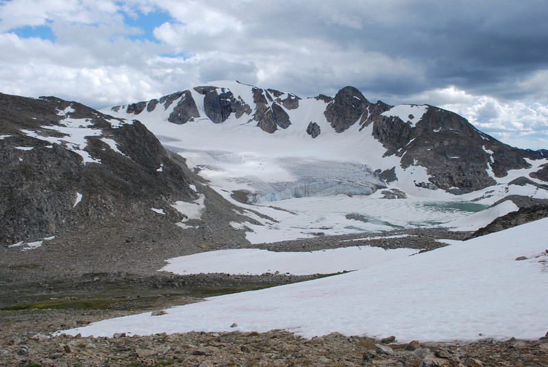
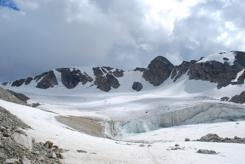
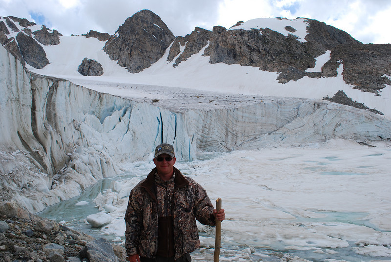
We hiked up to the face of Sourdough Glacier to kill some time (and because it was an amazing experience)
Rocking the camo on this trip (my dad had given me this jacket, and though heavy it was warm and the outer shell waterproof)
We spent a lot of time just wandering around camp aimlessly and watching the fog.
The next night was the coldest yet. The topic of "mansnuggling" to keep warm actually came up. We didn't have to, but the cold was pretty rough. On day 6, we woke up freezing and skipped breakfast. The air was clear, allowing for us to move, and it was so cold we just wanted to hike to warm up.
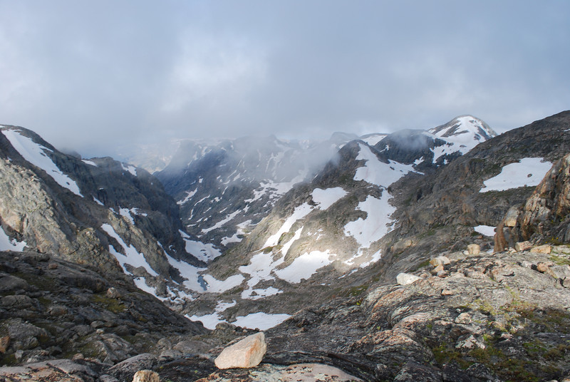
View down Pixley Creek
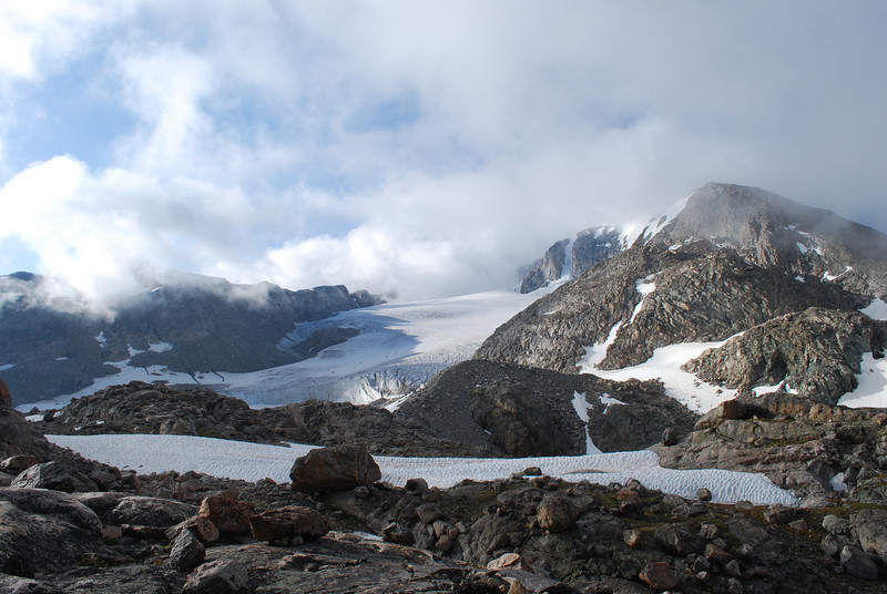
Last look at Sourdough Glacier
To get the short distance from camp to the far end of Baker Lake took 2 or 2.5 hours. The routefinding was incredibly challenging, the wind cold, and we just wanted to make some distance.
After getting past Baker Lake, things got somewhat easier. We were travelling mostly on snow, and it wasn't so terribly steep. The challenge was deciphering the best route from what we were actually seeing and what the map said.
Yeah just hike that way somewhere
So this view caused a bit of argument. Originally, via maps and the Google Earth of 2009, we thought this ridge up to Lost Eagle Peak would go. When we got there, it was obvious there was no way. I was pretty worked up that there was no way we were going up that--not entirely sure why, but the other guys gave me some well deserved static about it.
Originally, we were going to camp here, at Elbow Lake #2 (that's how it's labelled on the map). However, it was still fairly early in the day, and we were hearing the beers calling our names, so we made the somewhat foolish decision to keep going.
Fortunately, if you go around the south side of the lake, there's a straightforward ramp up onto the summit plateau of Lost Eagle Peak.
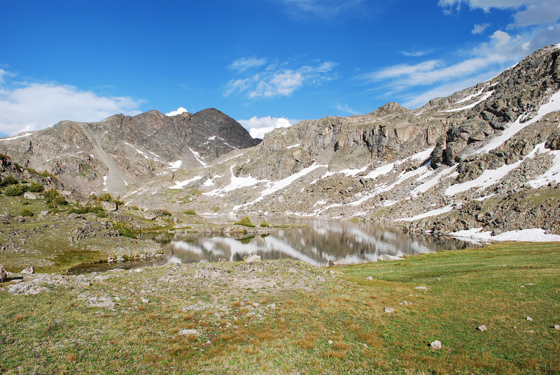
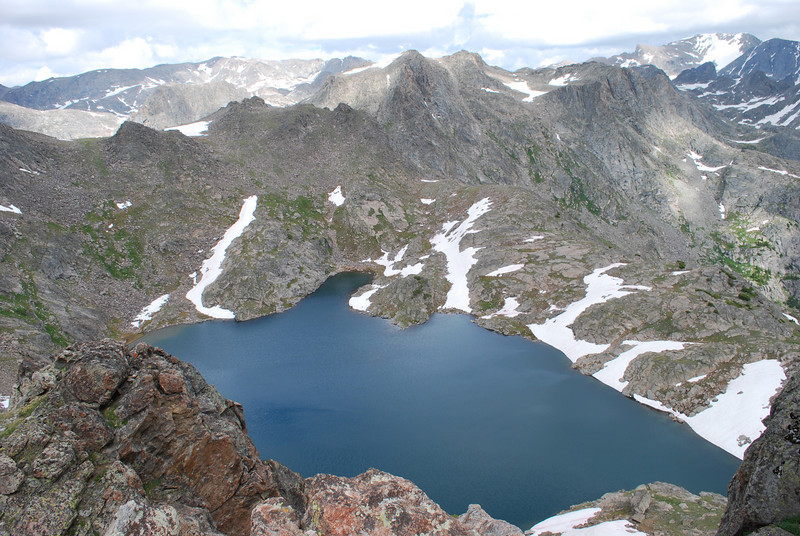
View back down on Elbow Lake #2 was really outstanding.
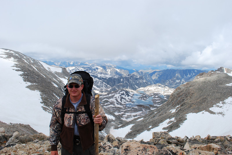
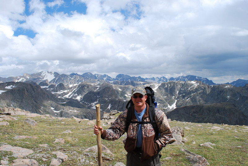
Views from the summit plateau of Lost Eagle Pk were outstanding (note another low-tech piece of gear I used to use--a stick, found on the trail on day 1, in lieu of proper trekking poles)
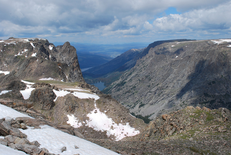
Green River Lakes in sight!!! This view really revived our spirits, but was also a bit depressing. Still a long way to go. We hadn't fully figured out how to get down to Slide Lake from Lost Eagle Peak yet, either.
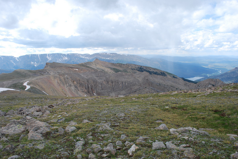
View into upper Green River valley from Lost Eagle Peak. I should note we never properly summited Lost Eagle, rather took the fastest route from Elbow Lk 2 toward Slide Lake.
View down toward Slide Lake, finally. This doesn't do justice to how steep this was. There's a saddle between Lost Eagle and the White Cliffs, and that's where we were standing when I took this pic.
Looking back up into the saddle. When we reached the bottom of it, we stood around debating what to do for a while. The upper part of the slope to Slide Lake was crazy steep, and very loose. Eventually I just dug my heels in and did a crazy man's rock glissade down it. The others followed. Sketchy, but not as terrifying as it could have been. Not convinced this is the best route down to Slide Lake, but it's what we did.
And I don't have any pictures from this point on. When we hit the trees above Slide Lake, we hit a wall of mosquitoes. It was BAD. We were having thoughts of camping at Slide until we hit the mosquitoes. Then it was determined for sure: Trailhead or bust. And bust it almost was for me. My memory from Slide Lake on is a bit foggy. We had only stopped for a few snacks, no meals, and I was getting dehydrated at this point. We had to keep pushing on, though, or we wouldn't make it to the trailhead before dark. I recall crossing the "bridge of logs" at the outlet of Slide Lake (there's no bridge, but just a huge log jam that acts as one). I remember the Clear Creek valley being really pretty. I also recall every small climb on the trail along the lower Green River Lake being agony. 13.5 hours after starting, we got back to my car at the trailhead. Fortunately we had water and food stashed in it, so I did recover some--enough to drive back to Pinedale, where we got a hotel room.
So there you have it. 6 crazy days in the Northern Winds. If you ever try to go up there yourself, be prepared to earn it--we sure did. I'd still like to get back up there and explore a few more areas though. There's some tough country that I want to see someday.
So, here we go.
We started and ended the loop at the Green River trailhead. I recall finding the drive in really amazing, though in subsequent trips up there I haven't been quite as impressed (it's still a neat drive, just doesn't match my original memory).
Obligatory trailhead shot (Yes, I drove a Buick to the trailhead).
The beginning of our route involved climbing over the ridge between the Green River and the Roaring Fork (our first camp would be on the Roaring Fork). It was an incredible carpet of flowers the whole hike up to the top, through meadows and aspen groves. It was a really scenic bit of trail.
The view somewhere before cresting the ridge. If I recall, once we hit timber after topping the ridge, the mosquitoes were atrocious. They would be atrocious anywhere below treeline for the rest of the trip.
Camp on the first night, set up hastily as storms rolled in. Our gear back in these days wasn't so great--heavy tent, lots of garbage bags for waterproofing.... our stove was a single burner Coleman propane stove that screwed on top of 1lb propane canisters! But we had youth going for us, at least.
The original goal for day 2 was the vicinity of Dad's Lake, but, spoiler alert, that did not happen. Day 1 was the only easy day of the trip, and the rest all had some pretty good challenges.
There's supposed to be trail for a good portion of the way up the Roaring Fork Valley. However, somewhere around Alexander Park, the trail just disappeared, and we were left to find our own way. USGS maps also show a trail up to Native Lake, which we never saw as we passed by in the bottom of the valley. As we continued up, the Roaring Fork lived up to its name, and became a serious challenge to cross. At one point one of the group got about halfway across then turned back--too fast and deep. We had to search for a better spot, but did eventually find one to get to the side we wanted to be on.
Alexander Park. Beautiful place. Not much for trail though!
This is roughly near the Native Lake outlet stream, in the area where the map shows a trail. We never found one. We did speak to a few people who were either headed to or out from Native Lake (I no longer remember which)
We continued on up the Roaring Fork, nearing the treeline. The valley narrows and gets steeper and rockier as you go. Just beyond where this pic was taken, the stream turns right and becomes walled in badly. We were unable to cross, because the stream was ROARING, and couldn't find a safe way to continue without crossing. So, we had to turn back and choose an alternate. We had anticipated this might happen, so headed to an alternate destination for the night: Crescent Lake.
On our way toward Crescent, we stumbled upon some old outfitter trails and a camp, then found good trail going up the valley leading to Crescent. The views were outstanding when the trail got into some above treeline meadows.
We arrived at Crescent, and found it incredibly scenic. Again we were dodging storms. The mileage wasn't super big this day, but they were hard earned miles. I went to bed pretty early. We would not drop below treeline again until our last day.
The 3rd day, we were headed to a lake that is on some maps called "Rocking Horse" in the upper Bear Basin.
Morning at Crescent
There was a ton of rock scrambling, snow travel, and skirting tarns on our route. There's really no good way across this country--it's all very rough. We did, interestingly, meet a large NOLS group up here (maybe 30ish people?). That was unexpected in this rough country.
Good views of Osborn Mountain as we gained elevation
Um... yeah, you just walk through there somewhere
There's one very nice meadowy saddle above Bear Lake and its large basin. It's very incongruous to the rest of the terrain.
Once you drop into the basin around Bear Lake, you are committed to some serious ankle-busting sidehilling.
As we neared the upper basin and Rocking Horse, we got socked in by a brutal thunderstorm. We waited for quite a while behind a boulder, but seeing it not wanting to let up one bit, we braved the conditions and continued on. We hastily found a place to pitch the tent and set to work at it. No idea what the winds really were, but definitely 40+ mph with no such thing as shelter from it--certainly no trees and not really even any good boulders to hide behind. Somehow we got the tent up and staked it down and tied it down in every way possible. Not long after we got that done and got in the tent, the storm blew past. Felt a bit stupid having risked setting up the tent in that kind of weather (and possibly losing grip on it then watching it blow off over the continental divide). But the evening sunlight was amazing, and the basin is a place of wild beauty not matched by many other places.
Camp at Rocking Horse
In the previous two pictures you can maybe see a bit of a hanging valley with a waterfall coming out of it. If you know what you're looking for. We intended to climb up onto the divide via that valley. Crazy, but I like routes with that kind of madness.
The nights above treeline were brutally cold. After each night lakes had skiffs of ice on them in the mornings. Water bottles iced up overnight. But we got up, forced some oatmeal down our throats, and started out hiking super early. For one to beat storms, and also to warm ourselves up.
Headed up toward the Divide. The feeder stream to Rocking Horse flows over some awesome slabs.
The climb up along the falls was sketchy at best. It was probably the most challenging part of getting up to the divide.
The hanging valley itself was very neat. And FULL of snow. It was quite frozen on the surface, and we did not have ice axes or crampons. If we'd had those, it would have been a simple walk up to the divide up one of the gullies filled with snow. Since we didn't have that equipment, we had to scramble up on the rocks.
The way out is up!
My facial expression says what I thought about the climb. Challenging, to say the least. Previous night's camp was by the lake to the right of me.
Water was amazingly not at all in short supply up along the high divide ridge. We found it everywhere. Places that had any kind of soil were actually quite boggy.
As we hiked along the divide, we were treated to some great views of high Wind River Range scenery. Gannett, Grasshopper Glacier, and lots of other stuff I can't name off the top of my head.
Connie Glacier
Our camp for the night would be in the saddle between Sourdough and Grasshopper Glaciers. It's a very barren spot.
Our fifth day began with fog. Fog and rain. We were badly fogged in, in some country that requires visibility to get anywhere. We did not have GPS at all in those days, so no leaning on that for navigation (I wouldn't try to even navigate just by GPS in this country with as bad of visibility as we had that morning). Eventually we admitted defeat by the weather--we were stuck for the day. It was very cold. The fog "breathed" in and out of the valley toward Grasshopper Glacier as the wind gusted.
Barren, cold campsite.
We noticed unusually lush growth of vegetation around this rock, and found it to be a veritable marmot paradise--their droppings created the richer soil conditions that allowed plants to comparatively thrive around it.
We hiked up to the face of Sourdough Glacier to kill some time (and because it was an amazing experience)
Rocking the camo on this trip (my dad had given me this jacket, and though heavy it was warm and the outer shell waterproof)
We spent a lot of time just wandering around camp aimlessly and watching the fog.
The next night was the coldest yet. The topic of "mansnuggling" to keep warm actually came up. We didn't have to, but the cold was pretty rough. On day 6, we woke up freezing and skipped breakfast. The air was clear, allowing for us to move, and it was so cold we just wanted to hike to warm up.
View down Pixley Creek
Last look at Sourdough Glacier
To get the short distance from camp to the far end of Baker Lake took 2 or 2.5 hours. The routefinding was incredibly challenging, the wind cold, and we just wanted to make some distance.
After getting past Baker Lake, things got somewhat easier. We were travelling mostly on snow, and it wasn't so terribly steep. The challenge was deciphering the best route from what we were actually seeing and what the map said.
Yeah just hike that way somewhere
So this view caused a bit of argument. Originally, via maps and the Google Earth of 2009, we thought this ridge up to Lost Eagle Peak would go. When we got there, it was obvious there was no way. I was pretty worked up that there was no way we were going up that--not entirely sure why, but the other guys gave me some well deserved static about it.
Originally, we were going to camp here, at Elbow Lake #2 (that's how it's labelled on the map). However, it was still fairly early in the day, and we were hearing the beers calling our names, so we made the somewhat foolish decision to keep going.
Fortunately, if you go around the south side of the lake, there's a straightforward ramp up onto the summit plateau of Lost Eagle Peak.
View back down on Elbow Lake #2 was really outstanding.
Views from the summit plateau of Lost Eagle Pk were outstanding (note another low-tech piece of gear I used to use--a stick, found on the trail on day 1, in lieu of proper trekking poles)
Green River Lakes in sight!!! This view really revived our spirits, but was also a bit depressing. Still a long way to go. We hadn't fully figured out how to get down to Slide Lake from Lost Eagle Peak yet, either.
View into upper Green River valley from Lost Eagle Peak. I should note we never properly summited Lost Eagle, rather took the fastest route from Elbow Lk 2 toward Slide Lake.
View down toward Slide Lake, finally. This doesn't do justice to how steep this was. There's a saddle between Lost Eagle and the White Cliffs, and that's where we were standing when I took this pic.
Looking back up into the saddle. When we reached the bottom of it, we stood around debating what to do for a while. The upper part of the slope to Slide Lake was crazy steep, and very loose. Eventually I just dug my heels in and did a crazy man's rock glissade down it. The others followed. Sketchy, but not as terrifying as it could have been. Not convinced this is the best route down to Slide Lake, but it's what we did.
And I don't have any pictures from this point on. When we hit the trees above Slide Lake, we hit a wall of mosquitoes. It was BAD. We were having thoughts of camping at Slide until we hit the mosquitoes. Then it was determined for sure: Trailhead or bust. And bust it almost was for me. My memory from Slide Lake on is a bit foggy. We had only stopped for a few snacks, no meals, and I was getting dehydrated at this point. We had to keep pushing on, though, or we wouldn't make it to the trailhead before dark. I recall crossing the "bridge of logs" at the outlet of Slide Lake (there's no bridge, but just a huge log jam that acts as one). I remember the Clear Creek valley being really pretty. I also recall every small climb on the trail along the lower Green River Lake being agony. 13.5 hours after starting, we got back to my car at the trailhead. Fortunately we had water and food stashed in it, so I did recover some--enough to drive back to Pinedale, where we got a hotel room.
So there you have it. 6 crazy days in the Northern Winds. If you ever try to go up there yourself, be prepared to earn it--we sure did. I'd still like to get back up there and explore a few more areas though. There's some tough country that I want to see someday.
")


