Wendover to St. George (on dirt...)

DAA

Member
Joined
Jun 14, 2012
Messages
715
A simple idea... Drive from Wendover, straddling the Nevada/Utah border on I-80, to St. George in the SW corner of Utah, near the Arizona border. Drive from Wendover to St. George… on dirt.

When a friend mentioned the idea asking if I could plan a route, I knew from previous travel that the possibilities for route variations would be endless. I also knew, that a small amount of pavement would have to be endured to get fuel unless we wanted to carry a bunch of gas cans. Further, I knew that truly avoiding literally as much pavement as possible would add significant time and distance to the trip to avoid only a few miles of pavement. Also, I knew the trip could be made pretty fast and easy, but also very boring, by using the well maintained county dirt roads where possible.

I replied I knew a boring route that could easily be completed in a day and a half, but could concoct a much more interesting one that would require anywhere from three to seven days, depending on just how interesting we wanted to make it and just how committed to avoiding pavement. We decided on three days to complete the journey.

With all this in mind, I quickly laid out a route with accepting a small amount of pavement, but also avoiding the boring “good” dirt roads. Sticking to the obscure, the rough, the rarely travelled, the far more interesting routes as much as possible, given the time constraint of three days to complete.

I had already travelled about 75% of the route, most sections numerous times, but had never travelled it all in one contiguous journey – and there was that 25% I had not yet travelled to really set the hook in me to do this trip.

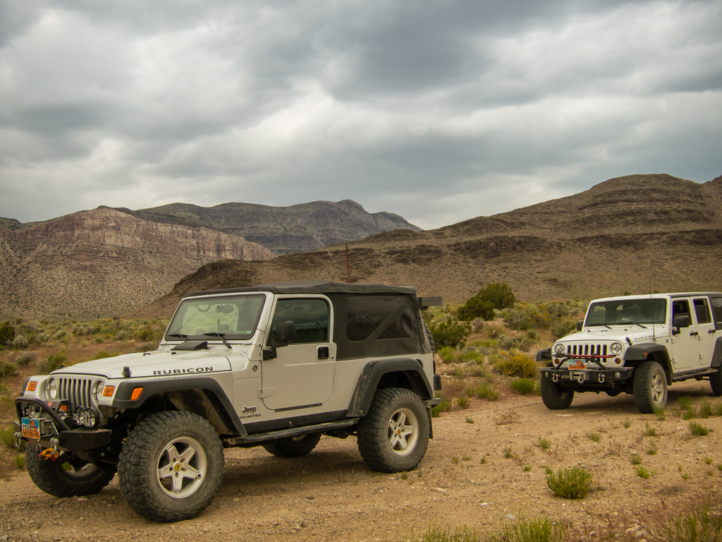
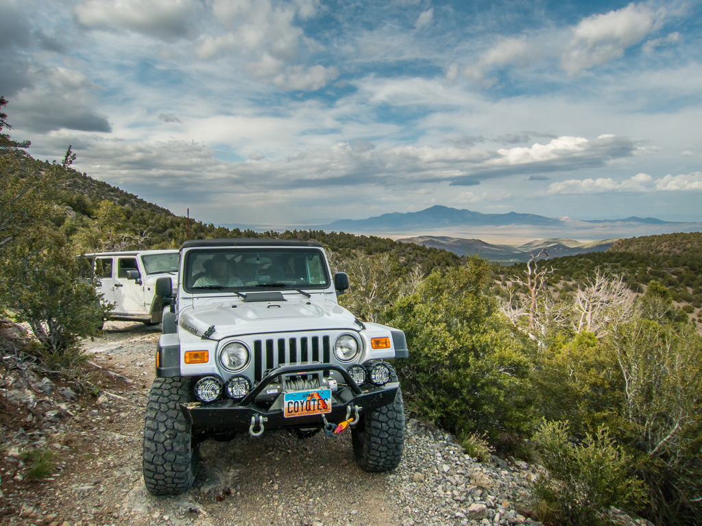
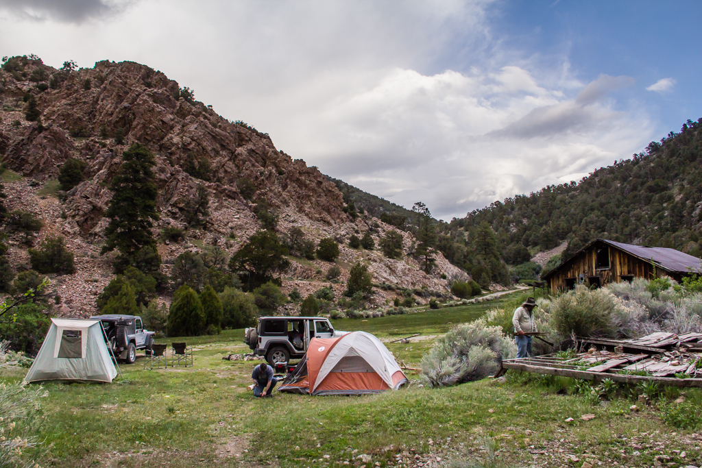
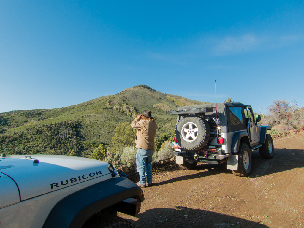
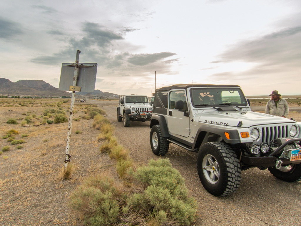
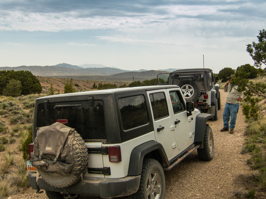
So… On the morning of Thur. May 16, my friend Tim and I in my Jeep, Eric flying solo in his Jeep, aired down our tires and left pavement behind on the outskirts of Wendover.

20130516_Wendover-STG_Offroad-300W.jpg


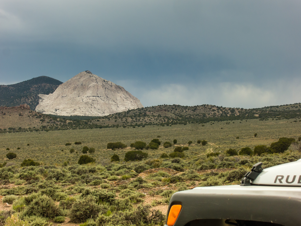
With weather that was cool, overcast and windy, but not too cold, we headed west for a few miles, then south along the east flank of the Goshute Mountains. Then between the back of Wildcat Peak and the north end of Ferguson Mountain, trending down to cross highway 93, jotted north and then west to visit Blue Lake.

20130516_Wendover-STG_Offroad-303W.jpg


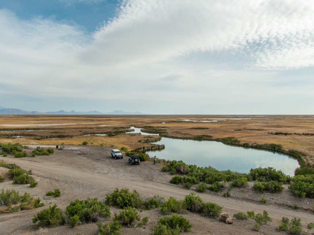
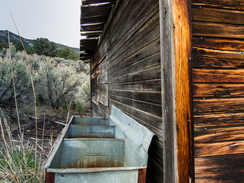
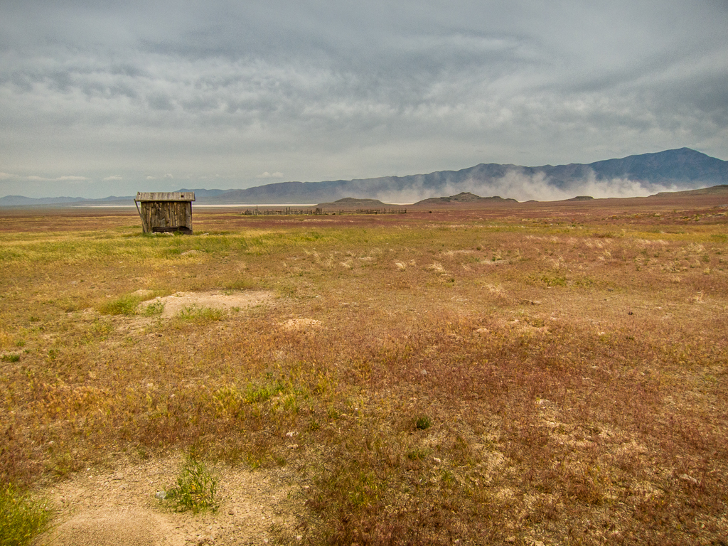
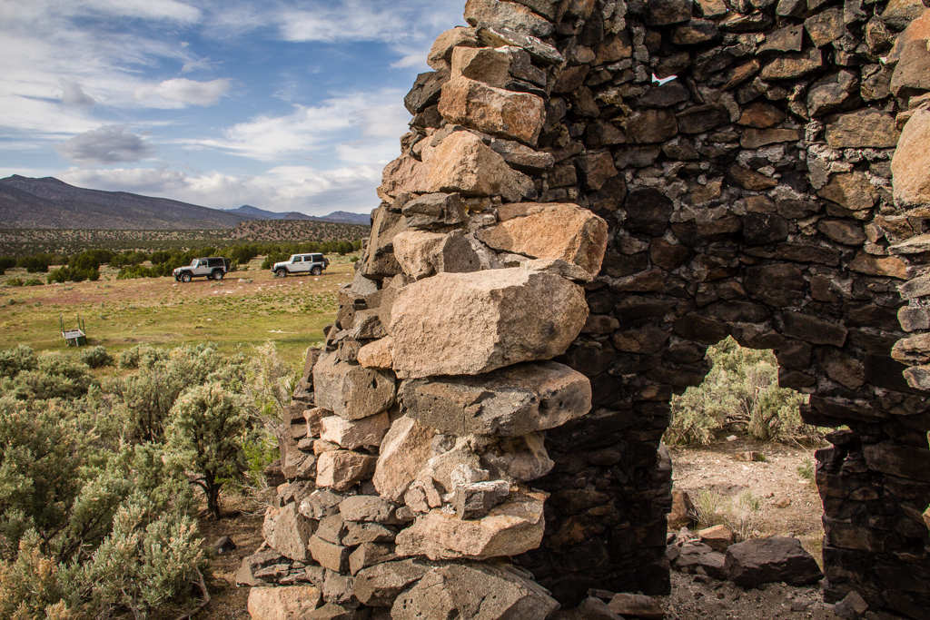
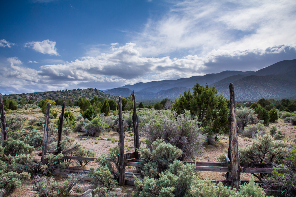
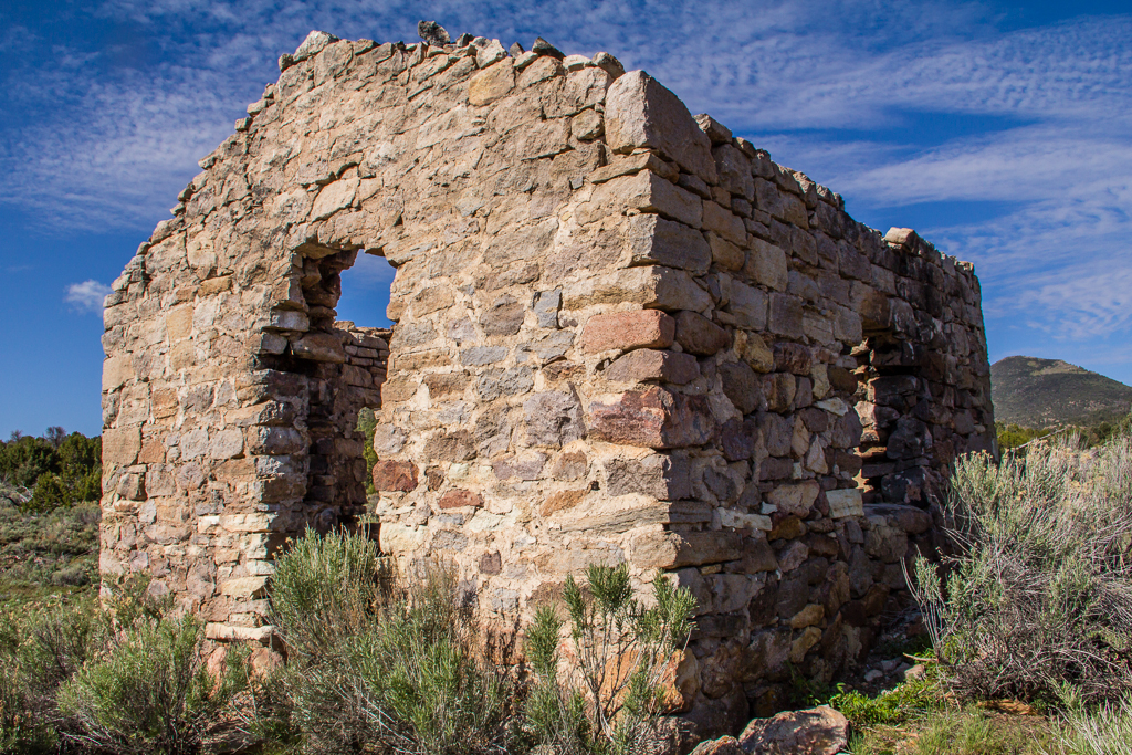
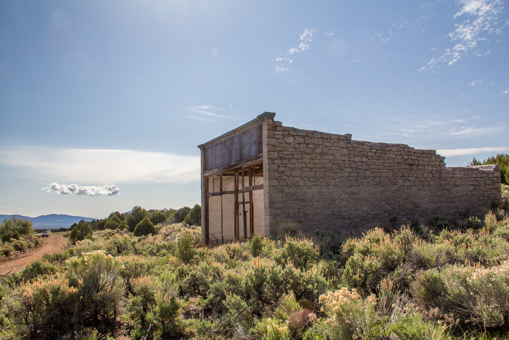
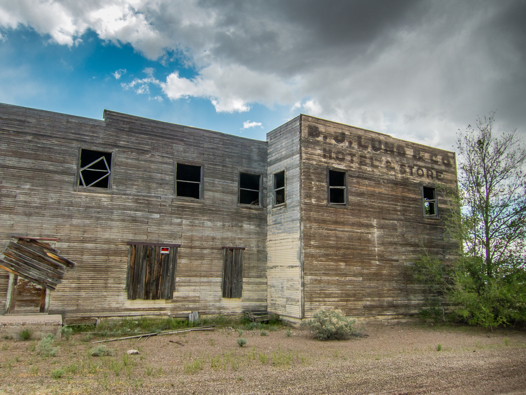
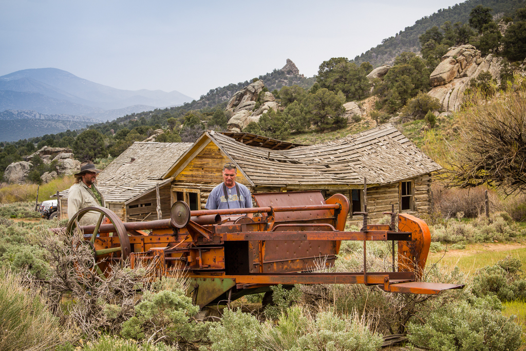
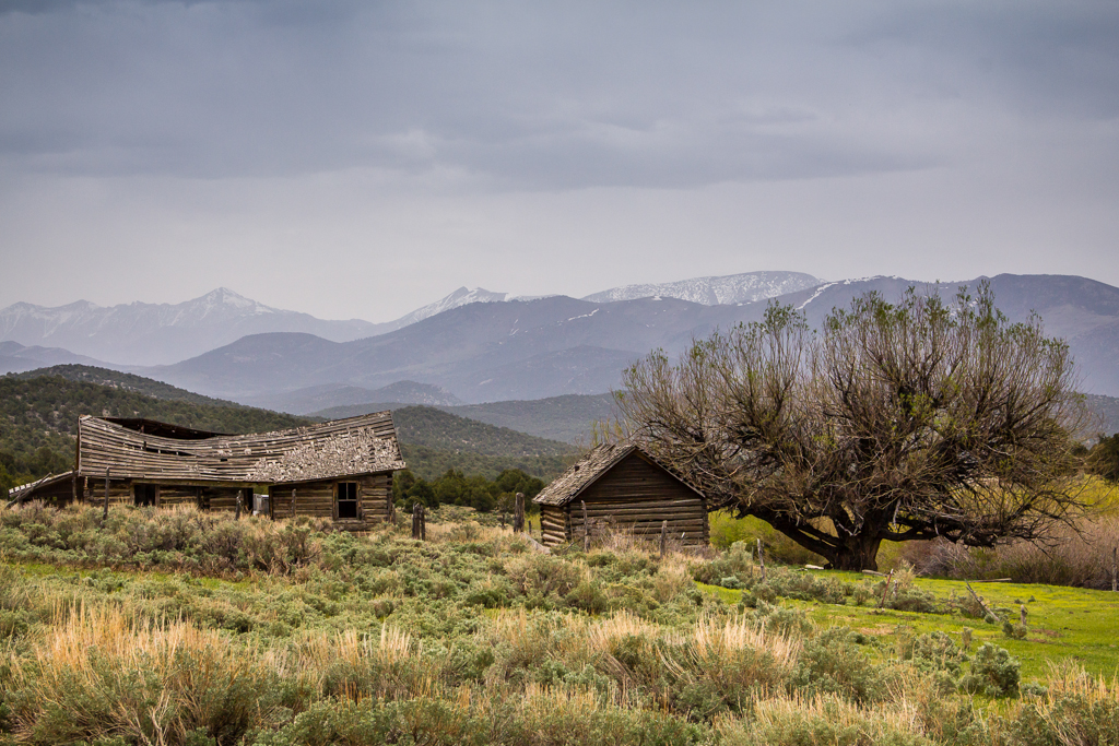
The deer flies and no-see-ums were fierce around the water so we didn’t dally before heading south to cross the Lead Mine Hills. We made another stop along this section to visit an archaeology site I’m familiar with – known as Bonneville Shores Estates.

20130516_Wendover-STG_Offroad-304W.jpg


A rich archaeological site, excavated in the ‘70s, it holds a treasure trove of artifacts and clues into the lives of the earliest inhabitants of the area. It’s one of the oldest documented habitation sites in the Great Basin, dating back even before the much more famous Danger cave, to more than 10,000 years ago.

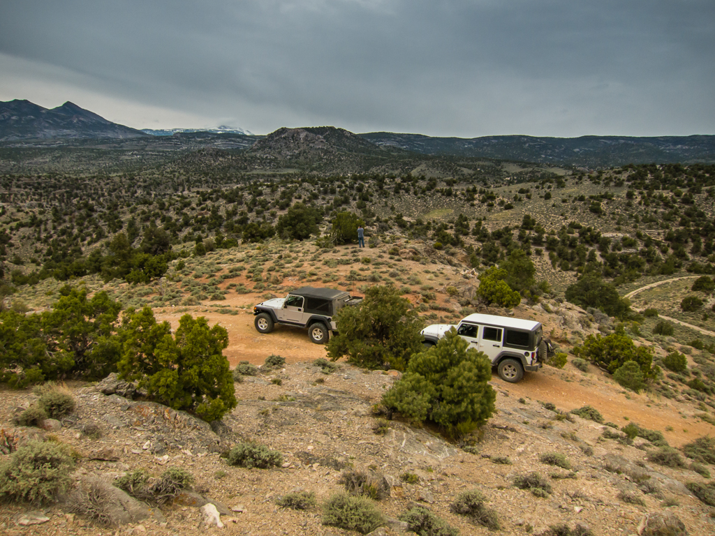
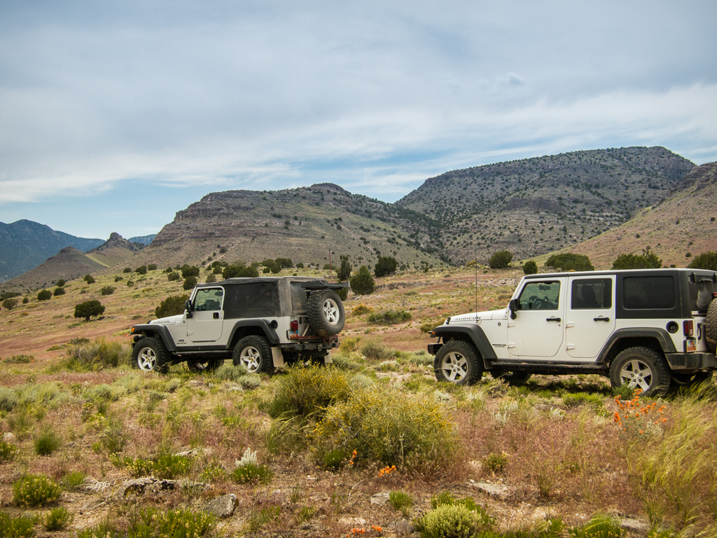
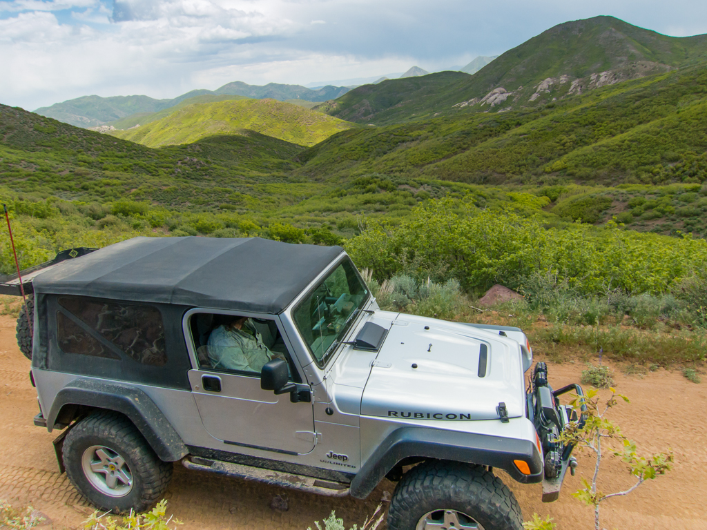
Crossing the paved road to Ibapah, we followed the Ferber Wash drainage towards Little White Horse Pass, where we turned south, over and through the un-named hills for about 25 miles, eventually descending past Ayarbe Spring to the flat plain of Antelope Valley. So far on our journey we had seen no other vehicles or people, but we did pass an occupied camp near Little White Horse.

Crossing the unnamed hills near Little White Horse Pass.

20130516_Wendover-STG_Offroad-308W.jpg


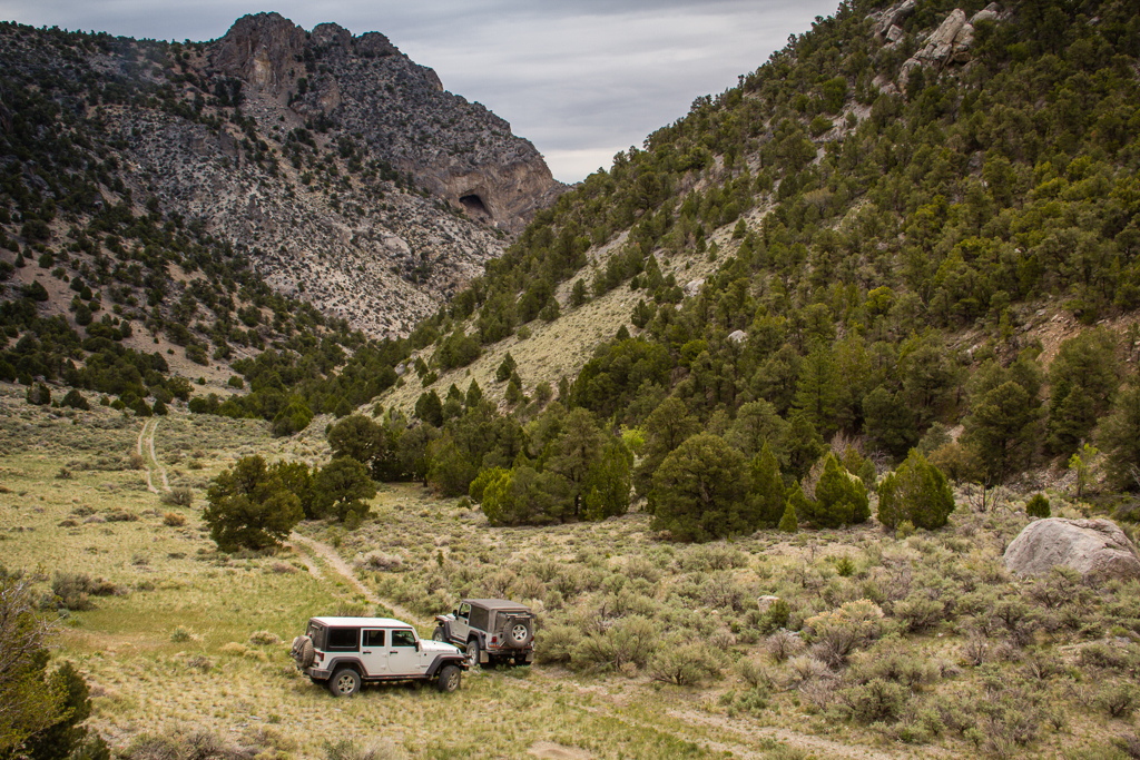
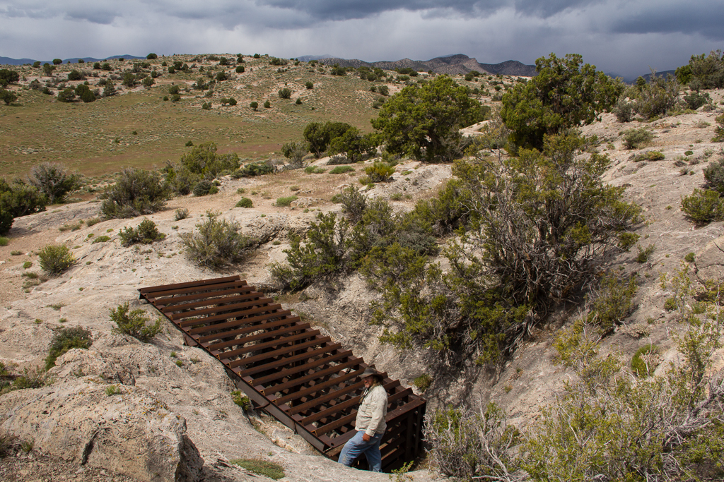
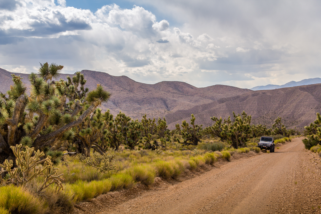
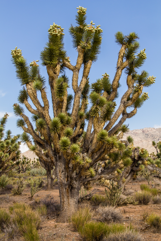
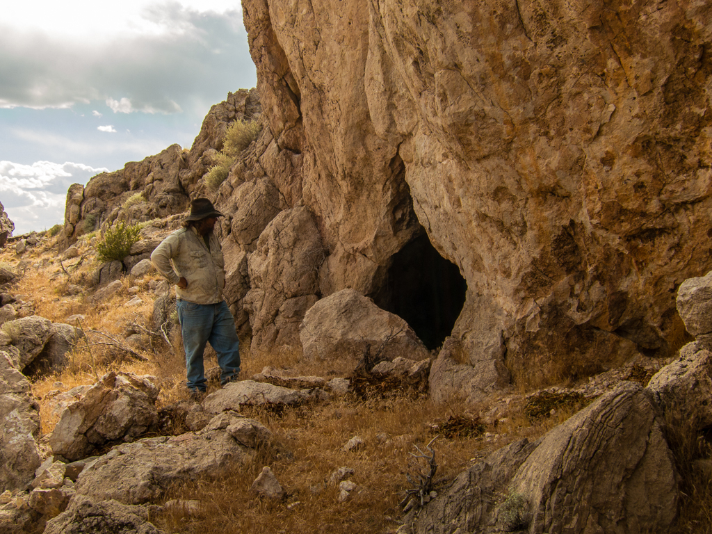
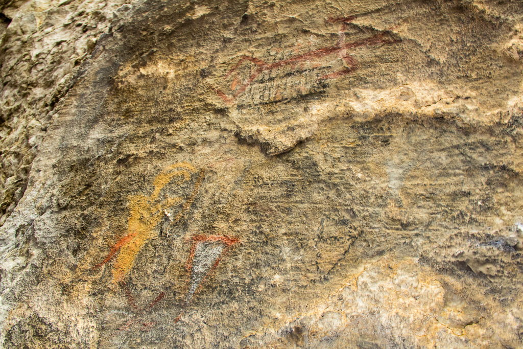
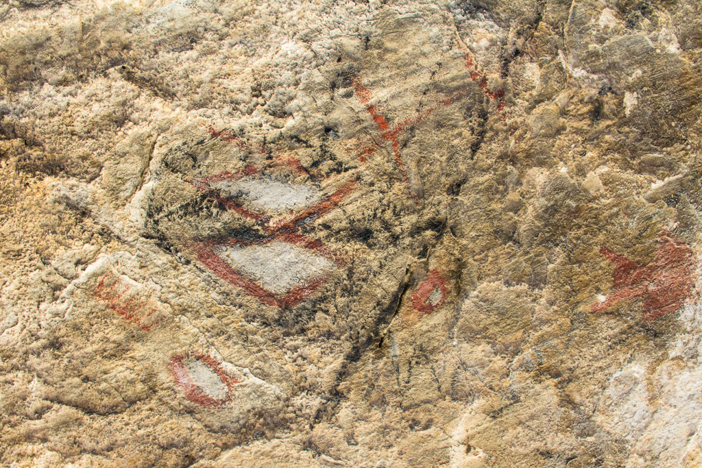
Our path then took us west, to shadow the flank of the Antelope Range southward. We took a side trip up one of the canyons for lunch and investigated a cave.

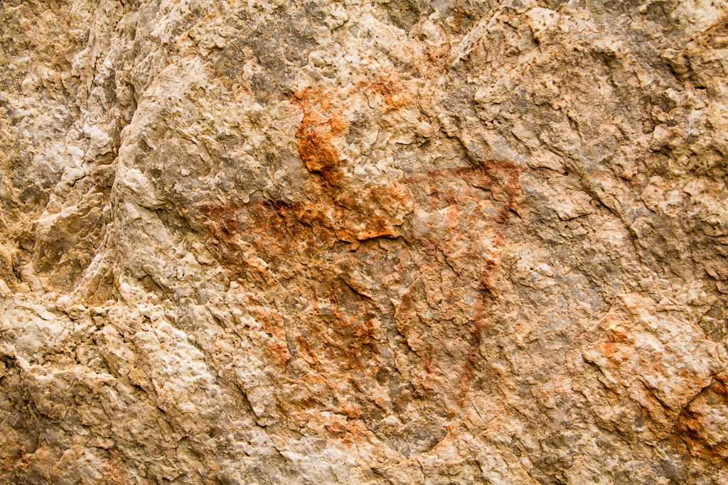
The cave was a nice little bonus. With the floor of the cave heavily blackened by generations of fire and midden material, it was obviously a well used, but un-excavated habitation site. The real bonus came when I looked more closely at the roof of the cave and found a collection of faint pictographs that included all the elements of anthropomorph, zoomorph and symbols both geometric and free form, in red, orange and black. Very nice surprise find!

20130516_Wendover-STG_Offroad-15W.jpg


20130516_Wendover-STG_Offroad-16W.jpg


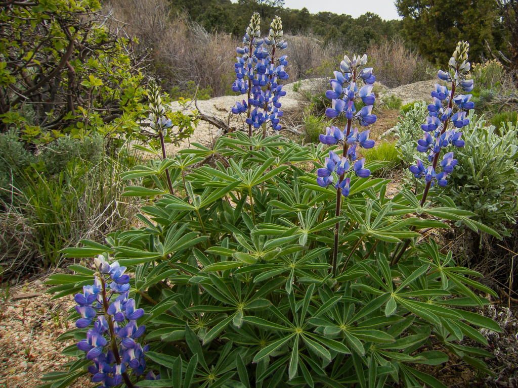
Next, we headed west crossing the valley again and up Tippett Canyon before turning onto the Blue Mass scenic route through the Kern Mountains. While we may have wished for other than dull, flat overcast lighting for picture taking, the scenery at Blue Mass was none the less breathtaking!

20130516_Wendover-STG_Offroad-33W.jpg


20130516_Wendover-STG_Offroad-46W.jpg


20130516_Wendover-STG_Offroad-59W.jpg


- DAA

Featured image for home page:
slide.jpg
 
From Blue Mass, we travelled down Grass Valley Canyon and along the south end of the Kern Mountains to visit the ghost town of Tungstonia. There isn’t much of the town left standing, but the scenery was excellent, with wildflowers of every color blooming in profusion.

20130516_Wendover-STG_Offroad-311W.jpg


20130516_Wendover-STG_Offroad-314W.jpg


Leaving Tungstonia we passed a second campsite for the day. With two battered looking camp trailers and a huge propane tank, it looked like a scene straight out of Breaking Bad (not kidding…). We didn’t see any of the people though and just motored on.


We turned southeast to circle around the back side of Spring Mountain and arrive at Gandy Warm Springs. A small RV was parked there, but the people were nowhere to be seen (a ladies top near the spring indicated they may have taken cover in a hurry as we pulled up…). The warm springs were just too inviting. So we spent some time just soaking some of the dust away.

20130516_Wendover-STG_Offroad-67W.jpg


Leaving the warm springs, we headed back to the west side of Government Peak and up into the north end of the Snake Range at Mormon Jack Pass to camp for the night. Nearby O’Neal Peak, still partially snow covered at 10,000’ was visible from camp.

20130516_Wendover-STG_Offroad-74W.jpg


We had travelled exactly 200 miles of dirt for the day. While we had seen two camps and an RV, we had not actually seen another person nor, another vehicle on the trail for the whole 200 miles. A good start for the trip!

For dinner, we broke out the pie irons and made some delicious calzones using fresh pizza dough and all the fixings. Then after an extended whiskey and cigar session around the pinion fed campfire, it was off to bed. It rained off and on through the night and it was raining when we got up and broke camp. Bringing a delicious freshness of air and fragrant aroma of wet sage to the air. Loving every second of it! There was also a dusting of fresh snow on O’Neal Peak that hadn’t been there the evening before. As we moved south over the pass before descending east down Marble Wash we would see the peak of 12,000; Mount Moriah straight ahead, freshly capped in snow.

20130516_Wendover-STG_Offroad-322W.jpg


We moved south along the east flank of Snake Range, taking in a side trip up the beautiful and rugged Horse Canyon.

20130516_Wendover-STG_Offroad-83W.jpg


From there it was south along the flank of Snakes again until we hit Highway 6. Here we endured 12 miles of pavement to gas up in Baker and visit Snake Creek cave near Garrison.

20130516_Wendover-STG_Offroad-84W.jpg


The cave has a sinkhole entrance that is gated and locked. So not really a whole lot to see. A very interesting place though, as excavation produced many ancient Indian remains showing it had been a burial cave. As well as a natural trap that many animals had fallen into and left fossil records over the centuries, including now extinct camels and horses.


Leaving pavement behind once more, we drove past the northern end of Burbank Hills, crossing the barren Ferguson Desert before ascending Snake Pass at the southern tip of the Confusion range. From the pass we made a short side trip north to visit the site of Ibex in the Barn Hills. Some neat rock formations and good looking campsites at Ibex, but not much else to see.

20130516_Wendover-STG_Offroad-339W.jpg


20130516_Wendover-STG_Offroad-338W.jpg


From Ibex we headed south again, taking some time to walk around and explore the interesting rock formations on Painted Rock mountain. While scrambling around in some boulders I found this nice little rock art panel.

20130516_Wendover-STG_Offroad-101W.jpg


20130516_Wendover-STG_Offroad-110W.jpg


While I was finding the rock art, Eric was finding a snaddlerake. Which was kind enough to wait for me to get there and take a picture. A gorgeous Western Diamondback.

20130516_Wendover-STG_Offroad-118W.jpg


20130516_Wendover-STG_Offroad-126W.jpg


Leaving the Confusion range behind we moved south along east flank of Wah Wah Mountains, starting near Crystal Peak.

20130516_Wendover-STG_Offroad-341W.jpg


Deep in the Wah Wah’s.

20130516_Wendover-STG_Offroad-350W.jpg


Tracing a serpentine route through Upper Pass, around Lawson Cove and Fifteen Mile Point, over rough and rarely travelled track we eventually descended back into the valley and crossed the highway east of Wah Wah Summit.

This day was quite windy (and overcast). We could see dust being whipped off the hardpan throughout the day. Here you can see the dust rising well south of our postion.

20130516_Wendover-STG_Offroad-343W.jpg


- DAA
 
We continued down the Wah Wah Valley, then west to the old coke ovens at Kiln spring.

20130516_Wendover-STG_Offroad-131W.jpg


20130516_Wendover-STG_Offroad-133W.jpg


20130516_Wendover-STG_Offroad-139W.jpg


Then it was up and over the rugged Wah Wah’s to the top of the aptly named Pine Grove Canyon, where we decided to pitch camp for the night near the remains of the old Revenue Mine operation.

Crossing the Wah Wah’s, dust rising off hardpan from above can be seen in far distance, now well to the north of us.

20130516_Wendover-STG_Offroad-357W.jpg


The Revenue mine/ghost town and camp for the night.

20130516_Wendover-STG_Offroad-142W.jpg


20130516_Wendover-STG_Offroad-157W.jpg


20130516_Wendover-STG_Offroad-167W.jpg


We had travelled 188 miles of dirt for the day without seeing a single other person, vehicle or camp anywhere, except the ranch yard we passed through near the highway.

The rain came a bit earlier this evening, so we waited for a break in the storm before cooking our rib eye steaks and our pie iron cherry turnovers. The whiskey and cigar session around the campfire got cut a little bit short when the rain started coming down more heavily, but we were all feeling pretty whipped and ready for the sack by then anyway.

The next morning, Sat. the 18th, dawned clear and beautiful. And, kind of cold! The thermometer in the Jeep showed 35* to begin the day. It felt good though! The day wouldn’t remain clear, as it continually clouded up, rained, cleared, repeated the cycle throughout the day. And it eventually warmed up quite a bit too. But all in all, this was probably the nicest weather day of the whole trip.

Descending from the Wah Wah’s we headed across Pine Valley and up into the Indian Peak range. My original route plan was thwarted, as we ran into a series of gates that were supposed to be open on May 1, but which were still locked. We soon found an open route over the range along Commissary creek though.

We spotted a bobcat earlier in the morning near one of the locked gates. Stopping to glass the opposing ridge here, we soon spotted dozens of elk and deer.

20130516_Wendover-STG_Offroad-360W.jpg


Then it was down Atchison Creek and west across the narrow Hamlin Valley to visit one of the best ghost town sites I know of, Stateline.

Unmarked graves near the ghost town of Stateline. Would like to know the story of these, all three that close together and the nearest one much smaller than the other two...

20130516_Wendover-STG_Offroad-171W.jpg


The ghost town of Stateline.

20130516_Wendover-STG_Offroad-187W.jpg


20130516_Wendover-STG_Offroad-194W.jpg


20130516_Wendover-STG_Offroad-203W.jpg


From Stateline we took the scenic detour to eventually connect with the main dirt road running down Modena Draw. We spotted these broomtails near the main draw.

20130516_Wendover-STG_Offroad-363W.jpg


You can’t really tell from the picture, but both the blue roan and the grulla had faint tiger striping on their legs. That, along with the location in the Needle Mountains, make me fairly certain that these are part of the Sulphur herd. Famous for having a very high retention of genes and traits of the original Spanish Barb stock.

We made a brief stop at the Modena Cemetary. Most of the graves were very old, some headstones showing deaths in the 1860’s. But this one was very recent. Since I can’t talk my family into feeding me to the coyotes or shooting my ashes out of a canon on the 4th of July, maybe I can get them to bury me like this.

20130516_Wendover-STG_Offroad-229W.jpg


Passing through the thriving metropolis of Modena…

20130516_Wendover-STG_Offroad-367W.jpg


From Modena we skirted the edge of the Bull Valley Mountains to gas up in Enterprise. Leaving Enterprise, we made the second paved leg of the trip, 12 miles to Enterprise Reservoir. Then it was SW up into the Bull Valley Mountains. A long bumpy ride around Lost Peak, Greek Peak , Mineral Mountain and Potters Peak before descending Beaver Dam Wash to Motoqua.

Crossing the Bull Valley Mountains.

20130516_Wendover-STG_Offroad-374W.jpg


With the end sadly drawing near, we took an unusually slow pace driving south along the west side of the Beaver Dam Mountains. Enjoying the forest of Joshua tree and cholla.

20130516_Wendover-STG_Offroad-243W.jpg


20130516_Wendover-STG_Offroad-240W.jpg


20130516_Wendover-STG_Offroad-239W.jpg


A few of the cholla still had flowers. It was really cool to see in person, as I’d bend over to inspect a flower the stamen would start to perceptibly weave and wave, perhaps hoping I was something that could be enticed to come inside and take some pollen away with me to lose in the next flower.

Somewhere along here we spotted a small cave with a heavily fire blackened roof, but no other obvious signs of habitation. Given the small size, but very heavy fire blackening, I’d guess it to have been a routinely used camp site of the ancients.

20130516_Wendover-STG_Offroad-385W.jpg


Eventually, we hit pavement again at Castle Cliff on the highway south of Shivwits. A check of the odometer showed that we were at 148 miles of dirt, 12 miles of pavement for the day.

Totals for the entire trip since leaving Wendover, 536 miles of dirt, 24 miles of pavement.

Sad to see the trip coming to an end, but feeling like we could retire the field with full honors, we somewhat reluctantly aired up the tires and turned north onto the pavement, bringing the journey to an end…

- DAA
 
That sounds like a good time.

I love the knowledge you bring to some of the sights you visit. Also love all the small details of the flora. Very nice.

Thanks for sharing.
 
Thanks a lot for that great report! I enjoyed both very much, the pictures as well as the writing.
 
Looks like a great trip. Some really cool stuff. Thanks for sharing.

Overall how were the roads? From your pictures they don't look too bad, (but not too many pictures of the roads.) Could any stock 4wd handle it?
 
There was one short section that something like a stock Tacoma would have struggled with and suffered some minor body damage (bumper dragging and stock mud flaps getting torn off, running boards trashed etc.). 99% of it would have been easy for any high clearance vehicle though.

- DAA
 
Wow. Thanks for the TR. That sounds like an epic trip.
 
Great trip report!


From wnorton using an iPad and Tapatalk HD.
 
Did you use a GPS or did you just map it all out before hand? Great post btw.
 
I'm not sure I understand the question?

But I always have a GPS on board and usually look at a map before leaving. For this trip I did plan the route out on the map before leaving. But I never bother creating GPS routes or any of that junk.

- DAA
 
Dave, where was the spot you mentioned where a stock Taco would get its mud flaps ripped off?
 
Art, that would have been going up Horse canyon in the Snake Range. It was an up and back side trip. Road got very rough, one spot where it had recently washed out was just a teensy bit iffy for the lifted Rubicon on 35's - anything with lesser approach/departure angles and bumpers not made for driving by braille would have gained visible character.

- DAA
 
This was a real pleasure to read. So many things I liked; that beautiful diamondback, the wild herd (which looked very different than the ones I encountered recently), that ghost town, the interesting landscapes... it all looks so cool.
 
  • Like
Reactions: DAA
Similar threads
Thread starter Title Forum Replies Date
T Wendover to SLC Trip Planning 11
natylka Sun Tunnel, Wendover and Salt Flats-New Year Day! Hiking & Camping 16
TrailScot Public bus from St George to Zion NP in 2024 General Discussion 7
TrektheWorld St. George - Thanksgiving Week Everything Else 7
fossana Red Cliffs & Dixie NF fire-related trail/road closures (St George area) Trip Planning 1
wabenho Move from the Wasatch Front to St. George area? General Discussion 6
M Climbing in St. George? Top Rope? Trip Planning 6
Nick St. George Campsites Trip Planning 10
Red Rock Rangers St. George summer Trip Planning 3
chandlerwest Hello from St. George, UT Noobs: Introduce yourself! 1
Dave March Weekend in St. George Hiking & Camping 9
Flaminghog2099 George washington national forest Trip Planning 3
Nick Dog-friendly hikes around St. George Trip Planning 28
Jammer Invite Around St. George 3/7ish + Meet Up (Members Only) 0
steve Invite St. George this weekend, 2/13-2/15 Meet Up (Members Only) 37
Don Group Site near Zion or St George? (Veterans Day) General Discussion 4
jrh Between Las Vegas and St. George Trip Planning 7
gloo Cedar City vs St. George General Discussion 7
Andy Heading to St George Trip Planning 7
Yvonne St. George and vicinity this weekend Trip Planning 3
Deadeye008 St. George, UT area day hikes Trip Planning 2
Tyler St George Mountain Biking March 2012 Off Road 2
Tyler Mountain biking St George Trip Planning 21
RyanP How long does it take the dirt roads (S. UT) to dry out after snow? Trip Planning 16
J How is the dirt road to the East Fork of Blacks Fork TH? Trip Planning 1
Aldaron Southern Utah Dirt General Discussion 43

Similar threads

Back
Top