swmalone
Member
- Joined
- Apr 27, 2016
- Messages
- 484
The Wellsville Mountains are what we would consider to be our home range. We live in their shadow and we see them everyday (unless the smoke or inversion is too bad). With that said this is only the second time that we have hiked them. I can't remember the first time, but it must have been far enough in the past that I forgot how brutal this hike can be.
We headed out towards Mendon Friday morning, arriving around 10. We planned our hike to start at the Coldwater Canyon trailhead and head to Stewart's Pass. To get to the trailhead you have to travel WSW of Mendon for a few miles on a gravel road that can get fairly rough in a couple of places. Once we reached the National Forest all of the sudden we started seeing trucks everywhere, which is very unusual at this location. We realized that they were all DNR trucks and there were evidence markers, guys with dogs and metal detectors. I finally decided to ask what was going on and found out they were having a training exercise. They told us they weren't crazy enough to do the training where we were headed so all was good.
You follow the gravel road all the way to the end. There is a sign, but nothing listing the trail. The sign just gives info on fire restrictions. The trail starts to the left of this sign.
After hiking for about 0.8 miles you come to Coldwater Lake. This isn't much of a lake more of a small marshy pond, not overly photogenic. The hike to this point is pretty mellow and the trail well defined. The trail stays pretty mellow and in good shape for about another 0.7 miles or so, and then things change.
Below is a picture of what the "trail" looks like in several locations.
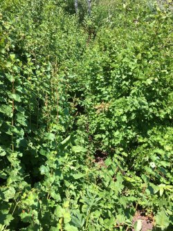
Needless to say there was a fair amount of bushwhacking. Along with the bushwhacking was also a drastic increase in incline. When the trail opened up the views to the East where fairly impressive.
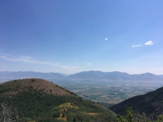
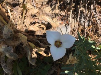
We didn't see much wildlife other than the insect variety, including biting horseflies that were present along the entire trail. Also with the low snow year and how dry it has been there wasn't a lot of wildflowers still blooming. We did see a couple of these guys.
Eventually we reached the top. It was about 3.5 miles and around 2600 feet of elevation gain, most in the last two miles. We had thought to go along the ridge and hit a peak or two but with the heat and climb we were done.
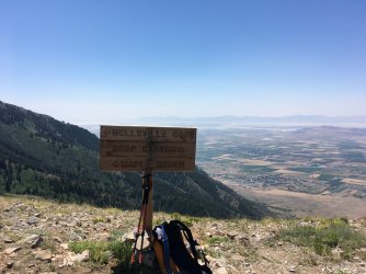
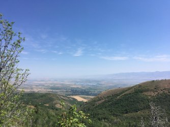
Here are some views to the west. We live down there somewhere.
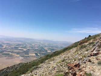
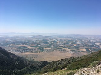
The trip down wasn't any easier. Still bushwhacking and since it was so steep feet and knees were definitely complaining. As we descended it started to get very smoky. I had concerns that perhaps the training exercise and started something on fire. Luckily for us the smoke was blowing in from distant fires, but still made for a stressful descent.
We eventually stumbled back to the truck and then drove into Logan for Jamba Juice and Five Guys. All said it took us just a bit over 6 hours to complete the 7 mile hike. I am sure that in a few years when we forget how much this place beat us up we will happily do it again.
We headed out towards Mendon Friday morning, arriving around 10. We planned our hike to start at the Coldwater Canyon trailhead and head to Stewart's Pass. To get to the trailhead you have to travel WSW of Mendon for a few miles on a gravel road that can get fairly rough in a couple of places. Once we reached the National Forest all of the sudden we started seeing trucks everywhere, which is very unusual at this location. We realized that they were all DNR trucks and there were evidence markers, guys with dogs and metal detectors. I finally decided to ask what was going on and found out they were having a training exercise. They told us they weren't crazy enough to do the training where we were headed so all was good.
You follow the gravel road all the way to the end. There is a sign, but nothing listing the trail. The sign just gives info on fire restrictions. The trail starts to the left of this sign.
After hiking for about 0.8 miles you come to Coldwater Lake. This isn't much of a lake more of a small marshy pond, not overly photogenic. The hike to this point is pretty mellow and the trail well defined. The trail stays pretty mellow and in good shape for about another 0.7 miles or so, and then things change.
Below is a picture of what the "trail" looks like in several locations.

Needless to say there was a fair amount of bushwhacking. Along with the bushwhacking was also a drastic increase in incline. When the trail opened up the views to the East where fairly impressive.


We didn't see much wildlife other than the insect variety, including biting horseflies that were present along the entire trail. Also with the low snow year and how dry it has been there wasn't a lot of wildflowers still blooming. We did see a couple of these guys.

Eventually we reached the top. It was about 3.5 miles and around 2600 feet of elevation gain, most in the last two miles. We had thought to go along the ridge and hit a peak or two but with the heat and climb we were done.

Here are some views to the west. We live down there somewhere.


The trip down wasn't any easier. Still bushwhacking and since it was so steep feet and knees were definitely complaining. As we descended it started to get very smoky. I had concerns that perhaps the training exercise and started something on fire. Luckily for us the smoke was blowing in from distant fires, but still made for a stressful descent.
We eventually stumbled back to the truck and then drove into Logan for Jamba Juice and Five Guys. All said it took us just a bit over 6 hours to complete the 7 mile hike. I am sure that in a few years when we forget how much this place beat us up we will happily do it again.
