Udink
Still right here.
- Joined
- Jan 17, 2012
- Messages
- 1,748
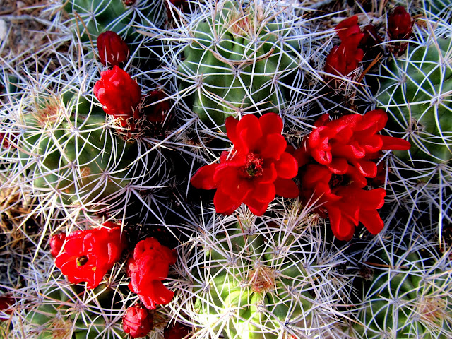
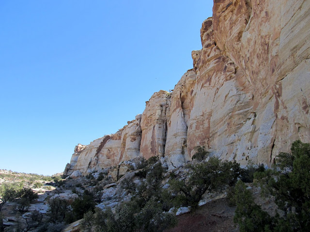
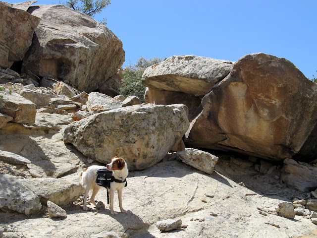
In February 2012 I hiked up Old Woman Wash as far as I could with Chris G. until we encountered a dryfall that prevented us from going farther up the canyon. That trip was primarily a rock art hunt, but it still irked me that I wasn't able to hike the entire canyon. Last weekend I tried to remedy that. There are several ways to get into upper Old Woman Wash, but in my trip research I found an odd trail leading up the San Rafael Reef that I wasn't previously aware of. Only very small portions of the trail are visible in Google Earth, but much of it can be seen in the higher quality Bing Maps (see here for an example). My initial thought upon seeing the trail on my computer was that it was an old mining road, much like the nearby Ekker Mine Road. However, this trail is a lot smaller than the obvious Ekker Road. I spent some time matching up the terrain in the satellite imagery between Google Earth and Bing Maps and created some waypoints to upload to my GPS so I could follow this faint trail up the Reef. I chose to camp at the rock chimney near Swazy Seep since I'd never camped there and it was closer to the trail. On Friday after work I drove down and parked at Swazy Seep and immediately began hiking to explore a couple of small canyons near my planned camp spot. They were nothing special, but I did find an arrowhead less than a quarter of a mile from where I'd parked the Jeep. It was nice to see some wildflowers in bloom, especially my first Claret Cup bloom of the year.
My map said this was Swazy Seep, but it was dry today
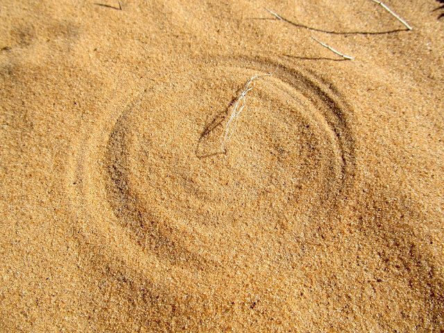
Tiny wind-blown plant making patterns in the sand
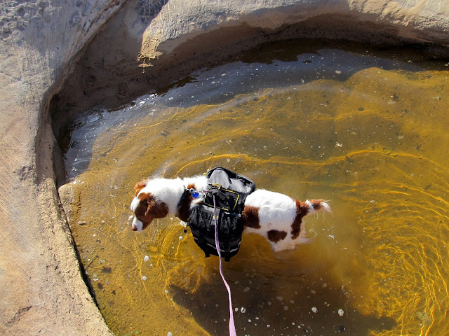
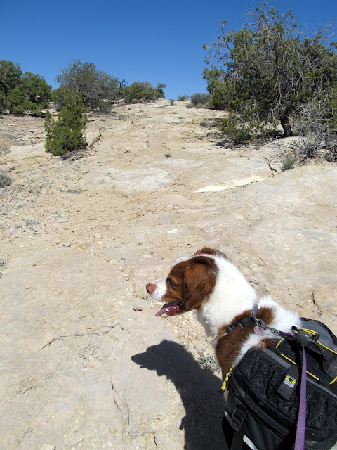
Found a nice spot for Torrey to swim and drink from
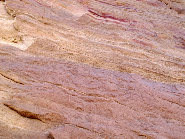
Ooh, a pretty rock!
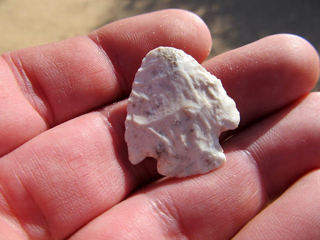
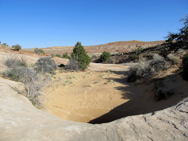
I spotted the arrowhead just downstream from this pothole
My first claret cup bloom of the year
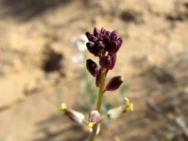
Purple flower buds
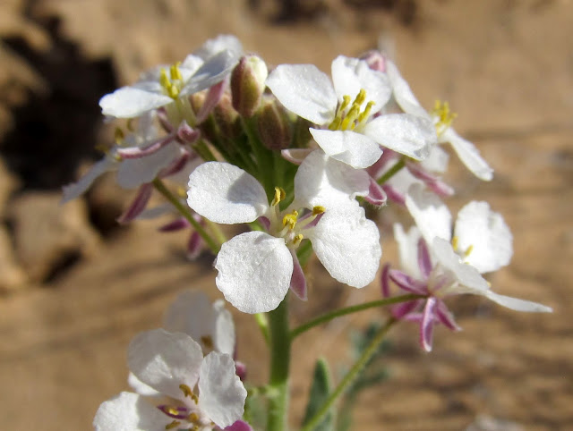
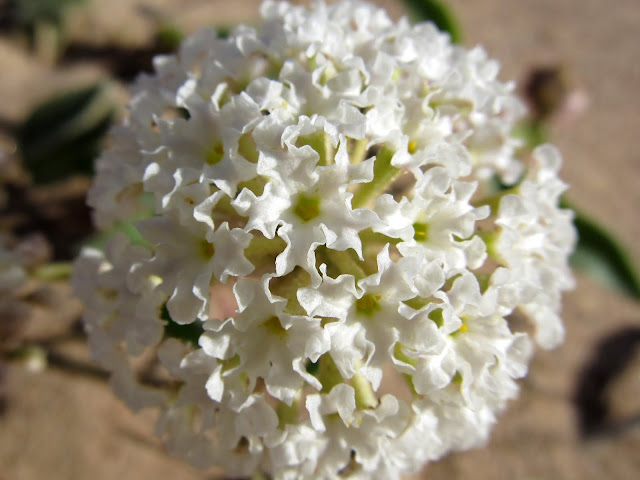
White wildflowers
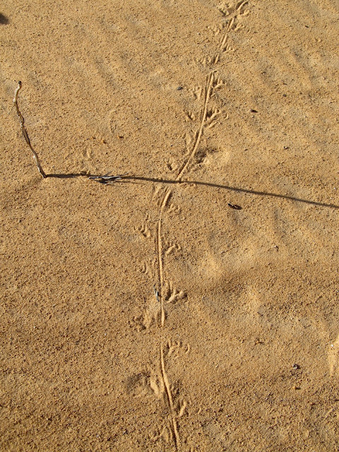
Lizard tracks
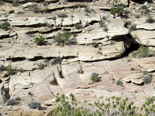
I figure by the greenery around this pothole that it must be spring-fed

White wildflowers
One canyon explored (right fork), now to explore the left fork
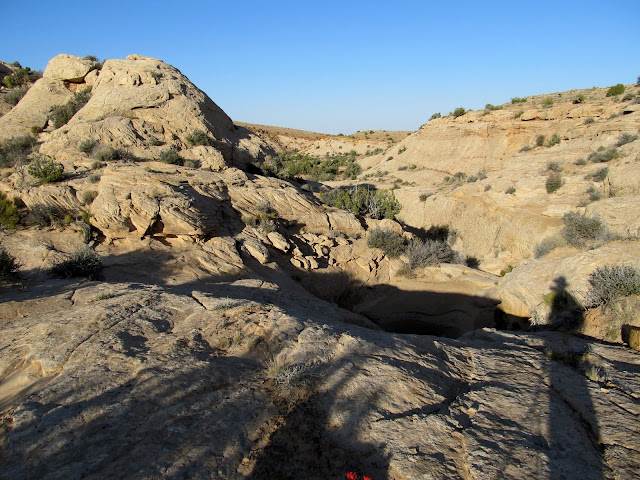
I tried walking around this pothole but with the mud I almost fell into the nasty water. Time to climb out and around it.
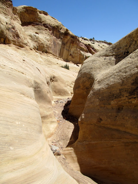
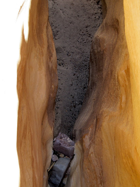
View down the narrow canyon
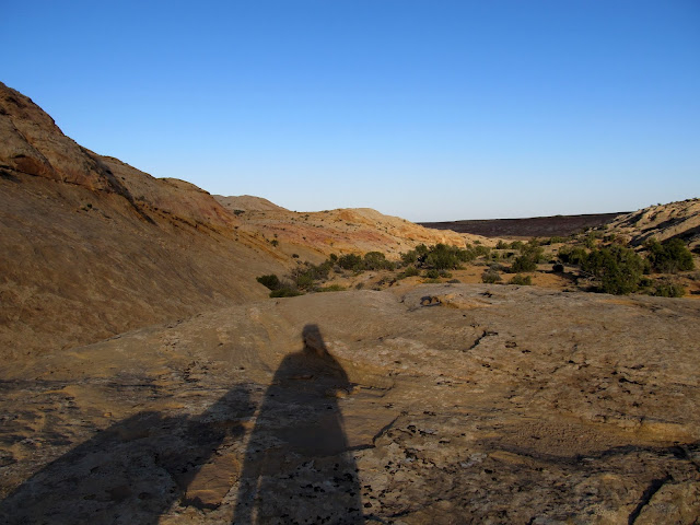
Mine and Torrey's shadows as we headed back to set up camp
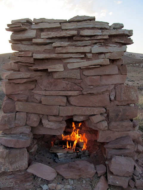
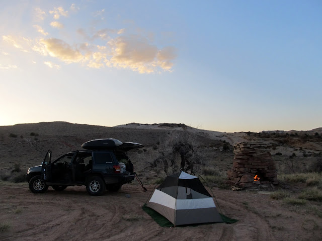
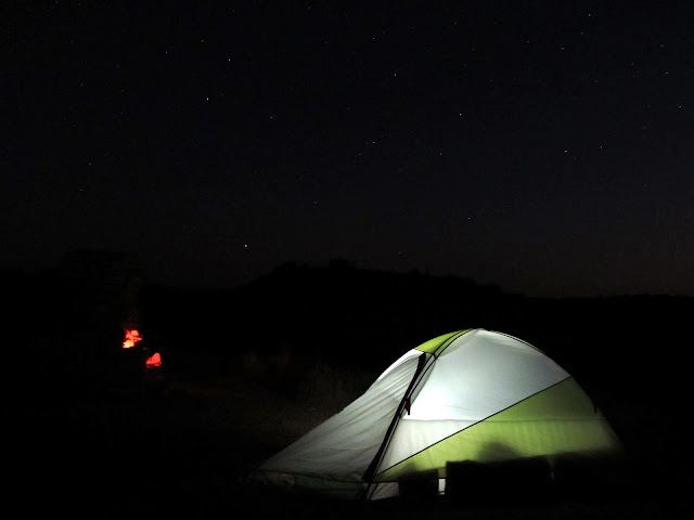
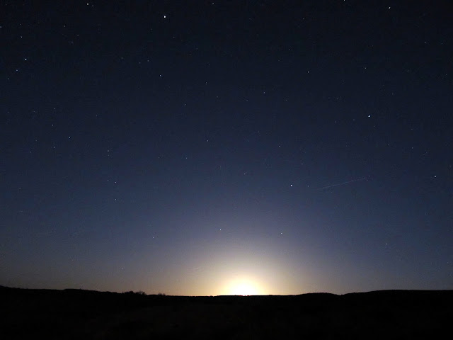
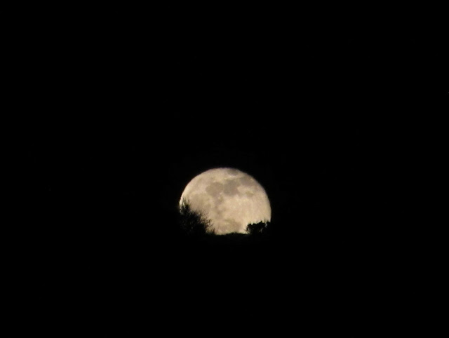
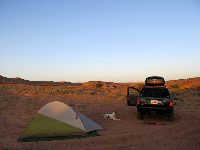
After hiking just over three miles and returning to the Jeep just after sundown, I started a small fire in the chimney and set up camp. I usually find myself wanting to go to bed early due to boredom, but this time I read the Jan./Feb. issue of Archaeology Magazine (a hand-me-down from my mom) and had to force myself to turn in around 10:30. While reading, I was absolutely transfixed by the brightness of the nearly full moon rising in the east. I took a few night shots before the moon rose, thinking that, judging by the brightness on the horizon, the moon must be about to appear any second. Still, it took a loooong time before the moon made an appearance. It stayed up all night and kept the interior of my tent lit up nicely. I slept comfortably, though still a little restlessly, until just before the sun hit my tent the next morning. I awoke and took a few photos, made coffee and ate a quick breakfast, then packed up camp and readied myself and Torrey for a long hike.
Fire in Swazy's Chimney
Camp
Tent
The glow from the nearly-full moon, even before it rose, was unbelievable!
Moon rising
Up with the sun on Saturday morning
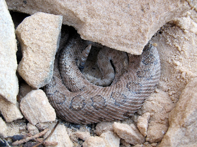
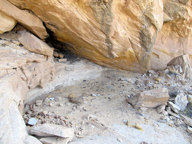
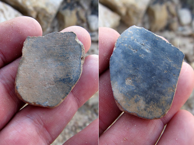
On my way to upper Old Woman Wash, I checked out a small drainage visible from camp. I'd spotted some patinated cliffs the previous evening and, sure enough, there were some faint (though not terribly interesting) petroglyphs there. There was also an alcove with soot stains on the ceiling, indicating that this was once an ancient habitation site. A friend had told me that metates would often be turned upside-down to protect the grinding surface, so when I saw such a rock that could have been such an upturned tool, I lifted it up to see the underside. The rock was layered and a few of the layers fell back down as I lifted it, but in that split-second I saw a strange coiled shape underneath the rock. It didn't immediately register what that shape was, so I foolishly lifted the remaining layers again and found a small rattlesnake. I freaked a little bit and dropped the rock on the snake, but it was apparently lethargic in the morning cold and maintained its position there. I kicked the rocks off of it and snapped a photo. The snake stayed put, not bothered by my disturbance. I decided then to end my exploration of this site, but I did spot a small piece of plain gray pottery on my way back down to the wash which I intended to hike up.
A spiral or concentric circles
A tiny rattlesnake that I roused from sleep
Probably an old habitation site. There was soot in the alcove, chert on the ground, and some pottery shards on the ground.
Both sides of a piece of pottery
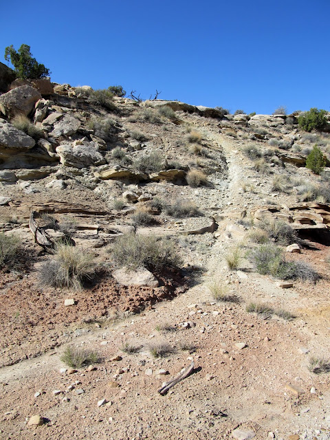
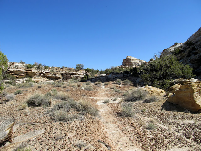
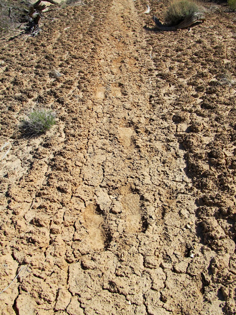
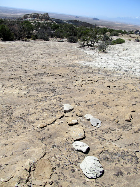
That wash held some promising-looking cliffs that could have held more rock art or old habitation sites, but I cautiously checked them out and found nothing. I left the wash and began following the trail I'd seen in the satellite imagery. The section just outside of the wash certainly looked like it had been traveled by full-sized vehicles and possibly created by heavy equipment. I saw some fresh footprints along that old road, but soon even those disappeared. As I climbed higher away from the canyon, the trail became more clear in spots, though it was narrower than I was expecting. It was apparent to me eventually that this was an old motorcycle trail! As much as I like to hike, I can't help but wonder how fun it must have been to ride a dirt bike up the Reef. The trail was obviously old, predating the BLM's travel plan and closures. It amazed me to see the technical sections where people had ridden their bikes.
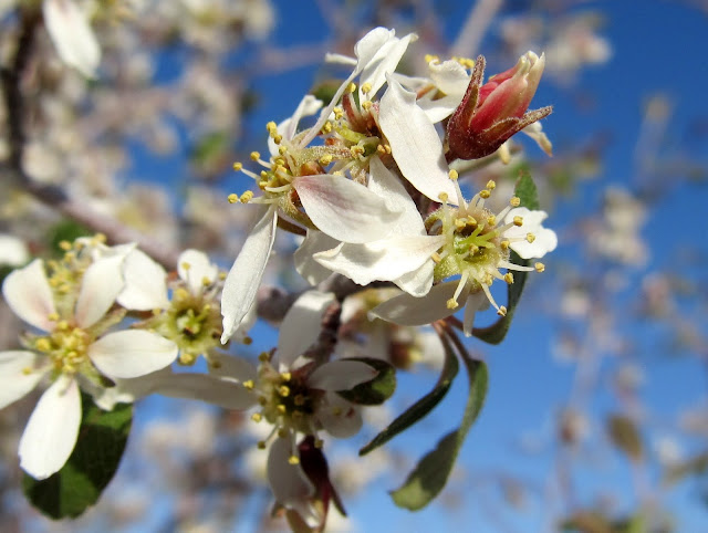
Beautiful white wildflower blooms
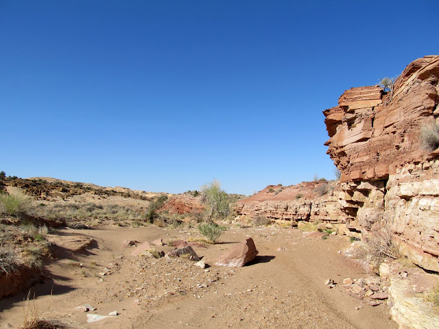
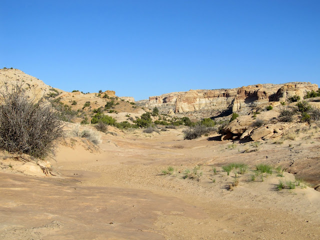
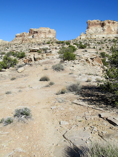
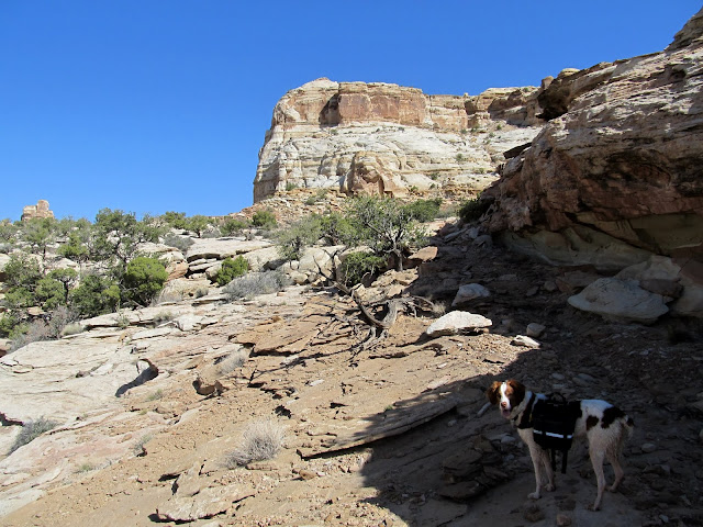
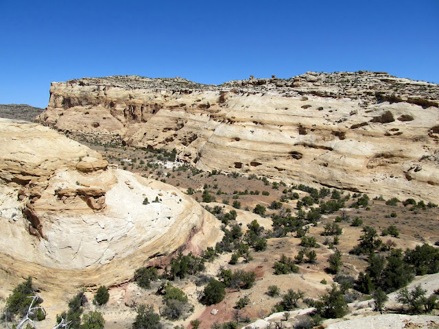
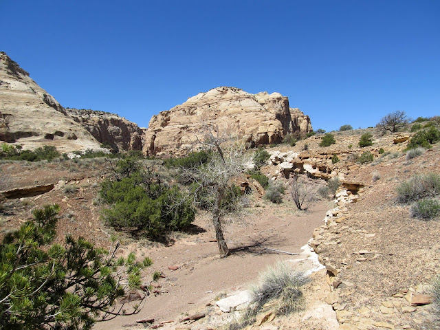
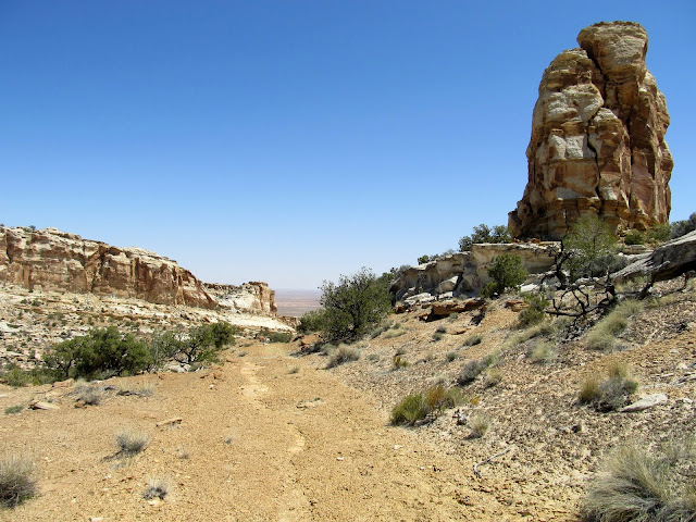
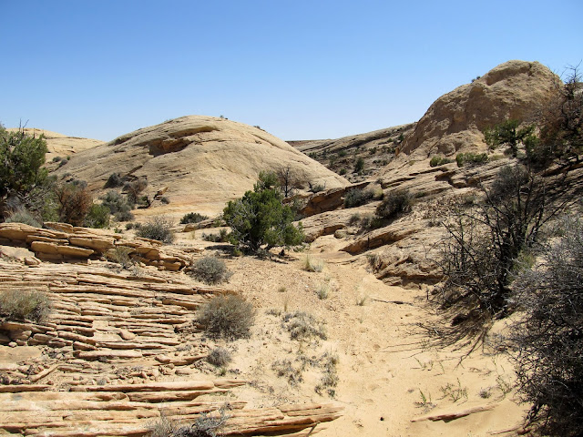
This is the canyon where I would begin the climb up the San Rafael Reef
An old, faint road became apparent here, and I saw some fresh footprints on it
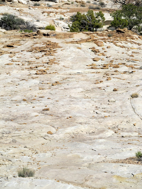
This old motorcycle trail is visible in Bing Maps, and it's how I determined the route I would take up the Reef
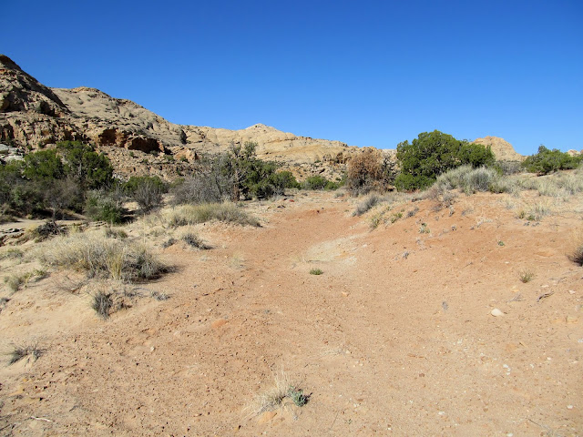
Still following the trail, which would take me through the gap in the distance
If you didn't already know this was an old motorcycle trail, you might not think this scene holds any significance
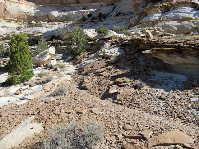
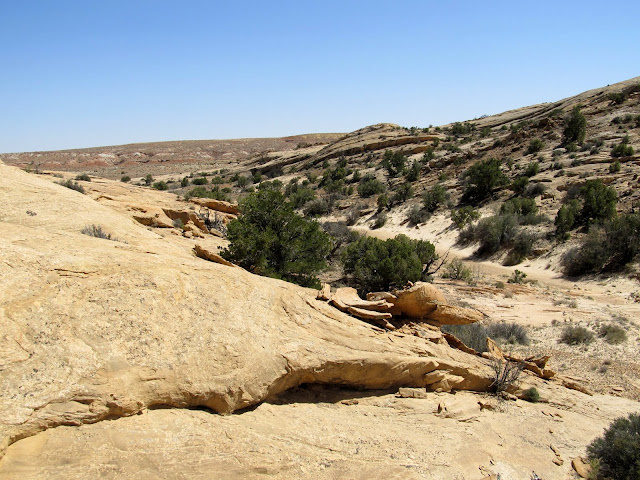
Skirting around the bottom of some cliffs and nearing the top of the Reef
More of the old motorcycle trail
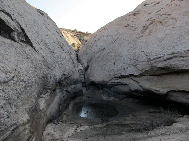
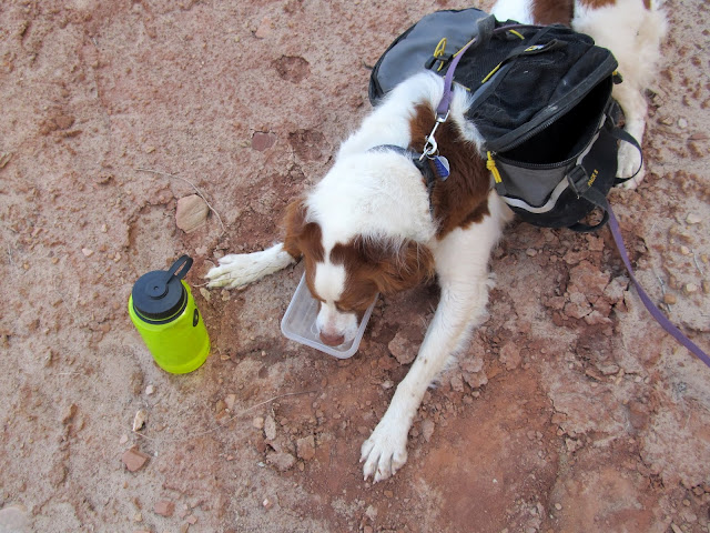
Although I was carrying four liters of water, and Torrey had another 1.75L in her pack, I was on the lookout for potholes for the mutt to sneak a drink from. Along the trail I saw a section of canyon about 300' away that held some water. I encouraged Torrey to go down for a cool-down drink, and surprisingly she abided and went down for a swim and drink. We stopped to take a break there, then continued ascending the San Rafael Reef. I kept seeing signs of dirt bikes on this section, though they were quite old, and eventually the footprints I'd seen lower in the canyon reappeared. Whoever made them must've stuck to the canyon bottom for a lot longer than I did. I eventually reached the Ekker Mine Road and followed it for a short distance before peeling off cross-country in search of upper Old Woman Wash.
Torrey getting a drink
The terrain began to level out here
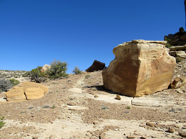
Boulders around the trail
Old motorcycle trail
It was nice to be shaded by these cliffs
Following the trail
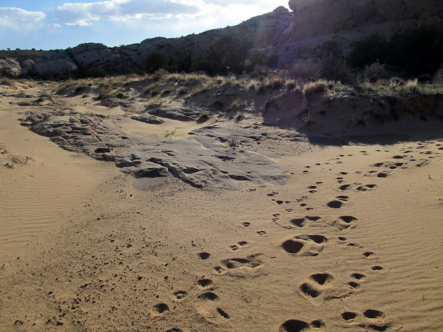
The footprints I'd seen earlier reappeared here. They must have followed the canyon up instead of the trail.
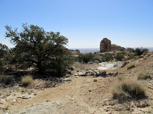
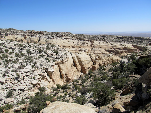
The evidence of human travel off the Ekker Road surprised me. Just after leaving the old, unused road, I saw a cairn and an arrow constructed of rocks pointing the opposite direction I was traveling. Whoever built the arrow had to have been going the wrong direction. I descended into a small valley where Torrey and I took our second break. After our rest, we ascended a small saddle into a side-canyon that joined up with Old Woman Wash. I was hoping to follow the side-canyon directly into OWW, but from above it was apparent that it was rugged and held at least one large dryfall. I followed the rim of the canyon the best I could, straying off-course once to bypass a cliff band, until eventually I could see a route directly down into Old Woman Wash.
The motorcycle trail joined up with the old Ekker Mine Road
Heading up the Ekker Mine Road
I must've been going the wrong way, 'cause I went in the opposite direction of this arrow
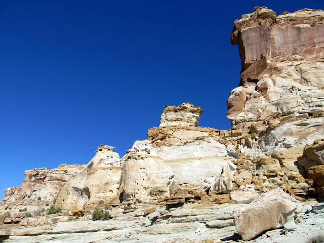
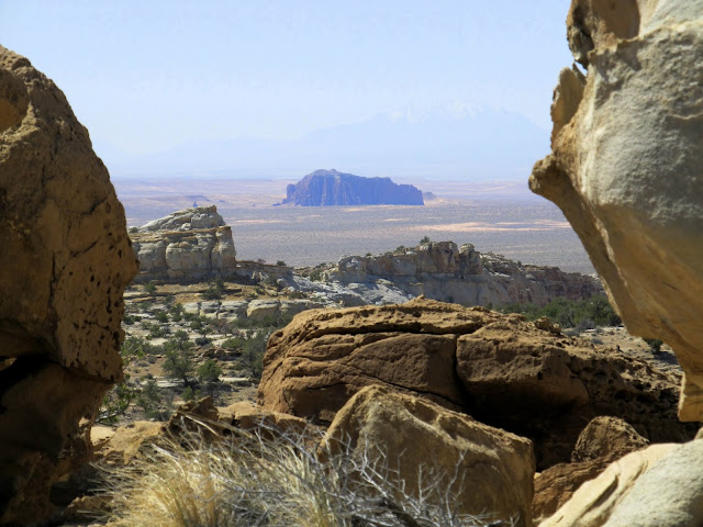
Beautiful views from atop the San Rafael Reef

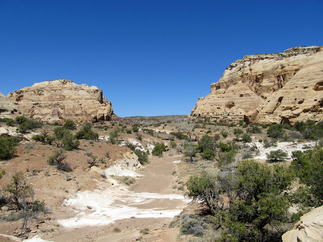
I followed this side canyon (beginning lower-left) into Old Woman Wash (running left to right)
Gilson Butte
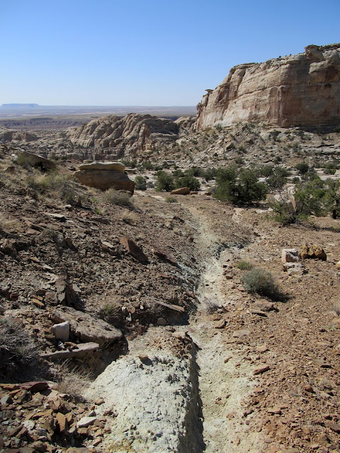
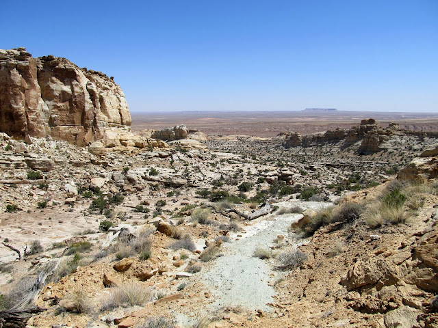
Upper Old Woman Wash
It was a steep route into the canyon--nothing I haven't done before, but daunting due to it's remoteness. I felt relief once I reached the bottom of Old Woman Wash, despite knowing I'd have to re-ascend this same route. I first went up-canyon to check things out. There were a couple of bare deciduous trees there that held my attention. I thought their presence indicated a spring, but the spring was apparently dry and the trees were dead. I returned down-canyon in the hopes that I could reach the top of the dryfall I'd encountered last year. There were some small narrows along the way which were easy to navigate through. However, I reached a narrow stretch with a small drop that was too sketchy for me to attempt alone. With a partner it would have perhaps been easy to climb back up, but on my own I didn't dare. Sadly, that ended my exploration of this canyon today, leaving 0.7 miles of canyon that I have yet to see.
Not looking forward to the steep descent
Finally in upper Old Woman Wash
This is about as far up Old Woman Wash as I went
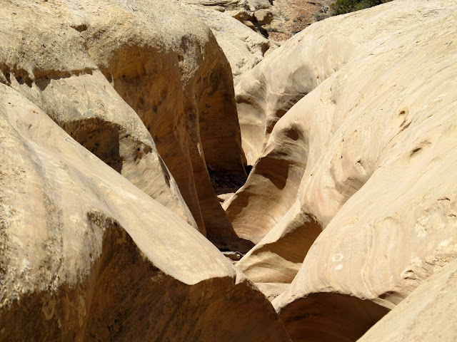
Kiddie narrows in Old Woman Wash
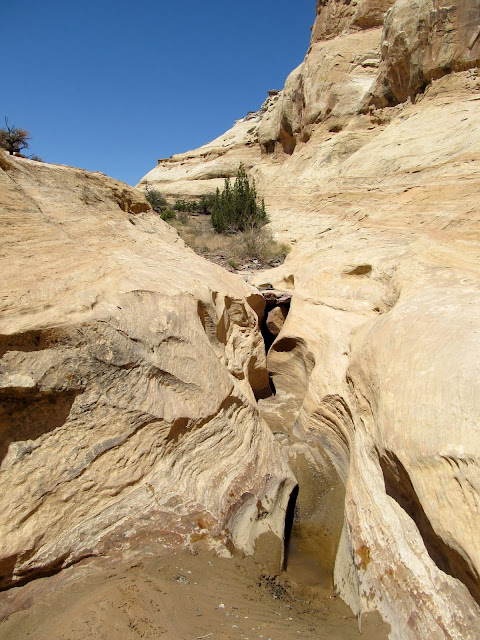
Narrows in Old Woman Wash
More narrows and a small pool from which Torrey took a drink
More narrows going down the canyon
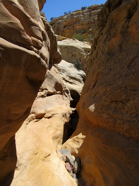
This section of narrows kept me from going further down the canyon
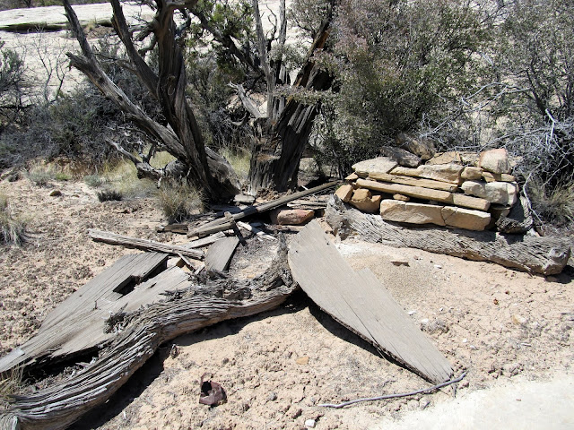
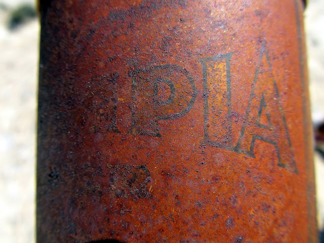
I made the steep climb out of the canyon and followed a different route back to the Ekker Mine Road. This route was much easier than that I'd taken in, and again I was surprised to see faint trails and human footprints along the way. Once I neared the old mining road I found what must have been a miner's camp. A large rock firepit had been built there, with the remains of an old wooden structure nearby. Beyond that was a pile of rusty cans, the most interesting of which was a steel Olympia Beer can with an aluminum top. I cruised down the Ekker Mine Road, stopping only once to give Torrey a drink from her pack. Once I got close enough to my entry route I left the mining road and joined up with the canyon where I'd started my hike. It was a relief to see mine and Torrey's footprints from that morning. Upon reaching the Jeep I drank some lukewarm Powerade and Torrey had her fill of water, then we set off for our waiting family at home.
Climbing back out of the canyon
Old miner's camp
Olympia Beer can. It was a steel can with an aluminum top.
Going down the Ekker Mine Road
Going down the Ekker Mine Road
That's a thirsty puppy!
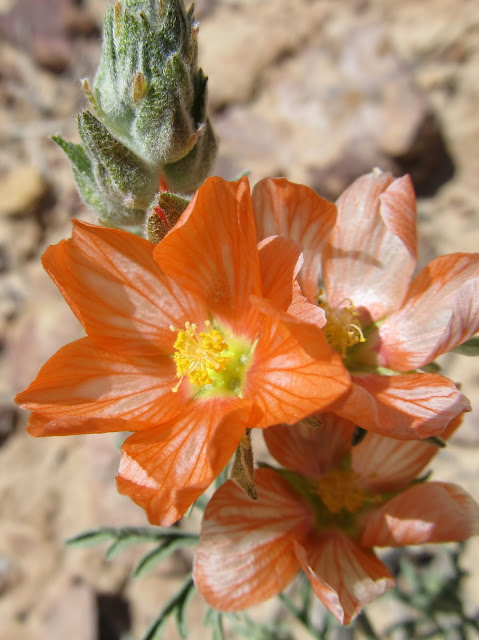
Globemallow
I left the mining road and headed south to the canyon I'd originally hiked up
Almost back in the canyon where I'd started my ascent
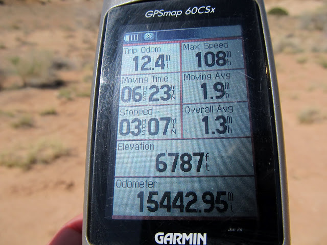
GPS stats from Friday evening's and Saturday's hike
Full photo gallery:
https://picasaweb.google.com/Dennis.Udink/UpperOldWomanWash
GPS tracklog and photo waypoints:
[parsehtml]<iframe width="640" height="480" frameborder="0" scrolling="no" marginheight="0" marginwidth="0" src="https://maps.google.com/maps?q=http:%2F%2Fudink.org%2Fgeo%2FUpperOldWomanWash.kmz&hl=en&sll=39.499761,-111.547028&sspn=4.907901,10.821533&t=h&ie=UTF8&ll=38.68618,-110.601254&spn=0.032159,0.054932&z=14&output=embed"></iframe><br /><small><a href="https://maps.google.com/maps?q=http:%2F%2Fudink.org%2Fgeo%2FUpperOldWomanWash.kmz&hl=en&sll=39.499761,-111.547028&sspn=4.907901,10.821533&t=h&ie=UTF8&ll=38.68618,-110.601254&spn=0.032159,0.054932&z=14&source=embed" style="color:#0000FF;text-align:left">View Larger Map</a></small>[/parsehtml]http://udink.org/geo/UpperOldWomanWash.kmz
Featured image for home page:

My map said this was Swazy Seep, but it was dry today
Tiny wind-blown plant making patterns in the sand
Found a nice spot for Torrey to swim and drink from
Ooh, a pretty rock!
I spotted the arrowhead just downstream from this pothole
My first claret cup bloom of the year
Purple flower buds
White wildflowers
Lizard tracks
I figure by the greenery around this pothole that it must be spring-fed
White wildflowers
One canyon explored (right fork), now to explore the left fork
I tried walking around this pothole but with the mud I almost fell into the nasty water. Time to climb out and around it.
View down the narrow canyon
Mine and Torrey's shadows as we headed back to set up camp
After hiking just over three miles and returning to the Jeep just after sundown, I started a small fire in the chimney and set up camp. I usually find myself wanting to go to bed early due to boredom, but this time I read the Jan./Feb. issue of Archaeology Magazine (a hand-me-down from my mom) and had to force myself to turn in around 10:30. While reading, I was absolutely transfixed by the brightness of the nearly full moon rising in the east. I took a few night shots before the moon rose, thinking that, judging by the brightness on the horizon, the moon must be about to appear any second. Still, it took a loooong time before the moon made an appearance. It stayed up all night and kept the interior of my tent lit up nicely. I slept comfortably, though still a little restlessly, until just before the sun hit my tent the next morning. I awoke and took a few photos, made coffee and ate a quick breakfast, then packed up camp and readied myself and Torrey for a long hike.
Fire in Swazy's Chimney
Camp
Tent
The glow from the nearly-full moon, even before it rose, was unbelievable!
Moon rising
Up with the sun on Saturday morning
On my way to upper Old Woman Wash, I checked out a small drainage visible from camp. I'd spotted some patinated cliffs the previous evening and, sure enough, there were some faint (though not terribly interesting) petroglyphs there. There was also an alcove with soot stains on the ceiling, indicating that this was once an ancient habitation site. A friend had told me that metates would often be turned upside-down to protect the grinding surface, so when I saw such a rock that could have been such an upturned tool, I lifted it up to see the underside. The rock was layered and a few of the layers fell back down as I lifted it, but in that split-second I saw a strange coiled shape underneath the rock. It didn't immediately register what that shape was, so I foolishly lifted the remaining layers again and found a small rattlesnake. I freaked a little bit and dropped the rock on the snake, but it was apparently lethargic in the morning cold and maintained its position there. I kicked the rocks off of it and snapped a photo. The snake stayed put, not bothered by my disturbance. I decided then to end my exploration of this site, but I did spot a small piece of plain gray pottery on my way back down to the wash which I intended to hike up.
A spiral or concentric circles
A tiny rattlesnake that I roused from sleep
Probably an old habitation site. There was soot in the alcove, chert on the ground, and some pottery shards on the ground.
Both sides of a piece of pottery
That wash held some promising-looking cliffs that could have held more rock art or old habitation sites, but I cautiously checked them out and found nothing. I left the wash and began following the trail I'd seen in the satellite imagery. The section just outside of the wash certainly looked like it had been traveled by full-sized vehicles and possibly created by heavy equipment. I saw some fresh footprints along that old road, but soon even those disappeared. As I climbed higher away from the canyon, the trail became more clear in spots, though it was narrower than I was expecting. It was apparent to me eventually that this was an old motorcycle trail! As much as I like to hike, I can't help but wonder how fun it must have been to ride a dirt bike up the Reef. The trail was obviously old, predating the BLM's travel plan and closures. It amazed me to see the technical sections where people had ridden their bikes.
Beautiful white wildflower blooms
This is the canyon where I would begin the climb up the San Rafael Reef
An old, faint road became apparent here, and I saw some fresh footprints on it
This old motorcycle trail is visible in Bing Maps, and it's how I determined the route I would take up the Reef
Still following the trail, which would take me through the gap in the distance
If you didn't already know this was an old motorcycle trail, you might not think this scene holds any significance
Skirting around the bottom of some cliffs and nearing the top of the Reef
More of the old motorcycle trail
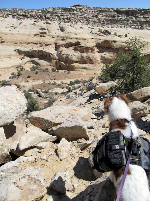
Although I was carrying four liters of water, and Torrey had another 1.75L in her pack, I was on the lookout for potholes for the mutt to sneak a drink from. Along the trail I saw a section of canyon about 300' away that held some water. I encouraged Torrey to go down for a cool-down drink, and surprisingly she abided and went down for a swim and drink. We stopped to take a break there, then continued ascending the San Rafael Reef. I kept seeing signs of dirt bikes on this section, though they were quite old, and eventually the footprints I'd seen lower in the canyon reappeared. Whoever made them must've stuck to the canyon bottom for a lot longer than I did. I eventually reached the Ekker Mine Road and followed it for a short distance before peeling off cross-country in search of upper Old Woman Wash.
Torrey getting a drink
The terrain began to level out here
Boulders around the trail
Old motorcycle trail
It was nice to be shaded by these cliffs
Following the trail
The footprints I'd seen earlier reappeared here. They must have followed the canyon up instead of the trail.
The evidence of human travel off the Ekker Road surprised me. Just after leaving the old, unused road, I saw a cairn and an arrow constructed of rocks pointing the opposite direction I was traveling. Whoever built the arrow had to have been going the wrong direction. I descended into a small valley where Torrey and I took our second break. After our rest, we ascended a small saddle into a side-canyon that joined up with Old Woman Wash. I was hoping to follow the side-canyon directly into OWW, but from above it was apparent that it was rugged and held at least one large dryfall. I followed the rim of the canyon the best I could, straying off-course once to bypass a cliff band, until eventually I could see a route directly down into Old Woman Wash.
The motorcycle trail joined up with the old Ekker Mine Road
Heading up the Ekker Mine Road
I must've been going the wrong way, 'cause I went in the opposite direction of this arrow
Beautiful views from atop the San Rafael Reef
I followed this side canyon (beginning lower-left) into Old Woman Wash (running left to right)
Gilson Butte
Upper Old Woman Wash
It was a steep route into the canyon--nothing I haven't done before, but daunting due to it's remoteness. I felt relief once I reached the bottom of Old Woman Wash, despite knowing I'd have to re-ascend this same route. I first went up-canyon to check things out. There were a couple of bare deciduous trees there that held my attention. I thought their presence indicated a spring, but the spring was apparently dry and the trees were dead. I returned down-canyon in the hopes that I could reach the top of the dryfall I'd encountered last year. There were some small narrows along the way which were easy to navigate through. However, I reached a narrow stretch with a small drop that was too sketchy for me to attempt alone. With a partner it would have perhaps been easy to climb back up, but on my own I didn't dare. Sadly, that ended my exploration of this canyon today, leaving 0.7 miles of canyon that I have yet to see.
Not looking forward to the steep descent
Finally in upper Old Woman Wash
This is about as far up Old Woman Wash as I went
Kiddie narrows in Old Woman Wash
Narrows in Old Woman Wash
More narrows and a small pool from which Torrey took a drink
More narrows going down the canyon
This section of narrows kept me from going further down the canyon
I made the steep climb out of the canyon and followed a different route back to the Ekker Mine Road. This route was much easier than that I'd taken in, and again I was surprised to see faint trails and human footprints along the way. Once I neared the old mining road I found what must have been a miner's camp. A large rock firepit had been built there, with the remains of an old wooden structure nearby. Beyond that was a pile of rusty cans, the most interesting of which was a steel Olympia Beer can with an aluminum top. I cruised down the Ekker Mine Road, stopping only once to give Torrey a drink from her pack. Once I got close enough to my entry route I left the mining road and joined up with the canyon where I'd started my hike. It was a relief to see mine and Torrey's footprints from that morning. Upon reaching the Jeep I drank some lukewarm Powerade and Torrey had her fill of water, then we set off for our waiting family at home.
Climbing back out of the canyon
Old miner's camp
Olympia Beer can. It was a steel can with an aluminum top.
Going down the Ekker Mine Road
Going down the Ekker Mine Road
That's a thirsty puppy!
Globemallow
I left the mining road and headed south to the canyon I'd originally hiked up
Almost back in the canyon where I'd started my ascent
GPS stats from Friday evening's and Saturday's hike
Full photo gallery:
https://picasaweb.google.com/Dennis.Udink/UpperOldWomanWash
GPS tracklog and photo waypoints:
[parsehtml]<iframe width="640" height="480" frameborder="0" scrolling="no" marginheight="0" marginwidth="0" src="https://maps.google.com/maps?q=http:%2F%2Fudink.org%2Fgeo%2FUpperOldWomanWash.kmz&hl=en&sll=39.499761,-111.547028&sspn=4.907901,10.821533&t=h&ie=UTF8&ll=38.68618,-110.601254&spn=0.032159,0.054932&z=14&output=embed"></iframe><br /><small><a href="https://maps.google.com/maps?q=http:%2F%2Fudink.org%2Fgeo%2FUpperOldWomanWash.kmz&hl=en&sll=39.499761,-111.547028&sspn=4.907901,10.821533&t=h&ie=UTF8&ll=38.68618,-110.601254&spn=0.032159,0.054932&z=14&source=embed" style="color:#0000FF;text-align:left">View Larger Map</a></small>[/parsehtml]http://udink.org/geo/UpperOldWomanWash.kmz
Featured image for home page: