Udink
Still right here.
- Joined
- Jan 17, 2012
- Messages
- 1,748
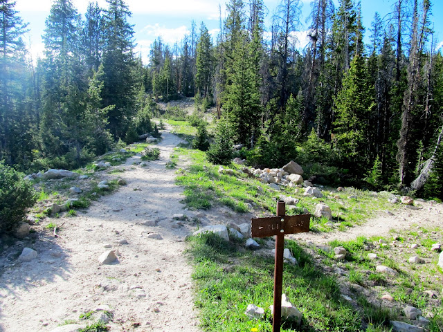
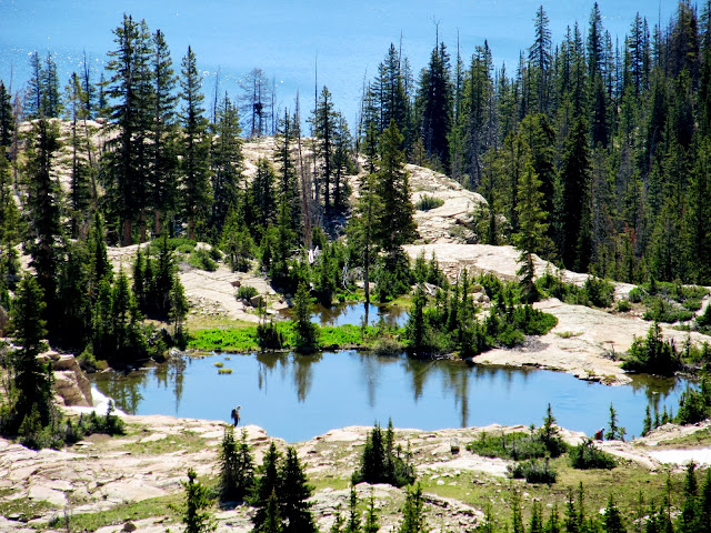
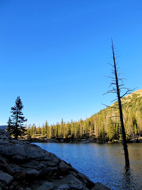
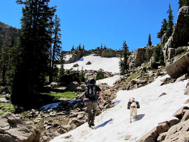
The last weekend in May proved to not be a good time for me to try backpacking in the Uintas. Fast-forward four weeks and conditions were wonderful. I planned out a loop in the vicinity of Notch Mountain with a little peak bagging thrown in the mix. Chris couldn't join me until late Friday night, so I started hiking solo (well, me and Torrey) from the car-packed Crystal Lake trailhead just after 6PM and shortly thereafter took the turn at the signed junction toward Cliff Lake. The trail was relatively easy as I strolled past Cliff, Petit, and Watson lakes. All my other Uinta backpacking trips consisted of sustained steep climbs but the elevation gain here was small and gradual. Mosquitoes were numerous at the lower lakes but not bothersome as long as I was moving. I somehow lost the trail at Watson Lake. I followed the inlet stream for a short distance without seeing any signs of a trail, so I cut cross-country to the east where I knew I'd run into it eventually--and I did.
Signed junction to Cliff Lake
Climbing up to Cliff Lake
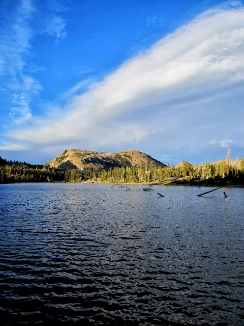
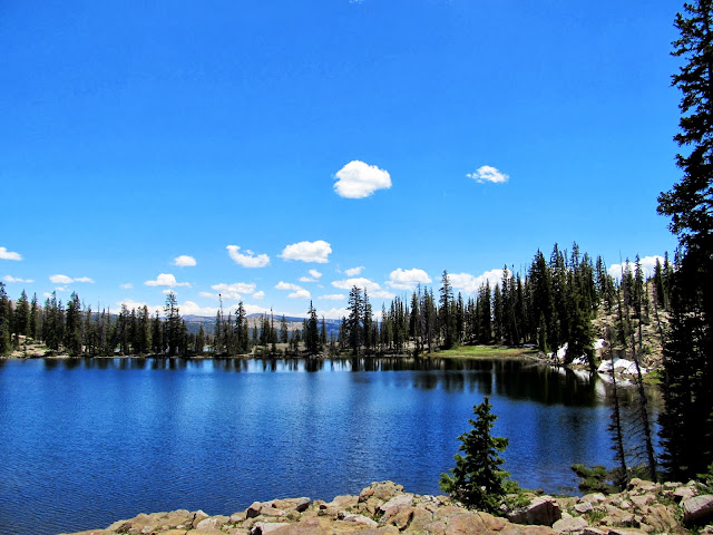
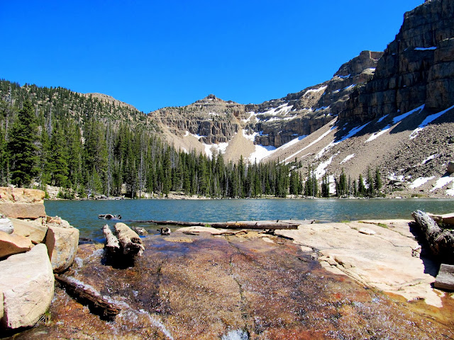
Cliff Lake and Mt. Watson
Cliff Lake
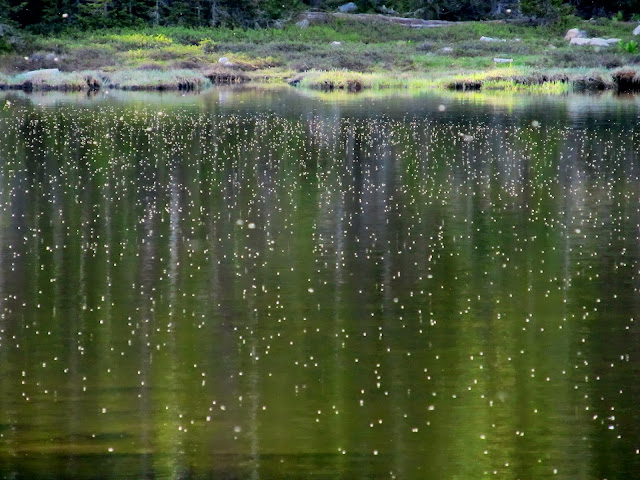
Mosquitoes over Petit Lake
Petit Lake reflection
Watson Lake
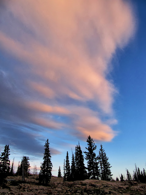
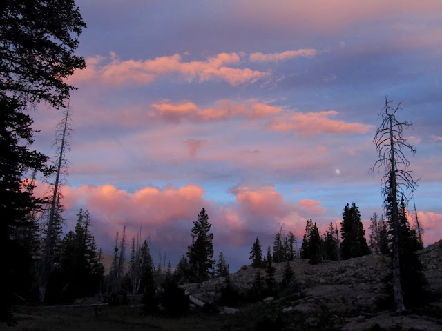
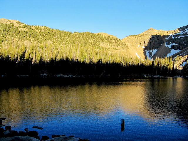
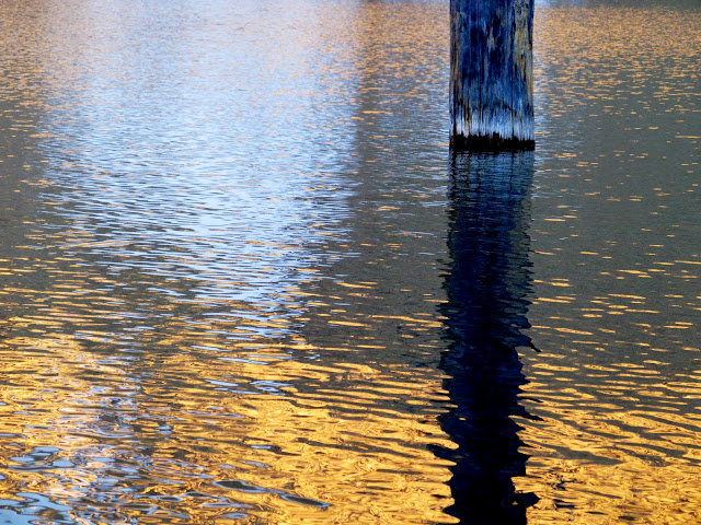
As I approached Clyde Lake the views became more grand as the sun sunk low in the sky. I almost set up camp on the shore of Clyde but the "No Camping" signs scared me off. Instead I pitched the tent in a small meadow next to a tiny stream between Clyde Lake and Twin Lakes. I was a third of a mile from where I'd told Chris to look for me. Cell service was flaky and I wasn't sure the text with my new coordinates had gotten out to him but I hoped he'd find me. If not, I was sure we'd meet up in the morning. Despite not having eaten since lunch eight hours earlier, I wasn't hungry. I still forced myself to boil some water and eat some rehydrated chili-mac which I shared with Torrey. The sunset was more delicious than dinner, with some beautiful low-angle light striking East Notch Mountain and cotton-candy pinks and purples in the clouds. I hit the sack at 10:30 and was awakened only an hour later by Chris. I crawled out of bed to greet him and chat while he set up camp, then we both got some sleep.
Pond below Clyde Lake, with East Notch Mountain, Reid's Peak, and Bald Mountain in the background
Clyde Lake and East Notch Mountain
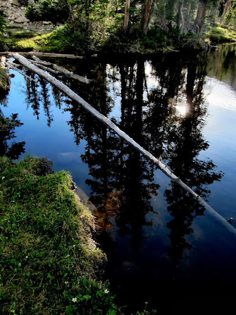
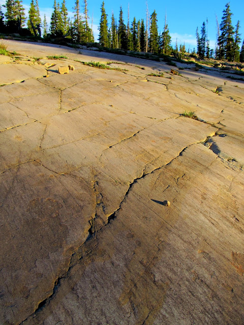
Glacier-honed rock at Clyde Lake
Pink clouds
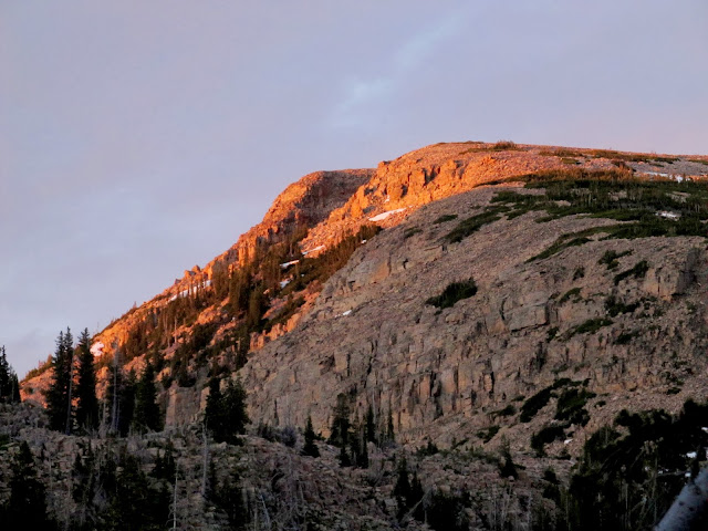
Sunset on East Notch Mountain
Sunset from camp
My tent in a meadow between Clyde Lake and Twin Lakes
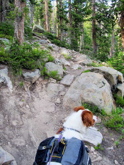
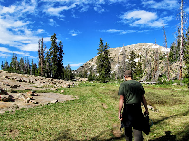
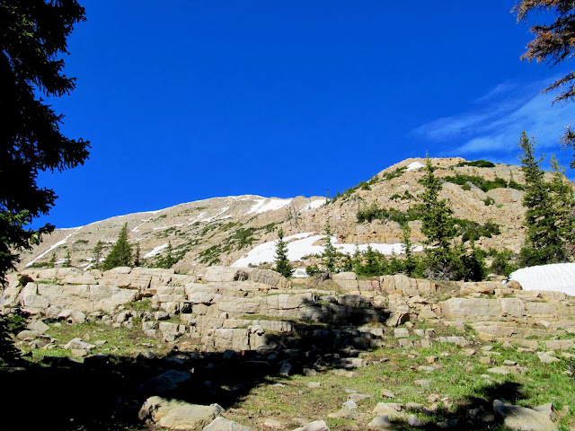
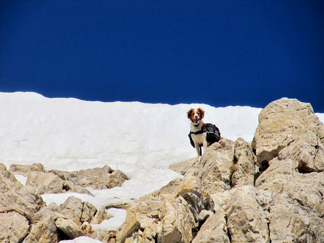
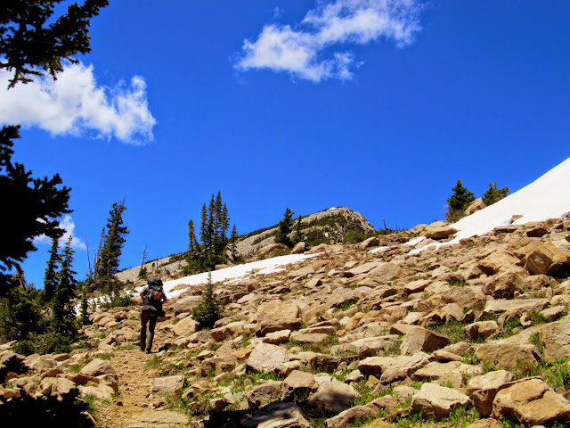
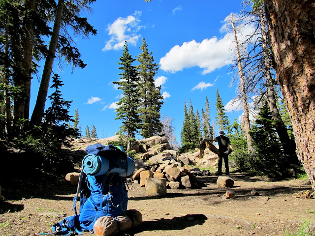
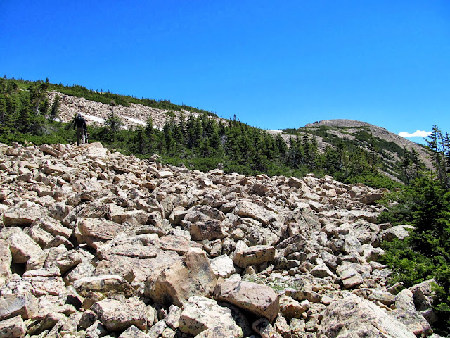
With an easy schedule for the day we were in no hurry to get moving on Saturday morning. We'd packed up camp and stashed our backpacks in some thick trees and hit the trail at 9:40. I purchased a lightweight day pack specifically to use on this trip since we'd be summiting two mountain peaks, and it proved to be invaluable. I threw two 1-L Nalgenes, some snacks, extra batteries, and some ibuprofen in the pack and clipped my GPS and camera to the sternum and waist straps. It sure beat carrying a water bottle and a granola bar! On the approach to Watson we scouted and planned a route up the northeast ridge and it worked out perfectly. We first hiked up a well-consolidated but steep, rocky slope to the ridge, kicking through a small snow drift just before reaching the top of the ridge. From then on it was a boulder hop to the summit with a couple of snow crossings. Chris, as usual, was well ahead of me for most of the hike. Torrey and I reached the summit and Chris was nowhere to be found. I approached the small summit shelter and found him nodding off comfortably in the pile of rocks.
Starting our dayhike to the summit of Mt. Watson
Approaching the base of Mt. Watson
Two backpackers at the pond below Clyde Lake
Torrey almost to the ridge
On the northeast ridge of Mt. Watson
View from the ridge toward Clyde Lake
View down the northeast ridge of Mt. Watson
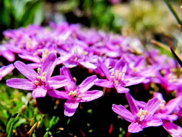
Pretty purple flowers
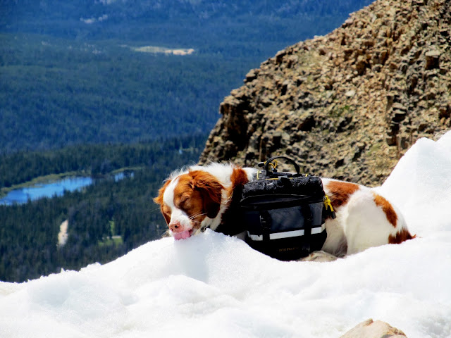
Torrey getting a drink
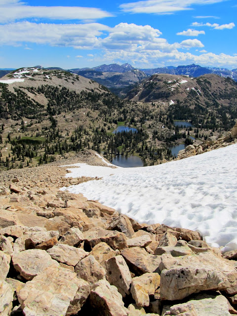
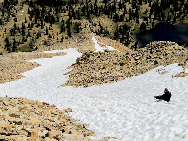
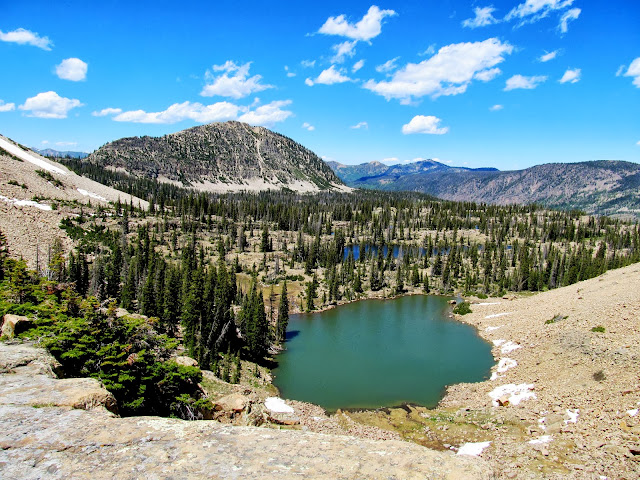
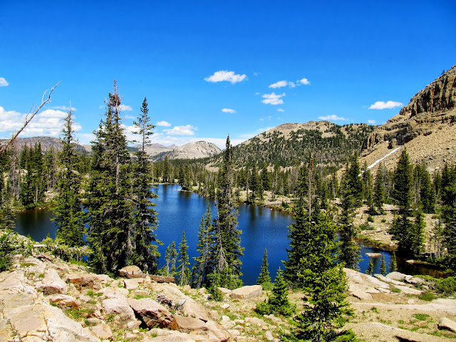
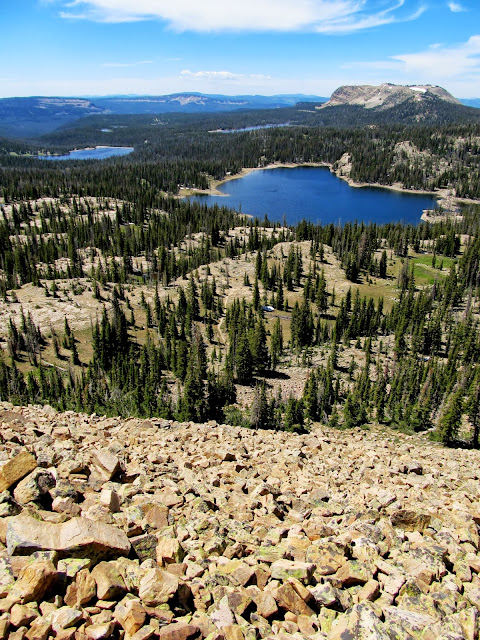
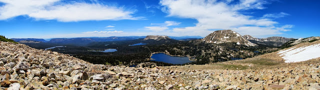
The view from the top--THE VIEW!--was incredible. We could see deep blue lakes in almost every direction, plus many other high Uinta peaks to the east. We spent some time searching for a summit register or survey marker but found neither. Chris wanted to glissade down the snow field but I was hesitant to follow him. Never having done it before, I wasn't certain I'd be able to stop myself upon reaching the rocks at the bottom. After watching Chris slide down uneventfully, I went for it. It was a lot of fun and even Torrey tried joining in by running alongside me playfully. After picking up our packs we hiked cross-country until we picked up the trail just south of the Notch. After a couple of switchbacks and crossing a short run of snow we were at the summit of the Notch, which divides Notch Mountain in two. @Nick had told me to watch out for mountain goats there, and without even looking I spotted some movement in the cliffs above and east of the Notch. The goats were bedded down high up and far away so I couldn't get a decent photo. After the trail began its descent north of the Notch we were treated to a nice view of Lovenia Lake and another unnamed lake below it.
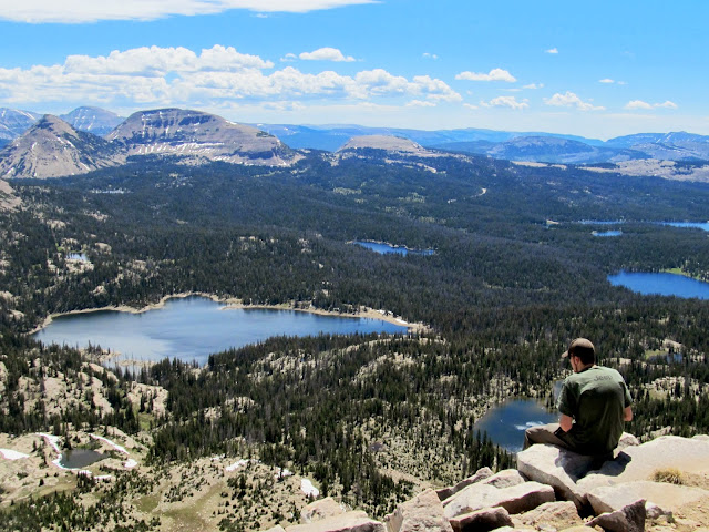
Chris enjoying the view from Mt. Watson summit
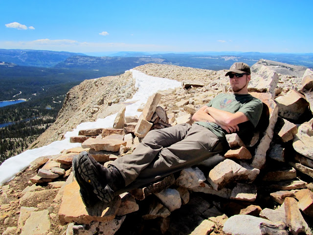
Rock recliner
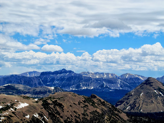
Lamotte, Hayden, and Ostler peaks all visible in the distance to the east
Chris glissading down the ridge
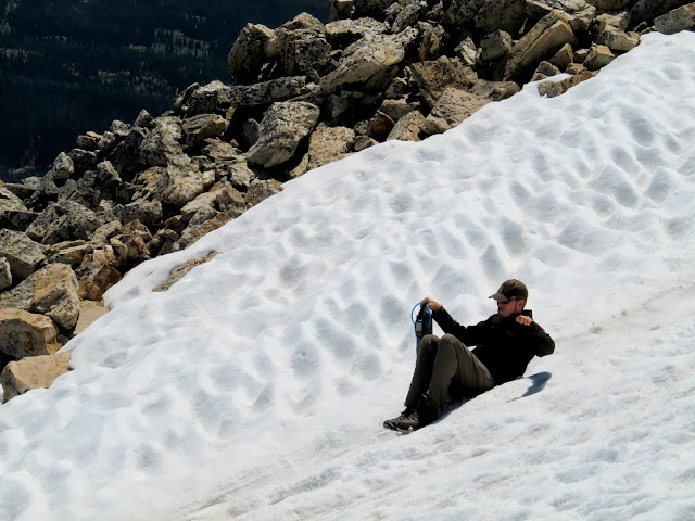
Chris glissading down the ridge
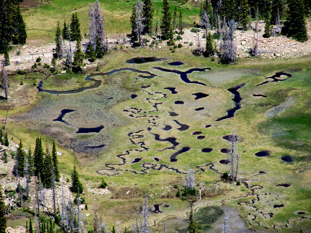
Marsh north of Mt. Watson
The northernmost of Twin Lakes
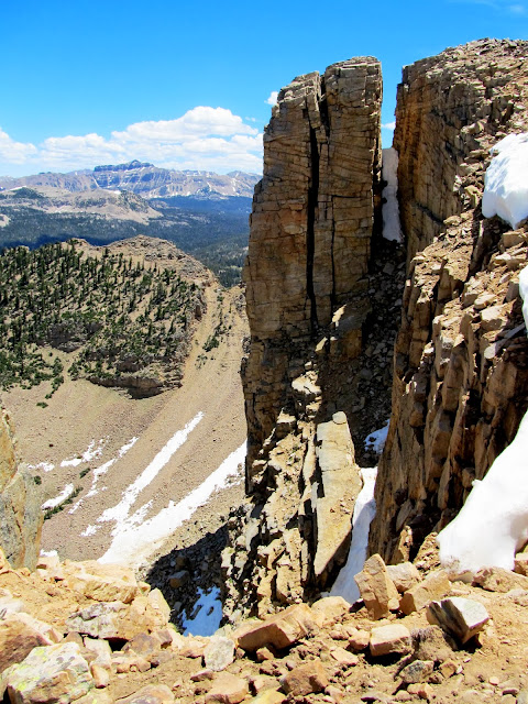
Climbing up to the Notch
Summit of the Notch
Mountain goat on the cliffs east of the Notch
Lovenia Lake
Unnamed lake below Lovenia
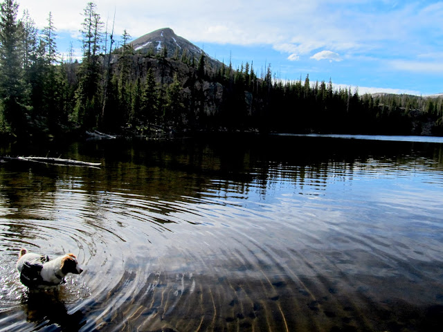
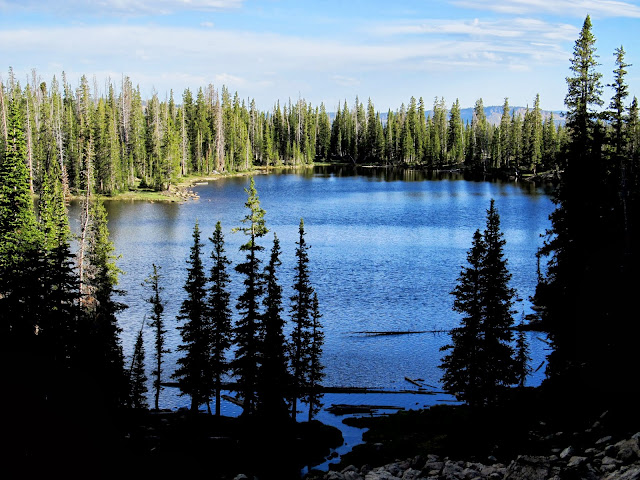
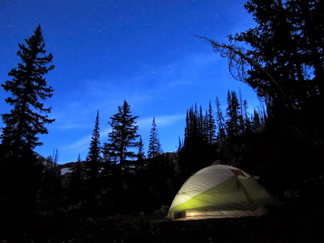
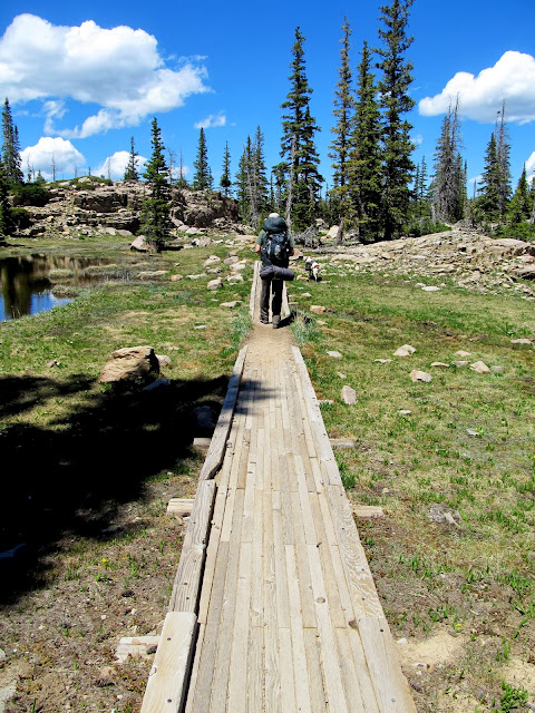
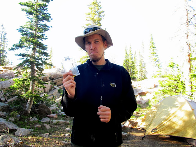
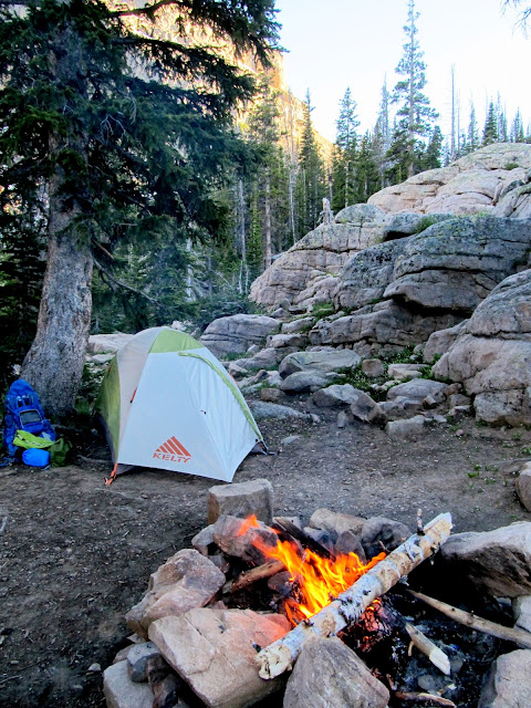
Our planned camp spot for the second night was at Ibantik Lake. The trail loses 500' of elevation in less than three-quarters of a mile between the Notch and Ibantik. It had me worried that our hike back out in the morning would be rough, but the descent was gradual enough that my worries were allayed as we hiked through mostly gentle terrain and a few switchbacks. There was one so-so camp spot immediately upon reaching Ibantik Lake, but after a circuit across the dam to the other side of the lake, we found all the good sites occupied. Discouraged to find so many people in the area, we found a place to camp away from the lake. It was grassy, flat, and sheltered by trees, but the view left much to be desired. The big plus was the snow drift remaining nearby where Chris and I each stashed a flask of liquor to chill. We lounged around a while, not wanting to set up camp too early. I walked away a short distance to relieve myself and noticed the group at one of the best sites on the lake leaving! Had I not had to go right then we'd have never known that a great spot to camp just opened up. We grabbed our packs and moved into the new digs, then returned to grab our flasks and a jacket full of snow to take to the new camp.
Walking the plank
On the spillway at Ibantik Lake
Flasks chilling in a pile of snow we carried to our camp
Setting up camp near Ibantik Lake
Chris is sad that one flask per person wasn't enough
Ibantik Lake
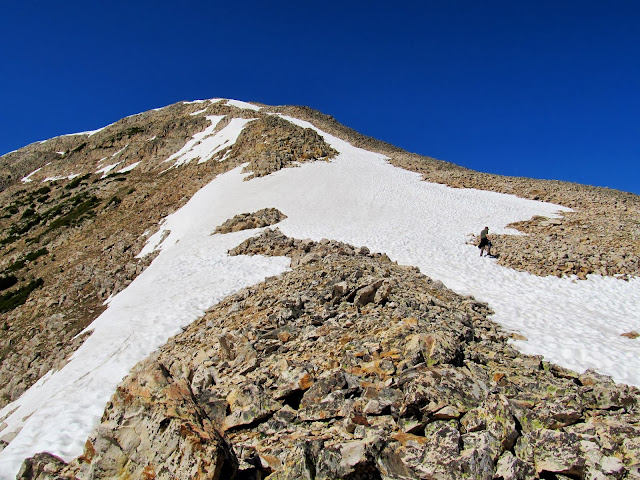
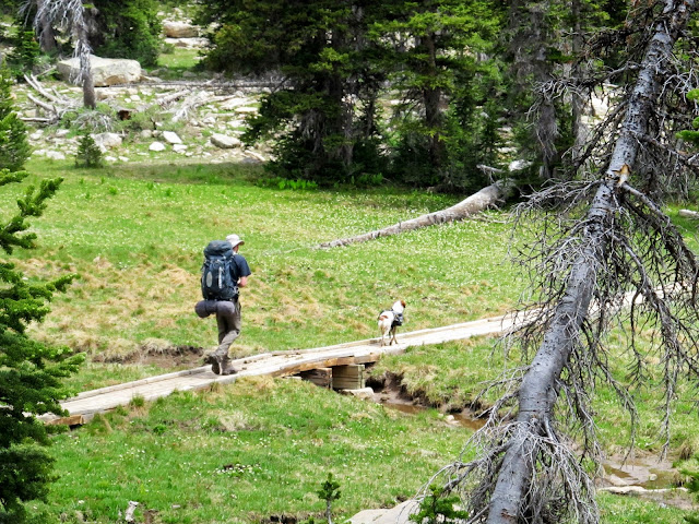
We set up camp while several groups passed through also looking for a place to camp. We selfishly tried to appear unwelcoming hoping to deter new neighbors from setting up in the spot 50' from us, but a couple and their two children did just that--we were nice after it was clear they were staying, though.") We had a fire and a drink, ate dinner, and went to bed relatively early once we were out of booze. Despite not overdoing it that evening, we slept in quite late on Sunday morning. It felt great. We packed up and hit the trail after 10:30, playing leapfrog with two other groups who were also hiking toward the Notch. Less than an hour after leaving camp we'd reached the saddle of the Notch, stashed our packs in the trees, and started the ugly boulder hop up East Notch Mountain.
We had a fire and a drink, ate dinner, and went to bed relatively early once we were out of booze. Despite not overdoing it that evening, we slept in quite late on Sunday morning. It felt great. We packed up and hit the trail after 10:30, playing leapfrog with two other groups who were also hiking toward the Notch. Less than an hour after leaving camp we'd reached the saddle of the Notch, stashed our packs in the trees, and started the ugly boulder hop up East Notch Mountain.
Tent and campfire
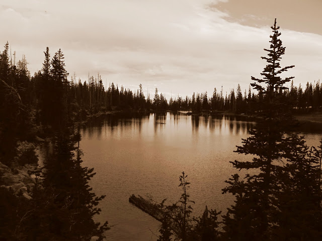
Ibantik Lake
Ibantik Lake reflection at sunset
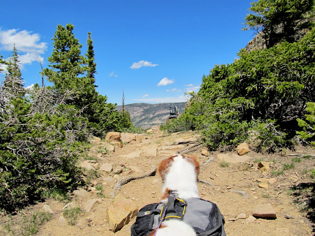
Chris and Torrey on the trail up to the Notch
The start of the ugly boulder ascent from the Notch to East Notch Mountain
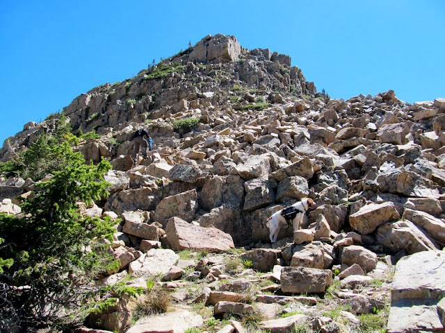
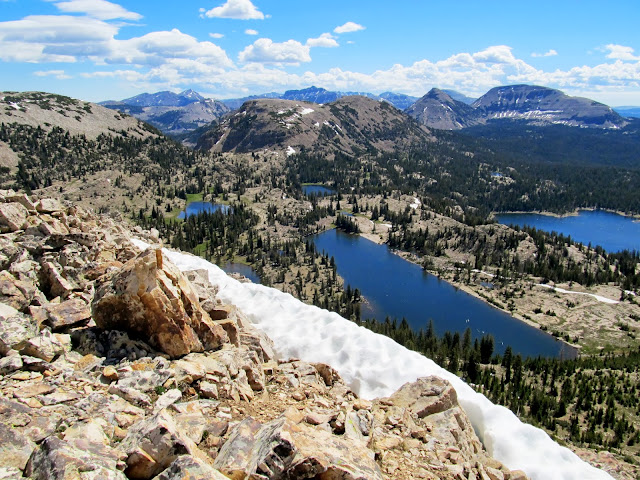
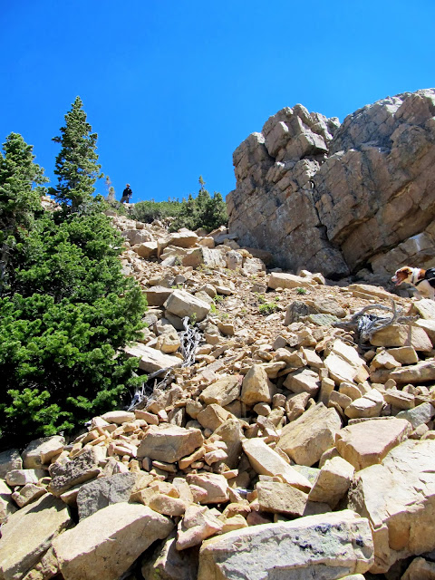
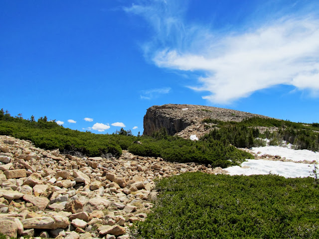
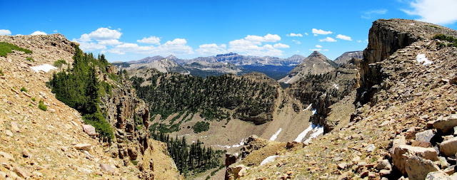
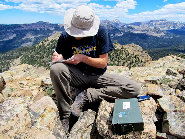
We skirted around the base of the cliffs on the southwest side of the mountain while looking for a break in the rock that would allow us to reach the more level ground above. The weakness in the cliffs that we found was difficult to scramble up. We briefly fought with loose soil and small, loose boulders until reaching safer ground. Above the cliffs we had fairly straightforward boulder hopping the rest of the way to the summit. The views were great but not quite comparable to those from Mt. Watson. We found the geocache at the summit and signed in, then attempted some Facebooking on our phones but despite a good signal we could barely send/receive any data. The descent went quickly, and surprisingly the steepest part seemed easier going down than it had going up.
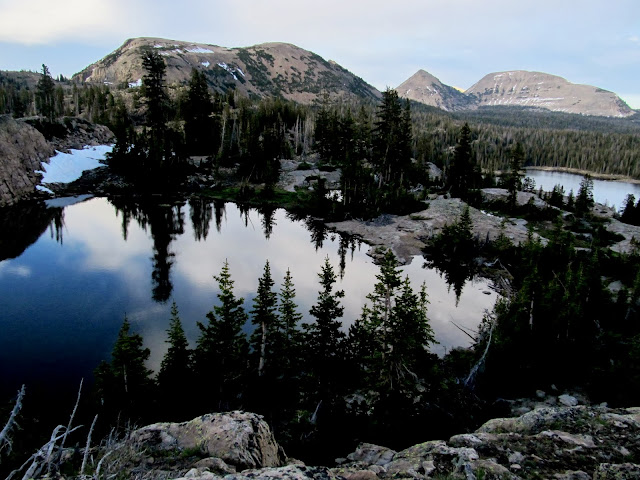
Trial Lake and Wall Lake viewed from East Notch Mountain
Steep, loose route through the cliffs to the ridge of East Notch Mountain
More boulder hopping
Panorama from East Notch Mountain
Approaching the saddle on East Notch Mountain
View northeast from East Notch Mountain saddle
Fractured cliffs
Ibantik Lake from East Notch Mountain

Chris signing the geocache log
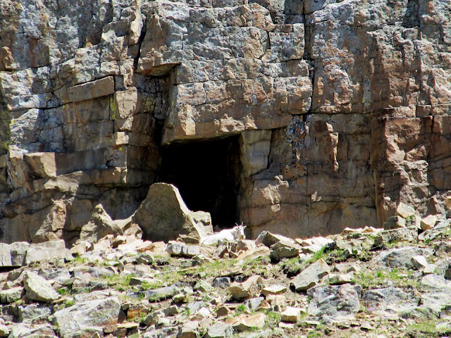
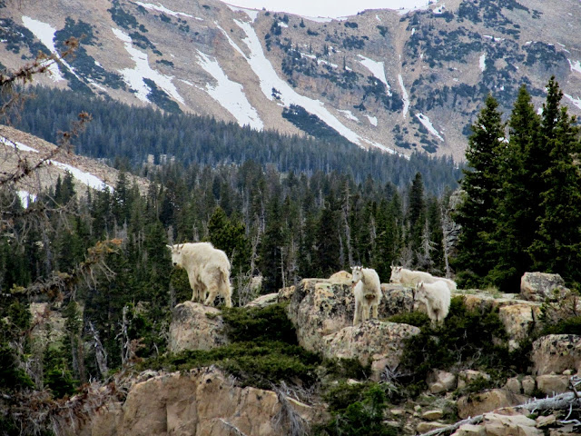
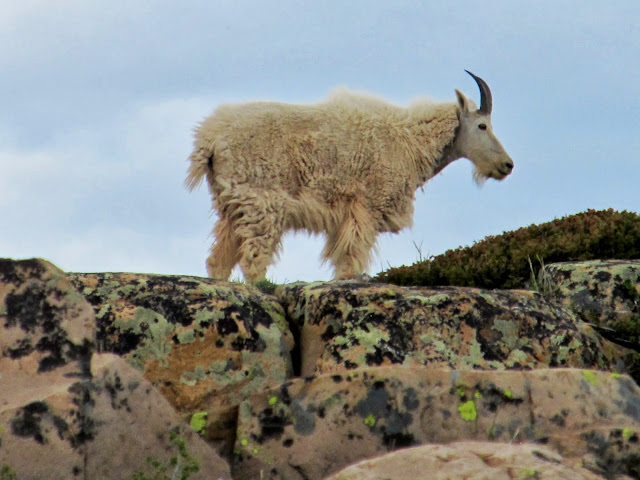
As we were retrieving our packs at the Notch we spotted the mountain goats again, this time just a short distance from the trail. There was a fair amount of traffic on the trail and soon there were almost a dozen onlookers. After taking a few photos, Chris and I were ready to start the hike back to the trailhead. We took a different route back than I'd taken in on Friday, and it was less scenic and more heavily-traveled. We passed several day-hikers, many of them with dogs, and saw a lot of people hanging out around Wall Lake. It took only 1.5 hours to get from the Notch to our vehicles--a seemingly short amount of time considering we'd been out for a couple of days and it felt to me like we were farther away from civilization. The mosquitoes at the trailhead were worse than they'd been at any other time during the trip. Chris and I visited a bit longer there before getting in our vehicles and parting ways.
Mountain goats at the Notch
Mountain goat at the Notch
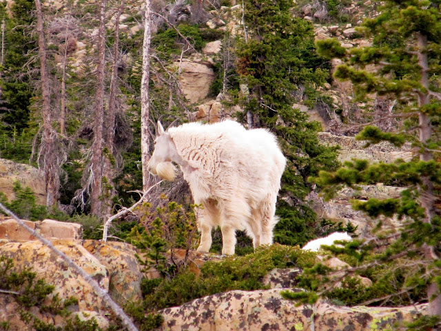
Mountain goat at the Notch
Boardwalk at Hope Lake
Hope Lake
Lily Lake
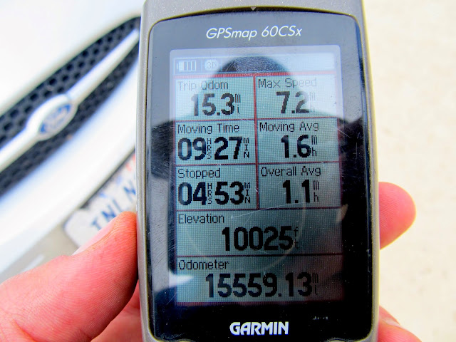
GPS stats back at the trailhead. Disappointed that I only got up to 7.2 mph on the glissade!
During the drive down the Mirror Lake Highway I saw a lot of cyclists hauling ass down the road--I find them kind of annoying but I'm fully accepting of their right to be there. However, one cyclist evoked quite a bit of joy when I saw him riding. Car traffic was slowing for an older gentleman riding a penny-farthing. Seriously! I threw him the shaka and he nodded back, as if to say, "I know." Yeah, he was a cool dude alright. Back at home that night as I was just falling asleep in bed, I was startled awake a couple of times by dreams of hopping on boulders that shifted under my weight. I'm sure that says something about my state of mind during the peak bagging portions of the trip, but the overarching thought in my head during the entire trip was that I need to take my family to this area and share it with them someday soon.
Full photo gallery:
https://picasaweb.google.com/Dennis.Udink/UintasNotchMountainArea
Featured image for home page:

Signed junction to Cliff Lake
Climbing up to Cliff Lake
Cliff Lake and Mt. Watson
Cliff Lake
Mosquitoes over Petit Lake
Petit Lake reflection
Watson Lake
As I approached Clyde Lake the views became more grand as the sun sunk low in the sky. I almost set up camp on the shore of Clyde but the "No Camping" signs scared me off. Instead I pitched the tent in a small meadow next to a tiny stream between Clyde Lake and Twin Lakes. I was a third of a mile from where I'd told Chris to look for me. Cell service was flaky and I wasn't sure the text with my new coordinates had gotten out to him but I hoped he'd find me. If not, I was sure we'd meet up in the morning. Despite not having eaten since lunch eight hours earlier, I wasn't hungry. I still forced myself to boil some water and eat some rehydrated chili-mac which I shared with Torrey. The sunset was more delicious than dinner, with some beautiful low-angle light striking East Notch Mountain and cotton-candy pinks and purples in the clouds. I hit the sack at 10:30 and was awakened only an hour later by Chris. I crawled out of bed to greet him and chat while he set up camp, then we both got some sleep.
Pond below Clyde Lake, with East Notch Mountain, Reid's Peak, and Bald Mountain in the background
Clyde Lake and East Notch Mountain
Glacier-honed rock at Clyde Lake
Pink clouds
Sunset on East Notch Mountain
Sunset from camp
My tent in a meadow between Clyde Lake and Twin Lakes
With an easy schedule for the day we were in no hurry to get moving on Saturday morning. We'd packed up camp and stashed our backpacks in some thick trees and hit the trail at 9:40. I purchased a lightweight day pack specifically to use on this trip since we'd be summiting two mountain peaks, and it proved to be invaluable. I threw two 1-L Nalgenes, some snacks, extra batteries, and some ibuprofen in the pack and clipped my GPS and camera to the sternum and waist straps. It sure beat carrying a water bottle and a granola bar! On the approach to Watson we scouted and planned a route up the northeast ridge and it worked out perfectly. We first hiked up a well-consolidated but steep, rocky slope to the ridge, kicking through a small snow drift just before reaching the top of the ridge. From then on it was a boulder hop to the summit with a couple of snow crossings. Chris, as usual, was well ahead of me for most of the hike. Torrey and I reached the summit and Chris was nowhere to be found. I approached the small summit shelter and found him nodding off comfortably in the pile of rocks.
Starting our dayhike to the summit of Mt. Watson
Approaching the base of Mt. Watson
Two backpackers at the pond below Clyde Lake
Torrey almost to the ridge
On the northeast ridge of Mt. Watson
View from the ridge toward Clyde Lake
View down the northeast ridge of Mt. Watson
Pretty purple flowers
Torrey getting a drink
The view from the top--THE VIEW!--was incredible. We could see deep blue lakes in almost every direction, plus many other high Uinta peaks to the east. We spent some time searching for a summit register or survey marker but found neither. Chris wanted to glissade down the snow field but I was hesitant to follow him. Never having done it before, I wasn't certain I'd be able to stop myself upon reaching the rocks at the bottom. After watching Chris slide down uneventfully, I went for it. It was a lot of fun and even Torrey tried joining in by running alongside me playfully. After picking up our packs we hiked cross-country until we picked up the trail just south of the Notch. After a couple of switchbacks and crossing a short run of snow we were at the summit of the Notch, which divides Notch Mountain in two. @Nick had told me to watch out for mountain goats there, and without even looking I spotted some movement in the cliffs above and east of the Notch. The goats were bedded down high up and far away so I couldn't get a decent photo. After the trail began its descent north of the Notch we were treated to a nice view of Lovenia Lake and another unnamed lake below it.
Chris enjoying the view from Mt. Watson summit
Rock recliner
Lamotte, Hayden, and Ostler peaks all visible in the distance to the east
Chris glissading down the ridge
Chris glissading down the ridge
Marsh north of Mt. Watson
The northernmost of Twin Lakes
Climbing up to the Notch
Summit of the Notch
Mountain goat on the cliffs east of the Notch
Lovenia Lake
Unnamed lake below Lovenia
Our planned camp spot for the second night was at Ibantik Lake. The trail loses 500' of elevation in less than three-quarters of a mile between the Notch and Ibantik. It had me worried that our hike back out in the morning would be rough, but the descent was gradual enough that my worries were allayed as we hiked through mostly gentle terrain and a few switchbacks. There was one so-so camp spot immediately upon reaching Ibantik Lake, but after a circuit across the dam to the other side of the lake, we found all the good sites occupied. Discouraged to find so many people in the area, we found a place to camp away from the lake. It was grassy, flat, and sheltered by trees, but the view left much to be desired. The big plus was the snow drift remaining nearby where Chris and I each stashed a flask of liquor to chill. We lounged around a while, not wanting to set up camp too early. I walked away a short distance to relieve myself and noticed the group at one of the best sites on the lake leaving! Had I not had to go right then we'd have never known that a great spot to camp just opened up. We grabbed our packs and moved into the new digs, then returned to grab our flasks and a jacket full of snow to take to the new camp.
Walking the plank
On the spillway at Ibantik Lake
Flasks chilling in a pile of snow we carried to our camp
Setting up camp near Ibantik Lake
Chris is sad that one flask per person wasn't enough
Ibantik Lake
We set up camp while several groups passed through also looking for a place to camp. We selfishly tried to appear unwelcoming hoping to deter new neighbors from setting up in the spot 50' from us, but a couple and their two children did just that--we were nice after it was clear they were staying, though.
We had a fire and a drink, ate dinner, and went to bed relatively early once we were out of booze. Despite not overdoing it that evening, we slept in quite late on Sunday morning. It felt great. We packed up and hit the trail after 10:30, playing leapfrog with two other groups who were also hiking toward the Notch. Less than an hour after leaving camp we'd reached the saddle of the Notch, stashed our packs in the trees, and started the ugly boulder hop up East Notch Mountain.Tent and campfire
Ibantik Lake
Ibantik Lake reflection at sunset
Chris and Torrey on the trail up to the Notch
The start of the ugly boulder ascent from the Notch to East Notch Mountain
We skirted around the base of the cliffs on the southwest side of the mountain while looking for a break in the rock that would allow us to reach the more level ground above. The weakness in the cliffs that we found was difficult to scramble up. We briefly fought with loose soil and small, loose boulders until reaching safer ground. Above the cliffs we had fairly straightforward boulder hopping the rest of the way to the summit. The views were great but not quite comparable to those from Mt. Watson. We found the geocache at the summit and signed in, then attempted some Facebooking on our phones but despite a good signal we could barely send/receive any data. The descent went quickly, and surprisingly the steepest part seemed easier going down than it had going up.
Trial Lake and Wall Lake viewed from East Notch Mountain
Steep, loose route through the cliffs to the ridge of East Notch Mountain
More boulder hopping
Panorama from East Notch Mountain
Approaching the saddle on East Notch Mountain
View northeast from East Notch Mountain saddle
Fractured cliffs
Ibantik Lake from East Notch Mountain
Chris signing the geocache log
As we were retrieving our packs at the Notch we spotted the mountain goats again, this time just a short distance from the trail. There was a fair amount of traffic on the trail and soon there were almost a dozen onlookers. After taking a few photos, Chris and I were ready to start the hike back to the trailhead. We took a different route back than I'd taken in on Friday, and it was less scenic and more heavily-traveled. We passed several day-hikers, many of them with dogs, and saw a lot of people hanging out around Wall Lake. It took only 1.5 hours to get from the Notch to our vehicles--a seemingly short amount of time considering we'd been out for a couple of days and it felt to me like we were farther away from civilization. The mosquitoes at the trailhead were worse than they'd been at any other time during the trip. Chris and I visited a bit longer there before getting in our vehicles and parting ways.
Mountain goats at the Notch
Mountain goat at the Notch
Mountain goat at the Notch
Boardwalk at Hope Lake
Hope Lake
Lily Lake
GPS stats back at the trailhead. Disappointed that I only got up to 7.2 mph on the glissade!
During the drive down the Mirror Lake Highway I saw a lot of cyclists hauling ass down the road--I find them kind of annoying but I'm fully accepting of their right to be there. However, one cyclist evoked quite a bit of joy when I saw him riding. Car traffic was slowing for an older gentleman riding a penny-farthing. Seriously! I threw him the shaka and he nodded back, as if to say, "I know." Yeah, he was a cool dude alright. Back at home that night as I was just falling asleep in bed, I was startled awake a couple of times by dreams of hopping on boulders that shifted under my weight. I'm sure that says something about my state of mind during the peak bagging portions of the trip, but the overarching thought in my head during the entire trip was that I need to take my family to this area and share it with them someday soon.
Full photo gallery:
https://picasaweb.google.com/Dennis.Udink/UintasNotchMountainArea
Featured image for home page:
