- Joined
- Aug 9, 2007
- Messages
- 12,959
Well look at this. I'm posting my trip report the same day of the trip this time! It's really nice to get out on a backpacking trip Friday night and then still have most of the weekend to relax and post photos to backcountrypost. 
This trip started out all over the place. I had dreams of splitboarding up to Bald Mountain Pass and camping on snow but that's logistically tricky, so on the day we left, we started thinking we would just hike a mile or two up one of the lower trails, backpack a night, then the next morning drive up and splitboard to the pass without overnight packs. So on Friday afternoon, with a wide variety of gear loaded in the truck, we set out for the Uintas.
We still didn't know exactly where we were going even as we drove east. We decided along the way that we would give the North Fork Provo River trail a try. I backpacked it last year in June when the snow was still deep up high and the rivers were much more swollen with runoff but we had screwed up and backpacked up the wrong side of the river. Last year, we parked at the highway and hiked on the west side, past the Boulder Creek Yurt. In reality, the North Fork Trail starts on the east side of the river and a couple miles up a nasty 4WD road. In fact, I realized on this trip that our eventual camp site for the last trip was directly across the river from the trailhead we started at this time.
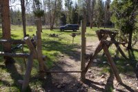
After negotiating the extremely rough North Fork road, we made it to the trailhead and were on our way by about 4pm. There is a huge corral around the entire trailhead area to keep ATVs from continuing up the canyon. Sad that they have to put up such a huge obstacle to keep people from being idiots.
There were so many beaver dams along the trail. Some huge like this, others small. More beaver dams in one area than I've ever seen.
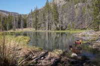
Beaver home
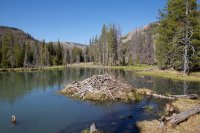
Nikita stopped and inspected every single dam for fish to catch.
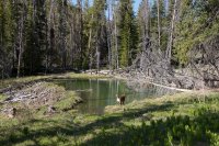
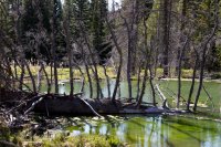
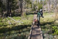
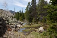
The North Fork Provo was flowing swift but nothing like last year
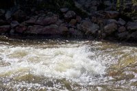
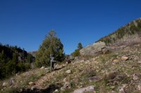
After about 1.3 miles, the trail crosses the river. We could have made the crossing but it would have been sketchy and no way of staying dry. Whether the dogs could have made it was another story. So instead we chose to follow a narrow trail that had developed on the same side of the river.
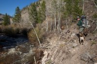
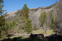
We followed that faint trail for a while until it petered out and we just started walking where ever our feet took us. Soon we were finally on a wide bench below a scree slope. Once again, beaver dams everywhere.
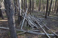
Further up the canyon we fond ourselves walking in and out of thick stands of pine trees. I found this lean to that someone had made in one of them. Surprising as their was not even a resemblance of a trail in the area.
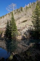
Looking down at the North Fork Provo where two forks come back together.
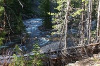
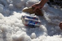
After a little over 3 miles of hiking, we found a sweet campsite up on the bench, out of the thick trees and next to a big scree slope. We had been hoping to find something with a little bit of snow to chill the beer in.
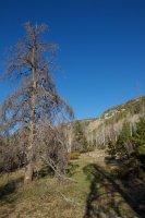
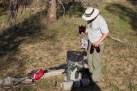
This is not how you backpack ultralight!
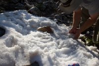
PBR+Snow+backpacking=AWESOME
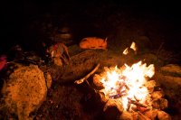
The pups around the fire that night. It was a clear night but I just wasn't motivated to shoot stars. Not much of a foreground I guess.
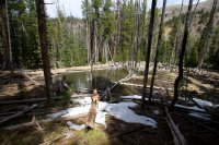
We were up until 2:30 finishing off our hard-earned beers and enjoying the fire so we were slow to get going the next morning. We decided to take a slightly different route through the forest. We ended up finding a lot more snow and of course, beaver dams. Side note, we also found a fair amount of bear scat. This was around 8200 feet, we only saw a few patches of snow like this.
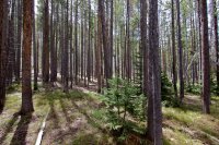
It was so nice to walk through this canyon with no trail. Some scrambling around fallen trees and rocks but for the most part it was like walking in a park.
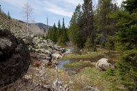
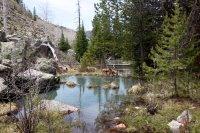
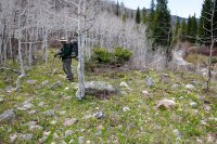
Lots of flowers and butterflies but still no leaves on the aspens until we were closer to the trailhead.
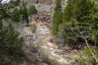
We ended up staying much higher on the way back then we did on the way up. In this photo you can see the river crossing we decided against and where we traversed the river through that bend.
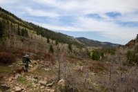
Back at the trailhead.
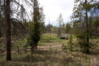
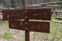
It would be fun to take this trail to the Marjorie/Duck Lake area, or maybe better, take it down from there to here.
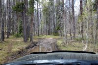
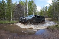
I didn't get any photos of the road on the way in, so here are a couple on the way out. I didn't get any of the massive rocks and roughness.
Great to be backpacking in the Uintas so early. Here's to an awesome season of backpacking in them.
Featured image for slideshow:
This trip started out all over the place. I had dreams of splitboarding up to Bald Mountain Pass and camping on snow but that's logistically tricky, so on the day we left, we started thinking we would just hike a mile or two up one of the lower trails, backpack a night, then the next morning drive up and splitboard to the pass without overnight packs. So on Friday afternoon, with a wide variety of gear loaded in the truck, we set out for the Uintas.
We still didn't know exactly where we were going even as we drove east. We decided along the way that we would give the North Fork Provo River trail a try. I backpacked it last year in June when the snow was still deep up high and the rivers were much more swollen with runoff but we had screwed up and backpacked up the wrong side of the river. Last year, we parked at the highway and hiked on the west side, past the Boulder Creek Yurt. In reality, the North Fork Trail starts on the east side of the river and a couple miles up a nasty 4WD road. In fact, I realized on this trip that our eventual camp site for the last trip was directly across the river from the trailhead we started at this time.
After negotiating the extremely rough North Fork road, we made it to the trailhead and were on our way by about 4pm. There is a huge corral around the entire trailhead area to keep ATVs from continuing up the canyon. Sad that they have to put up such a huge obstacle to keep people from being idiots.


There were so many beaver dams along the trail. Some huge like this, others small. More beaver dams in one area than I've ever seen.

Beaver home

Nikita stopped and inspected every single dam for fish to catch.


The North Fork Provo was flowing swift but nothing like last year


After about 1.3 miles, the trail crosses the river. We could have made the crossing but it would have been sketchy and no way of staying dry. Whether the dogs could have made it was another story. So instead we chose to follow a narrow trail that had developed on the same side of the river.

We followed that faint trail for a while until it petered out and we just started walking where ever our feet took us. Soon we were finally on a wide bench below a scree slope. Once again, beaver dams everywhere.

Further up the canyon we fond ourselves walking in and out of thick stands of pine trees. I found this lean to that someone had made in one of them. Surprising as their was not even a resemblance of a trail in the area.

Looking down at the North Fork Provo where two forks come back together.

After a little over 3 miles of hiking, we found a sweet campsite up on the bench, out of the thick trees and next to a big scree slope. We had been hoping to find something with a little bit of snow to chill the beer in.

This is not how you backpack ultralight!

PBR+Snow+backpacking=AWESOME


The pups around the fire that night. It was a clear night but I just wasn't motivated to shoot stars. Not much of a foreground I guess.

We were up until 2:30 finishing off our hard-earned beers and enjoying the fire so we were slow to get going the next morning. We decided to take a slightly different route through the forest. We ended up finding a lot more snow and of course, beaver dams. Side note, we also found a fair amount of bear scat. This was around 8200 feet, we only saw a few patches of snow like this.

It was so nice to walk through this canyon with no trail. Some scrambling around fallen trees and rocks but for the most part it was like walking in a park.


Lots of flowers and butterflies but still no leaves on the aspens until we were closer to the trailhead.

We ended up staying much higher on the way back then we did on the way up. In this photo you can see the river crossing we decided against and where we traversed the river through that bend.


Back at the trailhead.

It would be fun to take this trail to the Marjorie/Duck Lake area, or maybe better, take it down from there to here.

I didn't get any photos of the road on the way in, so here are a couple on the way out. I didn't get any of the massive rocks and roughness.


Great to be backpacking in the Uintas so early. Here's to an awesome season of backpacking in them.
Featured image for slideshow:

