ridings82
Member
- Joined
- Feb 2, 2017
- Messages
- 38
Nothing like a COVID-19 pandemic to give you the time to write up some long overdue trip reports. I've gotten so many great ideas, timely conditions reports, and ogled over enough pictures, that it's time to give back. While putting this together, I'm reminded about how far cell phone cameras have come in just a few years. Most of these shots are with the iPhone 6s. In the Summer of 2016, I fulfilled a decade long dream and backpacked the Highline Trail from Mirror Lake to Hacking Lake. In what has now turned into an annual backpacking ritual, I returned to the Uintas in 2017 for another weeklong trip. The logistics of a point-to-point hike like the Highline are a bit of a pain, so my hiking partner and I were looking for a loop. We didn't mind repeating some of the 2016 trek but wanted to see new things.
While we had a slightly different itinerary heading into the hike, we one major modification in-the-moment when we abandon the Highline and took went over the pass by between Lambert Meadow and Red Castle Lake. This was far and away, the best real-time itinerary change I've ever made on a long trek. Most of what we skipped were parts of the Highline we had already seen but the view from the top of that pass was simply divine. The route and hike I describe will be what we actually took.
Summary:
Day 0: Car camping at East Fork Blacks Fork to get an early start on the day.
Day 1: East Fork Blacks Fork over Red Knob Pass to Deadhorse Lake; 17.5 miles
Day 2: Deadhorse Lake to Ledge Lake (set up camp) and loop part of the Jack and Jill around Lightning Lake; 15.5 miles
Day 3: Ledge Lake through Squaw Basin to Cleveland Pass; 12 miles
Day 4: Cleveland Pass to Lambert Meadow before Squaw Pass and Porcupine Pass; 13.5 miles
Day 5: Lambert Meadow to Lower Red Castle Lake over an unnamed pass; 11 miles
Day 6: Lower Red Castle Lake to East Forks Black Fork to complete the loop; 11 miles
Total distance over 6 days and 5 nights: ~ 80 miles
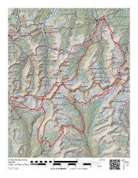
Caltopo map is below and hyperlinked here
Day 0:
Day zero is all about preparation. For me, that involves packing the beastly cooler I have that keeps ice for at least a week with several ice blocks, a 12-pack of beer for when we get off the trail, some fresh food that keeps well for a week like kielbasa, and some items for dinner and breakfast. Our destination is the campground at East Fork Blacks Fork. I drive a two-door Wrangler and it LOVES the dirt roads of the Unitas. We made decent time getting to camp and found that the campground was maybe 30% full. Plenty of spots to be had. We set up camp, saw a Moose from a distance, had dinner, and enjoyed a campfire.
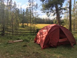
Campsite at East Fork Blacksfork Campground (Moose was in the field behind the tent).
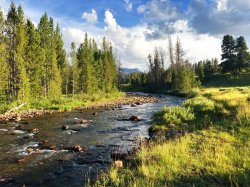
East Fork Blacks Fork River
Day 1:
The day begins with a hearty breakfast and the last fresh coffee we'll have for a week. We pack up camp and relocate the Jeep to the trailhead parking lot. One of my favorite parts about the Uintas is that you never need to carry more than 1-2 liters of water at any given time. The only time I've found myself using a second Nalgene is over a pass at high noon or when I'm settled into camp for the night. Our destination for the first day is extremely aggressive - over 17 miles to Deadhorse Lake. When we hiked passed Deadhorse Lake the year before we made the mental note that we wanted to camp there. While a few miles further than we'd like, Deadhorse is worth it.
The hike up the basin is stunning. West Fork gets most of the attention, and rightfully so, but the East Fork didn't disappoint. As we approached Red Knob Pass, the weather closed in on us in a hurry. Big winds and hail greeted us about halfway up the pass. While not uncommon in the Uintas, it was one of those storms that are so fast and brutal, you're too in awe of mother nature to be upset. The view from Red Knob is outstanding, and coming from the East Fork gives you an additional basin to peer into that you miss entirely when on the Highline. It feels like Deadhorse should come up quickly from the bottom of Red Knob, but on tired legs, with packs at their maximum weight with a week's worth of food, miles 16 and 17 drag on a bit. As we hit Deadhorse Lake, we're greeted by one couple and their dog, but the rest of the lake was deserted, and finding our distance was easy. I drop the fishing pole into the lake and enjoy the sun setting over the Deadhorse cliff bands. Simply spectacular.
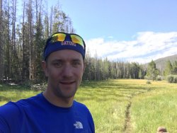
Starting off the hike, as clean and fresh as I'll look for the next 7 days.
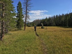
Navigating the East Fork basin.
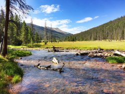
East Fork Blacks Fork River early in the day.
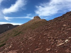
Looking up at Red Knob, the namesake for Red Knob Pass.
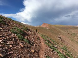
Navigating the long descent from Red Knob Pass.
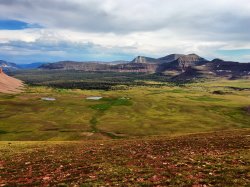
Looking toward Lambert Meadow (in the far far distance) and the rest of the Highline Trail. We'll meet up again with this portion of the trail in a few days but from the basin on the right-hand side of the picture.
Day 2:
This was a day I was looking forward to from the moment I sketched out the hike. We'd make the early morning and fresh legs climb over Deadhorse Pass and set up camp at Ledge Lake on the other side. By leaving our sleeping bags/pad, tent, and extra food (properly secured) behind, our packs would be light as a feather. The goal from there was to day hike parts of the Jack and Jill Trail, which the Highline embarrassingly skips over. The section of the HT that runs adjacent to the Jack and Jill isn't nearly as nice. We had a mostly overcast hike around the lakes but were fortunate that the sun came out for a brief minute right at Lightning Lake. This lake was beautiful. I'd love to camp there someday. From there, we took the trail towards Ouray Lake and the Jack and Jill Lakes. We lost the trail between Ouray and Jack and Jill Lakes and were forced to navigate by map and GPS until we hit Jill Lake. The fortunate part about a Lake being your destination is that they're hard to miss and trails that circumnavigate lakes are easy to find. A snack, some fast fishing at Jill Lake, and we set off back to Ledge Lake to eat some dinner and complete Day 2.
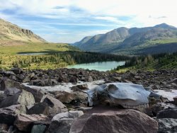
The prophetic horse skull heading up the backside of Deadhorse Pass. Deadhorse Lake is in the middle.
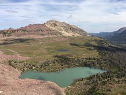
Deadhorse Lake from Deadhorse Pass.
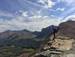
Enjoying the morning sun and view off of Deadhorse Pass.
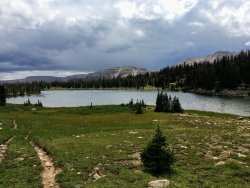
Lightning Lake.
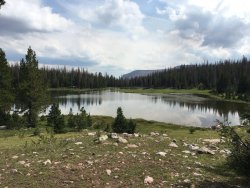
Ouray Lake.
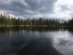
Clouds roll in over Jill Lake.
Day 3:
Today's hike would divert us from the Highline as we would head towards Squaw Basin and ultimately up to Cleveland Pass. I had done a solo trip in Brown Duck Basin over the 4th of July and loved the set up of Cleveland Pass and Cleveland Lake. Low and open with just enough shelter from the wind to make camp, and most importantly, I knew there wouldn't be a soul up there. We saw one set of hikers on Day 2 and would only see one set on Day 3. It's hard to imagine that these trails show the human impact of hiking and maintenance but how you can easily lose all of the other hikers in the vastness of the Uintas. The Ledge Lake Trail took us from camp directly into Squaw Basin. There are a number of small lakes right off the trail that provided easy resting places, fresh drinks, and great photo opportunities. At Squaw Lake, we rested and ate lunch. The sun was out, the scenery was impeccable, and it was hard not to leave. As an aside, we packed the RIE Flexlite Chairs for the first time this year, and since then, I've never taken a trip without it. We departed Squaw mid-afternoon and ascended Cleveland Pass. It's a gradual climb and only the last part of that pass shows any steepness. As you climb, the snowmelt off nearby Cleveland Peak and Squaw Peak take on paths of their own. It's a reminder that water always finds a way. I tried my luck fishing in Cleveland Lake, lost a lure, and didn't feel a nibble. The lake looks shallow, it's never been listed but the state of Utah as one they've stocked, and I wouldn't be surprised if it freezes all the way through in the winter.
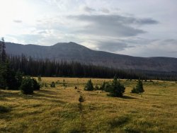
Slicing through a meadow along the Ledge Lake Trail heading towards Phinney and Anderson Lakes.
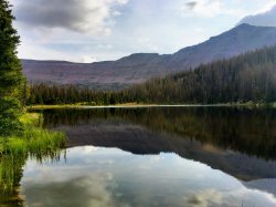
Anderson Lake provides a great reflection. The shot is looking north.
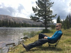
Relaxing at Squaw Lake.
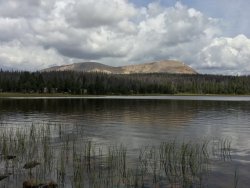
Our destination that evening. Cleveland Peak perched above Squaw lake with Cleveland Pass off to the right.
Day 4:
We awoke to a chilly morning with frost covering our tent and the meadow surrounding Cleveland Pass. It had been a little stormy the night before but the morning would bring us full sunshine to help us warm-up and an extremely still and reflective Cleveland Lake. The hike today would break up into three sections. Descending Cleveland Pass along the Ottoson Creek, turning north and hiking along the Lake Fork River, and then intersecting with the Highline Trail on the east side of Red Knob Pass. Our goal was to make it into Lambert Meadow before the trees completely thin out. From our experience the year prior, there are a number of creeks that cross the Highline in this area, finding one nearby would be ideal. The junction at Lake Fork would take us all the way down to 9300 ft and which means the hike up towards Lambert is slowly uphill. The crossing at Lake Fork is one of the few legitimate bridges that you'll find in the Uintas. We were glad it was there. Once you hit the junction for the Highline, the walk heading into Lambert is one that I enjoy. The trail is surrounded by giant mountains and dotted with reflective lakes. As the forest turns to shrubs, and the shrubs thin out, we make camp.
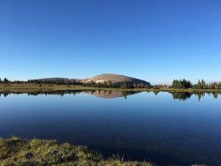
It doesn't look it, but it's about 35 degrees and not a cloud in the sky. Cleveland Peak reflects perfectly into Cleveland Lake.
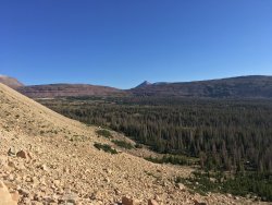
Descending Cleveland Pass looking towards Ottoson Basin. If only Ottoson had trail access; it looks amazing.
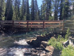
The newish looking bridge crossing the Lake Fork River.
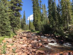
About halfway between the two trail junctions along the Lake Fork River. This section of the hike stays near the river which is a change of pace from the typically expansive views the Uintas offers.
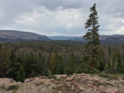
A ledge that overlooks Lambert Lake (can only see clearing). A year earlier we side hiked down to Lambert Lake. It always bothered me that the Highline comes within a few hundred yards of this lake but you'd never know if you're not using your map.
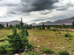
The trees begin to thin out heading into Lambert Meadow. Time to make camp.
Day 5:
Today would be the day we'd call an audible for the ages. Our original plan was to cross over Porcupine Pass and head towards the Five Lakes Region. From there, we planned to cross over Smith-Fork pass on Day 6, camp just on the other side, and hike out on Day 7. Our change wasn't because we wanted to end the trip a day early but for three reasons. First, we had already been up Porcupine Pass and hiked along this section of the Highline. Secondly, the hike towards Smith-Fork looked a lot like Lake Fork, a slow slog. And third, as we planned this hike, we had a few itineraries that took us towards Red Castle, but the mileage on the final day was too much to include it in there. Through this site, I've read that you can cross the unnamed pass between Lambert Meadow and Upper Red Castle Lake. That would be our plan. For those wondering about this as an option, it is entirely doable.
The hike up the pass is pretty straight forward. There are a few random cairns but it's pretty straight forward, not very steep, and mostly a choose your own adventure. When you arrive at the top, you are greeted with one of the best views that the Unitas has to offer - Red Castle, her colors, and adjacent lakes, simply showing off (pictures below). We stopped for food, snapped pictures, and loitered for at least an hour just soaking in the view. The early part of the descent put us on a collision course with a massive herd of mountain goats. Lots of babies, several wanderers, and some concerned mama's. They kept their distance and quickly scurried off towards the steep cliff bands of Red Castle. Watching them navigate these cliffs is remarkable. The only tricky part of this off-trail adventure is the descent towards Red Castle. There are a series of cliff bands that you have to navigate around. Not cliff bands in the sense of hiking with a lot of exposure, but you're going down and you hit a dead end. The challenge is you can't really see more than a cliff band ahead to plan your route. As long as your patient and smart, this really isn't a big deal. I recommend veering north (your left) and trying to intersect the southern tip of Red Castle Lake vs. trying to intersect Upper Red Castle. Once you hit the lakes, there are plenty of hikers trails to take you where you want to go. I dropped my fishing pole into Red Castle and had some success. I watched Cutthroat after Cutthroat chase my spinner. The biggest problem I had was that these Cutthroat were HUGE and my spinner was meant for your typical small Uintas variety. It was clear that the depth of Red Castle Lake keeps these guys alive for years. The first one I caught swallowed the spinner so deep that I had to wait until the fish passed out to set him free as the spinner was lodged well past that set of sharp teeth. This area would be an angler's delight.
Lower Red Castle is really the only place to camp. It was busy but there are enough camping spots if you take the time to look. We found a great perch overlooking Red Castle and Lower Red Castle Lake. More sunshine and a few hours left in the day gave us a chance to relax and enjoy the view.
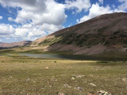
A large lake below Squaw Pass in Lambert Meadow.
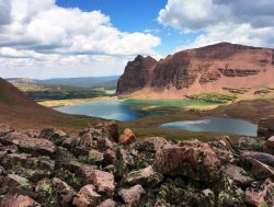
This is the first view you have when you ascend the unnamed pass. You can see all of Red Castle Lake, it's size, funny-looking shape, and great color from up high.
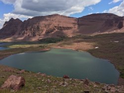
Upper Red Castle Lake.
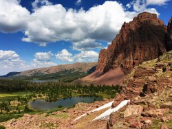
Looking toward Lower Red Castle Lake (background).
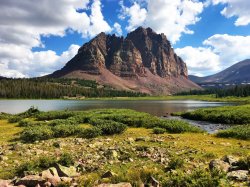
Lower Red Castle Lake being dwarfed by Red Castle.
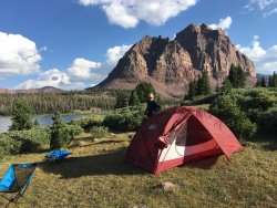
Our campsite for the evening. A three-minute walk to the shores of Lower Red Castle Lake.
Day 6:
We were tempted to spend another night at Red Castle. We had enough food to make it another day. Being so close to the Jeep, a cooler of cold beer, fresh food, and clean clothes, was too much to pass up. The hike out was interesting as the landscape changed several times. We hiked north along the Bald Mountain Trail but left the trail to ascend Bald Mountain. This is not the same Bald Mountain that's along Mirror Lake Highway, but a little nub on the top of a long and high plateau. The trail itself only cuts off the last few hundred vertical feet of the Mountain so it's worth climbing up. The Bald Mountain trail his a junction with the Bear Rivers Smith Fork Trail that heads towards the two Blacks Fork trailheads. The landscape there changes as you begin to pull away from the heart of the Uintas. The last few miles ascend down towards the campground. You can see if from far away but it's still several hours of hiking. But soon enough we arrive, and the beer cooler is a giant tease just begging to be opened. We sat in our chairs in the middle of the lower elevation sunshine. It was the warmest we've been in a week. Those cold beers went down easy.
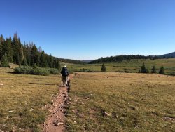
Leaving the Red Castle Basin.
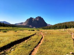
Looking back at Red Castle.
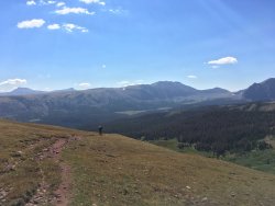
Along the Bald Mountain Ridge.
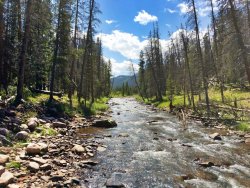
A sign we're finished, recrossing the East Fork Blacks Fork River. The Jeep is just a few hundred feet ahead.
While we had a slightly different itinerary heading into the hike, we one major modification in-the-moment when we abandon the Highline and took went over the pass by between Lambert Meadow and Red Castle Lake. This was far and away, the best real-time itinerary change I've ever made on a long trek. Most of what we skipped were parts of the Highline we had already seen but the view from the top of that pass was simply divine. The route and hike I describe will be what we actually took.
Summary:
Day 0: Car camping at East Fork Blacks Fork to get an early start on the day.
Day 1: East Fork Blacks Fork over Red Knob Pass to Deadhorse Lake; 17.5 miles
Day 2: Deadhorse Lake to Ledge Lake (set up camp) and loop part of the Jack and Jill around Lightning Lake; 15.5 miles
Day 3: Ledge Lake through Squaw Basin to Cleveland Pass; 12 miles
Day 4: Cleveland Pass to Lambert Meadow before Squaw Pass and Porcupine Pass; 13.5 miles
Day 5: Lambert Meadow to Lower Red Castle Lake over an unnamed pass; 11 miles
Day 6: Lower Red Castle Lake to East Forks Black Fork to complete the loop; 11 miles
Total distance over 6 days and 5 nights: ~ 80 miles
Caltopo map is below and hyperlinked here

Day 0:
Day zero is all about preparation. For me, that involves packing the beastly cooler I have that keeps ice for at least a week with several ice blocks, a 12-pack of beer for when we get off the trail, some fresh food that keeps well for a week like kielbasa, and some items for dinner and breakfast. Our destination is the campground at East Fork Blacks Fork. I drive a two-door Wrangler and it LOVES the dirt roads of the Unitas. We made decent time getting to camp and found that the campground was maybe 30% full. Plenty of spots to be had. We set up camp, saw a Moose from a distance, had dinner, and enjoyed a campfire.

Campsite at East Fork Blacksfork Campground (Moose was in the field behind the tent).

East Fork Blacks Fork River
Day 1:
The day begins with a hearty breakfast and the last fresh coffee we'll have for a week. We pack up camp and relocate the Jeep to the trailhead parking lot. One of my favorite parts about the Uintas is that you never need to carry more than 1-2 liters of water at any given time. The only time I've found myself using a second Nalgene is over a pass at high noon or when I'm settled into camp for the night. Our destination for the first day is extremely aggressive - over 17 miles to Deadhorse Lake. When we hiked passed Deadhorse Lake the year before we made the mental note that we wanted to camp there. While a few miles further than we'd like, Deadhorse is worth it.
The hike up the basin is stunning. West Fork gets most of the attention, and rightfully so, but the East Fork didn't disappoint. As we approached Red Knob Pass, the weather closed in on us in a hurry. Big winds and hail greeted us about halfway up the pass. While not uncommon in the Uintas, it was one of those storms that are so fast and brutal, you're too in awe of mother nature to be upset. The view from Red Knob is outstanding, and coming from the East Fork gives you an additional basin to peer into that you miss entirely when on the Highline. It feels like Deadhorse should come up quickly from the bottom of Red Knob, but on tired legs, with packs at their maximum weight with a week's worth of food, miles 16 and 17 drag on a bit. As we hit Deadhorse Lake, we're greeted by one couple and their dog, but the rest of the lake was deserted, and finding our distance was easy. I drop the fishing pole into the lake and enjoy the sun setting over the Deadhorse cliff bands. Simply spectacular.

Starting off the hike, as clean and fresh as I'll look for the next 7 days.

Navigating the East Fork basin.

East Fork Blacks Fork River early in the day.

Looking up at Red Knob, the namesake for Red Knob Pass.

Navigating the long descent from Red Knob Pass.

Looking toward Lambert Meadow (in the far far distance) and the rest of the Highline Trail. We'll meet up again with this portion of the trail in a few days but from the basin on the right-hand side of the picture.
Day 2:
This was a day I was looking forward to from the moment I sketched out the hike. We'd make the early morning and fresh legs climb over Deadhorse Pass and set up camp at Ledge Lake on the other side. By leaving our sleeping bags/pad, tent, and extra food (properly secured) behind, our packs would be light as a feather. The goal from there was to day hike parts of the Jack and Jill Trail, which the Highline embarrassingly skips over. The section of the HT that runs adjacent to the Jack and Jill isn't nearly as nice. We had a mostly overcast hike around the lakes but were fortunate that the sun came out for a brief minute right at Lightning Lake. This lake was beautiful. I'd love to camp there someday. From there, we took the trail towards Ouray Lake and the Jack and Jill Lakes. We lost the trail between Ouray and Jack and Jill Lakes and were forced to navigate by map and GPS until we hit Jill Lake. The fortunate part about a Lake being your destination is that they're hard to miss and trails that circumnavigate lakes are easy to find. A snack, some fast fishing at Jill Lake, and we set off back to Ledge Lake to eat some dinner and complete Day 2.

The prophetic horse skull heading up the backside of Deadhorse Pass. Deadhorse Lake is in the middle.

Deadhorse Lake from Deadhorse Pass.

Enjoying the morning sun and view off of Deadhorse Pass.

Lightning Lake.

Ouray Lake.

Clouds roll in over Jill Lake.
Day 3:
Today's hike would divert us from the Highline as we would head towards Squaw Basin and ultimately up to Cleveland Pass. I had done a solo trip in Brown Duck Basin over the 4th of July and loved the set up of Cleveland Pass and Cleveland Lake. Low and open with just enough shelter from the wind to make camp, and most importantly, I knew there wouldn't be a soul up there. We saw one set of hikers on Day 2 and would only see one set on Day 3. It's hard to imagine that these trails show the human impact of hiking and maintenance but how you can easily lose all of the other hikers in the vastness of the Uintas. The Ledge Lake Trail took us from camp directly into Squaw Basin. There are a number of small lakes right off the trail that provided easy resting places, fresh drinks, and great photo opportunities. At Squaw Lake, we rested and ate lunch. The sun was out, the scenery was impeccable, and it was hard not to leave. As an aside, we packed the RIE Flexlite Chairs for the first time this year, and since then, I've never taken a trip without it. We departed Squaw mid-afternoon and ascended Cleveland Pass. It's a gradual climb and only the last part of that pass shows any steepness. As you climb, the snowmelt off nearby Cleveland Peak and Squaw Peak take on paths of their own. It's a reminder that water always finds a way. I tried my luck fishing in Cleveland Lake, lost a lure, and didn't feel a nibble. The lake looks shallow, it's never been listed but the state of Utah as one they've stocked, and I wouldn't be surprised if it freezes all the way through in the winter.

Slicing through a meadow along the Ledge Lake Trail heading towards Phinney and Anderson Lakes.

Anderson Lake provides a great reflection. The shot is looking north.

Relaxing at Squaw Lake.

Our destination that evening. Cleveland Peak perched above Squaw lake with Cleveland Pass off to the right.
Day 4:
We awoke to a chilly morning with frost covering our tent and the meadow surrounding Cleveland Pass. It had been a little stormy the night before but the morning would bring us full sunshine to help us warm-up and an extremely still and reflective Cleveland Lake. The hike today would break up into three sections. Descending Cleveland Pass along the Ottoson Creek, turning north and hiking along the Lake Fork River, and then intersecting with the Highline Trail on the east side of Red Knob Pass. Our goal was to make it into Lambert Meadow before the trees completely thin out. From our experience the year prior, there are a number of creeks that cross the Highline in this area, finding one nearby would be ideal. The junction at Lake Fork would take us all the way down to 9300 ft and which means the hike up towards Lambert is slowly uphill. The crossing at Lake Fork is one of the few legitimate bridges that you'll find in the Uintas. We were glad it was there. Once you hit the junction for the Highline, the walk heading into Lambert is one that I enjoy. The trail is surrounded by giant mountains and dotted with reflective lakes. As the forest turns to shrubs, and the shrubs thin out, we make camp.

It doesn't look it, but it's about 35 degrees and not a cloud in the sky. Cleveland Peak reflects perfectly into Cleveland Lake.

Descending Cleveland Pass looking towards Ottoson Basin. If only Ottoson had trail access; it looks amazing.

The newish looking bridge crossing the Lake Fork River.

About halfway between the two trail junctions along the Lake Fork River. This section of the hike stays near the river which is a change of pace from the typically expansive views the Uintas offers.

A ledge that overlooks Lambert Lake (can only see clearing). A year earlier we side hiked down to Lambert Lake. It always bothered me that the Highline comes within a few hundred yards of this lake but you'd never know if you're not using your map.

The trees begin to thin out heading into Lambert Meadow. Time to make camp.
Day 5:
Today would be the day we'd call an audible for the ages. Our original plan was to cross over Porcupine Pass and head towards the Five Lakes Region. From there, we planned to cross over Smith-Fork pass on Day 6, camp just on the other side, and hike out on Day 7. Our change wasn't because we wanted to end the trip a day early but for three reasons. First, we had already been up Porcupine Pass and hiked along this section of the Highline. Secondly, the hike towards Smith-Fork looked a lot like Lake Fork, a slow slog. And third, as we planned this hike, we had a few itineraries that took us towards Red Castle, but the mileage on the final day was too much to include it in there. Through this site, I've read that you can cross the unnamed pass between Lambert Meadow and Upper Red Castle Lake. That would be our plan. For those wondering about this as an option, it is entirely doable.
The hike up the pass is pretty straight forward. There are a few random cairns but it's pretty straight forward, not very steep, and mostly a choose your own adventure. When you arrive at the top, you are greeted with one of the best views that the Unitas has to offer - Red Castle, her colors, and adjacent lakes, simply showing off (pictures below). We stopped for food, snapped pictures, and loitered for at least an hour just soaking in the view. The early part of the descent put us on a collision course with a massive herd of mountain goats. Lots of babies, several wanderers, and some concerned mama's. They kept their distance and quickly scurried off towards the steep cliff bands of Red Castle. Watching them navigate these cliffs is remarkable. The only tricky part of this off-trail adventure is the descent towards Red Castle. There are a series of cliff bands that you have to navigate around. Not cliff bands in the sense of hiking with a lot of exposure, but you're going down and you hit a dead end. The challenge is you can't really see more than a cliff band ahead to plan your route. As long as your patient and smart, this really isn't a big deal. I recommend veering north (your left) and trying to intersect the southern tip of Red Castle Lake vs. trying to intersect Upper Red Castle. Once you hit the lakes, there are plenty of hikers trails to take you where you want to go. I dropped my fishing pole into Red Castle and had some success. I watched Cutthroat after Cutthroat chase my spinner. The biggest problem I had was that these Cutthroat were HUGE and my spinner was meant for your typical small Uintas variety. It was clear that the depth of Red Castle Lake keeps these guys alive for years. The first one I caught swallowed the spinner so deep that I had to wait until the fish passed out to set him free as the spinner was lodged well past that set of sharp teeth. This area would be an angler's delight.
Lower Red Castle is really the only place to camp. It was busy but there are enough camping spots if you take the time to look. We found a great perch overlooking Red Castle and Lower Red Castle Lake. More sunshine and a few hours left in the day gave us a chance to relax and enjoy the view.

A large lake below Squaw Pass in Lambert Meadow.

This is the first view you have when you ascend the unnamed pass. You can see all of Red Castle Lake, it's size, funny-looking shape, and great color from up high.

Upper Red Castle Lake.

Looking toward Lower Red Castle Lake (background).

Lower Red Castle Lake being dwarfed by Red Castle.

Our campsite for the evening. A three-minute walk to the shores of Lower Red Castle Lake.
Day 6:
We were tempted to spend another night at Red Castle. We had enough food to make it another day. Being so close to the Jeep, a cooler of cold beer, fresh food, and clean clothes, was too much to pass up. The hike out was interesting as the landscape changed several times. We hiked north along the Bald Mountain Trail but left the trail to ascend Bald Mountain. This is not the same Bald Mountain that's along Mirror Lake Highway, but a little nub on the top of a long and high plateau. The trail itself only cuts off the last few hundred vertical feet of the Mountain so it's worth climbing up. The Bald Mountain trail his a junction with the Bear Rivers Smith Fork Trail that heads towards the two Blacks Fork trailheads. The landscape there changes as you begin to pull away from the heart of the Uintas. The last few miles ascend down towards the campground. You can see if from far away but it's still several hours of hiking. But soon enough we arrive, and the beer cooler is a giant tease just begging to be opened. We sat in our chairs in the middle of the lower elevation sunshine. It was the warmest we've been in a week. Those cold beers went down easy.

Leaving the Red Castle Basin.

Looking back at Red Castle.

Along the Bald Mountain Ridge.

A sign we're finished, recrossing the East Fork Blacks Fork River. The Jeep is just a few hundred feet ahead.
Last edited:

