- Joined
- Jul 23, 2013
- Messages
- 1,666
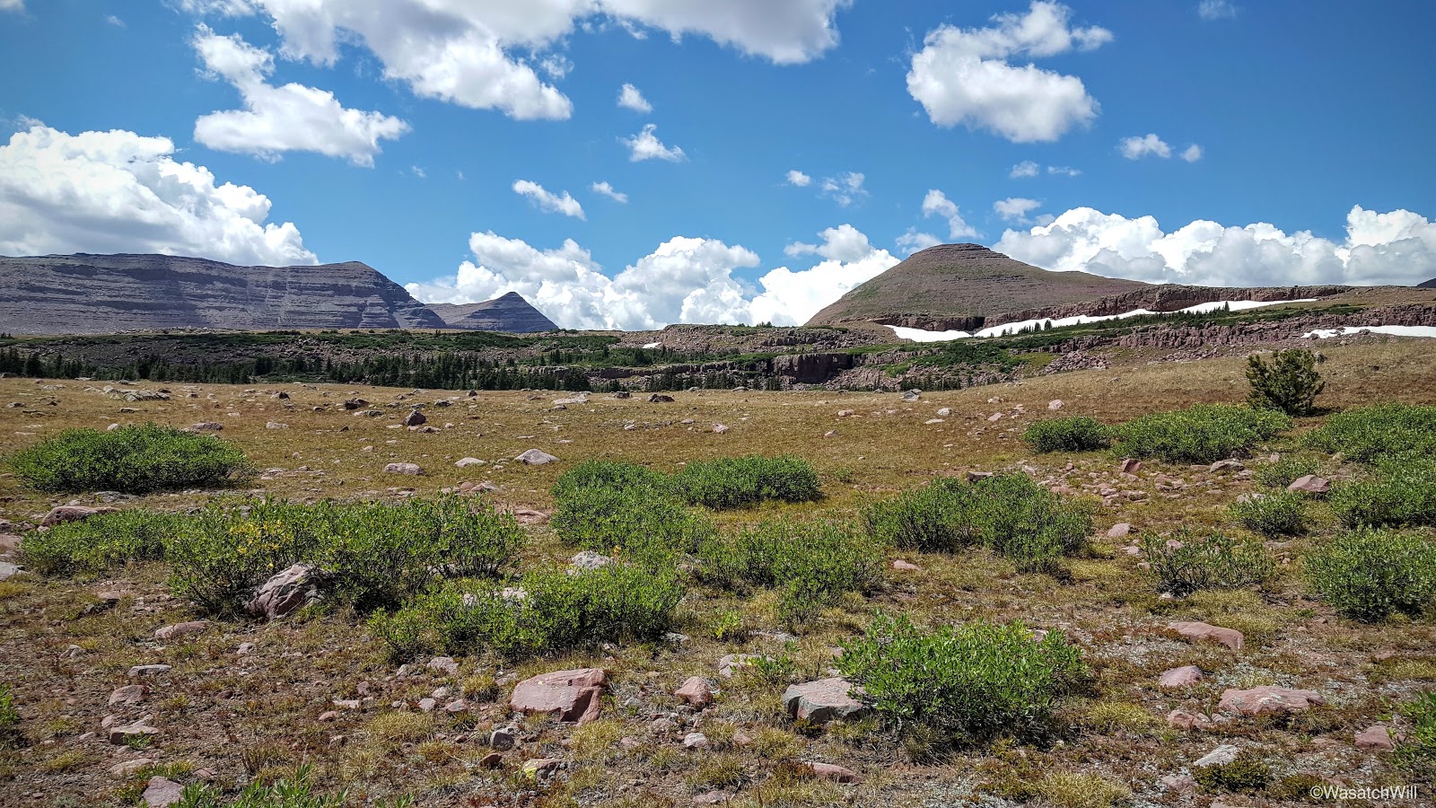
Day 3 on the Highline Trail would take us up the highest pass of the trail and subsequently, the high point of the trip (and the state), Kings Peak. We would then descend Anderson Pass into the Yellowstone drainage on our way to crossing over Tungsten Pass before setting camp near North Star Lake. We finished the day with about 11 miles, including the side trip up Kings Peak. This would also be the first of a streak of three two-pass days.
Uinta Highline Trail - Day 3
Tuesday - August 16, 2016
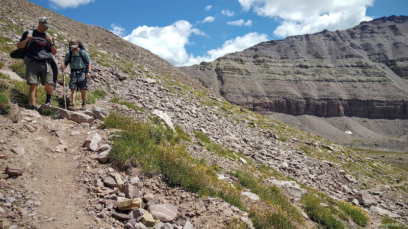
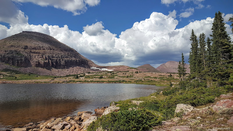
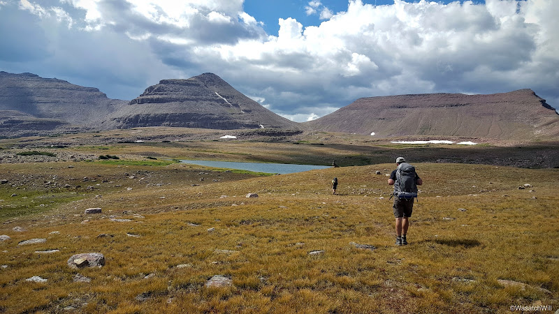
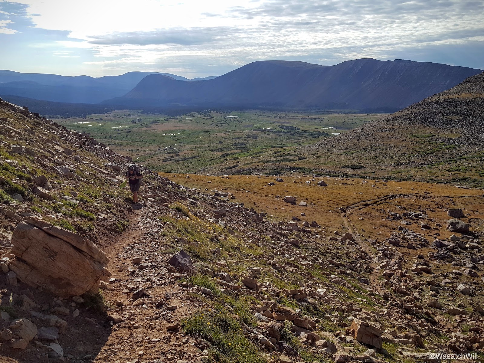
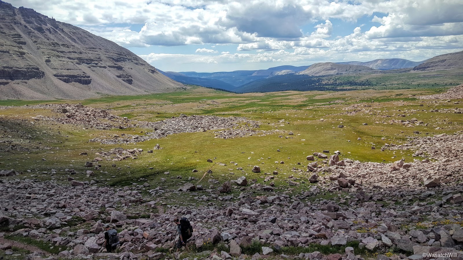
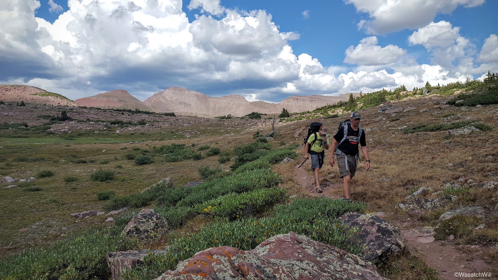
As anticipated, we awoke to favorable weather with clear skies. Kings Peak stood waiting. Wanting to get a good start, we got on the trail just after 7 am. It had gotten a bit cold overnight, down into the mid 30's, so emerging from the trees and into the sun was delightful. Not only did it warm us up on the outside, but after a day of gloomy overcast skies the day before, it warmed and refreshed the soul.
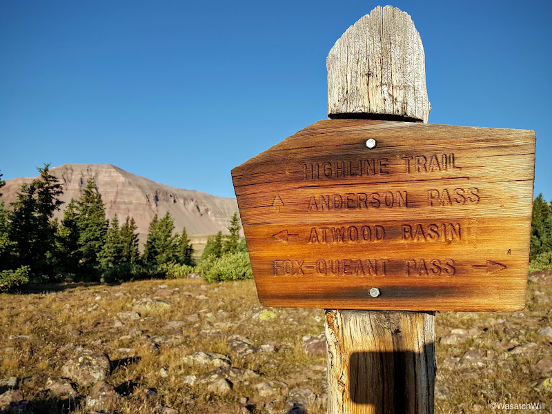
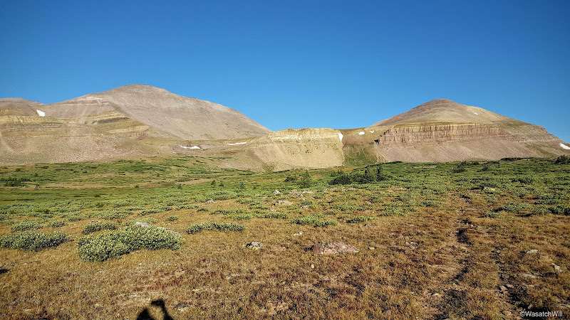
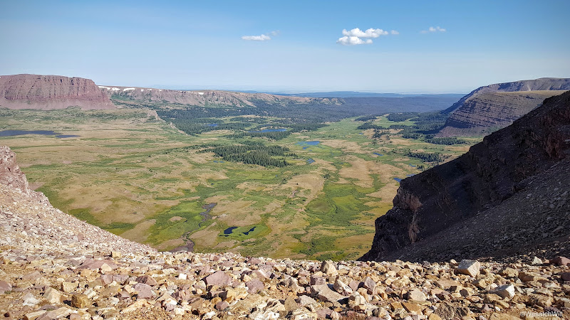
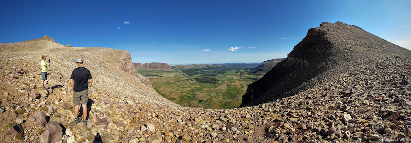
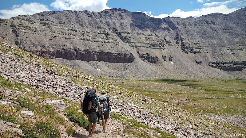
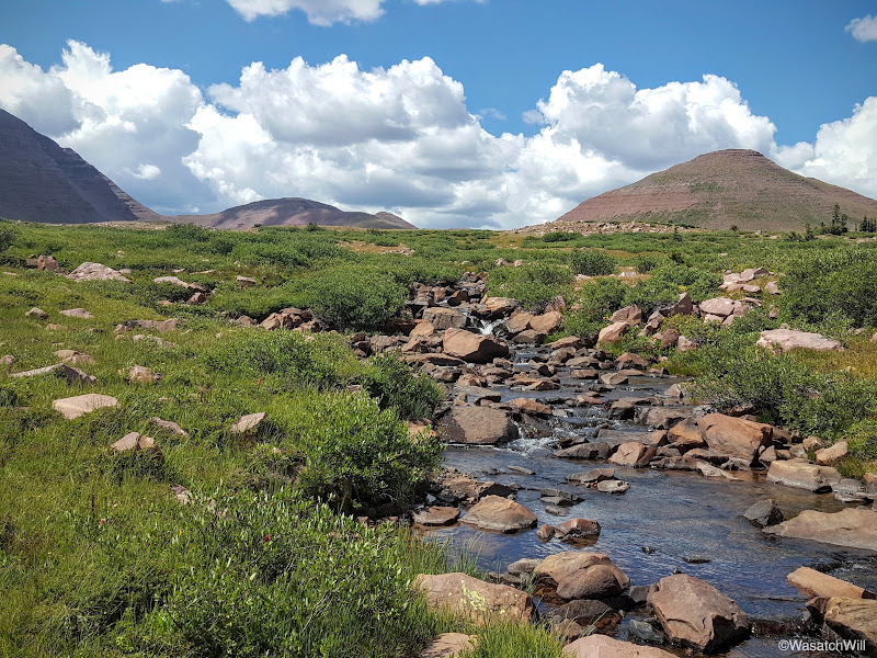
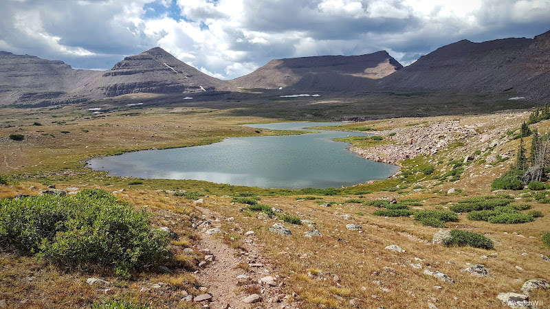
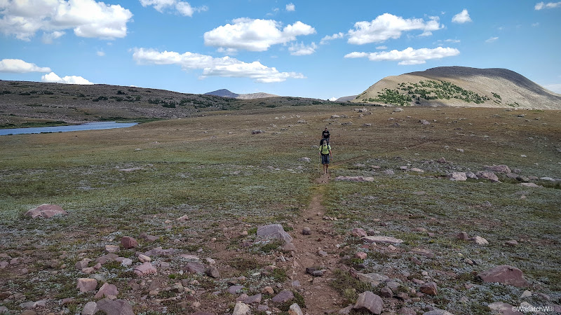
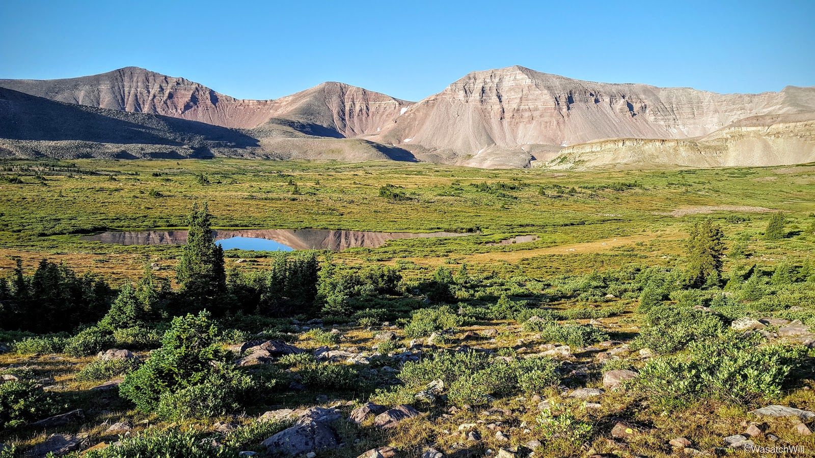
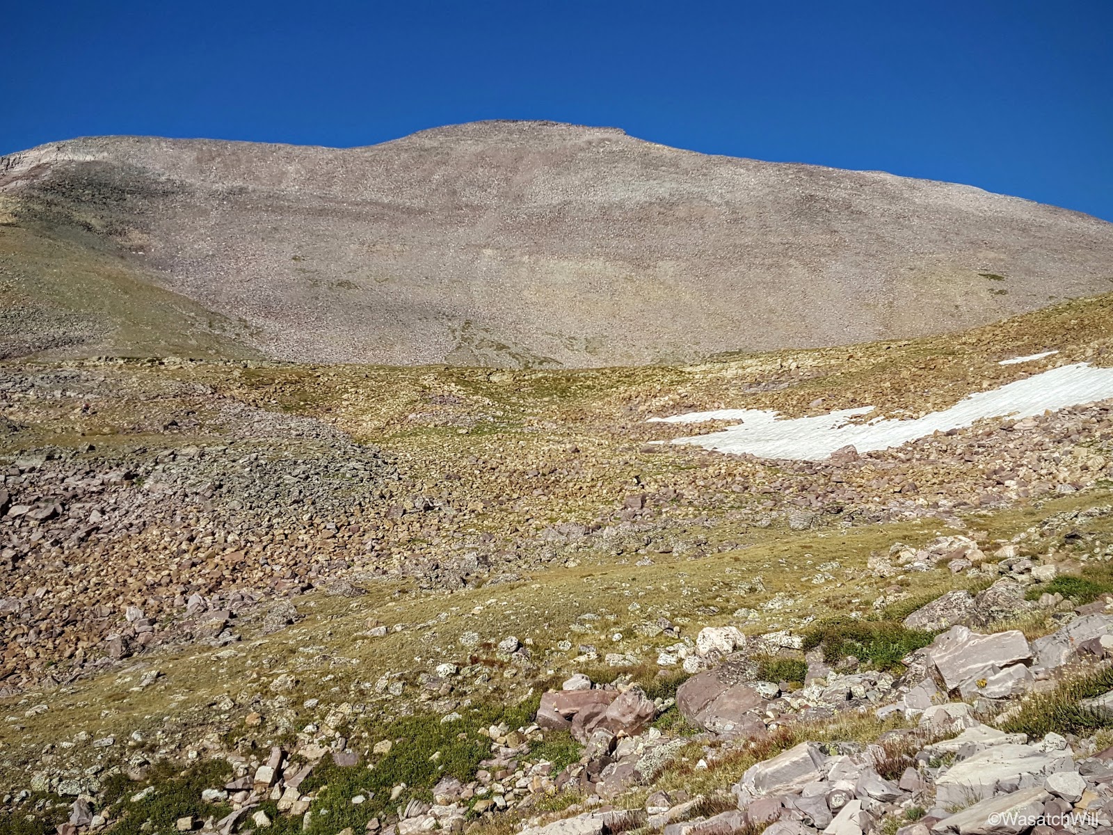
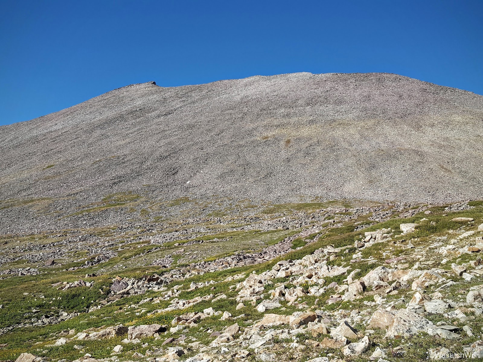
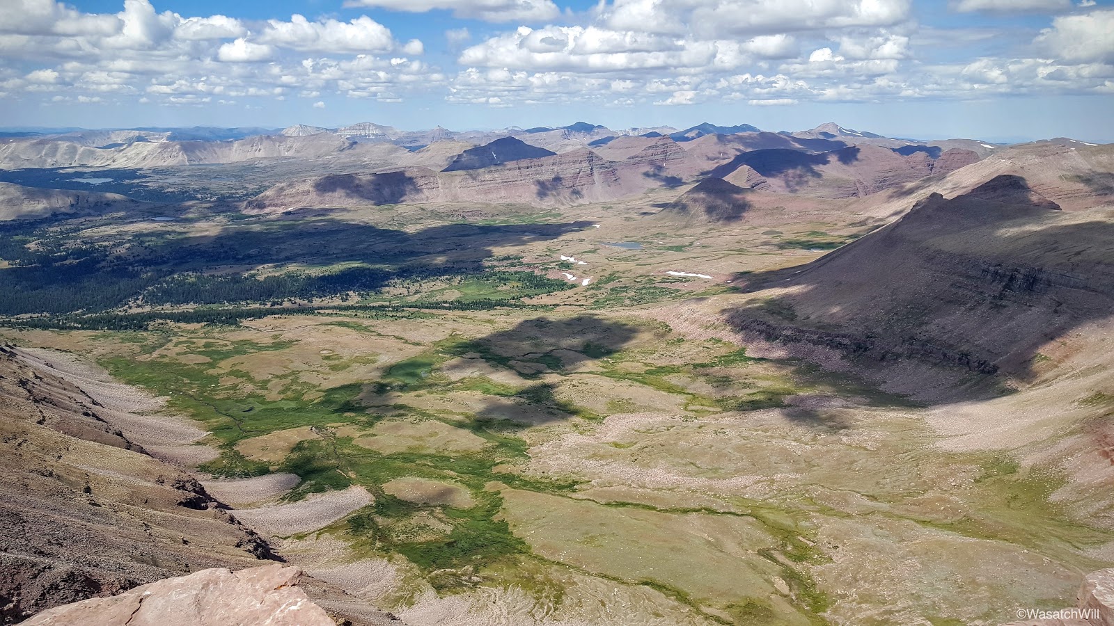
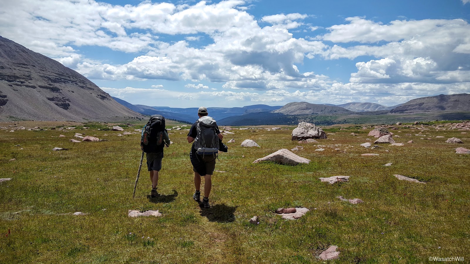
Once back on the trail, we went up hill to the junction with the Atwood trail and then set our course northward through the rest of Painter Basin and on up to Anderson Pass, where we planned to drop our packs for the scramble up to Kings Peak. Along the way, we stopped to filter and resupply our water reserves at the last major stream crossing prior to the ascent up out of the basin and up to Anderson Pass. Anderson Pass is the highest pass and thus the highest point along the Highline Trail rising to about 12,700 feet. Given the distance up and over it, the overall altitude, and the elevation gained and lost with it, it is certainly among the most strenuous of the many passes the Highline crosses over.
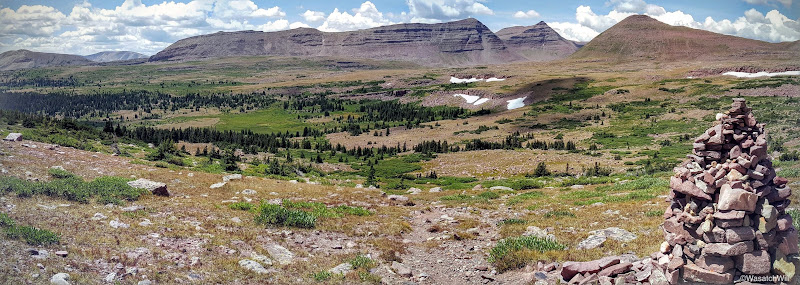
Another trail junction

Looking southwest toward Trail Rider Peak, Painter Peak, and Second Gemini
King Peak (left), Anderson Pass (middle), Dome Peak (right)
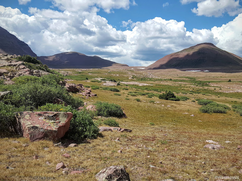
Looking back into Painter Basin from the trail up Anderson Pass

Kings Peak

Trail Rider Peak (middle) and Second Gemini (right)
Steve (dark spot) working his way toward Anderson Pass

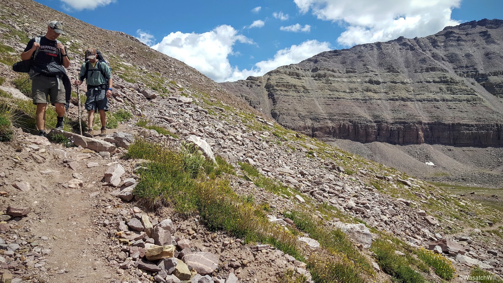
Steve and Adam following cairns leading up to Anderson Pass

King Peak (left) and its ridge from below Anderson Pass

Looking back toward Painter Basin
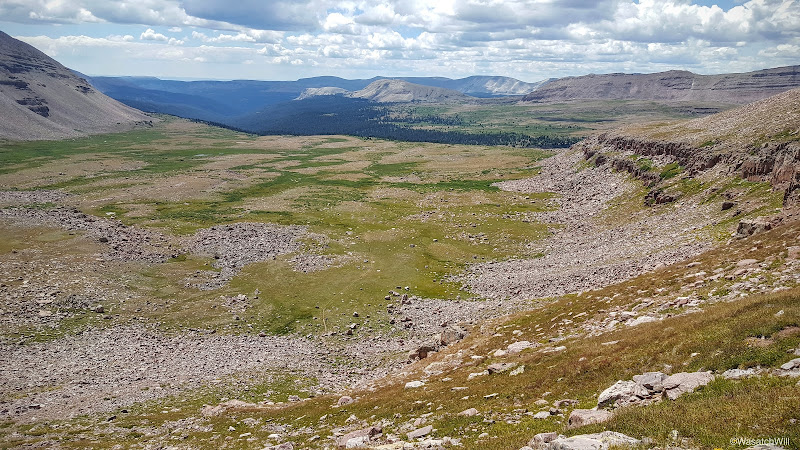
Just before reaching the crest of Anderson Pass, however, we paused for another quick break where we dropped our packs and trotted over to an overlook that offers a grand view into Henry Fork Basin. It was at the top of what many call The Chute, a massive, long, and steep scree field that descends a thousand feet in just under half a mile into Henry Fork Basin.
Adam and I both had prior experience with 'The Chute' from a few years before where we had both come up with separate groups to summit Kings Peak via Henry Fork. While each of our groups had ascended Kings Peak via the traditional route of coming out of Henry Fork via Gunsight Pass and then on up to Anderson Pass to capture the ridge line leading to Kings Peak, each of our respective groups had chosen to descend back into Henry Fork by way of 'The Chute'. Needless to say, it makes for quite an adventure in and of itself.
Because Henry Fork offers the shortest distance to Kings Peak from its trailhead (13.5 miles), Henry Fork Basin gets, by far, the most traffic of those seeking to bag the state high point of 13, 528 feet.
From the top of 'The Chute' looking down into Henry Fork
Panorama of 'The Chute'. Henry Fork Peak to the left and Dome Peak on the right.
We did not linger long. We were anxious to get on with Kings Peak. Back to our packs we went and up the final stretch to Anderson Pass where once again we parted with our packs, extracting only small summit bags with minimal essentials, and began the moderately strenuous, half mile, class 2 scramble up the ridge.
As mentioned above, Adam and I had both summited Kings Peak with different groups once before, but this would be Steve's first. Being from Northern Idaho where the Sawtooths are his primary playground, he had never even experienced the Uintas in any fashion prior to this trip, let alone stand atop Kings Peak. Whether it's with children, friends, or new acquaintances, it's always a joy to introduce people to magnificent landscapes you are already familiar with and then be able relive the newness, wonder, and awe of such majestic places vicariously through them.

Looking west across the Western Uintas from Anderson Pass (Wilson Peak in shadow)
After scrambling up the ridge for a little while, the notorious false summit reared its head, distinguished by its inverted, cloven hoof appearance. The true summit sits out of sight, a stone's throw away from the false summit just around and on the other side of it. Onward and upward.
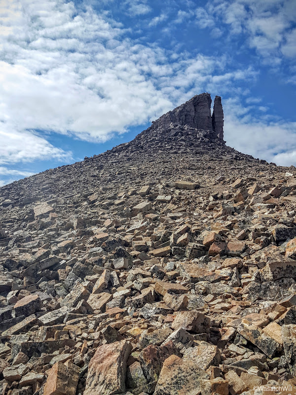
False Summit
Adam and Steve traversing around the false summit. Painter Basin down below at left.
Moments later, we were atop of the summit at last. Once again, as with the last time I was up here, our group was the only one on the summit, at least for a good while. We did pass an elder solo hiker along the ridge who eventually caught up. Other than that, we encountered nobody else on the ridge on the ascent. We did encounter several coming down from Anderson Pass earlier on who had made an earlier summit. As a side note, last time I had been here, it was late June, and our group appeared to have the whole mountain to ourselves for the day as we saw nobody coming or going. So it was quite the contrast to see so many along the trail up Anderson Pass earlier on.
No matter. As with last time, the views were every bit as spectacular.

Kings Peak - Highest point in Utah
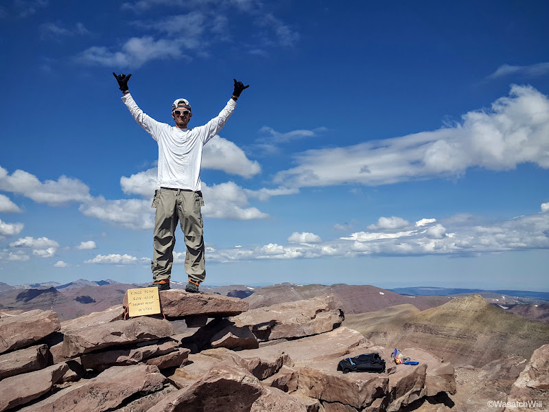
King of Kings

Group Summit Shot

Looking down the south face at South Kings Peak

Kings Peak Pano
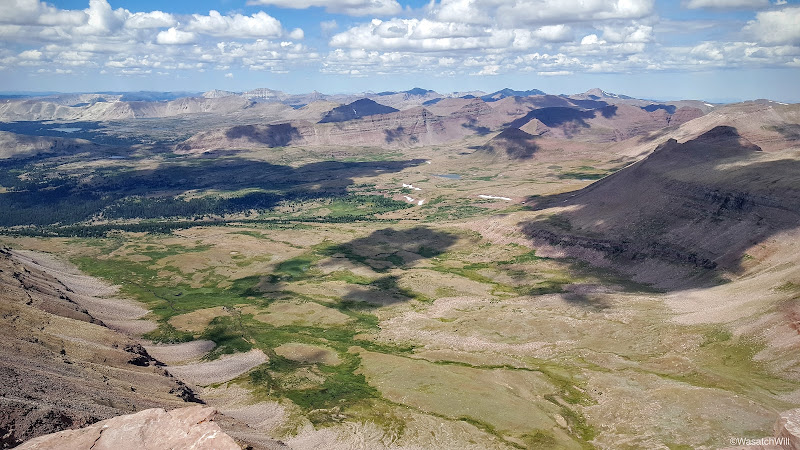
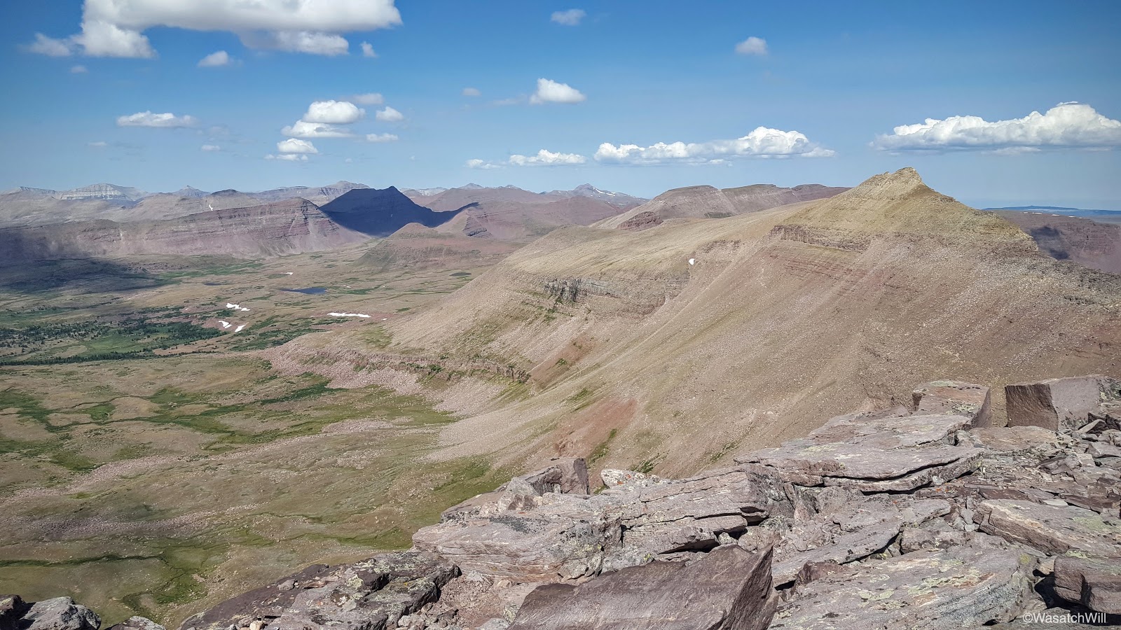
Looking west from Kings Peak. Yellowstone Creek runs from center to left.
Looking east into Painter Basin. Val Benchmark (center) and Lake Atwood (right) also visible.
After some celebration and brief recovery rituals, we each placed calls to our wives and families. Between my Sprint phone, Steve's AT&T phone, and Adam's Verizon phone, only the Verizon phone pulled in a signal strong enough to get a call out. We then found and signed the summit register and then looked for a USGS marker, but could only find remnants of cement that appeared to be where it could have once been embedded. We're assuming someone had since took it upon themself to chisel it out and keep it as a souvenir and token of their achievement. Pity. I wonder how long the wooden plaque somebody brought up will remain.

Former home of USGS marker?
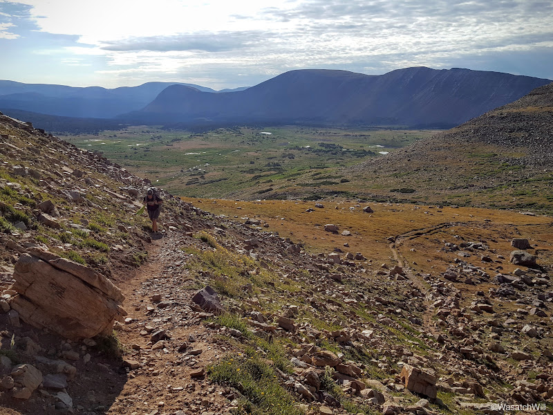
Clouds began to form and thicken in typical summer monsoon fashion as we made the descent back down to our packs hidden atop Anderson Pass. At first sight, it was hard to see how the trail could lead you safely down through the steep and exposed cliff lines embedded within the slopes descending down the cirque toward Yellowstone Creek. However, the descent down the west side of Anderson Pass proved to be rather mellow and easy going.
Looking back down toward Yellowstone Creek. Trail is faintly visible far below.
Adam and Steve descending Anderson Pass (center)
Adam and Steve descending Anderson Pass with Kings Peak above
Almost down
Adam and Steve finishing the last switchback off of Anderson Pass
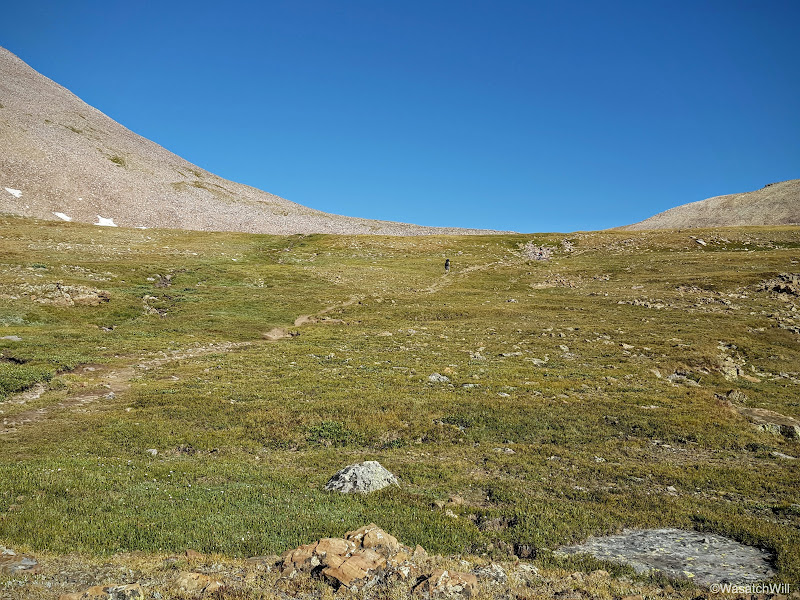
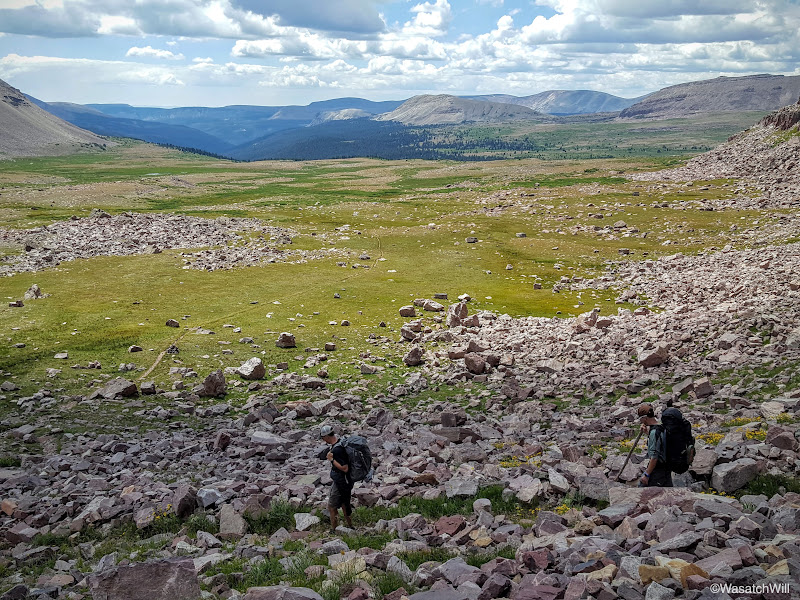
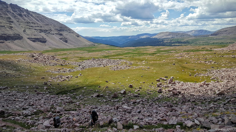
Soon enough, we were done with the descent down Anderson Pass and back on relatively level land.

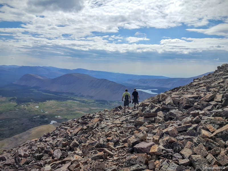
Adam and Steve setting their sights on Yellowstone Creek and Tungsten Pass
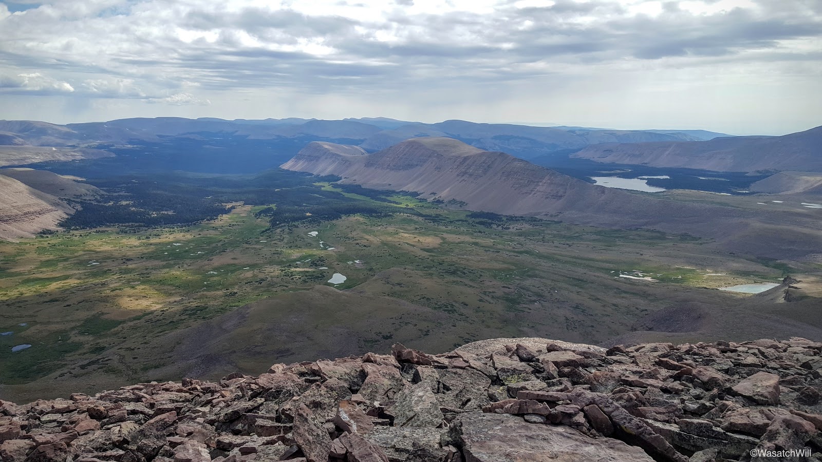
We continued on for about another mile through the grassy flat until we reached a point where the trail started to descend down to Yellowstone Creek. It also presented a fantastic view across Yellowstone Creek at the Wilson Peak ridge, Wilson Peak being another peak I had my sights set on for the following morning. It also presented a view of Tungsten Pass further to the left down the ridge which would lead us over to the desired destination we wanted to camp at for the night. With such a great view we decided to pull over and take a break for lunch.
Yellowstone Creek drainage. Tungsten Pass (left) and Wilson Peak (middle right) on the horizon.

Adam getting ready to sit down for lunch. Wilson Peak sits prominently above center.
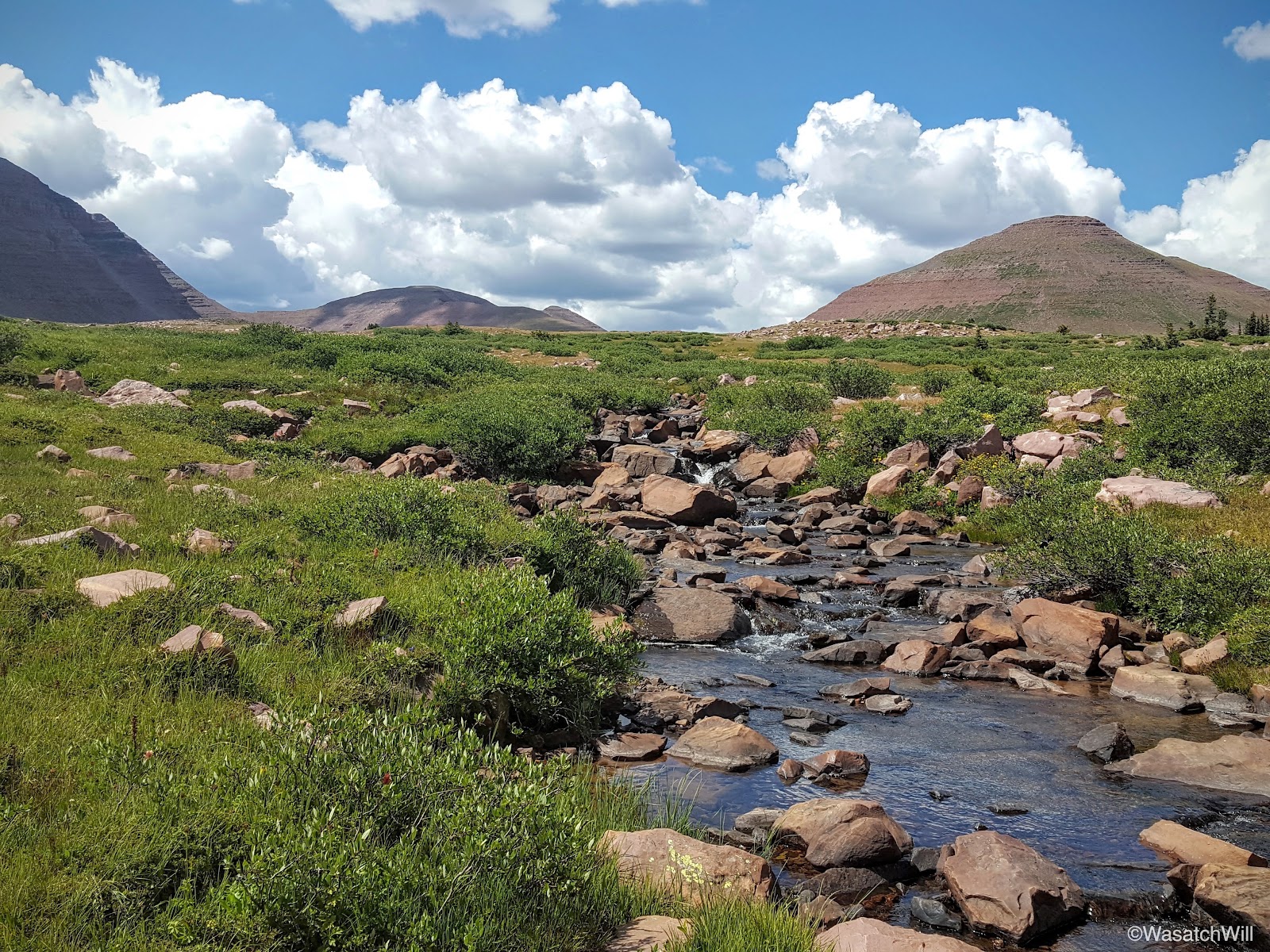
After lunch, we continued on down to Yellowstone Creek, resupplied with water there, and then crossed over and continued the westward trek across the basin.

Looking north toward Smith Fork Pass from near Yellowstone Creek
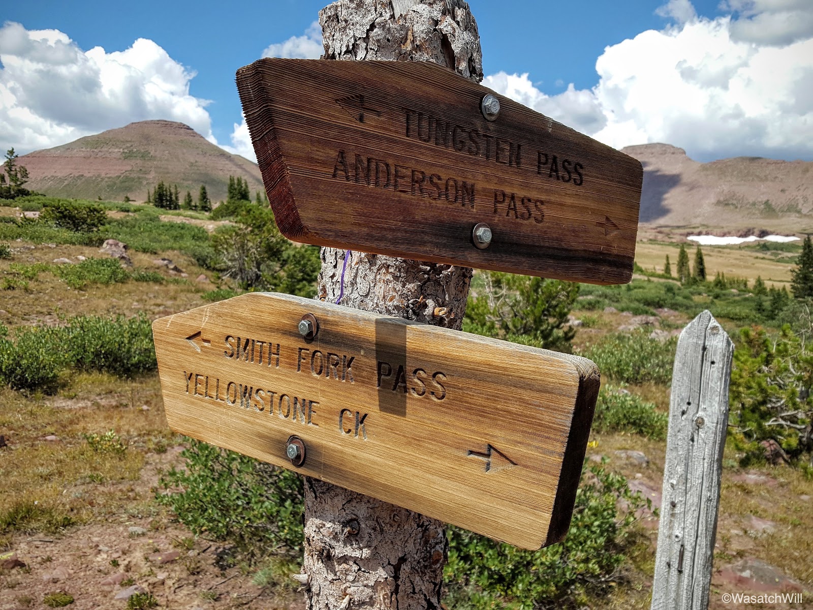
After passing the junction with the Smith Fork Pass Trail and a tributary of Yellowstone Creek, the trail began to ascend upward for Tungsten Pass.

Smith Fork Pass trail junction
Yellowstone tributary
Looking back northward at Smith Fork Pass from the ascent up to Tungsten Pass
Looking eastward across Yellowstone Creek. Anderson Pass and Kings Peak in shadow (right).

Adam and Steve closing in on Tungsten Pass
Unnamed lake near Tungsten Pass
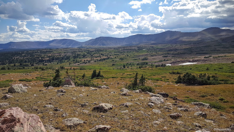
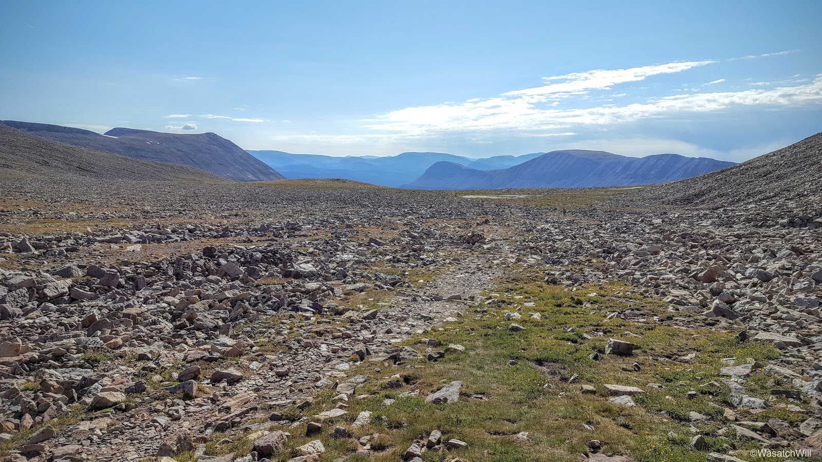
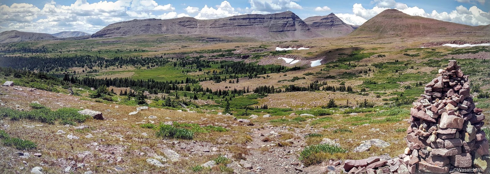
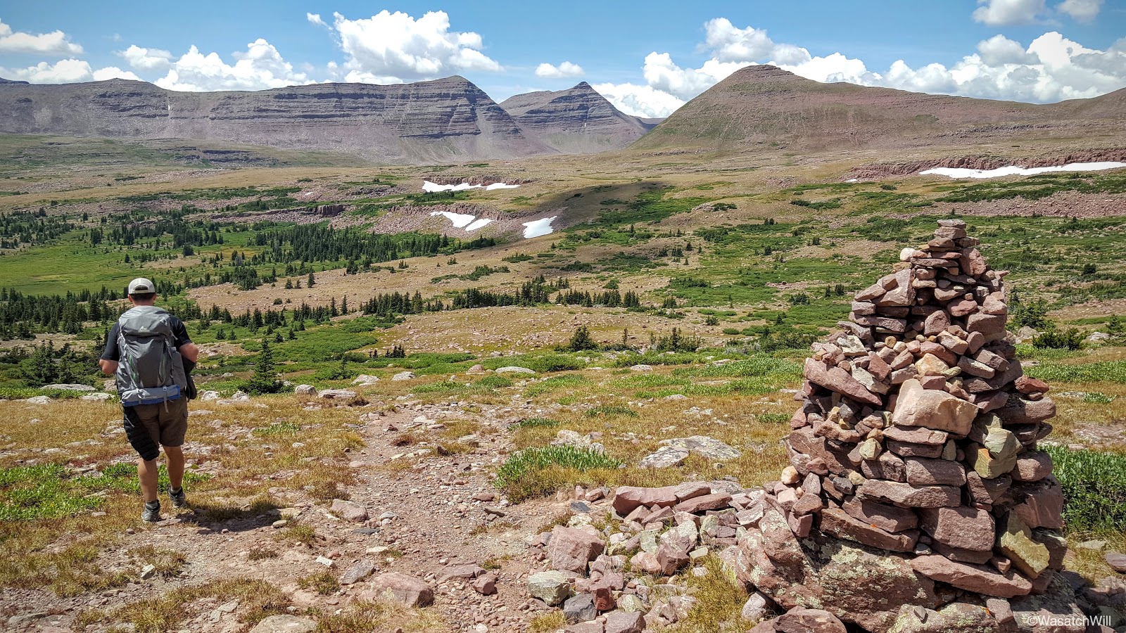
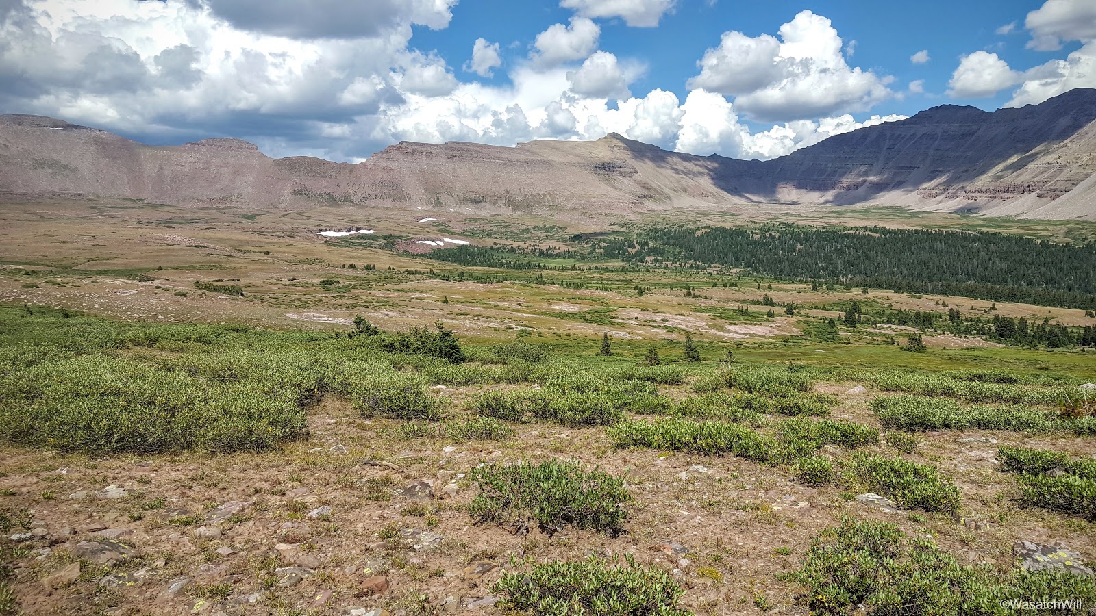
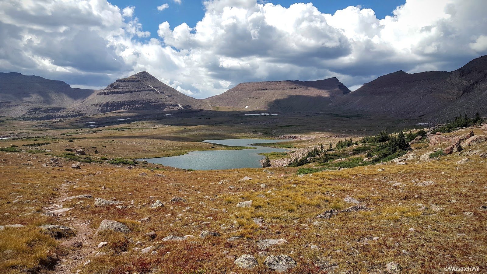
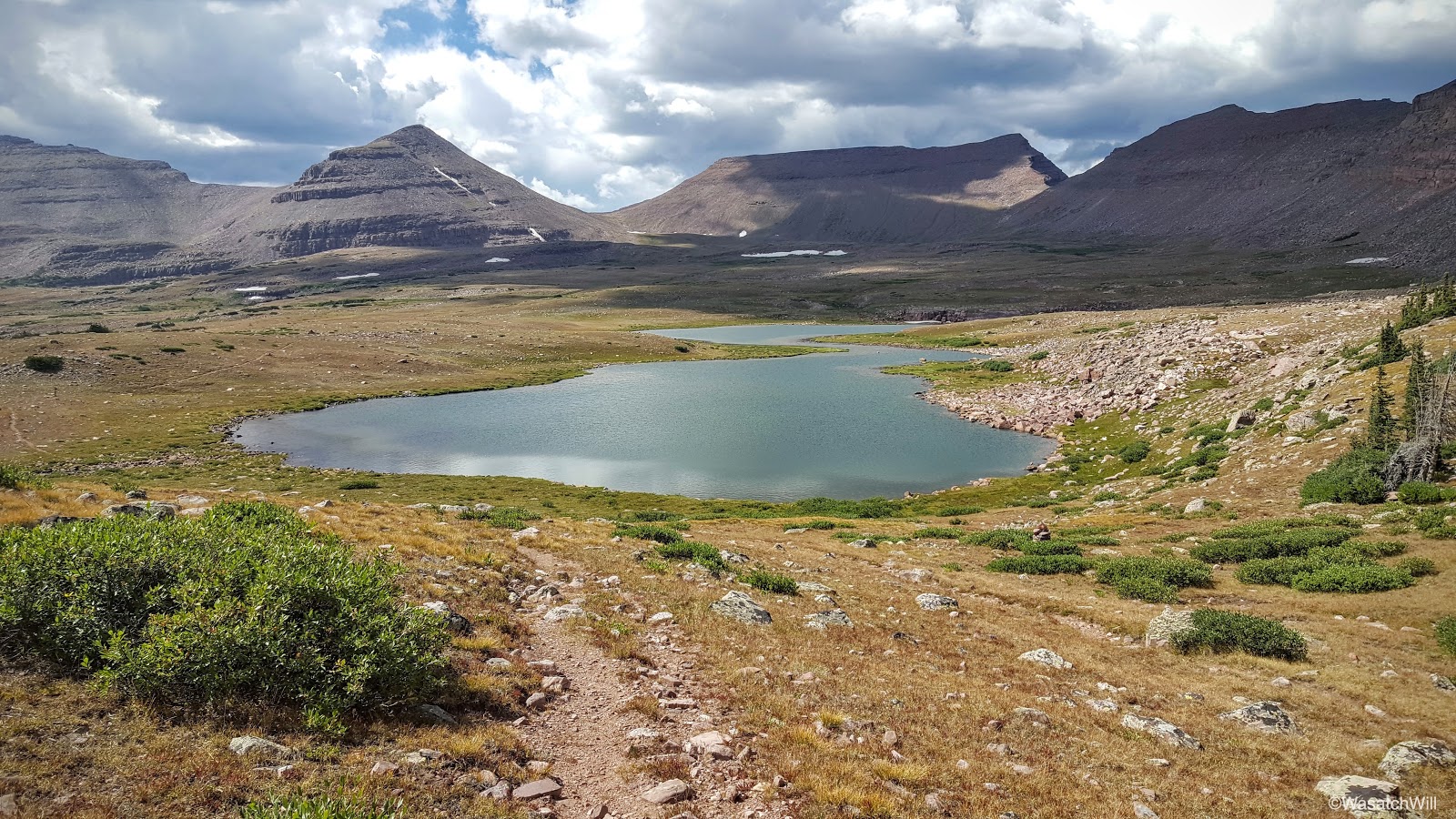
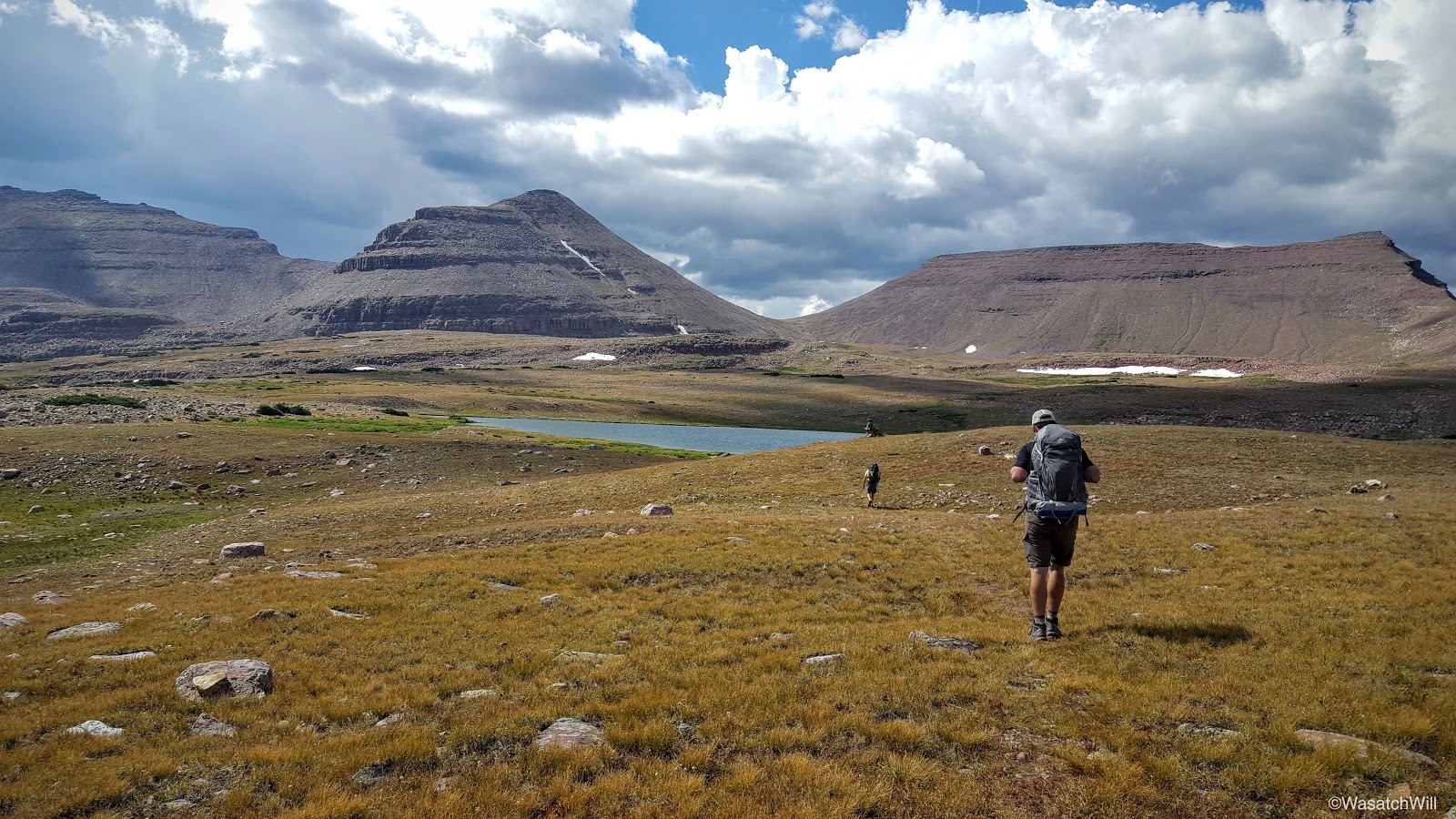
After rounding a lake with no name along the eastern flank of Tungsten Pass we quickly crested over and were looking down up Tunsten Lake. Tungsten Pass is quite the contrast from Anderson Pass with its high point only rising to about 11,440. Combined with the very gradual ascent and descent over it, it proved to be the easiest pass of the trip. Clouds around the horizon also continued getting thicker and darker and with trees sparse, we were extra eager to get down and seek out a campsite and set up some shelter.

Tungsten Lake with Porcupine Mountain, Porcupine Pass, and Wilson Peak above
A little closer to Tungsten Lake
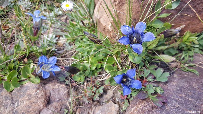
Wildflowers
Adam and Steve rounding Tungsten Lake (left) from Tungsten Pass (above)

"Friendly" cairn
To be a little closer to Porcupine Pass for the next morning, we continued past Tungsten Lake and sought a site near North Star Lake.
Moving on to North Star Lake
We eventually settled into a small, lower lying clearing among some brush a little bit down slope from North Star Lake.

Day 3 Camp
It seemed as if the weather couldn't make up its mind either. Along the mountains behind us, clouds remained dark and threatening but out to the front of us across Garfield Creek and the Five Point Lake basin beyond, skies remained relatively calm. The direction of the clouds were moving in a direction in such a way that it appeared conditions in our spot would remain consistent for the rest of the afternoon.
Looking southwest toward Five Point Lake basin
Looking northwest at Porcupine Mountain
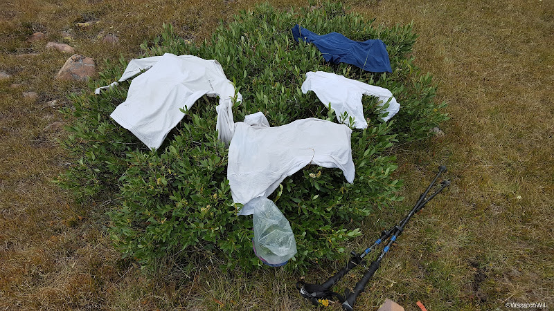
I had been hoping to bathe myself a bit and make it a laundry day by washing my trail clothes early that evening. Just three days into the journey and the odor was already mounting up. I decided to chance it change into my camp clothes after wiping myself down. I then washed my trail clothes as best as I could using a gallon ziploc bag full of water fetched from the nearby stream and bit of Dr Bronner. I then laid the clothing out across a neighboring bush in hopes the sun would prove triumphant through the clouds above and behind us. Unfortunately, the clouds remained dominant and we stayed in the shadow of the clouds until nightfall when the skies finally decided to clear out all around us. With no sun, my clothing ended up remaining damp all through the evening, making it a very cold and sticky affair when I went to put them on the next morning.
Mountain fresh laundry...literally!
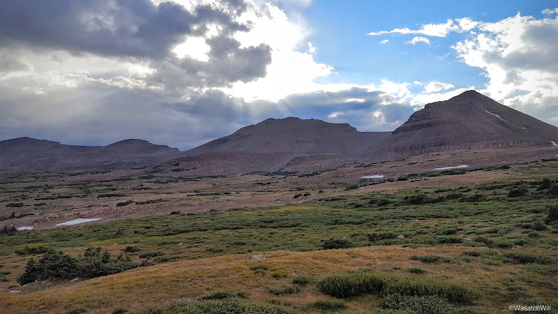
Still, we were able to enjoy a glowing, though lesser dramatic sunset followed by a brightly lit moon that kept our camp aglow for the better part of the evening. As the skies cleared, combined with our elevation and no sanctuary of trees around us, temperatures began to really plummet down into the low 30's.
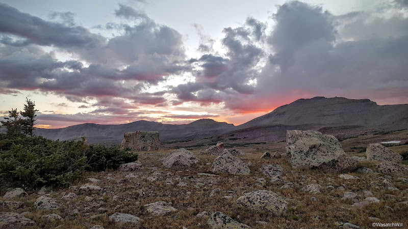
Sunset
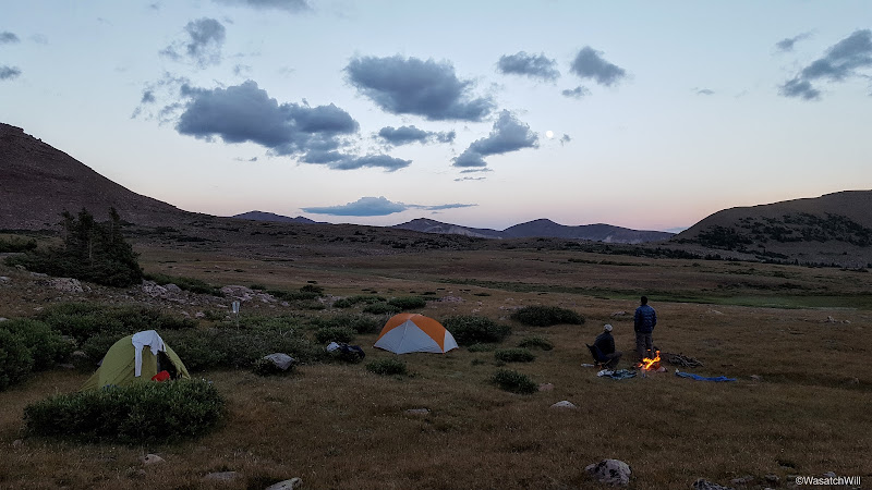
Nightfall
After some nightly campfire chat reminiscing on the highlights of the day and other topics, it was off to bed for some much deserved rest and warmth. Day 4 and Wilson Peak would await the next morning.
Video:
Uinta Highline Trail - Day 3
Tuesday - August 16, 2016
As anticipated, we awoke to favorable weather with clear skies. Kings Peak stood waiting. Wanting to get a good start, we got on the trail just after 7 am. It had gotten a bit cold overnight, down into the mid 30's, so emerging from the trees and into the sun was delightful. Not only did it warm us up on the outside, but after a day of gloomy overcast skies the day before, it warmed and refreshed the soul.
Once back on the trail, we went up hill to the junction with the Atwood trail and then set our course northward through the rest of Painter Basin and on up to Anderson Pass, where we planned to drop our packs for the scramble up to Kings Peak. Along the way, we stopped to filter and resupply our water reserves at the last major stream crossing prior to the ascent up out of the basin and up to Anderson Pass. Anderson Pass is the highest pass and thus the highest point along the Highline Trail rising to about 12,700 feet. Given the distance up and over it, the overall altitude, and the elevation gained and lost with it, it is certainly among the most strenuous of the many passes the Highline crosses over.
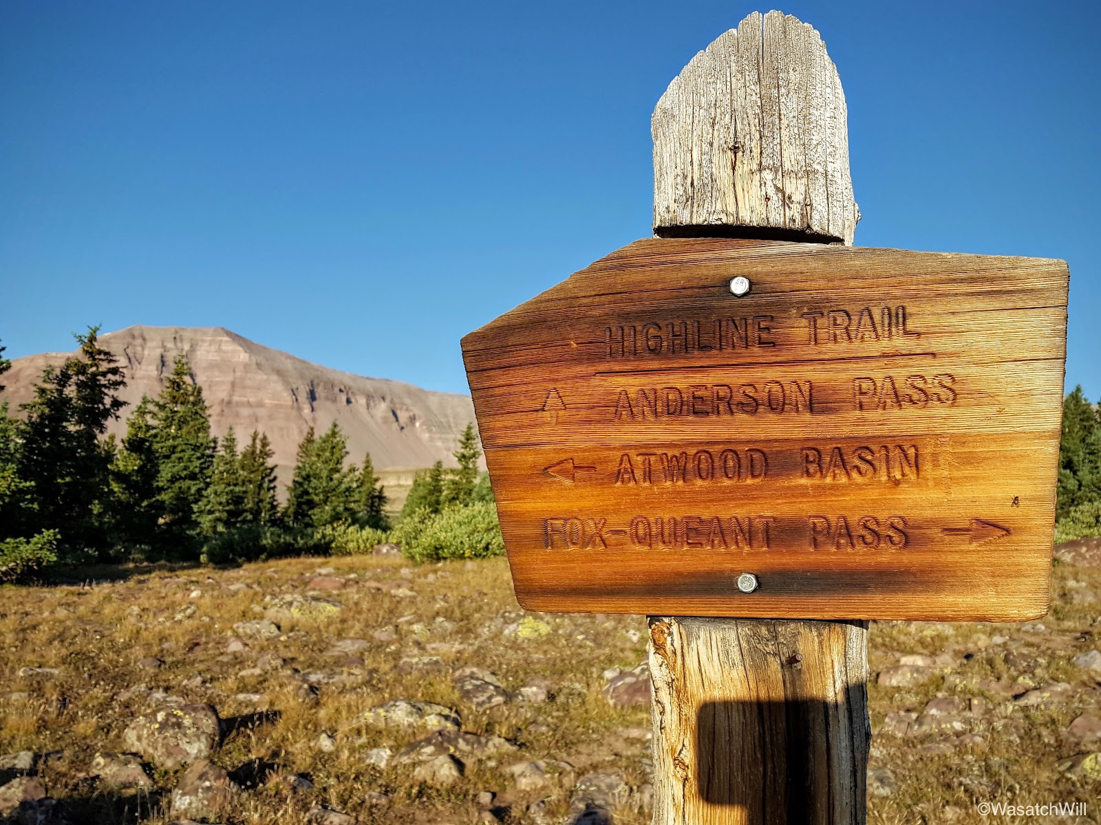
Another trail junction
Looking southwest toward Trail Rider Peak, Painter Peak, and Second Gemini

King Peak (left), Anderson Pass (middle), Dome Peak (right)
Looking back into Painter Basin from the trail up Anderson Pass
Kings Peak

Trail Rider Peak (middle) and Second Gemini (right)
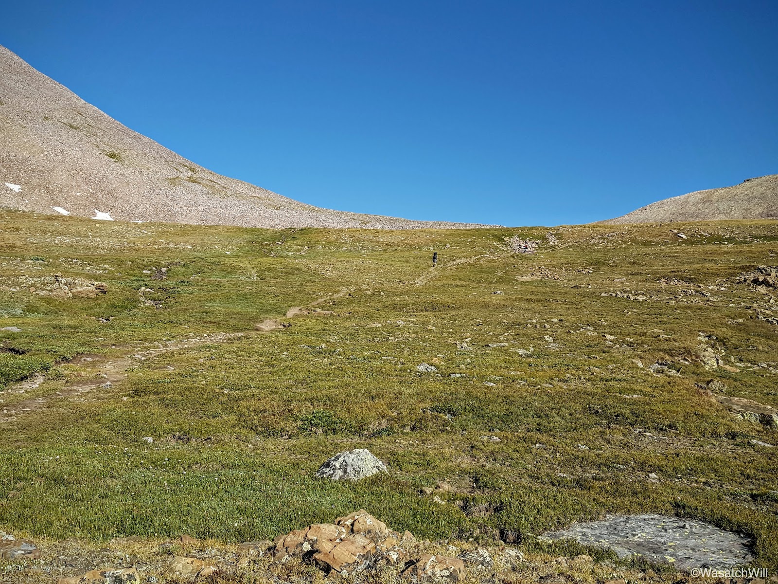
Steve (dark spot) working his way toward Anderson Pass
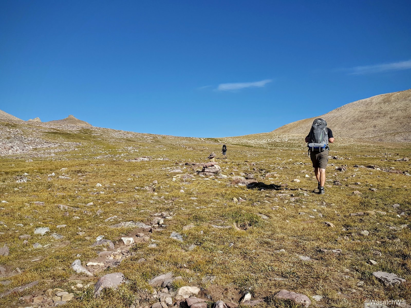
Steve and Adam following cairns leading up to Anderson Pass
King Peak (left) and its ridge from below Anderson Pass
Looking back toward Painter Basin
Just before reaching the crest of Anderson Pass, however, we paused for another quick break where we dropped our packs and trotted over to an overlook that offers a grand view into Henry Fork Basin. It was at the top of what many call The Chute, a massive, long, and steep scree field that descends a thousand feet in just under half a mile into Henry Fork Basin.
Adam and I both had prior experience with 'The Chute' from a few years before where we had both come up with separate groups to summit Kings Peak via Henry Fork. While each of our groups had ascended Kings Peak via the traditional route of coming out of Henry Fork via Gunsight Pass and then on up to Anderson Pass to capture the ridge line leading to Kings Peak, each of our respective groups had chosen to descend back into Henry Fork by way of 'The Chute'. Needless to say, it makes for quite an adventure in and of itself.
Because Henry Fork offers the shortest distance to Kings Peak from its trailhead (13.5 miles), Henry Fork Basin gets, by far, the most traffic of those seeking to bag the state high point of 13, 528 feet.

From the top of 'The Chute' looking down into Henry Fork

Panorama of 'The Chute'. Henry Fork Peak to the left and Dome Peak on the right.
We did not linger long. We were anxious to get on with Kings Peak. Back to our packs we went and up the final stretch to Anderson Pass where once again we parted with our packs, extracting only small summit bags with minimal essentials, and began the moderately strenuous, half mile, class 2 scramble up the ridge.
As mentioned above, Adam and I had both summited Kings Peak with different groups once before, but this would be Steve's first. Being from Northern Idaho where the Sawtooths are his primary playground, he had never even experienced the Uintas in any fashion prior to this trip, let alone stand atop Kings Peak. Whether it's with children, friends, or new acquaintances, it's always a joy to introduce people to magnificent landscapes you are already familiar with and then be able relive the newness, wonder, and awe of such majestic places vicariously through them.
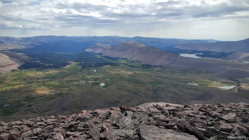
Looking west across the Western Uintas from Anderson Pass (Wilson Peak in shadow)
After scrambling up the ridge for a little while, the notorious false summit reared its head, distinguished by its inverted, cloven hoof appearance. The true summit sits out of sight, a stone's throw away from the false summit just around and on the other side of it. Onward and upward.

False Summit

Adam and Steve traversing around the false summit. Painter Basin down below at left.
Moments later, we were atop of the summit at last. Once again, as with the last time I was up here, our group was the only one on the summit, at least for a good while. We did pass an elder solo hiker along the ridge who eventually caught up. Other than that, we encountered nobody else on the ridge on the ascent. We did encounter several coming down from Anderson Pass earlier on who had made an earlier summit. As a side note, last time I had been here, it was late June, and our group appeared to have the whole mountain to ourselves for the day as we saw nobody coming or going. So it was quite the contrast to see so many along the trail up Anderson Pass earlier on.
No matter. As with last time, the views were every bit as spectacular.
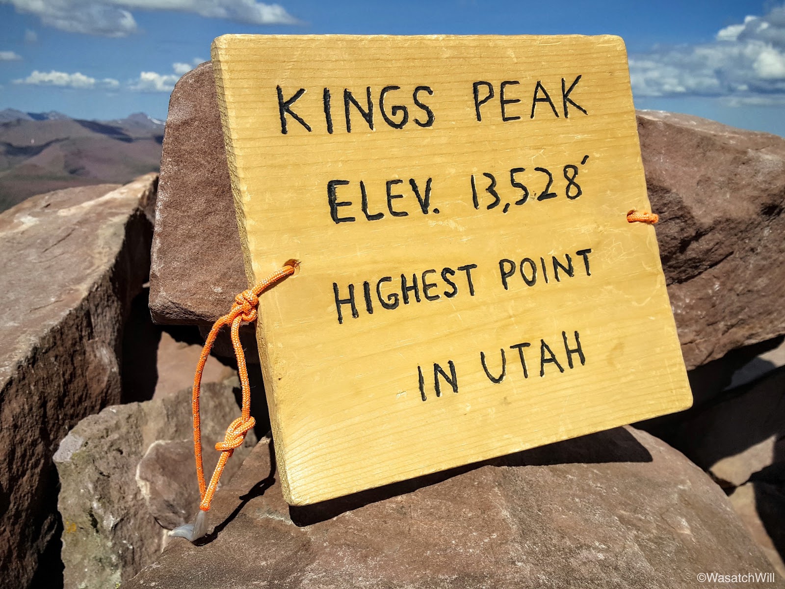
Kings Peak - Highest point in Utah
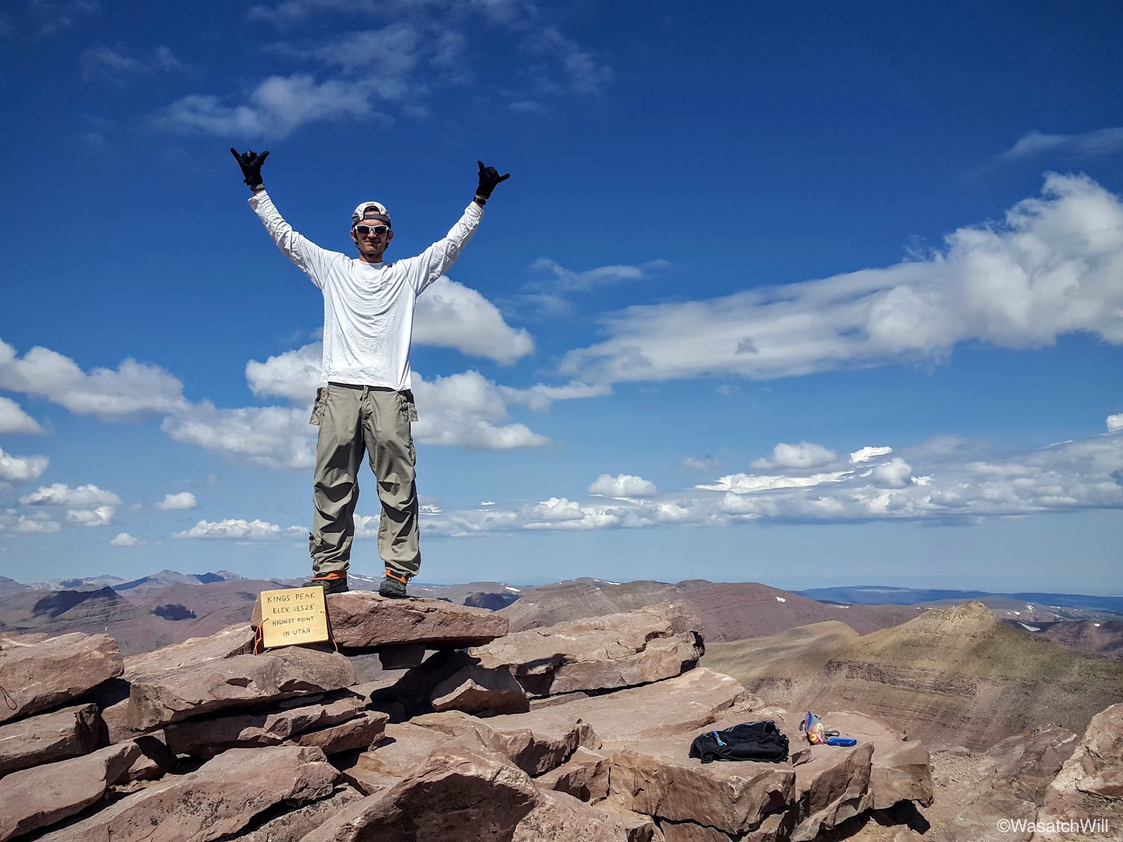
King of Kings
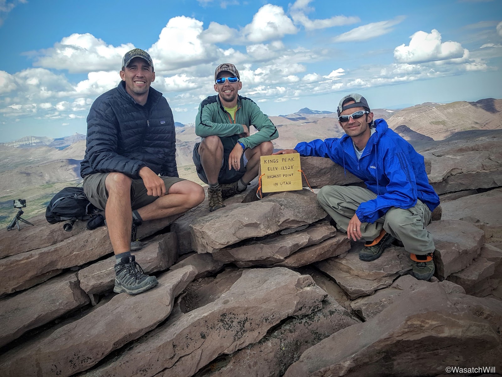
Group Summit Shot
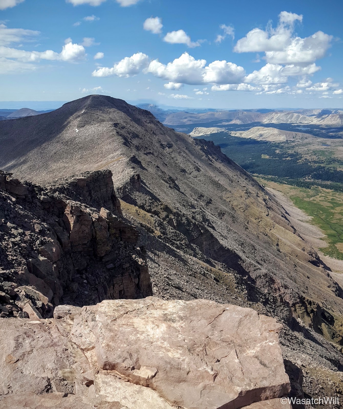
Looking down the south face at South Kings Peak
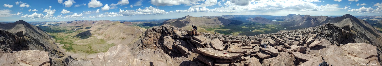
Kings Peak Pano
Looking west from Kings Peak. Yellowstone Creek runs from center to left.
Looking east into Painter Basin. Val Benchmark (center) and Lake Atwood (right) also visible.
After some celebration and brief recovery rituals, we each placed calls to our wives and families. Between my Sprint phone, Steve's AT&T phone, and Adam's Verizon phone, only the Verizon phone pulled in a signal strong enough to get a call out. We then found and signed the summit register and then looked for a USGS marker, but could only find remnants of cement that appeared to be where it could have once been embedded. We're assuming someone had since took it upon themself to chisel it out and keep it as a souvenir and token of their achievement. Pity. I wonder how long the wooden plaque somebody brought up will remain.
Former home of USGS marker?
Clouds began to form and thicken in typical summer monsoon fashion as we made the descent back down to our packs hidden atop Anderson Pass. At first sight, it was hard to see how the trail could lead you safely down through the steep and exposed cliff lines embedded within the slopes descending down the cirque toward Yellowstone Creek. However, the descent down the west side of Anderson Pass proved to be rather mellow and easy going.

Looking back down toward Yellowstone Creek. Trail is faintly visible far below.
Adam and Steve descending Anderson Pass (center)

Adam and Steve descending Anderson Pass with Kings Peak above

Almost down
Adam and Steve finishing the last switchback off of Anderson Pass
Soon enough, we were done with the descent down Anderson Pass and back on relatively level land.
Adam and Steve setting their sights on Yellowstone Creek and Tungsten Pass
We continued on for about another mile through the grassy flat until we reached a point where the trail started to descend down to Yellowstone Creek. It also presented a fantastic view across Yellowstone Creek at the Wilson Peak ridge, Wilson Peak being another peak I had my sights set on for the following morning. It also presented a view of Tungsten Pass further to the left down the ridge which would lead us over to the desired destination we wanted to camp at for the night. With such a great view we decided to pull over and take a break for lunch.
Yellowstone Creek drainage. Tungsten Pass (left) and Wilson Peak (middle right) on the horizon.
Adam getting ready to sit down for lunch. Wilson Peak sits prominently above center.
After lunch, we continued on down to Yellowstone Creek, resupplied with water there, and then crossed over and continued the westward trek across the basin.
Looking north toward Smith Fork Pass from near Yellowstone Creek
After passing the junction with the Smith Fork Pass Trail and a tributary of Yellowstone Creek, the trail began to ascend upward for Tungsten Pass.
Smith Fork Pass trail junction
Yellowstone tributary

Looking back northward at Smith Fork Pass from the ascent up to Tungsten Pass
Looking eastward across Yellowstone Creek. Anderson Pass and Kings Peak in shadow (right).
Adam and Steve closing in on Tungsten Pass

Unnamed lake near Tungsten Pass
After rounding a lake with no name along the eastern flank of Tungsten Pass we quickly crested over and were looking down up Tunsten Lake. Tungsten Pass is quite the contrast from Anderson Pass with its high point only rising to about 11,440. Combined with the very gradual ascent and descent over it, it proved to be the easiest pass of the trip. Clouds around the horizon also continued getting thicker and darker and with trees sparse, we were extra eager to get down and seek out a campsite and set up some shelter.
Tungsten Lake with Porcupine Mountain, Porcupine Pass, and Wilson Peak above
A little closer to Tungsten Lake

Wildflowers

Adam and Steve rounding Tungsten Lake (left) from Tungsten Pass (above)

"Friendly" cairn
To be a little closer to Porcupine Pass for the next morning, we continued past Tungsten Lake and sought a site near North Star Lake.
Moving on to North Star Lake
We eventually settled into a small, lower lying clearing among some brush a little bit down slope from North Star Lake.
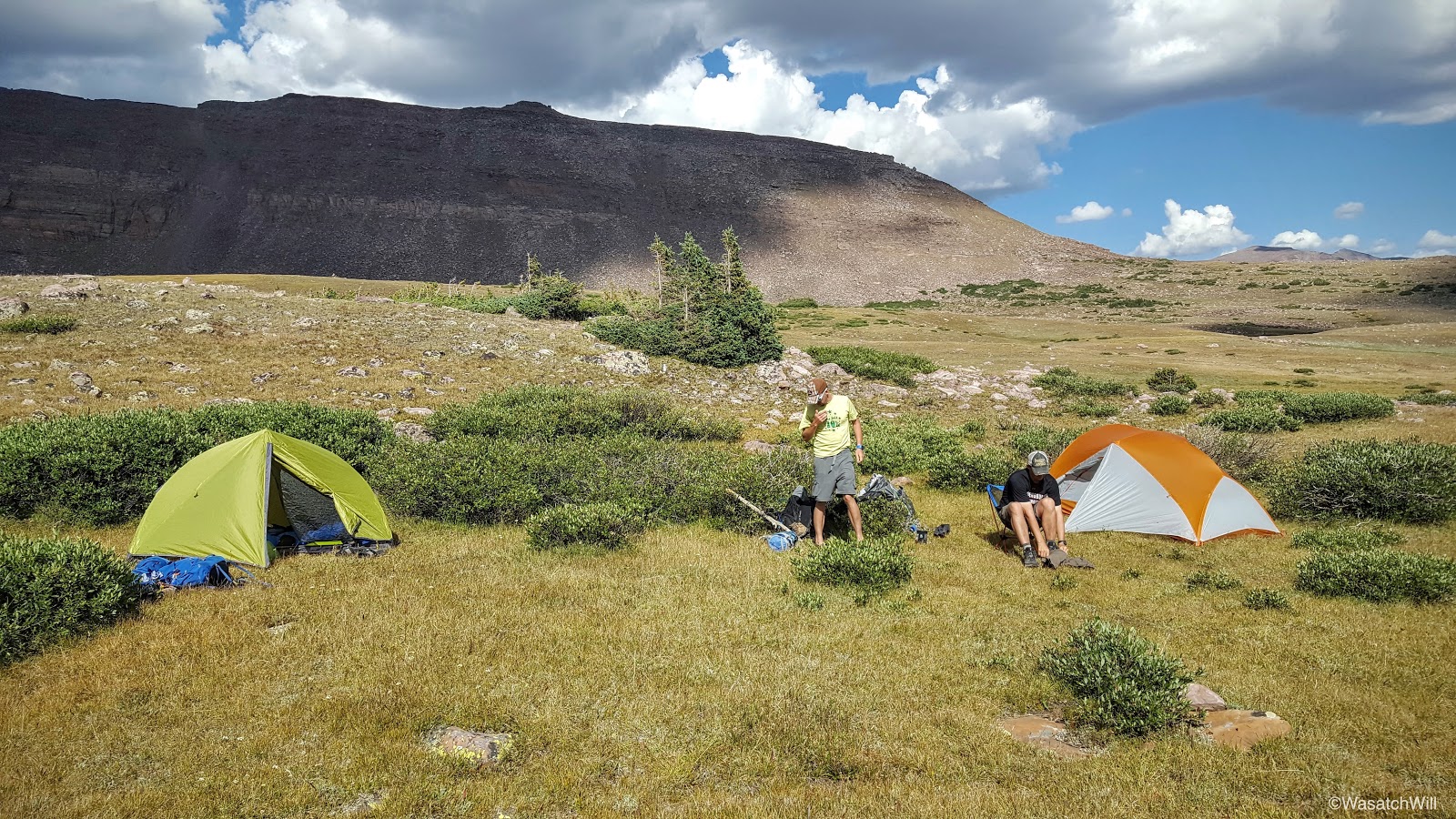
Day 3 Camp
It seemed as if the weather couldn't make up its mind either. Along the mountains behind us, clouds remained dark and threatening but out to the front of us across Garfield Creek and the Five Point Lake basin beyond, skies remained relatively calm. The direction of the clouds were moving in a direction in such a way that it appeared conditions in our spot would remain consistent for the rest of the afternoon.

Looking southwest toward Five Point Lake basin

Looking northwest at Porcupine Mountain
I had been hoping to bathe myself a bit and make it a laundry day by washing my trail clothes early that evening. Just three days into the journey and the odor was already mounting up. I decided to chance it change into my camp clothes after wiping myself down. I then washed my trail clothes as best as I could using a gallon ziploc bag full of water fetched from the nearby stream and bit of Dr Bronner. I then laid the clothing out across a neighboring bush in hopes the sun would prove triumphant through the clouds above and behind us. Unfortunately, the clouds remained dominant and we stayed in the shadow of the clouds until nightfall when the skies finally decided to clear out all around us. With no sun, my clothing ended up remaining damp all through the evening, making it a very cold and sticky affair when I went to put them on the next morning.
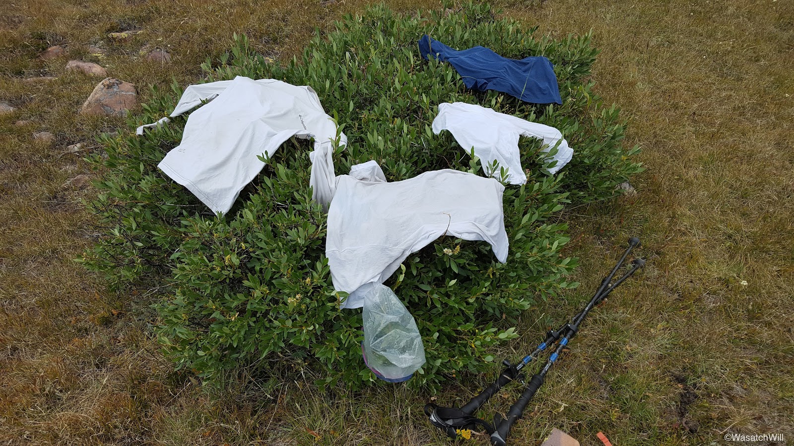
Mountain fresh laundry...literally!
Still, we were able to enjoy a glowing, though lesser dramatic sunset followed by a brightly lit moon that kept our camp aglow for the better part of the evening. As the skies cleared, combined with our elevation and no sanctuary of trees around us, temperatures began to really plummet down into the low 30's.

Sunset

Nightfall
After some nightly campfire chat reminiscing on the highlights of the day and other topics, it was off to bed for some much deserved rest and warmth. Day 4 and Wilson Peak would await the next morning.
Video:
")