- Joined
- Aug 9, 2007
- Messages
- 12,959
This is the second of three trip reports from a big backpacking trip down Maidenwater Canyon, Trachyte Creek and Swett Creek.
Part 1: Maidenwater Canyon
Part 3: Swett Creek
Trachyte Creek, April 2012
After taking our time getting through Maidenwater Canyon, we found ourselves wandering down the relatively open Trachyte Creek. The water in Trachyte was running clean and clear so we had the luxury of camping anywhere we wanted rather than having to push for Woodruff Canyon. When Trachyte is siltier, Woodruff is typically the next reliable source of clean water after leaving Maidenwater.
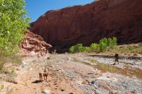
Trachyte, while nothing like Maidenwater, was a beautiful and serene place to hike through. There were no footprints or signs of other people at all. The character changed quite a bit along the upper route from open washes to the occasional solid rock river bed with small pools and waterfalls.
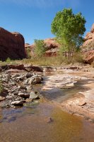
I was quite impressed by this large beaver damn near the mouth of Trail Canyon. I can't imagine this holds up to a flash flood.
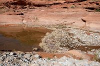
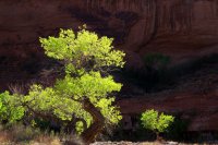
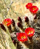
The first claret cups of my 2012 backpacking season.
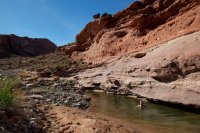
A great little swimming hole along the way. It was very hot hiking down Trachyte but this cooled us off nicely.
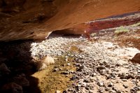
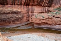
About half way down to Woodruff, Trachyte changes character dramatically and narrows up. Just as it starts, there are several very deep and low undercuts. Some were only a few feet high with the river flowing beneath but 20-30 feet deep.
We were intrigued as to why so many of these rocks were standing up right in an alcove above a bend in the river. It doesn't look at all to me like ruins, but I just have a hard time believing so many of those rocks would just happne to be standing on end. Does anyone know?

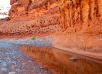
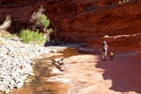
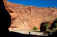
Trachyte got narrower and narrower the closer we got to Woodruff. We decided we would push through to that point because we wanted colder water. The water in Trachyte was quite warm.
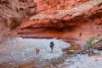
About 100 yards before the mouth of Woodruff, we found a fantastic spring coming out of the wall in many places. Luckily there was one spot that had a good flow that we could just stick our water bottles under. I was out of water at this point so it was particularly awesome to get there and just start drinking off of it. We filled all of our bladders and bottles and went looking for a campsite.
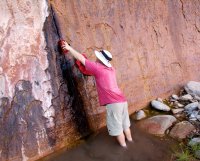
It was getting late and we decided to try for some bench camping for better views of the sky.

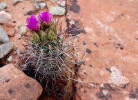
I scrambled a hundred feet or so off the canyon floor and found this beautiful Whipple's Fish Hook cactus along the way.
The bench spot by the spring didn't pan out. Great bench, just nowhere to camp without major destruction. So we went on down to check out Woodruff. We could tell immediately that there were no spots near the confluence. It was very narrow down.
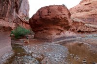
So we webt a bit further down Trachyte where we found a much better bench site almost directly above the confluence with Woodruff. It is an impressive confluence in my opinion. I've never seen one quite like it.
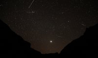
We laid out on the tarp the rest of the night, sipping whiskey and watching the sky. It was near the peak of the Lyrid Meteor shower. We didn't see a ton of them but enough to make it interesting. The big one in the top of this photo was actually much, much larger. I was lucky it made it into the frame at all. This is a composite of several frames of a time lapse I took. The bright object in the sky is Venus.
We slept all night out on the tarp with no tents or bug protection. I was proud of myself for that because it was very warm with plenty of 'creepy crawlies' about. We even had a loud chorus of frogs below us in the river.
The next morning we started back down Trachyte. Along the way we caught back up to a small herd of cows that we had encountered the night before.
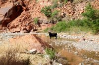
They made an awful mess of the place. Everywhere we followed them the ground was torn up with explosive cow diarrhea all over the place. I really don't think cows are meant to thrive on desert foliage. At least these ones have water though. I feel so bad for all of the black and brown cows up near Hanksville just sweltering in the desert sun.
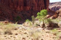
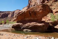
We found this nice swimming hole along the way so we stopped for a while.
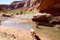
I played fetch with Sonny in the water. I'm probably posting way too many photos of this but I think they're entertaining.
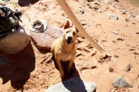
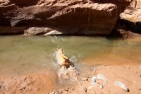
Satisfaction
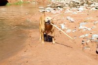
Shake!
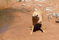
We spent a good amount of time at our swimming hole before heading further down Trachyte. Soon we were at the mouth of Swett Creek debating whether to continue hiking to Lake Powell. In high water, the lake would go all the way to Swett and a little beyond. But when it's low, you have to hike much further down Trachyte to get there.
We decided to go for it, how often are you here afterall? The evidence of the lake was very apparent as we hiked along. These high layers of sediment are from when the lake was at or near full pool.
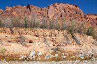
Further down, we reached more recent layers of sediment. I would imagine this is actually from the high water point last year.
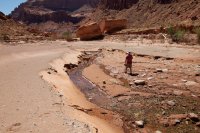
And after about 3/4 mile of hiking, we had reached the damn dam. Sorry, had to slip that in somewhere.
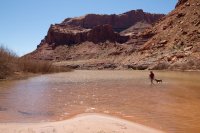
We climbed up to the high watermark on the side of the canyon and had lunch as the powerboats whizzed around in the distance, thinking about what this place must have been like before it was filled with silt and mud and talking about renting a boat one of these days and taking advantage of the water to reach some remote canyons... so long as it's there.
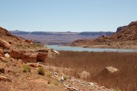
Looking back up into Trachyte. This would be an AWESOME place to camp for a night. There is so much driftwood at the high water mark. you could seriously build a huuuuuge campfire and not feel a bit bad about it. Hell, you can't do as much damage as the lake has , right?
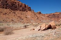
More silt deposits on the hike back. Totally different character than the rest of Trachyte.
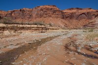
Back at Swett Creek, we debated our plan. The beta I was going off had said nothing about water availability in Swett other than that the narrows there can hold a lot of water. I guess that made me think there must be a reliable source of water throughout the canyon. We were mistaken, it was bone dry. We didn't really want to drink out of Trachyte with all the cows around but we each took a liter and started packing up into Swett not knowing when or if we would find more. Did I mention it was really, really hot out???
Continue reading in Part 3: Swett Creek
Featured image for slideshow:
Part 1: Maidenwater Canyon
Part 3: Swett Creek
Trachyte Creek, April 2012
After taking our time getting through Maidenwater Canyon, we found ourselves wandering down the relatively open Trachyte Creek. The water in Trachyte was running clean and clear so we had the luxury of camping anywhere we wanted rather than having to push for Woodruff Canyon. When Trachyte is siltier, Woodruff is typically the next reliable source of clean water after leaving Maidenwater.

Trachyte, while nothing like Maidenwater, was a beautiful and serene place to hike through. There were no footprints or signs of other people at all. The character changed quite a bit along the upper route from open washes to the occasional solid rock river bed with small pools and waterfalls.

I was quite impressed by this large beaver damn near the mouth of Trail Canyon. I can't imagine this holds up to a flash flood.


The first claret cups of my 2012 backpacking season.

A great little swimming hole along the way. It was very hot hiking down Trachyte but this cooled us off nicely.

About half way down to Woodruff, Trachyte changes character dramatically and narrows up. Just as it starts, there are several very deep and low undercuts. Some were only a few feet high with the river flowing beneath but 20-30 feet deep.

We were intrigued as to why so many of these rocks were standing up right in an alcove above a bend in the river. It doesn't look at all to me like ruins, but I just have a hard time believing so many of those rocks would just happne to be standing on end. Does anyone know?


Trachyte got narrower and narrower the closer we got to Woodruff. We decided we would push through to that point because we wanted colder water. The water in Trachyte was quite warm.

About 100 yards before the mouth of Woodruff, we found a fantastic spring coming out of the wall in many places. Luckily there was one spot that had a good flow that we could just stick our water bottles under. I was out of water at this point so it was particularly awesome to get there and just start drinking off of it. We filled all of our bladders and bottles and went looking for a campsite.

It was getting late and we decided to try for some bench camping for better views of the sky.

I scrambled a hundred feet or so off the canyon floor and found this beautiful Whipple's Fish Hook cactus along the way.

The bench spot by the spring didn't pan out. Great bench, just nowhere to camp without major destruction. So we went on down to check out Woodruff. We could tell immediately that there were no spots near the confluence. It was very narrow down.

So we webt a bit further down Trachyte where we found a much better bench site almost directly above the confluence with Woodruff. It is an impressive confluence in my opinion. I've never seen one quite like it.

We laid out on the tarp the rest of the night, sipping whiskey and watching the sky. It was near the peak of the Lyrid Meteor shower. We didn't see a ton of them but enough to make it interesting. The big one in the top of this photo was actually much, much larger. I was lucky it made it into the frame at all. This is a composite of several frames of a time lapse I took. The bright object in the sky is Venus.

We slept all night out on the tarp with no tents or bug protection. I was proud of myself for that because it was very warm with plenty of 'creepy crawlies' about. We even had a loud chorus of frogs below us in the river.
The next morning we started back down Trachyte. Along the way we caught back up to a small herd of cows that we had encountered the night before.

They made an awful mess of the place. Everywhere we followed them the ground was torn up with explosive cow diarrhea all over the place. I really don't think cows are meant to thrive on desert foliage. At least these ones have water though. I feel so bad for all of the black and brown cows up near Hanksville just sweltering in the desert sun.

We found this nice swimming hole along the way so we stopped for a while.


I played fetch with Sonny in the water. I'm probably posting way too many photos of this but I think they're entertaining.


Satisfaction

Shake!

We spent a good amount of time at our swimming hole before heading further down Trachyte. Soon we were at the mouth of Swett Creek debating whether to continue hiking to Lake Powell. In high water, the lake would go all the way to Swett and a little beyond. But when it's low, you have to hike much further down Trachyte to get there.
We decided to go for it, how often are you here afterall? The evidence of the lake was very apparent as we hiked along. These high layers of sediment are from when the lake was at or near full pool.

Further down, we reached more recent layers of sediment. I would imagine this is actually from the high water point last year.

And after about 3/4 mile of hiking, we had reached the damn dam. Sorry, had to slip that in somewhere.

We climbed up to the high watermark on the side of the canyon and had lunch as the powerboats whizzed around in the distance, thinking about what this place must have been like before it was filled with silt and mud and talking about renting a boat one of these days and taking advantage of the water to reach some remote canyons... so long as it's there.

Looking back up into Trachyte. This would be an AWESOME place to camp for a night. There is so much driftwood at the high water mark. you could seriously build a huuuuuge campfire and not feel a bit bad about it. Hell, you can't do as much damage as the lake has , right?

More silt deposits on the hike back. Totally different character than the rest of Trachyte.

Back at Swett Creek, we debated our plan. The beta I was going off had said nothing about water availability in Swett other than that the narrows there can hold a lot of water. I guess that made me think there must be a reliable source of water throughout the canyon. We were mistaken, it was bone dry. We didn't really want to drink out of Trachyte with all the cows around but we each took a liter and started packing up into Swett not knowing when or if we would find more. Did I mention it was really, really hot out???

Continue reading in Part 3: Swett Creek
Featured image for slideshow:


