- Joined
- Oct 6, 2021
- Messages
- 38
Hi folks, this report is for my trip to Trachyte Creek in Utah (near the Dirty Devil River and Henry Mountains) October 14–18, 2021.
This was my 48th canyon country adventure, though my first solo trip, because no one in my usual crew was available and I really had to get outside. Everything went well and I was pretty pleased, though it did get a bit lonely and I did miss the social part of being outside.
The photos are all on film, made with a Pentax Spotmatic II (1971) on 35mm black-and-white Ilford Delta 400, scanned by the film lab. I did teach myself how to develop film at home a few years ago, but then my second son arrived and I’ve been short on time ever since. I do hope to eventually return to these negatives and make some prints in a darkroom.
Day 1
I left home in the dark about 5:45 am and drove to the Trail Canyon trailhead, with a brief lunch stop near Cheesebox Canyon. I was on trail a little before 2:00 pm.
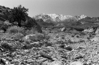
Trail Canyon is the shortest access to Trachyte Creek. Parking is just off the highway. It has very occasional social trails but is mostly a downstream cobblestone walk over granite washed down from the Henry Mountains, seen here on the skyline. This photo was made not too far below the trailhead.
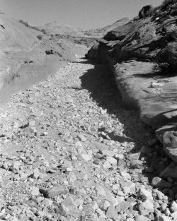
Trail Canyon as it starts to entrench into a real slickrock canyon, looking downstream.
Everything was quite wet. In particular, Trail had running water for perhaps the lower 15 minutes. According to the NWS radar estimates, it had rained quite a bit in the area in the few weeks before my trip, though the summer as a whole was pretty dry.
My camp was in Trachyte proper about 10 minutes below the confluence with Trail Canyon, under a cottonwood on a river-right bench. I did wander around for nearly 90 minutes looking for the “perfect” campsite, per my usual excess. I had hoped to do a short day-hike, e.g. to lower Maidenwater Canyon, which has some very nice narrows, but was too tired after my early morning, long drive, and wandering in search of camp, and also I was on vacation and had no deadlines. Dinner was frito pie; rating: delicious. I was in bed by 8:30, though I read for a while.
One small victory after bedtime was that a cow came into / very near my camp, but I didn’t freak out despite being all alone in the dark a long way from home, and I figured out fairly quickly that the huge animal snuffling around was a cow and not, say, a hungry bear.
Day 2
Again in the style of being on vacation, I had a very leisurely morning, not emerging from my tent until nearly 9:00 am. Breakfast was oatmeal with butter & brown sugar, something new which I determined was rather gross. Fortunately I had the exact same thing for every other breakfast too. I am still in search of somewhat efficient yet tasty backpacking breakfast food.
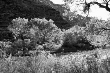
Mid-morning view from my camp. The cottonwoods were just starting to turn.
Goal for the day was to route-find up and over from a little below camp into Woodruff Canyon, a tributary of Trachyte. Satellite photos suggested this was possible. Then I hoped to follow Woodruff down to the confluence and then return to camp via Trachyte.
Ascent from the creek to the canyon rim was pretty straightforward, and the route is visible in its entirety from the bottom.
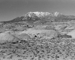
Henry Mountains overlooking the bench between Trachyte and Woodruff.
Once on the rim, I went due south to a point overlooking a shallow draw, then bench-walked to the west and worked my way down through the ledge system to the floor of Woodruff Canyon. The route-finding was fairly complex but no climbing was needed. Not far from the bottom was a single small cairn.
From there I headed down-canyon along the clear, flowing stream. After not too far the canyon began to cut into the Wingate and sections of narrows appeared. These were straightforward to bypass on the benches above.
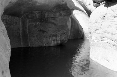
Pool in the first narrows.
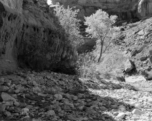
Cottonwoods in Woodruff Canyon.
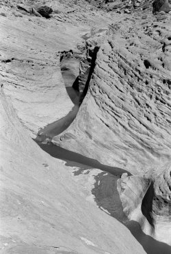
More Wingate narrows.
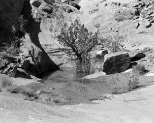
Juniper and pool at mouth of unnamed side canyon.
Close to the confluence with the “South Fork” (as named by Kelsey), there is a fall of 10–20 feet that I wasn’t willing to down-climb without technical equipment and a partner. Kelsey describes a high bypass accessed via the South Fork; I found a walk-up that did not require any climbing to get started (in contrast to Kelsey who used “mouse holes”). This passes close by a remarkable natural arch. The basic route is to ascend to the top of the Wingate, then follow that around the corner back into Woodruff proper (below the confluence) and descend back to the previous level using a debris slope. Exposure is minimal, though route-finding errors can very quickly lead to spectacular danger. Once back on the previous bench, Kelsey describes an “easy” cliff back to the canyon floor.
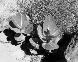
Milkweed in the South Fork.
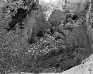
End of the line; I wasn’t able to find my way down to the bottom. Below the large boulder is a big pool, described by Kelsey as a mandatory swim or wade, though (spoiler alert) the ledge visible at left leads to an easy bypass downclimb that stays dry.
It was a bit frustrating to turn back because the far wall of Trachyte were easily visible only a few hundred yards ahead, though reading between the lines in the guidebook at lunch, I became skeptical the crux downclimb was something I was willing to do solo, so I didn’t look super hard. That said, I think my error was turning downstream instead of upstream when I reached the final cliff, though it’s also possible I just walked past it.
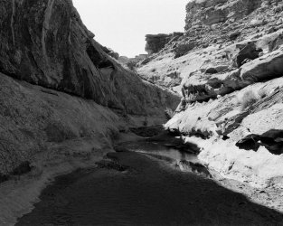
Looking back up the South Fork after reversing the bypass traverse.
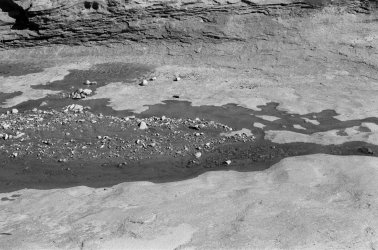
Trickle of water just above the blocking fall. This was a fabulous warm lunch spot and then break spot on the way back.
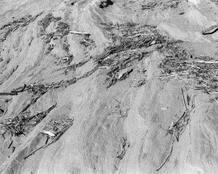
Driftwood in Woodruff Canyon.
One mistake I made was to not pay close enough attention to where I’d come down, assuming I would be making a loop rather than returning the same way. The start of the route back up is quite difficult to spot, since the ledges tend to all look the same and the route itself is essentially invisible from below. However my footprints told me that I hadn’t yet passed it, and after a few tries I found the start and made my way back up to the canyon rim.
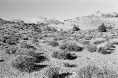
Bench between Woodruff and Trachyte on the way back.
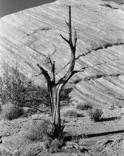
Dead juniper above Trachyte Creek.
Descent back into Trachyte was again straightforward. The whole trip I only had a couple of times where I was unhappy with my travel procedures, one of them being on this descent where I stepped on an unabridged dictionary-sized rock and it slid off the ledge and fell about three feet. Fortunately there was no further excitement.
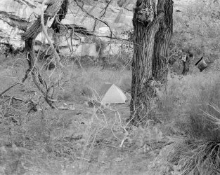
My camp. It sure felt tiny with only one person’s stuff.
Dinner was macaroni and cheese. I splurged on the ready-mix stuff with orange goo pre–made, rather than the add milk and butter kind. Again I was in bed early.
Day 3
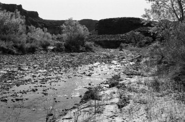
Morning view downstream from camp. Trachyte Creek flowed vigorously throughout the trip, enough that crossing required a little planning but not enough to be an obstacle.
My original plan for the day had been to go upstream and see what cool side canyons I could find. However, given my failure to complete the loop on Day 2, I wanted to try Woodruff again from below to figure out whether the loop was feasible. So I went downstream along the creek.
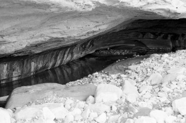
Deeply undercut alcove about 45 minutes below the confluence with Trail Canyon.
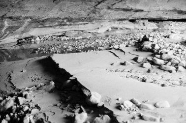
Sand bar inside the alcove.
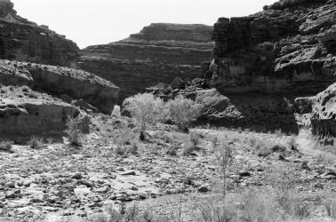
Cottonwoods and the walls of Trachyte Creek as it starts to cut into the Wingate.
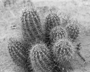
Cactus I found.
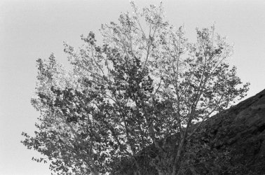
Cottonwood tree.
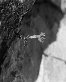
Flower growing out of a seep in the wall.
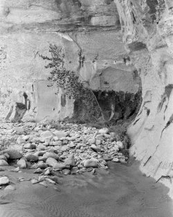
There were quite a few seeps between Trail Canyon and Woodruff.
Trachyte proper isn’t nearly as cobbly as Trail Canyon, but it’s still fairly rough walking, being mostly in the stream bed with few social trails. The confluence with Woodruff was maybe 90 minutes or a couple hours below Trail Canyon and is very cool (as I believe another commenter here noted a few years ago). I also passed several side canyons that looked promising to explore.
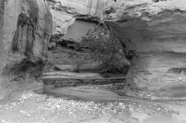
Woodruff Canyon as it enters Trachyte.
I turned and went up Woodruff. It was flowing and took some care to avoid getting wet.
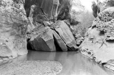
The big boulder in lower Woodruff. My turn-around ledge from the previous day is visible in the middle ground. According to my walking stick, the pool was definitely a swim, and the climb out on the far side looked very difficult. However, there is an easy climb (maybe Class 4– with minimal exposure, then Class 3 with 10' of exposure?) to the right that gives a dry bypass.
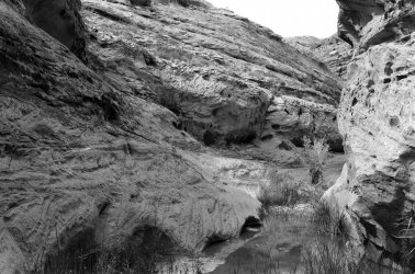
I believe this slope is the “easy” cliff described by Kelsey. There is a cairn at the top, though hard to see in this photo. I didn’t go any further because I thought the odds it was something I wanted to try solo were low enough that I didn’t want to do the required wading to get to the bottom.
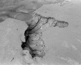
Cool erosional feature in a sand back a few yards above the confluence with Trachyte.
Despite not quite closing the loop, I was pretty happy with what I learned. From Woodruff I continued downstream in Trachyte to see what I came to. The going was quite a bit faster with fewer cobbles and more sand benches and social trails.
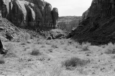
Typical view in Trachyte between Woodruff Canyon and Swett Creek.
My plan was to continue downstream until I got tired. However after only an hour, a large side canyon entered from river right and tamerisk-chocked benches began to emerge. I had arrived at Swett Creek! I briefly contemplated continuing up Swett to see the Hoskinnini Monument (a large pillar of Wingate Sandstone) but came to my senses and took a break at the base of a short, purple Chinle Formation cliff before returning upstream.
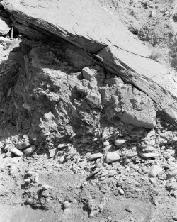
I’m pretty sure this is an ancient landslide atop the former streambed cobbles, due to the mix of angular particle sizes (from sand to boulders like the one at top and larger).
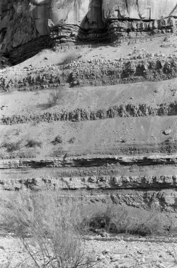
Lower Trachyte has some very nice exposures of layered Chinle Formation.
It was a bit of a slog back to camp. Omitting the side trip up Swett was definitely the right move. Dinner was my amazing enchiladas (no trip is complete without them) and then another somewhat early bedtime.
Day 4
I got up at least a little early (awake at first light), packed up, and headed for home. The last morning does always make me a bit melancholy.
I was surprised to discover that my camp was only about 10 minutes below Trail Canyon, since it took me 1½ hours of wandering from the confluence on the way in.
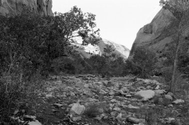
Typical scenery in lower Trail Canyon.
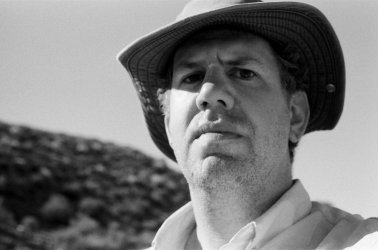
The required “after” picture. Dang what rugged good looks! (I must say it is a quite different experience taking a selfie on film with no live view nor even a way to check what happened afterwards.)
And that’s a wrap! Thanks for reading. I am happy to answer any questions.
This was my 48th canyon country adventure, though my first solo trip, because no one in my usual crew was available and I really had to get outside. Everything went well and I was pretty pleased, though it did get a bit lonely and I did miss the social part of being outside.
The photos are all on film, made with a Pentax Spotmatic II (1971) on 35mm black-and-white Ilford Delta 400, scanned by the film lab. I did teach myself how to develop film at home a few years ago, but then my second son arrived and I’ve been short on time ever since. I do hope to eventually return to these negatives and make some prints in a darkroom.
Day 1
I left home in the dark about 5:45 am and drove to the Trail Canyon trailhead, with a brief lunch stop near Cheesebox Canyon. I was on trail a little before 2:00 pm.

Trail Canyon is the shortest access to Trachyte Creek. Parking is just off the highway. It has very occasional social trails but is mostly a downstream cobblestone walk over granite washed down from the Henry Mountains, seen here on the skyline. This photo was made not too far below the trailhead.

Trail Canyon as it starts to entrench into a real slickrock canyon, looking downstream.
Everything was quite wet. In particular, Trail had running water for perhaps the lower 15 minutes. According to the NWS radar estimates, it had rained quite a bit in the area in the few weeks before my trip, though the summer as a whole was pretty dry.
My camp was in Trachyte proper about 10 minutes below the confluence with Trail Canyon, under a cottonwood on a river-right bench. I did wander around for nearly 90 minutes looking for the “perfect” campsite, per my usual excess. I had hoped to do a short day-hike, e.g. to lower Maidenwater Canyon, which has some very nice narrows, but was too tired after my early morning, long drive, and wandering in search of camp, and also I was on vacation and had no deadlines. Dinner was frito pie; rating: delicious. I was in bed by 8:30, though I read for a while.
One small victory after bedtime was that a cow came into / very near my camp, but I didn’t freak out despite being all alone in the dark a long way from home, and I figured out fairly quickly that the huge animal snuffling around was a cow and not, say, a hungry bear.
Day 2
Again in the style of being on vacation, I had a very leisurely morning, not emerging from my tent until nearly 9:00 am. Breakfast was oatmeal with butter & brown sugar, something new which I determined was rather gross. Fortunately I had the exact same thing for every other breakfast too. I am still in search of somewhat efficient yet tasty backpacking breakfast food.

Mid-morning view from my camp. The cottonwoods were just starting to turn.
Goal for the day was to route-find up and over from a little below camp into Woodruff Canyon, a tributary of Trachyte. Satellite photos suggested this was possible. Then I hoped to follow Woodruff down to the confluence and then return to camp via Trachyte.
Ascent from the creek to the canyon rim was pretty straightforward, and the route is visible in its entirety from the bottom.

Henry Mountains overlooking the bench between Trachyte and Woodruff.
Once on the rim, I went due south to a point overlooking a shallow draw, then bench-walked to the west and worked my way down through the ledge system to the floor of Woodruff Canyon. The route-finding was fairly complex but no climbing was needed. Not far from the bottom was a single small cairn.
From there I headed down-canyon along the clear, flowing stream. After not too far the canyon began to cut into the Wingate and sections of narrows appeared. These were straightforward to bypass on the benches above.

Pool in the first narrows.

Cottonwoods in Woodruff Canyon.

More Wingate narrows.

Juniper and pool at mouth of unnamed side canyon.
Close to the confluence with the “South Fork” (as named by Kelsey), there is a fall of 10–20 feet that I wasn’t willing to down-climb without technical equipment and a partner. Kelsey describes a high bypass accessed via the South Fork; I found a walk-up that did not require any climbing to get started (in contrast to Kelsey who used “mouse holes”). This passes close by a remarkable natural arch. The basic route is to ascend to the top of the Wingate, then follow that around the corner back into Woodruff proper (below the confluence) and descend back to the previous level using a debris slope. Exposure is minimal, though route-finding errors can very quickly lead to spectacular danger. Once back on the previous bench, Kelsey describes an “easy” cliff back to the canyon floor.

Milkweed in the South Fork.

End of the line; I wasn’t able to find my way down to the bottom. Below the large boulder is a big pool, described by Kelsey as a mandatory swim or wade, though (spoiler alert) the ledge visible at left leads to an easy bypass downclimb that stays dry.
It was a bit frustrating to turn back because the far wall of Trachyte were easily visible only a few hundred yards ahead, though reading between the lines in the guidebook at lunch, I became skeptical the crux downclimb was something I was willing to do solo, so I didn’t look super hard. That said, I think my error was turning downstream instead of upstream when I reached the final cliff, though it’s also possible I just walked past it.

Looking back up the South Fork after reversing the bypass traverse.

Trickle of water just above the blocking fall. This was a fabulous warm lunch spot and then break spot on the way back.

Driftwood in Woodruff Canyon.
One mistake I made was to not pay close enough attention to where I’d come down, assuming I would be making a loop rather than returning the same way. The start of the route back up is quite difficult to spot, since the ledges tend to all look the same and the route itself is essentially invisible from below. However my footprints told me that I hadn’t yet passed it, and after a few tries I found the start and made my way back up to the canyon rim.

Bench between Woodruff and Trachyte on the way back.

Dead juniper above Trachyte Creek.
Descent back into Trachyte was again straightforward. The whole trip I only had a couple of times where I was unhappy with my travel procedures, one of them being on this descent where I stepped on an unabridged dictionary-sized rock and it slid off the ledge and fell about three feet. Fortunately there was no further excitement.

My camp. It sure felt tiny with only one person’s stuff.
Dinner was macaroni and cheese. I splurged on the ready-mix stuff with orange goo pre–made, rather than the add milk and butter kind. Again I was in bed early.
Day 3

Morning view downstream from camp. Trachyte Creek flowed vigorously throughout the trip, enough that crossing required a little planning but not enough to be an obstacle.
My original plan for the day had been to go upstream and see what cool side canyons I could find. However, given my failure to complete the loop on Day 2, I wanted to try Woodruff again from below to figure out whether the loop was feasible. So I went downstream along the creek.

Deeply undercut alcove about 45 minutes below the confluence with Trail Canyon.

Sand bar inside the alcove.

Cottonwoods and the walls of Trachyte Creek as it starts to cut into the Wingate.

Cactus I found.

Cottonwood tree.

Flower growing out of a seep in the wall.

There were quite a few seeps between Trail Canyon and Woodruff.
Trachyte proper isn’t nearly as cobbly as Trail Canyon, but it’s still fairly rough walking, being mostly in the stream bed with few social trails. The confluence with Woodruff was maybe 90 minutes or a couple hours below Trail Canyon and is very cool (as I believe another commenter here noted a few years ago). I also passed several side canyons that looked promising to explore.

Woodruff Canyon as it enters Trachyte.
I turned and went up Woodruff. It was flowing and took some care to avoid getting wet.

The big boulder in lower Woodruff. My turn-around ledge from the previous day is visible in the middle ground. According to my walking stick, the pool was definitely a swim, and the climb out on the far side looked very difficult. However, there is an easy climb (maybe Class 4– with minimal exposure, then Class 3 with 10' of exposure?) to the right that gives a dry bypass.

I believe this slope is the “easy” cliff described by Kelsey. There is a cairn at the top, though hard to see in this photo. I didn’t go any further because I thought the odds it was something I wanted to try solo were low enough that I didn’t want to do the required wading to get to the bottom.

Cool erosional feature in a sand back a few yards above the confluence with Trachyte.
Despite not quite closing the loop, I was pretty happy with what I learned. From Woodruff I continued downstream in Trachyte to see what I came to. The going was quite a bit faster with fewer cobbles and more sand benches and social trails.

Typical view in Trachyte between Woodruff Canyon and Swett Creek.
My plan was to continue downstream until I got tired. However after only an hour, a large side canyon entered from river right and tamerisk-chocked benches began to emerge. I had arrived at Swett Creek! I briefly contemplated continuing up Swett to see the Hoskinnini Monument (a large pillar of Wingate Sandstone) but came to my senses and took a break at the base of a short, purple Chinle Formation cliff before returning upstream.

I’m pretty sure this is an ancient landslide atop the former streambed cobbles, due to the mix of angular particle sizes (from sand to boulders like the one at top and larger).

Lower Trachyte has some very nice exposures of layered Chinle Formation.
It was a bit of a slog back to camp. Omitting the side trip up Swett was definitely the right move. Dinner was my amazing enchiladas (no trip is complete without them) and then another somewhat early bedtime.
Day 4
I got up at least a little early (awake at first light), packed up, and headed for home. The last morning does always make me a bit melancholy.
I was surprised to discover that my camp was only about 10 minutes below Trail Canyon, since it took me 1½ hours of wandering from the confluence on the way in.

Typical scenery in lower Trail Canyon.

The required “after” picture. Dang what rugged good looks! (I must say it is a quite different experience taking a selfie on film with no live view nor even a way to check what happened afterwards.)
And that’s a wrap! Thanks for reading. I am happy to answer any questions.
Last edited:
