Touching the Thorofare

Pringles

Member
.
Joined
Nov 23, 2015
Messages
460
This will be an odd post for me. First, there are people. I usually go alone, and when I go with people, there's usually only one other person. This trip had 6 of us. I don't have any permission from anyone to post about them, or their pictures, so let's just pretend they aren't there, ok? I will say that they were all nice people and we all got along. It ends differently, too.

I got a new knee a year and a half ago. I've been ok for backpacking, but haven't done anything remotely far, even for me. I also haven't trusted my balance as much as I used to. I have been conversing on Facebook with a man, Jim, who is from the other side of Yellowstone, and he had a health issue that was resolved in March or April, but he also was feeling a little slower and less strong than previously. I had "won" an early entry in the reservation lottery. It wasn't particularly good, so as my appointed time drew near, I was going to go to Cache Creek, up to the next campsite (looking at Wahb Springs as I passed, which I had read about as a kid), and then back down, and out. Three nights, pretty easy days, hopefully pretty, check off Wahb Springs. About 45 minutes before I was allowed to get my sites, I sent Jim a note and asked if he wanted to join me. He was quite interested, but had some suggestions. If he brought a couple of his step kids, and a couple of their friends, we could have "sherpas." He also suggested a longer, more ambitious trip. In the 45 minutes, we worked out what we could do, and at the appointed time, BAM, I had the trip. As the trip grew closer, I looked at the altitude gain, and ain't no way I was doin' that. I told him I'd be happy to shuttle, but I wasn't doing it. Once he found the real elevation gain, he wasn't doing it either. Of course my original easy peasy trip was no longer available. We fiddled a little, and let it sit. A few days later, he suggested that we get shuttled by boat to a drop off point, and then hike into the Thorofare. Some sites were open, and we made a plan, and I went to rec . gov to reserve plan B. Rec . gov wouldn't let me. I fussed with it and fussed, and called the backcountry office, which didn't pick up, and I sent an e-mail and they were doing something and, well, they finally called me. This was probably to keep me from having a total meltdown. Rec . gov is not my friend. Apparently, you must delete your trip from the end and work your way forward. Whatever. We now had reservations for the same dates, but to the Thorofare. Whoooo hoooo. We got reservations on the shuttle. Done. Except... I got to looking. We had to ford the Yellowstone. I'd heard from two people, whose opinions I respect, who said that Yellowstone ford might be quite deep. Not one, but two people told me that. I didn't like that idea. I stewed. I suggested that we might want to adjust our plans. There weren't any other sites open, though. Pooh. We kept watching. Ultimately, we did get to adjust it so we weren't swimming the Yellowstone, but it meant that we would only just get to the edge of the Thorofare. Oh well, it looked to be a good trip, so I was happy with it.

On the appointed day, we met at the marina at Bridge Bay. It was me, Jim, his step son and daughter and each had a friend. The kids were late high school age. We loaded our stuff on the boats, under the direction of the captain. It was his first season doing shuttles, and the water was low, so he was going to drop us off at a different spot than usual. Whatever.

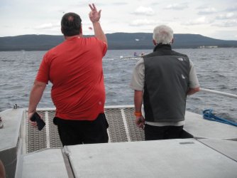
Out of the bay, we got up onto plane, and were zipping along. The captain noticed an outboard boat that he thought was venturing too far out considering how rough it was. He radioed back, and they said it was ok. We went a little further and he was more concerned, so he turned back toward the boat. Our folks were out back, trying to talk to the folks on the other boat which was doing its best to avoid getting close to our boat. Ultimately, no conversation was had but they turned in a different, somewhat sheltered direction, and we sped off again.
01.JPG

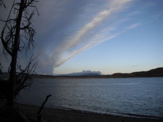
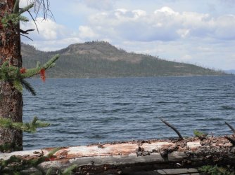
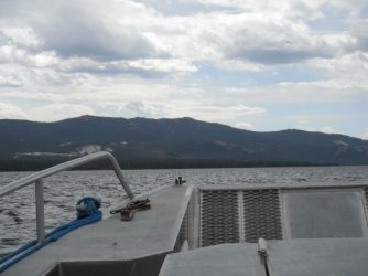
Headed toward the far shore.

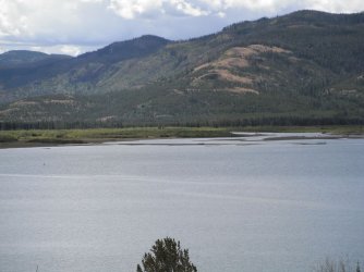
You see the thermal area on the side of the hill? That is the Brimstone Thermal Area, I think. There had been some talk about going up there to explore a little bit. Ultimately, we didn't.
02.JPG

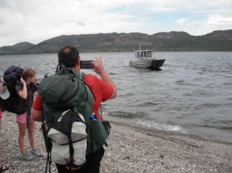
The boat has a ramp that drops down, sort of like for Marines landing. My dad was a Marine. I am a delicate little thing, but liked the idea. :) It did make it easy to go ashore.

We were to be picked up at this spot (if you remember, it was different from the usual Columbine drop off point) in five or six days. We took pictures as the boat sped off.
04.JPG

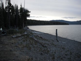
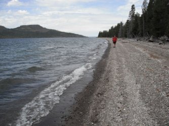
There's always that vacant feeling when the drop off vehicle leaves and you are left with no option but to move along under your own power. Since it wasn't the usual drop off point, there was no direct trail to the trail leading to the Thorofare. Well pooh. We went toward the trail, but immediately above the lip of the beach was a pond that blocked the route. So, we walked south along the shore. It wasn't awful. It was mostly small rocks. I've walked on sand and it's worse, and cobbles, and they're lots worse. This was a little shifty, but not bad.
05.JPG

We came to a dry creek, and we explored following it to the trail, but there were lots of downed trees, so we went back to the shore.
06.JPG

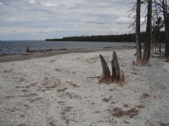
There were a few places where we had to climb over trees and branches, or walk out into the water to get around. Again, I didn't mind that much, but others found it more distasteful. We stopped for snacks. Mmmm. Snacks.
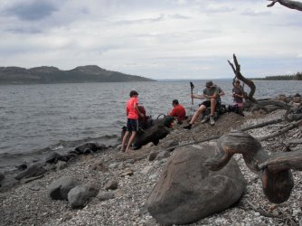
08.JPG

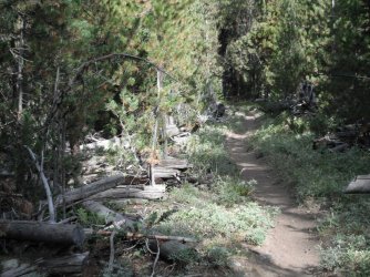
We came to a campsite. This was to be our final night's campsite. We had another snack, or maybe lunch. I forget which. After that, we went up to the trail (no more shore walking!) and headed down the trail toward the next site. That was to be our site for the night. Being poky, I wandered off first, so I could poke along. It was in woods, with the occasional opening. The walking was easier than the shore. I'd only been to the first set of campsites down from Nine Mile, so this was new to me, and I was enjoying strolling along.
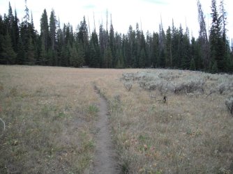
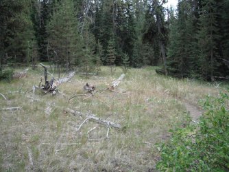
09.JPG

10.JPG

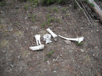
Kinda typical for Yellowstone, there were some bones beside the trail to make you wonder who/what came before.
11.JPG

At camp, I found a place to put up my tent. It was sort of on the edge of the camp, and provided a view of the lake. I like being on the edge of the campsite, when there are people. It's quieter and, well, less people-y.
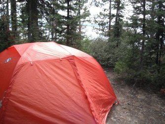
12.JPG

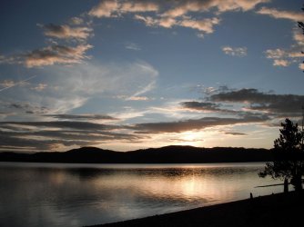
It got cloudy. It may have sprinkled, though I don't remember. Others paid a lot of attention to the sunset. I crawled in my tent.
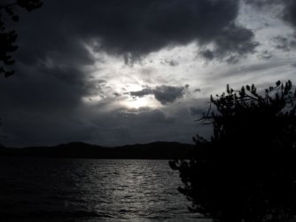
13.JPG
 
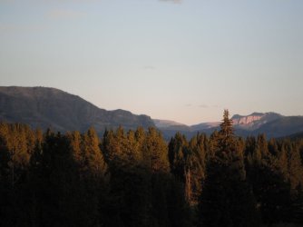
Day two dawned clear, with a few clouds. I was up earlier than others, which I'm only sure of because off in the medium distance, I saw a grizzly walk around the next point, and no one else was around to see that. I had my breakfast of coffee, and a little pouch of yogurt with a granola bar. It was a good combo.

14.JPG

That point in the middle distance was where I saw a round, rolly-polly grizzly go.

15.JPG

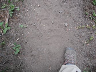
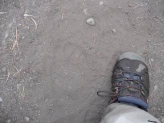
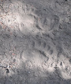
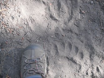
I packed up pretty quickly, and started down the trail. Almost immediately, I noticed footprints. Large footprints. My "Hey Bear" yelling became a little louder. Jim and I talked later, and we agreed, there were a number of bear's prints. We guessed this was a big boar, but later there were smaller adult bear prints, and a sow with a cub's prints, and another large grizzly, and a bear or two going the other way for a while. There were plenty of bears using the Bear Interstate.

16.JPG

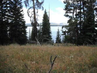
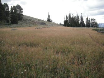
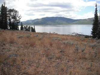
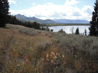
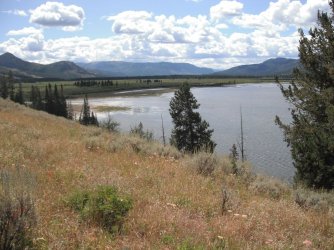
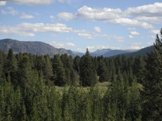
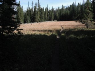
The trail came to an open meadow, with beautiful views. I think this was right below Landford Point. Maybe? Langford (if that's right) was on one of the early expeditions. It certainly was beautiful. It' the kind of place that you're glad there isn't a road right up to it. The road would have to offer a parking area, and an outhouse or two. It was good that there was no road.

17.JPG

The hill on the left is part of that point.

18.JPG

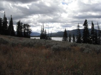
Sometimes the clouds made the view more dramatic.

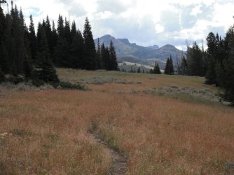
I was finally able to see where the trail was leading. It looked impressive. Sort of like an area that is as impressive as the Lamar, only I don't know about it yet.

19.JPG

Down there is where the creek we were to camp at drains out into Yellowstone Lake, AND the Yellowstone River drains into the lake.

20.JPG

My fingers kept clicking the button. Did I need more pictures? No. But they kept taking themselves.

I thought I was getting close to the campsite, which was to be just this side of the creek. I still had a mile or more to go. It wasn't hard walking, though. I had lots to look at.

21.JPG

Back to looking at the soggy mouth of the creek and river. And the Absaroka Mountains.

I enjoy looking at new trail. You don't know what you're seeing and it's all fresh.

22.JPG

I spent some time looking at the mouth of the Yellowstone River. There had been some birds, and it took me a little too long to recognize that they were Canada geese.

I looked at those open spots on the mountain across from me, and wondered if there were grizzlies wandering about there, like there often are in the Lamar.

23.JPG

Back to following the trail. It was getting closer to some woods, and I wondered if the campsite was just ahead.

No.

Of course not.

24.JPG

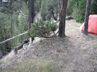
After another stretch in the woods, complete with bear prints. the trail came to our campsite. It was on the top of a hill, with Beaverdam Creek at the bottom. I turned down the little trail, and was surprised at how far it went. I think the campsite was 300 yards off the trail. After a short ways, the trail went along the edge of a bluff. It wasn't incredibly high, but it was high enough that it made me cautious. A fall would have been dangerous.

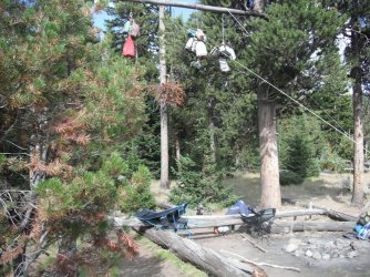
I came to the campsite, and hung my food, and wandered to the edge of camp to find a really nice spot. From the tent, I'd be able to see that view I'd been looking at for half the day. My tent fit just perfectly.

26.JPG

Eventually, the rest showed up. Food was hung, water was gathered, and wood for a fire. Jim stressed to the young ones that if a fire was built, it would have to be dead out, and that meant getting water. Water was visible from the campsite, but about 70 feet straight down that bluff. Or, 300 yards down the side trail to the main trail, and then down the hill to the creek. It was a ways.

Jim had offered sherpa services when we initially talked--that quick conversation we had in the 45 minutes before my rec . gov registration time. The sherpa service I did take advantage of was water retrieval and filtering. This was a spot that I truly appreciated it. Those young legs... they got lots of water, and I took my share, gratefully.

27.JPG

I sat in my little camp chair and looked out at that view. (It's sad that was the best we could do. :) )

28.JPG

You can't tell how large the drop off just ahead of my tent was. It was pretty steep, though. I loved that site. I referred to it as The IMAX Site because it was floor to ceiling view in about as Technicolor as Technicolor could be.

29.JPG

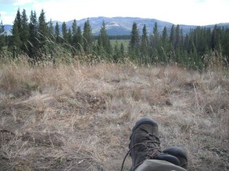
I probably took a nap, though, I remember doing a lot of sitting and staring. I'm not sure what I expect to get from staring at beautiful scenery, but stare I do. I stare and breathe and feel and smell it.

Possibly I should have tied my shoe.

30.JPG

The sun started to go down, and the light changed down the valley.

31.JPG

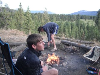
We had a fire, which I enjoyed. I rarely have a fire because of that "dead out" rule. If I don't start a fire, I don't have to worry about putting a fire out. But, I do enjoy watching the fire and *smelling* a fire. Oooo.

31a.JPG

The light to the east-ish was quite nice. One of the kids kept getting told to move and he never did seem to figure out that if the lenses were all pointing at him, it wasn't because the rest of us wanted a picture of him.

It was pretty and calm, and a nice ending to the day. The fire was put out, and we headed to our tents.

32.JPG
 
On this day, we only had to walk back to the trail, down the hill, slosh across the creek, and into the next campsite. My understanding is that once you cross Beaverdam Creek, you are in the Thorofare, so I figure I touched it. I got into the Thorofare by 30 or 40 yards. I guess even if I didn't, I got someplace pretty and nice. It made me happy.

On the previous day, the boys had done a little day hike and found that there was a long passage in willows. The trail to the campsite was through that long passage, and then off to the side. Once you got on the trail to the campsite, it was pretty overgrown, so they had walked the creek to the trail, and come back that way. We did the reverse on this day.

We walked back to the trail, down the hill, and into the creek. We went upstream a hundred yards, or so, and then found a little path, which led to the campsite. That was easy.

We hung food and set up tents and discussed a day hike. We had only hiked a half mile, or so. But all of us decided we wanted to enjoy here, rather than heading off for "there."

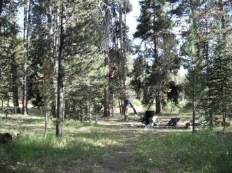
This site was in the open woods. We had lots of room for the tents, and a big kitchen area. It was a great rest day.

33.JPG

There was, alas, no great sunset from this campsite.
 
We began our journey back.

I was first out of camp. Hey, I hike slowly, but if I get going early, and keep moving, I can get a goodly ways down the trail. It's not much of a plan, but it's my plan.

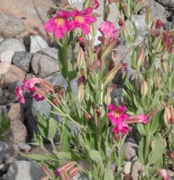
First I walked to the creek, where these flowers were blooming. They're monkey flowers, I think.

34.JPG

35.JPG

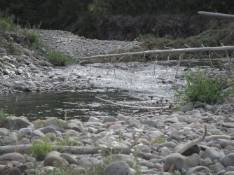
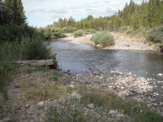
I walked down the shore for a ways, until I got to where I could see the main trail, then waded through the creek to the trail.

It wasn't much to wade, but it was startlingly refreshing early in the morning.

36.JPG

We were headed to our first night's campsite again. I wandered along, looking this way and that, and hollering, "Hey bear!"

38.JPG

Again, there were plenty of bear prints. You wonder where the bears are, but are also grateful that they aren't right on the trail when you are.

39.JPG

I had my head twisting around, looking at the scenery. It was beautiful and I was leaving after just a tiny taste. I consoled myself by thinking that while I wasn't going to see more of the new-to-me scenery, I had seen some. I would have to be happy with that. But I did look at as much of it as I could.

I got to the campsite, hung my food, and put my tent up in the site it had been at before. I think everyone put their tent up in the same site.

It wasn't as windy on this day, and I think the kids got to swim, and the guys played with a football.

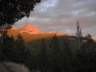
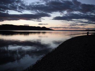
The sunset was worth watching.

40.JPG

41.JPG
 
Today was a short hike day. We had the next site over, the one we had eaten lunch at on the first day. It was close to the pickup point, and we had to be there by 10 am the next day. I think it was three miles, though I'm not sure.

I was up early, and watched that point where I'd seen the bear before, but saw nothing.

I packed up and headed out.

I was told later that there had been a bear at the edge of camp. Only one person had seen it, but they could see the bushes moving. It was a grizzly, and it was eating berries that were near the edge of camp. It was about 20 yards away. While they watched for it, all it did was eat.

The group packed up and hiked off toward the next campsite.

Meanwhile, as I hiked, there were again bear prints all over the trail.

42.JPG

43.JPG

I retraced steps through the little meadows.

44.JPG

I got to camp, hung my food, and picked a spot. It wasn't quite at the edge of camp... there was a spot a little further, but liked where I ended up. I could sort of see the water from inside my tent (unless it's raining, I sleep with one vestibule open, and can look out and see the water and stars).

45.JPG

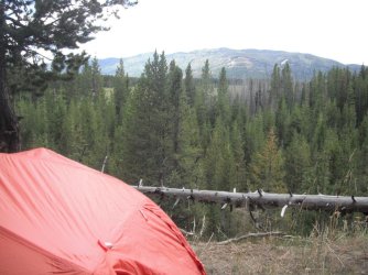
I've shown a picture of my tent at most sites. It's new. I stopped at REI one day this spring. Remind me I shouldn't do that. I don't need anything. Anything at all. Remind me! Yes, YOU.

They had last year's model of the Copperspur HV UL for a bunch off. It ended up being something like $360. I needed another tent like I needed a hole in my head, but here it is. The first time I put it up, I thought it was too delicate, and yet I kept it. Now that I've used it 10 nights, I like the double vestibules (most of my tents have two doors so that was nothing new). It is light, but seems durable enough. The stakes are v shaped, and kind of hard to get in the concrete like ground, but I added some wire-like titanium stakes, so I have options. What I found that I really, REALLY like is the laundromat pocket. They don't call it that, I don't think. But it's a big pocket on the foot end of the tent that has a gap between it and the mesh of the tent. That gap is maybe 2-3 inches, so if you put your socks in, there is some space for air to circulate and your socks, to allow them to dry. Above your head is a pocket that doesn't have that gap. It has little holes that are marked for earphone cords. I don't use those, but I put my headlamp in that pocket and let the strap dangle out. At o'dark thirty, I just reach up and grab the strap, and there's my headlamp. None of this rooting around "where I usually keep it" to actually find it. There are also little pockets beside the door, for things like glasses. I really like those pockets and how they let me organize things that want to be easy to find. I wish I'd had all of those pockets for the last 35 years. But, I have them now. Though, I rotate through tents each summer. I have to take allllll my gear-friends camping.
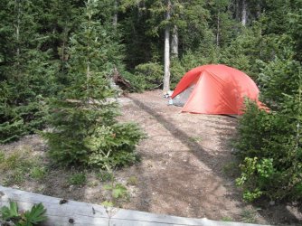
46.JPG

Since our pickup the next day was at the drop off point, and we had walked the shore, three of the four kids wanted to go scout out a better route, one that led from the nice trail, to the shore. So they went off on an expedition. I handed them my InReach, gave really basic instructions, and hoped they weren't going to need it. I'm not sure what the fourth kid did. I took a nap, and I think Jim did, too.

When they came back, the guys were talking about the route down Alluvium Creek, and how the trees that blocked the way were only for the last 50 or 100 yards, and we could go to the side to get by them. Yay. While they were talking about that, the third scout, came in, telling Jim about feeling dizzy and her chest hurt. Jim went into Wilderness First Responder mode. I was still mostly groggy from my nap, but something was going on, so I got up.

Jim sent the dizzy girl to her tent to lie down. Her heart rate was really high, and he hoped that laying down would lower it. After five or ten minutes, it was fluctuating, but still pretty high. He gave it a few more minutes and then told me to press the button on my InReach. I had to actually turn it on--I'd turned it off when they returned it to me after they got to camp--but when it was all fired up, I opened the little protector (so you don't accidentally press the SOS button) and hesitantly pressed it. Have you ever actually USED your InReach? I mostly carry it like one carries a tarp, so it won't rain. It's a decoration. I never dreamed I'd actually USE the thing. Anyway, it immediately started making noises. This isn't exact, but basically, "You've intiated an emergency alert. What is your emergency?" Um, I had no idea how to tell it what the emergency was. Helpfully, after two or three of those announcements, separated by a minute or so appiece, it said that I'd intiated an emergency alert, and I could communicate if I would tether my InReach to the app. Well, I did have the app installed. I'd done that a few years ago when I bought the thing. I opened the app and hoped for the best. I still couldn't tell it anything. It kept making suggestions for about 4 or 5 minutes, and then it pronounced that I'd intiated an emergecy alert and a plan was being made. Honestly, that's kind of what I'd always hoped for. I'd poke the button and something (helpful) would happen. In the meantime, one of the girls had a phone that had a single bar, and Jim called the park's comm center. He started explaining what the situation was. Again, the now-patient had a very high heart rate, and by now had other symptoms. They had more questions, and he went back to the tent with the patient to try to get answers and one of the other kids would talk on the phone. We "connected" that my Garmin SOS and this call were the same issue. The phone call broke up a couple of times, but we were told that a boat would be to us in about half an hour. Jim said to take down tents and be prepared to leave. We did. We had packs packed in ways that looked like a Boy's Scout Troops's first backpacking trip ever. Pacing and caring and looking to the water for the boat became activities. When it came into view, one of the boys wanted to make sure the boat knew where to land, so started to wave the brightest thing he had. (Never mind that the phone call had told the park service which site we were at, and that my GPS had alerted them to within 3 feet of where I was when it went off. This young man started waving the bag for his tent poles. (Yup, two and half feet long and 3 inches wide. Wildest waving ever. (I can joke because it turned out ok, right?) )

The boat buzzed toward the beach and slowed only at the end. A ranger hopped off and stuck something in the gravel to tie off the boat. Then a pair of paramedics got off the boat, and we pointed to the tent. I think they spent about 20 minutes with her, but it could have been more. Finally, they walked her to the boat. A ranger came to ask me about whether the rest of us wanted to stay or leave. I may have been using fuzzy logic, but of those of us who woud be left, the only last name I would have known would have been my own. And while I'm told that the phones had juice, if we needed to contact the park about an emergency, I'm remembering that the connection kept breaking off. Further, while my gizmo had worked, I had no idea how much juice it had left. Yeah. I didn't feel very comfortable with that. So the ranger said that they would take the patient and Jim, and come back for us. It might take an hour and a half, because they'd need to refuel. He suggested that we eat. Then they were gone.

Silence.

We did eat, and just as we were finishing, the boat could be seen coming our way. The last little things were packed somewhere, somehow, and then the boat arrived. We climbed aboard. This boat wasn't the concessionaire's boat that had that nice drop ramp, this had a metal ladder that was functional, but required some thought, by me, at least. The young'uns scampered up easily. We all got aboard, and we were each handed a PFD to put on. I stayed inside, but most of the others went out on the bow. I spoke to one of the park people. It turned out that he was a doctor, there for some kind of an emergency management something. We had a nice conversation, and a nice boat ride. It was a startling way to end the trip.

When we got to the marina, we got off the boat, and were handed our packs, and climbed up the docks to shore. Jim was waiting. The patient had been put on an ambulance and driven to the hospital in Cody. He said she was much better by the time they got to land, so he figured he'd drive the group to the hospital, where he thought she was going to be released. (She was. I'm not going to go into any more detail. ) I loaded my stuff into my vehicle, and they loaded their stuff into their vehicle, and we headed out.

I thought they were right behind me, but it turned out they had stopped to get a few sunset pictures. Jim is addicted to sunset pictures. It's legal.

As I got to about Sylvan Pass, it got dark. As I exited the park, I drove slower, so I didn't hit anything (animals, that it, I'm pretty good at not hitting mailboxes and cars and such). I hadn't gotten far past Pahaska Teepee, and I saw a fox in my headlights. A bit further, there were two animals on the side of the road, in my headlights. One was quickly identified as a coyote, but the other... it was sort of curled up a little (maybe because it was backing away from the road, where my car was?), and it had a long, thick tail, curled in a cat-like way. I've not seen a mountain lion, and I don't want to say I saw a mountain lion without having clearly seen a mountain lion. But, I can't think of a single thing that has a tail like that, except a mountain lion. I've asked others if they can think of any other animal with a tail like a mountain lion, and people just shake their heads. I didn't see anything that made me think it wasn't a mountain lion, other than there wasn't the whole mountain lion body visible, but in replaying it in my head, I think the animal was curled, to get back from the road. I think back to the first wolf I saw. It was in the boundary waters, and I knew it was a wolf by looking at its body, which was all I got to see, because it was headed into the woods before I got a good look. That was enough for me to know it was a wolf. I guess I'm comfortable saying I saw a mountain lion tail, and it was probably attached to a mountain lion. Oh, I went back, but it and the coyote were gone.

Well, I told you this trip report would end a little different. I learned some things. The InReach works, and I was very, very glad I had it. I don't love paying the monthly fee, but it was worth it when all I had to do was open the little cover and press the button. I suppose I should get more familiar with the app, but honestly, if I need it again, I'll likely have another phone and have forgotten how to pair it, and have forty-eleven more excuses for not knowing how to do a bunch more with the gizmo. I do like to be able to get the weather, and occasionally check the map. I'm not a super user. I had charged it up to maybe 80% at camp previous night, and felt confident that would get me back to civilization. I had handed it to the kids when they went off on their off-trail day hike, with confidence that there was enough battery to work if needed. I will change my typical behavior to make sure I have maybe 50% charge on my phone, at a minimum. Usually, I use it as a camera, and get/send the occasional text on it. While *I* didn't have a bar to call for help at the campsite, I would want to have battery if I did.

And, I've seen a mountain lion.
 

Don't like ads? Become a BCP Supporting Member and kiss them all goodbye. Click here for more info.

Back
Top