JimmyW
Member
- Joined
- Aug 17, 2015
- Messages
- 29
Outside of Helena, MT, south of the town of Elliston, lies Blackfoot Meadows an the source of the Little Blackfoot River. A trail takes off from the Kading Campground, about 15 miles up the Little Blackfoot Rd., and takes you to the Meadows and beyond. Before you get to Kading, there's a trail that runs up Larabee Gulch and ends at a trail that runs from the old Monarch Mine to the Blackfoot Meadows trail. It's just another way to go to the Meadows.
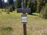
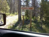
Another way to go is up Ontario Creek to the Monarch mine, and over the top, past the Larabee Gulch trail and down to the Meadows. The Ontario Creek road is a little rough and ends at the intersection of the trail over to the Meadows and the Continental Divide Trail. I took the trail to the Meadows, but went out the Larabee Gulch trail for about a mile. FWIW, I just took a couple pics of the end-of-the-road trail options:

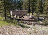
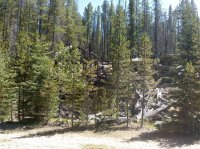
Next are some pics of part of what's left of Monarch Mine.
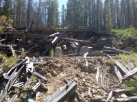
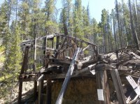
Anyway, going toward Larabee Gulch takes you to a pretty park with some great views. The next pick looks out toward Cliff Mountain, which is he granite ridge toward the right. You can take a rough-road trip out of Deer Lodge and hike a short, steep trail to the top.
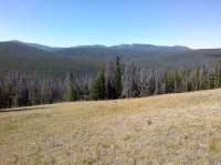
The next shot shows Electric Peak, which is south of Cliff Mountain. It's the pointed peak on the horizon. Trails can take you around it, but there isn't a trail to the top. From Helena, it's about 20 miles to Ellsiton and the Little Blackfoot Road.
Another way to go is up Ontario Creek to the Monarch mine, and over the top, past the Larabee Gulch trail and down to the Meadows. The Ontario Creek road is a little rough and ends at the intersection of the trail over to the Meadows and the Continental Divide Trail. I took the trail to the Meadows, but went out the Larabee Gulch trail for about a mile. FWIW, I just took a couple pics of the end-of-the-road trail options:


Next are some pics of part of what's left of Monarch Mine.


Anyway, going toward Larabee Gulch takes you to a pretty park with some great views. The next pick looks out toward Cliff Mountain, which is he granite ridge toward the right. You can take a rough-road trip out of Deer Lodge and hike a short, steep trail to the top.

The next shot shows Electric Peak, which is south of Cliff Mountain. It's the pointed peak on the horizon. Trails can take you around it, but there isn't a trail to the top. From Helena, it's about 20 miles to Ellsiton and the Little Blackfoot Road.
