- Joined
- Aug 9, 2007
- Messages
- 12,956
For years I've spent my summers exploring the Uintas. Checking off items on my list, one by one, rarely spending more than a 3-day weekend, but always dreaming of biting off a bigger chunk. Back in 2005, I did my most ambitious trip yet, a solo hike from West Fork Black's Fork over Dead Horse Pass and west to the Highline Trailhead. It was only 35 miles but it was the first real taste of the heart of the Uintas and I was hooked. From then on the dream of doing something bigger nagged at me but I never felt ready for it. I did a few more trips in the 35 mile range that got me into the heart of the range in snippets, but the hike I really wanted to do was the Highline.
The Uintas Highline trail spans 80+ miles, starting from the far east end of the range at Leidy Peak and ending at Hayden Pass along the Mirror Lake Highway in the west. As a novice backpacker, it seemed completely out of my range. Each year, I would be proud to knock out a hundred or so backpacking miles all season long, forget about doing that much in a week!
But in the last couple of years, I began to realize that I was about done exploring the areas of the Uintas I had yet to see. I was literally running out of places to go. Below is a map with every place I've ever camped in the Uinta range. Blue flags indicate one night at that spot, purple indicate two nights. Since the eastern end of the range isn't as interesting, you can see why I felt like I was running out of places to go.

So in the winter of 2011/12, I decided that 2012 would be my year to do it. I planned to go crazy with the backpacking trips in the spring and summer to prepare myself. I didn't want to have a bad experience like many trip reports that I had read about people either not being in shape for it or packing a ridiculous amount of equipment and being overburdened by the weight.
In 2011, my goal was to hit 300 miles of backpacking and I fell about 50 miles short. In 2012, I hoped to be about to that point before I even set foot at Leidy Peak and indeed, before we arrived I had already logged more than 230 miles of actual backpacking in 2012. I felt stronger and healthier than I ever had. I was ready.
I had anticipated a solo trip but in the months ahead of time Dan Ransom and Cody expressed interest and so we planned the trip together. Don was also going to join us but had to back out the week before.
So on the morning of Saturday July 21st, we set out for Leidy Peak, stopping along the way to drop my truck off at the Highline Trailhead at Hayden Pass. My wife audraiam was extraordinarily kind and patient to follow us up and then drive us all the way out to Leidy peak to drop us off.
The dirt road to Leidy Peak was long but easy, even for a car and we were at the trailhead getting ready shortly before 11am. The forecast for the next week called for turbulent, monsoon-driven weather which meant the afternoons would likely be difficult to hike thanks fo the clockwork thunderstorms. But we had at least 10, if not 16+ miles to go that first day so we set off quickly towards Leidy Peak.
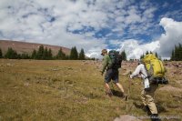
You'll notice that a lot of the shots I took this first day have been converted to black and white. The clouds and textures of the tundra in this area just seemed to look good like that. This is looking east from the flanks of Leidy Peak. I suppose the true Highline would extend even further east but this is really the last of the high terrain.
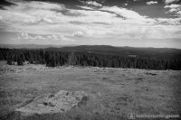
We took the route around the south of Leidy Peak. In retrospect, we should have gone north, but the view towards Marsh Peak and the basin between were still very nice.
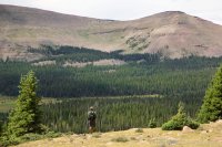
As we rounded the west edge of Leidy Peak, the trail climbed to an open tundra with sweeping views in all directions. The dramatic clouds only added to the magical sense of being in such a place.
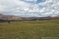
Cody cresting a low ridge. There was rarely any sign of a trail aside from very large cairns like this.
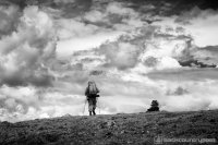
Dan passing the sign where the north Leidy Peak trail comes in. Notice the giant cairns in the distance.
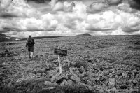
Looking back at Leidy Peak from the west.
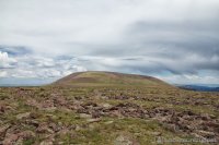
As we approached Gabbro Pass, we were treated with this incredible view of Mount Untermann. Gabro Pass is just left of the peak, the low point with the large snow drift.
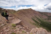
We lost a bit of elevation as we approached Lake Wilde but fortunately we didn't have to go all the way down. Gabbro is unique as it actually has two distinct trails, one on each side of the lake as you approach the pass from the east.
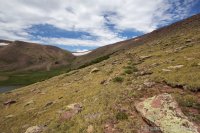
As we approached the pass, the size of the snow drift became more apparent. It was gigantic with nearly vertical walls at it's foot. No way we would be climbing over that so we hiked up the steep slope to the north to get around it. That's Cody cresting the ridge.
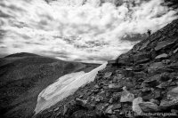
Group shot on Gabbro Pass, looking east.
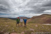
We stopped on the pass for a quick lunch before heading down the other side. Next up is the unnamed pass you see in the distance in this photo, the one with a small patch of snow, but before that, we would drop all the way down to Deadman Lake.
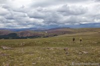
As we hiked down from the pass, I started to feel not so hot. Audra and I had both gotten some sort of stomach thing earlier in the week and it appeared to be hitting me again. I moved slower than I would have liked as I rushed down to treeline to *ahem*, handle some business. From that point on, I felt like death warmed over. As we climbed over the next pass, my energy level went to a fraction of what it should be and I felt dizzy. I was told that I looked extremely pale.
This shot is looking back down at Deadman Lake as we climbed the other side.
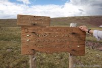
At the top of the pass, we stopped at this sign for a minute while I tried to figure out what the hell was wrong with me. Look closely... ya like how they spelled 'Chepeta'? Ha! And the mileage is about as accurate.
I decided I must just be having a reaction to the altitude so I grabbed a liter of water and we sat down on the west side of the pass where I mixed up a gatorade. I only brought two packed for the week and this seemed like a good time to get some sugar and electrolytes flowing through me.
In this shot, you can see the ridge that divides Chepeta Lake from the Whiterocks basin area. The trail heads right out through those trees and skirts around the left of the high dome in the center-left section of the photo.
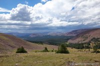
After the break and my gatorade, I felt a little better but still weak. Dan and Cody smoked it down the trail and I struggled to keep up. We stopped along the way to discuss our options for the night. We wanted to make it to Chepeta or beyond this first night but I just wasn't feeling up to the task. That and I didn't really care for the idea of camping at the one spot along the trail that people can actually drive to. So we decided to go check out Whiterocks and see how we felt when we got there.
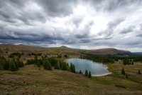
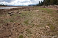
Sadly, Whiterocks was a mess. Probably the single ugliest 'lake' I've ever seen in the Uintas, much thanks to the fact that there is a huge dam built here that is no where near capacity. In fact, I'd have a hard time imagining this lake could get much emptier than this and still have an outlet stream.
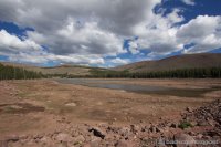
The 'shoreline' of Whiterocks Lake
At that point, we decided we would not camp at Whiterocks. There was a new sign at there that said something like 3.5 to Chepeta, quite different than what should be 6 miles if you go by the sign on the ridge which said 2 miles to Whiterocks and 8 to Chepeta. But whatever, at that point, I was feeling a little better and agreed to keep hiking towards to Chepeta and probably just camp in a meadow. But I think we all really wanted to camp by a lake because the consensus was to hike off trail a half mile to Dollar Lake, just south of Chepeta, and see if it looked any better.
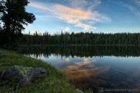
Sure enough, Dollar was tip-top full. It wasn't terribly scenic but it did the job. There were only a few fish in the lake but there was an active population of what we believe were otters. They kept swimming by 20 feet away from where I camped but I never got a picture of one.
The sunset was nothing to write home about but I took a photo anyway.
That night, my goal was to just get a solid night of sleep. Resting at the lake was making me feel a lot better but I still felt kind of dizzy and generally out of it. I hit the pillow shortly after dark. But then, not even an hour later, a significant wind storm blew in. It was one of those things where you hear it roaring up the canyon, then swirling around, then it about puts your tent to the ground.
To make things worse I was in my old MSR Missing Link. By far my favorite tent for sitting out a rain storm but also my worst tent when it comes to wind. If it's tied out nicely and the wind hits from the back, it does pretty good. If it hits from the front on it's broad wall, all bets are off. This wind was slamming it from the front, grabbing it like a sail. For what felt like 2 or 3 hours, I sat in the tent, riding out the wind, expecting at any moment that a stake would finally pull out and I would be finding my way out of a collapsed tent in the dark.
Fortunately that never happened but it did rob me of hours of precious sleep that I needed. I'm sad and happy to say that I am now retiring that tent. It's been great to me but that night, feeling like I felt and not being able to sleep was pure hell. Had I been in any of my other tents, I think I could have slept through most of it. You can see in this pic that the wind really loosened it up that night.
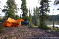
Looking out at the lake from my spot. Cody and Dan had both camped about 100 yards away in the meadow, I wanted the view of the lake.
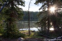
I ate some food and packed up and we were on the trail by about 8am. I felt okay but tired. I just hoped that hiking would get me in the zone and I would be past whatever held me down up until now.
The hike between Dollar and Chepeta was nicer than I expected. A lot of beautiful meadows and nice light.
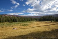
Pretty hard to see in this photo but there's a small herd of Elk in the distant field. I had my wide lens on of course...
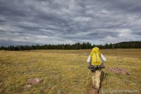
Soon enough we had arrived at the Chepeta Lake area and could see an actual SUV in the distance.
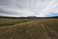
From here we crossed the river and found the road. I was really hoping to run into a proper trailhead with a pit but we missed it by about a hundred yards and continued east to connect to the trail. None of us really cared to lay eyes on Chepeta Lake as it was just another reservoir that probably had a big, ugly bathtub ring.
After we made it into the trees, I had another compelling need to handle some business. Now I wouldn't normally discuss such matter in a trip report, but it kind of goes along with how things went so wrong. After handling that, I went south again. I felt super sick, almost out of body. Walking on flat ground was a task. During my long sleepless night, I had already thought through the prospect of having to bail if things weren't improved and now I was confronted with it.
I talked to Cody and Dan and we decided to just walk a bit. Cody gave me some electrolyte powder and I drank it. I racked my brain for a while trying to decide what to do but I think I already knew I had to call it. It was such a hard decision to make. If I were solo, or with some much slower hikers, maybe I could have kept going. Maybe taken a slow day, rested... but Cody and Dan are strong, fast hikers. Trying to continue would not only have been extremely difficult for me, it would have potentially ruined the experience for all of us.
So I did it, I got out my phone and sent a text message to Audra through my DeLorme inReach and told her what was happening and asked her to come pick me up at Chepeta Lake. She was able to message me back which was so nice. This was my first trip with the inReach and that made me feel so much better to be able to not only articulate what kind of help was needed but also get a message back knowing that help was on the way.
So I said goodbye to the guys and started east towards Chepeta Lake to solicit people to give me a ride down the dirt road to meet Audra. There were a couple vehicles around but no people so I decided to start hiking down the road and just hope someone would come along.
I walked for about 2 miles in the rain and got past by two vehicles who didn't even slow down to say hello. But finally one car did stop. It was a very small car with 3 people, 2 dogs and a lot of camping gear packed in but they still made room for me. It was a long ride down to Roosevelt but amazingly, Audra arrived there within 5 minutes of us. I was actually home on my couch within about 6 hours of sending out the message. Not bad considering Google Maps lists the one-way drive from my house to Chepeta Lake as being 4 hours and 38 minutes.
It took until Monday evening before I finally felt good again. I was really worried I would get back home and feel great and regret the decision so I was actually kind of happy to feel like crap. It was painful to watch Cody's spot tracking as they moved throughout the day though.
I thought about going back and finishing the hike a few days later, but I've since decided it will wait until 2013 and start again from the beginning. I don't want to have to explain that I've hiked the Highline but did it in two sections. So I guess this is kind of like the trailer trip report for 'Highline 2013'.
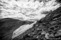
Featured image for home page:
The Uintas Highline trail spans 80+ miles, starting from the far east end of the range at Leidy Peak and ending at Hayden Pass along the Mirror Lake Highway in the west. As a novice backpacker, it seemed completely out of my range. Each year, I would be proud to knock out a hundred or so backpacking miles all season long, forget about doing that much in a week!
But in the last couple of years, I began to realize that I was about done exploring the areas of the Uintas I had yet to see. I was literally running out of places to go. Below is a map with every place I've ever camped in the Uinta range. Blue flags indicate one night at that spot, purple indicate two nights. Since the eastern end of the range isn't as interesting, you can see why I felt like I was running out of places to go.

So in the winter of 2011/12, I decided that 2012 would be my year to do it. I planned to go crazy with the backpacking trips in the spring and summer to prepare myself. I didn't want to have a bad experience like many trip reports that I had read about people either not being in shape for it or packing a ridiculous amount of equipment and being overburdened by the weight.
In 2011, my goal was to hit 300 miles of backpacking and I fell about 50 miles short. In 2012, I hoped to be about to that point before I even set foot at Leidy Peak and indeed, before we arrived I had already logged more than 230 miles of actual backpacking in 2012. I felt stronger and healthier than I ever had. I was ready.
I had anticipated a solo trip but in the months ahead of time Dan Ransom and Cody expressed interest and so we planned the trip together. Don was also going to join us but had to back out the week before.
So on the morning of Saturday July 21st, we set out for Leidy Peak, stopping along the way to drop my truck off at the Highline Trailhead at Hayden Pass. My wife audraiam was extraordinarily kind and patient to follow us up and then drive us all the way out to Leidy peak to drop us off.
The dirt road to Leidy Peak was long but easy, even for a car and we were at the trailhead getting ready shortly before 11am. The forecast for the next week called for turbulent, monsoon-driven weather which meant the afternoons would likely be difficult to hike thanks fo the clockwork thunderstorms. But we had at least 10, if not 16+ miles to go that first day so we set off quickly towards Leidy Peak.

You'll notice that a lot of the shots I took this first day have been converted to black and white. The clouds and textures of the tundra in this area just seemed to look good like that. This is looking east from the flanks of Leidy Peak. I suppose the true Highline would extend even further east but this is really the last of the high terrain.

We took the route around the south of Leidy Peak. In retrospect, we should have gone north, but the view towards Marsh Peak and the basin between were still very nice.

As we rounded the west edge of Leidy Peak, the trail climbed to an open tundra with sweeping views in all directions. The dramatic clouds only added to the magical sense of being in such a place.

Cody cresting a low ridge. There was rarely any sign of a trail aside from very large cairns like this.

Dan passing the sign where the north Leidy Peak trail comes in. Notice the giant cairns in the distance.

Looking back at Leidy Peak from the west.

As we approached Gabbro Pass, we were treated with this incredible view of Mount Untermann. Gabro Pass is just left of the peak, the low point with the large snow drift.

We lost a bit of elevation as we approached Lake Wilde but fortunately we didn't have to go all the way down. Gabbro is unique as it actually has two distinct trails, one on each side of the lake as you approach the pass from the east.

As we approached the pass, the size of the snow drift became more apparent. It was gigantic with nearly vertical walls at it's foot. No way we would be climbing over that so we hiked up the steep slope to the north to get around it. That's Cody cresting the ridge.

Group shot on Gabbro Pass, looking east.

We stopped on the pass for a quick lunch before heading down the other side. Next up is the unnamed pass you see in the distance in this photo, the one with a small patch of snow, but before that, we would drop all the way down to Deadman Lake.

As we hiked down from the pass, I started to feel not so hot. Audra and I had both gotten some sort of stomach thing earlier in the week and it appeared to be hitting me again. I moved slower than I would have liked as I rushed down to treeline to *ahem*, handle some business. From that point on, I felt like death warmed over. As we climbed over the next pass, my energy level went to a fraction of what it should be and I felt dizzy. I was told that I looked extremely pale.
This shot is looking back down at Deadman Lake as we climbed the other side.

At the top of the pass, we stopped at this sign for a minute while I tried to figure out what the hell was wrong with me. Look closely... ya like how they spelled 'Chepeta'? Ha! And the mileage is about as accurate.

I decided I must just be having a reaction to the altitude so I grabbed a liter of water and we sat down on the west side of the pass where I mixed up a gatorade. I only brought two packed for the week and this seemed like a good time to get some sugar and electrolytes flowing through me.
In this shot, you can see the ridge that divides Chepeta Lake from the Whiterocks basin area. The trail heads right out through those trees and skirts around the left of the high dome in the center-left section of the photo.

After the break and my gatorade, I felt a little better but still weak. Dan and Cody smoked it down the trail and I struggled to keep up. We stopped along the way to discuss our options for the night. We wanted to make it to Chepeta or beyond this first night but I just wasn't feeling up to the task. That and I didn't really care for the idea of camping at the one spot along the trail that people can actually drive to. So we decided to go check out Whiterocks and see how we felt when we got there.
Sadly, Whiterocks was a mess. Probably the single ugliest 'lake' I've ever seen in the Uintas, much thanks to the fact that there is a huge dam built here that is no where near capacity. In fact, I'd have a hard time imagining this lake could get much emptier than this and still have an outlet stream.

The 'shoreline' of Whiterocks Lake

At that point, we decided we would not camp at Whiterocks. There was a new sign at there that said something like 3.5 to Chepeta, quite different than what should be 6 miles if you go by the sign on the ridge which said 2 miles to Whiterocks and 8 to Chepeta. But whatever, at that point, I was feeling a little better and agreed to keep hiking towards to Chepeta and probably just camp in a meadow. But I think we all really wanted to camp by a lake because the consensus was to hike off trail a half mile to Dollar Lake, just south of Chepeta, and see if it looked any better.
Sure enough, Dollar was tip-top full. It wasn't terribly scenic but it did the job. There were only a few fish in the lake but there was an active population of what we believe were otters. They kept swimming by 20 feet away from where I camped but I never got a picture of one.
The sunset was nothing to write home about but I took a photo anyway.

That night, my goal was to just get a solid night of sleep. Resting at the lake was making me feel a lot better but I still felt kind of dizzy and generally out of it. I hit the pillow shortly after dark. But then, not even an hour later, a significant wind storm blew in. It was one of those things where you hear it roaring up the canyon, then swirling around, then it about puts your tent to the ground.
To make things worse I was in my old MSR Missing Link. By far my favorite tent for sitting out a rain storm but also my worst tent when it comes to wind. If it's tied out nicely and the wind hits from the back, it does pretty good. If it hits from the front on it's broad wall, all bets are off. This wind was slamming it from the front, grabbing it like a sail. For what felt like 2 or 3 hours, I sat in the tent, riding out the wind, expecting at any moment that a stake would finally pull out and I would be finding my way out of a collapsed tent in the dark.
Fortunately that never happened but it did rob me of hours of precious sleep that I needed. I'm sad and happy to say that I am now retiring that tent. It's been great to me but that night, feeling like I felt and not being able to sleep was pure hell. Had I been in any of my other tents, I think I could have slept through most of it. You can see in this pic that the wind really loosened it up that night.

Looking out at the lake from my spot. Cody and Dan had both camped about 100 yards away in the meadow, I wanted the view of the lake.

I ate some food and packed up and we were on the trail by about 8am. I felt okay but tired. I just hoped that hiking would get me in the zone and I would be past whatever held me down up until now.
The hike between Dollar and Chepeta was nicer than I expected. A lot of beautiful meadows and nice light.

Pretty hard to see in this photo but there's a small herd of Elk in the distant field. I had my wide lens on of course...

Soon enough we had arrived at the Chepeta Lake area and could see an actual SUV in the distance.

From here we crossed the river and found the road. I was really hoping to run into a proper trailhead with a pit but we missed it by about a hundred yards and continued east to connect to the trail. None of us really cared to lay eyes on Chepeta Lake as it was just another reservoir that probably had a big, ugly bathtub ring.
After we made it into the trees, I had another compelling need to handle some business. Now I wouldn't normally discuss such matter in a trip report, but it kind of goes along with how things went so wrong. After handling that, I went south again. I felt super sick, almost out of body. Walking on flat ground was a task. During my long sleepless night, I had already thought through the prospect of having to bail if things weren't improved and now I was confronted with it.
I talked to Cody and Dan and we decided to just walk a bit. Cody gave me some electrolyte powder and I drank it. I racked my brain for a while trying to decide what to do but I think I already knew I had to call it. It was such a hard decision to make. If I were solo, or with some much slower hikers, maybe I could have kept going. Maybe taken a slow day, rested... but Cody and Dan are strong, fast hikers. Trying to continue would not only have been extremely difficult for me, it would have potentially ruined the experience for all of us.
So I did it, I got out my phone and sent a text message to Audra through my DeLorme inReach and told her what was happening and asked her to come pick me up at Chepeta Lake. She was able to message me back which was so nice. This was my first trip with the inReach and that made me feel so much better to be able to not only articulate what kind of help was needed but also get a message back knowing that help was on the way.
So I said goodbye to the guys and started east towards Chepeta Lake to solicit people to give me a ride down the dirt road to meet Audra. There were a couple vehicles around but no people so I decided to start hiking down the road and just hope someone would come along.
I walked for about 2 miles in the rain and got past by two vehicles who didn't even slow down to say hello. But finally one car did stop. It was a very small car with 3 people, 2 dogs and a lot of camping gear packed in but they still made room for me. It was a long ride down to Roosevelt but amazingly, Audra arrived there within 5 minutes of us. I was actually home on my couch within about 6 hours of sending out the message. Not bad considering Google Maps lists the one-way drive from my house to Chepeta Lake as being 4 hours and 38 minutes.
It took until Monday evening before I finally felt good again. I was really worried I would get back home and feel great and regret the decision so I was actually kind of happy to feel like crap. It was painful to watch Cody's spot tracking as they moved throughout the day though.
I thought about going back and finishing the hike a few days later, but I've since decided it will wait until 2013 and start again from the beginning. I don't want to have to explain that I've hiked the Highline but did it in two sections. So I guess this is kind of like the trailer trip report for 'Highline 2013'.
Featured image for home page:


