IntrepidXJ
ADVENTR
- Joined
- Jan 17, 2012
- Messages
- 3,493
Saturday & Sunday, July 14-15, 2012
The Original Trip Report on ADVENTR.CO
I first tried to explore Horse Canyon in the Needles District of Canyonlands National Park back in 2008 when I camped at Peekaboo with a few friends. Back then the entrance to the canyon had been washed out pretty good and there was a very deep hole blocking vehicle entry. For the past two years I have been checking the condition of the road so that I could finally get back there to start exploring the area, but both the Salt Creek and Horse Canyon roads have been washed out and closed for that long. I have hiked up Salt Creek Canyon twice during those two years, but Horse Canyon was a bit too long for a day hike. A few weeks ago I finally received word that the National Parks Service had finally reopened the roads in Salt Creek and Horse Canyon, so I quickly made plans to get back. I reserved a campsite at Peekaboo for the weekend and invited Jared and Marty to come along.
After work on Friday, I drove down to Cottonwood Canyon and setup camp so that I would be close to Canyonlands in the morning and wouldn't have to do much driving. There were a few rain showers in the evening, but the precipitation stopped before I went to bed, and I had a great night of sleep.
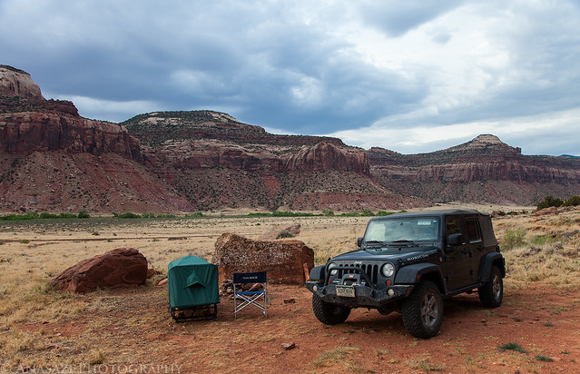
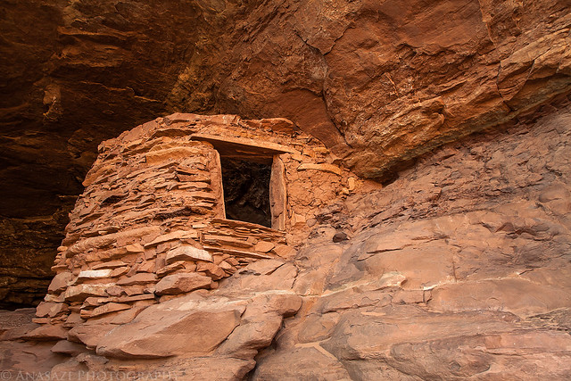
Good Morning by IntrepidXJ, on Flickr
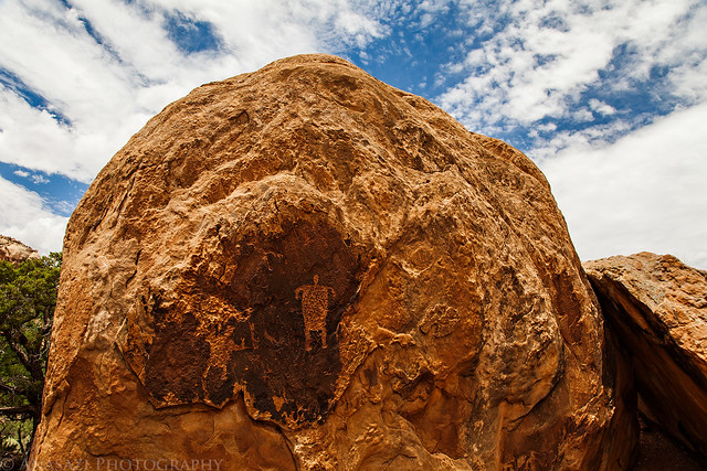
In the morning I had a little time to photograph this ruin high up on the canyon wall. I have driven by this site many times and had not been able to find it before. It would have been a long hike up to reach it, but unfortunately I didn't have the time this morning to try. I will have to return again to climb up to the ruin for some closer photos.
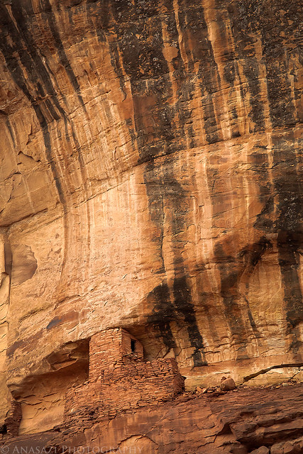
High Tower by IntrepidXJ, on Flickr
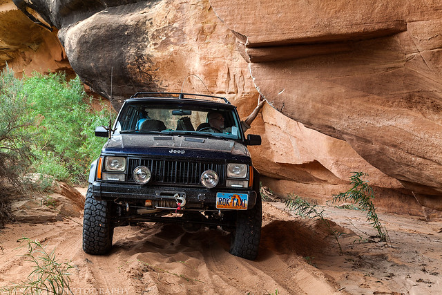
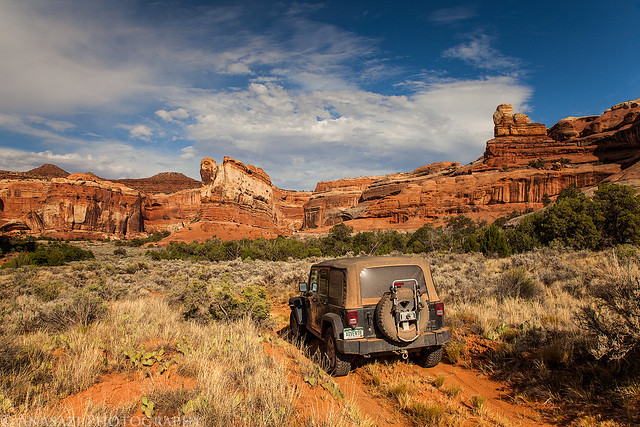
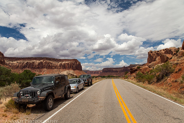
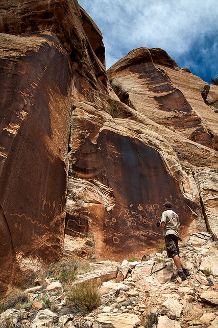
After photographing the tower, I continued my drive into the park where I met Jared and Marty at the Needle's Visitor Center so that we could get our permits and the combination for the lock on the gate. Jared transferred his camping gear into my Jeep and parked his car at the trailhead before we continued through the locked gate into Salt Creek. The drive through the wash was in soft sand as usual, but the debris that had blocked the road in May had been removed. It was nice to be able to avoid this mosquito-infested area by closing the windows of the Jeep") The deep holes that had blocked the entrance to Horse Canyon had also been filled in a bit. We drove through the holes and brush that was growing in the road and continued up Horse Canyon, where we would be spending much of the day searching for ruins and rock art.
The deep holes that had blocked the entrance to Horse Canyon had also been filled in a bit. We drove through the holes and brush that was growing in the road and continued up Horse Canyon, where we would be spending much of the day searching for ruins and rock art.
We almost missed the remains of a tower near the mouth of the canyon. Good thing Marty spotted this one after we had passed it.
Watch Tower by IntrepidXJ, on Flickr
Jared checks out a very small granary that we spotted and climbed up to. The interesting part about this site is how the ledge in front of it was built out in order to make it larger. I can't recall seeing this done anywhere else?
Built Ledge Granary by IntrepidXJ, on Flickr
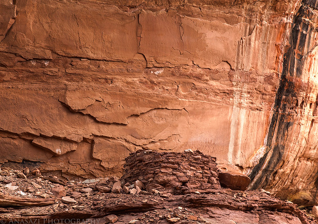
We almost missed this nice granary even though it was practically right next to the road.

Jeep & Ruin by IntrepidXJ, on Flickr
A closer look at the ruin.
Horse Canyon Ruin by IntrepidXJ, on Flickr
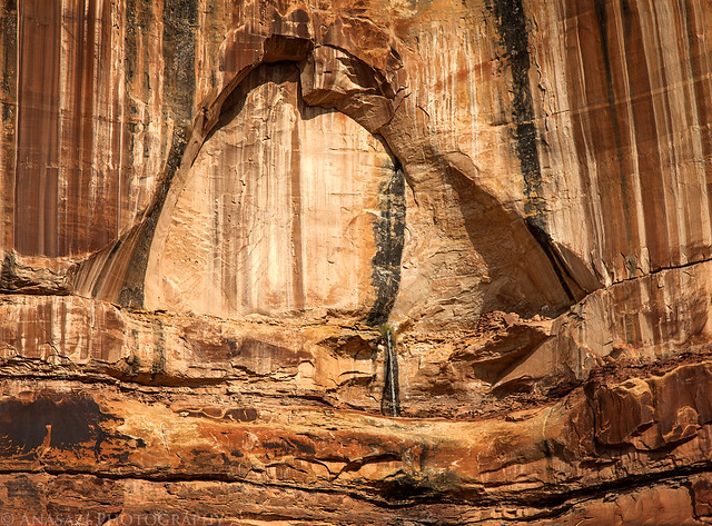
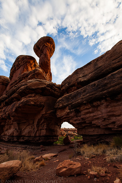
Soon we reached the large arch known as Paul Bunyan's Potty.

Paul Bunyan's Potty by IntrepidXJ, on Flickr
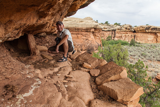
We found a route up the sandstone ledges that took us right under the arch so that we could try to visit the ruins and rock art hidden up there. Unfortunately, I was stopped stopped about 20 feet below the final ledge because the climb was just too steep for me. Jared, on the other hand, was able to make it to the final ledge to check it out. Here's Jared climbing the final pitch.

Jared Climbing by IntrepidXJ, on Flickr
Here's a view out from where I stopped climbing just under Paul Bunyan's Potty.
Overcast View by IntrepidXJ, on Flickr
Here's a photo from as high as I climbed of one of the ruins I was trying to reach.
Paul's Kiva by IntrepidXJ, on Flickr
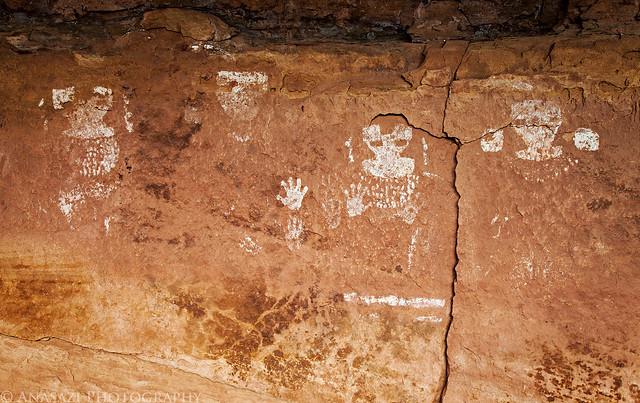
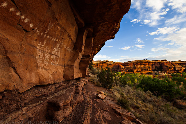
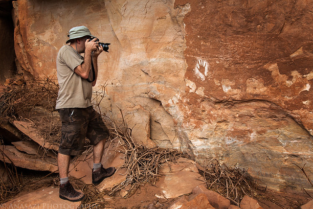
There were also a few other smaller ruins up there that I could see, plus many red handprints and some white dots on the back of the large alcove. You can see them all in this photo if you look closely.
Upper Ruins by IntrepidXJ, on Flickr
Our next stop on our journey up Horse Canyon was the Tower Ruins. After we found a way to scramble up closer to the ruins, I took this photo back over the side road we had just driven up.
Tower Ruin Parking by IntrepidXJ, on Flickr
The Tower Ruins in the large alcove above were pretty much inaccessible without a tall ladder or some serious climbing skills.
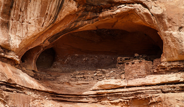
Tower Ruins Alcove by IntrepidXJ, on Flickr
Here's a closer look at the ruins. I should have dragged my long lens up here with me...
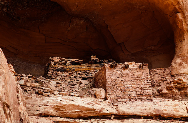
Tower Ruins by IntrepidXJ, on Flickr
Jared found this small granary around the corner.
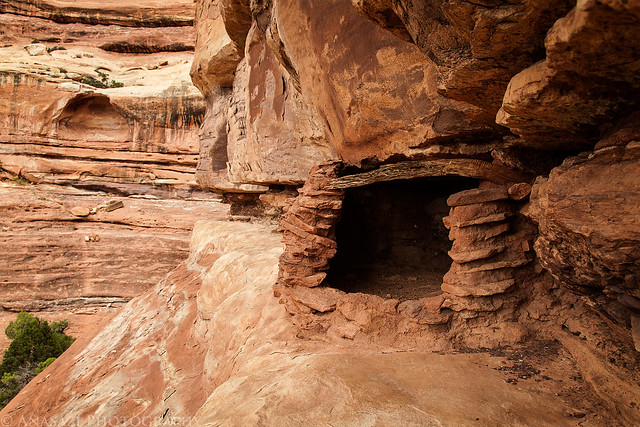
Ledge Granary by IntrepidXJ, on Flickr
After climbing back down from the Tower Ruins, we drove further up the canyon as some darker storm clouds started to roll in.
Storm Moving In by IntrepidXJ, on Flickr
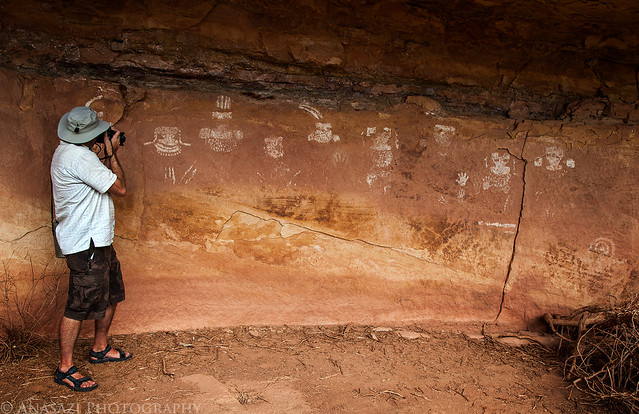
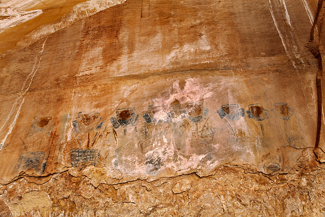
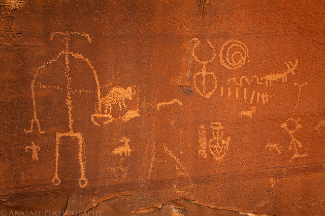
One of the main reason I've wanted to get into Horse Canyon for the past few years was so that I could visit the well-known Thirteen Faces pictograph panel. Once we drove a few more miles up the wash we stopped at a small side canyon that would lead us there. As we hiked up this canyon, the ominous clouds in the sky finally let loose and it started to rain on us. It was never a big downpour, but it was enough to get us wet. Luckily we reached the alcove containing the pictographs shortly after it started, so we were able to get out of the rain and take some photos at the same time. I'm just glad that we never got enough rain in the area to cause Horse Canyon or Salt Creek Canyon to flash flood since that could have caused trouble for us. We would later find out that the storm did indeed cause flash flooding in nearby Elephant Canyon, so we got lucky!
Even though this panel is called the Thirteen Faces, only about ten of them are actually still visible. I can't recall ever seeing a photo showing all thirteen faces, so I'm not sure how long they have been gone?

Thirteen Faces by IntrepidXJ, on Flickr
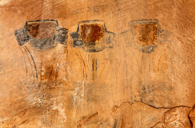
A closer look at six of the Thirteen Faces.
Six of Thirteen by IntrepidXJ, on Flickr
After we left the Thirteen Faces we spotted these ruins on a ledge high up on the canyon wall. We saw no way to access the ledge they were on, so we just took photos from the wash below.
Thirteen Canyon Ruin by IntrepidXJ, on Flickr
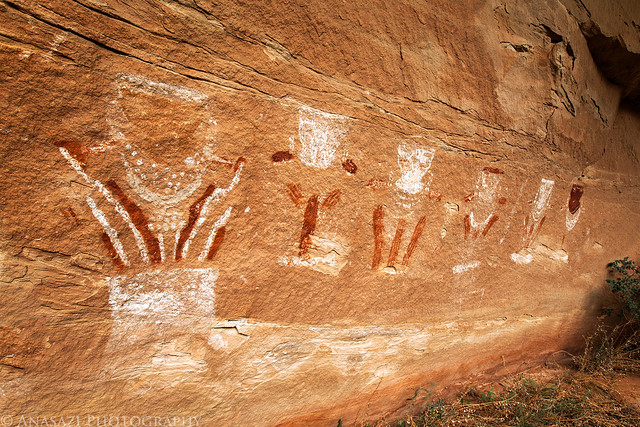
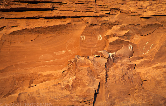
Next up, we searched for and found the ghostly Nine Faces pictograph panel. There are actually nine of them still visible, too!
Nine Faces by IntrepidXJ, on Flickr
Unlike the Thirteen Faces which have multiple colors, these are all white.
Four of Nine by IntrepidXJ, on Flickr
Jared taking a photo for some scale.
Jared and the Nine Faces by IntrepidXJ, on Flickr
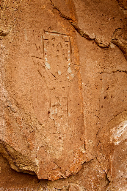
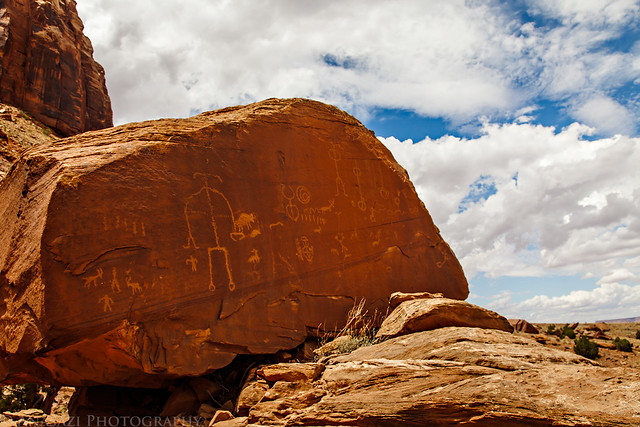
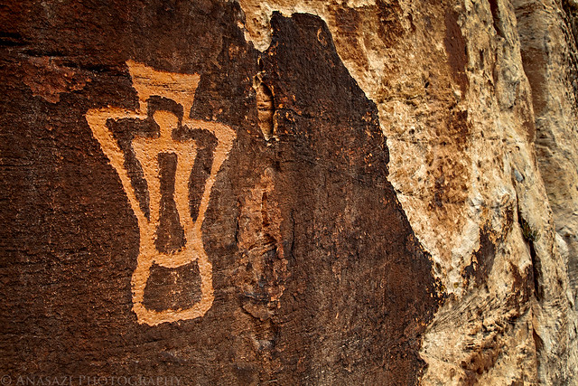
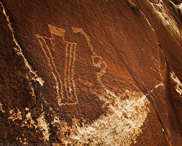
As we searched the area around the Nine Faces we spotted this faint but very large petroglyph. There appears to be an anthropomorph holding two very large shields.
Big Shields by IntrepidXJ, on Flickr
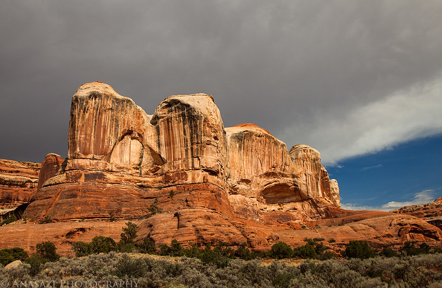
We continued our drive up the canyon to the end of the road and then took a short hike to a viewpoint of the impressive Castle Arch.
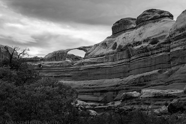
Castle Arch by IntrepidXJ, on Flickr
On our way back down the canyon I stopped for a photo under an overhang that apparently has cause some problems for other vehicles in the past.
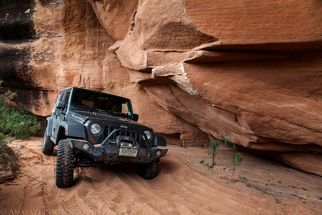
Under the Ledge by IntrepidXJ, on Flickr
Marty shows that there's plenty of room for a Jeep...full-sized vehicles might need to be more cautious.
Plenty of Room by IntrepidXJ, on Flickr
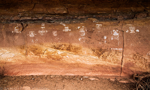
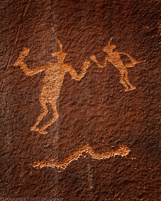
For our final hike of the day we set out to find the Eleven Faces. Again, this panel only really has eight faces that are still visible, although you can see some faint traces of the other three faces that are now missing. Unfortunately, calcite has been leaching from the sandstone that these pictographs were painted on, so much of it has been covered in the white substance, making it difficult to photograph. I did my best to bring out the details in this photo.
Eleven Faces by IntrepidXJ, on Flickr
Here's a closer look at the three figures on the right side of the panel that seem to be grouped together on purpose.
Three Warriors by IntrepidXJ, on Flickr
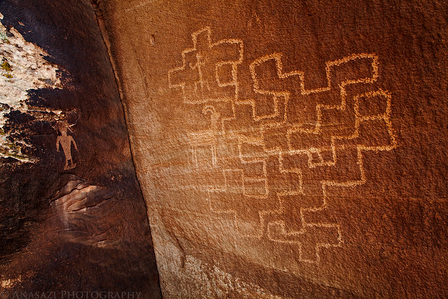
Before leaving the area, Jared spotted this lone petroglyph that is done in a similar style to the nearby Eleven Faces. While there are number of pictographs in the area done in this 'faces motif' this is the first and only petroglyph I have seen done like this. It's very cool, and I probably would have missed it if Jared hadn't spotted it.
One Face by IntrepidXJ, on Flickr
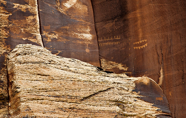
We also spotted an interesting ruin high above on our hike back to the vehicles. See if you can spot it in this photo...
Ladder Ruin View by IntrepidXJ, on Flickr
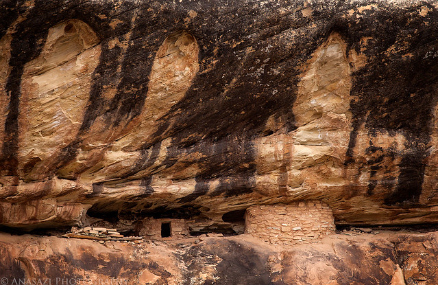
Here's a closer look at the ruin with the large ladder used to access the site. I'm curious to know if the ladder that is up there is original or not? It's hard to get a good look at it in this photo, and we didn't have the time or energy to climb up there to check it out. Maybe next time. If anyone has any information about the ladder or ruin, please feel free to leave a comment below.
Ladder Ruin by IntrepidXJ, on Flickr
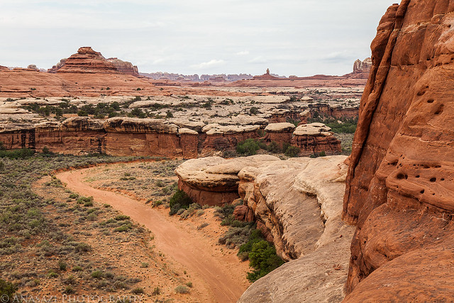
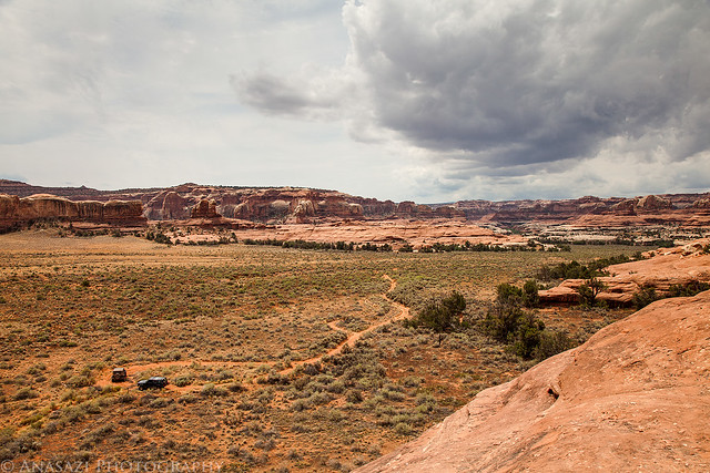
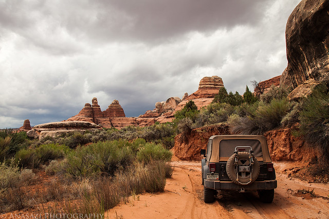
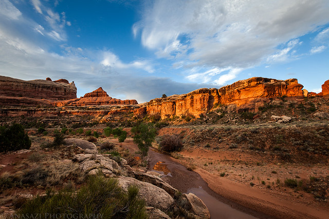
Driving back out of the canyon as the clouds finally start to clear out of the sky.
Horse Canyon Road by IntrepidXJ, on Flickr
Horse Canyon Wash by IntrepidXJ, on Flickr
This is the deepest hole we had to drive through to get into and back out of Horse Canyon. No problem if you have high clearance and your air intake isn't too low.
Horse Canyon Hole by IntrepidXJ, on Flickr
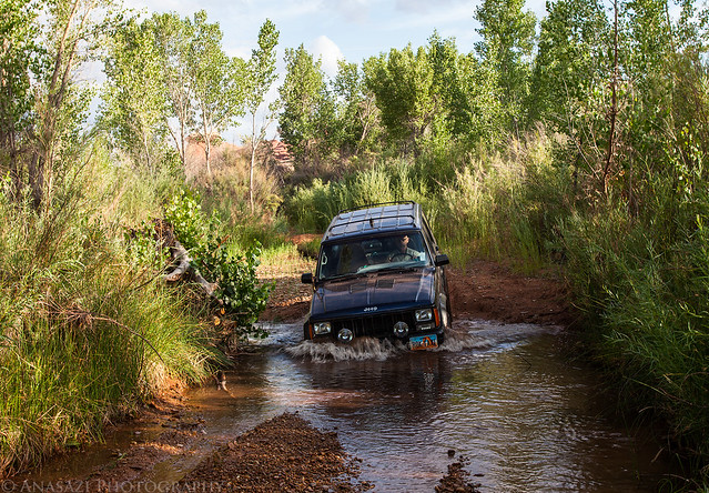
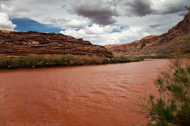
After reaching Salt Creek again we turned up the wash and drove through the deeper water and mild quicksand to reach our campsite at Peekaboo for the evening. We setup camp, had some dinner, talked and relaxed before finally getting to bed. It had been a long day and we were all pretty tired.
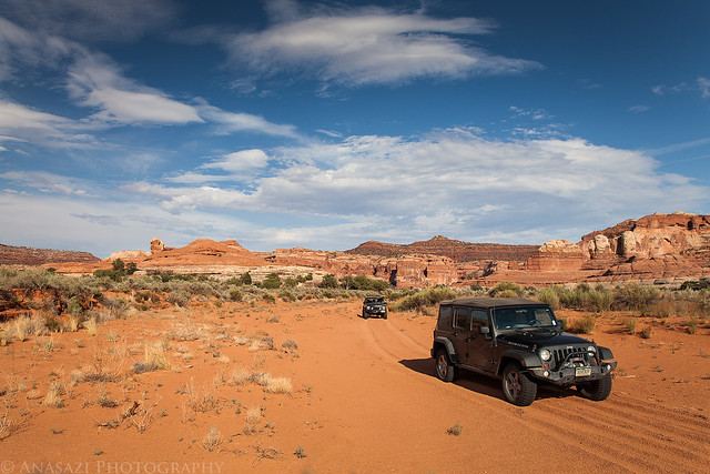
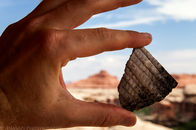
Featured image for home page:

The Original Trip Report on ADVENTR.CO
I first tried to explore Horse Canyon in the Needles District of Canyonlands National Park back in 2008 when I camped at Peekaboo with a few friends. Back then the entrance to the canyon had been washed out pretty good and there was a very deep hole blocking vehicle entry. For the past two years I have been checking the condition of the road so that I could finally get back there to start exploring the area, but both the Salt Creek and Horse Canyon roads have been washed out and closed for that long. I have hiked up Salt Creek Canyon twice during those two years, but Horse Canyon was a bit too long for a day hike. A few weeks ago I finally received word that the National Parks Service had finally reopened the roads in Salt Creek and Horse Canyon, so I quickly made plans to get back. I reserved a campsite at Peekaboo for the weekend and invited Jared and Marty to come along.
After work on Friday, I drove down to Cottonwood Canyon and setup camp so that I would be close to Canyonlands in the morning and wouldn't have to do much driving. There were a few rain showers in the evening, but the precipitation stopped before I went to bed, and I had a great night of sleep.
Good Morning by IntrepidXJ, on Flickr
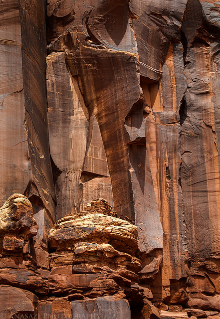
In the morning I had a little time to photograph this ruin high up on the canyon wall. I have driven by this site many times and had not been able to find it before. It would have been a long hike up to reach it, but unfortunately I didn't have the time this morning to try. I will have to return again to climb up to the ruin for some closer photos.
High Tower by IntrepidXJ, on Flickr
After photographing the tower, I continued my drive into the park where I met Jared and Marty at the Needle's Visitor Center so that we could get our permits and the combination for the lock on the gate. Jared transferred his camping gear into my Jeep and parked his car at the trailhead before we continued through the locked gate into Salt Creek. The drive through the wash was in soft sand as usual, but the debris that had blocked the road in May had been removed. It was nice to be able to avoid this mosquito-infested area by closing the windows of the Jeep
The deep holes that had blocked the entrance to Horse Canyon had also been filled in a bit. We drove through the holes and brush that was growing in the road and continued up Horse Canyon, where we would be spending much of the day searching for ruins and rock art.We almost missed the remains of a tower near the mouth of the canyon. Good thing Marty spotted this one after we had passed it.
Watch Tower by IntrepidXJ, on Flickr
Jared checks out a very small granary that we spotted and climbed up to. The interesting part about this site is how the ledge in front of it was built out in order to make it larger. I can't recall seeing this done anywhere else?
Built Ledge Granary by IntrepidXJ, on Flickr
We almost missed this nice granary even though it was practically right next to the road.
Jeep & Ruin by IntrepidXJ, on Flickr
A closer look at the ruin.
Horse Canyon Ruin by IntrepidXJ, on Flickr
Soon we reached the large arch known as Paul Bunyan's Potty.
Paul Bunyan's Potty by IntrepidXJ, on Flickr
We found a route up the sandstone ledges that took us right under the arch so that we could try to visit the ruins and rock art hidden up there. Unfortunately, I was stopped stopped about 20 feet below the final ledge because the climb was just too steep for me. Jared, on the other hand, was able to make it to the final ledge to check it out. Here's Jared climbing the final pitch.
Jared Climbing by IntrepidXJ, on Flickr
Here's a view out from where I stopped climbing just under Paul Bunyan's Potty.
Overcast View by IntrepidXJ, on Flickr
Here's a photo from as high as I climbed of one of the ruins I was trying to reach.
Paul's Kiva by IntrepidXJ, on Flickr
There were also a few other smaller ruins up there that I could see, plus many red handprints and some white dots on the back of the large alcove. You can see them all in this photo if you look closely.
Upper Ruins by IntrepidXJ, on Flickr
Our next stop on our journey up Horse Canyon was the Tower Ruins. After we found a way to scramble up closer to the ruins, I took this photo back over the side road we had just driven up.
Tower Ruin Parking by IntrepidXJ, on Flickr
The Tower Ruins in the large alcove above were pretty much inaccessible without a tall ladder or some serious climbing skills.
Tower Ruins Alcove by IntrepidXJ, on Flickr
Here's a closer look at the ruins. I should have dragged my long lens up here with me...
Tower Ruins by IntrepidXJ, on Flickr
Jared found this small granary around the corner.
Ledge Granary by IntrepidXJ, on Flickr
After climbing back down from the Tower Ruins, we drove further up the canyon as some darker storm clouds started to roll in.
Storm Moving In by IntrepidXJ, on Flickr
One of the main reason I've wanted to get into Horse Canyon for the past few years was so that I could visit the well-known Thirteen Faces pictograph panel. Once we drove a few more miles up the wash we stopped at a small side canyon that would lead us there. As we hiked up this canyon, the ominous clouds in the sky finally let loose and it started to rain on us. It was never a big downpour, but it was enough to get us wet. Luckily we reached the alcove containing the pictographs shortly after it started, so we were able to get out of the rain and take some photos at the same time. I'm just glad that we never got enough rain in the area to cause Horse Canyon or Salt Creek Canyon to flash flood since that could have caused trouble for us. We would later find out that the storm did indeed cause flash flooding in nearby Elephant Canyon, so we got lucky!
Even though this panel is called the Thirteen Faces, only about ten of them are actually still visible. I can't recall ever seeing a photo showing all thirteen faces, so I'm not sure how long they have been gone?
Thirteen Faces by IntrepidXJ, on Flickr
A closer look at six of the Thirteen Faces.
Six of Thirteen by IntrepidXJ, on Flickr
After we left the Thirteen Faces we spotted these ruins on a ledge high up on the canyon wall. We saw no way to access the ledge they were on, so we just took photos from the wash below.
Thirteen Canyon Ruin by IntrepidXJ, on Flickr
Next up, we searched for and found the ghostly Nine Faces pictograph panel. There are actually nine of them still visible, too!
Nine Faces by IntrepidXJ, on Flickr
Unlike the Thirteen Faces which have multiple colors, these are all white.
Four of Nine by IntrepidXJ, on Flickr
Jared taking a photo for some scale.
Jared and the Nine Faces by IntrepidXJ, on Flickr
As we searched the area around the Nine Faces we spotted this faint but very large petroglyph. There appears to be an anthropomorph holding two very large shields.
Big Shields by IntrepidXJ, on Flickr
We continued our drive up the canyon to the end of the road and then took a short hike to a viewpoint of the impressive Castle Arch.
Castle Arch by IntrepidXJ, on Flickr
On our way back down the canyon I stopped for a photo under an overhang that apparently has cause some problems for other vehicles in the past.
Under the Ledge by IntrepidXJ, on Flickr
Marty shows that there's plenty of room for a Jeep...full-sized vehicles might need to be more cautious.
Plenty of Room by IntrepidXJ, on Flickr
For our final hike of the day we set out to find the Eleven Faces. Again, this panel only really has eight faces that are still visible, although you can see some faint traces of the other three faces that are now missing. Unfortunately, calcite has been leaching from the sandstone that these pictographs were painted on, so much of it has been covered in the white substance, making it difficult to photograph. I did my best to bring out the details in this photo.
Eleven Faces by IntrepidXJ, on Flickr
Here's a closer look at the three figures on the right side of the panel that seem to be grouped together on purpose.
Three Warriors by IntrepidXJ, on Flickr
Before leaving the area, Jared spotted this lone petroglyph that is done in a similar style to the nearby Eleven Faces. While there are number of pictographs in the area done in this 'faces motif' this is the first and only petroglyph I have seen done like this. It's very cool, and I probably would have missed it if Jared hadn't spotted it.
One Face by IntrepidXJ, on Flickr
We also spotted an interesting ruin high above on our hike back to the vehicles. See if you can spot it in this photo...
Ladder Ruin View by IntrepidXJ, on Flickr
Here's a closer look at the ruin with the large ladder used to access the site. I'm curious to know if the ladder that is up there is original or not? It's hard to get a good look at it in this photo, and we didn't have the time or energy to climb up there to check it out. Maybe next time. If anyone has any information about the ladder or ruin, please feel free to leave a comment below.
Ladder Ruin by IntrepidXJ, on Flickr
Driving back out of the canyon as the clouds finally start to clear out of the sky.
Horse Canyon Road by IntrepidXJ, on Flickr
Horse Canyon Wash by IntrepidXJ, on Flickr
This is the deepest hole we had to drive through to get into and back out of Horse Canyon. No problem if you have high clearance and your air intake isn't too low.
Horse Canyon Hole by IntrepidXJ, on Flickr
After reaching Salt Creek again we turned up the wash and drove through the deeper water and mild quicksand to reach our campsite at Peekaboo for the evening. We setup camp, had some dinner, talked and relaxed before finally getting to bed. It had been a long day and we were all pretty tired.
Featured image for home page:


")