The Deeps, June '14

DAA

Member
Joined
Jun 14, 2012
Messages
715
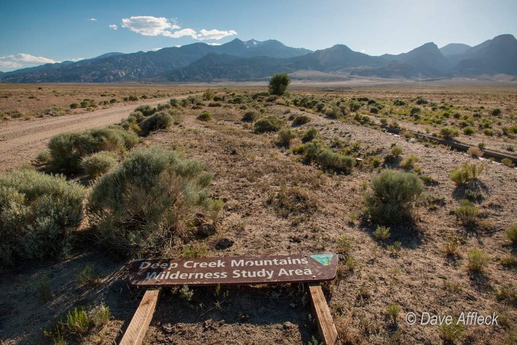
The seed for this trip was planted in my mind last August. When I read that a legal settlement had resulted in the re-opening of several historic routes in the Deep Creek mountains.

A snippet of the press release: “Under the settlement announced Monday by officials for Utah and Juab County and a number of environmental groups, the federal government agreed to reopen Granite Canyon, Toms Creek and Trout Creek roads in the Deep Creek Mountains.”

Good enough for me! Subsequent research and phone calls to the BLM and Juab county revealed that the new routes wouldn’t be opened until June 1, 2014. So, I put it on my calendar and bided my time.

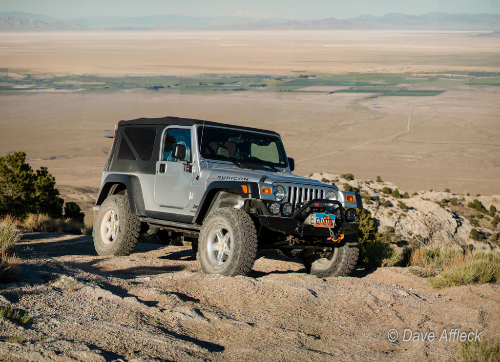
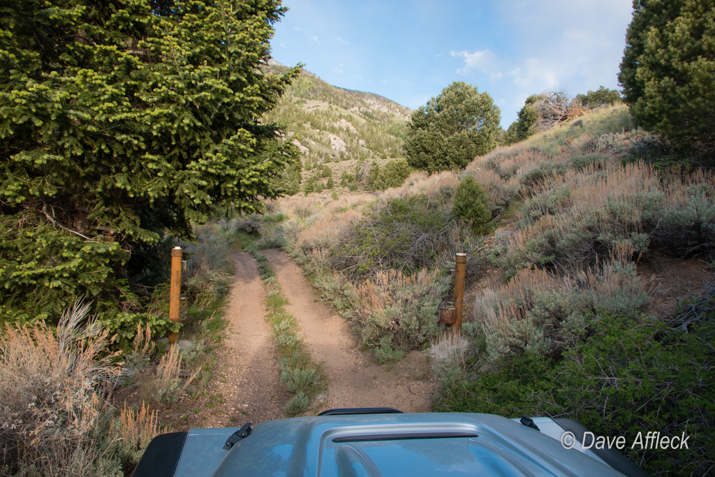
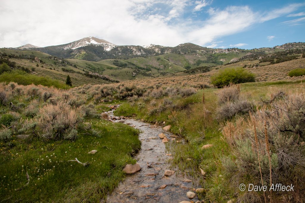
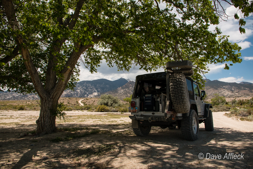
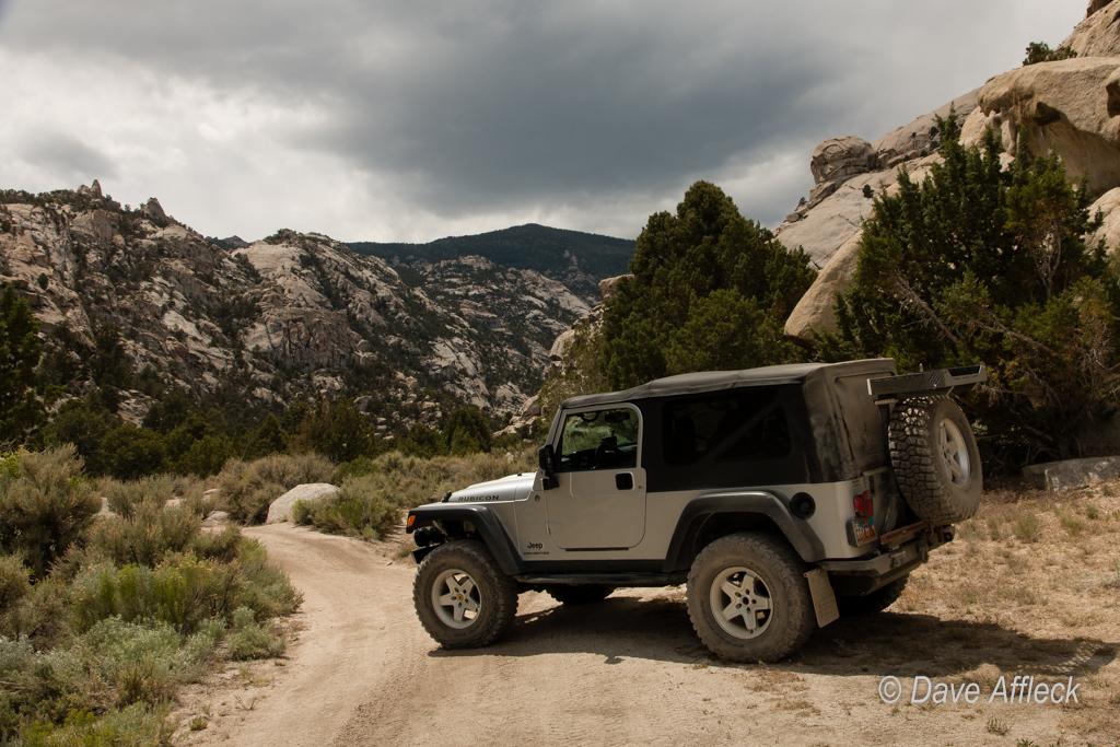
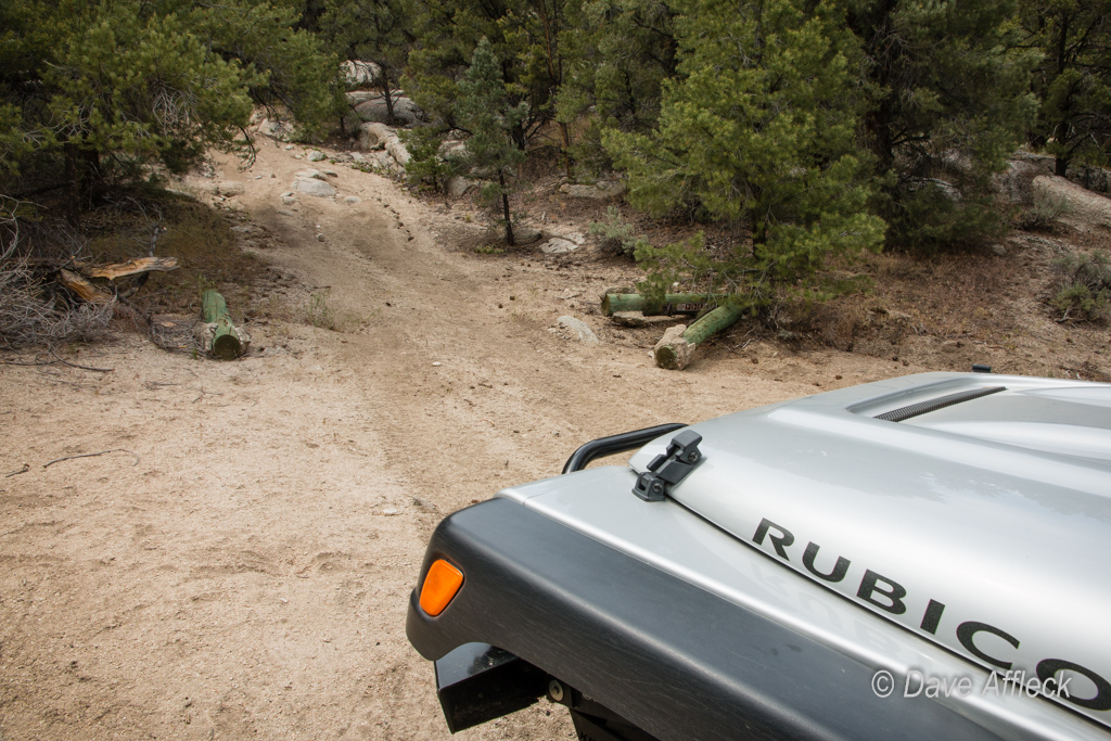
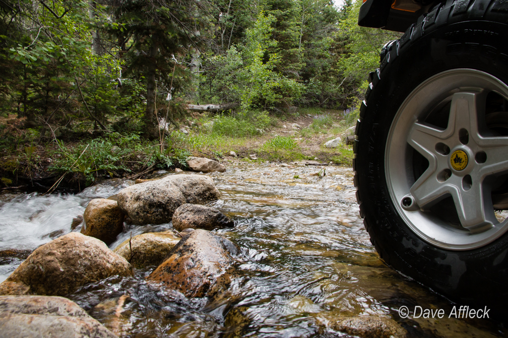
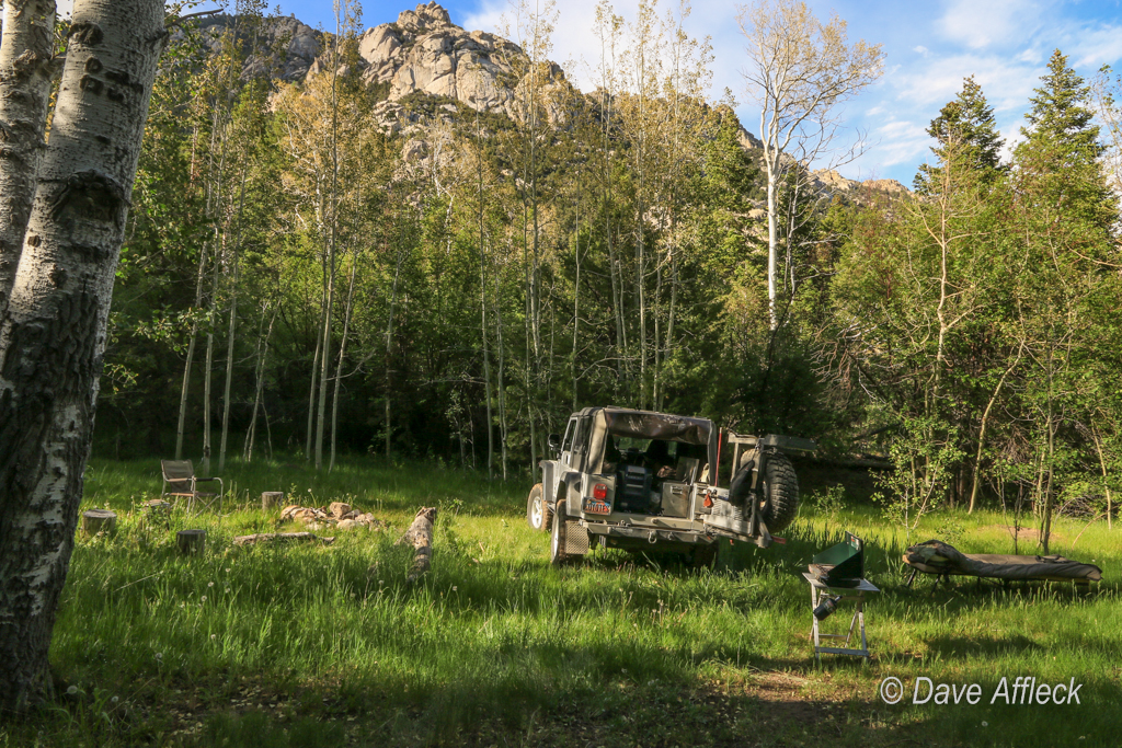
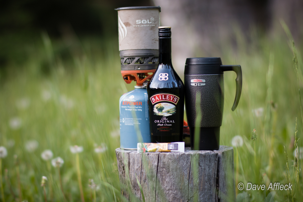
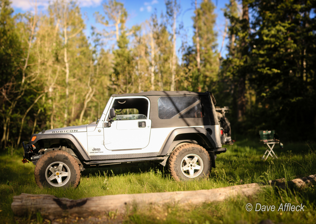
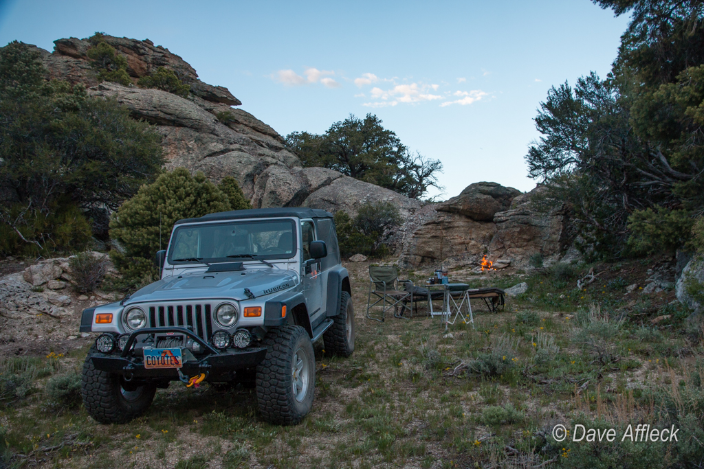
Last Thursday, after confirming with the BLM that the gates were in fact now open, it was finally time to go! So after work I pointed the Jeep’s hood west and let the old pig roar on I-80 for Wendover. From there I headed south towards the turn off for Ibapah and Gold Hill.

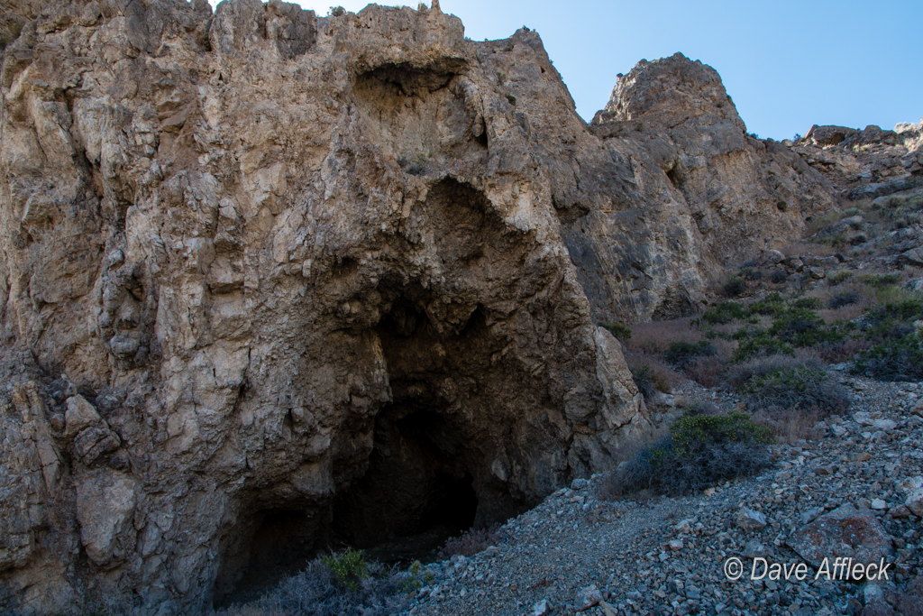
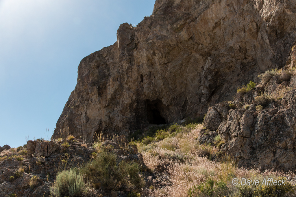
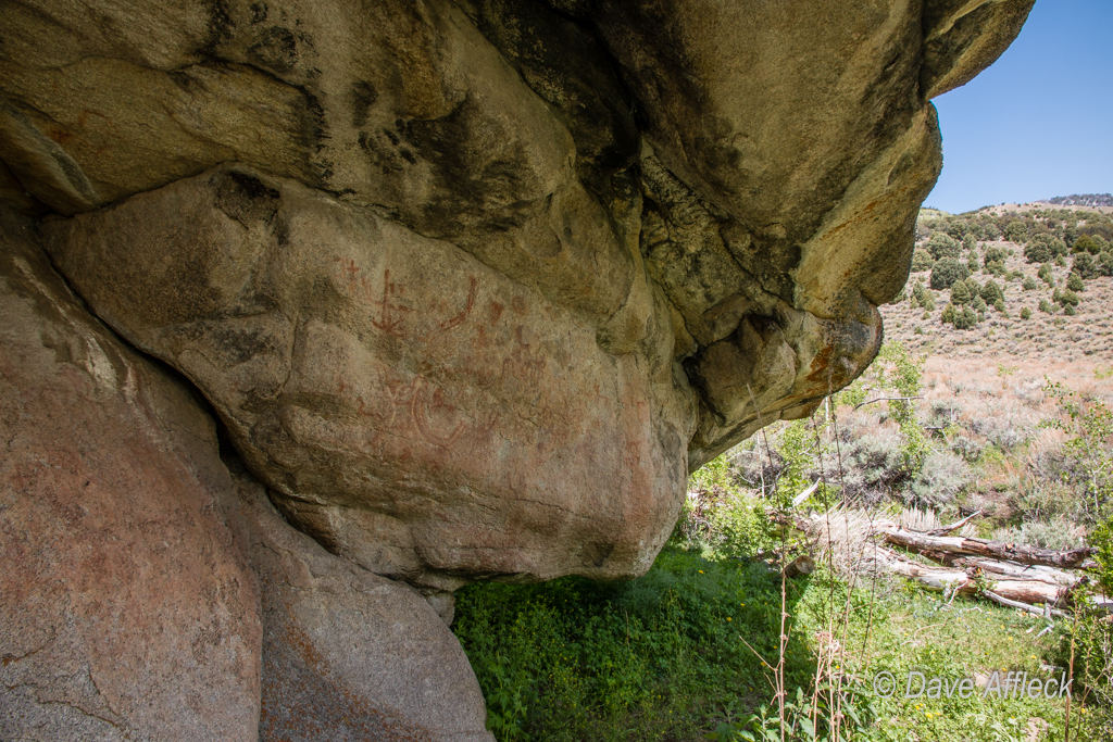
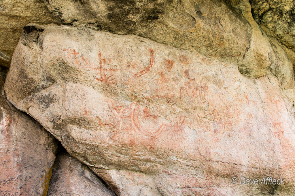
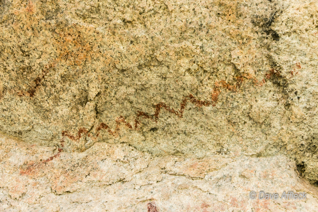
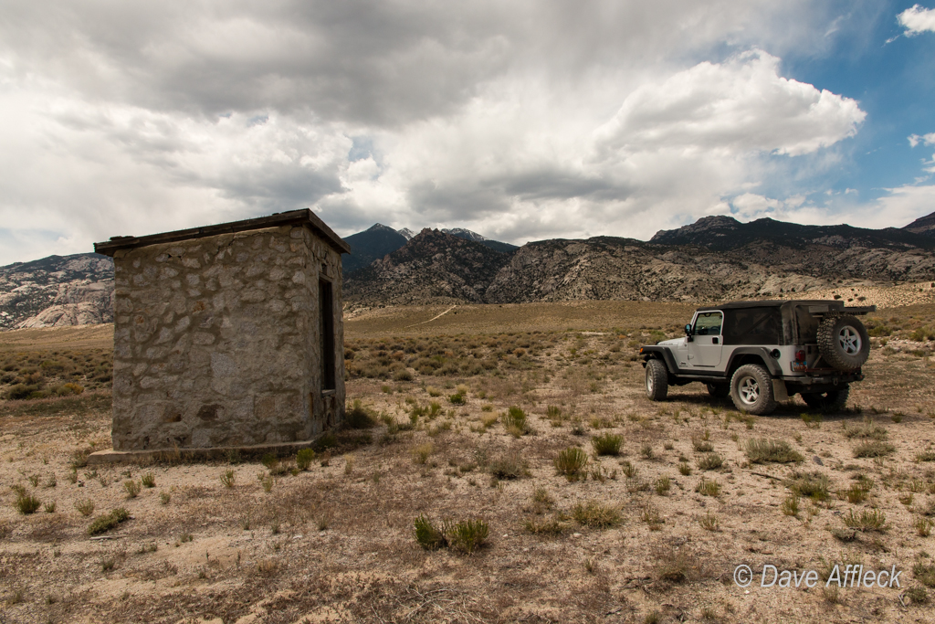
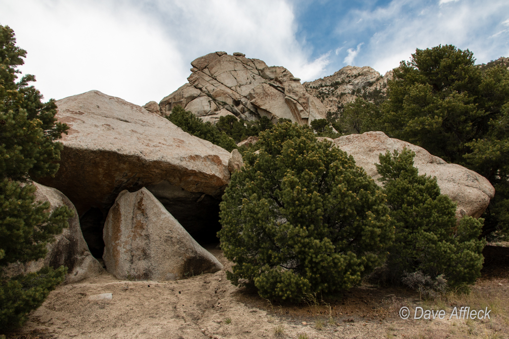
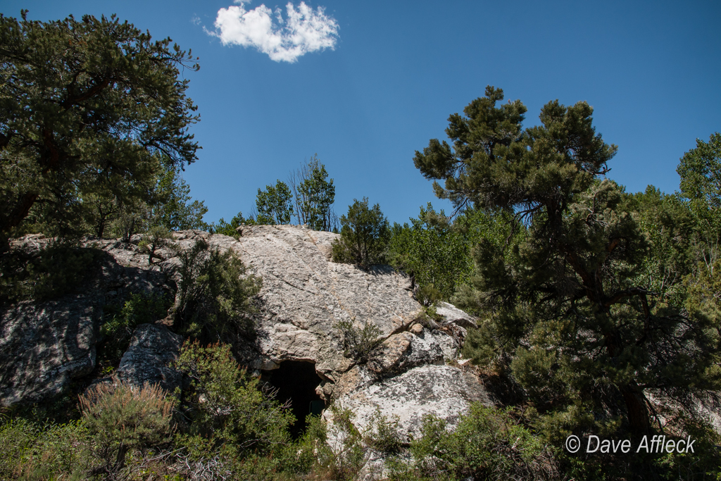
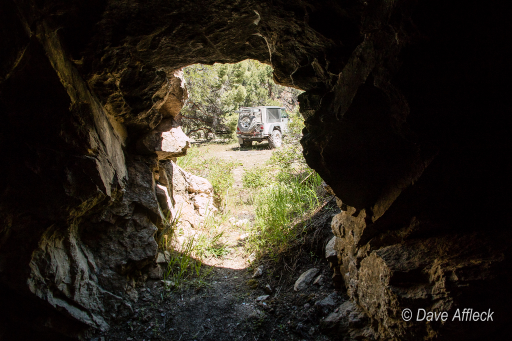
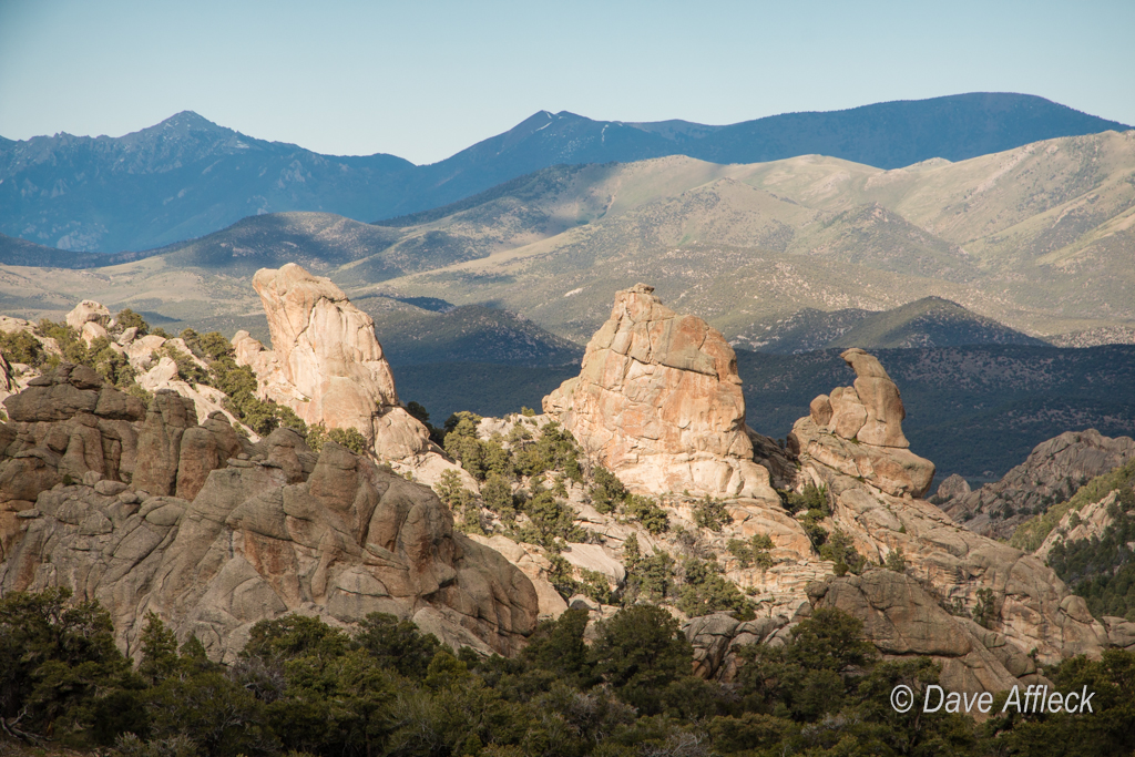
First stop was to check out the old Indian caves right off the main road there. I know of half a dozen other similar caves in the vicinity that also show signs of ancient occupation. Strange to think about it – but this area was more densely populated ten thousand years ago than it is today.

Two caves right here, with the larger one showing little sign of occupation. But it’s aspect makes it drafty, it’s not hard to see why the Old Ones preferred the smaller cave to live in.

20140605_Deep%20Creeks_Camping-2245W.jpg


20140605_Deep%20Creeks_Camping-2240W.jpg


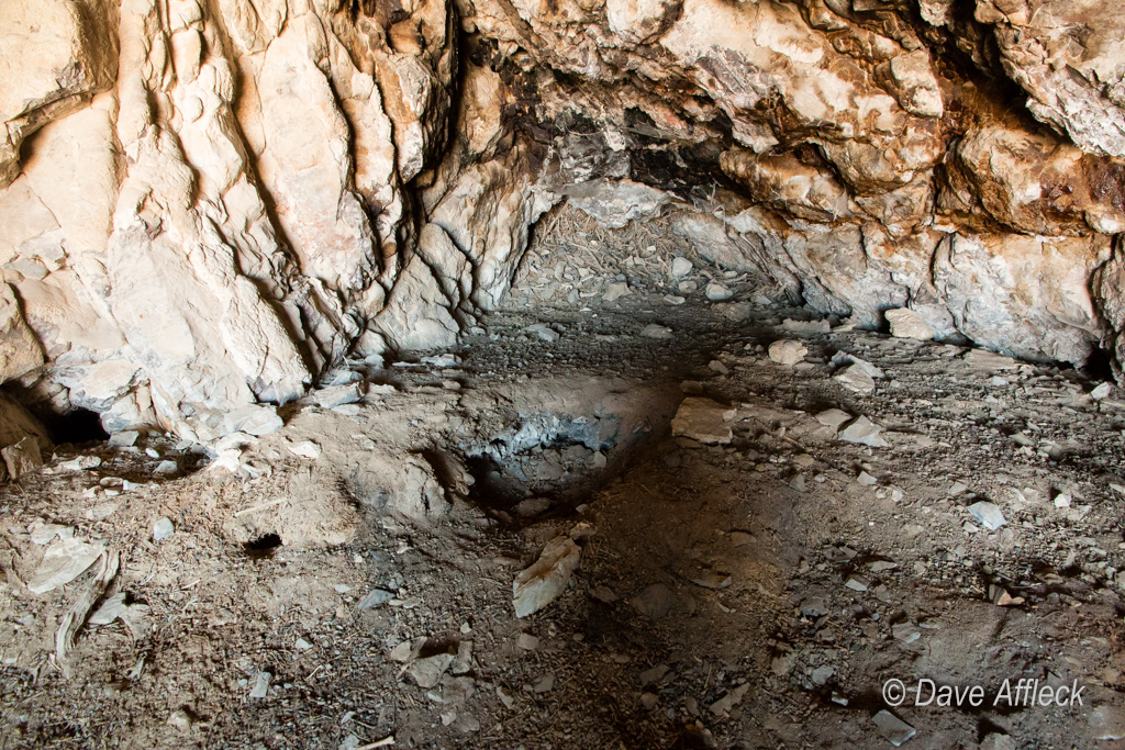
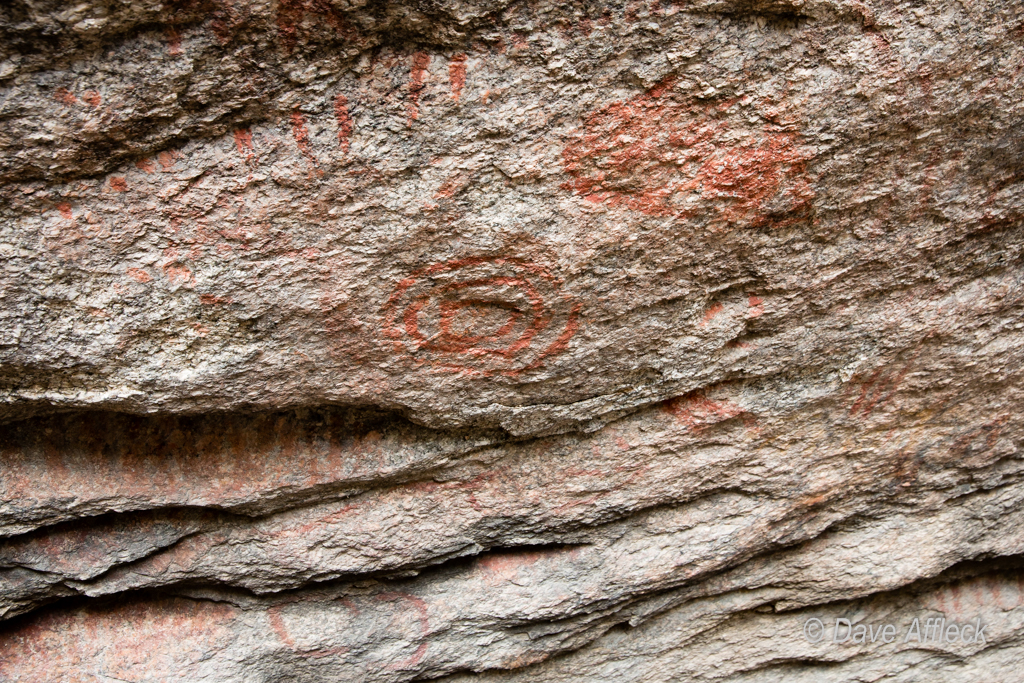
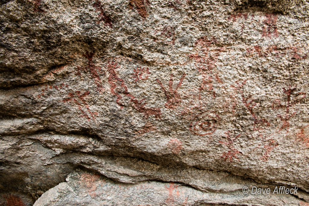
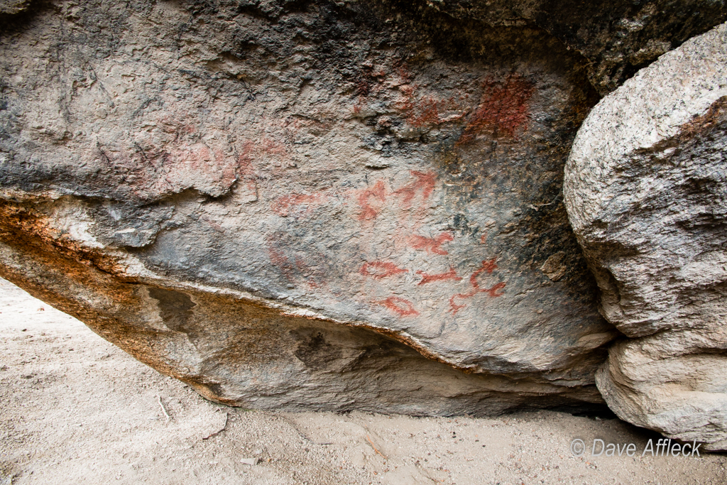
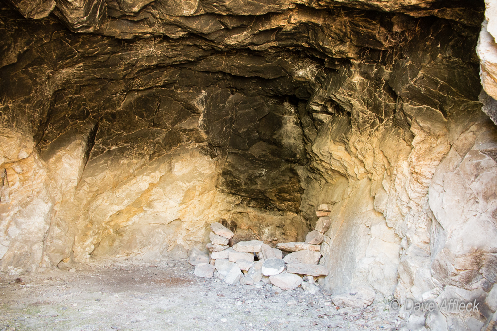
It’s been a good ten years since I last looked in this cave. It had pot hunter digging then. This time, the old pot holes were loosely filled, but there were a few new ones to take their place. Pot hunting seems quite popular in this little cave…

20140605_Deep%20Creeks_Camping-2251W.jpg


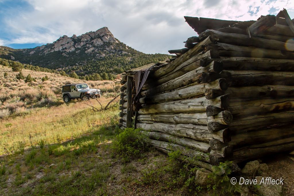
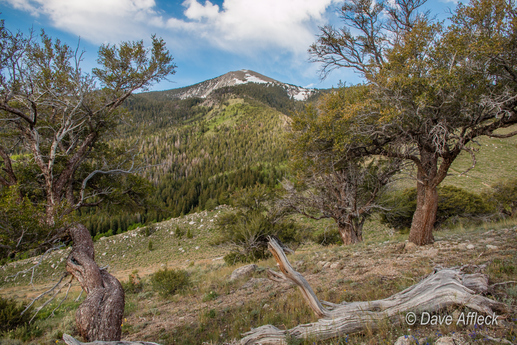
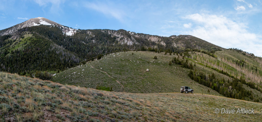
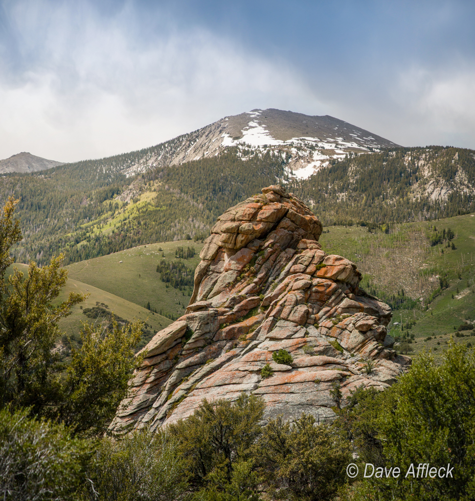
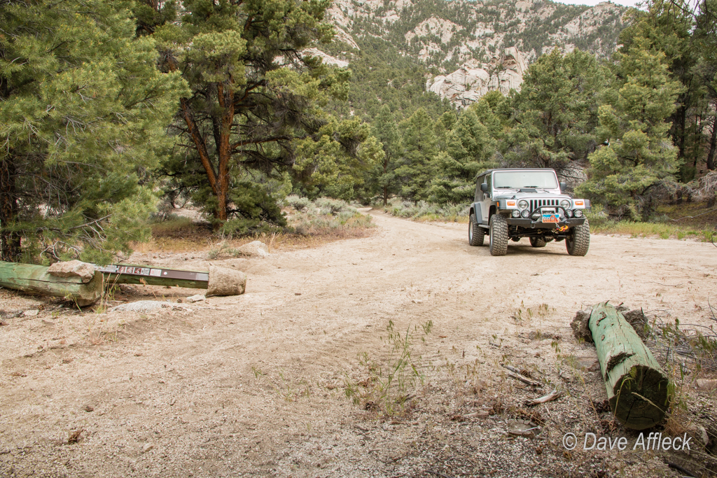
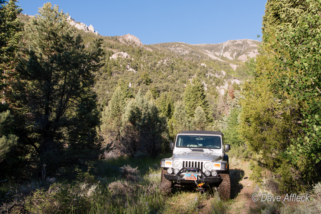
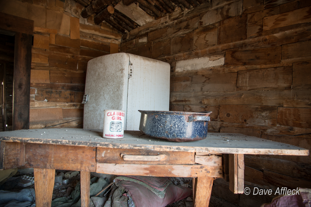
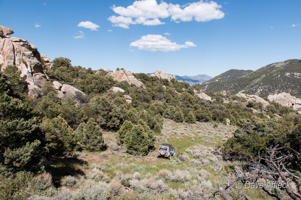
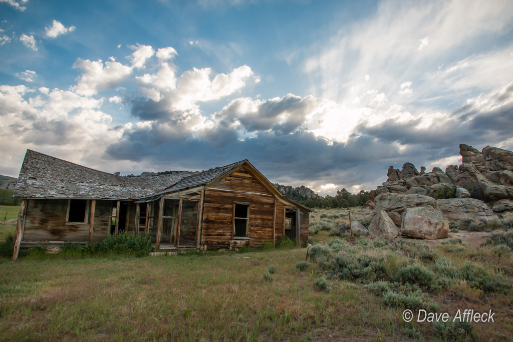
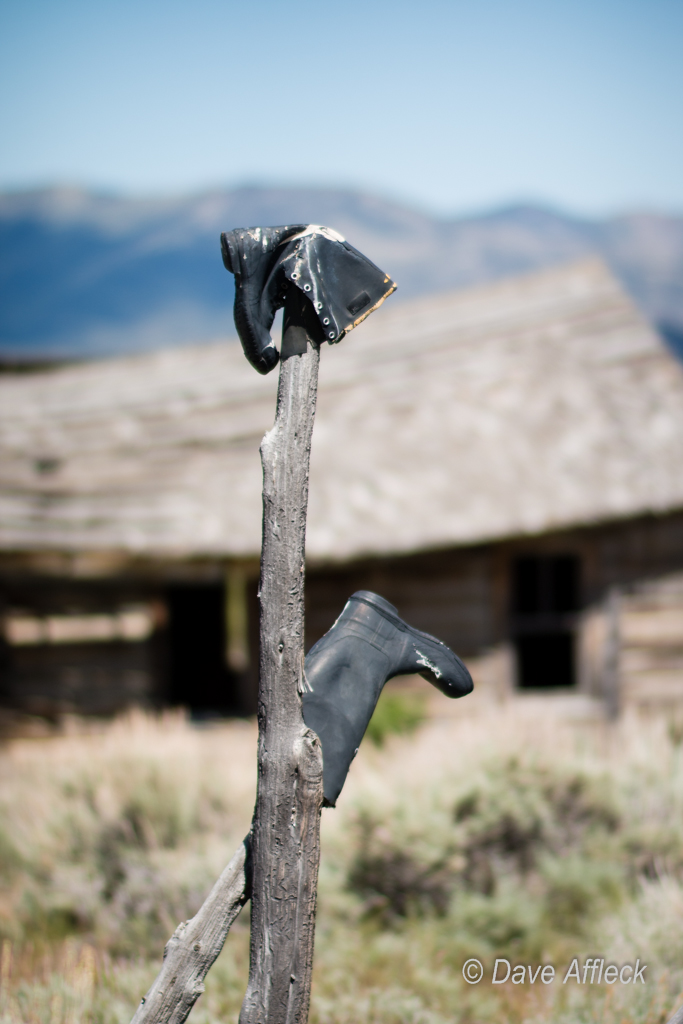
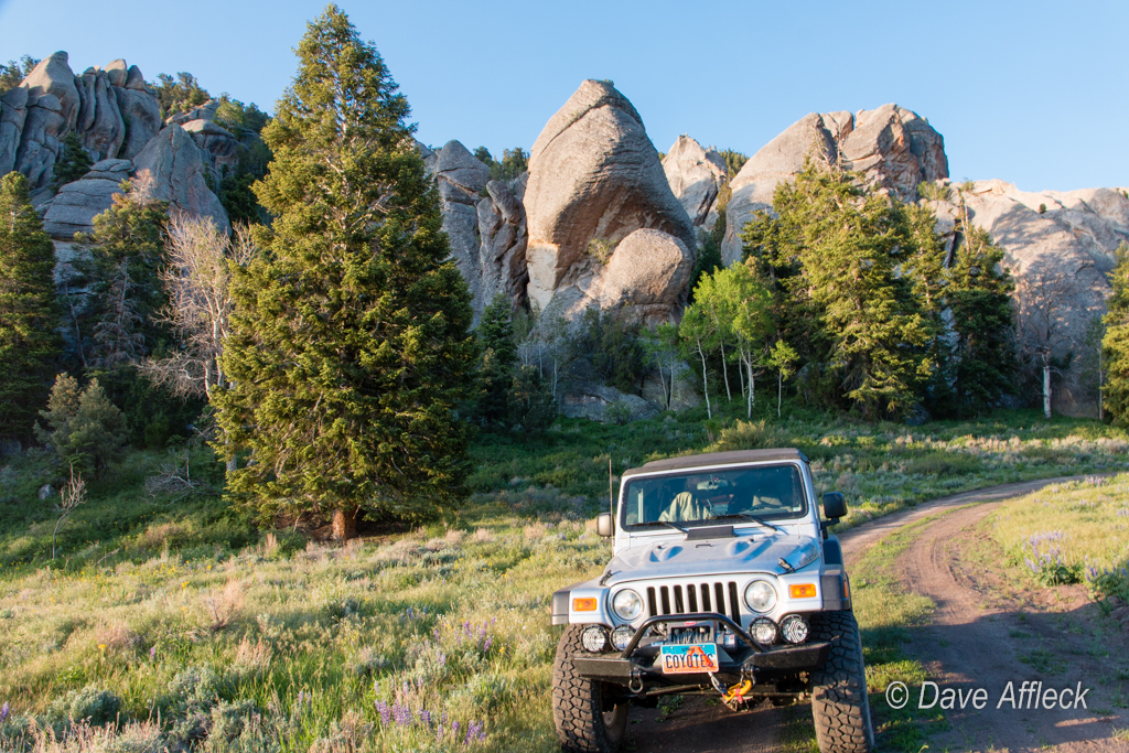
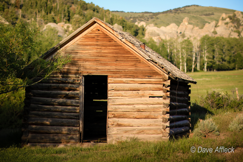
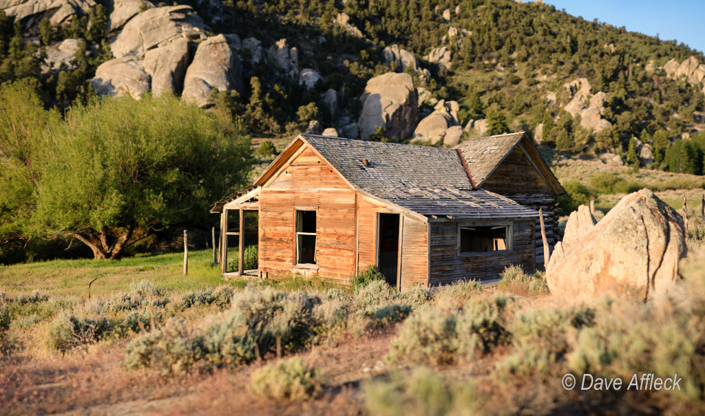
From there I passed through Gold Hill, heading south towards Overland Canyon. I took a short side trip to snap a couple pictures of Clifton along the way.

20140605_Deep%20Creeks_Camping-7W.jpg


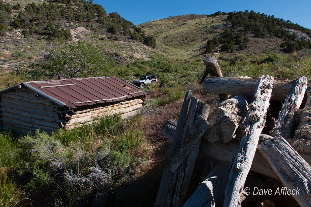
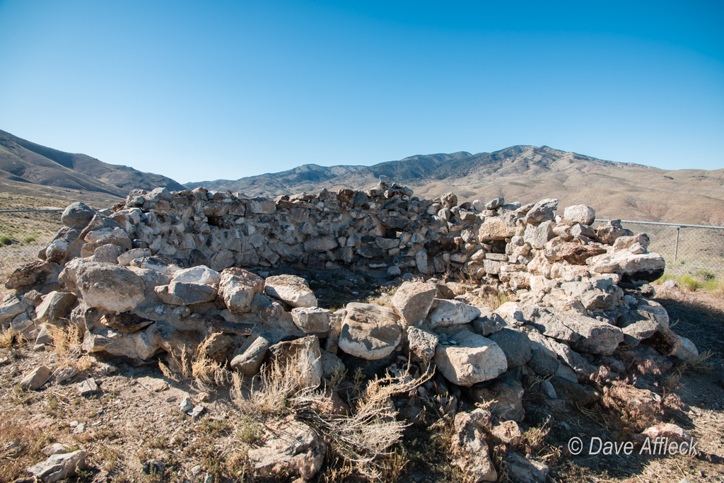
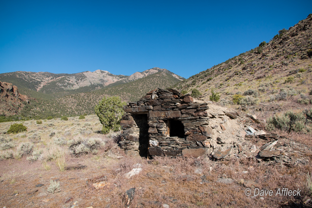
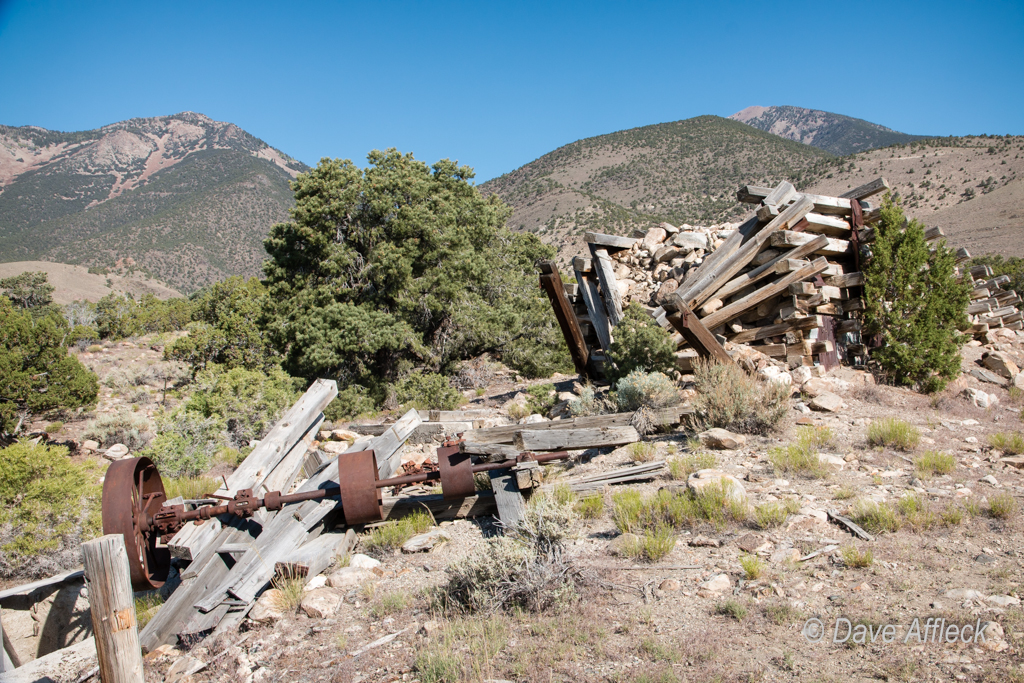
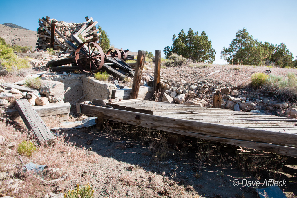
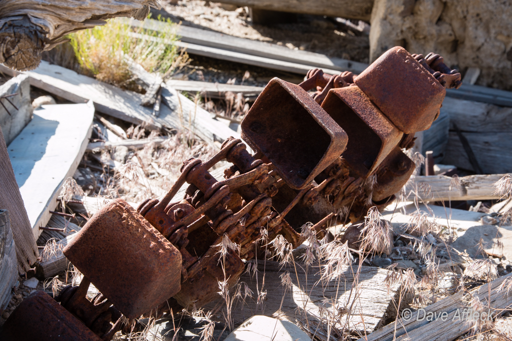
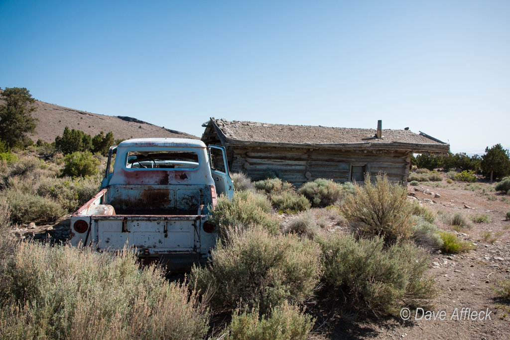
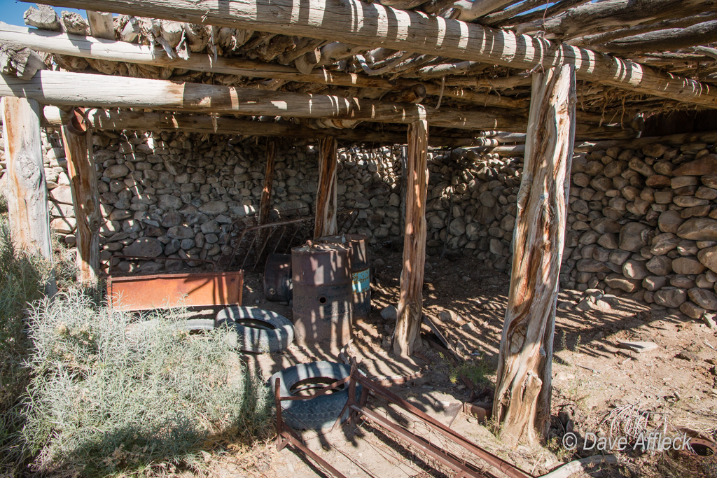
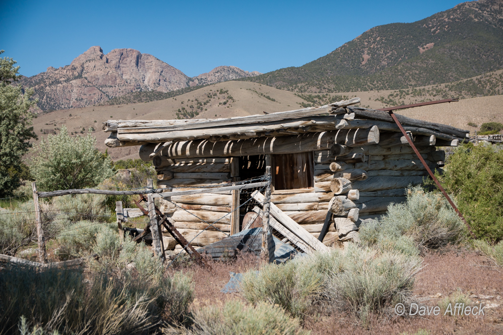
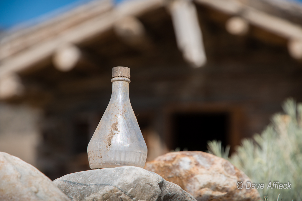
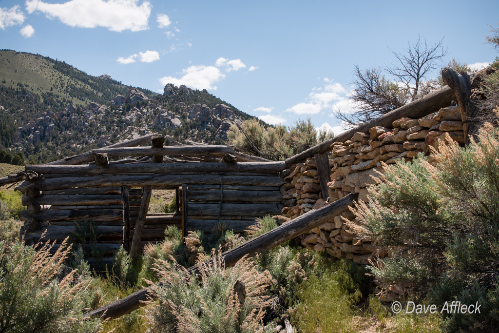
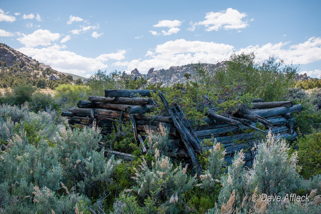
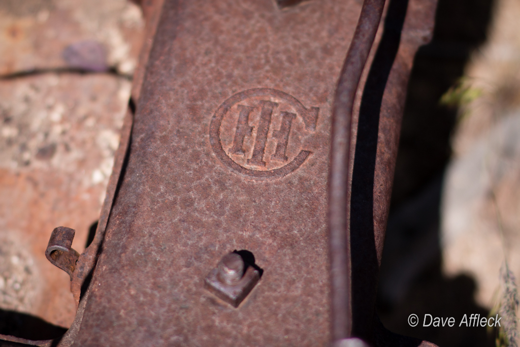
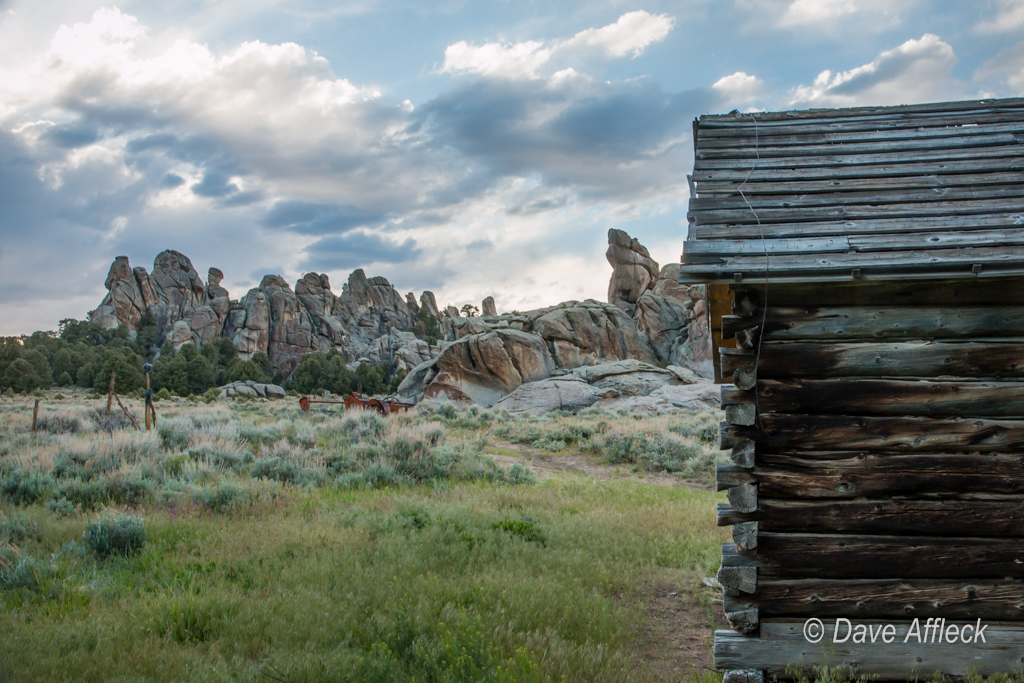
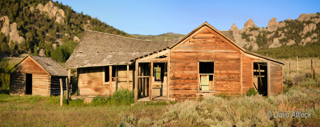
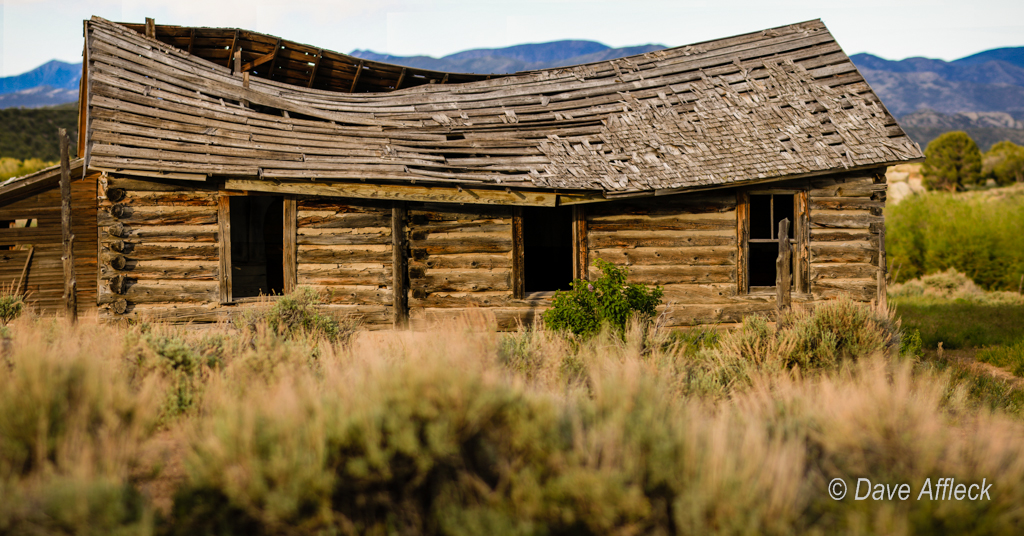
Next stop, the Canyon Station ruins at the mouth of Overland Canyon.

20140605_Deep%20Creeks_Camping-13W.jpg


- DAA

Featured image for home page:
slide.jpg
 
Then it was south past Callao and west again along Tom’s creek up Tom’s canyon.

20140605_Deep%20Creeks_Camping-22W.jpg


Callao is in the distance below in this pic.

TomsCreek-1W.jpg


Tom’s canyon is an absolute gem! The road has just enough steepness and obstacles to make a short wheelbase and low range welcome and to make you pay attention to your line in spots. It was a fun drive. As with every other canyon I’d visit on this trip, the creek was running full and filling the entire canyon with it’s roar. The scenery fantastic. I saw nobody my whole time spent in Tom’s canyon.

20140605_Deep%20Creeks_Camping-519W.jpg


20140605_Deep%20Creeks_Camping-523W.jpg


I stopped to camp for the night just short of the gate that had just been opened, near the creek and an old cabin. A thoroughly delightful camp spot!

20140605_Deep%20Creeks_Camping-201W.jpg


20140605_Deep%20Creeks_Camping-210W.jpg


I made a small fire and roasted brats over it for dinner before sipping a bit of the Irish and enjoying a cigar before bed.

20140605_Deep%20Creeks_Camping-196W.jpg


I didn’t use a tent on this trip, sleeping on my cot under the stars all three nights. Next morning I headed further up canyon, past the previously closed gate, to see what I could see.

20140605_Deep%20Creeks_Camping-350W.jpg


- DAA
 
You can only go about another 1.5 miles after the old gate, but it sure is a pretty 1.5 miles! The whole canyon is just fantastic. Tom’s was one of the highpoints of the whole trip and the canyon I’d pick to camp in again if I had to choose from all I visited on this trip.

20140605_Deep%20Creeks_Camping-359W.jpg


TomsCanyon6-1W.jpg


From the top of Tom’s canyon I backtracked to the foothills and took a turn up a rough Jeep trail that goes up the next canyon to the north – Middle canyon. The trail was tight and rough, obviously rarely travelled by anything larger than a SxS.

It eventually ends in a saddle overlooking Scott’s Basin. That’s where I wanted to take a hike this morning to see what I could see. Some pics from down in Scott’s Basin.

ScottsBasin10-1W.jpg


20140605_Deep%20Creeks_Camping-647W.jpg


I knew there was supposed to be petroglyphs somewhere in the basin and I wanted to find it, so once I got to the area with the most likely looking boulders, I started searching the rocks for art. I found a couple small petroglyphs, but then after about an hour of searching I came on a fantastic pictograph panel. I’d heard nothing about pictographs here and certainly nothing about a nice big panel. Totally unexpected!

20140605_Deep%20Creeks_Camping-627W.jpg


20140605_Deep%20Creeks_Camping-612W.jpg


20140605_Deep%20Creeks_Camping-624W.jpg


While I was checking out the rock art, I became aware of a loud humming, or buzzing sound in the background. Having heard similar sounds a few times before, I figured there must be either a very active beehive nearby, or… Yup, something dead.

20140605_Deep%20Creeks_Camping-630W.jpg


A VERY fresh lion kill. Couldn’t have been any older than the night before. It hadn’t started to smell bad yet, was still moist and juicy and the eyes still had a fair amount of clarity in them. Probably from that same morning, only a few hours old. Shame I hadn’t arrived in time to see old long tail filling his face with deer!

20140605_Deep%20Creeks_Camping-635W.jpg


- DAA
 
From there, it was a long steep hike back to the Jeep. Then a rough drive back down to the main road, where I stopped in some shade at the Callao CCC campground for lunch.

20140605_Deep%20Creeks_Camping-656W.jpg


After lunch I headed up Indian Farm Creek canyon just for grins. It’s stupendously rough and beautiful, with plenty of places to flex out a Jeep if you are so inclined. Some good camp spots near the mouth of the canyon too.

An old building of unknown to me purpose near the mouth of Indian Farm.

20140605_Deep%20Creeks_Camping-659W.jpg


A rock shelter, with more pictographs inside.

20140605_Deep%20Creeks_Camping-699W.jpg


20140605_Deep%20Creeks_Camping-692W.jpg


20140605_Deep%20Creeks_Camping-681W.jpg


20140605_Deep%20Creeks_Camping-679W.jpg


Leaving Indian Farm Creek.

20140605_Deep%20Creeks_Camping-666W.jpg


Next up was Granite Creek.

Ever think you’d see this? Done by the BLM no less?!

20140605_Deep%20Creeks_Camping-701W.jpg


20140605_Deep%20Creeks_Camping-710W.jpg


It’s the old WSA boundary/barricade. Previously cemented in, looked like forever, but it’s down now!

20140605_Deep%20Creeks_Camping-1312W.jpg


20140605_Deep%20Creeks_Camping-713W.jpg


- DAA
 
My thought was to drive all the way to the top of the new route and spend the night at Camp Ethel. But, it’s not to be. Not yet. Only about 1.5 miles from the old barricade, is this one:

20140605_Deep%20Creeks_Camping-1311W.jpg


Still about another mile and a half short of Camp Ethel. You can see the downed timber behind the barricade. I walked up it about half a mile, it’s in bad shape aside from all the downed timber. Will take some resources and some work to make it passable again. I’m purely guessing that based on what I read about the legal settlement, this part is on Juab county. Hopefully they are able to get ‘er done so people can drive the rest of the way up.

Anyway… The road veers right at this barricade, crosses the creek and dead ends in a nice little meadow. I decided to camp there for the night. Some pics of camp and some of the views from there.

20140605_Deep%20Creeks_Camping-1038W.jpg


20140605_Deep%20Creeks_Camping-1218W.jpg


20140605_Deep%20Creeks_Camping-832W.jpg


20140605_Deep%20Creeks_Camping-1260W.jpg


GraniteCreek16-1W.jpg


- DAA
 
The next morning I headed back down and then over and up again to check out Trout Creek canyon. Tons of cool stuff around there. Too much to list of show pictures of it all. But here’s some of it.

20140605_Deep%20Creeks_Camping-1323W.jpg


20140605_Deep%20Creeks_Camping-1408W.jpg


20140605_Deep%20Creeks_Camping-1410W.jpg


20140605_Deep%20Creeks_Camping-1414W.jpg


20140605_Deep%20Creeks_Camping-1422W.jpg


20140605_Deep%20Creeks_Camping-1424W.jpg


20140605_Deep%20Creeks_Camping-1430W.jpg


20140605_Deep%20Creeks_Camping-1435W.jpg


20140605_Deep%20Creeks_Camping-1438W.jpg


20140605_Deep%20Creeks_Camping-1444W.jpg


20140605_Deep%20Creeks_Camping-1446W.jpg


Then it was time to head back down towards the town of Trout Creek for lunch.

Old bike along the main road.

20140605_Deep%20Creeks_Camping-1459W.jpg


- DAA
 
For lunch, I stopped in at Barbara Mumm’s bed and breakfast, where she made me an enormous cheeseburger on the grill and fed me all the farm fresh deviled eggs, potato salad and fixings I could stuff down my gullet.

20140605_Deep%20Creeks_Camping-1464W.jpg


Good stuff! Then I took advantage of the very reasonably priced gasoline to give myself a comfortable fuel cushion and continued on my way.
Heading up Pleasant Valley draw.

20140605_Deep%20Creeks_Camping-1471W.jpg


Pleasant Valley was pleasant enough, but kind of tame, so when an obscure two track heading up a side canyon beckoned, I took it. Turned out to be a good call – the side canyon was incredibly beautiful. Huge, fantastically shaped boulders, greenery and wildflowers of every description in absolute profusion.
Plus this little gem of an unexpected find.

20140605_Deep%20Creeks_Camping-1476W.jpg


One of the more unusual caves I’ve come across. It’s kind of like just a big hollowed out granite boulder. The fire black on the roof speaks of countless fires. The Old Ones lived here for sure and the old timers of more recent times put it to good use as well. There’s a little natural vent hole above the modern fire ring.

20140605_Deep%20Creeks_Camping-1485W.jpg


20140605_Deep%20Creeks_Camping-1489W.jpg


I tried heading cross country from there on faint two track but ran into posted private ground and had to turn back to the main road in Pleasant Valley, which I continued on up to my destination for this last night of the trip – Blue Mass.

- DAA
 
Been to Blue Mass quite a few times before, just a very pretty area to hang out for an evening. Bunch of pics from the area and camp on this the last night of the trip.

20140605_Deep%20Creeks_Camping-1553W.jpg


20140605_Deep%20Creeks_Camping-1576W.jpg


20140605_Deep%20Creeks_Camping-1782W.jpg


20140605_Deep%20Creeks_Camping-1502W.jpg


20140605_Deep%20Creeks_Camping-1510W.jpg


20140605_Deep%20Creeks_Camping-1519W.jpg


20140605_Deep%20Creeks_Camping-1525W.jpg


20140605_Deep%20Creeks_Camping-1537W.jpg


20140605_Deep%20Creeks_Camping-1541W.jpg


20140605_Deep%20Creeks_Camping-1788W.jpg


20140605_Deep%20Creeks_Camping-1794W.jpg


- DAA
 
20140605_Deep%20Creeks_Camping-1795W.jpg


20140605_Deep%20Creeks_Camping-1805W.jpg


BlueMass24-1W.jpg


BlueMass23-2W.jpg


20140605_Deep%20Creeks_Camping-2193W.jpg


20140605_Deep%20Creeks_Camping-2136W.jpg


20140605_Deep%20Creeks_Camping-1959W.jpg


BlueMass26-1W.jpg


Sunday morning I was up and the Jeep was rolling towards home by 6:30am. I headed out via Tippett and Ibapah, taking the road through the Goshute res just because I was feeling so good.
Totally uneventful trip home, nothing more to report.

- DAA
 
To bad they opened the gates. I hunted the Deep Creeks for 30 years. Saw directly the ATV damage done in the Innner Bain and around. You used to have to hike or ride horseback everywhere. The inner Basin had a road (if you call it that) on the south side only, now ATVs run rampant in the Basin from that and from the Middle Canyon road (great Basin views from here). Used to be great walkin deer hunting there till ATVs showed up. You can drive the old road clear over to look down on Ibapah. There is also a old military plane wreck up on Rocky Peak. Tom's is a neat place, is the old ranch cabin there still occupied? was last time I was there for hunting. Used to be able to go up water canyon, trout creek quite a ways, till Gov Levitt gave a chunk of it back to the Indians, best hunting around. Next try Goshute Canyon to the top....did it with Dirt Bikes years ago, very rough don't think a jeep can even make it. Very neat mining ruins up the canyon and at Eagles NEst on top (you can see the tram towers from below). Also Hardscrabble Canyon has neat mining ruins.... One of my favorite places in the West Desert! :)

As you can tell I would rather have the entire top of the range closed to vehicles........
 
What a cool range! And fantastic pics of it to boot. That lion kill is cool. Your whiskey/cigar shots always really make me want to go outside and have an evening around the fire. Thanks for posting.
 
  • Like
Reactions: DAA
Similar threads
Thread starter Title Forum Replies Date
shredhiker Slough Creek mid June? Trip Planning 11
Janice San Juan Mtns - late June too early? Trip Planning 4
TheMountainRabbit Ecuador Mountaineering: Cayambe, Antisana, & Chimborazo - June 2023 Winter Sports 8
shredhiker Eagles Nest Wilderness June 30 2023 Backpacking 7
scatman The Wyoming Range (Scatman version) - June 26, 2023 Backpacking 21
I Rescue Creek - Yellowstone National Park - June 3, 2023 Backpacking 15
shredhiker Blacktail Creek June 2023 Backpacking 4
scatman Mount Aire - June 17, 2023 Hiking & Camping 23
F Frontenac Provided Park Ontario, Canada June 2023 Backpacking 4
scatman Grandeur Peak - Dragon Tail Route - June 10, 2023 Hiking & Camping 13
scatman Rescue Creek - Yellowstone National Park - June 3, 2023 Backpacking 56
I Slough Creek - Yellowstone June 5 & 6 Meet Up (Members Only) 19
Upgrayedd SLC to Oregon Coast to Reno to SLC - May 26th - June 4th Trip Planning 10
J UHT in June Trip Planning 4
travel2walk Gros Ventre Wilderness: Granite Creek, West Fork Crystal Creek, Crystal Creek, & Swift Creek - June 2021 Backpacking 8
Georgia Yankee Apostle Islands, Lake Superior (again), June 2022 On The Water 4
scatman Unnamed Peak 8194 - June 25, 2022 Hiking & Camping 17
scatman Mount Aire - June 18, 2022 Hiking & Camping 6
Absarokanaut Flooding in Yellowstone National Park and Adjacent Areas of Montana Today June 13, 2022 General Discussion 82
scatman Big Willow Canyon - June 11, 2022 Hiking & Camping 33
scatman Mendon Peak - Wellsville Mountain Wilderness - June 4, 2022 Hiking & Camping 13
bouldermtn May/June trip suggestions Trip Planning 0
Nethos Santa Fe/ABQ/Durango Area- Mid Late June Trip Planning 11
marquis20 Day 1: Grand Teton Wilderness and Black Canyon of the Yellowstone - June 2021 Backpacking 0
pstm13 Rocky Mountain National Park Mid June with Kids Trip Planning 7
pstm13 Rocky Mountain National Park Mid June with Kids Trip Planning 0
norwegianxplorer Backpacking Scandinavia, Norway & Sweden June-September Backpacking 4
Laura V. SEKI Mineral King Loop, June 2021 Backpacking 7
Georgia Yankee Apostle Islands, Lake Superior, June 2021 On The Water 4
scatman Mount Raymond and Gobblers Knob Lollipop Loop - June 18, 2021 Hiking & Camping 17
TheMountainRabbit Gros Ventre Wilderness - June 2021 Backpacking 10
chandlerwest Glacier National Park - June 2021 Hiking & Camping 8
scatman Mount Aire and Unnamed Peaks 8490 and 8319 Lollipop Loop - June 12, 2021 Hiking & Camping 11
TheMountainRabbit Bowen-Baker Loop (Never Summer Wilderness) - June 2020 Backpacking 1
TheMountainRabbit Invite Gros Ventre Wilderness, June 11th-13th Meet Up (Members Only) 5
M Suggestions for a 10 day backpacking trip in early June Trip Planning 8
norwegianxplorer Rae Lakes Loop, SEKI, June 2020 Backpacking 6
norwegianxplorer Bear Standoff and Bluff Charge in Kings Canyon yesterday June 30th Backpacking 16
scatman Mount Raymond via Bowman Fork - June 27, 2020 Hiking & Camping 6
TheMountainRabbit Invite Never Summer Range, June 27th-29th Meet Up (Members Only) 0
norwegianxplorer Sequoia National Park, Backpacking Mt Silliman area, June 2020 Backpacking 8
scatman Neff's Ridge Loop - June 13, 2020 Hiking & Camping 10
Born to Hike Early June 3-day jaunt on the Uinta Highline Trail: Naturalist Basin, Pinto Lake, Margo Lake Backpacking 8
J Family hike in the Maze in June? (Canyonlands / Moab) Am I crazy? Trip Planning 5
andyjaggy Windrivers mid to end of June Trip Planning 7
pstm13 HELP NEEDED- Idaho in Early June for 2-3 Days Trip Planning 6
J Grenadier Range, San Juan Mtns. Weminuche Wilderness, CO June 27-30, 2007 Retro Backpacking 9
Tarp Boy Uintas in late June? Trip Planning 10
P June Lamar overnight Backpacking 1
scatman Northern Section of the Toiyabe Crest Trail - June 15, 2019 Backpacking 22

Similar threads

Back
Top