The Confluence from The Dollhouse

Jammer

❤2Hike
.
Joined
Feb 23, 2012
Messages
652
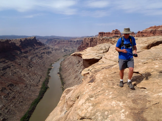
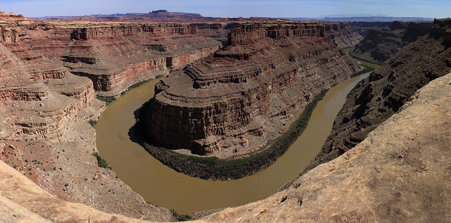
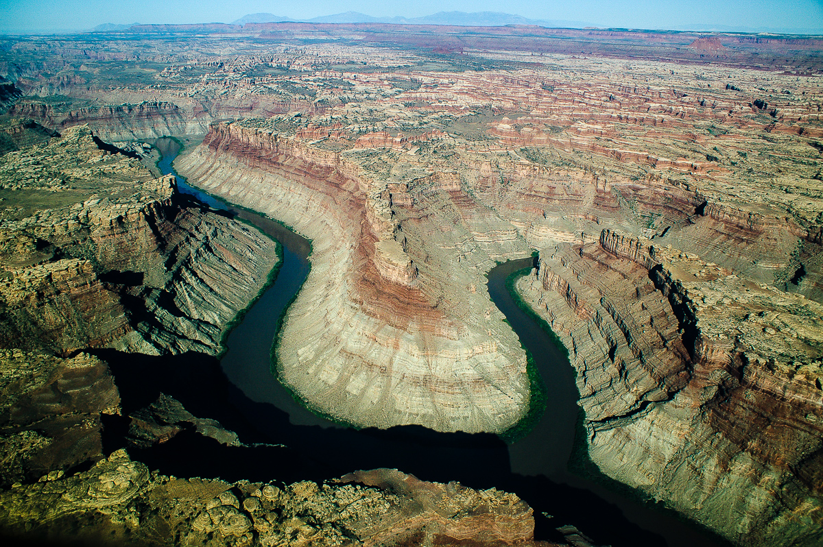
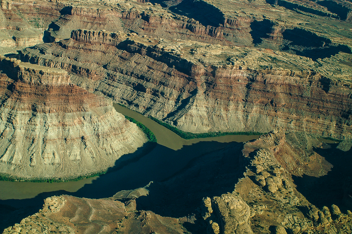
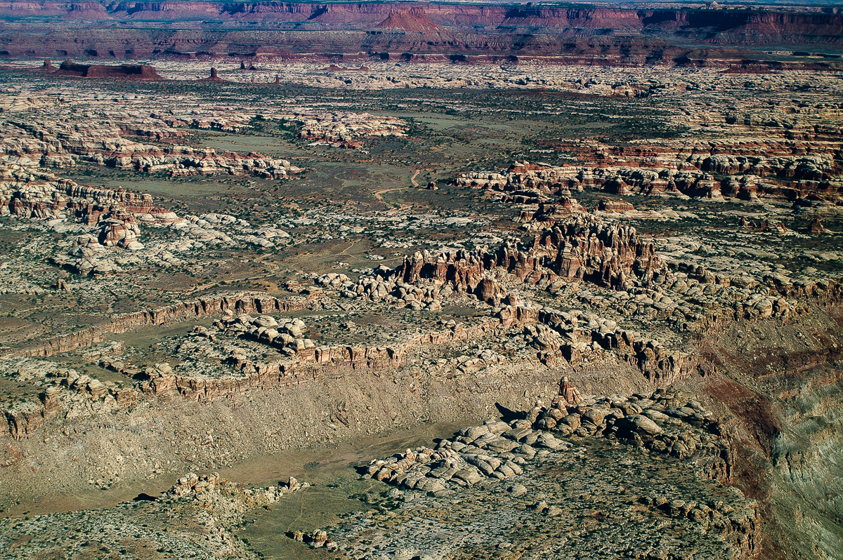
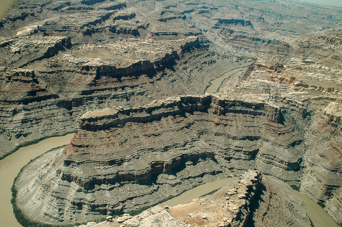
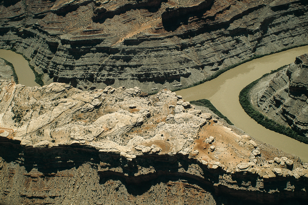
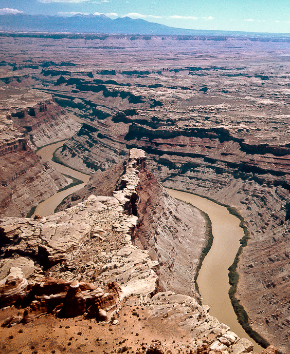
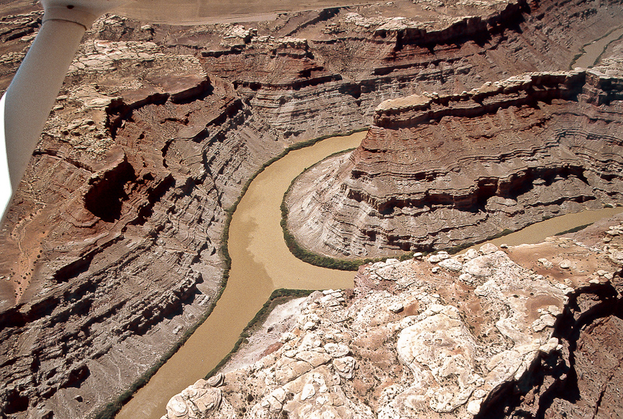
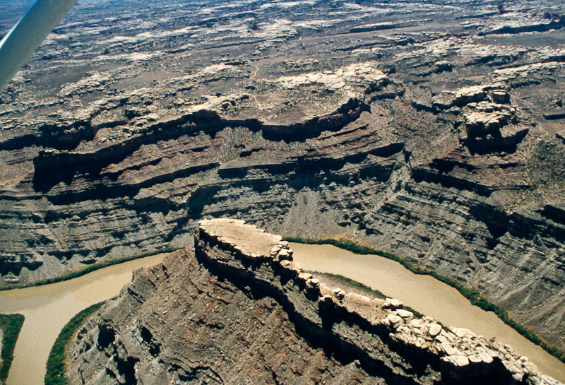
To those of you who have done the Colorado/Green Rivers Overlook Trail in Canyonlands... what stops one from going all the way out on the peninsula and overlooking the confluence? I'm guessing it's a drop of some sort or impassable block, but I've never seen a picture or read a description. I've seen some great pics from nick and Udink of the area; anybody have a pic or detail on the end of the line?


Also, Kelsey states it's possible to get down the gully on the north side which leads down to the Green; supposedly this is the way Powell got up. Anybody check that out?


Thanks,
- Jamal
 
cirrus2000 and I spent a little time trying to get farther out onto the peninsula, and the sandstone was jointed with some big gaps between blocks. The drops weren't huge, but too much to simply climb down and back up. I didn't get any photos from the spot where we tried, but this aerial shot from Bing Maps shows where I think we made it to. We jumped the gap with the yellow arrow (it was a little sketchy), and I think the red arrow is where we got stopped.

Fullscreen capture 12112012 90734 PM.jpg

This next photo was taken a ways out from where the joints got too deep to continue, but it was somewhere there in the right 1/4 of the photo, probably only 300' or 400' from where the photo was taken (the last shot is just a crop of the previous showing the terrain farther out on the peninsula).

IMG_6894.JPG

IMG_6894-001.JPG

I don't recall whether there was a possible route down to the river on the north side, and none of my photos show that terrain. It would be pretty cool to hike down there, though! :)
 
Here's the only photo I have that shows the terrain in the area - and it doesn't do much of that! This is on the southern edge of the promontory we reached, looking west-southwest over the Colorado. The big bend at Spanish Bottom is just out of sight:

P6040757.JPG


I'm afraid I have no real recollection of spotting a weakness down to the bank...
 
When I was in the area there was a guy who was on his way back to his camp in the dollhouse, but said he found an old Indian route all the way down to the green river where he went swimming. There are ways, but my personal experience just took me to the overlook. BTW, the National Geographic map of the loop to the overlook is not very accurate.
Confluence Pano by NateGeesaman, on Flickr
 
I just got back from this area and the route mentioned to the river is known as "Powell's route". It is a very nice cared trail from the basin just under the rim to the green river. As per usual in the maze, there is a bit of climbing but nothing more than the rest of the maze. We did this in February and it was pretty straightforward even with the snow.
As for the peninsula, I was told that is "hayduke point" My friend and I hauled ropes there and were able to make it all the way out to the point. This is not doable without ropes, I can say that pretty confidentially. We used the ropes to rappel down and ascend back up (Around 100 feet!). The crack that was mentioned above has a log that has been obviously been cut and possibly used to get over the crack. Other than that there were no signs of people making out there. I doubt we were the first people out there but it almost seemed like we were.
 

Similar threads

Back
Top